
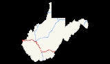
Interstate 64 in West Virginia
Encyclopedia
The alignment of Interstate 64 was to originally parallel US 60 from Charleston
to the Virginia
state line. This would go through environmentally sensitive areas such as Hawk's Nest and the New River Gorge area and might have disrupted the natural beauty and the isolation of the area.
In 1969, Governor Arch Moore
announced a delay in the construction of Interstate 64 east of Charleston
. He concluded that a study needed to be done on whether the highway should run parallel to US 60 east of Charleston
. On March 28, 1974, Governor Moore concluded that Interstate 64 would be routed from Sam Black Church
almost due west to a junction with the West Virginia Turnpike
(I-77) near Beckley
, rather than following the U.S. 60 alignment as initially proposed. From that point, I-64 was concurrent with the northern portion of an upgraded West Virginia Turnpike to reach the Charleston area. This section of I-64 is the only portion in West Virginia which is a toll road
.
In 1971, Interstate 64 was completed from WV 12 (MP 161.46) to the Virginia
state line at MP 184.02. This included six interchanges Exit 161 for WV 12, Exit 169 for US 219 and Lewisburg
, Exit 175 for US 60 for White Sulphur Springs
, Exit 181 for US 60 (WB only), and for WV 311 (EB only) at Exit 183. It was extended westward to Exit 156 (MP 155.98) at Sam Black Church
in 1973.
The final segment of Interstate 64 to be completed was between Sam Black Church
and the West Virginia Turnpike
near Beckley
. This revised interstate alignment traverses through an entirely rural area with extremely rugged terrain. Opened in 1988, this final portion is 38 miles (61.2 km) long and cost approximately $300 million to construct, making it one of the most expensive segments of Interstate Highway in the United States at $7.8 million per mile. It has some extremely rugged terrain, with one segment boasting a 7% grade downhill eastbound for seven miles (11 km) at Sandstone Mountain. Anticipating loss of braking situations, two emergency truck escape ramps were built to be used by runaway trucks. These emergency ramps were used with such frequency that, in addition to large warning signs alerting truckers to the steep grade, a special truck speed advisory system was installed to automatically weigh each truck and indicate the speed at which it should begin the downhill section. This section of roadway is the only place in West Virginia
where there is a truck speed limit. The eastbound lane, which is the downhill lane has a speed limit
of 45 for large trucks while normal traffic has a speed limit
of 70. The westbound uphill lane has 3 lanes with the far right lane being a truck lane whereas trucks are not allowed in the left lane. The speed limit
on the westbound uphill lane is 70 for all traffic.
Even with careful adherence to reduced speeds for truckers, the journey from Charleston
to Lewisburg
is far quicker and far safer on I-64 than the older routing via U.S. 60, much of which winds through the mountains as the Midland Trail
, a two-lane scenic byway, passing through hamlets such as Rainelle
and Ansted
.
The New River crossing is at milepost 137 atop the Mary Draper Ingles
Bridge. The highway also traverses through a wildlife refuge and marsh near milepost 154.
from Interstate 64 was quite evident since the highway's opening in the early-1960s. When the highway was first proposed in the late-1950s, Interstate 64 was originally to be led into the city of Huntington
and cross much of the city on a viaduct similar to Charleston
's. When the interstate was completed on the outskirts of the city instead, other means of shuttling people to and from the interstate and downtown were needed. A plan was devised that would radically reshape the city's major roadways. Two new underpasses would be constructed to carry traffic under the CSX railroad tracks that bisect the city—one at 15th Street and the other at 5th Street. The original intent was to pair a new and widened 15th Street with Hal Greer Blvd. (WV 10 - they parallel each other) and its existing underpass, and make each a flow in one direction. The plan also goes on to state that the curves on 5th Street Road would be straightened out and a wider bridge to be constructed at Four Pole Creek at Ritter Park. 5th Street from the bridge to the future underpass would be widened as well.
This never happened in full terms as money was in short supply. It would have been expensive to construct all segments of the plan. NIMBY
ism was also prevalent, as many residents complained it would destroy the quiet, residential neighborhood appeal.
Part of the plan was completed, however, in the early-1960s along Hal Greer Blvd. (WV 10). Proceeding southbound, Hal Greer Blvd. would use two 90-degree turns and use part of 15th Street as a four-lane one-way road. This would have been the southern end of the new 15th Street that was never fully constructed. Work began on March 19, 2003 to remove the dogleg as it appears the plan to add new underpasses and truly widen 15th Street will never be completed.
The state's long-term construction forecast, for a six-lane interstate from milepost 6 at West Huntington
to Charleston
and bridge replacements west of milepost 6 to the Kentucky
state line will take 30 years to complete at present funding levels and cost more than $325 million.
Freeway". The portion in the city limits of Charleston is signed as the "Nurse Veterans Highway". The portion from the West Virginia Turnpike to the Virginia line is the Hulett Smith Freeway.
Charleston, West Virginia
Charleston is the capital and largest city of the U.S. state of West Virginia. It is located at the confluence of the Elk and Kanawha Rivers in Kanawha County. As of the 2010 census, it has a population of 51,400, and its metropolitan area 304,214. It is the county seat of Kanawha County.Early...
to the Virginia
Virginia
The Commonwealth of Virginia , is a U.S. state on the Atlantic Coast of the Southern United States. Virginia is nicknamed the "Old Dominion" and sometimes the "Mother of Presidents" after the eight U.S. presidents born there...
state line. This would go through environmentally sensitive areas such as Hawk's Nest and the New River Gorge area and might have disrupted the natural beauty and the isolation of the area.
In 1969, Governor Arch Moore
Arch A. Moore, Jr.
Arch Alfred Moore, Jr. was the 28th and 30th Governor of West Virginia from 1969 until 1977 and from 1985 until 1989. He was a Congressman from 1957 until entering the governor's office. He is a member of the United States Republican Party. He ran for reelection in 1988, but was defeated by...
announced a delay in the construction of Interstate 64 east of Charleston
Charleston, West Virginia
Charleston is the capital and largest city of the U.S. state of West Virginia. It is located at the confluence of the Elk and Kanawha Rivers in Kanawha County. As of the 2010 census, it has a population of 51,400, and its metropolitan area 304,214. It is the county seat of Kanawha County.Early...
. He concluded that a study needed to be done on whether the highway should run parallel to US 60 east of Charleston
Charleston, West Virginia
Charleston is the capital and largest city of the U.S. state of West Virginia. It is located at the confluence of the Elk and Kanawha Rivers in Kanawha County. As of the 2010 census, it has a population of 51,400, and its metropolitan area 304,214. It is the county seat of Kanawha County.Early...
. On March 28, 1974, Governor Moore concluded that Interstate 64 would be routed from Sam Black Church
Sam Black Church, West Virginia
Sam Black Church is an unincorporated community in Greenbrier County, West Virginia, United States. It is located at the intersection of Interstate 64 and U.S. Highway 60 on the Midland Trail, a National Scenic Byway. The community is named for Sam Black Church, a Registered Historic Place which is...
almost due west to a junction with the West Virginia Turnpike
West Virginia Turnpike
The West Virginia Turnpike is a toll road in the US state of West Virginia. It is also signed as Interstate 77 for its entire length as well as Interstate 64 from Charleston to just south of Beckley. From Beckley, the road extends south to Princeton...
(I-77) near Beckley
Beckley, West Virginia
Beckley is a city in Raleigh County, West Virginia, United States, which was founded on April 4, 1838. The 2008 population was estimated to be 16,832 by the U.S. Census Bureau. Early in its history, the town was known as Beckleyville and Raleigh Court House...
, rather than following the U.S. 60 alignment as initially proposed. From that point, I-64 was concurrent with the northern portion of an upgraded West Virginia Turnpike to reach the Charleston area. This section of I-64 is the only portion in West Virginia which is a toll road
Toll road
A toll road is a privately or publicly built road for which a driver pays a toll for use. Structures for which tolls are charged include toll bridges and toll tunnels. Non-toll roads are financed using other sources of revenue, most typically fuel tax or general tax funds...
.
In 1971, Interstate 64 was completed from WV 12 (MP 161.46) to the Virginia
Virginia
The Commonwealth of Virginia , is a U.S. state on the Atlantic Coast of the Southern United States. Virginia is nicknamed the "Old Dominion" and sometimes the "Mother of Presidents" after the eight U.S. presidents born there...
state line at MP 184.02. This included six interchanges Exit 161 for WV 12, Exit 169 for US 219 and Lewisburg
Lewisburg, West Virginia
Lewisburg is a city in Greenbrier County, West Virginia, United States. The population was 3,830 at the 2010 census. It is the county seat of Greenbrier County.-Geography:Lewisburg is located at ....
, Exit 175 for US 60 for White Sulphur Springs
White Sulphur Springs, West Virginia
White Sulphur Springs is a city in Greenbrier County, West Virginia, United States. The population was 2,444 at the 2010 census.-Geography:White Sulphur Springs is located at ....
, Exit 181 for US 60 (WB only), and for WV 311 (EB only) at Exit 183. It was extended westward to Exit 156 (MP 155.98) at Sam Black Church
Sam Black Church, West Virginia
Sam Black Church is an unincorporated community in Greenbrier County, West Virginia, United States. It is located at the intersection of Interstate 64 and U.S. Highway 60 on the Midland Trail, a National Scenic Byway. The community is named for Sam Black Church, a Registered Historic Place which is...
in 1973.
The final segment of Interstate 64 to be completed was between Sam Black Church
Sam Black Church, West Virginia
Sam Black Church is an unincorporated community in Greenbrier County, West Virginia, United States. It is located at the intersection of Interstate 64 and U.S. Highway 60 on the Midland Trail, a National Scenic Byway. The community is named for Sam Black Church, a Registered Historic Place which is...
and the West Virginia Turnpike
West Virginia Turnpike
The West Virginia Turnpike is a toll road in the US state of West Virginia. It is also signed as Interstate 77 for its entire length as well as Interstate 64 from Charleston to just south of Beckley. From Beckley, the road extends south to Princeton...
near Beckley
Beckley, West Virginia
Beckley is a city in Raleigh County, West Virginia, United States, which was founded on April 4, 1838. The 2008 population was estimated to be 16,832 by the U.S. Census Bureau. Early in its history, the town was known as Beckleyville and Raleigh Court House...
. This revised interstate alignment traverses through an entirely rural area with extremely rugged terrain. Opened in 1988, this final portion is 38 miles (61.2 km) long and cost approximately $300 million to construct, making it one of the most expensive segments of Interstate Highway in the United States at $7.8 million per mile. It has some extremely rugged terrain, with one segment boasting a 7% grade downhill eastbound for seven miles (11 km) at Sandstone Mountain. Anticipating loss of braking situations, two emergency truck escape ramps were built to be used by runaway trucks. These emergency ramps were used with such frequency that, in addition to large warning signs alerting truckers to the steep grade, a special truck speed advisory system was installed to automatically weigh each truck and indicate the speed at which it should begin the downhill section. This section of roadway is the only place in West Virginia
West Virginia
West Virginia is a state in the Appalachian and Southeastern regions of the United States, bordered by Virginia to the southeast, Kentucky to the southwest, Ohio to the northwest, Pennsylvania to the northeast and Maryland to the east...
where there is a truck speed limit. The eastbound lane, which is the downhill lane has a speed limit
Speed limit
Road speed limits are used in most countries to regulate the speed of road vehicles. Speed limits may define maximum , minimum or no speed limit and are normally indicated using a traffic sign...
of 45 for large trucks while normal traffic has a speed limit
Speed limit
Road speed limits are used in most countries to regulate the speed of road vehicles. Speed limits may define maximum , minimum or no speed limit and are normally indicated using a traffic sign...
of 70. The westbound uphill lane has 3 lanes with the far right lane being a truck lane whereas trucks are not allowed in the left lane. The speed limit
Speed limit
Road speed limits are used in most countries to regulate the speed of road vehicles. Speed limits may define maximum , minimum or no speed limit and are normally indicated using a traffic sign...
on the westbound uphill lane is 70 for all traffic.
Even with careful adherence to reduced speeds for truckers, the journey from Charleston
Charleston, West Virginia
Charleston is the capital and largest city of the U.S. state of West Virginia. It is located at the confluence of the Elk and Kanawha Rivers in Kanawha County. As of the 2010 census, it has a population of 51,400, and its metropolitan area 304,214. It is the county seat of Kanawha County.Early...
to Lewisburg
Lewisburg, West Virginia
Lewisburg is a city in Greenbrier County, West Virginia, United States. The population was 3,830 at the 2010 census. It is the county seat of Greenbrier County.-Geography:Lewisburg is located at ....
is far quicker and far safer on I-64 than the older routing via U.S. 60, much of which winds through the mountains as the Midland Trail
Midland Trail (West Virginia)
The Midland Trail is a National Scenic Byway which carries U.S. Highway 60 through a portion of Southern West Virginia between Charleston and Sam Black Church...
, a two-lane scenic byway, passing through hamlets such as Rainelle
Rainelle, West Virginia
Rainelle is a town in Greenbrier County, West Virginia, United States. The population was 1,545 at the 2000 census.-History:Rainelle was named for the Raine family. Thomas and his brother John Raine moved there from Pennsylvania in 1906 to exploit one of the last large stands of virgin hardwoods in...
and Ansted
Ansted, West Virginia
Ansted is a town in Fayette County in the U.S. state of West Virginia. It is situated on high bluffs along U.S. Highway 60 on a portion of the Midland Trail a National Scenic Byway near Hawk's Nest overlooking the New River far below....
.
The New River crossing is at milepost 137 atop the Mary Draper Ingles
Mary Draper Ingles
Mary Draper Ingles was an American pioneer and early settler of western Virginia. She was abducted by Indians and later escaped, making a harrowing trek over hundreds of miles of rough terrain to return home.-Biography:...
Bridge. The highway also traverses through a wildlife refuge and marsh near milepost 154.
Huntington's inaccessibility
The difficulty of reaching downtown HuntingtonHuntington, West Virginia
Huntington is a city in Cabell and Wayne counties in the U.S. state of West Virginia, along the Ohio River. Most of the city is in Cabell County, for which it is the county seat. A small portion of the city, mainly the neighborhood of Westmoreland, is in Wayne County. Its population was 49,138 at...
from Interstate 64 was quite evident since the highway's opening in the early-1960s. When the highway was first proposed in the late-1950s, Interstate 64 was originally to be led into the city of Huntington
Huntington, West Virginia
Huntington is a city in Cabell and Wayne counties in the U.S. state of West Virginia, along the Ohio River. Most of the city is in Cabell County, for which it is the county seat. A small portion of the city, mainly the neighborhood of Westmoreland, is in Wayne County. Its population was 49,138 at...
and cross much of the city on a viaduct similar to Charleston
Charleston, West Virginia
Charleston is the capital and largest city of the U.S. state of West Virginia. It is located at the confluence of the Elk and Kanawha Rivers in Kanawha County. As of the 2010 census, it has a population of 51,400, and its metropolitan area 304,214. It is the county seat of Kanawha County.Early...
's. When the interstate was completed on the outskirts of the city instead, other means of shuttling people to and from the interstate and downtown were needed. A plan was devised that would radically reshape the city's major roadways. Two new underpasses would be constructed to carry traffic under the CSX railroad tracks that bisect the city—one at 15th Street and the other at 5th Street. The original intent was to pair a new and widened 15th Street with Hal Greer Blvd. (WV 10 - they parallel each other) and its existing underpass, and make each a flow in one direction. The plan also goes on to state that the curves on 5th Street Road would be straightened out and a wider bridge to be constructed at Four Pole Creek at Ritter Park. 5th Street from the bridge to the future underpass would be widened as well.
This never happened in full terms as money was in short supply. It would have been expensive to construct all segments of the plan. NIMBY
NIMBY
NIMBY or Nimby is an acronym for the phrase "not in my back yard". The term is used pejoratively to describe opposition by residents to a proposal for a new development close to them. Opposing residents themselves are sometimes called Nimbies...
ism was also prevalent, as many residents complained it would destroy the quiet, residential neighborhood appeal.
Part of the plan was completed, however, in the early-1960s along Hal Greer Blvd. (WV 10). Proceeding southbound, Hal Greer Blvd. would use two 90-degree turns and use part of 15th Street as a four-lane one-way road. This would have been the southern end of the new 15th Street that was never fully constructed. Work began on March 19, 2003 to remove the dogleg as it appears the plan to add new underpasses and truly widen 15th Street will never be completed.
Continuing improvements
Continuing improvements and new interchanges were discussed throughout the 1990s and 2000s.- Exit 20, the main road to the Huntington Mall and its associated developments along with US 60, was originally constructed as a diamond interchange that served OnaOna, West VirginiaOna is a small unincorporated community along US 60 in Cabell County, West Virginia. It is situated roughly half-way between the towns of Barboursville to the west and Milton to the east....
and US 60. The land surrounding the interchange was entirely rural and would not be developed until 1981 when the Huntington Mall was completed. The diamond interchange configuration was reconstructed into a five ramp partial cloverleaf. Exit 20A served US 60 while Exit 20B was for the Huntington Mall.- By 2001, development consumed both sides of the interstate. On holiday shopping days, traffic would congest at the interchange and cause major backups on the interstate. In 2001, the West Virginia Department of TransportationWest Virginia Department of TransportationThe West Virginia Department of Transportation is the state agency responsible for transportation in West Virginia. The Department of Transportation serves an umbrella organization for seven subsidiary agencies which are directly responsible for different areas of the state's...
constructed a new ramp, Exit 20A, that would serve US 60 and the west end of the Huntington Mall. The original Exit 20A ramp was removed. Exit 20B was kept, for the most part, in its current position with a left turn lane added that allowed it to serve the east end of the Huntington Mall, Melody Farm Road, and US 60.
- By 2001, development consumed both sides of the interstate. On holiday shopping days, traffic would congest at the interchange and cause major backups on the interstate. In 2001, the West Virginia Department of Transportation
- In 2001, a new interchange opened for the Merritts Creek Connector at BarboursvilleBarboursville, West VirginiaBarboursville is a village in Cabell County, West Virginia, United States. It is located near the second largest city in the state, Huntington. The population was 3,183 at the 2000 census....
. Exit 18 serves a new four-lane highway that links US 60 and WV 2 together.
- In 2002, cable barriers were installed in the median from milepost 6 to milepost 15 as a stopgap measure. These new barriers, installed for $2 million, required the regrading of the median and upgrades to the drainage system. These new protective devices have proved to be worthwhile, preventing many crossover accidents which have plagued the highway since the 1990s, mostly attributed to an increase in traffic on the overburdened Interstate Highway. This cable barrier system was extended to Exit 28 at MiltonMilton, West VirginiaMilton is a town in Cabell County, West Virginia, United States. The population was 2,206 at the 2000 census.Milton is a part of the Huntington-Ashland, WV-KY-OH Metropolitan Statistical Area . As of the 2000 census, the MSA had a population of 288,649...
in 2005 and future measures will ensure that the rest of the Interstate Highway system in West VirginiaWest VirginiaWest Virginia is a state in the Appalachian and Southeastern regions of the United States, bordered by Virginia to the southeast, Kentucky to the southwest, Ohio to the northwest, Pennsylvania to the northeast and Maryland to the east...
, where a depressed grassy median of similar width exists, will receive one.
- Aging roadbeds and bridges are of large concern to the Department of Highways. Many Interstate Highway spans are approaching the end of their useful life span, several nearing forty-years of age. One such span was in the HuntingtonHuntington, West VirginiaHuntington is a city in Cabell and Wayne counties in the U.S. state of West Virginia, along the Ohio River. Most of the city is in Cabell County, for which it is the county seat. A small portion of the city, mainly the neighborhood of Westmoreland, is in Wayne County. Its population was 49,138 at...
metro area which showed significant signs of deterioration. The Hal Greer Blvd./WV 10 crossings, were approaching 40 years of life, and decayed to the point where regular maintenance was needed. A three-foot by three-foot segment of the westbound bridge collapsed in early 2002 after a harsh winter, for example, and this only highlighted the problems being experienced on the original Interstate 64 spans. The two spans at Hal Greer Blvd. were replaced with a new wider crossing in 2009.
- In 2003, demolition of the West Pea Ridge Road overpass began. The bridge, built in 1961, utilized steel girders and had become deteriorated over the years and was replaced with pre-stressed concrete beams. Construction was completed in late-2004.
- The second Kanawha RiverKanawha RiverThe Kanawha River is a tributary of the Ohio River, approximately 97 mi long, in the U.S. state of West Virginia. The largest inland waterway in West Virginia, it has formed a significant industrial region of the state since the middle of the 19th century.It is formed at the town of Gauley...
crossing between DunbarDunbar, West VirginiaDunbar is a city in Kanawha County, West Virginia, along the Kanawha River. The population was 7,907 at the 2010 census estimate. Dunbar was incorporated on April 19, 1921, by an Act of the West Virginia Legislature, and named for Dunbar Baines, a prominent area banker.-History:Located at Dunbar is...
and South CharlestonSouth Charleston, West VirginiaSouth Charleston is a city in Kanawha County, West Virginia, U.S. The population was 13,450 at the 2010 census. South Charleston was established in 1906, but not incorporated until 1919 by special charter enacted by the West Virginia Legislature...
is being twinned. The new bridge, carrying eastbound traffic, was finished in October 2010. The old bridge is being rehabilitated and converted to one way traffic, with completion scheduled for October 2012. The combined bridges will carry six through lanes, three in each direction, with two auxiliary lanes to service the Dunbar and MacCorkle Avenue exits on each side of the bridge. When completed, the main span, at 760 feet, will be the longest concrete box girder span in the U.S. When completed the road will be at least six lanes from Charleston to Nitro.
- Other notable recent projects:
- Darnell Road Bridge replacement. This is just west of the BarboursvilleBarboursville, West VirginiaBarboursville is a village in Cabell County, West Virginia, United States. It is located near the second largest city in the state, Huntington. The population was 3,183 at the 2000 census....
/US 60 interchagne at milepost 15. The four-lane span is being replaced with a six-lane crossing at a cost of $7.5 million. It was completed in mid-2006. - The Hubbard Branch overpass near milepost two was replaced in 2005.
- The Edgewood Drive overpass near milepost three and the 19th Street overpass near milepost 5.5 and Exit 6 was replaced in 2006.
- The Crossroads underpass to tunnel conversion was completed in 2006 at milepost 12.
- The $5 million MiltonMilton, West VirginiaMilton is a town in Cabell County, West Virginia, United States. The population was 2,206 at the 2000 census.Milton is a part of the Huntington-Ashland, WV-KY-OH Metropolitan Statistical Area . As of the 2000 census, the MSA had a population of 288,649...
interchange project at milepost 28 was completed in 2009. - A new US 35 interchange in Teays Valley was started in 2003 and is now complete. A pseudo-flyover-diamond interchange variant connects I-64 to the new US 35 corridor route from Teays Valley to the previous US 35 alignment near BuffaloBuffalo, West VirginiaBuffalo is a town in Putnam County, West Virginia, along the Kanawha River. The population was 1,236 at the 2010 census.-Geography:Buffalo is located at .According to the United States Census Bureau, the town has a total area of...
. In addition, I-64 has been widened to six lanes between this interchange and exit 39 at WV 34. - Widening began on a segment from NitroNitro, West VirginiaNitro is a city in West Virginia, along the Kanawha River. Most of the city lies in Kanawha County, with the remainder in Putnam County. The population was 7,178 at the 2010 census.Nitro was incorporated in 1932 by Circuit Court.- City name origin :...
to DunbarDunbar, West VirginiaDunbar is a city in Kanawha County, West Virginia, along the Kanawha River. The population was 7,907 at the 2010 census estimate. Dunbar was incorporated on April 19, 1921, by an Act of the West Virginia Legislature, and named for Dunbar Baines, a prominent area banker.-History:Located at Dunbar is...
in 2001 and was completed in 2004.
- Darnell Road Bridge replacement. This is just west of the Barboursville
The state's long-term construction forecast, for a six-lane interstate from milepost 6 at West Huntington
Huntington, West Virginia
Huntington is a city in Cabell and Wayne counties in the U.S. state of West Virginia, along the Ohio River. Most of the city is in Cabell County, for which it is the county seat. A small portion of the city, mainly the neighborhood of Westmoreland, is in Wayne County. Its population was 49,138 at...
to Charleston
Charleston, West Virginia
Charleston is the capital and largest city of the U.S. state of West Virginia. It is located at the confluence of the Elk and Kanawha Rivers in Kanawha County. As of the 2010 census, it has a population of 51,400, and its metropolitan area 304,214. It is the county seat of Kanawha County.Early...
and bridge replacements west of milepost 6 to the Kentucky
Kentucky
The Commonwealth of Kentucky is a state located in the East Central United States of America. As classified by the United States Census Bureau, Kentucky is a Southern state, more specifically in the East South Central region. Kentucky is one of four U.S. states constituted as a commonwealth...
state line will take 30 years to complete at present funding levels and cost more than $325 million.
Naming
The portion from the Charleston city limits to the Kentucky state line is signed as the "Cecil H. UnderwoodCecil H. Underwood
Cecil Harland Underwood was an American Republican Party politician from West Virginia, known for the length of his career. He was the 25th and 32nd Governor of West Virginia from 1957 until 1961 and from 1997 until 2001. He ran for reelection in 2000 but was defeated by Bob Wise...
Freeway". The portion in the city limits of Charleston is signed as the "Nurse Veterans Highway". The portion from the West Virginia Turnpike to the Virginia line is the Hulett Smith Freeway.
Exit list
| County | Location | # Exit number An exit number is a number assigned to a road junction, usually an exit from a freeway. It is usually marked on the same sign as the destinations of the exit, as well as a sign in the gore.... |
Destinations | Notes |
|---|---|---|---|---|
| Wayne | Kenova | 1 | West end of US 52 overlap | |
| Cabell | Huntington | 6 | , Ironton | East end of US 52 overlap |
| 8 | ||||
| 11 | ||||
| Barboursville | 15 | |||
| 18 | ||||
| 20A | Eastbound exit only | |||
| 20B | Signed as exit 20 westbound | |||
| Milton | 28 | |||
| Putnam | Hurricane | 34 | ||
| 39 | ||||
| 40 | ||||
| 44 | ||||
| Nitro | 45 | |||
| Kanawha | 47 | Signed as exits 47A (south) and 47B (north) eastbound | ||
| 50 | ||||
| Dunbar | 53 | |||
| South Charleston | 54 | |||
| 55 | Westbound exit and eastbound entrance | |||
| 56 | ||||
| Charleston | 58A | West end of US 119 overlap | ||
| 58B | - Civic Center Charleston Civic Center The Charleston Civic Center is a municipal complex located in the downtown area of Charleston, West Virginia. Originally completed in 1959 at the cost of $2.5 million, the Charleston Civic Center has undergone numerous renovations and expansions... |
East end of US 119 overlap; eastbound exit and westbound entrance | ||
| 58C | - Civic Center Charleston Civic Center The Charleston Civic Center is a municipal complex located in the downtown area of Charleston, West Virginia. Originally completed in 1959 at the cost of $2.5 million, the Charleston Civic Center has undergone numerous renovations and expansions... |
|||
| 59 | West end of I-77 overlap | |||
| See Interstate 77 (exits 101 to 40) | ||||
| Raleigh | 121 | East end of I-77 overlap | ||
| 124 | ||||
| 125 | Signed as exits 125A (WV 307) and 125B (CR 9/9) eastbound | |||
| 129 | Signed as exits 129A (south) and 129B (north) eastbound | |||
| 133 | ||||
| Summers | 139 | Access via connector road. | ||
| 143 | Access via connector road. | |||
| Greenbrier | 150 | |||
| 156 | ||||
| 161 | ||||
| Lewisburg | 169 | |||
| 175 | Access via connector road. | |||
| 181 | West end of US 60 overlap; westbound exit and eastbound entrance | |||
| 183 | - Crows Crows, Virginia Crows is an unincorporated community in Alleghany County, Virginia, United States.-References:*... |
Eastbound exit and westbound entrance | ||