

High Shincliffe
Encyclopedia
High Shincliffe is a village in County Durham
, England
. It is situated about two miles south-east of Durham
City, on the A177 road
to Stockton-on-Tees
. The altitude of High Shincliffe is approximately 90 metres (295.3 ft), and it lies 55 metres (180.4 ft) above the River Wear
at Shincliffe bridge.
High Shincliffe, formerly known as Shincliffe Colliery, is still often thought of as being part of Shincliffe
, although the terms Shincliffe Village and High Shincliffe are also often used to distinguish the two. The place name sign on the A177 northbound through High Shincliffe reads 'Shincliffe'.
Ecclesiastically, High Shincliffe is within the Church of England
parish of Shincliffe, in the diocese of Durham
. There is no church in High Shincliffe, although there was once a chapel, remembered in the name given to the location of two houses built on the site: Chapel Place. The parish church of St. Mary is located in Shincliffe Village, where there is also a graveyard in which burials still take place.
High Shincliffe is part of the civil parish of Shincliffe which is unwarded and elects a parish council. High Shincliffe is part of the Durham South electoral division of Durham County Council. High Shincliffe is in the Durham City parliamentary constituency represented by the Labour Party
's Roberta Blackman-Woods
.
at Bank Top which also served as a small general store. The nearest shops and Post Office are in Bowburn
, about a mile to the south. The nearest public lending library is also in Bowburn, although the new Clayport Library in Durham has a wider range of books and facilities.
Broadband
quality is poor, caused by the distance to Durham telephone exchange. High Shincliffe is not served by a cable network
. Digital television
by aerial is available from the transmitter at Pontop Pike, but the quality of reception can be patchy. There is adequate, though not excellent, mobile phone reception in High Shincliffe.
There are no public recycling facilities in High Shincliffe, although there is a fortnightly kerbside collection of material for recycling. More extensive recycling facilities are located at Coxhoe
.
The A177 from Durham to Bowburn, via High Shincliffe, has been partly laid out as a cycle route. High Shincliffe is served by several bus routes, some to local villages, and others ranging more regionally. The buses are popular, but car ownership in High Shincliffe is high, not least because most supermarket shopping is located at out-of-town sites with no direct bus links (Sainsbury's and Lidl at the Arnison Centre; Tesco and Aldi in Gilesgate Moor and Dragonville).
The nearest railway station is about three miles away in Durham, on the East Coast Main Line
between London and Edinburgh. The next major station to the north is Newcastle (16 minutes), and to the south is Darlington (20 minutes).
Two airports, approximately equidistant, are within reach of High Shincliffe. To the north is Newcastle Airport
(the major of the two airports); to the south, near Darlington, is Durham Tees Valley Airport
(formerly Teesside Airport).
From that closure the population declined substantially; this can be seen on the Ordnance Survey map of 1894-1899. The maps of 1919-1926, 1938–1950 and 1951-1959 show only a handful of rows of houses remaining. By the time of the 1960-1969 Ordnance Survey map there were even fewer houses, and the name Shincliffe Colliery was finally lost. The only cartographical indication that these dwellings were separate from Shincliffe (Village) is the retention of the name 'Bank Top' for the houses that clustered around the Post Office at the top of Shincliffe Bank.
Subsequently, policy changes by the County Council led to a major housing development and primary school, and the introduction of the name 'High Shincliffe'.
Most evidence of the nineteenth century colliery has long vanished but some houses of the period remain, such as in Quality Street, Pond Street and The Avenue. The school is built on site of the pit head, and the centre circle of the school's football pitch marks the spot where the coal mine shaft was sunk. The line of the colliery waggon-way can still be traced northwards past Manor Farm and on to Shincliffe Lane. To the south-east a waggon-way was extended to join what was once the main railway line from London to Edinburgh, now locally called the Leamside Line, at Shincliffe Station.
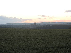
High Shincliffe is surrounded by farmland supporting a mixture of crops and livestock, and several brakes largely deciduous woodland. There are no rivers but Whitwell Beck rises in High Shincliffe. Many footpaths and bridleways cross the fields, which often have boundaries of hawthorn hedges. The hedgerows include trees such as oak, ash and rowan, and bushes such as bramble, briar, elder and blackthorn.
Coal Measures
, from which coal was mined for several decades during the nineteenth century. As elsewhere on the Durham coalfield, the principal seam mined was the Hutton Seam, as this was generally of sufficient thickness to make mining economically viable. Several other thinner seams were also mined. The strata dip southwards, and so the Hutton Seam lies at some depth. Moreover, several metres of boulder clay
glacial drift
is overlying, and is of sufficient depth to prevent any outcropping. Two sand pits can be found towards Shincliffe Village, and whilst of no economic value now, will have had some significance in times past. It can be speculated that these pockets of sand resulted from small rivers outflowing from retreating glaciers at the end of the last Ice Age
about 10,000 years ago. Sand martins build their nests in these sand pits.
Visible from High Shincliffe, from the south west around to the east, are escarpments of Permian
magnesian limestone (dolomite
), which is intensively quarried for roadstone throughout the region.
Shincliffe Bank is probably the south easterly bank of a deep flood plain following the course of a swollen, immediately post-glacial River Wear.
Of note, too, is a spring in the bank on the same side of the road several hundred metres towards High Shincliffe.
Village.
http://www.dailymail.co.uk/news/article-1201388/The-Grand-Canyon-Durham-Flooding-heavy-rain-carves-vast-trench-farm-land.html
County Durham
County Durham is a ceremonial county and unitary district in north east England. The county town is Durham. The largest settlement in the ceremonial county is the town of Darlington...
, England
England
England is a country that is part of the United Kingdom. It shares land borders with Scotland to the north and Wales to the west; the Irish Sea is to the north west, the Celtic Sea to the south west, with the North Sea to the east and the English Channel to the south separating it from continental...
. It is situated about two miles south-east of Durham
Durham
Durham is a city in north east England. It is within the County Durham local government district, and is the county town of the larger ceremonial county...
City, on the A177 road
A177 road
The A177 is a road in County Durham, England. It runs from Stockton to Durham, passing Sedgefield. It therefore links the two main centres for Durham University: Durham City and the university's Queen's Campus in Stockton, via the NetPark knowledge park in Sedgefield, in which the university is a...
to Stockton-on-Tees
Stockton-on-Tees
Stockton-on-Tees is a market town in north east England. It is the major settlement in the unitary authority and borough of Stockton-on-Tees. For ceremonial purposes, the borough is split between County Durham and North Yorkshire as it also incorporates a number of smaller towns including...
. The altitude of High Shincliffe is approximately 90 metres (295.3 ft), and it lies 55 metres (180.4 ft) above the River Wear
River Wear
The River Wear is located in North East England, rising in the Pennines and flowing eastwards, mostly through County Durham, to the North Sea at Sunderland.-Geology and history:...
at Shincliffe bridge.
High Shincliffe, formerly known as Shincliffe Colliery, is still often thought of as being part of Shincliffe
Shincliffe
Shincliffe is a village in the County Durham in England. It is situated just over a mile to the south-east of Durham city centre, on the A177 road to Stockton...
, although the terms Shincliffe Village and High Shincliffe are also often used to distinguish the two. The place name sign on the A177 northbound through High Shincliffe reads 'Shincliffe'.
Ecclesiastically, High Shincliffe is within the Church of England
Church of England
The Church of England is the officially established Christian church in England and the Mother Church of the worldwide Anglican Communion. The church considers itself within the tradition of Western Christianity and dates its formal establishment principally to the mission to England by St...
parish of Shincliffe, in the diocese of Durham
Diocese of Durham
The Diocese of Durham is a Church of England diocese, based in Durham, and covering the historic County Durham . It was created in AD 1000 to replace the Diocese of Lindisfarne...
. There is no church in High Shincliffe, although there was once a chapel, remembered in the name given to the location of two houses built on the site: Chapel Place. The parish church of St. Mary is located in Shincliffe Village, where there is also a graveyard in which burials still take place.
High Shincliffe is part of the civil parish of Shincliffe which is unwarded and elects a parish council. High Shincliffe is part of the Durham South electoral division of Durham County Council. High Shincliffe is in the Durham City parliamentary constituency represented by the Labour Party
Labour Party (UK)
The Labour Party is a centre-left democratic socialist party in the United Kingdom. It surpassed the Liberal Party in general elections during the early 1920s, forming minority governments under Ramsay MacDonald in 1924 and 1929-1931. The party was in a wartime coalition from 1940 to 1945, after...
's Roberta Blackman-Woods
Roberta Blackman-Woods
Professor Roberta Carol Blackman-Woods is a British Labour Party politician who has been the Member of Parliament for the City of Durham since 2005.-Biography:...
.
Facilities
High Shincliffe can be characterised as a dormitory suburb of Durham City. There is a small, well-regarded, primary school, a recreational park with a playing field with equipment for young children, a public house, a public telephone box and several bus stops. There used to be a sub Post OfficePost office
A post office is a facility forming part of a postal system for the posting, receipt, sorting, handling, transmission or delivery of mail.Post offices offer mail-related services such as post office boxes, postage and packaging supplies...
at Bank Top which also served as a small general store. The nearest shops and Post Office are in Bowburn
Bowburn
Bowburn is a village in County Durham, England. It is situated about to the south-east of Durham, on the A177, between Coxhoe to the south-east, and High Shincliffe to the north-west.It is part of the Cassop-cum-Quarrington parish.- History :...
, about a mile to the south. The nearest public lending library is also in Bowburn, although the new Clayport Library in Durham has a wider range of books and facilities.
Broadband
Broadband
The term broadband refers to a telecommunications signal or device of greater bandwidth, in some sense, than another standard or usual signal or device . Different criteria for "broad" have been applied in different contexts and at different times...
quality is poor, caused by the distance to Durham telephone exchange. High Shincliffe is not served by a cable network
Cable network
A cable channel is a television channel available via cable television. Such channels are usually also available via satellite television, including direct broadcast satellite providers such as DirecTV, Dish Network and BSkyB...
. Digital television
Digital television
Digital television is the transmission of audio and video by digital signals, in contrast to the analog signals used by analog TV...
by aerial is available from the transmitter at Pontop Pike, but the quality of reception can be patchy. There is adequate, though not excellent, mobile phone reception in High Shincliffe.
There are no public recycling facilities in High Shincliffe, although there is a fortnightly kerbside collection of material for recycling. More extensive recycling facilities are located at Coxhoe
Coxhoe
Coxhoe is a village in County Durham, England. It is situated between Bowburn and Cornforth, a few miles south of Durham.Coxhoe is also a civil parish which also includes nearby Quarrington Hill....
.
Transport
High Shincliffe is within a mile of the A1(M) from London to Edinburgh, although its nearest junction is two miles away at Bowburn.The A177 from Durham to Bowburn, via High Shincliffe, has been partly laid out as a cycle route. High Shincliffe is served by several bus routes, some to local villages, and others ranging more regionally. The buses are popular, but car ownership in High Shincliffe is high, not least because most supermarket shopping is located at out-of-town sites with no direct bus links (Sainsbury's and Lidl at the Arnison Centre; Tesco and Aldi in Gilesgate Moor and Dragonville).
The nearest railway station is about three miles away in Durham, on the East Coast Main Line
East Coast Main Line
The East Coast Main Line is a long electrified high-speed railway link between London, Peterborough, Doncaster, Wakefield, Leeds, York, Darlington, Newcastle and Edinburgh...
between London and Edinburgh. The next major station to the north is Newcastle (16 minutes), and to the south is Darlington (20 minutes).
Two airports, approximately equidistant, are within reach of High Shincliffe. To the north is Newcastle Airport
Newcastle Airport
Newcastle International Airport is located in Woolsington in the City of Newcastle upon Tyne, England, north-west of the city centre. In 2010 it was the 11th busiest airport in the United Kingdom....
(the major of the two airports); to the south, near Darlington, is Durham Tees Valley Airport
Durham Tees Valley Airport
Durham Tees Valley Airport is an international airport in north east England, located southeast of Darlington, about southwest of Middlesbrough and south of Durham. The airport serves County Durham and parts of North Yorkshire, and is in Middleton St George in the borough of Darlington...
(formerly Teesside Airport).
History
During the nineteenth century High Shincliffe was known as Shincliffe Colliery, as shown on the Ordnance Survey map of 1856-1865. According to Durham Mining Museum, a shaft into a coal mine was first sunk here in 1837. Two years later the mine started to produce coal. By 1840 the colliery was in full production, mining a seam of coal (the Hutton seam) 6 feet (1.8 m) thick at a depth of 400 feet (121.9 m), which was 100 feet (30.5 m) below sea level. Most of the pre-twentieth century houses in High Shincliffe date from this period, including Quality Street. In total, 18 people were killed at the mine, the youngest being a girl aged nine years who strayed onto the waggonway and was crushed by some waggons. The mine was finally closed, considered exhausted, in 1875.From that closure the population declined substantially; this can be seen on the Ordnance Survey map of 1894-1899. The maps of 1919-1926, 1938–1950 and 1951-1959 show only a handful of rows of houses remaining. By the time of the 1960-1969 Ordnance Survey map there were even fewer houses, and the name Shincliffe Colliery was finally lost. The only cartographical indication that these dwellings were separate from Shincliffe (Village) is the retention of the name 'Bank Top' for the houses that clustered around the Post Office at the top of Shincliffe Bank.
Subsequently, policy changes by the County Council led to a major housing development and primary school, and the introduction of the name 'High Shincliffe'.
Most evidence of the nineteenth century colliery has long vanished but some houses of the period remain, such as in Quality Street, Pond Street and The Avenue. The school is built on site of the pit head, and the centre circle of the school's football pitch marks the spot where the coal mine shaft was sunk. The line of the colliery waggon-way can still be traced northwards past Manor Farm and on to Shincliffe Lane. To the south-east a waggon-way was extended to join what was once the main railway line from London to Edinburgh, now locally called the Leamside Line, at Shincliffe Station.
Natural history
Much of High Shincliffe has generous amounts of open space and footpaths and a tranquil atmosphere. Consequently there is considerable wildlife and many types of bird. Mice and shrews are common, as are bats during the warmer months. Foxes and badgers are in the fields around the estate.High Shincliffe is surrounded by farmland supporting a mixture of crops and livestock, and several brakes largely deciduous woodland. There are no rivers but Whitwell Beck rises in High Shincliffe. Many footpaths and bridleways cross the fields, which often have boundaries of hawthorn hedges. The hedgerows include trees such as oak, ash and rowan, and bushes such as bramble, briar, elder and blackthorn.
Geology
High Shincliffe lies on CarboniferousCarboniferous
The Carboniferous is a geologic period and system that extends from the end of the Devonian Period, about 359.2 ± 2.5 Mya , to the beginning of the Permian Period, about 299.0 ± 0.8 Mya . The name is derived from the Latin word for coal, carbo. Carboniferous means "coal-bearing"...
Coal Measures
Coal Measures
The Coal Measures is a lithostratigraphical term for the coal-bearing part of the Upper Carboniferous System. It represents the remains of fluvio-deltaic sediment, and consists mainly of clastic rocks interstratified with the beds of coal...
, from which coal was mined for several decades during the nineteenth century. As elsewhere on the Durham coalfield, the principal seam mined was the Hutton Seam, as this was generally of sufficient thickness to make mining economically viable. Several other thinner seams were also mined. The strata dip southwards, and so the Hutton Seam lies at some depth. Moreover, several metres of boulder clay
Boulder clay
Boulder clay, in geology, is a deposit of clay, often full of boulders, which is formed in and beneath glaciers and ice-sheets wherever they are found, but is in a special sense the typical deposit of the Glacial Period in northern Europe and North America...
glacial drift
Moraine
A moraine is any glacially formed accumulation of unconsolidated glacial debris which can occur in currently glaciated and formerly glaciated regions, such as those areas acted upon by a past glacial maximum. This debris may have been plucked off a valley floor as a glacier advanced or it may have...
is overlying, and is of sufficient depth to prevent any outcropping. Two sand pits can be found towards Shincliffe Village, and whilst of no economic value now, will have had some significance in times past. It can be speculated that these pockets of sand resulted from small rivers outflowing from retreating glaciers at the end of the last Ice Age
Ice age
An ice age or, more precisely, glacial age, is a generic geological period of long-term reduction in the temperature of the Earth's surface and atmosphere, resulting in the presence or expansion of continental ice sheets, polar ice sheets and alpine glaciers...
about 10,000 years ago. Sand martins build their nests in these sand pits.
Visible from High Shincliffe, from the south west around to the east, are escarpments of Permian
Permian
The PermianThe term "Permian" was introduced into geology in 1841 by Sir Sir R. I. Murchison, president of the Geological Society of London, who identified typical strata in extensive Russian explorations undertaken with Edouard de Verneuil; Murchison asserted in 1841 that he named his "Permian...
magnesian limestone (dolomite
Dolomite
Dolomite is a carbonate mineral composed of calcium magnesium carbonate CaMg2. The term is also used to describe the sedimentary carbonate rock dolostone....
), which is intensively quarried for roadstone throughout the region.
Shincliffe Bank is probably the south easterly bank of a deep flood plain following the course of a swollen, immediately post-glacial River Wear.
Of note, too, is a spring in the bank on the same side of the road several hundred metres towards High Shincliffe.
Other
Shincliffe Bank is sufficiently lengthy that a water trough for the refreshment of draught horses can still be seen on the southbound side of the A177 close to the Seven Stars public house at the High Shincliffe end of ShincliffeShincliffe
Shincliffe is a village in the County Durham in England. It is situated just over a mile to the south-east of Durham city centre, on the A177 road to Stockton...
Village.
People
Having only a relatively short history, High Shincliffe boasts few well-known residents, past or present.- Tony BlairTony BlairAnthony Charles Lynton Blair is a former British Labour Party politician who served as the Prime Minister of the United Kingdom from 2 May 1997 to 27 June 2007. He was the Member of Parliament for Sedgefield from 1983 to 2007 and Leader of the Labour Party from 1994 to 2007...
lived in Hill Meadows during his school years at the Chorister SchoolChorister SchoolThe Chorister School is a co-educational independent school for the 2 to 13 age range. It consists of a nursery , a pre-preparatory and preparatory day and boarding school in Durham, England...
in Durham.
External links
- Shincliffe Community Association
- Shincliffe Parish Council
- GenUKi entry on Shincliffe
- History of Sherburn House Station, including further information on Shincliffe Station
http://www.dailymail.co.uk/news/article-1201388/The-Grand-Canyon-Durham-Flooding-heavy-rain-carves-vast-trench-farm-land.html
Further reading
- "British Regional Geology: Northern England", Fourth Edition, Institute of Geological Sciences, HMSO, London, 1971.