
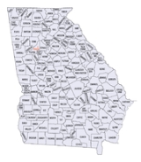
Georgia census statistical areas
Encyclopedia
The United States Census Bureau
has defined 5 Combined Statistical Area
s (CSAs), 15 Metropolitan Statistical Areas (MSAs), and 24 Micropolitan Statistical Areas (μSAs) in the State of Georgia
. The following table describes these areas with the following information:
_counties_map.png)
United States Census Bureau
The United States Census Bureau is the government agency that is responsible for the United States Census. It also gathers other national demographic and economic data...
has defined 5 Combined Statistical Area
Combined Statistical Area
The United States Office of Management and Budget defines micropolitan and metropolitan statistical areas. Metropolitan and micropolitan statistical areas consist of one or more counties...
s (CSAs), 15 Metropolitan Statistical Areas (MSAs), and 24 Micropolitan Statistical Areas (μSAs) in the State of Georgia
Georgia (U.S. state)
Georgia is a state located in the southeastern United States. It was established in 1732, the last of the original Thirteen Colonies. The state is named after King George II of Great Britain. Georgia was the fourth state to ratify the United States Constitution, on January 2, 1788...
. The following table describes these areas with the following information:
- The name of the Combined Statistical Area (CSA), if any.
- The population of the CSA as of 2006-07-01, as estimated by the United States Census Bureau.
- The name of the Core Based Statistical AreaCore based statistical areaA Core Based Statistical Area is a U.S. geographic area defined by the Office of Management and Budget based around an urban center of at least 10,000 people and adjacent areas that are socioeconomically tied to the urban center by commuting. Areas defined on the basis of these standards applied...
(CBSA). - The population of the CBSA as of 2006-07-01, as estimated by the United States Census Bureau.
- The name of the countyCounty (United States)In the United States, a county is a geographic subdivision of a state , usually assigned some governmental authority. The term "county" is used in 48 of the 50 states; Louisiana is divided into parishes and Alaska into boroughs. Parishes and boroughs are called "county-equivalents" by the U.S...
. - The population of the county as of 2006-07-01, as estimated by the United States Census Bureau.
| Combined Statistical Area | 2006 Pop | Core Based Statistical Area | 2006 Pop | County | 2006 Pop |
|---|---|---|---|---|---|
| Atlanta-Sandy Springs-Gainesville, GA-AL CSA | 5,478,667 5,443,491 |
Atlanta-Sandy Springs-Marietta, GA MSA | 5,138,223 | Fulton County, Georgia Fulton County, Georgia Fulton County is a county located in the U.S. state of Georgia. Its county seat is Atlanta, the state capital since 1868 and the principal county of the Atlanta metropolitan area... |
1,033,756 |
| Gwinnett County, Georgia Gwinnett County, Georgia , Gwinnett County had a population of 805,321. The racial and ethnic composition of the population was 53.3% white , 23.6% black , 2.7% Korean, 2.6% Asian Indian, 2.0% Vietnamese, 3.3% other Asian, 0.1% Pacific Islander, 8.8% some other race and 3.1% from two or more races... |
808,167 | ||||
| DeKalb County, Georgia DeKalb County, Georgia DeKalb County is a county located in the U.S. state of Georgia. The population of the county was 691,893 at the 2010 census. Its county seat is the city of Decatur. It is bordered to the west by Fulton County and contains roughly 10% of the city of Atlanta... |
747,274 | ||||
| Cobb County, Georgia Cobb County, Georgia Cobb County is a county located in the U.S. state of Georgia. Its county seat and largest city is Marietta, which is located in the center of the county. The county was named for Thomas Willis Cobb, who in the early 19th century was a United States representative and senator from Georgia... |
714,692 | ||||
| Clayton County, Georgia Clayton County, Georgia Clayton County is a county located in the U.S. state of Georgia. As of 2000, the population was 236,517. The 2008 Census estimate placed the population at 273,718. The county seat is Jonesboro... |
273,718 | ||||
| Cherokee County, Georgia Cherokee County, Georgia As of the census of 2000, there were 141,903 people, 49,495 households, and 39,200 families residing in the county. The population density was 335 people per square mile . There were 51,937 housing units at an average density of 123 per square mile... |
215,084 | ||||
| Henry County, Georgia Henry County, Georgia Henry County is a growing suburban county located in the U.S. state of Georgia. As of the 2000 census, the population was 119,341. As of 2010, the county's population swelled to 203,922, up 70.9% from the previous census and becoming Georgia's 8th most populous county and the 10th fastest growing... |
201,343 | ||||
| Forsyth County, Georgia Forsyth County, Georgia Forsyth County is a county located in the U.S. state of Georgia. The county seat is Cumming, Georgia. Forsyth County is a part of the Atlanta metropolitan area... |
174,520 | ||||
| Paulding County, Georgia Paulding County, Georgia Paulding County is a county located in the U.S. state of Georgia. As of the 2010 census, the population was 142,324. The county seat is Dallas.... |
127,906 | ||||
| Douglas County, Georgia Douglas County, Georgia Douglas County, Georgia has been experiencing numerous natural disasters over the most recent decades. Being located in the South Eastern United States the county experiences strong storms and tornadoes often because of its location in Dixie Alley.... |
119,557 | ||||
| Coweta County, Georgia Coweta County, Georgia Coweta County is a county located in the U.S. state of Georgia. As of 2000, the population was 89,215. The 2009 Census Estimate placed the population at 131,936... |
115,291 | ||||
| Carroll County, Georgia Carroll County, Georgia Carroll County is a county located in the U.S. state of Georgia. As of the 2000 census, the population was 87,268. The 2007 Census Estimate shows a population of 111,954... |
107,325 | ||||
| Fayette County, Georgia Fayette County, Georgia Fayette County is a county located in the U.S. state of Georgia. As of 2000, the population was 91,263. The 2007 Census Estimate shows a population of 106,144. The county seat is Fayetteville.... |
106,671 | ||||
| Newton County, Georgia Newton County, Georgia Newton County is a county located in the U.S. state of Georgia. As of 2000, the population was 62,001. The 2010 Census showed a population of 99,958. The county seat is Covington.... |
91,451 | ||||
| Bartow County, Georgia Bartow County, Georgia Bartow County is a county located in the U.S. state of Georgia. As of the 2010 census, the population was 100,157. According to the U.S. Census Bureau's July 1, 2009 estimate, the county's explosive growth resulted in a population of 96,217, a 26.5% increase in less than ten years... |
91,266 | ||||
| Rockdale County, Georgia Rockdale County, Georgia Rockdale County is a county located in the U.S. state of Georgia. As of 2000, the population was 70,111. The 2007 Census Estimate shows a population of 82,052. Two years later, the population was 84,569. The county seat is Conyers.-Geography:... |
80,332 | ||||
| Walton County, Georgia Walton County, Georgia Walton County is a county located in the U.S. state of Georgia. As of 2009, the population was 87,311. The county seat is Monroe.This county is a part of the Atlanta Metropolitan Area .... |
79,388 | ||||
| Barrow County, Georgia Barrow County, Georgia Barrow County is a county located in the U.S. state of Georgia. As of 2000, the population was 46,144. The 2007 Census Estimate placed the population at 67,139... |
63,702 | ||||
| Spalding County, Georgia Spalding County, Georgia Spalding County is a county located in the U.S. state of Georgia. It was created December 20, 1851. As of 2000, the population was 58,417. The 2007 Census Estimate showed a population of 62,826... |
62,185 | ||||
| Pickens County, Georgia Pickens County, Georgia Pickens County is a county located in the U.S. state of Georgia. The 2000 Census showed a population of 22,983. The 2007 Census Estimate showed a population of 30,488... |
29,640 | ||||
| Haralson County, Georgia Haralson County, Georgia Haralson County is a county located in the U.S. state of Georgia. It was created on January 26, 1856 and was named for Hugh A. Haralson. As of 2000, the population was 25,690. The 2007 Census Estimate shows a population of 28,718... |
28,616 | ||||
| Butts County, Georgia Butts County, Georgia Butts County is a county located in the northern half of the U.S. state of Georgia. It was created on December 24, 1825. As of 2000, the population was 19,522. The 2007 Census Estimate showed a population of 23,759... |
23,561 | ||||
| Meriwether County, Georgia Meriwether County, Georgia Meriwether County is a county located in the U.S. state of Georgia. It was created on December 14, 1827. As of 2000, the population was 22,534. The 2009 Census Estimate reflects a population of 22,783... |
22,881 | ||||
| Dawson County, Georgia Dawson County, Georgia Dawson County is a county located in the U.S. state of Georgia. It was created on December 3, 1857 from Gilmer and Lumpkin counties. As of 2000, the population is 15,999. The 2007 Census Estimate showed a population of 21,484... |
20,643 | ||||
| Pike County, Georgia Pike County, Georgia Pike County is a county located in the U.S. state of Georgia. It was created on December 9, 1822. As of 2000, the population was 13,688. The 2007 Census Estimate shows a population of 17,204... |
16,801 | ||||
| Lamar County, Georgia Lamar County, Georgia Lamar County is a county located in the U.S. state of Georgia. As of 2000, the population was 15,912. The 2007 Census Estimate shows a population of 16,961... |
16,679 | ||||
| Jasper County, Georgia Jasper County, Georgia Jasper County is a county located in the U.S. state of Georgia. As of 2000, the population was 11,426. The 2007 Census Estimate shows a population of 13,660... |
13,624 | ||||
| Heard County, Georgia Heard County, Georgia Heard County is a county located in the U.S. state of Georgia. It was created on December 22, 1830. As of 2000, the population was 11,012. The 2007 Census Estimate shows a population of 11,387... |
11,472 | ||||
| Gainesville, GA MSA | 173,256 | Hall County, Georgia Hall County, Georgia Hall County is a county located in the U.S. state of Georgia. In 2000, the population was 139,277. It is included in the Gainesville, Georgia, Metropolitan Statistical Area... |
173,256 | ||
| LaGrange, GA μSA | 63,245 | Troup County, Georgia Troup County, Georgia Troup County is a county located in the U.S. state of Georgia. As of 2010, the population was 67,044. The county seat is LaGrange.-History:... |
63,245 | ||
| Cedartown, GA μSA | 41,091 | Polk County, Georgia Polk County, Georgia Polk County is a county located in the U.S. state of Georgia. As of 2000, the population was 38,127. The 2007 Census Estimate shows a population of 41,460. The county seat is Cedartown.- History :... |
41,091 | ||
| Valley, AL μSA | 35,176 | Chambers County, Alabama Chambers County, Alabama Chambers County is a county of the U.S. state of Alabama. Its name is in honor of Henry H. Chambers, who served as a United States Senator from Alabama. As of 2010 the population was 34,215. Its county seat is Lafayette... |
35,176 | ||
| Thomaston, GA μSA | 27,676 | Upson County, Georgia Upson County, Georgia Upson County is a county located in the U.S. state of Georgia. It is a part of the Atlanta Metropolitan Area . It was created on December 15, 1824. As of 2000, the population was 27,597. The 2007 Census Estimate shows a population of 27,562... |
27,676 | ||
| Savannah-Hinesville-Fort Stewart, GA CSA | 394,036 | Savannah, GA MSA | 320,013 | Chatham County, Georgia Chatham County, Georgia Chatham County is a county located in the U.S. state of Georgia. The county seat and largest city is Savannah. In the official US Census of 2010, Chatham County had a total population of 265,128 . Chatham is the most populous Georgia county outside the Atlanta metropolitan area... |
241,411 |
| Effingham County, Georgia Effingham County, Georgia Effingham County is a county located in the U.S. state of Georgia. In the United States Census of 2000, the population was 37,535. The Census Bureau's 2008 estimate estimates that this figure has grown to 52,060. The seat of Effingham County is Springfield.... |
48,954 | ||||
| Bryan County, Georgia Bryan County, Georgia Bryan County is a county located in the U.S. state of Georgia. As of 2000, the population was 23,417. The 2007 Census Estimate shows a population of 30,132... |
29,648 | ||||
| Hinesville-Fort Stewart, GA MSA | 74,023 | Liberty County, Georgia Liberty County, Georgia Liberty County is a county located in the U.S. state of Georgia. As of 2000, the population was 61,610. The 2007 Census Estimate shows a population of 60,503... |
62,571 | ||
| Long County, Georgia Long County, Georgia Long County is a county located in the U.S. state of Georgia. The constitutional amendment to create the county was proposed August 14, 1920, and ratified November 2, 1920. As of 2000, the population is 10,304. The 2007 Census Estimate shows a population of 11,300... |
11,452 | ||||
| Macon-Warner Robins-Fort Valley, GA CSA | 381,641 | Macon, GA MSA | 229,326 | Bibb County, Georgia Bibb County, Georgia Bibb County is a county located in the U.S. state of Georgia. As of 2000, the population was 153,887. The 2007 Census Estimate shows a population of 154,709... |
154,903 |
| Jones County, Georgia Jones County, Georgia Jones County is a county located in the U.S. state of Georgia. It was created on December 10, 1807. As of 2010, the population was 27,740 . The county seat is Gray.-History:The county is named after U.S... |
26,973 | ||||
| Monroe County, Georgia Monroe County, Georgia Monroe County is a county located in the U.S. state of Georgia. It was created on May 15, 1821. As of 2000, the population was 21,757. The 2007 Census Estimate showed a population of 25,145... |
24,443 | ||||
| Crawford County, Georgia Crawford County, Georgia Crawford County is a county located in the U.S. state of Georgia. As of 2000, the population was 12,495. The 2007 Census Estimate shows a population of 12,483. The unincorporated county seat is Knoxville.-History:... |
12,823 | ||||
| Twiggs County, Georgia Twiggs County, Georgia Twiggs County is a county located in the U.S. state of Georgia. It was created on December 14, 1809. As of 2000, the population was 10,590. The 2007 Census Estimate shows a population of 10,280... |
10,184 | ||||
| Warner Robins, GA MSA | 127,530 | Houston County, Georgia Houston County, Georgia Houston County is a county located in the U.S. state of Georgia. It was created on May 15, 1821, as one of five huge counties, later reduced in the formation of Bibb, Crawford, Pike, Macon and Peach counties. As of the 2000 census, the population is 110,765... |
127,530 | ||
| Fort Valley, GA μSA | 24,785 | Peach County, Georgia Peach County, Georgia Peach County is a county located in the U.S. state of Georgia. As of the 2000 census, the population was 23,668. The 2007 Census Estimate showed a population of 25,672. Its county seat is Fort Valley.... |
24,785 | ||
| primary census statistical area | 523,249 346,188 |
Augusta-Richmond County, GA-SC MSA | 523,249 346,188 |
Richmond County, Georgia Richmond County, Georgia Richmond County is a county located in the U.S. state of Georgia. It is one of the original counties of Georgia, created February 5, 1777. As of 2010, the population was 200,549. The 2007 Census Estimate showed a population of 199,486.... |
194,398 |
| Aiken County, South Carolina Aiken County, South Carolina Aiken County is a county located in the U.S. state of South Carolina. In 2000, its population was 142,552; in 2010, the U.S. Census Bureau estimated that its population had reached 160,099... |
151,800 | ||||
| Columbia County, Georgia Columbia County, Georgia Columbia County is a county located in the US state of Georgia along the Savannah River. As of 2010 the population was 124,054 a growth of 39% from the 2000 census figure of 89,288. The de jure county seat is Appling. Appling is an unincorporated area, making Columbia one of only three counties... |
106,887 | ||||
| Edgefield County, South Carolina | 25,261 | ||||
| Burke County, Georgia Burke County, Georgia Burke County is a county located in the U.S. state of Georgia. As of 2000, the population was 22,243. The 2007 Census Estimate showed a population of 22,754... |
22,986 | ||||
| McDuffie County, Georgia McDuffie County, Georgia McDuffie County is a county located in the U.S. state of Georgia. It was created on October 18, 1870. As of 2000, the population was 21,231. The 2007 Census Estimate showed a population of 21,551. The county seat is Thomson.... |
21,917 | ||||
| Columbus-Auburn-Opelika, GA-AL CSA | 437,222 238,762 |
Columbus, GA-AL MSA | 288,847 238,762 |
Muscogee County, Georgia Muscogee County, Georgia Muscogee County is a county located on the central western border of the U.S. state of Georgia. It is part of the Columbus, Georgia-Alabama Metropolitan Statistical Area. As of the 2000 census, the population was 186,291. The 2009 Census Estimate shows a population of 190,414... |
188,660 |
| Russell County, Alabama Russell County, Alabama Russell County is a county of the U.S. state of Alabama. Its name is in honor of Colonel Gilbert C. Russell, who fought in the wars against the Creek Indians. As of 2010, the population was 52,947... |
50,085 | ||||
| Harris County, Georgia Harris County, Georgia Harris County is located in the U.S. state of Georgia. It was created on December 14, 1827. As of 2000, the population was 23,695. The 2007 Census Estimate shows a population of 29,073. The county seat is Hamilton... |
28,785 | ||||
| Chattahoochee County, Georgia Chattahoochee County, Georgia Chattahoochee County is a county located in the U.S. state of Georgia. It was created on February 13, 1854. The 2000 Census reported a population of 14,882. The 2009 Census Estimate shows a population of 14,402. It is part of the Columbus, Georgia-Alabama Metropolitan Statistical Area... |
14,041 | ||||
| Marion County, Georgia Marion County, Georgia Marion County is located in the U.S. state of Georgia. It was created on December 14, 1827. It is part of the Columbus, Georgia-Alabama Metropolitan Statistical Area. The 2000 Census reflected a population of 7,144. The 2009 Census Estimate shows a population of 6,995... |
7,276 | ||||
| Auburn-Opelika, AL MSA | 125,781 | Lee County, Alabama Lee County, Alabama Lee County is a county of the U.S. state of Alabama. It is named in honor of Robert E. Lee, commanding general of the Confederate Army. As of 2010 the population was 140,247. It is part of the Auburn, Alabama Metropolitan Area. The county seat is Opelika, and the largest city is Auburn... |
125,781 | ||
| Tuskegee, AL μSA | 22,594 | Macon County, Alabama Macon County, Alabama Macon County is a county in the U.S. state of Alabama. Its name is in honor of Nathaniel Macon, a member of the United States Senate from North Carolina. Developed for cotton plantation agriculture in the nineteenth century, it is one of the counties in Alabama within the Black Belt of the South.As... |
22,594 | ||
| primary census statistical area | 185,479 | Athens-Clarke County, GA MSA | 185,479 | Clarke County, Georgia Clarke County, Georgia Clarke County is a county in the U.S. state of Georgia. As of the 2000 census, the population was 101,489. The 2007 Census Estimate shows a population of 114,063... |
112,787 |
| Oconee County, Georgia Oconee County, Georgia Oconee County is a county located in the U.S. state of Georgia. It was created on February 25, 1875. As of the 2000 census, the population was 26,225. Census estimates for 2007 show a population of 31,367... |
30,858 | ||||
| Madison County, Georgia Madison County, Georgia Madison County is a county located in the U.S. state of Georgia. It was created on December 5, 1811. As of 2000, the population was 25,730. The 2007 Census Estimate shows a population of 28,012. The county seat is Danielsville.... |
27,837 | ||||
| Oglethorpe County, Georgia Oglethorpe County, Georgia Oglethorpe County is a county located in the U.S. state of Georgia. It is the largest county in Northeast Georgia. As of 2000, the population was 12,635. The 2007 Census Estimate showed a population of 13,963... |
13,997 | ||||
| primary census statistical area | 163,961 | Albany, GA MSA | 163,961 | Dougherty County, Georgia Dougherty County, Georgia Dougherty County is a county located in the U.S. state of Georgia. As of 2000, the population was 96,065. The 2009 Census Estimate shows a population of 95,859. It is included in the Albany, Georgia Metropolitan Statistical Area... |
94,773 |
| Lee County, Georgia Lee County, Georgia Lee County is a county located in the U.S. state of Georgia. As of 2000, the population was 24,757. The 2007 Census Estimate shows a population of 33,050... |
32,495 | ||||
| Worth County, Georgia Worth County, Georgia Worth County is a county located in the southwestern part of the U.S. state of Georgia. As of 2000, the population was 21,967. The 2007 Census Estimate shows a population of 21,285... |
21,938 | ||||
| Terrell County, Georgia Terrell County, Georgia Terrell County is a county located in the U.S. state of Georgia. The 2000 United States Census reported the county's population at 10,970. The 2007 Census Estimate shows a population of 10,260... |
10,657 | ||||
| Baker County, Georgia Baker County, Georgia Baker County is a county in the U.S. state of Georgia. , the population is 4,074. The 2007 Census Estimate placed the population at 3,781. The county seat is Newton.Baker County is included in the Albany, Georgia Metropolitan Statistical Area.-History:... |
4,098 | ||||
| Chattanooga-Cleveland-Athens, TN-GA CSA | 658,201 142,855 |
Chattanooga, TN-GA MSA | 496,704 142,855 |
Hamilton County, Tennessee Hamilton County, Tennessee Hamilton County is a county located in the U.S. state of Tennessee. It was named for Alexander Hamilton, the first Secretary of the Treasury. The 2005 Census Estimate placed the population at 310,935 . Its county seat is Chattanooga.... |
312,905 |
| Walker County, Georgia Walker County, Georgia Walker County is a county located in the U.S. state of Georgia. It was created on December 18, 1833 from land formerly belonging to the Cherokee Indian Nation. As of 2000, the population was 61,053. The 2007 Census Estimate shows a population of 64,554... |
64,606 | ||||
| Catoosa County, Georgia Catoosa County, Georgia Catoosa County is a county located in the U.S. state of Georgia. It was created on December 5, 1853. As of 2000, the population was 53,282. The 2007 Census Estimate shows a population of 62,241... |
62,016 | ||||
| Marion County, Tennessee Marion County, Tennessee Marion County is a county located in the U.S. state of Tennessee. As of 2000, the population was 27,776. Its county seat is Jasper.Marion County is part of the Chattanooga, TN–GA Metropolitan Statistical Area.-Geography:According to the U.S... |
27,942 | ||||
| Dade County, Georgia Dade County, Georgia Dade County is a county located in the U.S. state of Georgia. As of 2000, the population is 15,154. The 2007 Census Estimate shows a population of 16,098... |
16,233 | ||||
| Sequatchie County, Tennessee | 13,002 | ||||
| Cleveland, TN MSA | 109,477 | Bradley County, Tennessee | 93,538 | ||
| Polk County, Tennessee | 15,939 | ||||
| Athens, TN μSA | 52,020 | McMinn County, Tennessee | 52,020 | ||
| primary census statistical area | 134,397 | Dalton, GA MSA | 134,397 | Whitfield County, Georgia Whitfield County, Georgia Whitfield County is a county located in the U.S. state of Georgia. It was created on December 30, 1851. The 2010 Census shows a population of 102,599. The county seat is Dalton.It is part of the Dalton, Georgia, Metropolitan Statistical Area.-Civil War:... |
92,999 |
| Murray County, Georgia Murray County, Georgia Murray County is a county located in the U.S. state of Georgia. As of 2000, the population was 36,506. The 2007 Census Estimate showed a population of 40,664. The county seat is Chatsworth.It is part of the Dalton, Georgia, Metropolitan Statistical Area.... |
41,398 | ||||
| primary census statistical area | 126,305 | Valdosta, GA MSA | 126,305 | Lowndes County, Georgia Lowndes County, Georgia Lowndes County is a county located in the U.S. state of Georgia along the Florida border. It was created December 23, 1825. The 2010 Census showed a population of 109,233... |
97,844 |
| Brooks County, Georgia Brooks County, Georgia Brooks County is a county located in the U.S. state of Georgia. It is part of the Valdosta, Georgia Metropolitan Statistical Area. As of 2010, the population was 16,243. The county seat is Quitman... |
16,464 | ||||
| Lanier County, Georgia Lanier County, Georgia Lanier County is a county located in the U.S. state of Georgia. It is part of the Valdosta, Georgia Metropolitan Statistical Area. As of 2009, the population was 8,423. The 2007 Census Estimate shows a population of 7,847. The county seat is Lakeland. Lakeland is Lanier County's only incorporated... |
7,723 | ||||
| Echols County, Georgia Echols County, Georgia Echols County is a county located in the U.S. state of Georgia. It is part of the Valdosta, Georgia Metropolitan Statistical Area. As of 2000, the population is 3,754. The 2007 Census Estimate shows a population of 4,093. The county seat is Statenville... |
4,274 | ||||
| primary census statistical area | 100,613 | Brunswick, GA MSA | 100,613 | Glynn County, Georgia Glynn County, Georgia Glynn County is a county located in the U.S. state of Georgia. As of 2000, the population was 67,568. The 2008 Census Estimate showed a population of 75,884... |
73,630 |
| Brantley County, Georgia Brantley County, Georgia Brantley County is a county located in the U.S. state of Georgia. It is part of the 'Brunswick, Georgia Metropolitan Statistical Area' which encompasses all of Brantley, Glynn, and McIntosh counties. As of 2000, the population is 14,629. The 2007 Census Estimate shows a population of 15,440... |
15,735 | ||||
| McIntosh County, Georgia McIntosh County, Georgia McIntosh County is a county located in the U.S. state of Georgia. It is part of the Brunswick, Georgia, Metropolitan Statistical Area which encompasses all of McIntosh, Glynn, and Brantley counties. As of 2010, the population is 14,333. The county seat is Darien.-History:McIntosh County was split... |
11,248 | ||||
| primary census statistical area | 95,322 | Rome, GA MSA | 95,322 | Floyd County, Georgia Floyd County, Georgia Floyd County is a county located in the U.S. state of Georgia. As of 2000, the population was 90,565. Census estimates for 2007 show a population of 95,618... |
95,322 |
| primary census statistical area | 63,207 | Statesboro, GA μSA | 63,207 | Bulloch County, Georgia Bulloch County, Georgia Bulloch County is a county located in the U.S. state of Georgia. It was created on February 8, 1796. Bulloch County has undergone rapid growth in recent years. As of 2000, the population was 55,983. The 2009 Census Estimate showed a population of 69,213. The county seat is Statesboro.In... |
63,207 |
| primary census statistical area | 56,942 | Dublin, GA μSA | 56,942 | Laurens County, Georgia Laurens County, Georgia Laurens County is a county located in the U.S. state of Georgia. It was created on December 10, 1807. As of 2000, the population was 44,874. The 2007 Census Estimate shows a population of 47,520... |
47,316 |
| Johnson County, Georgia Johnson County, Georgia Johnson County is a county located in the U.S. state of Georgia. As of 2000, the population was 8,560. The 2007 Census Estimate shows a population of 9,533... |
9,626 | ||||
| primary census statistical area | 54,952 | Milledgeville, GA μSA | 54,952 | Baldwin County, Georgia Baldwin County, Georgia Baldwin County is a county located in the U.S. state of Georgia. As of 2010, the population was 46,337. The county seat is Milledgeville.Baldwin County is part of the Milledgeville Micropolitan Statistical Area, which includes neighboring Hancock County.... |
45,275 |
| Hancock County, Georgia Hancock County, Georgia -Demographics:As of the census of 2000, there were 10,076 people, 3,237 households, and 2,311 families residing in the county. The population density was 21 people per square mile . There were 4,287 housing units at an average density of 9 per square mile... |
9,677 | ||||
| primary census statistical area | 53,200 | Waycross, GA μSA | 53,200 | Ware County, Georgia Ware County, Georgia Ware County is a county located in the southeast of the U.S. state of Georgia. As of 2000, the population was 35,483. The 2007 Census Estimate shows a population of 35,831 The county seat is Waycross.... |
35,748 |
| Pierce County, Georgia Pierce County, Georgia Pierce County is a county located in the U.S. state of Georgia. As of 2000, the population was 15,636. The 2007 Census Estimate shows a population of 17,881. The county seat is Blackshear.... |
17,452 | ||||
| primary census statistical area | 51,419 | Calhoun, GA μSA | 51,419 | Gordon County, Georgia Gordon County, Georgia Gordon County is a county located in the U.S. state of Georgia. As of 2000, the population was 44,104. The 2007 Census Estimate shows a population of 52,044. The county seat is Calhoun.- History :... |
51,419 |
| primary census statistical area | 48,289 | Douglas, GA μSA | 48,289 | Coffee County, Georgia Coffee County, Georgia Coffee County is a county located in the U.S. state of Georgia. As of 2000, the population was 37,413. The 2007 Census Estimate shows a population of 40,085. The county seat is Douglas.-History:... |
40,242 |
| Atkinson County, Georgia Atkinson County, Georgia Atkinson County is a county located in the U.S. state of Georgia, and was formed in 1917 from parts of Coffee and Clinch counties. As of 2000, the population was 7,609. The 2007 Census Estimate placed the population at 8,223... |
8,047 | ||||
| primary census statistical area | 45,135 | Thomasville, GA μSA | 45,135 | Thomas County, Georgia Thomas County, Georgia Thomas County is a county located in the U.S. state of Georgia. The 2010 Census showed a population of 44,720. The county seat is Thomasville.-History:... |
45,135 |
| primary census statistical area | 45,118 | St. Marys, GA μSA | 45,118 | Camden County, Georgia Camden County, Georgia Camden County is a county located in the U.S. state of Georgia. It is one of the original counties of Georgia, created February 5, 1777. As of 2000, the population was 43,664. The 2007 Census Estimate shows a population of 48,689. The county seat is Woodbine.-History:The first European to land... |
45,118 |
| primary census statistical area | 44,821 | Moultrie, GA μSA | 44,821 | Colquitt County, Georgia Colquitt County, Georgia Colquitt County is a county located in the U.S. state of Georgia. It was created on February 25, 1856. As of 2000, the population was 42,053. The 2007 Census Estimate shows a population of 45,744. The county seat is Moultrie... |
44,821 |
| primary census statistical area | 41,685 | Tifton, GA μSA | 41,685 | Tift County, Georgia Tift County, Georgia Tift County is a county located in the U.S. state of Georgia. As of 2000, the population was 38,407. The 2007 Census Estimate shows a population of 41,610... |
41,685 |
| primary census statistical area | 41,112 | Cornelia, GA μSA | 41,112 | Habersham County, Georgia Habersham County, Georgia Habersham County is a county located in the U.S. state of Georgia. It was created on December 15, 1818, and named for Colonel Joseph Habersham. As of 2000, the population was 35,902. The 2007 Census Estimate shows a population of 42,272. Clarkesville is the county seat.Chartered in 1823, the... |
41,112 |
| primary census statistical area | 36,690 | Vidalia, GA μSA | 36,690 | Toombs County, Georgia Toombs County, Georgia Toombs County is a county located in the U.S. state of Georgia. It was created on August 18, 1905. As of 2000, the population was 26,067. The 2007 Census Estimate showed a population of 27,820. The county seat is Lyons.... |
27,623 |
| Montgomery County, Georgia Montgomery County, Georgia Montgomery County is a county in the U.S. state of Georgia. As of 2000, the population was 8,270. The 2007 Census Estimate shows a population of 9,060... |
9,067 | ||||
| primary census statistical area | 36,688 | Americus, GA μSA | 36,688 | Sumter County, Georgia Sumter County, Georgia Sumter County is a county located in the southwest portion of the U.S. state of Georgia. It was created on December 26, 1831. As of 2000, the population was 33,200. The 2007 Census Estimate shows a population of 32,532... |
32,490 |
| Schley County, Georgia Schley County, Georgia Schley County is a county located in the U.S. state of Georgia. As of 2000, the county's population was 3,766. The 2007 Census Estimate shows a population of 4,123... |
4,198 | ||||
| primary census statistical area | 28,895 | Jesup, GA μSA | 28,895 | Wayne County, Georgia Wayne County, Georgia Wayne County is a county located in the U.S. state of Georgia. As of 2000, the population was 26,565. The 2007 Census Estimate showed a population of 29,046. The county seat is Jesup.-History:... |
28,895 |
| primary census statistical area | 28,665 | Bainbridge, GA μSA | 28,665 | Decatur County, Georgia Decatur County, Georgia Decatur County is a county located in the U.S. state of Georgia. As of 2000, the population was 28,240. The 2007 Census Estimate shows a population of 28,544. The county seat is Bainbridge.-History:... |
28,665 |
| primary census statistical area | 28,038 | Fitzgerald, GA μSA | 28,038 | Ben Hill County, Georgia Ben Hill County, Georgia Ben Hill County is a county located in the U.S. state of Georgia. The constitutional amendment to create the county was proposed July 31, 1906 and ratified November 6, 1906. As of 2000, the population was 17,484. The 2007 Census Estimate placed the population at 17,650... |
17,635 |
| Irwin County, Georgia Irwin County, Georgia Irwin County is a county located in the U.S. state of Georgia. It was created on December 15, 1818. As of 2000, the population was 9,931. The 2007 Census Estimate shows a population of 9,934... |
10,403 | ||||
| primary census statistical area | 26,442 | Summerville, GA μSA | 26,442 | Chattooga County, Georgia Chattooga County, Georgia Chattooga County is a county located in the U.S. state of Georgia. It was created on December 28, 1838. As of 2000, the population was 25,470. The 2007 Census Estimate shows a population of 26,797. The county seat is Summerville.-Geography:... |
26,442 |
| primary census statistical area | 25,143 | Toccoa, GA μSA | 25,143 | Stephens County, Georgia Stephens County, Georgia Stephens County is a county located in the U.S. state of Georgia. According to the 2010 Census, the population was 26,175. The 2007 Census Estimate shows a population of 25,268. The county seat is Toccoa.-History:... |
25,143 |
| primary census statistical area | 22,051 | Cordele, GA μSA | 22,051 | Crisp County, Georgia Crisp County, Georgia Crisp County is a county located in the U.S. state of Georgia. It was created on August 17, 1905 and named for Charles Frederick Crisp. As of 2000, the population was 21,996. The 2007 Census Estimate shows a population of 22,125... |
22,051 |
| primary census statistical area | 30,657 2,486 |
Eufaula, AL-GA μSA | 30,657 2,486 |
Barbour County, Alabama Barbour County, Alabama Barbour County, Alabama is a county of the U.S. state of Alabama. Its name is in honor of James Barbour, who served as Governor of Virginia. As of 2010 the population was 27,457. Its county seat is Clayton.-History:... |
28,171 |
| Quitman County, Georgia Quitman County, Georgia Quitman County is a county located in the U.S. state of Georgia. It was created on December 10, 1858 and named after General John A. Quitman, leader in the Mexican War, and once Governor of Mississippi. As of 2000, the population was 2,598. The 2007 Census Estimate shows a population of 2,666... |
2,486 | ||||
| none | Jackson County, Georgia Jackson County, Georgia Jackson County is a county located in the U.S. state of Georgia. The population in 2000 was 41,589. Explosive growth is evident with a population of 63,544 in the 2009 Census estimates. The county seat is Jefferson.-History:... |
55,778 | |||
| Gilmer County, Georgia Gilmer County, Georgia Gilmer County is a county located in the U.S. state of Georgia. It was created on December 3, 1832 and was named for George Rockingham Gilmer. As of 2000, the population was 23,456. The 2007 Census Estimate shows a population of 28,389... |
28,175 | ||||
| Lumpkin County, Georgia Lumpkin County, Georgia Lumpkin County is a county located in the U.S. state of Georgia. As of the 2010 census, the population was 29,966. Its county seat is Dahlonega.- History :... |
25,462 | ||||
| Grady County, Georgia Grady County, Georgia Grady County is a county located in the U.S. state of Georgia. As of 2000, the population was 23,659. The 2007 Census Estimate shows a population of 25,042. The county seat is Cairo.- History :... |
25,082 | ||||
| White County, Georgia White County, Georgia White County is a county located in the northeast corner of the U.S. state of Georgia. It was created on December 22, 1857, from part of Habersham County. The county was named for Newton County Representative David T. White, who helped a Habersham representative successfully attain passage of an... |
24,738 | ||||
| Hart County, Georgia Hart County, Georgia Hart County is a county located in the U.S. state of Georgia. It was created December 7, 1853. As of 2000, the population was 22,997. The 2007 Census Estimate shows a population of 24,240. The county seat is Hartwell.... |
24,276 | ||||
| Mitchell County, Georgia Mitchell County, Georgia Mitchell County is a county located in the U.S. state of Georgia. It was created on December 21, 1857. As of 2000, the population was 23,932. The 2007 Census Estimate showed a population of 24,139. The county seat is Camilla.-Geography:... |
23,852 | ||||
| Tattnall County, Georgia Tattnall County, Georgia Tattnall County is a county located in the U.S. state of Georgia. As of 2000, the population was 22,305. The 2007 Census Estimate showed a population of 23,179... |
23,492 | ||||
| Emanuel County, Georgia Emanuel County, Georgia Emanuel County is a county located in the U.S. state of Georgia. As of 2000, the population was 21,837. The 2007 Census Estimate shows a population of 22,469. The county seat is Swainsboro.-History:... |
22,600 | ||||
| Fannin County, Georgia Fannin County, Georgia Fannin County is a county located in the U.S. state of Georgia. It was created on January 21, 1854. As of 2000, the population was 19,798. The 2007 Census Estimate shows a population of 22,580... |
22,319 | ||||
| Franklin County, Georgia Franklin County, Georgia Franklin County is a county located in the U.S. state of Georgia. It became Georgia's ninth county, incorporating on February 25, 1784, and was named in honor of patriot Benjamin Franklin... |
21,691 | ||||
| Elbert County, Georgia Elbert County, Georgia Elbert County is a county located in the U.S. state of Georgia. It was established on December 10, 1790 and was named for Samuel Elbert. As of 2000, the population was 20,511. The 2007 Census Estimate shows a population of 20,525... |
20,768 | ||||
| Washington County, Georgia Washington County, Georgia Washington County is a county located in the U.S. state of Georgia. It was established on February 25, 1784. As of 2000, the population was 21,176. The 2007 Census Estimate shows a population of 20,937. The county seat is Sandersville.... |
20,723 | ||||
| Union County, Georgia Union County, Georgia Union County is a county located in the U.S. state of Georgia. As of 2000, the population was 17,289. The 2007 Census Estimate shows a population of 20,968. The county seat is Blairsville.Its Sole commissioner is Lamar Paris, who has served since 2001.... |
20,652 | ||||
| Putnam County, Georgia Putnam County, Georgia Putnam County is a county located in the U.S. state of Georgia. As of 2000, the population was 18,812. The 2007 Census Estimate showed a population of 21,251... |
19,930 | ||||
| Dodge County, Georgia Dodge County, Georgia Dodge County is a county located in the U.S. state of Georgia. As of 2000, the population was 19,171. The 2007 Census Estimate shows a population of 20,042. The county seat is Eastman. Dodge County lies in the Historic South region of Georgia, an area that has architectural wonders and shows the... |
19,700 | ||||
| Morgan County, Georgia Morgan County, Georgia Morgan County is a county located in the U.S. state of Georgia. As of 2000, the population was 15,457. The 2005 Census Estimate shows a population of 17,492. The county seat is Madison, Georgia.-Geography:... |
17,908 | ||||
| Appling County, Georgia Appling County, Georgia Appling County is a county located in the U.S. state of Georgia. As of 2000, the population is 17,419. The 2007 Census Estimate placed the population at 17,946... |
17,860 | ||||
| Jefferson County, Georgia Jefferson County, Georgia Jefferson County is a county located in the U.S. state of Georgia. It was created on February 20, 1796. As of 2000, the population was 17,266. The 2007 Census Estimate shows a population of 16,454... |
16,768 | ||||
| Berrien County, Georgia Berrien County, Georgia Berrien County is a county located in the U.S. state of Georgia. As of 2000, the population is 16,235. The 2007 Census Estimate placed the population at 16,722. The county seat is Nashville.... |
16,756 | ||||
| Banks County, Georgia Banks County, Georgia Banks County is a county located in the U.S. state of Georgia. As of 2010, the population is 18,395. The county seat is Homer.-History:*The Georgia General Assembly passed legislation to create Banks County on February 1, 1859, from Franklin and Habersham Counties.*The county is named for Richard... |
16,445 | ||||
| Rabun County, Georgia Rabun County, Georgia Rabun County is a county located in the U.S. state of Georgia. As of the 2000 census, the population was 15,050. The 2007 Census Estimate shows a population of 16,519... |
16,354 | ||||
| Cook County, Georgia Cook County, Georgia Cook County is a county located in the U.S. state of Georgia. The constitutional amendment to create the county was proposed July 30, 1918, and ratified November 5, 1918. As of 2010, the population is 17,212. The county seat is Adel... |
16,333 | ||||
| Greene County, Georgia Greene County, Georgia Greene County is a county located in the U.S. state of Georgia. It was created on February 3, 1786. As of 2000, the population is 14,406. The 2007 Census Estimate shows a population of 15,662. The county seat is Greensboro... |
15,534 | ||||
| Screven County, Georgia Screven County, Georgia Screven County is a county located in the U.S. state of Georgia. As of 2000, the population was 15,374. The 2007 Census Estimate shows a population of 15,037... |
15,190 | ||||
| Macon County, Georgia Macon County, Georgia Macon County is a county located in the U.S. state of Georgia. As of the 2000 census, the population was 14,074. The 2007 Census Estimate shows a population of 13,542. The county seat is Oglethorpe.-History:... |
13,817 | ||||
| Jeff Davis County, Georgia Jeff Davis County, Georgia Jeff Davis County is a county located in the U.S. state of Georgia. It was created on August 18, 1905. As of 2000, the population was 12,684. It was named for the only President of the Confederate States of America, Jefferson Davis. The 2007 Census Estimate showed a population of 13,291... |
13,278 | ||||
| Telfair County, Georgia Telfair County, Georgia Telfair County is a county located in the U.S. state of Georgia. As of the 2000 U.S. Census, the population was 11,794. The 2007 Census Estimate shows a population of 13,366... |
13,268 | ||||
| Bleckley County, Georgia Bleckley County, Georgia Bleckley County is a county located in the U.S. state of Georgia. As of 2000, the population is 11,666. The 2007 Census Estimate shows a population of 12,306. The county seat is Cochran.- History :... |
12,353 | ||||
| Early County, Georgia Early County, Georgia Early County is a county located in the U.S. state of Georgia. It was created on December 15, 1818 and was named for Peter Early. As of 2010, the population is 11,008. The county seat is Blakely.-Geography:... |
12,065 | ||||
| Dooly County, Georgia Dooly County, Georgia Dooly County is a county located in the U.S. state of Georgia. As of 2000, the population was 11,525. The 2007 Census Estimate shows a population of 11,592. The county seat is Vienna.... |
11,748 | ||||
| Evans County, Georgia Evans County, Georgia Evans County is a county located in the southeastern portion of the U.S. state of Georgia in an area known as the Magnolia Midlands within the Historic South region. A bill creating the county was passed in the Georgia General Assembly on August 11, 1914, and later, on November 3, 1914, an... |
11,425 | ||||
| Charlton County, Georgia Charlton County, Georgia Charlton County is a county located in the U.S. state of Georgia. As of 2000, the population was 10,282. The 2007 Census Estimate shows a population of 10,609. The county seat is Folkston.-History:... |
10,882 | ||||
| Candler County, Georgia Candler County, Georgia Candler County is a county located in the U.S. state of Georgia. The constitutional amendment to create the county was proposed July 14, 1914, and ratified November 3, 1914. Candler County, was named in 1914 for Allen D... |
10,674 | ||||
| Towns County, Georgia Towns County, Georgia Towns County is a county located in the U.S. state of Georgia. It was created on March 6, 1856. As of the 2000 census, the population was 9,319. The 2007 Census Estimate shows a population of 10,894. Its county seat is Hiawassee.-History:... |
10,525 | ||||
| Bacon County, Georgia Bacon County, Georgia Bacon County is a county located in the U.S. state of Georgia. Bacon County is named after Augustus Bacon, a former United States Senator from Georgia. The constitutional amendment to create the county was proposed July 7, 1914, and ratified November 3, 1914. As of 2000, the population is... |
10,482 | ||||
| Wilkes County, Georgia Wilkes County, Georgia Wilkes County is a county located in the U.S. state of Georgia. As of 2000, the population was 10,687. The 2007 Census estimate shows a population of 10,262. The county seat is the city of Washington. Referred to as "Washington-Wilkes", the county seat and county are commonly treated as a... |
10,468 | ||||
| Wilkinson County, Georgia Wilkinson County, Georgia Wilkinson County is a county located in the U.S. state of Georgia. It was created on May 11, 1803. As of 2000, the population was 10,220. The 2007 Census Estimate shows a population of 10,064... |
9,995 | ||||
| Pulaski County, Georgia Pulaski County, Georgia Pulaski County is a county located in the U.S. state of Georgia. As of 2000, the population was 9,588. The 2010 U.S. Census reports the population at 12,010, with a growth rate of 25.3% from 2000 to 2010, while surpassing Georgia's change of 18.3%., making it one of Georgia's fastest growing... |
9,887 | ||||
| Turner County, Georgia Turner County, Georgia Turner County is a county located in the U.S. state of Georgia. It was created on August 18, 1905. As of 2010, the population was 8,930. The county seat is Ashburn.-History:The County is named for Henry Gray Turner, U.S... |
9,322 | ||||
| Seminole County, Georgia Seminole County, Georgia Seminole County is a county located in the U.S. state of Georgia. As of 2000, the population was 9,369. The 2007 Census Estimate shows a population of 9,081. The county seat is Donalsonville.-History:... |
9,168 | ||||
| Taylor County, Georgia Taylor County, Georgia Taylor County is a county located in the U.S. state of Georgia. As of 2000, the population was 8,815. The 2007 Census Estimate shows a population of 8,738... |
8,792 | ||||
| Jenkins County, Georgia Jenkins County, Georgia Jenkins County is a county located in the U.S. state of Georgia. It was created on August 17, 1905. As of 2000, the population was 8,575. The 2007 Census Estimate shows a population of 8,595. The county seat is Millen.-Geography:... |
8,725 | ||||
| Wilcox County, Georgia | 8,712 | ||||
| Lincoln County, Georgia Lincoln County, Georgia Lincoln County is a county located in the U.S. state of Georgia, with the Savannah River forming its northeastern border. Located above the fall line, it is part of the Central Savannah River Area and a member of the CSRA Regional Development Center. The county was created on February 20, 1796. ... |
8,257 | ||||
| Randolph County, Georgia Randolph County, Georgia Randolph County is a county located in the US state of Georgia. As of 2000, the population is 7,791. The 2007 Census Estimate showed a population of 7,294. The county seat is Cuthbert.-History:Randolph County is named after Virginian John Randolph.... |
7,357 | ||||
| Wheeler County, Georgia Wheeler County, Georgia Wheeler County is a county located in the U.S. state of Georgia. As of 2000, the population was 6,179. The 2007 Census Estimate shows a population of 6,830. The county seat is Alamo.-History:Wheeler County is named after Confederate General Joseph Wheeler... |
6,908 | ||||
| Clinch County, Georgia Clinch County, Georgia Clinch County is a county located in the U.S. state of Georgia. It was created on February 14, 1850, named in honor of Duncan Lamont Clinch. As of 2000, the population is 6,878. The 2007 Census Estimate shows a population of 6,992... |
6,897 | ||||
| Treutlen County, Georgia Treutlen County, Georgia Treutlen County is a county located in the U.S. state of Georgia. As of 2000, the population was 6,854. The 2007 Census Estimate shows a population of 6,938. The county seat is Soperton... |
6,852 | ||||
| Talbot County, Georgia Talbot County, Georgia Talbot County is a county located in the U.S. state of Georgia. The 2000 Census showed a population of 6,498. The 2009 Census Estimate showed a population of 6,355. The county seat is Talbotton.-History:... |
6,605 | ||||
| Miller County, Georgia Miller County, Georgia Miller County is a county located in the U.S. state of Georgia. It was created on February 26, 1856. As of 2000, the population was 6,383. The 2007 Census Estimate shows a population of 6,163. The county seat is Colquitt.-Geography:... |
6,239 | ||||
| Calhoun County, Georgia Calhoun County, Georgia Calhoun County is a county located in the U.S. state of Georgia. It was created on February 20, 1854. As of 2000, the population was 6,320. The 2007 Census Estimate shows a population of 6,098... |
6,094 | ||||
| Warren County, Georgia Warren County, Georgia Warren County is a county located in the U.S. state of Georgia. It was created on December 19, 1793. As of 2000, the population was 6,336. The 2007 Census Estimate shows a population of 5,908... |
5,949 | ||||
| Stewart County, Georgia Stewart County, Georgia Stewart County is a county located in the U.S. state of Georgia. It was created on December 23, 1830. The 2010 Census reflected a population of 6,058. The 2009 Census Estimate shows a population of 4,558. The county seat is Lumpkin.-History:... |
4,754 | ||||
| Clay County, Georgia Clay County, Georgia Clay County is a county located in the U.S. state of Georgia. As of 2000, the population was 3,357. The 2007 Census Estimate shows a population of 3,207... |
3,180 | ||||
| Glascock County, Georgia Glascock County, Georgia Glascock County is a county located in the U.S. state of Georgia. It was created on December 19, 1857. As of 2000, the population is 2,556. The 2007 Census Estimate showed a population of 2,771. The county seat is Gibson.-History:... |
2,720 | ||||
| Webster County, Georgia Webster County, Georgia Webster County is a county located in the U.S. state of Georgia. The 2000 Census reflected a population of 2,390. The 2009 Census Estimate shows a population of 2,192. The county seat is Preston.-History:... |
2,252 | ||||
| Taliaferro County, Georgia Taliaferro County, Georgia Taliaferro County is a county located in the U.S. state of Georgia. As of the 2000 census, the population was 2,077, making it the least populous county east of the Mississippi River. The 2007 Census Estimate shows a population of 1,884. The county seat is Crawfordville.The spelling of the... |
1,877 | ||||
See also
- State of GeorgiaGeorgia (U.S. state)Georgia is a state located in the southeastern United States. It was established in 1732, the last of the original Thirteen Colonies. The state is named after King George II of Great Britain. Georgia was the fourth state to ratify the United States Constitution, on January 2, 1788...
- Demographics of GeorgiaDemographics of GeorgiaThe Demographics of Georgia is about the demographic features of the population of Georgia, including population growth, population density, ethnicity, education level, health, economic status, religious affiliations, and other aspects of the population....
- Geography of GeorgiaGeography of Georgia (U.S. state)The geography of Georgia describes a state in the Southeastern United States in North America. The Golden Isles of Georgia lie off the coast of the state...
- Demographics of Georgia
- United States of America
- United States Census BureauUnited States Census BureauThe United States Census Bureau is the government agency that is responsible for the United States Census. It also gathers other national demographic and economic data...
- Table of United States Combined Statistical AreasTable of United States Combined Statistical Areasthumb|An enlargeable map of the 125 [[Combined Statistical Area]]s of the [[United States]]The United States Office of Management and Budget has defined 125 Combined Statistical Areas for the United States of America...
(CSA) - Table of United States Core Based Statistical Areas (CBSA)
- Table of United States Metropolitan Statistical AreasTable of United States Metropolitan Statistical Areasthumb|An enlargeable map of the 942 [[Core Based Statistical Area]]s of the [[United States]]. The 367 [[Metropolitan Statistical Area]]s are shown in red....
(MSA) - Table of United States Micropolitan Statistical AreasTable of United States Micropolitan Statistical Areasthumb|An enlargeable map of the 942 [[Core Based Statistical Area]]s of the [[United States]]. The 576 [[Micropolitan Statistical Area]]s are shown in blue....
(μSA) - Table of United States primary census statistical areas (PCSA)
- Table of United States Combined Statistical Areas
- United States Census Bureau