
Fulton County, Georgia
Encyclopedia
Fulton County is a county located in the U.S. state
of Georgia
. Its county seat
is Atlanta, the state capital since 1868 and the principal county of the Atlanta metropolitan area
. At the 2010 United States Census
, the population
was 920,581; however, Atlanta mayor Kasim Reed suspects significant undercounting in the City of Atlanta, which implies similar concerns for Fulton County as a whole – the 2009 estimate of the county's population was 1,020,014, 10.8% higher than the 2010 census results.
Fulton County is one of the five core counties of the Atlanta metropolitan area and the most populous county in the U.S. state of Georgia.
in 1853.
During General William T. Sherman's March to the Sea
during the Atlanta Campaign
of the American Civil War
, Sherman spared Roswell
because he had a cousin who lived there. As a result, Roswell has more pre-Civil War historical buildings than anywhere else in north Georgia.
The county's name is often assumed to be in honor of inventor Robert Fulton
, who built the first successful steamboat
in 1807. This assumption is likely because this steam engine
was the predecessor to the steam locomotives which built Atlanta. Some research
now indicates that the name may have been in honor of Hamilton Fulton
, a surveyor for the Western and Atlantic Railroad
. Nonetheless, the county claims to be named after Robert Fulton.
At the beginning of 1932, as an austerity
measure to save money during the Great Depression
, Milton County
to the north and Campbell County
to the southwest became part of Fulton County. This gave the county its current long shape along 80 miles (128.7 km) of the Chattahoochee River
. On May 9 of that year, neighboring Cobb County ceded
to Fulton the city of Roswell and lands lying east of Willeo Creek
, in order that the latter county be more contiguous with the lands ceded from Milton.
system of government, in which day-to-day operation of the county is handled by a manager appointed by the board. The chairman of the Board of Commissioners is elected to District 1, a county-wide position. The vice chairman is elected by his or her peers on a yearly basis.
With 34 branches, the Atlanta-Fulton Public Library System
is one of the largest library systems in Georgia.
Human services programs include one of the strongest senior center networks in metro Atlanta, including four multipurpose senior facilities. The county also provides funding to nonprofits with FRESH and Human Services grant
s.
Atlanta is the largest city in Fulton County, occupying the county's narrow center section and thus geographically dividing the county's northern and southern portions. Atlanta's last major annexation in 1952 brought over 118 square miles (305.6 km²) into the city, including the affluent suburb of Buckhead, and was motivated in part to maintain a majority of white voters in the city.
The movement to create a city of Sandy Springs
, launched in the early 1970s and reaching fruition in 2005, was largely an effort to prevent additional annexations by the city of Atlanta, and later to wrest local control from the county commission
.
directed Fulton County, alone among all the counties in the state, to limit the expenditure of funds to the geographic region of the county where they were collected. Fulton County contested this law, known as the "Shafer Amendment" after Sen. David Shafer
(Republican from Duluth
), in a lawsuit
that went to the Georgia Supreme Court. On June 19, 2006, the Court handed down a decision upholding the legality of the Shafer Amendment.
The creation of the city of Sandy Springs prompted a move to create two additional cities that completely municipalized
north Fulton. In a domino effect
, the residents of south Fulton then moved for referenda to potentially create additional cities. One of these two referenda passed; the other was defeated.
had waged a long-running battle to incorporate their own city. They were repeatedly blocked by Atlanta Democrats, but when control of state government switched to suburban Republicans after the 2002 and 2004 election, the movement to create the city picked up steam.
The General Assembly approved creation of the city in 2005, and a suspension of existing state law that prohibited new cities (the only type of municipality in the state) from being within three miles (4.8 km) of an existing one. The citizens of Sandy Springs voted 94% in favor of ratifying the city charter in a referendum
held on June 21, 2005. The new city was officially incorporated later that year at midnight
on December 1.
Creation of Sandy Springs spurred a movement toward municipalization
of the entire county, which would attempt to incorporate every area into a city. This would essentially eliminate the county's home rule
powers (granted statewide by a constitutional amendment
to the Georgia State Constitution in the 1960s) to act as a municipality
in unincorporated areas, and return it to being entirely the local extension of state government.
In 2006, the General Assembly approved creation of two new cities, Milton
and Johns Creek
, that would completely municipalize North Fulton. The charters of these two new cities were ratified overwhelmingly in a referendum
held July 18, 2006.
Voters in the Chattahoochee Hills
community of southwest Fulton (west of Cascade-Palmetto Highway) voted overwhelmingly to incorporate in June 2007. The city became incorporated on December 1, 2007.
The General Assembly also approved a proposal to form a new city called South Fulton
. Its proposed boundaries were to include those areas still unincorporated on July 1, 2007. As a direct result of possibly being permanently landlocked, many of the existing cities proposed annexation
s, while some communities drew-up incorporation plans.
Voters in the area defined as the proposed city of South Fulton overwhelmingly rejected cityhood in September 2007. It remains the only unincorporated section of the county.
, after the county that was absorbed into Fulton County in 1932 during the Great Depression
. Fulton County, in comparison to the state's other counties, is physically large. Its population is greater than that of each of the six smallest U.S. state
s.
The demographic make-up of Fulton County has changed considerably in recent decades. The northern portion of the county, a suburban area that is mostly Republican
, is among the most affluent areas in the nation. The central and southern portion of the county, which includes the city of Atlanta
and its core satellite cities to the south on the other hand, is overwhelmingly Democratic
, and contains some of the poorest sections in the metropolitan area. However, there exist exceptions to this particularly in the neighborhoods of Cascade Heights
and Sandtown
located in the southwest region of Fulton County which are made up of predominantly affluent African-Americans.
Years of being outnumbered politically, with North Fulton's desires continually being ignored, have led citizens of north Fulton County to propose the recreation of Milton County. The main opposition to the separation comes from the residents of south Fulton County, who say that the proposed separation is racially based. State Senator Vincent Fort
, an Atlanta Democrat and a member of the Georgia Legislative Black Caucus, very strongly opposes the plan to split the county. "If it gets to the floor, there will be blood on the walls", Fort stated. "As much as you would like to think it's not racial, it's difficult to draw any other conclusion", he later added.
A political firestorm broke out in Atlanta in 2006 when State Senator Sam Zamarripa
(Democrat from Atlanta) suggested that the cities in North Fulton be allowed to secede and form Milton County in exchange for Atlanta and Fulton County consolidating their governments into a new "Atlanta County". South Fulton residents were strongly opposed to Fulton County's possible future separation.
, including 4% state, 1% SPLOST, 1% homestead exemption
, and 1% MARTA. Sales taxes apply through the entire county and its cities, except for Atlanta's additional 1% Municipal Option Sales Tax to fund capital improvements to its combined wastewater
sewer system
s (laying new pipes to separate storm sewers from sanitary sewer
s), and to its drinking water
system. Fulton County has lowered its General Fund millage rate by 26% over an eight-year period.
to the southwest.
MARTA
serves most of the county, and along with Dekalb County, Fulton pays a 1% sales tax to fund it. MARTA train
service in Fulton is currently limited to the cities of Atlanta, Sandy Springs, East Point, and College Park, as well as the airport
. Bus
service covers most of the remainder, except the rural areas in the far southwest. North Fulton residents have been asking for service, to extend the North Line ten miles (16 km) or 16 kilometers up the Georgia 400 corridor, from Perimeter Center
to the fellow edge city
of Alpharetta. However, as the only major transit system in the country that its state government will not fund, there is no money to expand the system. Sales taxes now go entirely to operating, maintaining, and refurbishing the system.
Hartsfield-Jackson Atlanta International Airport
straddles the border with Clayton County
to the south and is the busiest airport in the world. The Fulton County Airport
, often called Charlie Brown Field after aviator
Charles Brown, is located just west-southwest of Atlanta's city limit
. It is run by the county as a municipal or general aviation
airport, serving business jet
s and private aircraft.
, they are:
of 2000, there were 816,006 people, 321,242 households, and 185,677 families residing in the county. The population density
was 1,544 people per square mile (596/km²). There were 348,632 housing units at an average density of 660 per square mile (255/km²). The racial makeup of the county was 48.1% White
, 44.6% Black or African American
, 0.2% Native American
, 3.0% Asian
, 0.04% Pacific Islander
, 2.60% from other races
, and 1.5% from two or more races. 5.9% of the population were Hispanic or Latino of any race. The largest self-reported European ancestry group in Fulton County is English (8.7%) followed by German (7.5%)
There were 321,242 households out of which 28.70% had children under the age of 18 living with them, 37.30% were married couples
living together, 16.50% had a female householder with no husband present, and 42.20% were non-families. 32.20% of all households were made up of individuals and 6.70% had someone living alone who was 65 years of age or older. The average household size was 2.44 and the average family size was 3.15.
The age distribution was 24.40% under the age of 18, 11.00% from 18 to 24, 35.50% from 25 to 44, 20.70% from 45 to 64, and 8.50% who were 65 years of age or older. The median age was 33 years. For every 100 females there were 97.00 males. For every 100 females age 18 and over, there were 95.00 males.
The median income for a household in the county was $49,321, and the median income for a family was $58,143. Males had a median income of $43,495 versus $32,122 for females. The per capita income
for the county was $30,003. About 12.40% of families and 15.70% of the population were below the poverty line, including 22.60% of those under age 18 and 15.20% of those age 65 or over.
(Popeyes Chicken/Cinnabon), AT&T Mobility, Chick-fil-A, Children's Healthcare of Atlanta, Church's Chicken, The Coca Cola Company, Cox Enterprises
, Delta Air Lines, Earthlink
, Equifax
, First Data, Georgia-Pacific, Global Payments, Inc., The Home Depot
, InterContinental Hotels Group, IBM Internet Security Systems, Mirant
Corp., Newell Rubbermaid
, Northside Hospital, Porsche Cars North America, Saint Joseph's Hospital, Southern Company, Spectrum Brands
, SunTrust Banks, United Parcel Service
, and Wendy's
/Arby's
Group are based in various cities throughout Fulton County.
MaggieMoo's and Marble Slab Creamery
had their headquarters in an unincorporated area
in the county, however, now those companies are located in neighboring Gwinnett County in Norcross
.
.
All portions within Atlanta are served by Atlanta Public Schools
.
, is in unincorporated
Fulton County.
U.S. state
A U.S. state is any one of the 50 federated states of the United States of America that share sovereignty with the federal government. Because of this shared sovereignty, an American is a citizen both of the federal entity and of his or her state of domicile. Four states use the official title of...
of Georgia
Georgia (U.S. state)
Georgia is a state located in the southeastern United States. It was established in 1732, the last of the original Thirteen Colonies. The state is named after King George II of Great Britain. Georgia was the fourth state to ratify the United States Constitution, on January 2, 1788...
. Its county seat
County seat
A county seat is an administrative center, or seat of government, for a county or civil parish. The term is primarily used in the United States....
is Atlanta, the state capital since 1868 and the principal county of the Atlanta metropolitan area
Metro Atlanta
The Atlanta metropolitan area or metro Atlanta, officially designated by the US Census Bureau as the Atlanta-Sandy Springs-Marietta Metropolitan Statistical Area, is the most populous metro area in the U.S. state of Georgia and the ninth-largest metropolitan statistical area in the United States...
. At the 2010 United States Census
United States Census
The United States Census is a decennial census mandated by the United States Constitution. The population is enumerated every 10 years and the results are used to allocate Congressional seats , electoral votes, and government program funding. The United States Census Bureau The United States Census...
, the population
Population
A population is all the organisms that both belong to the same group or species and live in the same geographical area. The area that is used to define a sexual population is such that inter-breeding is possible between any pair within the area and more probable than cross-breeding with individuals...
was 920,581; however, Atlanta mayor Kasim Reed suspects significant undercounting in the City of Atlanta, which implies similar concerns for Fulton County as a whole – the 2009 estimate of the county's population was 1,020,014, 10.8% higher than the 2010 census results.
Fulton County is one of the five core counties of the Atlanta metropolitan area and the most populous county in the U.S. state of Georgia.
History
Fulton County was created from the western half of DeKalb CountyDeKalb County, Georgia
DeKalb County is a county located in the U.S. state of Georgia. The population of the county was 691,893 at the 2010 census. Its county seat is the city of Decatur. It is bordered to the west by Fulton County and contains roughly 10% of the city of Atlanta...
in 1853.
During General William T. Sherman's March to the Sea
Sherman's March to the Sea
Sherman's March to the Sea is the name commonly given to the Savannah Campaign conducted around Georgia from November 15, 1864 to December 21, 1864 by Maj. Gen. William Tecumseh Sherman of the Union Army in the American Civil War...
during the Atlanta Campaign
Atlanta Campaign
The Atlanta Campaign was a series of battles fought in the Western Theater of the American Civil War throughout northwest Georgia and the area around Atlanta during the summer of 1864. Union Maj. Gen. William T. Sherman invaded Georgia from the vicinity of Chattanooga, Tennessee, beginning in May...
of the American Civil War
American Civil War
The American Civil War was a civil war fought in the United States of America. In response to the election of Abraham Lincoln as President of the United States, 11 southern slave states declared their secession from the United States and formed the Confederate States of America ; the other 25...
, Sherman spared Roswell
Roswell, Georgia
Roswell is a city located in northern Fulton County; it is a suburb of northern Atlanta, Georgia, United States. The 2010 Census population was 88,346. It is the eighth largest city in Georgia...
because he had a cousin who lived there. As a result, Roswell has more pre-Civil War historical buildings than anywhere else in north Georgia.
The county's name is often assumed to be in honor of inventor Robert Fulton
Robert Fulton
Robert Fulton was an American engineer and inventor who is widely credited with developing the first commercially successful steamboat...
, who built the first successful steamboat
Steamboat
A steamboat or steamship, sometimes called a steamer, is a ship in which the primary method of propulsion is steam power, typically driving propellers or paddlewheels...
in 1807. This assumption is likely because this steam engine
Steam engine
A steam engine is a heat engine that performs mechanical work using steam as its working fluid.Steam engines are external combustion engines, where the working fluid is separate from the combustion products. Non-combustion heat sources such as solar power, nuclear power or geothermal energy may be...
was the predecessor to the steam locomotives which built Atlanta. Some research
Research
Research can be defined as the scientific search for knowledge, or as any systematic investigation, to establish novel facts, solve new or existing problems, prove new ideas, or develop new theories, usually using a scientific method...
now indicates that the name may have been in honor of Hamilton Fulton
Hamilton Fulton
Hamilton Fulton was a British engineer who later immigrated to North Carolina.He was born in Great Britain, presumably of Scottish parentage, and had studied under the noted Scottish Engineer, John Rennie, the designer of London Bridge...
, a surveyor for the Western and Atlantic Railroad
Western and Atlantic Railroad
The Western and Atlantic Railroad of the State of Georgia' is a historic railroad that operated in the southeastern United States from Atlanta, Georgia to Chattanooga, Tennessee....
. Nonetheless, the county claims to be named after Robert Fulton.
At the beginning of 1932, as an austerity
Austerity
In economics, austerity is a policy of deficit-cutting, lower spending, and a reduction in the amount of benefits and public services provided. Austerity policies are often used by governments to reduce their deficit spending while sometimes coupled with increases in taxes to pay back creditors to...
measure to save money during the Great Depression
Great Depression
The Great Depression was a severe worldwide economic depression in the decade preceding World War II. The timing of the Great Depression varied across nations, but in most countries it started in about 1929 and lasted until the late 1930s or early 1940s...
, Milton County
Milton County, Georgia
Milton County was a county of the U.S. state of Georgia from 1857 to 1931. It was created on December 18, 1857 from parts of northeastern Cobb, southeastern Cherokee, and southwestern Forsyth counties. The county was named for John Milton, Secretary of State of Georgia from 1777 to 1799...
to the north and Campbell County
Campbell County, Georgia
Campbell County, Georgia was a county of the U.S. state of Georgia from 1828 to 1931. It was created by the state legislature on December 20, 1828 from land taken from Fayette, Coweta, and Carroll counties, and from the half of DeKalb County which became Fulton County soon afterward. Georgia's...
to the southwest became part of Fulton County. This gave the county its current long shape along 80 miles (128.7 km) of the Chattahoochee River
Chattahoochee River
The Chattahoochee River flows through or along the borders of the U.S. states of Georgia, Alabama, and Florida. It is a tributary of the Apalachicola River, a relatively short river formed by the confluence of the Chattahoochee and Flint Rivers and emptying into Apalachicola Bay in the Gulf of...
. On May 9 of that year, neighboring Cobb County ceded
Cession
The act of Cession, or to cede, is the assignment of property to another entity. In international law it commonly refers to land transferred by treaty...
to Fulton the city of Roswell and lands lying east of Willeo Creek
Willeo Creek
Willeo Creek is a stream in the U.S. state of Georgia, and is located in the north-northwestern part of metro Atlanta. It is a significant tributary of the Chattahoochee River, into which it flows at Bull Sluice Lake, just upstream from Morgan Falls Dam and downstream from the Chattahoochee...
, in order that the latter county be more contiguous with the lands ceded from Milton.
Governance
Fulton County is governed by a seven-member board of commissioners, whose members serve concurrent four year terms. The most recent election was held in November 2010. The county has a county managerCounty Manager
In local government in the Republic of Ireland, the Council Manager is the chief executive of the local authority of a county or city. Whereas the county council and city council are elected officials who formulate policy, the manager is an appointed official who manages the implementation of...
system of government, in which day-to-day operation of the county is handled by a manager appointed by the board. The chairman of the Board of Commissioners is elected to District 1, a county-wide position. The vice chairman is elected by his or her peers on a yearly basis.
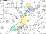
| Board of Commissioners | ||
|---|---|---|
| District | Commissioner | Party |
| District 1 (At-Large) | John H. Eaves (Chairman) | Democratic |
| District 2 (At-Large) | Robert "Robb" Pitts | Democratic |
| District 3 | Liz Hausmann | Republican |
| District 4 | Tom Lowe | Republican |
| District 5 | Emma I. Darnell | Democratic |
| District 6 | Joan P. Garner | Democratic |
| District 7 | William "Bill" Edwards (Vice Chairman) | Democratic |
| Board of Commissioners Staff | |
|---|---|
| Position held | Name |
| County manager | Zachary Williams |
| Clerk to the Commission | Mark Massey |
| County attorney | David Ware |
| Finance director | Patrick O' Connor |
Services
Fulton County's budget of $1.2 billion funds an array of resident services.With 34 branches, the Atlanta-Fulton Public Library System
Atlanta-Fulton Public Library System
The Atlanta-Fulton Public Library System is a network of public libraries serving the City of Atlanta and Fulton County, both in the U.S. state of Georgia. The system is currently administered by Fulton County...
is one of the largest library systems in Georgia.
Human services programs include one of the strongest senior center networks in metro Atlanta, including four multipurpose senior facilities. The county also provides funding to nonprofits with FRESH and Human Services grant
Grant (money)
Grants are funds disbursed by one party , often a Government Department, Corporation, Foundation or Trust, to a recipient, often a nonprofit entity, educational institution, business or an individual. In order to receive a grant, some form of "Grant Writing" often referred to as either a proposal...
s.
Politics
| Year | Democratic Democratic Party (United States) The Democratic Party is one of two major contemporary political parties in the United States, along with the Republican Party. The party's socially liberal and progressive platform is largely considered center-left in the U.S. political spectrum. The party has the lengthiest record of continuous... |
Republican Republican Party (United States) The Republican Party is one of the two major contemporary political parties in the United States, along with the Democratic Party. Founded by anti-slavery expansion activists in 1854, it is often called the GOP . The party's platform generally reflects American conservatism in the U.S... |
Others |
|---|---|---|---|
| 2008 United States presidential election, 2008 The United States presidential election of 2008 was the 56th quadrennial presidential election. It was held on November 4, 2008. Democrat Barack Obama, then the junior United States Senator from Illinois, defeated Republican John McCain, the senior U.S. Senator from Arizona. Obama received 365... |
67.06% 272,000 | 32.08% 130,136 | 0.86% 3,489 |
| 2004 United States presidential election, 2004 The United States presidential election of 2004 was the United States' 55th quadrennial presidential election. It was held on Tuesday, November 2, 2004. Republican Party candidate and incumbent President George W. Bush defeated Democratic Party candidate John Kerry, the then-junior U.S. Senator... |
59.28% 199,436 | 39.94% 134,372 | 0.77% 2,599 |
| 2000 United States presidential election, 2000 The United States presidential election of 2000 was a contest between Republican candidate George W. Bush, then-governor of Texas and son of former president George H. W. Bush , and Democratic candidate Al Gore, then-Vice President.... |
59.76% 152,039 | 39.84% 104,870 | 2.39% 6,303 |
| 1996 United States presidential election, 1996 The United States presidential election of 1996 was a contest between the Democratic national ticket of President Bill Clinton of Arkansas and Vice President Al Gore of Tennessee and the Republican national ticket of former Senator Bob Dole of Kansas for President and former Housing Secretary Jack... |
58.9% 143,306 | 39.6% 89,809 | 4.2% 10,053 |
| 1992 United States presidential election, 1992 The United States presidential election of 1992 had three major candidates: Incumbent Republican President George Bush; Democratic Arkansas Governor Bill Clinton, and independent Texas businessman Ross Perot.... |
57.3% 147,459 | 33.2% 85,451 | 9.6% 24,499 |
| 1988 United States presidential election, 1988 The United States presidential election of 1988 featured no incumbent president, as President Ronald Reagan was unable to seek re-election after serving the maximum two terms allowed by the Twenty-second Amendment. Reagan's Vice President, George H. W. Bush, won the Republican nomination, while the... |
56.2% 120,752 | 42.8% 91,785 | 1.0% 2,152 |
| 1984 United States presidential election, 1984 The United States presidential election of 1984 was a contest between the incumbent President Ronald Reagan, the Republican candidate, and former Vice President Walter Mondale, the Democratic candidate. Reagan was helped by a strong economic recovery from the deep recession of 1981–1982... |
56.9% 125,567 | 43.1% 95,149 | 0.0% 0 |
| 1980 United States presidential election, 1980 The United States presidential election of 1980 featured a contest between incumbent Democrat Jimmy Carter and his Republican opponent, Ronald Reagan, as well as Republican Congressman John B. Anderson, who ran as an independent... |
61.6% 118,748 | 33.7% 64,909 | 4.7% 9,066 |
| 1976 United States presidential election, 1976 The United States presidential election of 1976 followed the resignation of President Richard Nixon in the wake of the Watergate scandal. It pitted incumbent President Gerald Ford, the Republican candidate, against the relatively unknown former governor of Georgia, Jimmy Carter, the Democratic... |
67.8% 129,849 | 32.2% 61,552 | 0.0% 0 |
| 1972 United States presidential election, 1972 The United States presidential election of 1972 was the 47th quadrennial United States presidential election. It was held on November 7, 1972. The Democratic Party's nomination was eventually won by Senator George McGovern, who ran an anti-war campaign against incumbent Republican President Richard... |
43.6% 74,329 | 56.4% 96,256 | 0.0% 0 |
| 1968 United States presidential election, 1968 The United States presidential election of 1968 was the 46th quadrennial United States presidential election. Coming four years after Democrat Lyndon B. Johnson won in a historic landslide, it saw Johnson forced out of the race and Republican Richard Nixon elected... |
43.5% 77,847 | 35.8% 64,153 | 20.7% 37,068 |
| 1964 United States presidential election, 1964 The United States presidential election of 1964 was held on November 3, 1964. Incumbent President Lyndon B. Johnson had come to office less than a year earlier following the assassination of his predecessor, John F. Kennedy. Johnson, who had successfully associated himself with Kennedy's... |
56.1% 93,540 | 43.9% 73,205 | 0.0% 11 |
| 1960 United States presidential election, 1960 The United States presidential election of 1960 was the 44th American presidential election, held on November 8, 1960, for the term beginning January 20, 1961, and ending January 20, 1965. The incumbent president, Republican Dwight D. Eisenhower, was not eligible to run again. The Republican Party... |
50.8% 55,803 | 49.2% 53,940 | 0.0% 0 |
Atlanta is the largest city in Fulton County, occupying the county's narrow center section and thus geographically dividing the county's northern and southern portions. Atlanta's last major annexation in 1952 brought over 118 square miles (305.6 km²) into the city, including the affluent suburb of Buckhead, and was motivated in part to maintain a majority of white voters in the city.
The movement to create a city of Sandy Springs
Sandy Springs, Georgia
Sandy Springs is a city in north Georgia, United States. It is a northern suburb of Atlanta. With a 2010 population of 93,853, Sandy Springs is the sixth-largest city in the state and the second-largest city in Metro Atlanta. Sandy Springs is located in north Fulton County, Georgia, just south of...
, launched in the early 1970s and reaching fruition in 2005, was largely an effort to prevent additional annexations by the city of Atlanta, and later to wrest local control from the county commission
County commission
A county commission is a group of elected officials charged with administering the county government in local government in some states of the United States. County commissions are usually made up of three or more individuals...
.
Taxation
Geographically remote from each other, the northern and southern sections of the county have grown increasingly at odds over the collection of taxes and distribution of services. Residents of the affluent areas of North Fulton have increasingly complained that the Fulton County Board of Commissioners has ignored their needs, taking taxes collected in North Fulton and spending them on programs and services in South Fulton. In 2005, the Georgia General AssemblyGeorgia General Assembly
The Georgia General Assembly is the state legislature of the U.S. state of Georgia. It is bicameral, being composed of the Georgia House of Representatives and the Georgia Senate....
directed Fulton County, alone among all the counties in the state, to limit the expenditure of funds to the geographic region of the county where they were collected. Fulton County contested this law, known as the "Shafer Amendment" after Sen. David Shafer
David Shafer
David J. Shafer is an American politician currently serving in the Georgia State Senate representing Senate District 48. This suburban district, located north of Atlanta, includes portions of Fulton County and Gwinnett County. Shafer is a Republican...
(Republican from Duluth
Duluth, Georgia
Duluth is a city in Gwinnett County, Georgia and an increasingly more affluent and developed suburb of Atlanta. Unincorporated portions of Forsyth County also have Duluth as a mailing address, though this area is outside city limits...
), in a lawsuit
Lawsuit
A lawsuit or "suit in law" is a civil action brought in a court of law in which a plaintiff, a party who claims to have incurred loss as a result of a defendant's actions, demands a legal or equitable remedy. The defendant is required to respond to the plaintiff's complaint...
that went to the Georgia Supreme Court. On June 19, 2006, the Court handed down a decision upholding the legality of the Shafer Amendment.
The creation of the city of Sandy Springs prompted a move to create two additional cities that completely municipalized
Municipalization
Municipalization is the transfer of corporations or other assets to municipal ownership. The transfer may be from private ownership or from other levels of government. It is the opposite of privatization and is different from nationalization.-Services:There have been two main waves of...
north Fulton. In a domino effect
Domino effect
The domino effect is a chain reaction that occurs when a small change causes a similar change nearby, which then will cause another similar change, and so on in linear sequence. The term is best known as a mechanical effect, and is used as an analogy to a falling row of dominoes...
, the residents of south Fulton then moved for referenda to potentially create additional cities. One of these two referenda passed; the other was defeated.
Municipalization
Since the 1970s, residents of Sandy SpringsSandy Springs, Georgia
Sandy Springs is a city in north Georgia, United States. It is a northern suburb of Atlanta. With a 2010 population of 93,853, Sandy Springs is the sixth-largest city in the state and the second-largest city in Metro Atlanta. Sandy Springs is located in north Fulton County, Georgia, just south of...
had waged a long-running battle to incorporate their own city. They were repeatedly blocked by Atlanta Democrats, but when control of state government switched to suburban Republicans after the 2002 and 2004 election, the movement to create the city picked up steam.
The General Assembly approved creation of the city in 2005, and a suspension of existing state law that prohibited new cities (the only type of municipality in the state) from being within three miles (4.8 km) of an existing one. The citizens of Sandy Springs voted 94% in favor of ratifying the city charter in a referendum
Referendum
A referendum is a direct vote in which an entire electorate is asked to either accept or reject a particular proposal. This may result in the adoption of a new constitution, a constitutional amendment, a law, the recall of an elected official or simply a specific government policy. It is a form of...
held on June 21, 2005. The new city was officially incorporated later that year at midnight
Midnight
Midnight is the transition time period from one day to the next: the moment when the date changes. In the Roman time system, midnight was halfway between sunset and sunrise, varying according to the seasons....
on December 1.
Creation of Sandy Springs spurred a movement toward municipalization
Municipalization
Municipalization is the transfer of corporations or other assets to municipal ownership. The transfer may be from private ownership or from other levels of government. It is the opposite of privatization and is different from nationalization.-Services:There have been two main waves of...
of the entire county, which would attempt to incorporate every area into a city. This would essentially eliminate the county's home rule
Home rule
Home rule is the power of a constituent part of a state to exercise such of the state's powers of governance within its own administrative area that have been devolved to it by the central government....
powers (granted statewide by a constitutional amendment
Constitutional amendment
A constitutional amendment is a formal change to the text of the written constitution of a nation or state.Most constitutions require that amendments cannot be enacted unless they have passed a special procedure that is more stringent than that required of ordinary legislation...
to the Georgia State Constitution in the 1960s) to act as a municipality
Municipality
A municipality is essentially an urban administrative division having corporate status and usually powers of self-government. It can also be used to mean the governing body of a municipality. A municipality is a general-purpose administrative subdivision, as opposed to a special-purpose district...
in unincorporated areas, and return it to being entirely the local extension of state government.
In 2006, the General Assembly approved creation of two new cities, Milton
Milton, Georgia
Milton is a city in Fulton County, Georgia, United States. Incorporated on December 1, 2006, it was created out of the entire unincorporated northwestern part of northern Fulton County. It is a highly affluent community with an average household income within the zip code 30004 of $99,412...
and Johns Creek
Johns Creek, Georgia
Johns Creek is a suburban city in Fulton County, Georgia, USA, which incorporated December 1, 2006. It is named for a tributary that runs through the area. The city was created out of the northeastern part of unincorporated Fulton County...
, that would completely municipalize North Fulton. The charters of these two new cities were ratified overwhelmingly in a referendum
Referendum
A referendum is a direct vote in which an entire electorate is asked to either accept or reject a particular proposal. This may result in the adoption of a new constitution, a constitutional amendment, a law, the recall of an elected official or simply a specific government policy. It is a form of...
held July 18, 2006.
Voters in the Chattahoochee Hills
Chattahoochee Hills, Georgia
Chattahoochee Hills is a city in southern Fulton County, Georgia, United States. As of the 2010 census, it had a population of 2,378. It is the incorporated part of a region called "Chattahoochee Hill Country," an area encompassing approximately southwest of Atlanta, bordered on the northwest...
community of southwest Fulton (west of Cascade-Palmetto Highway) voted overwhelmingly to incorporate in June 2007. The city became incorporated on December 1, 2007.
The General Assembly also approved a proposal to form a new city called South Fulton
South Fulton, Georgia
South Fulton is the unofficial nickname of the last remaining unincorporated area region of Fulton County, Georgia, United States. It was a proposed municipality, to comprise all of the remaining unincorporated land Fulton, southwest of East Point and College Park. This area is known to residents...
. Its proposed boundaries were to include those areas still unincorporated on July 1, 2007. As a direct result of possibly being permanently landlocked, many of the existing cities proposed annexation
Annexation
Annexation is the de jure incorporation of some territory into another geo-political entity . Usually, it is implied that the territory and population being annexed is the smaller, more peripheral, and weaker of the two merging entities, barring physical size...
s, while some communities drew-up incorporation plans.
Voters in the area defined as the proposed city of South Fulton overwhelmingly rejected cityhood in September 2007. It remains the only unincorporated section of the county.
Secession
Some residents of suburban north Fulton have advocated that they be allowed to secede and re-form Milton CountyMilton County, Georgia
Milton County was a county of the U.S. state of Georgia from 1857 to 1931. It was created on December 18, 1857 from parts of northeastern Cobb, southeastern Cherokee, and southwestern Forsyth counties. The county was named for John Milton, Secretary of State of Georgia from 1777 to 1799...
, after the county that was absorbed into Fulton County in 1932 during the Great Depression
Great Depression
The Great Depression was a severe worldwide economic depression in the decade preceding World War II. The timing of the Great Depression varied across nations, but in most countries it started in about 1929 and lasted until the late 1930s or early 1940s...
. Fulton County, in comparison to the state's other counties, is physically large. Its population is greater than that of each of the six smallest U.S. state
U.S. state
A U.S. state is any one of the 50 federated states of the United States of America that share sovereignty with the federal government. Because of this shared sovereignty, an American is a citizen both of the federal entity and of his or her state of domicile. Four states use the official title of...
s.
The demographic make-up of Fulton County has changed considerably in recent decades. The northern portion of the county, a suburban area that is mostly Republican
Republican Party (United States)
The Republican Party is one of the two major contemporary political parties in the United States, along with the Democratic Party. Founded by anti-slavery expansion activists in 1854, it is often called the GOP . The party's platform generally reflects American conservatism in the U.S...
, is among the most affluent areas in the nation. The central and southern portion of the county, which includes the city of Atlanta
Atlanta, Georgia
Atlanta is the capital and most populous city in the U.S. state of Georgia. According to the 2010 census, Atlanta's population is 420,003. Atlanta is the cultural and economic center of the Atlanta metropolitan area, which is home to 5,268,860 people and is the ninth largest metropolitan area in...
and its core satellite cities to the south on the other hand, is overwhelmingly Democratic
Democratic Party (United States)
The Democratic Party is one of two major contemporary political parties in the United States, along with the Republican Party. The party's socially liberal and progressive platform is largely considered center-left in the U.S. political spectrum. The party has the lengthiest record of continuous...
, and contains some of the poorest sections in the metropolitan area. However, there exist exceptions to this particularly in the neighborhoods of Cascade Heights
Cascade Heights
Cascade Heights is an affluent predominantly African-American neighborhood in southwest Atlanta. Along with Sandtown and other portions of unincorporated South Fulton County, the area has a reputation as having a high concentration of the African-American elite in the city.Cascade Heights, or...
and Sandtown
Sandtown
Sandtown is a predominantly African-American neighborhood located southwest of Atlanta, Georgia. It is one of the Atlanta area's most affluent African American communities with the majority of the population belonging to the middle and upper middle class....
located in the southwest region of Fulton County which are made up of predominantly affluent African-Americans.
Years of being outnumbered politically, with North Fulton's desires continually being ignored, have led citizens of north Fulton County to propose the recreation of Milton County. The main opposition to the separation comes from the residents of south Fulton County, who say that the proposed separation is racially based. State Senator Vincent Fort
Vincent Fort
Vincent D. Fort is a state Senator in the Georgia State Senate, elected since 1996. He represents part of Fulton County for the 39th district...
, an Atlanta Democrat and a member of the Georgia Legislative Black Caucus, very strongly opposes the plan to split the county. "If it gets to the floor, there will be blood on the walls", Fort stated. "As much as you would like to think it's not racial, it's difficult to draw any other conclusion", he later added.
A political firestorm broke out in Atlanta in 2006 when State Senator Sam Zamarripa
Sam Zamarripa
Sam Zamarripa is the first Hispanic to serve in the Georgia State Senate, representing the 36th District located in eastern Fulton County, Georgia. Mr...
(Democrat from Atlanta) suggested that the cities in North Fulton be allowed to secede and form Milton County in exchange for Atlanta and Fulton County consolidating their governments into a new "Atlanta County". South Fulton residents were strongly opposed to Fulton County's possible future separation.
Taxes
Fulton County has a 7% total sales taxSales tax
A sales tax is a tax, usually paid by the consumer at the point of purchase, itemized separately from the base price, for certain goods and services. The tax amount is usually calculated by applying a percentage rate to the taxable price of a sale....
, including 4% state, 1% SPLOST, 1% homestead exemption
Homestead exemption
Homestead exemption is a legal regime designed to protect the value of the homes of residents from property taxes, creditors, and circumstances arising from the death of the homeowner spouse...
, and 1% MARTA. Sales taxes apply through the entire county and its cities, except for Atlanta's additional 1% Municipal Option Sales Tax to fund capital improvements to its combined wastewater
Wastewater
Wastewater is any water that has been adversely affected in quality by anthropogenic influence. It comprises liquid waste discharged by domestic residences, commercial properties, industry, and/or agriculture and can encompass a wide range of potential contaminants and concentrations...
sewer system
Sanitary sewer
A sanitary sewer is a separate underground carriage system specifically for transporting sewage from houses and commercial buildings to treatment or disposal. Sanitary sewers serving industrial areas also carry industrial wastewater...
s (laying new pipes to separate storm sewers from sanitary sewer
Sanitary sewer
A sanitary sewer is a separate underground carriage system specifically for transporting sewage from houses and commercial buildings to treatment or disposal. Sanitary sewers serving industrial areas also carry industrial wastewater...
s), and to its drinking water
Drinking water
Drinking water or potable water is water pure enough to be consumed or used with low risk of immediate or long term harm. In most developed countries, the water supplied to households, commerce and industry is all of drinking water standard, even though only a very small proportion is actually...
system. Fulton County has lowered its General Fund millage rate by 26% over an eight-year period.
Transportation
Almost every major highway, and every major Interstate highway, in metro Atlanta passes through Fulton County. Outside Atlanta proper, Georgia 400 is the major highway through north Fulton, and Interstate 85Interstate 85
Interstate 85 is a major interstate highway in the Southeastern United States. Its current southern terminus is at an interchange with Interstate 65 in Montgomery, Alabama; its northern terminus interchanges with Interstate 95 in Petersburg, Virginia, near Richmond...
to the southwest.
MARTA
Metropolitan Atlanta Rapid Transit Authority
The Metropolitan Atlanta Rapid Transit Authority or MARTA is the principal rapid-transit system in the Atlanta metropolitan area and the ninth-largest in the United States. Formed in 1971 as strictly a bus system, MARTA operates a network of bus routes linked to a rapid transit system consisting...
serves most of the county, and along with Dekalb County, Fulton pays a 1% sales tax to fund it. MARTA train
Rapid transit
A rapid transit, underground, subway, elevated railway, metro or metropolitan railway system is an electric passenger railway in an urban area with a high capacity and frequency, and grade separation from other traffic. Rapid transit systems are typically located either in underground tunnels or on...
service in Fulton is currently limited to the cities of Atlanta, Sandy Springs, East Point, and College Park, as well as the airport
Airport
An airport is a location where aircraft such as fixed-wing aircraft, helicopters, and blimps take off and land. Aircraft may be stored or maintained at an airport...
. Bus
Bus
A bus is a road vehicle designed to carry passengers. Buses can have a capacity as high as 300 passengers. The most common type of bus is the single-decker bus, with larger loads carried by double-decker buses and articulated buses, and smaller loads carried by midibuses and minibuses; coaches are...
service covers most of the remainder, except the rural areas in the far southwest. North Fulton residents have been asking for service, to extend the North Line ten miles (16 km) or 16 kilometers up the Georgia 400 corridor, from Perimeter Center
Perimeter Center
Perimeter Center is a neighborhood and major edge city in metro Atlanta, Georgia, United States. It is centered on Perimeter Mall, the nucleus around which it has formed. Perimeter Center is located north-northeast of Atlanta proper, and lies within two cities - Dunwoody and Sandy Springs...
to the fellow edge city
Edge city
"Edge city" is an American term for a concentration of business, shopping, and entertainment outside a traditional urban area in what had recently been a residential suburb or semi-rural community...
of Alpharetta. However, as the only major transit system in the country that its state government will not fund, there is no money to expand the system. Sales taxes now go entirely to operating, maintaining, and refurbishing the system.
Hartsfield-Jackson Atlanta International Airport
Hartsfield-Jackson Atlanta International Airport
Hartsfield–Jackson Atlanta International Airport , known locally as Atlanta Airport, Hartsfield Airport, and Hartsfield–Jackson, is located seven miles south of the central business district of Atlanta, Georgia, United States...
straddles the border with Clayton County
Clayton County, Georgia
Clayton County is a county located in the U.S. state of Georgia. As of 2000, the population was 236,517. The 2008 Census estimate placed the population at 273,718. The county seat is Jonesboro...
to the south and is the busiest airport in the world. The Fulton County Airport
Fulton County Airport (Georgia)
Fulton County Airport at Charlie Brown Field is a local Class D airport located just west of Atlanta, and run by Fulton County of the U.S. state of Georgia. It is the nearest airport to Hartsfield-Jackson Atlanta International Airport , and handles much of the general aviation traffic that would...
, often called Charlie Brown Field after aviator
Aviator
An aviator is a person who flies an aircraft. The first recorded use of the term was in 1887, as a variation of 'aviation', from the Latin avis , coined in 1863 by G. de la Landelle in Aviation Ou Navigation Aérienne...
Charles Brown, is located just west-southwest of Atlanta's city limit
City limits
The terms city limits and city boundary refer to the defined boundary or border of a city. The area within the city limits is sometimes called the city proper. The terms town limits/boundary and village limits/boundary mean the same as city limits/boundary, but apply to towns and villages...
. It is run by the county as a municipal or general aviation
General aviation
General aviation is one of the two categories of civil aviation. It refers to all flights other than military and scheduled airline and regular cargo flights, both private and commercial. General aviation flights range from gliders and powered parachutes to large, non-scheduled cargo jet flights...
airport, serving business jet
Business jet
Business jet, private jet or, colloquially, bizjet is a term describing a jet aircraft, usually of smaller size, designed for transporting groups of up to 19 business people or wealthy individuals...
s and private aircraft.
Geography
According to the 2000 census, the county has a total area of 534.61 square miles (1,384.6 km²), of which 528.66 square miles (1,369.2 km²) (or 98.89%) is land and 5.95 square miles (15.4 km²) (or 1.11%) is water. The shape of the county resembles a sword with its handle at the northeastern part, and the tip at the southwestern portion.Major highways
 Interstate 20Interstate 20Interstate 20 is a major east–west Interstate Highway in the Southern United States. I‑20 runs 1,535 miles from near Kent, Texas, at Interstate 10 to Florence, South Carolina, at Interstate 95...
 Interstate 75Interstate 75Interstate 75 is a major north–south Interstate Highway in the Great Lakes and Southeastern regions of the United States. It travels from State Road 826 and State Road 924 in Hialeah, Florida to Sault Ste. Marie, Michigan, at the Ontario, Canada, border...
 Interstate 85Interstate 85Interstate 85 is a major interstate highway in the Southeastern United States. Its current southern terminus is at an interchange with Interstate 65 in Montgomery, Alabama; its northern terminus interchanges with Interstate 95 in Petersburg, Virginia, near Richmond...
 Interstate 285Interstate 285Interstate 285 is an Interstate Highway loop encircling Atlanta, Georgia, for . I-285 is also known as unsigned State Route 407 and is colloquially referred to as the Perimeter. Suburban sprawl has made it one of the most heavily traveled roadways in the United States, and portions of the highway...
 U.S. Route 19U.S. Route 19U.S. Route 19 is a north–south U.S. Highway. Despite encroaching Interstate Highways, the route has remained a long-haul route, connecting the Gulf of Mexico with Lake Erie....
 U.S. Route 23
 U.S. Route 29U.S. Route 29U.S. Route 29 is a north–south United States highway that runs for from the western suburbs of Baltimore, Maryland, to Pensacola, Florida. This highway's northern terminus is at Maryland Route 99 in Ellicott City, Maryland...
 U.S. Route 41U.S. Route 41U.S. Route 41 is a north–south United States Highway that runs from Miami, Florida to the Upper Peninsula of Michigan. Until 1949, the part in southern Florida, from Naples to Miami, was U.S...
 U.S. Route 78U.S. Route 78U.S. Highway 78 is an east–west United States highway that runs for 715 miles from Memphis, Tennessee, to Charleston, South Carolina. Between Memphis and Birmingham, Alabama, it is being upgraded to become Interstate 22....
 U.S. Route 278U.S. Route 278U.S. Route 278 is a parallel route of U.S. Route 78. It currently runs for 1,074 miles from Hilton Head Island, South Carolina to Wickes, Arkansas at U.S. Highway 71/U.S. Highway 59. It might be notable that it is longer than its parent highway, US Hwy-78. US Hwy-278 passes through the states of...
 State Route 3Georgia State Route 3State Route 3 runs in a generally north–south orientation from Georgia's northern border to its southern border. Its northern terminus is at the Tennessee state line just southeast of Chattanooga , and its southern terminus is at the Florida state line about twelve miles south-southeast of...
 State Route 6Georgia State Route 6State Route 6 State Route 6 State Route 6 (also known as Camp Creek Parkway and honorarily as Tuskegee Airmen Parkway in Fulton County, Thornton Road in Douglas County, C.H...
 State Route 9Georgia State Route 9State Route 9 is a north–south highway running from Atlanta to just north of Dahlonega. It overlaps U.S. 19 from along 14th Street, in northwest Atlanta, to Roswell Road at I-285, in Sandy Springs. It is also concurrent with U.S. 19 from Dahlonega to its northern terminus at US 129...
 State Route 10Georgia State Route 10Georgia state route 10 begins at the Downtown Connector in Atlanta and ends at the South Carolina state line in Augusta, Georgia. The western end of Georgia 10 travels along Freedom Parkway, which bypasses the Carter Center to the west....
 State Route 13Georgia State Route 13State Route 13 , known as Buford Highway, Falcon Parkway, and Atlanta Highway, is a state highway in Georgia. It begins at West Peachtree Street and Spring Street just to the north of 17th Street in north Midtown Atlanta. The section near downtown Atlanta is a full freeway, from its south end to...
 State Route 14Georgia State Route 14State Route 14 begins in West Point and ends at Spring Street in southwest Atlanta. It overlaps U.S. 29 for its entire length, except for its last mile in Downtown Atlanta .In south Fulton County, S.R. 14 has a spur route State Route 14 begins in West Point (Troup County) and ends at Spring Street...
 State Route 42Georgia State Route 42State Route 42 is a Georgia state highway that runs in a generally north–south orientation from a short distance northeast of Atlanta in DeKalb County to Byron in Peach County.-Routing:...
 State Route 54Georgia State Route 54State Route 54 starts at US 27/SR 1 in Troup County and ends in southwest Atlanta, as University Avenue, at the Downtown Connector .In Clayton County, SR 54 passes by Southlake Mall , a shopping mall....
 State Route 70Georgia State Route 70State Route 70 begins just east of Newnan, Georgia at Millard Farmer Industrial Boulevard and ends at Donald Lee Hollowell Parkway in northwest Atlanta ....
 State Route 74Georgia State Route 74State Route 74 starts in Macon at I-75 and ends at Roosevelt Highway , just southwest of Historic Downtown Fairburn.-Bibb County:-Monroe County:-Upson County:-Pike County:-Meriwether County:-Coweta County:-Fayette County:...
 State Route 92Georgia State Route 92State Route 92 is a highway in the U.S. state of Georgia. The road runs for from Griffin to Roswell. Primarily signed from south to north, Route 92 is a rural route that passes through three county seats.- Route description :...
 State Route 120Georgia State Route 120State Route 120 begins at SR 100 near Tallapoosa and ends at West Crogan Street in Lawrenceville.In Marietta, SR 120 has a spur route , which acts as a perimeter for the northern part city. In Paulding County, the highway cosigns with the following highways . Then it cosigns with through Dallas...
 State Route 138Georgia State Route 138State Route 138 is a highway in the U.S. state of Georgia. The highway is an east–west route that begins at the junction of S.R. 92 just north of Fairburn and ends at U.S. 78/S.R. 10 near Monroe. It totals approximately in length...
 State Route 139Georgia State Route 139State Route 139 is a Georgia state route that starts in Clayton County at S.R. 85 in Riverdale, and ends at Veterans Memorial Highway in Mableton. The portion of S.R. 139 in College Park has been rerouted around the new Atlanta Airport runway, which crosses over I-285....
 State Route 140Georgia State Route 140Georgia state route 140 begins at U.S. 27/S.R. 1 in Armuchee, travels east through Adairsville and across Interstate 75. It goes through Waleska before reaching Canton, where it meets Interstate 575. Georgia 140 then travels southeast into Roswell, where it meets Georgia 400 expressway...
 State Route 141Georgia State Route 141State Route 141 is a north–south route which begins where Roswell Road and Peachtree Road split in Buckhead....
 State Route 154Georgia State Route 154State Route 154 begins at S.R. 54 in Sharpsburg and ends at S.R. 10 just to the east of Avondale Estates....
 State Route 400Georgia State Route 400Georgia State Route 400 is a highway in the U.S. state of Georgia, concurrent with U.S. Route 19 from exit 4B until its terminus just south of Dahlonega. ST 400 goes from Atlanta, at Interstate 85 , to Buckhead, Sandy Springs, Roswell, Alpharetta, Cumming, Dawson County, and Dahlonega...
Secondary highways
- Abernathy Road
- East Wesley Road
- Freedom Parkway (Georgia 10Georgia State Route 10Georgia state route 10 begins at the Downtown Connector in Atlanta and ends at the South Carolina state line in Augusta, Georgia. The western end of Georgia 10 travels along Freedom Parkway, which bypasses the Carter Center to the west....
) - Glenridge Drive
- Hammond Drive
- Johnson FerryJohnson FerryJohnson's Ferry or the Johnson Ferry was an important ferry built and operated by Johnson Garwood, and like most of the historic ferries of the Atlanta area, dates back to the 1830s...
Road - Lindbergh Drive (Georgia 236Georgia State Route 236State Route 236 is a long state highway in Fulton County and DeKalb County, Georgia. The route begins at Piedmont Road in south Buckhead and ends at Stone Mountain Freeway exit 7 in Stone Mountain. It is signed as Lindbergh Drive in Fulton County, and LaVista Road and Hugh Howell Road in DeKalb...
) - Memorial Drive (Georgia 154Georgia State Route 154State Route 154 begins at S.R. 54 in Sharpsburg and ends at S.R. 10 just to the east of Avondale Estates....
) - Moreland Avenue (U.S. 23/Georgia 42Georgia State Route 42State Route 42 is a Georgia state highway that runs in a generally north–south orientation from a short distance northeast of Atlanta in DeKalb County to Byron in Peach County.-Routing:...
) - Mount Vernon Highway
- Peachtree RoadPeachtree StreetPeachtree Street is the main street of Atlanta. The city grew up around the street, and many of its historical and municipal buildings are or were located along it...
(Georgia 141Georgia State Route 141State Route 141 is a north–south route which begins where Roswell Road and Peachtree Road split in Buckhead....
) - Peachtree-Dunwoody Road
- Piedmont Road (Georgia 237Georgia State Route 237State Route 237 begins at Buford Highway in Midtown Atlanta and ends at Roswell Road in North Buckhead. It is known best as Piedmont Road....
) - Ponce de Leon Avenue (U.S. 23/29U.S. Route 29U.S. Route 29 is a north–south United States highway that runs for from the western suburbs of Baltimore, Maryland, to Pensacola, Florida. This highway's northern terminus is at Maryland Route 99 in Ellicott City, Maryland...
/78U.S. Route 78U.S. Highway 78 is an east–west United States highway that runs for 715 miles from Memphis, Tennessee, to Charleston, South Carolina. Between Memphis and Birmingham, Alabama, it is being upgraded to become Interstate 22....
/278U.S. Route 278U.S. Route 278 is a parallel route of U.S. Route 78. It currently runs for 1,074 miles from Hilton Head Island, South Carolina to Wickes, Arkansas at U.S. Highway 71/U.S. Highway 59. It might be notable that it is longer than its parent highway, US Hwy-78. US Hwy-278 passes through the states of...
/Georgia 8Georgia State Route 8State Route 8 is a west–east route located in the U.S. state of Georgia. The route is cosigned with either U.S. 29 or U.S. 78 for much of its entire length.-Major intersections:...
/10Georgia State Route 10Georgia state route 10 begins at the Downtown Connector in Atlanta and ends at the South Carolina state line in Augusta, Georgia. The western end of Georgia 10 travels along Freedom Parkway, which bypasses the Carter Center to the west....
) - Powers Ferry Road
- Roswell Road (U.S. 19U.S. Route 19U.S. Route 19 is a north–south U.S. Highway. Despite encroaching Interstate Highways, the route has remained a long-haul route, connecting the Gulf of Mexico with Lake Erie....
/Georgia 9Georgia State Route 9State Route 9 is a north–south highway running from Atlanta to just north of Dahlonega. It overlaps U.S. 19 from along 14th Street, in northwest Atlanta, to Roswell Road at I-285, in Sandy Springs. It is also concurrent with U.S. 19 from Dahlonega to its northern terminus at US 129...
) - Windsor Parkway
Adjacent counties
Fulton County, Georgia, is one of the few counties in the United States to border as many as ten counties. Listed clockwiseClockwise
Circular motion can occur in two possible directions. A clockwise motion is one that proceeds in the same direction as a clock's hands: from the top to the right, then down and then to the left, and back to the top...
, they are:
- Cherokee CountyCherokee County, GeorgiaAs of the census of 2000, there were 141,903 people, 49,495 households, and 39,200 families residing in the county. The population density was 335 people per square mile . There were 51,937 housing units at an average density of 123 per square mile...
– northwest - Forsyth CountyForsyth County, GeorgiaForsyth County is a county located in the U.S. state of Georgia. The county seat is Cumming, Georgia. Forsyth County is a part of the Atlanta metropolitan area...
– northeast - Gwinnett CountyGwinnett County, Georgia, Gwinnett County had a population of 805,321. The racial and ethnic composition of the population was 53.3% white , 23.6% black , 2.7% Korean, 2.6% Asian Indian, 2.0% Vietnamese, 3.3% other Asian, 0.1% Pacific Islander, 8.8% some other race and 3.1% from two or more races...
– east - DeKalb CountyDeKalb County, GeorgiaDeKalb County is a county located in the U.S. state of Georgia. The population of the county was 691,893 at the 2010 census. Its county seat is the city of Decatur. It is bordered to the west by Fulton County and contains roughly 10% of the city of Atlanta...
– east at Moreland Avenue - Clayton CountyClayton County, GeorgiaClayton County is a county located in the U.S. state of Georgia. As of 2000, the population was 236,517. The 2008 Census estimate placed the population at 273,718. The county seat is Jonesboro...
– south - Fayette CountyFayette County, GeorgiaFayette County is a county located in the U.S. state of Georgia. As of 2000, the population was 91,263. The 2007 Census Estimate shows a population of 106,144. The county seat is Fayetteville....
– south - Coweta CountyCoweta County, GeorgiaCoweta County is a county located in the U.S. state of Georgia. As of 2000, the population was 89,215. The 2009 Census Estimate placed the population at 131,936...
– southwest - Carroll CountyCarroll County, GeorgiaCarroll County is a county located in the U.S. state of Georgia. As of the 2000 census, the population was 87,268. The 2007 Census Estimate shows a population of 111,954...
– west - Douglas CountyDouglas County, GeorgiaDouglas County, Georgia has been experiencing numerous natural disasters over the most recent decades. Being located in the South Eastern United States the county experiences strong storms and tornadoes often because of its location in Dixie Alley....
– west at Chattahoochee RiverChattahoochee RiverThe Chattahoochee River flows through or along the borders of the U.S. states of Georgia, Alabama, and Florida. It is a tributary of the Apalachicola River, a relatively short river formed by the confluence of the Chattahoochee and Flint Rivers and emptying into Apalachicola Bay in the Gulf of... - Cobb CountyCobb County, GeorgiaCobb County is a county located in the U.S. state of Georgia. Its county seat and largest city is Marietta, which is located in the center of the county. The county was named for Thomas Willis Cobb, who in the early 19th century was a United States representative and senator from Georgia...
– west at Willeo CreekWilleo CreekWilleo Creek is a stream in the U.S. state of Georgia, and is located in the north-northwestern part of metro Atlanta. It is a significant tributary of the Chattahoochee River, into which it flows at Bull Sluice Lake, just upstream from Morgan Falls Dam and downstream from the Chattahoochee...
and Chattahoochee River
National protected areas
- Chattahoochee River National Recreation AreaChattahoochee River National Recreation AreaChattahoochee River National Recreation Area preserves a series of sites between Atlanta in the United States and Lake Sidney Lanier along the Chattahoochee River. The 48-mile stretch of the river affords public recreation opportunities and access to historic spots...
(part) - Martin Luther King, Jr. National Historic SiteMartin Luther King, Jr. National Historic SiteMartin Luther King, Jr., National Historic Site established on October 10, 1980, consists of several buildings surrounding Martin Luther King, Jr.'s boyhood home on Auburn Avenue in the Sweet Auburn historic district of Atlanta, Georgia. The original Ebenezer Baptist Church, the church where King...
Demographics
As of the censusCensus
A census is the procedure of systematically acquiring and recording information about the members of a given population. It is a regularly occurring and official count of a particular population. The term is used mostly in connection with national population and housing censuses; other common...
of 2000, there were 816,006 people, 321,242 households, and 185,677 families residing in the county. The population density
Population density
Population density is a measurement of population per unit area or unit volume. It is frequently applied to living organisms, and particularly to humans...
was 1,544 people per square mile (596/km²). There were 348,632 housing units at an average density of 660 per square mile (255/km²). The racial makeup of the county was 48.1% White
White American
White Americans are people of the United States who are considered or consider themselves White. The United States Census Bureau defines White people as those "having origins in any of the original peoples of Europe, the Middle East, or North Africa...
, 44.6% Black or African American
African American
African Americans are citizens or residents of the United States who have at least partial ancestry from any of the native populations of Sub-Saharan Africa and are the direct descendants of enslaved Africans within the boundaries of the present United States...
, 0.2% Native American
Native Americans in the United States
Native Americans in the United States are the indigenous peoples in North America within the boundaries of the present-day continental United States, parts of Alaska, and the island state of Hawaii. They are composed of numerous, distinct tribes, states, and ethnic groups, many of which survive as...
, 3.0% Asian
Asian American
Asian Americans are Americans of Asian descent. The U.S. Census Bureau definition of Asians as "Asian” refers to a person having origins in any of the original peoples of the Far East, Southeast Asia, or the Indian subcontinent, including, for example, Cambodia, China, India, Indonesia, Japan,...
, 0.04% Pacific Islander
Pacific Islander American
Pacific Islander Americans, also known as Oceanian Americans, are residents of the United States with original ancestry from Oceania. They represent the smallest racial group counted in the United States census of 2000. They numbered 874,000 people or 0.3 percent of the United States population...
, 2.60% from other races
Race (United States Census)
Race and ethnicity in the United States Census, as defined by the Federal Office of Management and Budget and the United States Census Bureau, are self-identification data items in which residents choose the race or races with which they most closely identify, and indicate whether or not they are...
, and 1.5% from two or more races. 5.9% of the population were Hispanic or Latino of any race. The largest self-reported European ancestry group in Fulton County is English (8.7%) followed by German (7.5%)
There were 321,242 households out of which 28.70% had children under the age of 18 living with them, 37.30% were married couples
Marriage
Marriage is a social union or legal contract between people that creates kinship. It is an institution in which interpersonal relationships, usually intimate and sexual, are acknowledged in a variety of ways, depending on the culture or subculture in which it is found...
living together, 16.50% had a female householder with no husband present, and 42.20% were non-families. 32.20% of all households were made up of individuals and 6.70% had someone living alone who was 65 years of age or older. The average household size was 2.44 and the average family size was 3.15.
The age distribution was 24.40% under the age of 18, 11.00% from 18 to 24, 35.50% from 25 to 44, 20.70% from 45 to 64, and 8.50% who were 65 years of age or older. The median age was 33 years. For every 100 females there were 97.00 males. For every 100 females age 18 and over, there were 95.00 males.
The median income for a household in the county was $49,321, and the median income for a family was $58,143. Males had a median income of $43,495 versus $32,122 for females. The per capita income
Per capita income
Per capita income or income per person is a measure of mean income within an economic aggregate, such as a country or city. It is calculated by taking a measure of all sources of income in the aggregate and dividing it by the total population...
for the county was $30,003. About 12.40% of families and 15.70% of the population were below the poverty line, including 22.60% of those under age 18 and 15.20% of those age 65 or over.
Incorporated cities and towns
- AlpharettaAlpharetta, Georgia-Demographics:As of the census of 2000, there were 34,854 people, 13,911 households, and 8,916 families residing in the city. The population density was 1,631.6 people per square mile . There were 14,670 housing units at an average density of 686.7 per square mile...
- AtlantaAtlanta, GeorgiaAtlanta is the capital and most populous city in the U.S. state of Georgia. According to the 2010 census, Atlanta's population is 420,003. Atlanta is the cultural and economic center of the Atlanta metropolitan area, which is home to 5,268,860 people and is the ninth largest metropolitan area in...
- Chattahoochee HillsChattahoochee Hills, GeorgiaChattahoochee Hills is a city in southern Fulton County, Georgia, United States. As of the 2010 census, it had a population of 2,378. It is the incorporated part of a region called "Chattahoochee Hill Country," an area encompassing approximately southwest of Atlanta, bordered on the northwest...
- College ParkCollege Park, GeorgiaCollege Park is a city located partly in Fulton County, Georgia and partially in Clayton County, Georgia, in the United States. As of the 2010 census, the city population was 13,942...
- East PointEast Point, GeorgiaThe city of East Point is southwest of the neighborhoods of Atlanta in Fulton County, Georgia, United States. As of the 2010 census, the city had a population of 33,712...
- FairburnFairburn, GeorgiaFairburn is a city in Fulton County, Georgia. The population was 12,950 at the 2010 census.- History :Fairburn is located along a railroad line and was once the county seat for Campbell County, Georgia, starting in 1870...
- HapevilleHapeville, GeorgiaHapeville is a city in Fulton County, Georgia, United States, located directly adjacent to the city of Atlanta. The population was 6,373 at the 2010 census. It is named for Dr...
- Johns CreekJohns Creek, GeorgiaJohns Creek is a suburban city in Fulton County, Georgia, USA, which incorporated December 1, 2006. It is named for a tributary that runs through the area. The city was created out of the northeastern part of unincorporated Fulton County...
- MiltonMilton, GeorgiaMilton is a city in Fulton County, Georgia, United States. Incorporated on December 1, 2006, it was created out of the entire unincorporated northwestern part of northern Fulton County. It is a highly affluent community with an average household income within the zip code 30004 of $99,412...
- Mountain ParkMountain Park, Fulton County, GeorgiaMountain Park is a city primarily in the western part of northern Fulton County in the U.S. state of Georgia, with a small portion extending less than into southeastern Cherokee County. As of the 2010 census, the city had a total population of 547....
- PalmettoPalmetto, GeorgiaPalmetto is a city located mostly in Fulton County and now partly in Coweta County in the U.S. state of Georgia...
- RoswellRoswell, GeorgiaRoswell is a city located in northern Fulton County; it is a suburb of northern Atlanta, Georgia, United States. The 2010 Census population was 88,346. It is the eighth largest city in Georgia...
- Sandy SpringsSandy Springs, GeorgiaSandy Springs is a city in north Georgia, United States. It is a northern suburb of Atlanta. With a 2010 population of 93,853, Sandy Springs is the sixth-largest city in the state and the second-largest city in Metro Atlanta. Sandy Springs is located in north Fulton County, Georgia, just south of...
- Union CityUnion City, GeorgiaUnion City is a city in Fulton County, Georgia, United States. The population was 19,456 at the 2010 census.-Geography:Union City is located at ....
Unincorporated communities
- Birmingham (now within Milton)
- CampbelltonCampbellton, GeorgiaCampbellton is an unincorporated town in southwestern Fulton County, Georgia, that lies along the banks of the Chattahoochee River. The area prior to white settlement was populated by the Creek Indians. Campbellton was settled by several families. The Beavers Family owned and farmed a large...
- CrabappleCrabapple, GeorgiaCentered today at the crossroads of Georgia Highways 140 and 372 , Crabapple, Georgia, is one of the oldest parts of Fulton County, Georgia. Originally part of Cherokee County, Georgia, , Crabapple was part of the land contributed in 1857 to form Milton County, Georgia...
(now within Milton) - OceeOcee, GeorgiaOcee was a small community in Milton County, now located in Johns Creek in Fulton County, Georgia. It was centered at .It was originally called New York, then Mazeppa. The Ocee name, possibly after a man whose initials were O.C., is still in use today for a school, a park, a library and a church,...
(originally New York, then Mazeppa, now within Johns Creek) - Red OakRed Oak, GeorgiaRed Oak is an unincorporated community of Fulton County, Georgia, near College Park, Georgia and East Point. It is located largely along US 29, NE of Union City, and about five minutes from Hartsfield-Jackson Airport, the world's busiest airport....
- Rico (now within Chattahoochee Hills)
- Sandtown
- Shakerag
- South FultonSouth Fulton, GeorgiaSouth Fulton is the unofficial nickname of the last remaining unincorporated area region of Fulton County, Georgia, United States. It was a proposed municipality, to comprise all of the remaining unincorporated land Fulton, southwest of East Point and College Park. This area is known to residents...
(entirety of remaining unincorporated land, voted against cityhood in 2007) - Warsaw (now within Johns Creek)
Economy
AFC EnterprisesAFC Enterprises
AFC Enterprises is the Sandy Springs, Georgia-headquartered company that owns Popeye's Chicken & Biscuits. AFC Enterprises is a publicly traded company....
(Popeyes Chicken/Cinnabon), AT&T Mobility, Chick-fil-A, Children's Healthcare of Atlanta, Church's Chicken, The Coca Cola Company, Cox Enterprises
Cox Enterprises
Cox Enterprises is the successor to the publishing company founded in Dayton, Ohio, United States, by James Middleton Cox, who began with the Dayton Daily News. He was the Democratic candidate for the President of the United States in the election of 1920...
, Delta Air Lines, Earthlink
EarthLink
EarthLink , is an Internet service provider headquartered in Atlanta, Georgia, USA. It claims 1.94 million subscribers.- Business :EarthLink provides a variety of Internet connection types, including dial-up, DSL, satellite, and cable. Both dial-up and high speed Internet access are available...
, Equifax
Equifax
Equifax Inc. is a consumer credit reporting agency in the United States, considered one of the three largest American credit agencies along with Experian and TransUnion. Founded in 1899, Equifax is the oldest of the three agencies and gathers and maintains information on over 400 million credit...
, First Data, Georgia-Pacific, Global Payments, Inc., The Home Depot
The Home Depot
The Home Depot is an American retailer of home improvement and construction products and services.The Home Depot operates 2,248 big-box format stores across the United States , Canada , Mexico and China, with a 12-store chain...
, InterContinental Hotels Group, IBM Internet Security Systems, Mirant
Mirant
Mirant Corporation, an Atlanta-based energy company, produces and sells electricity in the United States. The company was spun off from its former parent, Southern Company, on April 2, 2001...
Corp., Newell Rubbermaid
Newell Rubbermaid
Newell Rubbermaid is a global marketer of consumer and commercial products including such well-known brands as Rubbermaid food storage, home organization, and refuse container products; Sharpie, PaperMate, Parker and Waterman writing instruments; Calphalon gourmet cookware; Goody beauty and...
, Northside Hospital, Porsche Cars North America, Saint Joseph's Hospital, Southern Company, Spectrum Brands
Spectrum Brands
Spectrum Brands is a diversified company established in 2005 as the successor company to Rayovac Corporation. Rayovac had been located in Wisconsin since its conception as The French Battery Company in 1906, but then in 2004, as Spectrum Brands, located its Corporate headquarters just north of...
, SunTrust Banks, United Parcel Service
United Parcel Service
United Parcel Service, Inc. , typically referred to by the acronym UPS, is a package delivery company. Headquartered in Sandy Springs, Georgia, United States, UPS delivers more than 15 million packages a day to 6.1 million customers in more than 220 countries and territories around the...
, and Wendy's
Wendy's
Wendy's is an international fast food chain restaurant founded by Dave Thomas on November 15, 1969, in Columbus, Ohio, United States. The company decided to move its headquarters to Dublin, Ohio, on January 29, 2006. It has been owned by Triarc since 2008...
/Arby's
Arby's
Arby's is a fast food restaurant chain in the United States and Canada. Roark Capital Group owns 81.5% of the company, with Wendy's Company owning the other 18.5%. It is primarily known for selling roast beef sandwiches and curly fries. The Arby's menu also includes chicken sandwiches, appetizers,...
Group are based in various cities throughout Fulton County.
MaggieMoo's and Marble Slab Creamery
Marble Slab Creamery
Marble Slab Creamery is a chain of independently owned and operated franchised stores that specialize in serving ice cream and a variety of other desserts. It is a franchise brand in the portfolio of Global Franchise Group LLC...
had their headquarters in an unincorporated area
Unincorporated area
In law, an unincorporated area is a region of land that is not a part of any municipality.To "incorporate" in this context means to form a municipal corporation, a city, town, or village with its own government. An unincorporated community is usually not subject to or taxed by a municipal government...
in the county, however, now those companies are located in neighboring Gwinnett County in Norcross
Norcross, Georgia
As of 2010 Norcross had a population of 9,116. The racial and ethnic composition of the population was 40.8% white , 19.8% black or African American , 0.7% Native American, 2.1% Asian Indian, 10.7% Asian, 0.1% Pacific Islander, 21.5% from some other race and 4.3% reporting two or more races...
.
Education
All portions of Fulton County outside of the city limits of Atlanta are served by the Fulton County School SystemFulton County School System
The Fulton County School System is a school district headquartered in East Point, Georgia, United States. The system serves the area of Fulton County, Georgia outside the Atlanta city limits...
.
All portions within Atlanta are served by Atlanta Public Schools
Atlanta Public Schools
Atlanta Public Schools is a school district based in Atlanta, Georgia, United States. APS is run by the Atlanta Board of Education with interim superintendent Erroll Davis...
.
Culture
World Changers Church, the megachurch of Creflo DollarCreflo Dollar
Creflo Augustus Dollar, Jr. is an American Word of Faith teacher, pastor, and the founder of the non-denominational World Changers Church International based in Fulton County, Georgia. Creflo Dollar Ministerial Association , Creflo Dollar Ministries, and Arrow Records...
, is in unincorporated
Unincorporated area
In law, an unincorporated area is a region of land that is not a part of any municipality.To "incorporate" in this context means to form a municipal corporation, a city, town, or village with its own government. An unincorporated community is usually not subject to or taxed by a municipal government...
Fulton County.
See also
- National Register of Historic Places listings in Fulton County, GeorgiaNational Register of Historic Places listings in Fulton County, GeorgiaThis is a list of properties and districts in Fulton County, Georgia that are listed on the National Register of Historic Places . It covers most of the NRHP properties in Atlanta, Georgia; other Atlanta listings are covered in National Register of Historic Places listings in DeKalb County,...