

Gaston, Oregon
Encyclopedia
Gaston is a city in Washington County
, Oregon
, United States
. The population was 600 at the 2000 census
. The 2006 estimate is 630 residents.
in the area lived similarly to other Pacific Northwest
tribes. In nearby Cherry Grove
there are a few petroglyph
s usually credited to the Atfalati
tribe, which is a division of Kalapuya. Like many other indigenous peoples
in North America, it is thought as many as 90% of the local population were killed by smallpox
, malaria
, influenza
or other European diseases even before the area began to feel the presence of significant European settlement.
line brought more settlers, and in anticipation of a new rail line
, railroad developer and town namesake Joseph Gaston set aside 2 acre (0.00809372 km²) of land on what was then the edge of town for a school.
opened in the new town. The same year, the first church, Gaston Congregational Church
, was also built. In the 1880s, Joseph Gaston was responsible for draining Wapato Lake
, which lay in the valley around the rail stop, creating the farmland that exists today. "Wapato" is a word from the local Indians that refers to a water-based starchy root vegetable
related to arrowroot sometimes called a "water potato" in local English. Rail service ended in 1985 with the removal of rails back to the junction to the Seghers spur.
in 1911 added significant activity to the local economy, although it had to be shut down in 1913 during a lumber market crash. The crash of 1913 notwithstanding, by 1916 Gaston had added a bank, J.H. Wescott and Sons General Merchandise, Bell & Owens General Mercantile Company, and other businesses.
In early May 1935 workers at the Stimson Mill went on strike. On May 22, "twenty-five cars loaded with pickets left the Labor Temple in Portland" to support the strikers. The next morning Governor Charles Martin ordered the state police and National Guard to protect the strikebreakers. Armed with gas grenades and machine guns, the military and police forces demanded the strikers leave or be shot. The strikers chose to disperse, averting a potential bloodbath.
, when it was condemned. The condemning of the building became a crucial local issue for the town, with residents split between merging with a nearby district (both Forest Grove or Yamhill were considered), and building a new high school. In the end, a new high school was built and Gaston retained its independent school
system and with it a degree of local pride. Currently the Gaston School District
is a full K-12 district, with 525 students total in 2007, and a single high school
.
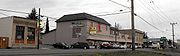
and the 1990s baseball/softball-oriented park. Just after 2000, a new post office was built on the edge of town. Thus far, the town has not been able to effectively capitalize on the local wine industry's growing national and international recognition. In 2006, the mayoral candidate advocated obtaining state or federal funding to revitalize the commercial strip
on Main Street which, in theory, could help the city capture some of the wine tourism
dollars.
, the city has a total area of 0.6 square kilometre (0.231661295155521 sq mi), all land.
 As of the census
of 2000, there were 600 people, 196 households, and 139 families residing in the city. The population density
was 2,691.7 people per square mile (1,053.0/km²). There were 204 housing units at an average density of 915.2 per square mile (358.0/km²). The racial makeup of the city was 88.33% White, 0.83% Native American, 0.17% Asian, 7.00% from other races
, and 3.67% from two or more races. Hispanic or Latino of any race were 14.50% of the population.
There were 196 households out of which 44.9% had children under the age of 18 living with them, 52.0% were married couples
living together, 14.8% had a female householder with no husband present, and 28.6% were non-families. 25.0% of all households were made up of individuals and 3.1% had someone living alone who was 65 years of age or older. The average household size was 3.06 and the average family size was 3.73.
In the city the population was spread out with 37.7% under the age of 18, 9.5% from 18 to 24, 30.7% from 25 to 44, 18.2% from 45 to 64, and 4.0% who were 65 years of age or older. The median age was 28 years. For every 100 females there were 104.1 males. For every 100 females age 18 and over, there were 90.8 males.
The median income
for a household in the city was $36,458, and the median income for a family was $42,031. Males had a median income of $31,641 versus $25,833 for females. The per capita income
for the city was $17,758. About 9.8% of families and 11.1% of the population were below the poverty line, including 21.3% of those under age 18 and none of those age 65 or over.
45.436337°N 123.141501°W
Washington County, Oregon
- Major highways :* Interstate 5* Interstate 205* U.S. Route 26* Oregon Route 6* Oregon Route 8* Oregon Route 10* Oregon Route 47* Oregon Route 99W* Oregon Route 210* Oregon Route 217* Oregon Route 219-Demographics:...
, Oregon
Oregon
Oregon is a state in the Pacific Northwest region of the United States. It is located on the Pacific coast, with Washington to the north, California to the south, Nevada on the southeast and Idaho to the east. The Columbia and Snake rivers delineate much of Oregon's northern and eastern...
, United States
United States
The United States of America is a federal constitutional republic comprising fifty states and a federal district...
. The population was 600 at the 2000 census
United States Census, 2000
The Twenty-second United States Census, known as Census 2000 and conducted by the Census Bureau, determined the resident population of the United States on April 1, 2000, to be 281,421,906, an increase of 13.2% over the 248,709,873 persons enumerated during the 1990 Census...
. The 2006 estimate is 630 residents.
Early history
Prior to the arrival of European immigrants in the 1800s, little is known about Native American settlements in the Gaston area. What is known indicates that Native AmericansNative Americans in the United States
Native Americans in the United States are the indigenous peoples in North America within the boundaries of the present-day continental United States, parts of Alaska, and the island state of Hawaii. They are composed of numerous, distinct tribes, states, and ethnic groups, many of which survive as...
in the area lived similarly to other Pacific Northwest
Pacific Northwest
The Pacific Northwest is a region in northwestern North America, bounded by the Pacific Ocean to the west and, loosely, by the Rocky Mountains on the east. Definitions of the region vary and there is no commonly agreed upon boundary, even among Pacific Northwesterners. A common concept of the...
tribes. In nearby Cherry Grove
Cherry Grove, Oregon
Cherry Grove is an unincorporated community in Washington County, Oregon, United States. Cherry Grove is situated on the north bank of the Tualatin River near where it exits the Northern Oregon Coast Range and enters Patton Valley....
there are a few petroglyph
Petroglyph
Petroglyphs are pictogram and logogram images created by removing part of a rock surface by incising, picking, carving, and abrading. Outside North America, scholars often use terms such as "carving", "engraving", or other descriptions of the technique to refer to such images...
s usually credited to the Atfalati
Atfalati
The Atfalati, also known as the Tualatin were a tribe or band of the Kalapuya Native Americans who originally inhabited the Tualatin Valley in the northwest part of the U.S. state of Oregon...
tribe, which is a division of Kalapuya. Like many other indigenous peoples
Indigenous peoples
Indigenous peoples are ethnic groups that are defined as indigenous according to one of the various definitions of the term, there is no universally accepted definition but most of which carry connotations of being the "original inhabitants" of a territory....
in North America, it is thought as many as 90% of the local population were killed by smallpox
Smallpox
Smallpox was an infectious disease unique to humans, caused by either of two virus variants, Variola major and Variola minor. The disease is also known by the Latin names Variola or Variola vera, which is a derivative of the Latin varius, meaning "spotted", or varus, meaning "pimple"...
, malaria
Malaria
Malaria is a mosquito-borne infectious disease of humans and other animals caused by eukaryotic protists of the genus Plasmodium. The disease results from the multiplication of Plasmodium parasites within red blood cells, causing symptoms that typically include fever and headache, in severe cases...
, influenza
Influenza
Influenza, commonly referred to as the flu, is an infectious disease caused by RNA viruses of the family Orthomyxoviridae , that affects birds and mammals...
or other European diseases even before the area began to feel the presence of significant European settlement.
Schools
In the 1860s, the census recorded only about 70 people in the Gaston area. Nonetheless, in 1866, the first Gaston School was founded. In 1870, a new school was built near the connecting road between Old Highway 47 and the new Highway 47. Initially students only attended school for 3–6 months per year, later expanded to 9 months. In 1871, as a stage coachStagecoach
A stagecoach is a type of covered wagon for passengers and goods, strongly sprung and drawn by four horses, usually four-in-hand. Widely used before the introduction of railway transport, it made regular trips between stages or stations, which were places of rest provided for stagecoach travelers...
line brought more settlers, and in anticipation of a new rail line
Rail transport
Rail transport is a means of conveyance of passengers and goods by way of wheeled vehicles running on rail tracks. In contrast to road transport, where vehicles merely run on a prepared surface, rail vehicles are also directionally guided by the tracks they run on...
, railroad developer and town namesake Joseph Gaston set aside 2 acre (0.00809372 km²) of land on what was then the edge of town for a school.
Rail services
In the early 1870s, stagecoach and rail service was expanding rapidly in Washington County. By 1872, a stop on the Portland-St. Joseph line in Patton Valley was officially named Gaston. With a train stop, more people came and by 1873 a post officePost office
A post office is a facility forming part of a postal system for the posting, receipt, sorting, handling, transmission or delivery of mail.Post offices offer mail-related services such as post office boxes, postage and packaging supplies...
opened in the new town. The same year, the first church, Gaston Congregational Church
Congregational church
Congregational churches are Protestant Christian churches practicing Congregationalist church governance, in which each congregation independently and autonomously runs its own affairs....
, was also built. In the 1880s, Joseph Gaston was responsible for draining Wapato Lake
Wapato Lake
Wapato Lake was a historic lake located in what became parts of Washington County and Yamhill County in the U.S. state of Oregon. The area is sometimes known as Wapato Lake Bed and Wapato Flat. The lake bed is located about a half mile east of Gaston at elevation...
, which lay in the valley around the rail stop, creating the farmland that exists today. "Wapato" is a word from the local Indians that refers to a water-based starchy root vegetable
Root vegetable
Root vegetables are plant roots used as vegetables. Here "root" means any underground part of a plant.Root vegetables are generally storage organs, enlarged to store energy in the form of carbohydrates. They differ in the concentration and the balance between sugars, starches, and other types of...
related to arrowroot sometimes called a "water potato" in local English. Rail service ended in 1985 with the removal of rails back to the junction to the Seghers spur.
1900 to present
The addition of a spur line to the nearby Cherry Grove area for the construction of a lumber millSawmill
A sawmill is a facility where logs are cut into boards.-Sawmill process:A sawmill's basic operation is much like those of hundreds of years ago; a log enters on one end and dimensional lumber exits on the other end....
in 1911 added significant activity to the local economy, although it had to be shut down in 1913 during a lumber market crash. The crash of 1913 notwithstanding, by 1916 Gaston had added a bank, J.H. Wescott and Sons General Merchandise, Bell & Owens General Mercantile Company, and other businesses.
In early May 1935 workers at the Stimson Mill went on strike. On May 22, "twenty-five cars loaded with pickets left the Labor Temple in Portland" to support the strikers. The next morning Governor Charles Martin ordered the state police and National Guard to protect the strikebreakers. Armed with gas grenades and machine guns, the military and police forces demanded the strikers leave or be shot. The strikers chose to disperse, averting a potential bloodbath.
New high school
In 1915 a new high school was built on the land Joseph Gaston had previously set aside for a school. That high school was in use through the 1986-1987 school yearAcademic term
An academic term is a division of an academic year, the time during which a school, college or university holds classes. These divisions may be called terms...
, when it was condemned. The condemning of the building became a crucial local issue for the town, with residents split between merging with a nearby district (both Forest Grove or Yamhill were considered), and building a new high school. In the end, a new high school was built and Gaston retained its independent school
Independent school
An independent school is a school that is independent in its finances and governance; it is not dependent upon national or local government for financing its operations, nor reliant on taxpayer contributions, and is instead funded by a combination of tuition charges, gifts, and in some cases the...
system and with it a degree of local pride. Currently the Gaston School District
Gaston School District
Gaston School District 11J is a public school district in Washington County, Oregon, United States serving the city of Gaston. The district was established about 1852 and later the Wappato and Yamhill districts in neighboring Yamhill County merged into the district. It is a two-school district,...
is a full K-12 district, with 525 students total in 2007, and a single high school
Gaston Junior/Senior High School
Gaston Junior/Senior High School is a public high school in Gaston, Oregon, United States.-Academics:In 2008, 78% of the high school's seniors received their high school diploma. Of 45 students, 35 graduated, 5 dropped out, and 5 are still in high school....
.
Modern expansion
The growing popularity of Portland and the Pacific Northwest in general has led to population growth throughout the region. Though too far from Portland to benefit much at first, recently Gaston has started to see new housing and an uptick in school registrations. The late 1980s brought a new fire stationFire station
A fire station is a structure or other area set aside for storage of firefighting apparatus , personal protective equipment, fire hose, fire extinguishers, and other fire extinguishing equipment...
and the 1990s baseball/softball-oriented park. Just after 2000, a new post office was built on the edge of town. Thus far, the town has not been able to effectively capitalize on the local wine industry's growing national and international recognition. In 2006, the mayoral candidate advocated obtaining state or federal funding to revitalize the commercial strip
Commerce
While business refers to the value-creating activities of an organization for profit, commerce means the whole system of an economy that constitutes an environment for business. The system includes legal, economic, political, social, cultural, and technological systems that are in operation in any...
on Main Street which, in theory, could help the city capture some of the wine tourism
Wine tourism
Wine tourism refers to tourism whose purpose is or includes the tasting, consumption or purchase of wine, often at or near the source. Wine tourism can consist of visits to wineries, vineyards and restaurants known to offer unique vintages, as well as organized wine tours, wine festivals or other...
dollars.
Geography
According to the United States Census BureauUnited States Census Bureau
The United States Census Bureau is the government agency that is responsible for the United States Census. It also gathers other national demographic and economic data...
, the city has a total area of 0.6 square kilometre (0.231661295155521 sq mi), all land.
Demographics
Census
A census is the procedure of systematically acquiring and recording information about the members of a given population. It is a regularly occurring and official count of a particular population. The term is used mostly in connection with national population and housing censuses; other common...
of 2000, there were 600 people, 196 households, and 139 families residing in the city. The population density
Population density
Population density is a measurement of population per unit area or unit volume. It is frequently applied to living organisms, and particularly to humans...
was 2,691.7 people per square mile (1,053.0/km²). There were 204 housing units at an average density of 915.2 per square mile (358.0/km²). The racial makeup of the city was 88.33% White, 0.83% Native American, 0.17% Asian, 7.00% from other races
Race (United States Census)
Race and ethnicity in the United States Census, as defined by the Federal Office of Management and Budget and the United States Census Bureau, are self-identification data items in which residents choose the race or races with which they most closely identify, and indicate whether or not they are...
, and 3.67% from two or more races. Hispanic or Latino of any race were 14.50% of the population.
There were 196 households out of which 44.9% had children under the age of 18 living with them, 52.0% were married couples
Marriage
Marriage is a social union or legal contract between people that creates kinship. It is an institution in which interpersonal relationships, usually intimate and sexual, are acknowledged in a variety of ways, depending on the culture or subculture in which it is found...
living together, 14.8% had a female householder with no husband present, and 28.6% were non-families. 25.0% of all households were made up of individuals and 3.1% had someone living alone who was 65 years of age or older. The average household size was 3.06 and the average family size was 3.73.
In the city the population was spread out with 37.7% under the age of 18, 9.5% from 18 to 24, 30.7% from 25 to 44, 18.2% from 45 to 64, and 4.0% who were 65 years of age or older. The median age was 28 years. For every 100 females there were 104.1 males. For every 100 females age 18 and over, there were 90.8 males.
The median income
Median household income
The median household income is commonly used to generate data about geographic areas and divides households into two equal segments with the first half of households earning less than the median household income and the other half earning more...
for a household in the city was $36,458, and the median income for a family was $42,031. Males had a median income of $31,641 versus $25,833 for females. The per capita income
Per capita income
Per capita income or income per person is a measure of mean income within an economic aggregate, such as a country or city. It is calculated by taking a measure of all sources of income in the aggregate and dividing it by the total population...
for the city was $17,758. About 9.8% of families and 11.1% of the population were below the poverty line, including 21.3% of those under age 18 and none of those age 65 or over.
External links
- Entry for Gaston in the Oregon Blue BookOregon Blue BookThe Oregon Blue Book is the official directory and fact book for the U.S. state of Oregon copyrighted by the Oregon Secretary of State and published by the Office of the Secretary's Archives Division. As Governor Ted Kulongoski notes in his introduction for the 2005–2006 edition, it "provides...
- History Summary by Gaston High School
45.436337°N 123.141501°W