
Easter weekend 1999 tornado outbreak
Encyclopedia
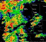
The Easter weekend 1999 tornado outbreak was a series of tornado
touchdowns which occurred on April 2-3 1999 from Kansas
to Louisiana
. The most powerful tornado occurred in Caddo Parish and Bossier Parish in northwestern Louisiana where an F4
tornado killed 7 people and injured 112. Damages from the outbreak were estimated near $16.6 million (2006 USD). A total of 17 tornadoes were confirmed across the southern Plains during the two-day event.
during the early morning hours on April 3 causing an estimated $831,000 in damages (2006 USD).
The strongest tornadoes of the outbreak took place across the Arklatex region during the afternoon hours were the strongest and lone killer tornado took place. At 3:52 PM, a supercell thunderstorm spawned a tornado over Cross Lake
, north of Shreveport Regional Airport
. The tornado moved northeast. In Caddo Parish
the tornado damaged 66 buildings. In Caddo Parish, damages are estimated at near $1.6 million (2006 dollars). At 4:01 PM, the tornado entered Bossier Parish
as an F4 tornado. In Bossier Parish, 227 buildings suffered major damage or were destroyed. An additional 162 buildings were damaged. Damages in Bossier Parish are estimated at near $8.1 million (2006 dollars). The tornado dissipated about eight miles northeast of Benton
. In all, 7 people were killed and 112 were injured. The tornado was on the ground for about 20 miles. Its width reached as high as 200 yards.
Three additional tornadoes touched down besides the Caddo-Bossier Parish tornado. These tornadoes injured 1 person and caused up to $6.6 million in damages. Heavy damage was reported near Logansport
, Summerfield
and Athens
heavily damaging several residences.
Weaker tornadoes (rated either F0 or F1) touched down across most of central and northern Arkansas into Missouri as well as in eastern Texas. 4 people in total were injured in two separate tornadoes near Ben and Mammoth Spring
with isolated damage to some structures and also to trees and power lines. The outbreak ended just before 6 PM on April 3.
Tornado
A tornado is a violent, dangerous, rotating column of air that is in contact with both the surface of the earth and a cumulonimbus cloud or, in rare cases, the base of a cumulus cloud. They are often referred to as a twister or a cyclone, although the word cyclone is used in meteorology in a wider...
touchdowns which occurred on April 2-3 1999 from Kansas
Kansas
Kansas is a US state located in the Midwestern United States. It is named after the Kansas River which flows through it, which in turn was named after the Kansa Native American tribe, which inhabited the area. The tribe's name is often said to mean "people of the wind" or "people of the south...
to Louisiana
Louisiana
Louisiana is a state located in the southern region of the United States of America. Its capital is Baton Rouge and largest city is New Orleans. Louisiana is the only state in the U.S. with political subdivisions termed parishes, which are local governments equivalent to counties...
. The most powerful tornado occurred in Caddo Parish and Bossier Parish in northwestern Louisiana where an F4
Fujita scale
The Fujita scale , or Fujita-Pearson scale, is a scale for rating tornado intensity, based primarily on the damage tornadoes inflict on human-built structures and vegetation...
tornado killed 7 people and injured 112. Damages from the outbreak were estimated near $16.6 million (2006 USD). A total of 17 tornadoes were confirmed across the southern Plains during the two-day event.
Tornado event
A first series of tornadoes touched down on April 2 across Oklahoma causing mostly minor damage to some structures. An isolated F1 tornado touched down near Columbus, KansasColumbus, Kansas
Columbus is the second largest city and county seat of Cherokee County, Kansas, United States, 15 miles south-southwest of Pittsburg, Kansas. As of the 2010 census, the city population was 3,312.-History:...
during the early morning hours on April 3 causing an estimated $831,000 in damages (2006 USD).
The strongest tornadoes of the outbreak took place across the Arklatex region during the afternoon hours were the strongest and lone killer tornado took place. At 3:52 PM, a supercell thunderstorm spawned a tornado over Cross Lake
Cross Lake (Shreveport, Louisiana)
Cross Lake is an lake located near Shreveport, Louisiana. The waterway provides the water supply for the City of Shreveport. Moss covered cypress trees line the banks of this open lake popular for fishing and recreational boating. Supporting waterfowl, alligators and an abundance of wildlife...
, north of Shreveport Regional Airport
Shreveport Regional Airport
Shreveport Regional Airport is a public use airport in Shreveport, Louisiana, United States. It is owned by the City of Shreveport and located four nautical miles southwest of its central business district....
. The tornado moved northeast. In Caddo Parish
Caddo Parish, Louisiana
Caddo Parish is a parish located in the U.S. state of Louisiana. The parish seat is Shreveport; as of 2000, the population was 252,161...
the tornado damaged 66 buildings. In Caddo Parish, damages are estimated at near $1.6 million (2006 dollars). At 4:01 PM, the tornado entered Bossier Parish
Bossier Parish, Louisiana
Bossier Parish is named for Pierre Bossier, a 19th-century Louisiana state senator and U.S. representative from Natchitoches Parish.Bossier Parish was spared fighting on its soil during the American Civil War...
as an F4 tornado. In Bossier Parish, 227 buildings suffered major damage or were destroyed. An additional 162 buildings were damaged. Damages in Bossier Parish are estimated at near $8.1 million (2006 dollars). The tornado dissipated about eight miles northeast of Benton
Benton, Louisiana
The town of Benton is the parish seat of Bossier Parish, in the US state of Louisiana. The population was 2,035 at the 2000 census. The larger Bossier City is located south of Benton...
. In all, 7 people were killed and 112 were injured. The tornado was on the ground for about 20 miles. Its width reached as high as 200 yards.
Three additional tornadoes touched down besides the Caddo-Bossier Parish tornado. These tornadoes injured 1 person and caused up to $6.6 million in damages. Heavy damage was reported near Logansport
Logansport, Louisiana
Logansport is a town in western DeSoto Parish adjacent to the Sabine River in western Louisiana, United States. The population was 1,630 at the 2000 census. It is part of the Shreveport–Bossier City Metropolitan Statistical Area.-Geography:...
, Summerfield
Summerfield, Louisiana
Summerfield is an unincorporated area in northeast Claiborne Parish, Louisiana, United States. It is located sixteen miles east of the parish seat of Homer....
and Athens
Athens, Louisiana
Athens is a village in Claiborne Parish, Louisiana, United States. The population was 262 at the 2000 census.The Pilgrim's Pride poultry hatchery in Athens was designated for closure early in 2009, along with other company businesses in nearby Arcadia in Bienville Parish, Choudrant in Lincoln...
heavily damaging several residences.
Weaker tornadoes (rated either F0 or F1) touched down across most of central and northern Arkansas into Missouri as well as in eastern Texas. 4 people in total were injured in two separate tornadoes near Ben and Mammoth Spring
Mammoth Spring, Arkansas
Mammoth Spring is a city in Fulton County, Arkansas, United States. The population was 977 at the 2010 census.-Geography:Mammoth Spring is located at ....
with isolated damage to some structures and also to trees and power lines. The outbreak ended just before 6 PM on April 3.
April 2 event
| F# Fujita scale The Fujita scale , or Fujita-Pearson scale, is a scale for rating tornado intensity, based primarily on the damage tornadoes inflict on human-built structures and vegetation... |
Location | County | Time (UTC) | Path length | Damage | |
|---|---|---|---|---|---|---|
| Oklahoma Oklahoma Oklahoma is a state located in the South Central region of the United States of America. With an estimated 3,751,351 residents as of the 2010 census and a land area of 68,667 square miles , Oklahoma is the 28th most populous and 20th-largest state... |
||||||
| F0 | SW of Watchom | Noble Noble County, Oklahoma Noble County is a county located in the U.S. state of Oklahoma. As of 2010, the population was 11,561. Its county seat is Perry.-21st century:In 2010, the Keystone-Cushing Pipeline was constructed north to south through Noble County.... |
2145 | 1 miles (1.6 km) |
Weak tornado with no damage | |
| F0 | NW of Stafford | Custer Custer County, Oklahoma Custer County is a county located in the U.S. state of Oklahoma. It was named in honor of General George Armstrong Custer. As of 2000, the population was 26,142. Its county seat is Arapaho.-Geography:... |
0107 | 0.3 miles (0.5 km) |
Damage limited to downed tree limbs | |
| F1 | W of Bloomington | Harmon Harmon County, Oklahoma Harmon County is a county located in the U.S. state of Oklahoma. As of 2010, the population was 2,992. In population, it is the second smallest county in Oklahoma, only Cimarron County, according to the 2010 census, having fewer inhabitants. The county seat is Hollis.-Geography:According to the... , Greer Greer County, Oklahoma Greer County is a county located in the U.S. state of Oklahoma. As of 2000, the population was 6,061. Its county seat is Mangum. From 1860 to 1896, the state of Texas claimed an area known as Greer County, Texas, which included present-day Greer County along with neighboring... |
0125 | 7.5 miles (12 km) |
Barns, grain bins and Quonset hut-type buildings were damaged | |
| F1 | W of Moravia | Greer Greer County, Oklahoma Greer County is a county located in the U.S. state of Oklahoma. As of 2000, the population was 6,061. Its county seat is Mangum. From 1860 to 1896, the state of Texas claimed an area known as Greer County, Texas, which included present-day Greer County along with neighboring... , Beckham Beckham County, Oklahoma Beckham County is a county located in the U.S. state of Oklahoma. As of 2000, the population was 19,799. Its county seat is Sayre.Founded upon statehood in 1907, Beckham County was named for J. C. W... |
0213 | 6 miles (9.6 km) |
Damage to grain silos, a barn, one home, an ostrich building and tractors were damaged | |
| F1 | S of Dill City Dill City, Oklahoma Dill City is a town in Washita County, Oklahoma, United States. The population was 562 at the 2010 census.-Geography:Dill City is located at .... |
Washita Washita County, Oklahoma Washita County is a county located in the U.S. state of Oklahoma. As of 2000, the population was 11,508. Its county seat is New Cordell. It was formerly located in Cloud Chief, Oklahoma.... |
0250 | 1.1 miles (1.8 km) |
A shed was destroyed while a home, trees and power lines were damaged | |
| F0 | N of Custer City Custer City, Oklahoma Custer City is a town in Custer County, Oklahoma, United States. The population was 375 at the 2010 census.-Geography:Custer City is located at .According to the United States Census Bureau, the town has a total area of , all of it land.-Demographics:... |
Custer Custer County, Oklahoma Custer County is a county located in the U.S. state of Oklahoma. It was named in honor of General George Armstrong Custer. As of 2000, the population was 26,142. Its county seat is Arapaho.-Geography:... |
0355 | 1.1 miles (1.8 km) |
Weak tornado with little or no damage | |
| Texas Texas Texas is the second largest U.S. state by both area and population, and the largest state by area in the contiguous United States.The name, based on the Caddo word "Tejas" meaning "friends" or "allies", was applied by the Spanish to the Caddo themselves and to the region of their settlement in... |
||||||
| F0 | NE of Aspermont Aspermont, Texas Aspermont is a town in and the county seat of Stonewall County, Texas, United States. The population was 1,021 at the 2000 census. Aspermont means "rough mountain" in Latin.... |
Stonewall | 2315 | 0.1 miles (0.16 km) |
Brief touchdown with no damage | |
| Source: Tornado History Project - April 2, 1999 Storm Data | ||||||
April 3 event
| F# Fujita scale The Fujita scale , or Fujita-Pearson scale, is a scale for rating tornado intensity, based primarily on the damage tornadoes inflict on human-built structures and vegetation... |
Location | County | Time (UTC) | Path length | Damage | |
|---|---|---|---|---|---|---|
| Kansas Kansas Kansas is a US state located in the Midwestern United States. It is named after the Kansas River which flows through it, which in turn was named after the Kansa Native American tribe, which inhabited the area. The tribe's name is often said to mean "people of the wind" or "people of the south... |
||||||
| F1 | E of Stippville | Cherokee Cherokee County, Kansas Cherokee County is a county located in Southeast Kansas, in the Central United States. As of the 2010 census, the county population was 21,603. Its county seat is Columbus, and its most populous city is Baxter Springs... |
1110 | 0.1 miles (0.16 km) |
Three homes were damaged including one heavily | |
| Texas Texas Texas is the second largest U.S. state by both area and population, and the largest state by area in the contiguous United States.The name, based on the Caddo word "Tejas" meaning "friends" or "allies", was applied by the Spanish to the Caddo themselves and to the region of their settlement in... |
||||||
| F0 | NW of New Waverly New Waverly, Texas New Waverly is a city in Walker County, Texas, United States. The population was 950 at the 2000 census.-Geography:New Waverly is located at .... |
Walker Walker County, Texas Walker County is a county located in the U.S. state of Texas. In 2010, its population was 67,861. Its county seat is Huntsville.Initially, Walker County was named for Robert J. Walker, a legislator from Mississippi who introduced into the United States Congress the resolution to annex Texas... |
2142 | 0.3 miles (0.5 km) |
Damage limited to trees | |
| F3 | Logansport, LA Logansport, Louisiana Logansport is a town in western DeSoto Parish adjacent to the Sabine River in western Louisiana, United States. The population was 1,630 at the 2000 census. It is part of the Shreveport–Bossier City Metropolitan Statistical Area.-Geography:... area |
Shelby, TX Shelby County, Texas *Arcadia*Brooklyn*Center*Dreka *Huxley*Joaquin*Possum Trot*Shelbyville *Tenaha*Timpson*Weaver-Education:The following school districts serve Shelby County:*Center ISD*Excelsior ISD... , De Soto, LA De Soto Parish, Louisiana -Demographics:As of the census of 2010, there were 26,656 people, 9,691 households, and 6,967 families residing in the parish. The population density was 29 people per square mile . There were 11,204 housing units at an average density of 13 per square mile... |
2151 | 5.4 miles (8.6 km) |
Damage to farms, outbuildings and numerous trees in Texas. In Logansport, Louisiana, several homes had moderate to heavy damage. A church was also damaged with its steeple being knocked down and roof torn up. One person was injured. | |
| F0 | Willis Willis, Texas Willis is a city in Montgomery County, Texas, United States, located on the Missouri Pacific Railroad eight miles north of Conroe in north central Montgomery County.-Geography:Willis is located at .... area |
Montgomery Montgomery County, Texas Montgomery County is a county located in the U.S. state of Texas within the Houston–Sugar Land–Baytown metropolitan area. The county was created by an act of the Congress of the Republic of Texas on December 14, 1837. The county was named for the town of Montgomery, Texas. In 2000, its... |
2217 | 0.3 miles (0.5 km) |
Damage to a mobile home and trees | |
| Louisiana Louisiana Louisiana is a state located in the southern region of the United States of America. Its capital is Baton Rouge and largest city is New Orleans. Louisiana is the only state in the U.S. with political subdivisions termed parishes, which are local governments equivalent to counties... |
||||||
| F4 | NW of Shreveport Shreveport, Louisiana Shreveport is the third largest city in Louisiana. It is the principal city of the fourth largest metropolitan area in the state of Louisiana and is the 109th-largest city in the United States.... to N of Midway Midway, Louisiana Midway is a census-designated place in La Salle Parish, Louisiana, United States. The population was 1,505 at the 2000 census.-Geography:Midway is located at .... |
Caddo Caddo Parish, Louisiana Caddo Parish is a parish located in the U.S. state of Louisiana. The parish seat is Shreveport; as of 2000, the population was 252,161... , Bossier Bossier Parish, Louisiana Bossier Parish is named for Pierre Bossier, a 19th-century Louisiana state senator and U.S. representative from Natchitoches Parish.Bossier Parish was spared fighting on its soil during the American Civil War... |
2152 | 19.3 miles (30.9 km) |
7 deaths - 66 structures in Caddo Parish were damaged including Southern University Southern University Southern University and A&M College is a historically black college located in Baton Rouge, Louisiana. The Baton Rouge campus is located on Scott’s Bluff overlooking the Mississippi River in the northern section... and several homes. A hardware store was also levelled. In Bossier Parish, 389 structures were affected including 227 homes and businesses sustaining major damage or complete destruction. Brick homes were levelled with one of the structures being left with only a slab. 12 people were injured in Caddo Parish and 90 other in Bossier Parish where all the fatalities took place. |
|
| F3 | Athens Athens, Louisiana Athens is a village in Claiborne Parish, Louisiana, United States. The population was 262 at the 2000 census.The Pilgrim's Pride poultry hatchery in Athens was designated for closure early in 2009, along with other company businesses in nearby Arcadia in Bienville Parish, Choudrant in Lincoln... area |
Claiborne Claiborne Parish, Louisiana Claiborne Parish is a parish located in the U.S. state of Louisiana. The parish seat is Homer and as of 2000, the population is 16,851.-History:The parish is named for the first Louisiana governor, William C. C. Claiborne.... |
2258 | 8.5 miles (13.6 km) |
Two mobile homes were destroyed and 10 homes were heavily damaged | |
| F3 | N of Lisbon Lisbon, Louisiana Lisbon is a village in Claiborne Parish, Louisiana, United States. The population was 162 at the 2000 census. Lisbon is located east of the parish seat of Homer.... to NW of Randolph |
Claiborne Claiborne Parish, Louisiana Claiborne Parish is a parish located in the U.S. state of Louisiana. The parish seat is Homer and as of 2000, the population is 16,851.-History:The parish is named for the first Louisiana governor, William C. C. Claiborne.... |
2313 | 14.5 miles (23.2 km) |
15 homes were severely damaged | |
| Arkansas Arkansas Arkansas is a state located in the southern region of the United States. Its name is an Algonquian name of the Quapaw Indians. Arkansas shares borders with six states , and its eastern border is largely defined by the Mississippi River... |
||||||
| F0 | NW of Fivemile | Stone | 2235 | 1 miles (1.6 km) |
A few sheds and outbuildings were destroyed. Trees were also blown down 2 people were injured | |
| F1 | Mammoth Spring Mammoth Spring, Arkansas Mammoth Spring is a city in Fulton County, Arkansas, United States. The population was 977 at the 2010 census.-Geography:Mammoth Spring is located at .... area |
Fulton, AR, Oregon, MO Oregon County, Missouri Oregon County is a county located in South Central Missouri in the United States. As of the 2000 U.S. Census, the county's population was 10,344. A 2008 estimate, however, showed the population to be 10,264. Its county seat is Alton... |
2250 | 10.5 miles (16.8 km) |
A mobile homeand a barn were destroyed. Another mobile home, homes, businesses and a recreational vehicle were damaged. Two people were injured | |
| F1 | N of Getsemane | Jefferson Jefferson County, Arkansas Jefferson County is a county located in the U.S. state of Arkansas. Its population was 77,435 at the 2010 United States Census. It is included in the Pine Bluff Metropolitan Statistical Area. Jefferson County's county seat and largest city is Pine Bluff... , Lonoke |
2325 | 6.5 miles (10.4 km) |
Damage to outbuildings, signs, power poles and trees | |
| Source: Tornado History Project - April 3, 1999 Storm Data | ||||||