

Brockton Village
Encyclopedia
Brockton Village is a neighbourhood in Toronto
, Ontario
, Canada
. It comprises a section of the old Town of Brockton which was annexed by the City of Toronto in 1884. The town encompassed the area from Bloor Street
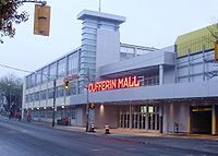
on the north, Dufferin Street
on the east, High Park
on the west and ranged from Queen Street
, along Roncesvalles Avenue
, Wright Avenue and Dundas Streets to the south. The section south of the rail lines became part of the Village of Parkdale. The section to the west of Lansdowne has become better known as Roncesvalles, around Roncesvalles Avenue
. Over the last half of the 20th century, the area south of College Street saw the influx of Portuguese
immigrants and is also known as part of the Little Portugal
neighbourhood. Today's 'Brockton Village' encompasses that section north of the rail lines between Dufferin and Lansdowne, south of Bloor Street.
The developed area of Brockton grew to border High Park on the west, Dufferin (then the border of Toronto) on the east, Bloor on the north and the rail-lines to the south-west by the time it was incorporated as a village in 1876. It became an incorporated town in 1881. The incorporated town only lasted three years before it was annexed by the City of Toronto in 1884.
Today, remnants of the former Brockton still exist, including its former town hall. The hall was converted to commercial usage, and is located at the south-west corner of Dundas Street West and Brock Avenue. Until recently, there was a Brockton High School, which closed. For a time it was used by the Royal Conservatory of Music
but it is now vacant. It is located at Brock Avenue and Croatia Street, near Bloor Street.
Toronto
Toronto is the provincial capital of Ontario and the largest city in Canada. It is located in Southern Ontario on the northwestern shore of Lake Ontario. A relatively modern city, Toronto's history dates back to the late-18th century, when its land was first purchased by the British monarchy from...
, Ontario
Ontario
Ontario is a province of Canada, located in east-central Canada. It is Canada's most populous province and second largest in total area. It is home to the nation's most populous city, Toronto, and the nation's capital, Ottawa....
, Canada
Canada
Canada is a North American country consisting of ten provinces and three territories. Located in the northern part of the continent, it extends from the Atlantic Ocean in the east to the Pacific Ocean in the west, and northward into the Arctic Ocean...
. It comprises a section of the old Town of Brockton which was annexed by the City of Toronto in 1884. The town encompassed the area from Bloor Street
Bloor Street
Bloor Street is a major east–west residential and commercial thoroughfare in Toronto, in the Canadian province of Ontario. Bloor Street runs from the Prince Edward Viaduct westward into Mississauga, where it ends at Central Parkway. East of the viaduct, Danforth Avenue continues along the same...
on the north, Dufferin Street
Dufferin Street
Dufferin Street is a major north-south street in Toronto, Ontario, Canada. It is a concession road, two concessions west of Yonge Street. The street starts at the foot of Lake Ontario, continues north to Toronto's northern boundary with some discontinuities and continues into York Region where it...
on the east, High Park
High Park
High Park is a municipal park in Toronto, Ontario, Canada. It spans , and is a mixed recreational and natural park, with sporting facilities, cultural facilities, educational facilities, gardens, playgrounds and a zoo. One third of the park remains in a natural state, with a rare oak savannah ecology...
on the west and ranged from Queen Street
Queen Street West
Queen Street West describes both the western branch of Queen Street, a major east-west thoroughfare, and a series of neighbourhoods or commercial districts, situated west of Yonge Street in downtown Toronto, Ontario, Canada. Queen Street begins in the west at the intersection of King Street, The...
, along Roncesvalles Avenue
Roncesvalles Avenue
Roncesvalles Avenue is a north-south arterial street in Toronto, Canada. It connects Queen Street West, King Street West and runs north to Dundas Street West. Roncesvalles Avenue takes its name from the Battle of Roncesvalles, which took place in the Roncesvalles gorge in Spain in 1813...
, Wright Avenue and Dundas Streets to the south. The section south of the rail lines became part of the Village of Parkdale. The section to the west of Lansdowne has become better known as Roncesvalles, around Roncesvalles Avenue
Roncesvalles Avenue
Roncesvalles Avenue is a north-south arterial street in Toronto, Canada. It connects Queen Street West, King Street West and runs north to Dundas Street West. Roncesvalles Avenue takes its name from the Battle of Roncesvalles, which took place in the Roncesvalles gorge in Spain in 1813...
. Over the last half of the 20th century, the area south of College Street saw the influx of Portuguese
Portugal
Portugal , officially the Portuguese Republic is a country situated in southwestern Europe on the Iberian Peninsula. Portugal is the westernmost country of Europe, and is bordered by the Atlantic Ocean to the West and South and by Spain to the North and East. The Atlantic archipelagos of the...
immigrants and is also known as part of the Little Portugal
Little Portugal, Toronto
Little Portugal is a neighbourhood and ethnic enclave in Toronto, Ontario, Canada. It is located west of downtown in the "Old" City of Toronto. It is bounded on the west by Lansdowne Avenue, on the north by College Street, on the east by Ossington Avenue and on the south by the CNR/CPR mainline...
neighbourhood. Today's 'Brockton Village' encompasses that section north of the rail lines between Dufferin and Lansdowne, south of Bloor Street.
History
In March 1812, Lot 30 in York Township, a 100 acres (40.5 ha) parcel of land, was granted to James Brock, a cousin of Sir Isaac Brock along with other parcels of land. This lot was a strip of land that stretched from Lot Street, today's Queen Street, north to Bloor Street, west of Dufferin Avenue. After Brock died, his widow Lucy Brock inherited his estate and she began selling the lands that Brock owned. She commissioned a roadway along the centre-line of the lot parcel, along its whole length. The road, built in 1850, is known today as Brock Avenue. The lands of lot 30 were sub-divided for small land-holders and development occurred. This unincorporated settlement took on the name of Brockton.The developed area of Brockton grew to border High Park on the west, Dufferin (then the border of Toronto) on the east, Bloor on the north and the rail-lines to the south-west by the time it was incorporated as a village in 1876. It became an incorporated town in 1881. The incorporated town only lasted three years before it was annexed by the City of Toronto in 1884.
Today, remnants of the former Brockton still exist, including its former town hall. The hall was converted to commercial usage, and is located at the south-west corner of Dundas Street West and Brock Avenue. Until recently, there was a Brockton High School, which closed. For a time it was used by the Royal Conservatory of Music
Royal Conservatory of Music
The Royal Conservatory of Music is a music school and performance venue in Toronto, Canada. Other uses of the term include:*The Madrid Royal Conservatory, Spain*The Royal Academy of Music, London, United Kingdom...
but it is now vacant. It is located at Brock Avenue and Croatia Street, near Bloor Street.