

Desjardins Canal
Encyclopedia
Dundas, Ontario
Dundas is a formerly independent town and now constituent community in the city of Hamilton in Ontario, Canada. It's nickname is the Valley Town. The population has been stable for decades at about twenty thousand, largely because it has not annexed rural land from the protected Dundas Valley...
, easier access to Lake Ontario
Lake Ontario
Lake Ontario is one of the five Great Lakes of North America. It is bounded on the north and southwest by the Canadian province of Ontario, and on the south by the American state of New York. Ontario, Canada's most populous province, was named for the lake. In the Wyandot language, ontarío means...
and the Great Lakes
Great Lakes
The Great Lakes are a collection of freshwater lakes located in northeastern North America, on the Canada – United States border. Consisting of Lakes Superior, Michigan, Huron, Erie, and Ontario, they form the largest group of freshwater lakes on Earth by total surface, coming in second by volume...
system of North America
North America
North America is a continent wholly within the Northern Hemisphere and almost wholly within the Western Hemisphere. It is also considered a northern subcontinent of the Americas...
. Although a technological achievement and a short term commercial success, the canal was soon eclipsed by the railway
Rail transport
Rail transport is a means of conveyance of passengers and goods by way of wheeled vehicles running on rail tracks. In contrast to road transport, where vehicles merely run on a prepared surface, rail vehicles are also directionally guided by the tracks they run on...
, and Dundas by neighbouring Hamilton
Hamilton, Ontario
Hamilton is a port city in the Canadian province of Ontario. Conceived by George Hamilton when he purchased the Durand farm shortly after the War of 1812, Hamilton has become the centre of a densely populated and industrialized region at the west end of Lake Ontario known as the Golden Horseshoe...
.
Historical context
Following the Revolutionary War the British government felt an urgent need to populate the interior of the province of Upper CanadaUpper Canada
The Province of Upper Canada was a political division in British Canada established in 1791 by the British Empire to govern the central third of the lands in British North America and to accommodate Loyalist refugees from the United States of America after the American Revolution...
. The immediate concern was to find a refuge for Loyalists forced from their previous homes in the United States. After the early settlement of Kingston and the lower St. Lawrence River, and the establishment of Butler’s Rangers and others in the Niagara peninsula, the possibility also existed for Loyalist communities at the head of Lake Ontario.
Another priority was the need to accelerate the settlement of the unoccupied areas in western Upper Canada in order to provide a buffer zone between that province and the United States in the event of further hostilities. Lieutenant-Governor John Graves Simcoe
John Graves Simcoe
John Graves Simcoe was a British army officer and the first Lieutenant Governor of Upper Canada from 1791–1796. Then frontier, this was modern-day southern Ontario and the watersheds of Georgian Bay and Lake Superior...
hoped to achieve this by offering free 200-acre (80 ha) grants of land in the interior of the province to prospective settlers regardless of nationality. It had been expected that this would entice from the United States immigrants who would become loyal citizens and add to the province’s defensive capability. However land in the Ohio Territory and western New York proved more to their liking.
In order to make the area more attractive, Simcoe wished to open transportation arteries between the interior of the province and the shipping corridor provided by Lake Ontario and the Saint Lawrence River. Not only would these support commercial services for the expanding population and economy of the new territory, they would also serve military purposes, routing traffic away from areas controlled by the United States.
The story of the area around the head of the lake during the early 19th century is one of competition between the towns of Dundas, Ancaster and Hamilton to service this increased trade and achieve economic supremacy. Each town had its unique advantages and disadvantages which might make it more or less attractive to prospective businessmen and settlers. Ancaster had an abundance of fertile land, streams adequate to power mills, and a population of nearly two thousand people. However in order for an industrial economy to develop, easy access to Lake Ontario was critical. As Ancaster did not border on the lake, in the 1820s and 1830s Dundas, with better water access, an established commercial centre, a relatively stable industrial base and available water power eclipsed it in size and importance. However Dundas in turn was challenged by Hamilton.
In 1816 the district of Gore had been created at the head of the lake amid jockeying over the selection of the district town. The previous year George Hamilton, then living in Queenston, had decided to move away from the border with the United States due to concern about further conflict. Well-connected (his father had been a member of the Legislative Council and an extensive landowner), he was aware that a new district was to be established and purchased a substantial amount of land in the area from James Durand. Within a year Hamilton had been selected as the district town. The Desjardins Canal was the centerpiece of Dundas’ efforts to adjust to this development and preserve its early status as the industrial hub of the area.
Early Maneuvering
Access to Lake Ontario from the mainland was made more difficult by the topography of the area, which included a large sandbar, a natural sand and gravel barrier, across Burlington BayBurlington Bay
Burlington Bay, known more commonly as Hamilton Harbour, lies on the western tip of Lake Ontario, bounded on the northwest by the City of Burlington, on the south by the City of Hamilton, and on the east by Hamilton Beach and Burlington Beach...
. A water outlet to the lake through a depression in the sandbar existed but it was intermittent and quite near the water’s surface with clearance of two to three feet, allowing only small boats and bateaux to pass through. For any other type of craft it was necessary for the cargo to be unloaded, carried across the barrier, and then reloaded on another vessel for further handling.
Because of this obstacle to any commercial shipping entering the bay from Lake Ontario all parties had an interest in seeing the barrier breached. Restricted access to Burlington Bay was a concern for reasons other than the usual commercial ones. One involved vessel safety, as access to a protected harbor had obvious advantages in the event of lake storms. There were also military considerations. Since action on the Niagara Peninsula could be expected in any future war with the United States, warships sheltering in Burlington Bay could be protected by land-based guns.
An added incentive was the fact that the liberalization of the British Navigation Acts
Navigation Acts
The English Navigation Acts were a series of laws that restricted the use of foreign shipping for trade between England and its colonies, a process which had started in 1651. Their goal was to force colonial development into lines favorable to England, and stop direct colonial trade with the...
in the 1820s meant that certain U.S. products could be exported from Canada as though they had originated there, allowing the U.S. Midwest to share in Colonial preferences and attracting additional trade from this source. Improved access to the lake from the entrepôts at the limits of land transportation was required in order for the scheme to achieve its full potential. However, with the road network in the province at that time being dismal at best, improving water transportation, was seen as vital to economic growth.
It was in this context that the government of Upper Canada authorized in 1823 the construction of a canal through the sandbar. In 1826 the passage was completed, allowing schooners to sail right up to Hamilton’s doorstep. Hamilton then became a major port and quickly expanded as a center of trade and commerce. Access to the hinterland through Dundas was still easier as the Dundas Valley offered a natural route up the Niagara Escarpment, yet its major problem, difficult passage of goods and produce through the marsh, still existed. The two most influential people in the effort to ensure that Dundas got its share of increased trade with the interior were Richard Hatt and Peter Desjardins.
The Key Players
Richard HattRichard Hatt
Richard Hatt was a businessman, judge and political figure in Upper Canada.He was born in London, England, in 1769 and came to Upper Canada in 1792. He originally started business as a merchant at Niagara but later moved to Ancaster, where he opened a store and built a grist mill...
emigrated from England to Canada in 1792, settling first at Niagara and moving, possibly as early as 1796, to Ancaster. In 1798 Hatt and his brother built his so-called “Red Mill” in Ancaster and cleared a road from there to Dundas in order to attract customers. However success in Ancaster was limited and he soon focused his attention on Spencer Creek in the Dundas area, which not only had ample water to power a mill but also potentially better access to Lake Ontario and the interior of the province.
In 1800 Hatt purchased land for a flour mill in Dundas. Recognizing the need for facilities near the inlet to the marsh, where cargoes were loaded and unloaded because of the lack of water clearance over the sandbar, he petitioned for land to build a storehouse and wharf. This request was granted in 1804. He expanded his holdings by building warehouses on both Burlington beach and in Cootes Paradise
Cootes Paradise
Cootes Paradise is the largest wetland at the western end of Lake Ontario, on the west side of Hamilton Harbour. It is bordered by the cities of Hamilton and Burlington, Ontario, Canada. It is owned and managed by the Royal Botanical Gardens , a private charitable status organization. These lands...
(the early name for Dundas). He also funded the clearing of debris from Spencer Creek and the deepening of portions of the channel between Burlington beach and Dundas.
Hatt saw the benefits of controlling not only the milling operation but also the transportation of goods to and from the area. In 1809 he received approval to deepen the channel through the village of Coote’s Paradise to the wharf at his mill. By 1808 he owned all the water rights and mills from Webster’s Falls to Main Street in Dundas and in that year cleared a path through the marsh, which was used until the canal opened in 1837. Hatt set in place the initial plans and facilities from which the Desjardins Canal would later emerge. When he died in 1819 he was one of the wealthiest men in Upper Canada, having an interest in over 10000 acres (40 km²) of land, several farms and a number of industries along Spencer Creek. On his death his business empire was divided. His waterway, storage and bateau interests were acquired by Pierre (Peter) Desjardins while his milling interests and water rights were taken over by others.
Desjardins, who was born in France, came to Canada in 1792. Following his arrival he worked in several locations, from 1812 serving as a clerk for Richard Hatt while Hatt was away campaigning. He held this position until Hatt’s death in 1819, then becoming a partner with William Lyon Mackenzie
William Lyon Mackenzie
William Lyon Mackenzie was a Scottish born American and Canadian journalist, politician, and rebellion leader. He served as the first mayor of Toronto, Upper Canada and was an important leader during the 1837 Upper Canada Rebellion.-Background and early years in Scotland, 1795–1820:Mackenzie was...
in a warehouse on the bank of Spencer Creek. Desjardins saw the considerable benefits possible if access from the lake to Dundas were improved. He was primarily interested in developing a canal between his property and Burlington Bay but also promoted related schemes, including a second canal (never built) extending from the Desjardins Canal in Dundas to Lake Huron. The proposal would have allowed the Desjardins Canal a direct water access to the western areas of both Canada and the United States and might have proved financially attractive, if technically viable. However by this time the Erie Canal
Erie Canal
The Erie Canal is a waterway in New York that runs about from Albany, New York, on the Hudson River to Buffalo, New York, at Lake Erie, completing a navigable water route from the Atlantic Ocean to the Great Lakes. The canal contains 36 locks and encompasses a total elevation differential of...
was completed and the Welland Canal
Welland Canal
The Welland Canal is a ship canal in Canada that extends from Port Weller, Ontario, on Lake Ontario, to Port Colborne, Ontario, on Lake Erie. As a part of the St...
was well on its way so undoubtedly the competition was seen to be too great, considering the late start.
The Search for Support
In 1820 Desjardins had petitioned the government for a lot on Spencer Creek as well as for a small island in front of the lot. He planned to build a storehouse beside Spencer Creek, deepen the creek to make a channel from the town to the marsh and cut a channel through the marsh to allow access of larger boats from Lake Ontario. The government was far from being solidly behind the project but was willing to let Desjardins go ahead on an experimental basis as long as in case of failure no risk would be transferred to the province. Desjardins’ proposal to provide access for “sloops and small vessels” was endorsed by local business leaders and approved by an order-in-council Nov 14, 1820, with the injunction that Desjardins could not charge tolls for access to the properties.Unfortunately, during the 1820s there was a serious depression and a reversal in the flour trade. For three years Desjardins circulated a prospectus to draw in capital but was unsuccessful. In spite of this he persevered and made substantial progress using his own resources. In 1825 a group of local incorporators, seeing in the canal a means of directing additional business to themselves and increasing the value of their real estate holdings, applied for a charter to build the canal. A joint stock company was planned.
Royal assent to the formation of the corporation was given on January 30, 1826. Eight hundred shares of capital stock were authorized at a price of £12 10 0 for a projected capitalization of £10,000. The parliamentary approval provided for a fifty year lease, with title to revert to the Crown after that period subject to reimbursement to the stockholders of the value of their holdings. Desjardins was granted land including a lot on North Quay Street in Coote’s Paradise, a piece of land on the bank of the creek in front of the lot and a small island in the creek itself.
However Desjardins did not live to see the results of his efforts. The costs that he personally incurred to get the Desjardins Canal project under way exhausted his assets and credit. He had hoped to be reimbursed when investor capital began to flow but instead was required by the agreement with the province to accept canal stock for one half of his expenditures and security (a provincial bond) for the other half. No actual cash was forthcoming. By 1827 he was forced to offer his house and some land for sale in order to finance work on the canal.
Peter Desjardins died on September 7, 1827, from injuries received while collecting amounts owing for stock in the Desjardins Canal. When his horse returned without a rider a search was made and Desjardins’ body was discovered. An inquest was inconclusive and finally ruled that Desjardins had “Died by the visitation of God”. There were no witnesses to the event and the cause of death was never truly known.
Project Progress
The project to build Desjardins Canal continued for ten years, from 1827 to 1837. It was a local operation with limited objectives and attracted financial backers and political support almost exclusively from within Upper Canada. In this it contrasted with such projects as the Welland Canal, the completion of which was of international importance, and whose individual backers were largely from outside the province.Once work on the Desjardins Canal had begun in earnest it was necessary to recruit a supply of workers. Although canal labourers were much in demand due to the many projects previously alluded to, still wages were low, fluctuating around two to three shillings per day, an amount barely sufficient for a family’s basic needs. The Desjardins Canal Company hired labourers directly for some tasks, for others dealing with contractors who would then recruit the labour force themselves.
Attracting capital was a continuing problem for the company. Available records do not indicate that at any time more than 70-80% of the authorized shares were subscribed or that more than £6000 (out of an authorized £10000) was raised in this way. A limited amount of money came from canal operations (tolls) but for the bulk of the needed capital other sources were required. Government financial support was continually necessary to prop up the company. The early 1830s were especially bleak.
However work continued in spite of all the difficulties that the project had endured, and by 1837 the company was able to put the final touches on the canal. For that year the company’s financial statements recorded income of close to £6000 of which the majority, £5,000, was from a government loan. £166 was received from canal tolls in 1837, the first year for which any operating income was recorded. The canal was officially opened and dedicated on August 16, 1837 to great celebration and hoopla. Steamers brought revelers to Dundas from Hamilton for concerts and an evening dinner.
The Canal at Mid-Century
Dundas experienced significantly increased prosperity once the canal had opened. Since flour could now be shipped more cheaply the local mills prospered. Shipments of lumber-based products of all types increased. Once the canal had provided an outlet to the lake, local manufacturers could sell to a broader market. As money flowed into the area the town was able to accumulate capital to finance the growth of local industries. The population, which had been 800 in 1836, had increased to 2000 by this time. Soon sailing vessels were being built in the turning basin.In spite of the economic benefits that the canal was generating, however, the company continued to struggle with technical and financial problems. Repairs and improvements were necessary in order to make canal operations viable on an ongoing basis but sufficient money was not available from private sources, or from canal operations. There were, however, some bright spots. Increased imports of coal and pig iron through the canal were indicative of the fact that an industrial economy was developing in Dundas. Imports of merchandise rapidly increased as the population grew, the economy developed, and people had more money to spend.
By the beginning of the 1850s the citizens of Dundas had reason to feel optimistic about their town. In 1849 14,000 tons of produce had been shipped via the Desjardins Canal, a reflection of the importance of the canal in supporting the export trade of the area. The construction of a road network connecting Dundas with the back country was also accelerated by the incorporation of the Paris and Dundas Road Company. The Desjardins Canal Company was able to keep the canal operational by means of a scaled down dredging operation.
Along the canal a warehouse 120 by 100 feet (30.5 m) described as one of the largest in British North America was nearing completion and had already been rented by a Toronto firm. There were several other warehouses on the margin of the canal and it was not uncommon to ship more than 100,000 barrels of flour yearly through the port. However the coming of railway service to Hamilton caused added complications and the competition finally doomed the canal.
The End of the Road
The first railway in Canada was the Champlain and St. Lawrence RailroadChamplain and St. Lawrence Railroad
The Champlain and St. Lawrence Railroad was a historic railway in Lower Canada, the first Canadian public railway and one of the first railways built in British North America.-Origin:...
, built in 1836 in Lower Canada to connect ports on the St. Lawrence and Richelieu Rivers. The potential for railroad transportation in Upper Canada was quickly recognized and almost immediately the Desjardins Canal Company was forced to deal with this new source of competition. Railways came on stream rapidly during the mid 1850s but the one that had the most impact on Dundas and the Desjardins Canal was the Great Western Railway
Great Western Railway
The Great Western Railway was a British railway company that linked London with the south-west and west of England and most of Wales. It was founded in 1833, received its enabling Act of Parliament in 1835 and ran its first trains in 1838...
connecting Niagara Falls and Windsor through Hamilton, Dundas and London. This development was good news for the province as a whole but, as the lines serviced areas on which the Desjardins Canal depended for much of its traffic, they had a negative impact on the canal company.
While the canal continued to provide benefits to Dundas, its problems did not abate. Chief among them were financial issues as the canal continued to be unable to generate sufficient operating income to remain viable. Competition from the railroads, and from the network of roads allowing improved travel between producers and consumers, certainly contributed to this. Another factor was that, with the development of steam-based power technology, it became possible to locate industry away from sources of water power. This, along with the availability of waterfront access not dependent on the vagaries of the Desjardins Canal, accelerated the growth of industry on Hamilton’s bay shore to the detriment of Dundas.
All this was exacerbated by squabbling between the railroad, road and canal companies about bridge construction and rights-of-way. As the canal cut through the shortest route between Toronto and Hamilton for both rail and road traffic it was necessary to bridge the gap in some way in order to accommodate land-based traffic. Conflict over the years centered over whether to build a low level bridge (cheaper but with the potential to block canal traffic, and difficult for trains to use) or a high level one (more expensive but providing a straight and level base for train traffic). The bridges also presented safety issues, most notably in 1857 when a derailment which killed 59 people received wide attention.
Protracted negotiations between the contending companies went led nowhere and finally the Desjardins Canal Company was offered $10,000 if they would close the canal down. However the town of Dundas had become the canal’s principal mortgage holder, with a $52,000 stake in the canal, and as income from future tolls was the only apparent way by which this debt could be discharged, the offer was refused. To protect their interest the town seized the canal to settle the mortgage and applied to the government for relief from canal debts. This was granted in 1873. However the bridges were still perceived to be in an unstable condition and this, along with rapidly dropping canal revenues, caused the town to reverse its position and agree to close the canal subject to payments of $35,000 each from both the road company and the railway company in lieu of any claims.
For all practical purposes the canal had ceased to have a serious commercial future once a low level road bridge was constructed in 1869, denying access to most lake schooners. Writing in 1875 a local historian commented on “The ill-fated Desjardins canal. It is now seldom used except by raftsmen for the purpose of floating timber into Burlington Bay, or sometimes by the people of Dundas who might use the small boat Argylle for the purpose of convening pleasure parties to Rock Bay or other points along the shore.”
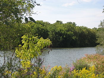
In 1876 the canal company was liquidated. The canal was turned over to the Crown as required by the original incorporation agreement and became a public work. However the provincial government, then as in the past, had no interest in equity ownership and the canal was placed under the control and management of the town of Dundas by an Order in Council on April 25, 1877. In October of that year full ownership was transferred to the town by two additional Orders in Council. In 1878 a canal committee was struck by Dundas, the canal was dredged again, tolls were revised and advertisements for business published. However this was to little avail and in 1895 direct rail service to Dundas was inaugurated, finally ending any dreams of commercial potential for the Desjardins Canal. Today, its remains can be seen north of Cootes Drive in east Dundas and in the rotting logs in the shallows of Cootes Paradise
Cootes Paradise
Cootes Paradise is the largest wetland at the western end of Lake Ontario, on the west side of Hamilton Harbour. It is bordered by the cities of Hamilton and Burlington, Ontario, Canada. It is owned and managed by the Royal Botanical Gardens , a private charitable status organization. These lands...
. As part of the renaissance in the area, the city of Hamilton
Hamilton, Ontario
Hamilton is a port city in the Canadian province of Ontario. Conceived by George Hamilton when he purchased the Durand farm shortly after the War of 1812, Hamilton has become the centre of a densely populated and industrialized region at the west end of Lake Ontario known as the Golden Horseshoe...
established a walking path
Trail
A trail is a path with a rough beaten or dirt/stone surface used for travel. Trails may be for use only by walkers and in some places are the main access route to remote settlements...
along the former canal.
External links
- Desjardins Canal plaque
- Railway accident contemporary reporting
- Railway accident gravesites
- Commercial photograph of railway accident
- Desjardins Canal historic postcard
- Desjardins Recreational Trail City of Hamilton listing