

Counties of Northern Ireland
Encyclopedia
The counties of Northern Ireland were the principal local government divisions of Northern Ireland
from its creation in 1921 until 1972 when their governmental features were abolished and replaced with twenty-six unitary authorities
.
Northern Ireland consists of six counties: Antrim
, Armagh
, Down
, Fermanagh
, Londonderry
, and Tyrone
. These form two-thirds of the historical province of Ulster
.
According to certain sources, the six-pointed star of the former Government of Northern Ireland flag
represents the six counties that make up Northern Ireland.
allowed the shiring of Ulster from 1604.
Though the present-day counties of Northern Ireland were planned in the early 16th century, some had already existed in one form or another beforehand although their boundaries would be adjusted. Each county would have an associated county town, with county courts of Quarter Sessions and Assizes.
's conquest of Ulaid
. Between the late 13th and early 14th centuries it was organised into administrative shires based around centres of Norman power such as Antrim
, Carrickfergus
, and Newtownards
.
The Bruce invasion (1315–18) saw the devastation of the Earldom of Ulster and its overlordship over the neighbouring Gaelic districts. With the murder of the last de Burgh earl in 1333, the resulting Gaelic recovery eroded the earldoms territory until by the 15th century only the areas of Carrickfergus and coastal enclaves in Down remained.
It wasn't until the reign of Queen Elizabeth I
that Ulster would be shired into more counties; based largely on the boundaries of existing lordships. In 1584, Lord Deputy of Ireland
Sir John Perrott created the following counties in what is now Northern Ireland: Armagh; Coleraine; Fermanagh; and Tyrone. Carrickfergus would retain its status as a county town until 1777 when it was merged with County Antrim.
, it was already being used for taxation and administrative purposes.
Baronies were used for many records from the 17th to 19th centuries such as: the Civil Survey; Petty's Down Survey; the Books of Survey and Distribution; the 19th century valuation books and census returns. The Grand Jury representment system would also be based on the barony.
s; Belfast
and Londonderry
. These were abolished in Northern Ireland in 1972 which saw the creation of twenty-six unitary councils, many of which cross county boundaries.
The six administrative counties and two county boroughs remain in use for some purposes, including car number plates. They were also used as postal counties
by the Royal Mail
for sorting purposes until their abolition in 1996.
s (see map on right). These are districts that have an appointed Lord Lieutenant
—the representative of the British monarch. Northern Ireland has eight lieutenancy areas: Antrim, Armagh, Down, Fermanagh, Tyrone, County of Londonderry, City of Londonderry
, and City of Belfast
.
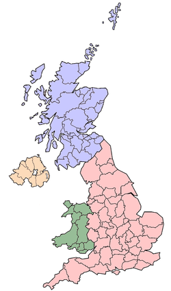
Northern Ireland
Northern Ireland is one of the four countries of the United Kingdom. Situated in the north-east of the island of Ireland, it shares a border with the Republic of Ireland to the south and west...
from its creation in 1921 until 1972 when their governmental features were abolished and replaced with twenty-six unitary authorities
Local government in Northern Ireland
Northern Ireland is divided into 26 districts for local government purposes. In Northern Ireland local councils do not carry out the same range of functions as those in the rest of the United Kingdom, for example they have no responsibility for education, for road building or for housing...
.
Northern Ireland consists of six counties: Antrim
County Antrim
County Antrim is one of six counties that form Northern Ireland, situated in the north-east of the island of Ireland. Adjoined to the north-east shore of Lough Neagh, the county covers an area of 2,844 km², with a population of approximately 616,000...
, Armagh
County Armagh
-History:Ancient Armagh was the territory of the Ulaid before the fourth century AD. It was ruled by the Red Branch, whose capital was Emain Macha near Armagh. The site, and subsequently the city, were named after the goddess Macha...
, Down
County Down
-Cities:*Belfast *Newry -Large towns:*Dundonald*Newtownards*Bangor-Medium towns:...
, Fermanagh
County Fermanagh
Fermanagh District Council is the only one of the 26 district councils in Northern Ireland that contains all of the county it is named after. The district council also contains a small section of County Tyrone in the Dromore and Kilskeery road areas....
, Londonderry
County Londonderry
The place name Derry is an anglicisation of the old Irish Daire meaning oak-grove or oak-wood. As with the city, its name is subject to the Derry/Londonderry name dispute, with the form Derry preferred by nationalists and Londonderry preferred by unionists...
, and Tyrone
County Tyrone
Historically Tyrone stretched as far north as Lough Foyle, and comprised part of modern day County Londonderry east of the River Foyle. The majority of County Londonderry was carved out of Tyrone between 1610-1620 when that land went to the Guilds of London to set up profit making schemes based on...
. These form two-thirds of the historical province of Ulster
Ulster
Ulster is one of the four provinces of Ireland, located in the north of the island. In ancient Ireland, it was one of the fifths ruled by a "king of over-kings" . Following the Norman invasion of Ireland, the ancient kingdoms were shired into a number of counties for administrative and judicial...
.
According to certain sources, the six-pointed star of the former Government of Northern Ireland flag
Ulster Banner
The Ulster Banner, more commonly known as the Ulster flag, Northern Ireland flag or the Red Hand of Ulster flag, was the flag of the Government of Northern Ireland between 1953 and 1972. Since that government was abolished in 1972, the flag has become a symbol of Ulster loyalism and is not...
represents the six counties that make up Northern Ireland.
The counties
| County | County town County town A county town is a county's administrative centre in the United Kingdom or Ireland. County towns are usually the location of administrative or judicial functions, or established over time as the de facto main town of a county. The concept of a county town eventually became detached from its... | First created | Extra | |
|---|---|---|---|---|
| County Antrim County Antrim County Antrim is one of six counties that form Northern Ireland, situated in the north-east of the island of Ireland. Adjoined to the north-east shore of Lough Neagh, the county covers an area of 2,844 km², with a population of approximately 616,000... |
Antrim Antrim, County Antrim Antrim is a town in County Antrim in the northeast of Northern Ireland, on the banks of the Six Mile Water, half a mile north-east of Lough Neagh. It had a population of 20,001 people in the 2001 Census. The town is the administrative centre of Antrim Borough Council... |
Early 14th century | 566,000 | Modern boundaries formed in 1605. |
| County Armagh County Armagh -History:Ancient Armagh was the territory of the Ulaid before the fourth century AD. It was ruled by the Red Branch, whose capital was Emain Macha near Armagh. The site, and subsequently the city, were named after the goddess Macha... |
Armagh Armagh Armagh is a large settlement in Northern Ireland, and the county town of County Armagh. It is a site of historical importance for both Celtic paganism and Christianity and is the seat, for both the Roman Catholic Church and the Church of Ireland, of the Archbishop of Armagh... |
1584 | 141,000 | |
| County Down County Down -Cities:*Belfast *Newry -Large towns:*Dundonald*Newtownards*Bangor-Medium towns:... |
Downpatrick Downpatrick Downpatrick is a medium-sized town about 33 km south of Belfast in County Down, Northern Ireland. It is the county town of Down with a rich history and strong connection to Saint Patrick. It had a population of 10,316 at the 2001 Census... |
Early 14th century | 492,840 | Modern boundaries formed in 1605. |
| County Fermanagh County Fermanagh Fermanagh District Council is the only one of the 26 district councils in Northern Ireland that contains all of the county it is named after. The district council also contains a small section of County Tyrone in the Dromore and Kilskeery road areas.... |
Enniskillen Enniskillen Enniskillen is a town in County Fermanagh, Northern Ireland. It is located almost exactly in the centre of the county between the Upper and Lower sections of Lough Erne. It had a population of 13,599 in the 2001 Census... |
1584 | 55,000 | Based on the territory of the Maguires. |
| County Londonderry County Londonderry The place name Derry is an anglicisation of the old Irish Daire meaning oak-grove or oak-wood. As with the city, its name is subject to the Derry/Londonderry name dispute, with the form Derry preferred by nationalists and Londonderry preferred by unionists... |
Coleraine Coleraine Coleraine is a large town near the mouth of the River Bann in County Londonderry, Northern Ireland. It is northwest of Belfast and east of Derry, both of which are linked by major roads and railway connections... |
1613 | 233,500 | Merging of County Coleraine (also spelt as Colerain), and the baronies of Loughinsholin, North East Liberties of Coleraine, and the North West Liberties of Londonderry |
| County Tyrone County Tyrone Historically Tyrone stretched as far north as Lough Foyle, and comprised part of modern day County Londonderry east of the River Foyle. The majority of County Londonderry was carved out of Tyrone between 1610-1620 when that land went to the Guilds of London to set up profit making schemes based on... |
Omagh Omagh Omagh is the county town of County Tyrone, Northern Ireland. It is situated where the rivers Drumragh and Camowen meet to form the Strule. The town, which is the largest in the county, had a population of 19,910 at the 2001 Census. Omagh also contains the headquarters of Omagh District Council and... |
1584 | 166,516 | Based on the Irish kingdom of Tír Eoghain, with its north-eastern part (barony of Loughinsholin) being merged with County Londonderry in 1613. |
Background of the counties
The English administration in Ireland in the years following the Anglo-Norman invasion of Ireland, created counties as the major subdivisions of an Irish province. This process lasted a period from the 13th to 17th centuries, however the number and shape of the counties that would form the future Northern Ireland would not be defined until the Flight of the EarlsFlight of the Earls
The Flight of the Earls took place on 14 September 1607, when Hugh Ó Neill of Tír Eóghain, Rory Ó Donnell of Tír Chonaill and about ninety followers left Ireland for mainland Europe.-Background to the exile:...
allowed the shiring of Ulster from 1604.
Though the present-day counties of Northern Ireland were planned in the early 16th century, some had already existed in one form or another beforehand although their boundaries would be adjusted. Each county would have an associated county town, with county courts of Quarter Sessions and Assizes.
Origins
The counties of Antrim and Down have their origins in the Norman Earldom of Ulster which was based on John de CourcyJohn de Courcy
John de Courcy was a Anglo-Norman knight who arrived in Ireland in 1176. From then until his expulsion in 1204, he conquered a considerable territory, endowed religious establishments, built abbeys for both the Benedictines and the Cistercians and built strongholds at Dundrum Castle in County...
's conquest of Ulaid
Ulaid
The Ulaid or Ulaidh were a people of early Ireland who gave their name to the modern province of Ulster...
. Between the late 13th and early 14th centuries it was organised into administrative shires based around centres of Norman power such as Antrim
Antrim, County Antrim
Antrim is a town in County Antrim in the northeast of Northern Ireland, on the banks of the Six Mile Water, half a mile north-east of Lough Neagh. It had a population of 20,001 people in the 2001 Census. The town is the administrative centre of Antrim Borough Council...
, Carrickfergus
Carrickfergus
Carrickfergus , known locally and colloquially as "Carrick", is a large town in County Antrim, Northern Ireland. It is located on the north shore of Belfast Lough, from Belfast. The town had a population of 27,201 at the 2001 Census and takes its name from Fergus Mór mac Eirc, the 6th century king...
, and Newtownards
Newtownards
Newtownards is a large town in County Down, Northern Ireland. It lies at the most northern tip of Strangford Lough, 10 miles east of Belfast, on the Ards Peninsula. Newtownards is the largest town in the Borough of Ards. According to the 2001 Census, it has a population of 27,821 people in...
.
The Bruce invasion (1315–18) saw the devastation of the Earldom of Ulster and its overlordship over the neighbouring Gaelic districts. With the murder of the last de Burgh earl in 1333, the resulting Gaelic recovery eroded the earldoms territory until by the 15th century only the areas of Carrickfergus and coastal enclaves in Down remained.
It wasn't until the reign of Queen Elizabeth I
Elizabeth I of England
Elizabeth I was queen regnant of England and Ireland from 17 November 1558 until her death. Sometimes called The Virgin Queen, Gloriana, or Good Queen Bess, Elizabeth was the fifth and last monarch of the Tudor dynasty...
that Ulster would be shired into more counties; based largely on the boundaries of existing lordships. In 1584, Lord Deputy of Ireland
Lord Deputy of Ireland
The Lord Deputy was the King's representative and head of the Irish executive under English rule, during the Lordship of Ireland and later the Kingdom of Ireland...
Sir John Perrott created the following counties in what is now Northern Ireland: Armagh; Coleraine; Fermanagh; and Tyrone. Carrickfergus would retain its status as a county town until 1777 when it was merged with County Antrim.
Baronies
Each county was divided into a number of baronies, a mid-way between a county and a parish. Baronies are now obsolete administrative units, partially derived from the territory of an Irish chieftain. By the time the process of turning local Irish kingdoms into baronies occurred throughout the whole of Ulster by the early 17th century as part of the Plantation of UlsterPlantation of Ulster
The Plantation of Ulster was the organised colonisation of Ulster—a province of Ireland—by people from Great Britain. Private plantation by wealthy landowners began in 1606, while official plantation controlled by King James I of England and VI of Scotland began in 1609...
, it was already being used for taxation and administrative purposes.
Baronies were used for many records from the 17th to 19th centuries such as: the Civil Survey; Petty's Down Survey; the Books of Survey and Distribution; the 19th century valuation books and census returns. The Grand Jury representment system would also be based on the barony.
Government and Modern Usage
The counties were also used as the administrative unit of local government introduced in Ireland under the 1898 Local Government Act, and in the case of what would become Northern Ireland, two county boroughCounty borough
County borough is a term introduced in 1889 in the United Kingdom of Great Britain and Ireland , to refer to a borough or a city independent of county council control. They were abolished by the Local Government Act 1972 in England and Wales, but continue in use for lieutenancy and shrievalty in...
s; Belfast
Belfast
Belfast is the capital of and largest city in Northern Ireland. By population, it is the 14th biggest city in the United Kingdom and second biggest on the island of Ireland . It is the seat of the devolved government and legislative Northern Ireland Assembly...
and Londonderry
Derry
Derry or Londonderry is the second-biggest city in Northern Ireland and the fourth-biggest city on the island of Ireland. The name Derry is an anglicisation of the Irish name Doire or Doire Cholmcille meaning "oak-wood of Colmcille"...
. These were abolished in Northern Ireland in 1972 which saw the creation of twenty-six unitary councils, many of which cross county boundaries.
The six administrative counties and two county boroughs remain in use for some purposes, including car number plates. They were also used as postal counties
Postal counties of the United Kingdom
The postal counties of the United Kingdom, now known officially as the former postal counties, were postal subdivisions in routine use by the Royal Mail until 1996. The raison d'être of the postal county – as opposed to any other kind of county – was to aid the sorting of mail by...
by the Royal Mail
Royal Mail
Royal Mail is the government-owned postal service in the United Kingdom. Royal Mail Holdings plc owns Royal Mail Group Limited, which in turn operates the brands Royal Mail and Parcelforce Worldwide...
for sorting purposes until their abolition in 1996.
Lieutenancy areas
Like the rest of the United Kingdom, Northern Ireland is divided into lieutenancy areaLieutenancy area
Lieutenancy areas are the separate areas of the United Kingdom appointed a Lord Lieutenant - the representative of the British monarch. In many cases they have similar demarcation and naming to, but are not necessarily conterminate with, the counties of the United Kingdom.-Origin:In England,...
s (see map on right). These are districts that have an appointed Lord Lieutenant
Lord Lieutenant
The title Lord Lieutenant is given to the British monarch's personal representatives in the United Kingdom, usually in a county or similar circumscription, with varying tasks throughout history. Usually a retired local notable, senior military officer, peer or business person is given the post...
—the representative of the British monarch. Northern Ireland has eight lieutenancy areas: Antrim, Armagh, Down, Fermanagh, Tyrone, County of Londonderry, City of Londonderry
Lord Lieutenant of the City of Londonderry
This is a list of people to have served as Lord Lieutenant of the city of Derry This is a list of people to have served as Lord Lieutenant of the city of Derry This is a list of people to have served as Lord Lieutenant of the city of Derry (originally formally "County of the City of Londonderry",...
, and City of Belfast
Lord Lieutenant of Belfast
The Lord Lieutenant of Belfast is the official representative of the Queen for the 'County Borough of Belfast', Northern Ireland. The current Lord Lieutenant is Dame Mary Peters who was appointed in August 2009. The position was first created in 1900 and was held by the Marquess of Londonderry...
.
Former counties
Former counties which formed part of the six modern counties of Northern Ireland:- County ColeraineCounty ColeraineCounty Coleraine, called County of Colerain in the earliest documents was one of the counties of Ireland from 1585 to 1613. It was named after its intended county town, Coleraine...
formed from the territory of the O'Cahans in 1584 by Queen Elizabeth IElizabeth I of EnglandElizabeth I was queen regnant of England and Ireland from 17 November 1558 until her death. Sometimes called The Virgin Queen, Gloriana, or Good Queen Bess, Elizabeth was the fifth and last monarch of the Tudor dynasty...
, formed the basis of modern County LondonderryCounty LondonderryThe place name Derry is an anglicisation of the old Irish Daire meaning oak-grove or oak-wood. As with the city, its name is subject to the Derry/Londonderry name dispute, with the form Derry preferred by nationalists and Londonderry preferred by unionists...
. - TyroneCounty TyroneHistorically Tyrone stretched as far north as Lough Foyle, and comprised part of modern day County Londonderry east of the River Foyle. The majority of County Londonderry was carved out of Tyrone between 1610-1620 when that land went to the Guilds of London to set up profit making schemes based on...
was formerly divided into Nether Tyrone and Upper Tyrone. - Carrickfergus was formerly a county of itselfCounty corporateA county corporate or corporate county was a type of subnational division used for local government in England, Ireland and Wales.Counties corporate were created during the Middle Ages, and were effectively small self-governing counties...
, it extended further than the modern borough of CarrickfergusCarrickfergus Borough CouncilCarrickfergus Borough Council is a district council in County Antrim in Northern Ireland. The council headquarters are in Carrickfergus and the council administers the town, on the north shore of Belfast Lough, and surrounding area, which extends from Greenisland in the south-west to Whitehead in...
. It was merged into County AntrimCounty AntrimCounty Antrim is one of six counties that form Northern Ireland, situated in the north-east of the island of Ireland. Adjoined to the north-east shore of Lough Neagh, the county covers an area of 2,844 km², with a population of approximately 616,000...
in 1777. - TwescardTwescardTwescard is a former county of Ireland, consisting of the northern coastland of Ulster as part of the Earldom of Ulster. At its height it stretched from Glenarm in the east of the Glens of Antrim to Inishowen in modern County Donegal. It was conquered and settled by Hugh de Lacy and was centered...
, Blathewyc (NewtownardsNewtownardsNewtownards is a large town in County Down, Northern Ireland. It lies at the most northern tip of Strangford Lough, 10 miles east of Belfast, on the Ards Peninsula. Newtownards is the largest town in the Borough of Ards. According to the 2001 Census, it has a population of 27,821 people in...
), del Art (ArdsArds (territory)Ards is the name of several different historical territorial divisions all located on the Ards Peninsula in modern-day County Down, Northern Ireland....
), Ladcathel (LecaleLecaleLecale is the name of two different historical territorial divisions both located in the east of modern-day County Down, Northern Ireland. Anciently it was the name of the ancient Irish district of Leath Cathail...
), four of seven counties that formed the Earldom of Ulster in 1333.
See also
- Counties of the United KingdomCounties of the United KingdomThe counties of the United Kingdom are subnational divisions of the United Kingdom, used for the purposes of administrative, geographical and political demarcation. By the Middle Ages counties had become established as a unit of local government, at least in England. By the early 17th century all...
- Counties of IrelandCounties of IrelandThe counties of Ireland are sub-national divisions used for the purposes of geographic demarcation and local government. Closely related to the county is the County corporate which covered towns or cities which were deemed to be important enough to be independent from their counties. A county...
- List of Irish counties by population
- List of Irish counties by area
- Provinces of IrelandProvinces of IrelandIreland has historically been divided into four provinces: Leinster, Ulster, Munster and Connacht. The Irish word for this territorial division, cúige, literally meaning "fifth part", indicates that there were once five; the fifth province, Meath, was incorporated into Leinster, with parts going to...