
Burra, New South Wales
Encyclopedia
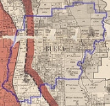
Burra is an Australia
n district and parish
of rural smallholdings lying 20 kilometres to the south of Queanbeyan, New South Wales
in Palerang Council
, postcode 2620. In 2006, Burra had a population of 480 people. The districts bounds have been defined as being the area to the south of the intersection of the Burra and Cooma Roads that contains the catchments of the Burra, Urila, Waterholes and Guises Creeks, and bounded to the East by the Queanbeyan River. The Burra Creek, whose headwaters are in the Tinderry Nature Reserve, flows through the centre of the Burra Valley to join the waters of the Queanbeyan River
at the Googong
Reservoir. Nearby small settlements include Royalla, Williamsdale
and Michelago
to the west and south. Urila Valley is accessed from the Burra Valley and lies to the east. Burra is also a commutable distance from Australia
's capital city Canberra
.
 It is also a parish
of the County of Murray
. The parish originally consisted of land between Guises Creek in the west, and Burra Creek in the east, encompassing land on both sides of Jerrabomberra Creek. A small part of this land was located to the west of the Queanbeyan-Cooma railway line and thus became part of the Australian Capital Territory
in 1911.
The Ngarigo people originally inhabited Burra as part of their wider country lands extending south to the Australian Alps
. The first European camp was called 'The Creek' although it soon became known amongst the early settlers as "The Burra", possibly from a local aboriginal word (for instance, the Ngarigo word "berra", meaning boomerang
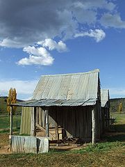
). The first grazing and clearing of the area began in the 1830-60s and farms in the burra valley were established at the Warm Corner, KT Park, Burra Station (the original 'creek' station), London Bridge and Lagoon. By the 1920s the local population had become large enough to support two competing cricket clubs, one at the Burra park, the other near Urila. Subdivision into smaller blocks began in the 1960s as Canberra's population expanded and has created the local regions such as those surrounding Candy Road, Badgery Road and Plumbers Road. Today the majority of the area has been subdivided in this way creating a population of over three hundred houses.
 Burra lies at the northern tip of the Monaro
tablelands, and shares with it some of the cooler climate of that region. Temperatures are on average two or three degrees Celsius below those in Canberra and Queanbeyan. Light falls of snow are not uncommon in the winter months.
Part of the Burra valley has always been treeless. Elsewhere remnants of uncleared open woodland of Snow Gum, Candlebark
, Yellow Box
, Apple Box
and Small Leaved Peppermint
remain. Black Sally
and Manna Gum are found in the cooler gullies and frost hollows. The wooded hills to the east are rocky and dry, sporting primarily Small Leafed Peppermint
, Brittle Gum
and Scribbly Gum. This area has never been heavily grazed and is in its original natural condition, in 2001 a part of it was protected by the creation of the Burra Creek Nature Reserve. The steeper slopes of the hills to the west of the Burra Valley, including Mount Campbell and Mount Gibraltar
(and known by some Burrans as the 'Purple Veil' range due to their shaded afternoon colour) are patchily covered by a forest type similar to the wet sclerophyll
that occurs further to the west on the Mount Clear Range and in Namadgi National Park
.
Most of the region is underlain by the Colinton Volcanics, composed of tuff
and lava
s deposited in shallow water during the Silurian
period. A fault runs parallel and to the east of the Burra Road, beyond which are the ancient deep sea Ordovician
sediments of the Pittman formation. A few limestone
lenses occur in younger rocks near to this faultline, one of which forms the locally famous 'London Bridge' natural arch over the Burra Creek. In the 1920-30s there was some prospecting of Iron, Lead and Silver along this fault but this was never commercially successful.
Australia
Australia , officially the Commonwealth of Australia, is a country in the Southern Hemisphere comprising the mainland of the Australian continent, the island of Tasmania, and numerous smaller islands in the Indian and Pacific Oceans. It is the world's sixth-largest country by total area...
n district and parish
Parish
A parish is a territorial unit historically under the pastoral care and clerical jurisdiction of one parish priest, who might be assisted in his pastoral duties by a curate or curates - also priests but not the parish priest - from a more or less central parish church with its associated organization...
of rural smallholdings lying 20 kilometres to the south of Queanbeyan, New South Wales
Queanbeyan, New South Wales
Queanbeyan is a regional centre in the Southern Tablelands in south-eastern New South Wales adjacent to the Australian Capital Territory. The city's mixed economy is based on light construction, high technology, manufacturing, service, retail and agriculture. It is the council seat of the...
in Palerang Council
Palerang Council
The Palerang Council is a Local Government Area in the Southern Tablelands Region of New South Wales, Australia. It is on the Kings Highway and the Sydney-Canberra railway....
, postcode 2620. In 2006, Burra had a population of 480 people. The districts bounds have been defined as being the area to the south of the intersection of the Burra and Cooma Roads that contains the catchments of the Burra, Urila, Waterholes and Guises Creeks, and bounded to the East by the Queanbeyan River. The Burra Creek, whose headwaters are in the Tinderry Nature Reserve, flows through the centre of the Burra Valley to join the waters of the Queanbeyan River
Queanbeyan River
The Queanbeyan River is a tributary of the Molonglo River and part of Murray-Darling Basin. The river is 70 kilometres in length and the river catchment is 96,000 hectares in size...
at the Googong
Googong, New South Wales
Googong is a suburb of Queanbeyan, New South Wales, and a parish of the County of Murray located to the south of Queanbeyan. Googong contains the developed areas of Fernleigh Park, Little Burra and Mount Campbell Estate. It borders Jerrabomberra and Karabar on the north and Environa on the west...
Reservoir. Nearby small settlements include Royalla, Williamsdale
Williamsdale, New South Wales
Williamsdale is a village on the New South Wales - Australian Capital Territory border in Australia on the Monaro Highway. The postcode is 2620.-Geology:...
and Michelago
Michelago, New South Wales
Michelago is a small settlement in the Monaro region of New South Wales, Australia, in the Cooma-Monaro Shire, approximately 54 km south of Canberra on the Monaro Highway. It was founded in the 1820s, on the main route from Sydney to the Snowy Mountains...
to the west and south. Urila Valley is accessed from the Burra Valley and lies to the east. Burra is also a commutable distance from Australia
Australia
Australia , officially the Commonwealth of Australia, is a country in the Southern Hemisphere comprising the mainland of the Australian continent, the island of Tasmania, and numerous smaller islands in the Indian and Pacific Oceans. It is the world's sixth-largest country by total area...
's capital city Canberra
Canberra
Canberra is the capital city of Australia. With a population of over 345,000, it is Australia's largest inland city and the eighth-largest city overall. The city is located at the northern end of the Australian Capital Territory , south-west of Sydney, and north-east of Melbourne...
.
Parish
A parish is a territorial unit historically under the pastoral care and clerical jurisdiction of one parish priest, who might be assisted in his pastoral duties by a curate or curates - also priests but not the parish priest - from a more or less central parish church with its associated organization...
of the County of Murray
Murray County, New South Wales
Murray County was one of the original Nineteen Counties in New South Wales and is now one of the 141 Lands administrative divisions of New South Wales. It included the area which is now part of Canberra and as far north as Lake George and Yass. It was originally bounded on the west by the...
. The parish originally consisted of land between Guises Creek in the west, and Burra Creek in the east, encompassing land on both sides of Jerrabomberra Creek. A small part of this land was located to the west of the Queanbeyan-Cooma railway line and thus became part of the Australian Capital Territory
Australian Capital Territory
The Australian Capital Territory, often abbreviated ACT, is the capital territory of the Commonwealth of Australia and is the smallest self-governing internal territory...
in 1911.
The Ngarigo people originally inhabited Burra as part of their wider country lands extending south to the Australian Alps
Australian Alps
The Australian Alps are the highest mountain ranges of mainland Australia. They are located in southeastern Australia and straddle the Australian Capital Territory, south-eastern New South Wales and eastern Victoria...
. The first European camp was called 'The Creek' although it soon became known amongst the early settlers as "The Burra", possibly from a local aboriginal word (for instance, the Ngarigo word "berra", meaning boomerang
Boomerang
A boomerang is a flying tool with a curved shape used as a weapon or for sport.-Description:A boomerang is usually thought of as a wooden device, although historically boomerang-like devices have also been made from bones. Modern boomerangs used for sport are often made from carbon fibre-reinforced...
). The first grazing and clearing of the area began in the 1830-60s and farms in the burra valley were established at the Warm Corner, KT Park, Burra Station (the original 'creek' station), London Bridge and Lagoon. By the 1920s the local population had become large enough to support two competing cricket clubs, one at the Burra park, the other near Urila. Subdivision into smaller blocks began in the 1960s as Canberra's population expanded and has created the local regions such as those surrounding Candy Road, Badgery Road and Plumbers Road. Today the majority of the area has been subdivided in this way creating a population of over three hundred houses.
Monaro, New South Wales
Monaro is the name of a region in the south of New South Wales, Australia. A small area of Victoria near Snowy River National Park is geographically part of the Monaro, whilst the Australian Capital Territory is frequently considered part of the region: most towns have very close links with...
tablelands, and shares with it some of the cooler climate of that region. Temperatures are on average two or three degrees Celsius below those in Canberra and Queanbeyan. Light falls of snow are not uncommon in the winter months.
Part of the Burra valley has always been treeless. Elsewhere remnants of uncleared open woodland of Snow Gum, Candlebark
Eucalyptus rubida
The Candlebark is a medium sized tree of the genus Eucalyptus. It occurs in south eastern Australia and Tasmania, typically in open woodland around the lower slopes of the Great Dividing Range, but also in taller forests...
, Yellow Box
Eucalyptus melliodora
Eucalyptus melliodora, commonly known as Yellow Box, is a medium sized to occasionally tall eucalypt. The bark is variable ranging from smooth with an irregular, short stocking, to covering most of the trunk, fibrous, dense or loosely held, grey, yellow or red-brown, occasionally very coarse,...
, Apple Box
Eucalyptus bridgesiana
The Apple Box is a medium to large sized tree of the genus Eucalyptus. It occurs in south eastern Australia, typically in grassy woodland and near watercourses around the lower slopes of the Great Dividing Range....
and Small Leaved Peppermint
Eucalyptus radiata
Eucalyptus radiata is a medium to tall tree to 30 m high with persistent bark on the trunk and larger branches or persistent to smaller branches. The bark shortly fibrous , grey to grey-brown, shedding in long ribbons...
remain. Black Sally
Eucalyptus stellulata
Eucalyptus stellulata, the Black Sallee or Black Sally is a high altitude tree found in south eastern Australia. Found from near the border of New South Wales and Queensland, down the Great Dividing Range to the eastern highland parts of Victoria.“Stellulata” refers to the star-shaped clusters of...
and Manna Gum are found in the cooler gullies and frost hollows. The wooded hills to the east are rocky and dry, sporting primarily Small Leafed Peppermint
Eucalyptus dives
Eucalyptus dives or broad-leaved peppermint is a small tree native to temperate dry sclerophyll woodlands and forests of south-eastern Australia. The juvenile leaves are ovate and glaucus, and adult leaves are lanceolate to broad-lanceolate. Leaves are aromatic.-Uses:There are two notable...
, Brittle Gum
Eucalyptus mannifera
Eucalyptus mannifera, commonly known as the Brittle Gum or Broad leaved Manna Gum, is a species of eucalypt native to eastern Australia....
and Scribbly Gum. This area has never been heavily grazed and is in its original natural condition, in 2001 a part of it was protected by the creation of the Burra Creek Nature Reserve. The steeper slopes of the hills to the west of the Burra Valley, including Mount Campbell and Mount Gibraltar
Mount Gibraltar
Mount Gibraltar is a small mountain between Bowral and Mittagong in New South Wales, Australia-Facts and Figures:The mountain is locally known as 'The Gib', and is in the form of a ridge, rather than an obvious conical peak. The western extremity of the ridge is commonly pointed out as the mountain...
(and known by some Burrans as the 'Purple Veil' range due to their shaded afternoon colour) are patchily covered by a forest type similar to the wet sclerophyll
Sclerophyll
Sclerophyll is the term for a type of vegetation that has hard leaves and short internodes . The word comes from the Greek sclero and phyllon ....
that occurs further to the west on the Mount Clear Range and in Namadgi National Park
Namadgi National Park
Namadgi National Park is located in the southwestern part of the Australian Capital Territory, bordering Kosciuszko National Park in New South Wales. It lies approximately 40 km southwest of Canberra, and makes up approximately 46% of the ACT's land area....
.
Most of the region is underlain by the Colinton Volcanics, composed of tuff
Tuff
Tuff is a type of rock consisting of consolidated volcanic ash ejected from vents during a volcanic eruption. Tuff is sometimes called tufa, particularly when used as construction material, although tufa also refers to a quite different rock. Rock that contains greater than 50% tuff is considered...
and lava
Lava
Lava refers both to molten rock expelled by a volcano during an eruption and the resulting rock after solidification and cooling. This molten rock is formed in the interior of some planets, including Earth, and some of their satellites. When first erupted from a volcanic vent, lava is a liquid at...
s deposited in shallow water during the Silurian
Silurian
The Silurian is a geologic period and system that extends from the end of the Ordovician Period, about 443.7 ± 1.5 Mya , to the beginning of the Devonian Period, about 416.0 ± 2.8 Mya . As with other geologic periods, the rock beds that define the period's start and end are well identified, but the...
period. A fault runs parallel and to the east of the Burra Road, beyond which are the ancient deep sea Ordovician
Ordovician
The Ordovician is a geologic period and system, the second of six of the Paleozoic Era, and covers the time between 488.3±1.7 to 443.7±1.5 million years ago . It follows the Cambrian Period and is followed by the Silurian Period...
sediments of the Pittman formation. A few limestone
Limestone
Limestone is a sedimentary rock composed largely of the minerals calcite and aragonite, which are different crystal forms of calcium carbonate . Many limestones are composed from skeletal fragments of marine organisms such as coral or foraminifera....
lenses occur in younger rocks near to this faultline, one of which forms the locally famous 'London Bridge' natural arch over the Burra Creek. In the 1920-30s there was some prospecting of Iron, Lead and Silver along this fault but this was never commercially successful.
See also
- Geology of the Australian Capital Territory
- Queanbeyan, New South WalesQueanbeyan, New South WalesQueanbeyan is a regional centre in the Southern Tablelands in south-eastern New South Wales adjacent to the Australian Capital Territory. The city's mixed economy is based on light construction, high technology, manufacturing, service, retail and agriculture. It is the council seat of the...
- Monaro, New South WalesMonaro, New South WalesMonaro is the name of a region in the south of New South Wales, Australia. A small area of Victoria near Snowy River National Park is geographically part of the Monaro, whilst the Australian Capital Territory is frequently considered part of the region: most towns have very close links with...