

British Columbia provincial highway 7
Encyclopedia
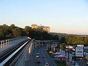
Highway 7, known for most of its length as the Lougheed Highway, is an alternative route to Highway 1 through the Lower Mainland
region of British Columbia
. Whereas the controlled access
Highway 1 follows the southern bank of the Fraser River
, Highway 7 follows the northern bank.
Highway 7 was first commissioned in 1941, and originally went from Vancouver
to Harrison Hot Springs
, following the Dewdney Trunk Road between Port Moody and Port Coquitlam. In 1953, Highway 7 was moved to its modern alignment between Vancouver and Coquitlam. Highway 7's eastern end was moved south from Harrison Hot Springs to Agassiz
in 1956, and then moved east to Ruby Creek
in 1968. Highway 7 has gone all the way to a junction with Highway 1 just past Hope
since 1973.
Unlike former Alberta
premier Peter Lougheed
's name , the Lougheed in Lougheed Highway is pronounced "LOW-heed". The highway is named after Nelson Seymour Lougheed
, MLA for the Dewdney District and the B.C. Minister of Public Works (1928-29) who ran a logging company in the area.
 Highway 7's total length under the jurisdiction of the British Columbia Ministry of Transportation is 118 km (93 mi). Highway 7 is signed as far west as Granville Street on Broadway in Vancouver, however the section under the MOT's jurisdiction begins at the westbound exit with Highway 1 near Schoolhouse Street, the total length is 2.3 km. The highway then turns immediately northeast, meets with Highway 1 at the Cape Horn Interchange and immediately after, an exit with United Boulevard. The highway leaves the MOT's jurisdiction 300 m after the interchange.
Highway 7 under the MOT's jurisdiction again after Ottawa street, and then Highway 7 crosses over the Pitt River Bridge
into Pitt Meadows. 6 km (4 mi) southeast of the Pitt River bridge, Highway 7 crosses into Maple Ridge
at Maple Meadows Way, and the highway then crosses into Mission
another 20 km (12 mi) east. 9 km (6 mi) of Highway 7's entry into Mission, it meets a junction with Highway 11. 8 km (5 mi) east of the Highway 11 junction, Highway 7 leaves Mission over the Hatzic Pump Bridge.
27 km (17 mi) east of the Highway's eastern exit from Mission, Highway 7 enters the Municipality of Kent
. 14 km (9 mi) east, Highway 7 reaches a junction with Highway 9 at Agassiz. 18 km (11 mi) northeast of the Highway 9 junction, Highway 7 leaves Kent. Another 12 km (7 mi) northeast, Highway 7 finally reaches its eastern terminus at a junction with Highway 1 at Haig
, just across the Fraser River from the main part of Hope.
The Greater Vancouver Transportation Authority (TransLink) has jurisdiction of Highway 7 the point east of Ottawa Street to the point east of United Blvd.
{| class=wikitable
!Regional district
!Location
!km
!Destinations
!Notes
|-
|rowspan=19|Metro Vancouver
|rowspan=7|City of Coquitlam
|
|colspan=2 align=center|Western terminus, roadway continues east as Lougheed Highway west to Burnaby, Vancouver
|-
|
|Myrman Street, Maple Leaf Self Storage
|Westbound exit and entrance only
|-
|
|To
|Westbound left turn only
|-
|
|Coleman Avenue
|Westbound exit and entrance only
|-
|bgcolor=#ffdddd|
|bgcolor=#ffdddd| to Surrey, Langley
, Abbotsford via the Port Mann Bridge
|bgcolor=#ffdddd|No access to Highway 1 westbound from Highway 7 at this interchange
|-
|
|United Boulevard to (Mary Hill Bypass) east
|Partially grade-separated
|-
|
|Pitt River Road to Port Coquitlam
|
|-
|rowspan=2|City of Port Coquitlam
|
|colspan=4 align=center|Highway 7 leaves MOT's jurisdiction, continues before the Pitt River Bridge
|-
|
| (Mary Hill Bypass) west to Coquitlam
|
|-
|Pitt River
|
|colspan=2 align=center|Pitt River Bridge
|-
|rowspan=7|City of Pitt Meadows
|
|Old Dewdney Trunk Road
|
|-
|
|Allen Way
|
|-
|
|Harris Road
|
|-
|
|Park Road, Meadow Gardens Way
|
|-
|
|To Golden Ears Way
south to Langley
, Surrey via the Golden Ears Bridge
|Eastbound exit only
|-
|
|Meadowtown Centre Way south; north to Golden Ears Way/Abernethy Connector
|
|-
|
|Dewdney Trunk Road & Maple Meadows Way (alternate route to Golden Ears Way south)
|
|-
|rowspan=2|District of Maple Ridge
|
|Haney Bypass east to Mission
|Route 7 follows Haney Bypass
|-
|
|Haney Bypass west to Pitt Meadows, Port Coquitlam, Coquitlam
|Route 7 returns to Lougheed Hwy
|-
|rowspan=8|Fraser Valley Regional District
|rowspan=4|District of Mission
|
| (Abbotsford-Mission Highway) to Abbotsford, Cedar Valley Connector
|
|-
|
|align=center colspan=2|One-way road
pair begins
|-
|
|Murray Street to Horne Street expressway connector to Highway 11
|
|-
|
|align=center colspan=2|One-way road pair ends
|-
|rowspan=3|District of Kent
|bgcolor=#ddffdd|
|bgcolor=#ddffdd| (Hot Springs Road) to Harrison Hot Springs
, Else Road
|bgcolor=#ddffdd|Highway 7 turns right; western end of Highway 9 concurrency
|-
|bgcolor=#ddffdd|
|bgcolor=#ddffdd| (Evergreen Drive) to Agassiz
City Centre
|bgcolor=#ddffdd|Eastern end of Highway 9 concurrency
|-
|
|Agassiz Bypass to Highway 9 (Haig Highway)
|
|-
|
|
| south to Hope, Greater Vancouver
, north to Cache Creek
|Grade-separated; Eastern terminus
Lower Mainland
The Lower Mainland is a name commonly applied to the region surrounding and including Vancouver, British Columbia, Canada. As of 2007, 2,524,113 people live in the region; sixteen of the province's thirty most populous municipalities are located there.While the term Lower Mainland has been...
region of British Columbia
British Columbia
British Columbia is the westernmost of Canada's provinces and is known for its natural beauty, as reflected in its Latin motto, Splendor sine occasu . Its name was chosen by Queen Victoria in 1858...
. Whereas the controlled access
Limited-access road
A limited-access road known by various terms worldwide, including limited-access highway, dual-carriageway and expressway, is a highway or arterial road for high-speed traffic which has many or most characteristics of a controlled-access highway , including limited or no access to adjacent...
Highway 1 follows the southern bank of the Fraser River
Fraser River
The Fraser River is the longest river within British Columbia, Canada, rising at Fraser Pass near Mount Robson in the Rocky Mountains and flowing for , into the Strait of Georgia at the city of Vancouver. It is the tenth longest river in Canada...
, Highway 7 follows the northern bank.
Highway 7 was first commissioned in 1941, and originally went from Vancouver
Vancouver
Vancouver is a coastal seaport city on the mainland of British Columbia, Canada. It is the hub of Greater Vancouver, which, with over 2.3 million residents, is the third most populous metropolitan area in the country,...
to Harrison Hot Springs
Harrison Hot Springs, British Columbia
The Village of Harrison Hot Springs is a small community at the southern end of Harrison Lake in the Fraser Valley of British Columbia. It is a member of the Fraser Valley Regional District; its immediate neighbour is the District of Kent and included in it, the town of Agassiz. It is a resort...
, following the Dewdney Trunk Road between Port Moody and Port Coquitlam. In 1953, Highway 7 was moved to its modern alignment between Vancouver and Coquitlam. Highway 7's eastern end was moved south from Harrison Hot Springs to Agassiz
Agassiz, British Columbia
Agassiz is a small community located in British Columbia's Fraser Valley. The only town within the jurisdiction of the District Municipality of Kent, it contains the majority of Kent's population.-References:...
in 1956, and then moved east to Ruby Creek
Ruby Creek, British Columbia
Ruby Creek is a locality on the Fraser River in the District of Kent, British Columbia, Canada, in the Upper Fraser Valley region, located on BC Highway 7 and the mainline of the Canadian Pacific Railway, near the confluence of Ruby Creek with the Fraser, northeast of Sea Bird Island. Ruby Creek...
in 1968. Highway 7 has gone all the way to a junction with Highway 1 just past Hope
Hope, British Columbia
Hope is a district municipality located at the confluence of the Fraser and Coquihalla rivers in the province of British Columbia, Canada. Hope is at the eastern end of both the Fraser Valley and the Lower Mainland region, and is at the southern end of the Fraser Canyon...
since 1973.
Unlike former Alberta
Alberta
Alberta is a province of Canada. It had an estimated population of 3.7 million in 2010 making it the most populous of Canada's three prairie provinces...
premier Peter Lougheed
Peter Lougheed
Edgar Peter Lougheed, PC, CC, AOE, QC, is a Canadian lawyer, and a former politician and Canadian Football League player. He served as the tenth Premier of Alberta from 1971 to 1985....
's name , the Lougheed in Lougheed Highway is pronounced "LOW-heed". The highway is named after Nelson Seymour Lougheed
Nelson Seymour Lougheed
Nelson Seymour Lougheed was a businessman and political figure in British Columbia. He represented Dewdney in the Legislative Assembly of British Columbia from 1928 to 1933 as a Conservative....
, MLA for the Dewdney District and the B.C. Minister of Public Works (1928-29) who ran a logging company in the area.
Route details
Highway 7 under the MOT's jurisdiction again after Ottawa street, and then Highway 7 crosses over the Pitt River Bridge
Pitt River Bridge
The Pitt River Bridge is a cable-stayed bridge that spans the Pitt River between Port Coquitlam and Pitt Meadows in British Columbia, Canada. The bridge is part of Highway 7, carrying Lougheed Highway across the river...
into Pitt Meadows. 6 km (4 mi) southeast of the Pitt River bridge, Highway 7 crosses into Maple Ridge
Maple Ridge, British Columbia
Maple Ridge is a District Municipality in British Columbia, located in the northeastern section of Metro Vancouver. Maple Ridge has a population of approximately 68,949.-History:...
at Maple Meadows Way, and the highway then crosses into Mission
Mission, British Columbia
Mission, the core of which was formerly known as Mission City, is a district municipality in the province of British Columbia, Canada. It is situated on the north bank of the Fraser River overlooking the City of Abbotsford and with that city is part of the Central Fraser Valley. Mission is the...
another 20 km (12 mi) east. 9 km (6 mi) of Highway 7's entry into Mission, it meets a junction with Highway 11. 8 km (5 mi) east of the Highway 11 junction, Highway 7 leaves Mission over the Hatzic Pump Bridge.
27 km (17 mi) east of the Highway's eastern exit from Mission, Highway 7 enters the Municipality of Kent
Kent, British Columbia
The District of Kent is a district municipality located east of Vancouver, British Columbia. Part of the Fraser Valley Regional District, Kent consists of several communities, the largest and most well-known being Agassiz, the only town in the municipality, Harrison Mills, Kilby, Mount Woodside,...
. 14 km (9 mi) east, Highway 7 reaches a junction with Highway 9 at Agassiz. 18 km (11 mi) northeast of the Highway 9 junction, Highway 7 leaves Kent. Another 12 km (7 mi) northeast, Highway 7 finally reaches its eastern terminus at a junction with Highway 1 at Haig
Haig, British Columbia
Haig is a settlement in British Columbia....
, just across the Fraser River from the main part of Hope.
The Greater Vancouver Transportation Authority (TransLink) has jurisdiction of Highway 7 the point east of Ottawa Street to the point east of United Blvd.
Major intersections
These are the exits on Route 7 under MOT jurisdiction.{| class=wikitable
!Regional district
!Location
!km
!Destinations
!Notes
|-
|rowspan=19|Metro Vancouver
|rowspan=7|City of Coquitlam
|
|colspan=2 align=center|Western terminus, roadway continues east as Lougheed Highway west to Burnaby, Vancouver
|-
|
|Myrman Street, Maple Leaf Self Storage
|Westbound exit and entrance only
|-
|
|To
|Westbound left turn only
|-
|
|Coleman Avenue
|Westbound exit and entrance only
|-
|bgcolor=#ffdddd|
|bgcolor=#ffdddd| to Surrey, Langley
Langley, British Columbia (city)
The City of Langley is a municipality in Metro Vancouver. It lies directly east of the City of Surrey, adjacent to Cloverdale, and surrounded on the north, east and south by Township of Langley.-History:...
, Abbotsford via the Port Mann Bridge
Port Mann Bridge
The Port Mann Bridge is a steel tied arch bridge that spans the Fraser River connecting Coquitlam to Surrey in British Columbia near Vancouver. The bridge consists of three spans with an orthotropic deck carrying five lanes of Trans-Canada Highway traffic, with approach spans of three steel plate...
|bgcolor=#ffdddd|No access to Highway 1 westbound from Highway 7 at this interchange
|-
|
|United Boulevard to (Mary Hill Bypass) east
|Partially grade-separated
|-
|
|Pitt River Road to Port Coquitlam
|
|-
|rowspan=2|City of Port Coquitlam
|
|colspan=4 align=center|Highway 7 leaves MOT's jurisdiction, continues before the Pitt River Bridge
|-
|
| (Mary Hill Bypass) west to Coquitlam
|
|-
|Pitt River
Pitt River
The Pitt River in British Columbia, Canada is a large tributary of the Fraser River, entering it a few miles upstream from New Westminster and about 25 km ESE of Downtown Vancouver. The river, which begins in the Garibaldi Ranges of the Coast Mountains, is in two sections above and below Pitt...
|
|colspan=2 align=center|Pitt River Bridge
Pitt River Bridge
The Pitt River Bridge is a cable-stayed bridge that spans the Pitt River between Port Coquitlam and Pitt Meadows in British Columbia, Canada. The bridge is part of Highway 7, carrying Lougheed Highway across the river...
|-
|rowspan=7|City of Pitt Meadows
|
|Old Dewdney Trunk Road
|
|-
|
|Allen Way
|
|-
|
|Harris Road
|
|-
|
|Park Road, Meadow Gardens Way
|
|-
|
|To Golden Ears Way
Golden Ears Way
Golden Ears Way is a two-to-six lane road in Greater Vancouver, British Columbia. It connects Maple Ridge and Pitt Meadows to Langley and Surrey via the Golden Ears Bridge...
south to Langley
Langley, British Columbia (city)
The City of Langley is a municipality in Metro Vancouver. It lies directly east of the City of Surrey, adjacent to Cloverdale, and surrounded on the north, east and south by Township of Langley.-History:...
, Surrey via the Golden Ears Bridge
Golden Ears Bridge
The Golden Ears Bridge is a six-lane extradosed bridge in Metro Vancouver, British Columbia. It spans the Fraser River, connecting Langley on the south side with Pitt Meadows and Maple Ridge on the north side. The All Electronic Toll bridge, owned by TransLink, has a clearance of , and a total...
|Eastbound exit only
|-
|
|Meadowtown Centre Way south; north to Golden Ears Way/Abernethy Connector
|
|-
|
|Dewdney Trunk Road & Maple Meadows Way (alternate route to Golden Ears Way south)
|
|-
|rowspan=2|District of Maple Ridge
|
|Haney Bypass east to Mission
|Route 7 follows Haney Bypass
|-
|
|Haney Bypass west to Pitt Meadows, Port Coquitlam, Coquitlam
|Route 7 returns to Lougheed Hwy
|-
|rowspan=8|Fraser Valley Regional District
Fraser Valley Regional District
The Fraser Valley Regional District is a regional district in British Columbia, Canada. The FVRD covers an area of 13,361.74 km²...
|rowspan=4|District of Mission
|
| (Abbotsford-Mission Highway) to Abbotsford, Cedar Valley Connector
|
|-
|
|align=center colspan=2|One-way road
One-way traffic
One-way traffic is traffic that moves in a single direction. A one-way street is a street either facilitating only one-way traffic, or designed to direct vehicles to move in one direction.-General signs:...
pair begins
|-
|
|Murray Street to Horne Street expressway connector to Highway 11
|
|-
|
|align=center colspan=2|One-way road pair ends
|-
|rowspan=3|District of Kent
|bgcolor=#ddffdd|
|bgcolor=#ddffdd| (Hot Springs Road) to Harrison Hot Springs
Harrison Hot Springs, British Columbia
The Village of Harrison Hot Springs is a small community at the southern end of Harrison Lake in the Fraser Valley of British Columbia. It is a member of the Fraser Valley Regional District; its immediate neighbour is the District of Kent and included in it, the town of Agassiz. It is a resort...
, Else Road
|bgcolor=#ddffdd|Highway 7 turns right; western end of Highway 9 concurrency
|-
|bgcolor=#ddffdd|
|bgcolor=#ddffdd| (Evergreen Drive) to Agassiz
Agassiz, British Columbia
Agassiz is a small community located in British Columbia's Fraser Valley. The only town within the jurisdiction of the District Municipality of Kent, it contains the majority of Kent's population.-References:...
City Centre
|bgcolor=#ddffdd|Eastern end of Highway 9 concurrency
|-
|
|Agassiz Bypass to Highway 9 (Haig Highway)
|
|-
|
|
| south to Hope, Greater Vancouver
Greater Vancouver
Greater Vancouver is the metropolitan area centred on the city of Vancouver, British Columbia, Canada, roughly coterminous with the Greater Vancouver Regional District, which is governed by a body known as Metro Vancouver...
, north to Cache Creek
Cache Creek, British Columbia
Cache Creek is a junction community northeast of Vancouver in British Columbia, Canada. It is on the Trans-Canada Highway in the province of British Columbia at its junction with northbound Highway 97...
|Grade-separated; Eastern terminus