Cache Creek, British Columbia
Encyclopedia
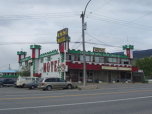
Cache Creek is a junction community 220 miles (354.1 km) northeast of Vancouver
Vancouver
Vancouver is a coastal seaport city on the mainland of British Columbia, Canada. It is the hub of Greater Vancouver, which, with over 2.3 million residents, is the third most populous metropolitan area in the country,...
in British Columbia
British Columbia
British Columbia is the westernmost of Canada's provinces and is known for its natural beauty, as reflected in its Latin motto, Splendor sine occasu . Its name was chosen by Queen Victoria in 1858...
, Canada
Canada
Canada is a North American country consisting of ten provinces and three territories. Located in the northern part of the continent, it extends from the Atlantic Ocean in the east to the Pacific Ocean in the west, and northward into the Arctic Ocean...
. It is on the Trans-Canada Highway
Trans-Canada Highway
The Trans-Canada Highway is a federal-provincial highway system that joins the ten provinces of Canada. It is, along with the Trans-Siberian Highway and Australia's Highway 1, one of the world's longest national highways, with the main route spanning 8,030 km...
in the province of British Columbia
British Columbia
British Columbia is the westernmost of Canada's provinces and is known for its natural beauty, as reflected in its Latin motto, Splendor sine occasu . Its name was chosen by Queen Victoria in 1858...
at its junction with northbound Highway 97. The same intersection and the town that grew around it was at the point on the Cariboo Wagon Road where a branch road, and previously only a trail, led east to Savona's Ferry
Savona, British Columbia
Savona is a small community located at the west end of Kamloops Lake, where the Thompson River exits it. It is approximately halfway between Kamloops and Cache Creek along the Trans-Canada Highway...
on Kamloops Lake
Kamloops Lake
Kamloops Lake in British Columbia, Canada is situated on the Thompson River just west of Kamloops. The lake is 1.6 km wide, 29 km long, and up to 152 m deep...
.
Its name is derived, apparently, from a cache or buried and hidden supply and tradegoods depot used by the fur traders of either the Hudson's Bay Company
Hudson's Bay Company
The Hudson's Bay Company , abbreviated HBC, or "The Bay" is the oldest commercial corporation in North America and one of the oldest in the world. A fur trading business for much of its existence, today Hudson's Bay Company owns and operates retail stores throughout Canada...
or its rival the North West Company
North West Company
The North West Company was a fur trading business headquartered in Montreal from 1779 to 1821. It competed with increasing success against the Hudson's Bay Company in what was to become Western Canada...
.
Although still very active with traffic, Cache Creek was extremely busy for a few decades before the Trans-Canada Highway
Trans-Canada Highway
The Trans-Canada Highway is a federal-provincial highway system that joins the ten provinces of Canada. It is, along with the Trans-Siberian Highway and Australia's Highway 1, one of the world's longest national highways, with the main route spanning 8,030 km...
was superseded by the newer and shorter Coquihalla Highway, which bypasses the Fraser
Fraser Canyon
The Fraser Canyon is an 84 km landform of the Fraser River where it descends rapidly through narrow rock gorges in the Coast Mountains en route from the Interior Plateau of British Columbia to the Fraser Valley...
and Thompson Canyons
Thompson River
The Thompson River is the largest tributary of the Fraser River, flowing through the south-central portion of British Columbia, Canada. The Thompson River has two main branches called the South Thompson and the North Thompson...
between Hope
Hope, British Columbia
Hope is a district municipality located at the confluence of the Fraser and Coquihalla rivers in the province of British Columbia, Canada. Hope is at the eastern end of both the Fraser Valley and the Lower Mainland region, and is at the southern end of the Fraser Canyon...
and Kamloops
Kamloops, British Columbia
Kamloops is a city in south central British Columbia, at the confluence of the two branches of the Thompson River and near Kamloops Lake. It is the largest community in the Thompson-Nicola Regional District and the location of the regional district's offices. The surrounding region is more commonly...
via Merritt
Merritt, British Columbia
Merritt is a city in the Nicola Valley of the south-central Interior of British Columbia, Canada. Situated at the confluence of the Nicola and Coldwater rivers, it is the first major community encountered after travelling along Phase One of the Coquihalla Highway and acts as the gateway to all...
, about 60 miles (97 km) southeast.
The nearby fossil locality of McAbee is noted for the wide diversity of Eocene
Eocene
The Eocene Epoch, lasting from about 56 to 34 million years ago , is a major division of the geologic timescale and the second epoch of the Paleogene Period in the Cenozoic Era. The Eocene spans the time from the end of the Palaeocene Epoch to the beginning of the Oligocene Epoch. The start of the...
plants and animals preserved in the shale, including the extinct plants Dillhoffia
Dillhoffia
Dillhoffia is an extinct monotypic genus of flowering plant with a single species, Dillhoffia cachensis known from Ypresian age Eocene fossils found in British Columbia, Canada, and Washington, USA...
and Trochodendron drachuckii
Trochodendron drachuckii
Trochodendron drachukii is an extinct species of flowering plant in the family Trochodendraceae known from a fossil fruiting structure found in the early Ypresian age Eocene fossils found in British Columbia, Canada. T. drachukii is one of the oldest members of the genus Trochodendron, which...
.