

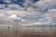
Bristol Bay
Encyclopedia
Bering Sea
The Bering Sea is a marginal sea of the Pacific Ocean. It comprises a deep water basin, which then rises through a narrow slope into the shallower water above the continental shelves....
, at 57° to 59° North 157° to 162° West in Southwest Alaska
Southwest Alaska
Southwest Alaska is a region of the U.S. state of Alaska. The area is not exactly defined by any governmental administrative region; nor does it always have a clear geographic boundary.-Geography:...
. Bristol Bay is 400 km (250 mi) long and 290 km, (180 mi) wide at its mouth. A number of rivers flow into the bay, including the Cinder
Cinder River
The Cinder River is a river in southwestern Lake and Peninsula Borough, Alaska. It begins in Aniakchak National Monument and Preserve and flows northwestward into Bristol Bay....
, Egegik
Egegik River
The Egegik River is a river in Alaska, USA. It is located on the Alaska Peninsula and flows westward from Becharof Lake into Bristol Bay via Egegik Bay....
, Igushik
Igushik River
The Igushik River is a river in Alaska, USA, which flows southward from Amanka Lake into the Nushagak Bay arm of Bristol Bay. The entire river is located within Togiak National Wildlife Refuge and is known for its fishing. It flows through the village of Manokotak ....
, Kvichak
Kvichak River
The Kvichak River is a river in southwestern Alaska, located at the conjunction of the Alaska Peninsula, to the Alaska mainland at about With headwaters in Lake Iliamna, it drains the lake into Kvichak Bay, an arm of Bristol Bay. The river is about long. The communities of Levelock and Igiugig...
, Meshik
Meshik River
The Meshik River is a river in Alaska which flows westward from Aniakchak National Monument and Preserve into Bristol Bay south of the city of Port Heiden....
, Nushagak
Nushagak River
The Nushagak River is a river in southwest Alaska, USA. It begins in the Alaska Range and flows southwest to Nushagak Bay, an inlet of Bristol Bay, east of Dillingham, Alaska.The Mulchatna River is a major tributary...
, Naknek
Naknek River
Naknek River is a 56-km-long river in the Bristol Bay Borough in the U.S. state of Alaska. It flows westward from Naknek Lake, draining it into the Kvichak Bay arm of Bristol Bay...
, Togiak
Togiak River
Togiak River is a 48-mile-long river in the U.S. state of Alaska. It begins at Togiak Lake and flows southwest to Togiak Bay, two miles east of Togiak and 45 miles east of Goodnews Bay....
, and Ugashik
Ugashik River
The Ugashik River is a 42-mile-long river on the Alaska Peninsula of the U.S. state of Alaska. It flows from headwaters near Lower Ugashik Lake and empties into Ugashik Bay, an estuary of the Bering Sea's Bristol Bay....
.
Upper reaches of Bristol Bay experience some of the highest tides in the world. One such reach, the Nushagak Bay
Nushagak Bay
Nushagak Bay is a large estuary covering over 100 km2 in southwest part of the U.S. state of Alaska. It opens to Bristol Bay, a large body of water in the eastern Bering Sea north of the Alaska Peninsula....
near Dillingham
Dillingham, Alaska
- Natural resources :Dillingham was once known as the Pacific salmon capital of the world and commercial fishing remains an important part of the local economy...
and another near Naknek
Naknek, Alaska
Naknek is a census-designated place located in Bristol Bay Borough in the U.S. state of Alaska. As of the 2000 census, the population of the CDP was 678....
in Kvichak Bay
Kvichak Bay
Kvichak Bay is an arm on the northeast side of Bristol Bay in southern Alaska, at . It is long and wide. The Kvichak River flows into the bay at its furthest northeast point, while the Naknek River comes in from the east about to the south of the Kvichak....
have tidal extremes in excess of 10 m (30 ft), ranking them — and the area — as eighth highest in the world. This, coupled with the extreme number of shoals, sandbars and shallows, makes navigation troublesome, especially during the area's frequently strong winds. As the shallowest part of the Bering Sea, Bristol Bay is one of the most dangerous areas for large vessels.
History
Bering land bridge
The Bering land bridge was a land bridge roughly 1,000 miles wide at its greatest extent, which joined present-day Alaska and eastern Siberia at various times during the Pleistocene ice ages. Like most of Siberia and all of Manchuria, Beringia was not glaciated because snowfall was extremely light...
. More recently, its proximity to mineral, animal and seafood riches provided incentive for human habitation along its shoreline. Early Russian and English exploration provided most of the non-native influences of the area. During his voyage through the area in 1778, the famed British navigator and explorer, Captain James Cook
James Cook
Captain James Cook, FRS, RN was a British explorer, navigator and cartographer who ultimately rose to the rank of captain in the Royal Navy...
named the area "in honor of the Admiral Earl of Bristol
Augustus Hervey, 3rd Earl of Bristol
Augustus John Hervey, 3rd Earl of Bristol, PC was a British admiral and politician.-Naval career:As a young man, he entered the Navy, where his promotion was rapid...
" in England.
After establishing some temporary settlements in the late 1790s, The Russian American Company sent exploratory parties to document the coast and nearby inland areas of Bristol Bay. One of these charted the area between the Kuskokwim
Kuskokwim River
The Kuskokwim River or Kusko River is a river, long, in Southwest Alaska in the United States. It is the ninth largest river in the United States by average discharge volume at its mouth and seventeenth largest by basin drainage area.The river provides the principal drainage for an area of the...
and Nushagak River
Nushagak River
The Nushagak River is a river in southwest Alaska, USA. It begins in the Alaska Range and flows southwest to Nushagak Bay, an inlet of Bristol Bay, east of Dillingham, Alaska.The Mulchatna River is a major tributary...
s. Later, in 1819, an Aleut by the name of Andrei Ustiugov drew the first intensive charts of Bristol Bay. Additionally, ships of the Russian Navy conducted extensive surveys of the Bering Sea coastline into the mid-19th century, naming many of the geographical features commonly used today: Capes Constantine, Chichagof, Menshikof and Greig, Mounts Veniaminof and Pavlof
Mount Pavlof
Pavlof Volcano is a stratovolcano of the Aleutian Range on the Alaska Peninsula. It has been one of the most active in the United States since 1980, with eruptions recorded in 1980, 1981, 1983, 1986–1988, 1996–1997, and an ongoing eruption starting on August 15, 2007 and ending on September 13...
, Becharof Lake
Becharof Lake
Becharof Lake is a long lake on the Alaska Peninsula. It is located south-east of Egegik, in the Aleutian Range.-History:The lake was named in 1868 by naturalist W. H...
, etc.
Industry
Bristol Bay is home to the world's largest sockeye salmonSockeye salmon
Sockeye salmon , also called red salmon or blueback salmon in the USA, is an anadromous species of salmon found in the Northern Pacific Ocean and rivers discharging into it...
fishery as well as strong runs of chum salmon, silver salmon and king salmon, each occurring seasonally. Kings are usually the first to run up the river followed by reds and chums. Silvers and Pinks are the last to run up the river.
Major industries are commercial fishing and the associated canneries, sport fishing, hunting
Hunting
Hunting is the practice of pursuing any living thing, usually wildlife, for food, recreation, or trade. In present-day use, the term refers to lawful hunting, as distinguished from poaching, which is the killing, trapping or capture of the hunted species contrary to applicable law...
and tourism
Tourism
Tourism is travel for recreational, leisure or business purposes. The World Tourism Organization defines tourists as people "traveling to and staying in places outside their usual environment for not more than one consecutive year for leisure, business and other purposes".Tourism has become a...
. The number of commercial lodges, hunting- and fishing-resorts and visitors to the nearby Katmai National Park and Preserve
Katmai National Park and Preserve
Katmai National Park and Preserve is a United States National Park in southern Alaska, notable for the Valley of Ten Thousand Smokes and for its brown bears. The park covers , being roughly the size of Wales. Most of this is a designated wilderness area, including of the park...
has grown exponentially in recent years.
The area has also experienced significant interest in oil and mineral development, most notably with the proposed Pebble Mine
Pebble Mine
Pebble Mine is the common name of an advanced mineral exploration project investigating a very large porphyry copper, gold, and molybdenum mineral deposit in the Bristol Bay region of Southwest Alaska, near Lake Iliamna and Lake Clark. The proposal to mine the ore deposit, using large-scale...
on the north shore of Iliamna Lake
Iliamna Lake
Iliamna Lake or Lake Iliamna is a lake in South-West Alaska, at North end of Alaska Peninsula, between Kvichak Bay and Cook Inlet, West of Seldovia, Alaska Bristol Bay Low....
, and auctioning of leases to tracts in the southern Bristol Bay area known as the North Aleutians Basin
North Aleutians Basin
The North Aleutians Basin is a geographic phenomenon, primarily a submarine depression, occurring in the southern Bristol Bay region of the Bering Sea and just off the northern shore of the Alaska Peninsula. It extends some 600 miles along the Alaska Peninsula and nearly as far north-south into...
, an area which has been closed to offshore oil and gas development since a moratorium in 1998. The draft plan by the Bureau of Land Management
Bureau of Land Management
The Bureau of Land Management is an agency within the United States Department of the Interior which administers America's public lands, totaling approximately , or one-eighth of the landmass of the country. The BLM also manages of subsurface mineral estate underlying federal, state and private...
(pending public comments until 2/5/2007), also proposes to open most of the BLM's 3.6 million acres (15,000 km²) in the area to hard rock mining and oil and gas drilling.
Demographics
The three largest communities of the Bristol Bay area are DillinghamDillingham, Alaska
- Natural resources :Dillingham was once known as the Pacific salmon capital of the world and commercial fishing remains an important part of the local economy...
, King Salmon
King Salmon, Alaska
King Salmon is a census-designated place in Bristol Bay Borough in the U.S. state of Alaska. As of the 2000 census the population was 442...
, and Naknek
Naknek, Alaska
Naknek is a census-designated place located in Bristol Bay Borough in the U.S. state of Alaska. As of the 2000 census, the population of the CDP was 678....
. Smaller communities which dot the coastline and rivers of Bristol Bay include: Egegik
Egegik, Alaska
Egegik is a city in Lake and Peninsula Borough, Alaska, United States. As of the 2000 census, the population of the city is 116.-Geography:...
(ˈ), Ekuk
Ekuk, Alaska
Ekuk is a small unincorporated community in the Dillingham Census Area in the U.S. state of Alaska. Until 2002 it was the site of a large fish processing operation owned by Ward's Cove Packing Company...
(ˈ), Igiugig
Igiugig, Alaska
Igiugig is a census-designated place in Lake and Peninsula Borough, Alaska, United States. The population was 53 at the 2000 census. The village is at the mouth of the Kvichak River, on Lake Iliamna, in the U.S...
(ˈ), Manokotak
Manokotak, Alaska
Manokotak is a city in Dillingham Census Area, Alaska, United States. At the 2000 census the population was 399.-Geography:Manokotak is located at ....
(m), New Stuyahok
New Stuyahok, Alaska
New Stuyahok is a city in Dillingham Census Area, Alaska, United States. At the 2000 census the population was 471.-Geography:New Stuyahok is located at ....
(ˈ), Newhalen
Newhalen, Alaska
Newhalen is a city in Lake and Peninsula Borough, Alaska, United States. At the 2000 census the population was 160.-Geography:Newhalen is located at ....
, Nondalton
Nondalton, Alaska
Nondalton is a city located on the west shore of Six Mile Lake in the Lake and Peninsula Borough, Alaska, United States. At the 2000 census, the population was 221.-Geography:Nondalton is located at ....
, Pilot Point
Pilot Point, Alaska
Pilot Point is a city in Lake and Peninsula Borough, Alaska, United States, on the Alaska Peninsula. As of the 2000 census, the population of the city is 100.-Geography:Pilot Point is located at...
, Port Heiden
Port Heiden, Alaska
Port Heiden is a city in Lake and Peninsula Borough, Alaska, United States. As of the 2000 census, the population of the city is 119.-Geography:Port Heiden is located at ....
, and Ugashik
Ugashik, Alaska
Ugashik is a census-designated place in Lake and Peninsula Borough, Alaska, United States. The population was 11 at the 2000 census.-Geography:Ugashik is located at ....
(juː).
All of these communities are primarily inhabited by Alaska Natives
Alaska Natives
Alaska Natives are the indigenous peoples of Alaska. They include: Aleut, Inuit, Tlingit, Haida, Tsimshian, Eyak, and a number of Northern Athabaskan cultures.-History:In 1912 the Alaska Native Brotherhood was founded...
, except for Dillingham, Alaska and King Salmon, Alaska; the former being influenced early-on by white salmon-cannery employees of European descent and the latter being heavily populated by military personnel stationed, primarily during Cold War years, at the nearby King Salmon Air Force Station and later by visitors and employees of the nearby Katmai National Park and Preserve
Katmai National Park and Preserve
Katmai National Park and Preserve is a United States National Park in southern Alaska, notable for the Valley of Ten Thousand Smokes and for its brown bears. The park covers , being roughly the size of Wales. Most of this is a designated wilderness area, including of the park...
.
Proposed Pebble Mine
A mineral exploration project investigating a large porphyry copper, goldGold
Gold is a chemical element with the symbol Au and an atomic number of 79. Gold is a dense, soft, shiny, malleable and ductile metal. Pure gold has a bright yellow color and luster traditionally considered attractive, which it maintains without oxidizing in air or water. Chemically, gold is a...
, and molybdenum
Molybdenum
Molybdenum , is a Group 6 chemical element with the symbol Mo and atomic number 42. The name is from Neo-Latin Molybdaenum, from Ancient Greek , meaning lead, itself proposed as a loanword from Anatolian Luvian and Lydian languages, since its ores were confused with lead ores...
deposit in the Bristol Bay region has been proposed and may be undertaken by British-Australian Rio Tinto Group
Rio Tinto Group
The Rio Tinto Group is a diversified, British-Australian, multinational mining and resources group with headquarters in London and Melbourne. The company was founded in 1873, when a multinational consortium of investors purchased a mine complex on the Rio Tinto river, in Huelva, Spain from the...
and Japanese conglomerate
Conglomerate (company)
A conglomerate is a combination of two or more corporations engaged in entirely different businesses that fall under one corporate structure , usually involving a parent company and several subsidiaries. Often, a conglomerate is a multi-industry company...
Mitsubishi
Mitsubishi
The Mitsubishi Group , Mitsubishi Group of Companies, or Mitsubishi Companies is a Japanese multinational conglomerate company that consists of a range of autonomous businesses which share the Mitsubishi brand, trademark and legacy...
. Because of the estimated 10 billion tons of mining waste that must be permanently stored in the area, which is an active earthquake zone, and Rio Tinto's environmental track record, which is seen as poor by many environmental advocacy groups, fears have been raised about the potential impact on the Bristol Bay area and its wildlife and residents.
External links
- Lake & Peninsula Borough
- Bristol Bay Borough
- Lake and Peninsula School District
- Bristol Bay Alliance
- Bristol Bay Native Association
- Save Bristol Bay
- Renewable Resources Coalition