
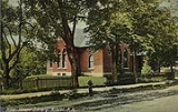
Bristol, New Hampshire
Encyclopedia
Bristol is a town in Grafton County
, New Hampshire
, United States
. The population was 3,054 at the 2010 census. It is home to Wellington State Park, Sugar Hill State Forest, and Profile Falls on the Smith River
. Surrounded by hills and lakes, Bristol includes the lower two-thirds of Newfound Lake
, a resort area.
The primary settlement in town, where 1,688 people resided at the 2010 census, is defined by the U.S. Census Bureau as the Bristol census-designated place
(CDP) and is located at the intersection of New Hampshire routes 3A
and 104
.
or clay
similar to the "Bristol sand" used in Bristol
, England
to make fine china and pottery
gave the town its name. Here the sand was used to make a superior quality brick
, marketed as Bristol brick. With water power from the Pemigewasset River
, the town was a center of manufacturing in the early days for goods such as paper
, leather
, woolen
s, flannel
, bedsteads and piano stools.
Bristol is one of four towns with shoreline on Newfound Lake, which has been a tourist destination since the mid-19th century. Farmers at first rented rooms and provided meals, but in the 1870s, hotels including the Hotel Bristol and G. G. Brown Hotel were built. In the 1920s, W. F. Darling created a compound of about one hundred cottages for rent, first known as Hiland Park and later as Bungalo Village. In 2004, the compound was sold to a proprietor who sold individual cottages to permanent owners.
, the town has a total area of 22.4 square miles (58 km²), of which 17.1 square miles (44.3 km²) is land and 5.3 square miles (13.7 km²) is water, comprising 23.43% of the town. Bristol is drained by the Pemigewasset River
(forming the southeastern boundary of the town), the Smith River
(on the town's short southern boundary) and the Newfound River
, draining Newfound Lake and most of the center of town. The highest point in town is Bristol Peak, elevation 1803 feet (549.6 m) above sea level
. Bristol lies fully within the Merrimack River
watershed
.
The town center, defined as a census-designated place
(CDP), covers an area of 4.8 square miles (12.4 km²), about 21.5% of the area of the town.
Bristol is served by state routes 3A
and 104
.
of 2000, there were 3,033 people, 1,219 households, and 830 families residing in the town. The population density
was 174.9 people per square mile (67.5/km²). There were 2,073 housing units at an average density of 46.2 persons/km² (119.5 persons/sq mi). The racial makeup of the town was 96.08% White, 0.26% African American
, 0.40% Native American, 1.38% Asia
n, 0.03% Pacific Islander, 0.49% from other races, and 1.35% from two or more races. 0.96% of the population were Hispanic
or Latino
of any race.
There were 1,219 households out of which 31.3% had children under the age of 18 living with them, 53.3% were married couples
living together, 11.0% have a woman whose husband does not live with her, and 31.9% were non-families. 24.8% of all households were made up of individuals and 9.1% had someone living alone who was 65 years of age or older. The average household size was 2.47 and the average family size was 2.94.
In the town the population was spread out with 24.3% under the age of 18, 7.0% from 18 to 24, 29.9% from 25 to 44, 24.6% from 45 to 64, and 14.2% who were 65 years of age or older. The median age was 38 years. For every 100 females there were 97.3 males. For every 100 females age 18 and over, there were 91.5 males.
The median income for a household in the town was $38,032, and the median income for a family was $44,766. Males had a median income of $31,088 versus $22,406 for females. The per capita income
for the town was $19,807. 6.9% of the population and 5.5% of families were below the poverty line. Out of the total people living in poverty, 7.6% are under the age of 18 and 8.4% are 65 or older.
of 2000, there were 1,670 people, 692 households, and 458 families residing in the CDP (census-designated place
) occupying the town center. The population density
was 352.1 people per square mile (136.0/km²). There were 928 housing units at an average density of 75.6 persons/km² (195.7 persons/sq mi). The racial makeup of the town was 96.53% White, 0.06% African American
, 0.42% Native American, 1.20% Asia
n, 0.00% Pacific Islander, 0.06% from other races, and 1.74% from two or more races. 1.14% of the population were Hispanic
or Latino
of any race.
There were 692 households out of which 31.9% had children under the age of 18 living with them, 48.1% were married couples
living together, 14.2% have a woman whose husband does not live with her, and 33.8% were non-families. 28.3% of all households were made up of individuals and 12.0% had someone living alone who was 65 years of age or older. The average household size was 2.39 and the average family size was 2.90.
In the CDP the population was spread out with 24.8% under the age of 18, 8.3% from 18 to 24, 29.2% from 25 to 44, 22.8% from 45 to 64, and 15.0% who were 65 years of age or older. The median age was 38 years. For every 100 females there were 94.9 males. For every 100 females age 18 and over, there were 88.0 males.
The median income for a household is $32,992, and the median income for a family was $40,804. Males had a median income of $30,478 versus $21,741 for females. The per capita income
for the town was $20,011. 9.8% of the population and 7.7% of families were below the poverty line. Out of the total people living in poverty, 10.6% are under the age of 18 and 14.0% are 65 or older.
Grafton County, New Hampshire
Grafton County is a county located in the U.S. state of New Hampshire. As of the 2010 census, the population was 89,118. Its county seat is North Haverhill, which is a village within the town of Haverhill. Until 1972, the county courthouse and other offices were located in downtown Woodsville, a...
, New Hampshire
New Hampshire
New Hampshire is a state in the New England region of the northeastern United States of America. The state was named after the southern English county of Hampshire. It is bordered by Massachusetts to the south, Vermont to the west, Maine and the Atlantic Ocean to the east, and the Canadian...
, United States
United States
The United States of America is a federal constitutional republic comprising fifty states and a federal district...
. The population was 3,054 at the 2010 census. It is home to Wellington State Park, Sugar Hill State Forest, and Profile Falls on the Smith River
Smith River (Pemigewasset River)
The Smith River is a river located in central New Hampshire in the United States. It is a tributary of the Pemigewasset River, part of the Merrimack River watershed....
. Surrounded by hills and lakes, Bristol includes the lower two-thirds of Newfound Lake
Newfound Lake
Newfound Lake is located in Grafton County, New Hampshire, USA, within the towns of Bridgewater, Bristol, Alexandria, and Hebron. The lake is located in a section of New Hampshire known as the Lakes Region. At 4,451 acres, it is the third-largest lake located entirely in New Hampshire. The lake's...
, a resort area.
The primary settlement in town, where 1,688 people resided at the 2010 census, is defined by the U.S. Census Bureau as the Bristol census-designated place
Census-designated place
A census-designated place is a concentration of population identified by the United States Census Bureau for statistical purposes. CDPs are delineated for each decennial census as the statistical counterparts of incorporated places such as cities, towns and villages...
(CDP) and is located at the intersection of New Hampshire routes 3A
New Hampshire Route 3A
New Hampshire Route 3A is a designation held by two separate state highways in New Hampshire. The two segments, although not directly connected, are linked by U.S. Route 3, from which they derive their route number.-Southern segment:...
and 104
New Hampshire Route 104
New Hampshire Route 104 is a long secondary east–west highway in central New Hampshire. The highway runs from Danbury to Meredith on Lake Winnipesaukee in the Lakes Region....
.
History
The town was incorporated in 1819. Extensive deposits of fine sandSand
Sand is a naturally occurring granular material composed of finely divided rock and mineral particles.The composition of sand is highly variable, depending on the local rock sources and conditions, but the most common constituent of sand in inland continental settings and non-tropical coastal...
or clay
Clay
Clay is a general term including many combinations of one or more clay minerals with traces of metal oxides and organic matter. Geologic clay deposits are mostly composed of phyllosilicate minerals containing variable amounts of water trapped in the mineral structure.- Formation :Clay minerals...
similar to the "Bristol sand" used in Bristol
Bristol
Bristol is a city, unitary authority area and ceremonial county in South West England, with an estimated population of 433,100 for the unitary authority in 2009, and a surrounding Larger Urban Zone with an estimated 1,070,000 residents in 2007...
, England
England
England is a country that is part of the United Kingdom. It shares land borders with Scotland to the north and Wales to the west; the Irish Sea is to the north west, the Celtic Sea to the south west, with the North Sea to the east and the English Channel to the south separating it from continental...
to make fine china and pottery
Pottery
Pottery is the material from which the potteryware is made, of which major types include earthenware, stoneware and porcelain. The place where such wares are made is also called a pottery . Pottery also refers to the art or craft of the potter or the manufacture of pottery...
gave the town its name. Here the sand was used to make a superior quality brick
Brick
A brick is a block of ceramic material used in masonry construction, usually laid using various kinds of mortar. It has been regarded as one of the longest lasting and strongest building materials used throughout history.-History:...
, marketed as Bristol brick. With water power from the Pemigewasset River
Pemigewasset River
The Pemigewasset River , known locally as "The Pemi", is a river in the state of New Hampshire, the United States. It is in length and drains approximately...
, the town was a center of manufacturing in the early days for goods such as paper
Paper
Paper is a thin material mainly used for writing upon, printing upon, drawing or for packaging. It is produced by pressing together moist fibers, typically cellulose pulp derived from wood, rags or grasses, and drying them into flexible sheets....
, leather
Leather
Leather is a durable and flexible material created via the tanning of putrescible animal rawhide and skin, primarily cattlehide. It can be produced through different manufacturing processes, ranging from cottage industry to heavy industry.-Forms:...
, woolen
Woolen
Woolen or woollen is a type of yarn made from carded wool. Woolen yarn is soft, light, stretchy, and full of air. It is thus a good insulator, and makes a good knitting yarn...
s, flannel
Flannel
Flannel is a soft woven fabric, of various fineness. Flannel was originally made from carded wool or worsted yarn, but is now often made from either wool, cotton, or synthetic fibre. Flannel may be brushed to create extra softness or remain unbrushed. The brushing process is a mechanical process...
, bedsteads and piano stools.
Bristol is one of four towns with shoreline on Newfound Lake, which has been a tourist destination since the mid-19th century. Farmers at first rented rooms and provided meals, but in the 1870s, hotels including the Hotel Bristol and G. G. Brown Hotel were built. In the 1920s, W. F. Darling created a compound of about one hundred cottages for rent, first known as Hiland Park and later as Bungalo Village. In 2004, the compound was sold to a proprietor who sold individual cottages to permanent owners.
Geography
According to the United States Census BureauUnited States Census Bureau
The United States Census Bureau is the government agency that is responsible for the United States Census. It also gathers other national demographic and economic data...
, the town has a total area of 22.4 square miles (58 km²), of which 17.1 square miles (44.3 km²) is land and 5.3 square miles (13.7 km²) is water, comprising 23.43% of the town. Bristol is drained by the Pemigewasset River
Pemigewasset River
The Pemigewasset River , known locally as "The Pemi", is a river in the state of New Hampshire, the United States. It is in length and drains approximately...
(forming the southeastern boundary of the town), the Smith River
Smith River (Pemigewasset River)
The Smith River is a river located in central New Hampshire in the United States. It is a tributary of the Pemigewasset River, part of the Merrimack River watershed....
(on the town's short southern boundary) and the Newfound River
Newfound River (New Hampshire)
The Newfound River is a river located in central New Hampshire in the United States. It is a tributary of the Pemigewasset River, part of the Merrimack River watershed.The Newfound River begins at the outlet of Newfound Lake in Bristol, New Hampshire...
, draining Newfound Lake and most of the center of town. The highest point in town is Bristol Peak, elevation 1803 feet (549.6 m) above sea level
Sea level
Mean sea level is a measure of the average height of the ocean's surface ; used as a standard in reckoning land elevation...
. Bristol lies fully within the Merrimack River
Merrimack River
The Merrimack River is a river in the northeastern United States. It rises at the confluence of the Pemigewasset and Winnipesaukee rivers in Franklin, New Hampshire, flows southward into Massachusetts, and then flows northeast until it empties into the Atlantic Ocean at Newburyport...
watershed
Drainage basin
A drainage basin is an extent or an area of land where surface water from rain and melting snow or ice converges to a single point, usually the exit of the basin, where the waters join another waterbody, such as a river, lake, reservoir, estuary, wetland, sea, or ocean...
.
The town center, defined as a census-designated place
Census-designated place
A census-designated place is a concentration of population identified by the United States Census Bureau for statistical purposes. CDPs are delineated for each decennial census as the statistical counterparts of incorporated places such as cities, towns and villages...
(CDP), covers an area of 4.8 square miles (12.4 km²), about 21.5% of the area of the town.
Bristol is served by state routes 3A
New Hampshire Route 3A
New Hampshire Route 3A is a designation held by two separate state highways in New Hampshire. The two segments, although not directly connected, are linked by U.S. Route 3, from which they derive their route number.-Southern segment:...
and 104
New Hampshire Route 104
New Hampshire Route 104 is a long secondary east–west highway in central New Hampshire. The highway runs from Danbury to Meredith on Lake Winnipesaukee in the Lakes Region....
.
Demographics
As of the censusCensus
A census is the procedure of systematically acquiring and recording information about the members of a given population. It is a regularly occurring and official count of a particular population. The term is used mostly in connection with national population and housing censuses; other common...
of 2000, there were 3,033 people, 1,219 households, and 830 families residing in the town. The population density
Population density
Population density is a measurement of population per unit area or unit volume. It is frequently applied to living organisms, and particularly to humans...
was 174.9 people per square mile (67.5/km²). There were 2,073 housing units at an average density of 46.2 persons/km² (119.5 persons/sq mi). The racial makeup of the town was 96.08% White, 0.26% African American
African American
African Americans are citizens or residents of the United States who have at least partial ancestry from any of the native populations of Sub-Saharan Africa and are the direct descendants of enslaved Africans within the boundaries of the present United States...
, 0.40% Native American, 1.38% Asia
Asia
Asia is the world's largest and most populous continent, located primarily in the eastern and northern hemispheres. It covers 8.7% of the Earth's total surface area and with approximately 3.879 billion people, it hosts 60% of the world's current human population...
n, 0.03% Pacific Islander, 0.49% from other races, and 1.35% from two or more races. 0.96% of the population were Hispanic
Hispanic
Hispanic is a term that originally denoted a relationship to Hispania, which is to say the Iberian Peninsula: Andorra, Gibraltar, Portugal and Spain. During the Modern Era, Hispanic sometimes takes on a more limited meaning, particularly in the United States, where the term means a person of ...
or Latino
Latino
The demonyms Latino and Latina , are defined in English language dictionaries as:* "a person of Latin-American descent."* "A Latin American."* "A person of Hispanic, especially Latin-American, descent, often one living in the United States."...
of any race.
There were 1,219 households out of which 31.3% had children under the age of 18 living with them, 53.3% were married couples
Marriage
Marriage is a social union or legal contract between people that creates kinship. It is an institution in which interpersonal relationships, usually intimate and sexual, are acknowledged in a variety of ways, depending on the culture or subculture in which it is found...
living together, 11.0% have a woman whose husband does not live with her, and 31.9% were non-families. 24.8% of all households were made up of individuals and 9.1% had someone living alone who was 65 years of age or older. The average household size was 2.47 and the average family size was 2.94.
In the town the population was spread out with 24.3% under the age of 18, 7.0% from 18 to 24, 29.9% from 25 to 44, 24.6% from 45 to 64, and 14.2% who were 65 years of age or older. The median age was 38 years. For every 100 females there were 97.3 males. For every 100 females age 18 and over, there were 91.5 males.
The median income for a household in the town was $38,032, and the median income for a family was $44,766. Males had a median income of $31,088 versus $22,406 for females. The per capita income
Per capita income
Per capita income or income per person is a measure of mean income within an economic aggregate, such as a country or city. It is calculated by taking a measure of all sources of income in the aggregate and dividing it by the total population...
for the town was $19,807. 6.9% of the population and 5.5% of families were below the poverty line. Out of the total people living in poverty, 7.6% are under the age of 18 and 8.4% are 65 or older.
Town center
As of the censusCensus
A census is the procedure of systematically acquiring and recording information about the members of a given population. It is a regularly occurring and official count of a particular population. The term is used mostly in connection with national population and housing censuses; other common...
of 2000, there were 1,670 people, 692 households, and 458 families residing in the CDP (census-designated place
Census-designated place
A census-designated place is a concentration of population identified by the United States Census Bureau for statistical purposes. CDPs are delineated for each decennial census as the statistical counterparts of incorporated places such as cities, towns and villages...
) occupying the town center. The population density
Population density
Population density is a measurement of population per unit area or unit volume. It is frequently applied to living organisms, and particularly to humans...
was 352.1 people per square mile (136.0/km²). There were 928 housing units at an average density of 75.6 persons/km² (195.7 persons/sq mi). The racial makeup of the town was 96.53% White, 0.06% African American
African American
African Americans are citizens or residents of the United States who have at least partial ancestry from any of the native populations of Sub-Saharan Africa and are the direct descendants of enslaved Africans within the boundaries of the present United States...
, 0.42% Native American, 1.20% Asia
Asia
Asia is the world's largest and most populous continent, located primarily in the eastern and northern hemispheres. It covers 8.7% of the Earth's total surface area and with approximately 3.879 billion people, it hosts 60% of the world's current human population...
n, 0.00% Pacific Islander, 0.06% from other races, and 1.74% from two or more races. 1.14% of the population were Hispanic
Hispanic
Hispanic is a term that originally denoted a relationship to Hispania, which is to say the Iberian Peninsula: Andorra, Gibraltar, Portugal and Spain. During the Modern Era, Hispanic sometimes takes on a more limited meaning, particularly in the United States, where the term means a person of ...
or Latino
Latino
The demonyms Latino and Latina , are defined in English language dictionaries as:* "a person of Latin-American descent."* "A Latin American."* "A person of Hispanic, especially Latin-American, descent, often one living in the United States."...
of any race.
There were 692 households out of which 31.9% had children under the age of 18 living with them, 48.1% were married couples
Marriage
Marriage is a social union or legal contract between people that creates kinship. It is an institution in which interpersonal relationships, usually intimate and sexual, are acknowledged in a variety of ways, depending on the culture or subculture in which it is found...
living together, 14.2% have a woman whose husband does not live with her, and 33.8% were non-families. 28.3% of all households were made up of individuals and 12.0% had someone living alone who was 65 years of age or older. The average household size was 2.39 and the average family size was 2.90.
In the CDP the population was spread out with 24.8% under the age of 18, 8.3% from 18 to 24, 29.2% from 25 to 44, 22.8% from 45 to 64, and 15.0% who were 65 years of age or older. The median age was 38 years. For every 100 females there were 94.9 males. For every 100 females age 18 and over, there were 88.0 males.
The median income for a household is $32,992, and the median income for a family was $40,804. Males had a median income of $30,478 versus $21,741 for females. The per capita income
Per capita income
Per capita income or income per person is a measure of mean income within an economic aggregate, such as a country or city. It is calculated by taking a measure of all sources of income in the aggregate and dividing it by the total population...
for the town was $20,011. 9.8% of the population and 7.7% of families were below the poverty line. Out of the total people living in poverty, 10.6% are under the age of 18 and 14.0% are 65 or older.
Notable inhabitants
- Nathaniel S. BerryNathaniel S. BerryNathaniel Springer Berry was an American tanner from Hebron, New Hampshire. He served New Hampshire in both houses of the state legislature and as Governor for two terms. He was born in 1796 in Bath, Maine. During the American Civil War, he played a vital role in state recruitment levels...
, governor of New Hampshire - John CheeverJohn CheeverJohn William Cheever was an American novelist and short story writer. He is sometimes called "the Chekhov of the suburbs." His fiction is mostly set in the Upper East Side of Manhattan, the Westchester suburbs, old New England villages based on various South Shore towns around Quincy,...
, writer (summer resident) - Benjamin FlandersBenjamin FlandersBenjamin Franklin Flanders was appointed the 21st Governor of Louisiana during Reconstruction and was Mayor of New Orleans.-Early life:...
, Reconstruction governor of LouisianaLouisianaLouisiana is a state located in the southern region of the United States of America. Its capital is Baton Rouge and largest city is New Orleans. Louisiana is the only state in the U.S. with political subdivisions termed parishes, which are local governments equivalent to counties...
; mayor of New Orleans - Thomas A. WatsonThomas A. WatsonThomas Augustus Watson was an assistant to Alexander Graham Bell, notably in the invention of the telephone in 1876. He is best known because his name was one of the first words spoken over the telephone. "Mr. Watson - Come here - I want to see you." were the first words Bell said using the new...
, inventor (summer resident)