
Branchville, New Jersey
Encyclopedia
- For the former name of the unincorporated community in Somerset County, see South Branch, New JerseySouth Branch, New JerseySouth Branch is an unincorporated community located within Hillsborough Township, located in Somerset County, New Jersey.The community goes back to 1750 and was also known as Branchville. It is situated on the South Branch Raritan River near its junction with the Raritan River...
Branchville is a borough
Borough (New Jersey)
A borough in the context of New Jersey local government refers to one of five types and one of eleven forms of municipal government....
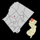
in Sussex County
Sussex County, New Jersey
The County of Sussex is the northernmost county in the State of New Jersey. It is part of the New York City Metropolitan Area. As of the 2010 Federal decennial census, 149,265 persons resided in Sussex County...
, New Jersey
New Jersey
New Jersey is a state in the Northeastern and Middle Atlantic regions of the United States. , its population was 8,791,894. It is bordered on the north and east by the state of New York, on the southeast and south by the Atlantic Ocean, on the west by Pennsylvania and on the southwest by Delaware...
, in the United States. As of the 2010 United States Census, the borough population was 841. The borough is located in the northernmost region of Sussex County.
Branchville was incorporated as a borough by an Act of the New Jersey Legislature
New Jersey Legislature
The New Jersey Legislature is the legislative branch of the government of the U.S. state of New Jersey. In its current form, as defined by the New Jersey Constitution of 1947, the Legislature consists of two houses: the General Assembly and the Senate...
on March 9, 1898, from portions of Frankford Township
Frankford Township, New Jersey
Frankford Township is a Township in Sussex County, New Jersey, United States. As of the 2010 United States Census, the township population was 5,565....
. An additional portion of Frankford Township was annexed as of March 1, 1951.
History
Branchville was established by settlers from ConnecticutConnecticut
Connecticut is a state in the New England region of the northeastern United States. It is bordered by Rhode Island to the east, Massachusetts to the north, and the state of New York to the west and the south .Connecticut is named for the Connecticut River, the major U.S. river that approximately...
in the 18th century. It grew quickly and in the 1820s the town was divided into building lots. By the year 1844, Branchville was a well established community with 32 dwellings, mills, blacksmiths, an academy, a church and a variety of other factories and businesses.
The addition of two water-powered mills and a dam in 1855 furthered the town's prosperity. Energy would later be harnessed from this dam and a second one that was built to supply Branchville with electricity and its own power company.
Extension of rail service to Branchville in 1869 brought an even greater boon to the village's economic market growth. From 1869-1871 forty new homes were built. The railroad had made it possible to ship products from the local mills and creameries to larger urban areas to the east. With lake communities nearby the tourism was also spurred by the railroad. Up to six trains a day would bring people from the larger cities to enjoy a country vacation.
Geography
Branchville is located at 41°8'48" NorthLatitude
In geography, the latitude of a location on the Earth is the angular distance of that location south or north of the Equator. The latitude is an angle, and is usually measured in degrees . The equator has a latitude of 0°, the North pole has a latitude of 90° north , and the South pole has a...
, 74°44'57" West
Longitude
Longitude is a geographic coordinate that specifies the east-west position of a point on the Earth's surface. It is an angular measurement, usually expressed in degrees, minutes and seconds, and denoted by the Greek letter lambda ....
(41.146748, -74.749243).
According to the United States Census Bureau
United States Census Bureau
The United States Census Bureau is the government agency that is responsible for the United States Census. It also gathers other national demographic and economic data...
, the borough has a total area of 0.6 square miles (1.6 km²).
Geology
Branchville is on the OrdovicianOrdovician
The Ordovician is a geologic period and system, the second of six of the Paleozoic Era, and covers the time between 488.3±1.7 to 443.7±1.5 million years ago . It follows the Cambrian Period and is followed by the Silurian Period...
Martinsburg Formation. This is a shale, slate, and limestone formation created 450 millions of years ago when a chain of volcanic islands collided with proto North America. The islands went over the North American Plate
North American Plate
The North American Plate is a tectonic plate covering most of North America, Greenland, Cuba, Bahamas, and parts of Siberia, Japan and Iceland. It extends eastward to the Mid-Atlantic Ridge and westward to the Chersky Range in eastern Siberia. The plate includes both continental and oceanic crust...
, creating the Highlands of Sussex County and the Kittatinny Valley
Kittatinny valley
The Kittatinny Valley lies east of the Kittatinny Mountain in western Sussex County, New Jersey. To the east of the valley is the Highlands in eastern Sussex County. The valley is part of the Great Appalachian Valley.-Geography:...
. Millions of years of erosion occurred and there was a second event. About 400 million years ago a small continent that was long and thin, collided with proto North America creating folding and faulting. The Silurian
Silurian
The Silurian is a geologic period and system that extends from the end of the Ordovician Period, about 443.7 ± 1.5 Mya , to the beginning of the Devonian Period, about 416.0 ± 2.8 Mya . As with other geologic periods, the rock beds that define the period's start and end are well identified, but the...
Shawangunk conglomerate that was under a shallow sea, lifted due to pressure. The pressure created heat which melted the silica and bonded the quartz and conglomerate together, creating Kittatinny Mountain.
The Wisconsin Glacier covered all of Branchville from 21,000 BC to 13,000 BC, covering the top of Kittatinny Mountain. End moraines exist in Stokes State Forest
Stokes State Forest
Stokes State Forest is a state park located in Sandyston Township, Montague and Frankford Twp. in Sussex County, New Jersey, United States. Stokes comprises of mountainous woods...
, another just off Route 565 north of the Skylands Park and one about a mile south of Ross's Corner. An esker
Esker
An esker is a long winding ridge of stratified sand and gravel, examples of which occur in glaciated and formerly glaciated regions of Europe and North America...
was created when the glacier retreated due to climate warming. Many ponds and lakes created. Culver Lake was created at this time, as the drainage became blocked. Branchville is drained by Culver's Lake Creek and Dry brook. Dry Creek starts at the Branchville Reservoir, travels south, enters into Culver's Creek in Branchville and eventually empties into the Paulinskill. There is a chain of hills between Dry Creek and Papakatin Creek. These hills are what separate the Paulinskill River drainage system from that of the Wallkill. The drainage divide is just north of Route 206 and the goes northwest toward Branchville Reservoir. Water near Route 206 or south of Route 206 drains into the Paulinskill. Water north of Route 206 drains into the Wallkill River.
Demographics
As of the censusCensus
A census is the procedure of systematically acquiring and recording information about the members of a given population. It is a regularly occurring and official count of a particular population. The term is used mostly in connection with national population and housing censuses; other common...
of 2000, there were 845 people, 354 households, and 225 families residing in the borough. The population density
Population density
Population density is a measurement of population per unit area or unit volume. It is frequently applied to living organisms, and particularly to humans...
was 1,421.6 people per square mile (553.0/km2). There were 377 housing units at an average density of 634.3 per square mile (246.7/km2). The racial makeup of the borough was 100.00% White, 0.12% African American, 0.36% Native American, 0.36% Asian, 0.12% from other races
Race (United States Census)
Race and ethnicity in the United States Census, as defined by the Federal Office of Management and Budget and the United States Census Bureau, are self-identification data items in which residents choose the race or races with which they most closely identify, and indicate whether or not they are...
, and 0.59% from two or more races. Hispanic or Latino of any race were 1.30% of the population.
There were 354 households out of which 28.8% had children under the age of 18 living with them, 52.5% were married couples
Marriage
Marriage is a social union or legal contract between people that creates kinship. It is an institution in which interpersonal relationships, usually intimate and sexual, are acknowledged in a variety of ways, depending on the culture or subculture in which it is found...
living together, 9.6% had a female householder with no husband present, and 36.4% were non-families. 32.2% of all households were made up of individuals and 18.1% had someone living alone who was 65 years of age or older. The average household size was 2.37 and the average family size was 3.03.
In the borough the population was spread out with 24.0% under the age of 18, 4.5% from 18 to 24, 26.4% from 25 to 44, 27.0% from 45 to 64, and 18.1% who were 65 years of age or older. The median age was 42 years. For every 100 females there were 87.4 males. For every 100 females age 18 and over, there were 82.4 males.
The median income for a household in the borough was $45,855, and the median income for a family was $60,909. Males had a median income of $36,250 versus $27,159 for females. The per capita income
Per capita income
Per capita income or income per person is a measure of mean income within an economic aggregate, such as a country or city. It is calculated by taking a measure of all sources of income in the aggregate and dividing it by the total population...
for the borough was $22,748. About 4.2% of families and 4.4% of the population were below the poverty line, including 4.9% of those under age 18 and 6.2% of those age 65 or over.
Local government
Branchville is governed under the BoroughBorough (New Jersey)
A borough in the context of New Jersey local government refers to one of five types and one of eleven forms of municipal government....
form of New Jersey municipal government. The government consists of a Mayor and a Borough Council comprising six council members, with all positions elected at large. A Mayor is elected directly by the voters to a four-year term of office. The Borough Council consists of six members elected to serve three-year terms on a staggered basis, with two seats coming up for election each year.
, the Mayor
Mayor
In many countries, a Mayor is the highest ranking officer in the municipal government of a town or a large urban city....
of Branchville Borough is Gerald W. Van Gorden (R
Republican Party (United States)
The Republican Party is one of the two major contemporary political parties in the United States, along with the Democratic Party. Founded by anti-slavery expansion activists in 1854, it is often called the GOP . The party's platform generally reflects American conservatism in the U.S...
, term ends December 31, 2011). Members of the Branchville Borough Council are William Bathgate (R, 2011), Katieanne Harrison (R, 2011), David Wayne Howell (R, 2012), Marc Lordi (R, 2010), Frank San Phillip (R, 2012) and Richard VanStone (R, 2010).
Federal, state and county representation
Branchville is in the 5th Congressional district and is part of New Jersey's 24th state legislative district. The legislative district was kept unchanged by the New Jersey Apportionment CommissionNew Jersey Apportionment Commission
The New Jersey Apportionment Commission is a constitutionally-created ten-member commission responsible for apportioning the forty districts of the New Jersey Legislature. The commission is convened after each decennial U.S. Census, and the districts are to be in use for the legislative elections...
based on the results of the 2010 Census.
Politics
As of March 23, 2011, out of a 2010 Census population of 841 in Branchville, there were 556 registered voters (66.1% of the population, vs. 65.8% in all of Sussex County). Of registered voters, 75 (13.5% vs. 16.5% countywide) were registered as DemocratsDemocratic Party (United States)
The Democratic Party is one of two major contemporary political parties in the United States, along with the Republican Party. The party's socially liberal and progressive platform is largely considered center-left in the U.S. political spectrum. The party has the lengthiest record of continuous...
, 306 (55.0% vs. 39.3% countywide) were registered as Republicans
Republican Party (United States)
The Republican Party is one of the two major contemporary political parties in the United States, along with the Democratic Party. Founded by anti-slavery expansion activists in 1854, it is often called the GOP . The party's platform generally reflects American conservatism in the U.S...
and 175 (31.5% vs. 44.1% countywide) were registered as Undeclared
Undeclared (New Jersey)
Unaffiliated is a status for registered voters in New Jersey. Those voters who do not specify a political party affiliation when they register to vote are listed as unaffiliated....
. There were no voters registered to other parties.
In recent years, on the national level, Branchville is a stronghold for the Republican Party. In the 2004 presidential election
United States presidential election, 2004
The United States presidential election of 2004 was the United States' 55th quadrennial presidential election. It was held on Tuesday, November 2, 2004. Republican Party candidate and incumbent President George W. Bush defeated Democratic Party candidate John Kerry, the then-junior U.S. Senator...
, Republican George W. Bush
George W. Bush
George Walker Bush is an American politician who served as the 43rd President of the United States, from 2001 to 2009. Before that, he was the 46th Governor of Texas, having served from 1995 to 2000....
received 65% of the vote here, defeating Democrat John Kerry
John Kerry
John Forbes Kerry is the senior United States Senator from Massachusetts, the 10th most senior U.S. Senator and chairman of the Senate Foreign Relations Committee. He was the presidential nominee of the Democratic Party in the 2004 presidential election, but lost to former President George W...
, who received 32%. In the 2008 presidential election
United States presidential election, 2008
The United States presidential election of 2008 was the 56th quadrennial presidential election. It was held on November 4, 2008. Democrat Barack Obama, then the junior United States Senator from Illinois, defeated Republican John McCain, the senior U.S. Senator from Arizona. Obama received 365...
, Republican John McCain
John McCain
John Sidney McCain III is the senior United States Senator from Arizona. He was the Republican nominee for president in the 2008 United States election....
received 60% of the vote here, defeating Democrat Barack Obama
Barack Obama
Barack Hussein Obama II is the 44th and current President of the United States. He is the first African American to hold the office. Obama previously served as a United States Senator from Illinois, from January 2005 until he resigned following his victory in the 2008 presidential election.Born in...
, who received 38%. This gives Branchville a Cook PVI of R+15.
Education
Students in public school for pre-Kindergarten through eighth grade attend the Frankford Township School DistrictFrankford Township School District
The Frankford Township School District is a comprehensive community public school district that serves students in pre-Kindergarten through eighth grade from Frankford Township, in Sussex County, New Jersey, United States...
, located in Branchville, as part of a sending/receiving relationship
Sending/receiving relationship
A sending/receiving relationship is one in which a public school district sends some or all of its students to attend the schools of another district. This is often done to achieve costs savings in smaller districts or continues after districts have grown as part of a historical relationship...
. The district served 625 students as of the 2008-09 school year.
Public school students in grades 9 - 12 attend High Point Regional High School
High Point Regional High School
High Point Regional High School is a comprehensive four-year public high school and school district, which serves students from five municipalities in Sussex County, New Jersey, serving students from the five municipalities of Branchville Borough, Frankford Township, Lafayette Township, Sussex...
, located in Sussex. Attending the school are students from Branchville, Frankford Township
Frankford Township, New Jersey
Frankford Township is a Township in Sussex County, New Jersey, United States. As of the 2010 United States Census, the township population was 5,565....
, Lafayette Township
Lafayette Township, New Jersey
Lafayette Township is a Township located in the Skylands Region of Sussex County, New Jersey. As of the 2000 United States Census, the township population was 2,300....
, Sussex Borough
Sussex, New Jersey
Sussex is a borough in Sussex County, New Jersey, United States. As of the 2010 census, the borough population was 2,130.Sussex was incorporated as a borough by an act of the New Jersey Legislature on October 14, 1891, as Deckertown, from portions of Wantage...
and Wantage Township
Wantage Township, New Jersey
Wantage Township is a Township in Sussex County, New Jersey, United States. As of the 2000 United States Census, the township population was 10,387.-Geography:...
.
External links
- Sussex County webpage for Branchville Borough
- Branchville Borough history
- Frankford Township School District
- Data for the Frankford Township School District, National Center for Education StatisticsNational Center for Education StatisticsThe National Center for Education Statistics is the part of the United States Department of Education's Institute of Education Sciences that collects, analyzes, and publishes statistics on education and public school district finance information in the United States...
- High Point Regional High School