
Aurunci Mountains
Encyclopedia
The Aurunci Mountains is mountain range
of southern Lazio, in central Italy
. They are part of the Antiappennini, a group running from the Apennines
chain to the Tyrrhenian Sea
, where they form the promontory of Gaeta
. They are bounded northwestward by the Ausoni Mountains, northward by the Liri river, eastward by the Ausente, southeastward by the Garigliano and southward by the Tyrrhenian sea. The line between the Aurunci and the Ausoni has not been clearly established but the Aurunci are considered by convention to be east of a line through Fondi
, Lenola, Pico
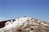
, S.Giovanni and Incarico. Altitudes vary from hills to the 1,533 m of Monte Petrella
. Main peaks include the Redentore (1,252 m) and Monte Sant'Angelo (1,402 m). They include a Regional Park, the Parco Naturale dei Monti Aurunci, created in 1997.
The mountains take the name from the ancient tribe of the Aurunci
, an offshoot of the Ausoni. Both tribes were derived from the Italic people who were called by the Romans the Volsci
; hence, the Monti Lepini
, the Monti Ausoni
and the Monti Aurunci are also called the Volsci or Volscian Chain. Coincidentally they are all of the same karst topography
and have the same orogeny, which is not quite the same as the Apennines proper.
, which becomes harder toward Gaeta
. The degree of faulting and cracking is so high that the mountains retain no rainfall; it sinks in to emerge as springs (and in human times wells) on the lower flanks. The stream beds are dry except for vernal pools.
Most generally, the western central coastal region of Italy is the front of a subduction
zone where the African plate
moving locally from southwest to northeast is carried under the European plate. There is some counterclockwise rotation of Italy; hence the faults in the Tyrrhenian Sea
slip both parallel to the shoreline and perpendicular to it.
The surface rock in the Anti-Apennines was deposited on the floor of Tethys Sea during the Jurassic
and Cretaceous
of the Mesozoic
. This lighter calcareous rock rides over the front of the subduction zone, uplifted by compressional and isostatic
forces. Just behind it is a zone of crustal thinning caused by extensional forces; i.e., the subduction and the rotation cause a wave of compression with a peak under the Anti-Apennines and a valley in the Tyrrhenian Sea. The result is a karst-graben or half-graben landform with the Volscian Mountains as karst and the coastal chain of Pontine marshes
, South Pontine marsh, Terracina
Basin, Gaeta
Basin and Volturno
Basin as graben.
This landform began to appear in the Messinian
stage of the Miocene
, about 7.2 to 5.3 million years ago. It went on to mature in the Pliocene
. Also in this time volcanic activity associated with the faults and the weakening of the crust over the subduction created the volcanic zones of Latium
and Campania
, which intruded into the karst-graben, mainly on the karst side. In the Pleistocene
the basins slowly filled with sediment from the weak run-off of the mountains, accelerating with the deforestation of modern times.
s, Urodela
are found at around 557 m (1,827.4 ft) and Anura
at around 314 m (1,030.2 ft) in vernal pools, springs and wells. The salamanders are Salamandrina
perspicillata, Triturus carnifex
, Lissotriton italicus
and Lissotriton vulgaris
; the frogs are Bufo bufo, Bufo viridis, Hyla intermedia and Rana italica
.
on the Garigliano River, the water of which they used for cooling, on the border of the Monti Aurunci. It was intended to provide electrical power to the region. After several accidental releases of radioactive gas and water the plant ceased operation in 1978 but continued to be used as a storage facility for radioactive waste, which was stored under the plant. Subsequent flooding carried the waste downstream into the Gulf of Gaeta. The effect on the ecology was toxic. One study reports:
Additional studies were unable to tie anomalies of the skull and teeth in the area's rodents to contamination from the power plant; maybe they are attributable to a naturally high radiational level caused by the volcanic intrusions in the rock. The lower Garigliano remains sparsely populated.
Mountain range
A mountain range is a single, large mass consisting of a succession of mountains or narrowly spaced mountain ridges, with or without peaks, closely related in position, direction, formation, and age; a component part of a mountain system or of a mountain chain...
of southern Lazio, in central Italy
Italy
Italy , officially the Italian Republic languages]] under the European Charter for Regional or Minority Languages. In each of these, Italy's official name is as follows:;;;;;;;;), is a unitary parliamentary republic in South-Central Europe. To the north it borders France, Switzerland, Austria and...
. They are part of the Antiappennini, a group running from the Apennines
Apennine mountains
The Apennines or Apennine Mountains or Greek oros but just as often used alone as a noun. The ancient Greeks and Romans typically but not always used "mountain" in the singular to mean one or a range; thus, "the Apennine mountain" refers to the entire chain and is translated "the Apennine...
chain to the Tyrrhenian Sea
Tyrrhenian Sea
The Tyrrhenian Sea is part of the Mediterranean Sea off the western coast of Italy.-Geography:The sea is bounded by Corsica and Sardinia , Tuscany, Lazio, Campania, Basilicata and Calabria and Sicily ....
, where they form the promontory of Gaeta
Gaeta
Gaeta is a city and comune in the province of Latina, in Lazio, central Italy. Set on a promontory stretching towards the Gulf of Gaeta, it is 120 km from Rome and 80 km from Naples....
. They are bounded northwestward by the Ausoni Mountains, northward by the Liri river, eastward by the Ausente, southeastward by the Garigliano and southward by the Tyrrhenian sea. The line between the Aurunci and the Ausoni has not been clearly established but the Aurunci are considered by convention to be east of a line through Fondi
Fondi
Fondi is a city and comune in the province of Latina, Lazio, central Italy, halfway between Rome and Naples. Before the construction of the highway between the latter cities in the late 1950s, Fondi had been an important settlement on the Roman Via Appia, which was the main connection from Rome to...
, Lenola, Pico
Pico, Italy
Pico is a town and comune in the province of Frosinone, in the Lazio region of central Italy. It is bounded by other communes of San Giovanni Incarico, Campodimele, Pontecorvo, Pastena and Lenola.It is part of the Comunità Montana Monti Ausoni....
, S.Giovanni and Incarico. Altitudes vary from hills to the 1,533 m of Monte Petrella
Monte Petrella
Monte Petrella is the highest peak in the Aurunci Mountains, in southern Lazio, central Italy. It has an elevation of .It can be reached from Spigno Saturnia from east, and Maranola, a frazione of Formia, from west.- External links :...
. Main peaks include the Redentore (1,252 m) and Monte Sant'Angelo (1,402 m). They include a Regional Park, the Parco Naturale dei Monti Aurunci, created in 1997.
The mountains take the name from the ancient tribe of the Aurunci
Aurunci
The Aurunci were an Italic population which lived in southern Italy from around the 1st millennium BC. Of Indo-European origin, their language belonged to the Oscan group...
, an offshoot of the Ausoni. Both tribes were derived from the Italic people who were called by the Romans the Volsci
Volsci
The Volsci were an ancient Italic people, well known in the history of the first century of the Roman Republic. They then inhabited the partly hilly, partly marshy district of the south of Latium, bounded by the Aurunci and Samnites on the south, the Hernici on the east, and stretching roughly from...
; hence, the Monti Lepini
Monti Lepini
The Monti Lepini are a mountain range which belongs to the Anti-Apennines of the Lazio region of central Italy, between the two provinces of Latina and Rome....
, the Monti Ausoni
Monti Ausoni
The Ausoni Mountains are mountain range of southern Lazio, in central Italy. They are part of the Antiappennini, a group running from the Apennines chain to the Tyrrhenian Sea. They are bounded northwards by the Monti Lepini and southwards by the Aurunci Mountains.They take the name from the...
and the Monti Aurunci are also called the Volsci or Volscian Chain. Coincidentally they are all of the same karst topography
Karst topography
Karst topography is a geologic formation shaped by the dissolution of a layer or layers of soluble bedrock, usually carbonate rock such as limestone or dolomite, but has also been documented for weathering resistant rocks like quartzite given the right conditions.Due to subterranean drainage, there...
and have the same orogeny, which is not quite the same as the Apennines proper.
Geology
The Monti Aurunci mainly consist of friable limestoneLimestone
Limestone is a sedimentary rock composed largely of the minerals calcite and aragonite, which are different crystal forms of calcium carbonate . Many limestones are composed from skeletal fragments of marine organisms such as coral or foraminifera....
, which becomes harder toward Gaeta
Gaeta
Gaeta is a city and comune in the province of Latina, in Lazio, central Italy. Set on a promontory stretching towards the Gulf of Gaeta, it is 120 km from Rome and 80 km from Naples....
. The degree of faulting and cracking is so high that the mountains retain no rainfall; it sinks in to emerge as springs (and in human times wells) on the lower flanks. The stream beds are dry except for vernal pools.
Most generally, the western central coastal region of Italy is the front of a subduction
Subduction
In geology, subduction is the process that takes place at convergent boundaries by which one tectonic plate moves under another tectonic plate, sinking into the Earth's mantle, as the plates converge. These 3D regions of mantle downwellings are known as "Subduction Zones"...
zone where the African plate
African Plate
The African Plate is a tectonic plate which includes the continent of Africa, as well as oceanic crust which lies between the continent and various surrounding ocean ridges.-Boundaries:...
moving locally from southwest to northeast is carried under the European plate. There is some counterclockwise rotation of Italy; hence the faults in the Tyrrhenian Sea
Tyrrhenian Sea
The Tyrrhenian Sea is part of the Mediterranean Sea off the western coast of Italy.-Geography:The sea is bounded by Corsica and Sardinia , Tuscany, Lazio, Campania, Basilicata and Calabria and Sicily ....
slip both parallel to the shoreline and perpendicular to it.
The surface rock in the Anti-Apennines was deposited on the floor of Tethys Sea during the Jurassic
Jurassic
The Jurassic is a geologic period and system that extends from about Mya to Mya, that is, from the end of the Triassic to the beginning of the Cretaceous. The Jurassic constitutes the middle period of the Mesozoic era, also known as the age of reptiles. The start of the period is marked by...
and Cretaceous
Cretaceous
The Cretaceous , derived from the Latin "creta" , usually abbreviated K for its German translation Kreide , is a geologic period and system from circa to million years ago. In the geologic timescale, the Cretaceous follows the Jurassic period and is followed by the Paleogene period of the...
of the Mesozoic
Mesozoic
The Mesozoic era is an interval of geological time from about 250 million years ago to about 65 million years ago. It is often referred to as the age of reptiles because reptiles, namely dinosaurs, were the dominant terrestrial and marine vertebrates of the time...
. This lighter calcareous rock rides over the front of the subduction zone, uplifted by compressional and isostatic
Isostasy
Isostasy is a term used in geology to refer to the state of gravitational equilibrium between the earth's lithosphere and asthenosphere such that the tectonic plates "float" at an elevation which depends on their thickness and density. This concept is invoked to explain how different topographic...
forces. Just behind it is a zone of crustal thinning caused by extensional forces; i.e., the subduction and the rotation cause a wave of compression with a peak under the Anti-Apennines and a valley in the Tyrrhenian Sea. The result is a karst-graben or half-graben landform with the Volscian Mountains as karst and the coastal chain of Pontine marshes
Pontine Marshes
thumb|250px|Lake Fogliano, a coastal lagoon in the Pontine Plain.The Pontine Marshes, termed in Latin Pomptinus Ager by Titus Livius, Pomptina Palus and Pomptinae Paludes by Pliny the Elder, today the Agro Pontino in Italian, is an approximately quadrangular area of former marshland in the Lazio...
, South Pontine marsh, Terracina
Terracina
Terracina is a town and comune of the province of Latina - , Italy, 76 km SE of Rome by rail .-Ancient times:...
Basin, Gaeta
Gaeta
Gaeta is a city and comune in the province of Latina, in Lazio, central Italy. Set on a promontory stretching towards the Gulf of Gaeta, it is 120 km from Rome and 80 km from Naples....
Basin and Volturno
Volturno
The Volturno is a river in south-central Italy.-Geography:It rises in the Abruzzese central Apennines of Samnium near Rocchetta a Volturno and flows southeast as far as its junction with the Calore River near Caiazzo and runs south as far as Venafro, and then turns southwest, past Capua, to...
Basin as graben.
This landform began to appear in the Messinian
Messinian
The Messinian is in the geologic timescale the last age or uppermost stage of the Miocene. It spans the time between 7.246 ± 0.005 Ma and 5.332 ± 0.005 Ma...
stage of the Miocene
Miocene
The Miocene is a geological epoch of the Neogene Period and extends from about . The Miocene was named by Sir Charles Lyell. Its name comes from the Greek words and and means "less recent" because it has 18% fewer modern sea invertebrates than the Pliocene. The Miocene follows the Oligocene...
, about 7.2 to 5.3 million years ago. It went on to mature in the Pliocene
Pliocene
The Pliocene Epoch is the period in the geologic timescale that extends from 5.332 million to 2.588 million years before present. It is the second and youngest epoch of the Neogene Period in the Cenozoic Era. The Pliocene follows the Miocene Epoch and is followed by the Pleistocene Epoch...
. Also in this time volcanic activity associated with the faults and the weakening of the crust over the subduction created the volcanic zones of Latium
Latium
Lazio is one of the 20 administrative regions of Italy, situated in the central peninsular section of the country. With about 5.7 million residents and a GDP of more than 170 billion euros, Lazio is the third most populated and the second richest region of Italy...
and Campania
Campania
Campania is a region in southern Italy. The region has a population of around 5.8 million people, making it the second-most-populous region of Italy; its total area of 13,590 km² makes it the most densely populated region in the country...
, which intruded into the karst-graben, mainly on the karst side. In the Pleistocene
Pleistocene
The Pleistocene is the epoch from 2,588,000 to 11,700 years BP that spans the world's recent period of repeated glaciations. The name pleistocene is derived from the Greek and ....
the basins slowly filled with sediment from the weak run-off of the mountains, accelerating with the deforestation of modern times.
Fauna
Of the AmphibianAmphibian
Amphibians , are a class of vertebrate animals including animals such as toads, frogs, caecilians, and salamanders. They are characterized as non-amniote ectothermic tetrapods...
s, Urodela
Salamander
Salamander is a common name of approximately 500 species of amphibians. They are typically characterized by a superficially lizard-like appearance, with their slender bodies, short noses, and long tails. All known fossils and extinct species fall under the order Caudata, while sometimes the extant...
are found at around 557 m (1,827.4 ft) and Anura
Frog
Frogs are amphibians in the order Anura , formerly referred to as Salientia . Most frogs are characterized by a short body, webbed digits , protruding eyes and the absence of a tail...
at around 314 m (1,030.2 ft) in vernal pools, springs and wells. The salamanders are Salamandrina
Salamandrina
Salamandrina is a genus of salamander in the Salamandridae family. The IUCN Red List follows Mattoccia et al. and Canestrelli et al. in separating Salamandrina perspicillata from S. terdigitata.It contains the following species:...
perspicillata, Triturus carnifex
Italian Crested Newt
The Italian Crested Newt is a species of newt in the family Salamandridae.It is found in Albania, Austria, Bosnia and Herzegovina, Croatia, Czech Republic, Germany, Greece, Hungary, Italy, Macedonia, Serbia and Montenegro, Slovenia, Switzerland, and the Netherlands...
, Lissotriton italicus
Italian Newt
The Italian Newt is a species of salamander in the Salamandridae family. It is found only in Italy. Its natural habitats are temperate forests, temperate shrubland, Mediterranean-type shrubby vegetation, freshwater lakes, intermittent freshwater lakes, freshwater marshes, intermittent freshwater...
and Lissotriton vulgaris
Smooth Newt
The Smooth Newt, also known as the Common Newt, Lissotriton vulgaris is the most common newt species of the Lissotriton genus of amphibians. L...
; the frogs are Bufo bufo, Bufo viridis, Hyla intermedia and Rana italica
Italian Stream Frog
The Italian Stream Frog is a species of frog in the Ranidae family. It is found in Italy and San Marino. Its natural habitats are rivers, intermittent rivers, swamps, freshwater marshes, and intermittent freshwater marches. It is threatened by habitat loss.-References:* Andreone, F. 2004. . ...
.
Radioactive pollution of the lower Garigliano
The Garigliano Nuclear Power Plant was constructed from 1959 to 1963 by General ElectricGeneral Electric
General Electric Company , or GE, is an American multinational conglomerate corporation incorporated in Schenectady, New York and headquartered in Fairfield, Connecticut, United States...
on the Garigliano River, the water of which they used for cooling, on the border of the Monti Aurunci. It was intended to provide electrical power to the region. After several accidental releases of radioactive gas and water the plant ceased operation in 1978 but continued to be used as a storage facility for radioactive waste, which was stored under the plant. Subsequent flooding carried the waste downstream into the Gulf of Gaeta. The effect on the ecology was toxic. One study reports:
Additional studies were unable to tie anomalies of the skull and teeth in the area's rodents to contamination from the power plant; maybe they are attributable to a naturally high radiational level caused by the volcanic intrusions in the rock. The lower Garigliano remains sparsely populated.