
2004 Indian Ocean earthquake
Overview
Submarine earthquake
A submarine, undersea, or underwater earthquake is an earthquake that occurs underwater at the bottom of a body of water, especially an ocean. They are the leading cause of tsunamis...
megathrust earthquake
Megathrust earthquake
Megathrust earthquakes occur at subduction zones at destructive plate boundaries , where one tectonic plate is forced under another. Due to the shallow dip of the plate boundary, which causes large sections to get stuck, these earthquakes are among the world's largest, with moment magnitudes ...
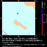
that occurred at 00:58:53 UTC
Coordinated Universal Time
Coordinated Universal Time is the primary time standard by which the world regulates clocks and time. It is one of several closely related successors to Greenwich Mean Time. Computer servers, online services and other entities that rely on having a universally accepted time use UTC for that purpose...
on Sunday, December 26, 2004, with an epicentre off the west coast of Sumatra
Sumatra
Sumatra is an island in western Indonesia, westernmost of the Sunda Islands. It is the largest island entirely in Indonesia , and the sixth largest island in the world at 473,481 km2 with a population of 50,365,538...
, Indonesia
Indonesia
Indonesia , officially the Republic of Indonesia , is a country in Southeast Asia and Oceania. Indonesia is an archipelago comprising approximately 13,000 islands. It has 33 provinces with over 238 million people, and is the world's fourth most populous country. Indonesia is a republic, with an...
. The quake itself is known by the scientific community
Scientific community
The scientific community consists of the total body of scientists, its relationships and interactions. It is normally divided into "sub-communities" each working on a particular field within science. Objectivity is expected to be achieved by the scientific method...
as the Sumatra-Andaman earthquake. The resulting tsunami
Tsunami
A tsunami is a series of water waves caused by the displacement of a large volume of a body of water, typically an ocean or a large lake...
is given various names, including the 2004 Indian Ocean tsunami, South Asian Tsunami, Indonesian Tsunami, and Boxing Day
Boxing Day
Boxing Day is a bank or public holiday that occurs on 26 December, or the first or second weekday after Christmas Day, depending on national or regional laws. It is observed in Australia, Canada, New Zealand, the United Kingdom and some other Commonwealth nations. In Ireland, it is recognized as...
Tsunami.
The earthquake was caused by subduction
Subduction
In geology, subduction is the process that takes place at convergent boundaries by which one tectonic plate moves under another tectonic plate, sinking into the Earth's mantle, as the plates converge. These 3D regions of mantle downwellings are known as "Subduction Zones"...
and triggered a series of devastating tsunami
Tsunami
A tsunami is a series of water waves caused by the displacement of a large volume of a body of water, typically an ocean or a large lake...
s along the coasts of most landmasses bordering the Indian Ocean
Indian Ocean
The Indian Ocean is the third largest of the world's oceanic divisions, covering approximately 20% of the water on the Earth's surface. It is bounded on the north by the Indian Subcontinent and Arabian Peninsula ; on the west by eastern Africa; on the east by Indochina, the Sunda Islands, and...
, killing over 230,000 people in fourteen countries, and inundating coastal communities with waves up to 30 metres (98.4 ft) high.