

West Virginia State Route 2
Encyclopedia
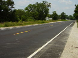
West Virginia Route 2 is a state highway
in the U.S. state
of West Virginia
. It generally parallels the Ohio River
along the west border of the state, from U.S. Route 60 in Huntington (just west of the East End Bridge
) northeasterly to U.S. Route 30 in Chester (just south of the Jennings Randolph Memorial Bridge).
WV 2 leaves the shores of the Ohio River in two places: between Point Pleasant and Mount Alto
(where West Virginia Route 62 follows the river) and between Ravenswood and Waverly
(where West Virginia Route 68 mostly follows the river).
to Wheeling
.
 For a time, Route 2 deviated from its current alignment to follow a more northeasterly route from New Cumberland to US 30 via new Manchester. The current alignment of WV 2 past Mountaineer Race Track was formerly numbered WV 66. The former routing of WV 2 is now WV 8.
On June 23, 2000, work began on a project that widened WV 2 from two to four lanes from Weirton
at US 22 (Robert C. Byrd Expressway)
south to CR 8 near Follansbee
. The project length was just 0.9 miles. Work was supposed to be complete by June 31, 2001, however, construction wrapped up on October 31 at a cost of $21,444,875. The project entailed stabilizing the hillside by reshaping the highwall, widening the roadway with four 12 feet (3.7 m) lanes, creating 10 feet (3 m) outside shoulders, and 8 feet (2.4 m) interior shoulders. 3.9 million cubic yards of earth were removed during the excavation process.
 One year later, the highway widening project progressed further south for 2.5 miles (4 km).
There are currently plans to widen WV 2 from two to four lanes from US 22 north to Chester at a cost of $463,900,000; this would include a bypass of New Cumberland
and would also correct rockfall hazards along the entire length . Likewise, a project to widen WV 2 from two to four lanes from Follansbee south to Wheeling is projected to cost $489,500,000. This would connect to an incomplete interchange at Interstate 70
and U.S. Route 250
and include a northern bypass of Wheeling. The projects are ranked 45th and 48th, respectively.
. Ranked 55th, this project has an estimated price tag of $432,000,000 .
northeast to Point Pleasant
to four lanes at a cost of $237,300,000. Even further down the road is WV 2 widening from Point Pleasant to Interstate 77
at a cost of $207,300,000. The projects are ranked 86th and 98th,respectively.
State highway
State highway, state road or state route can refer to one of three related concepts, two of them related to a state or provincial government in a country that is divided into states or provinces :#A...
in the U.S. state
U.S. state
A U.S. state is any one of the 50 federated states of the United States of America that share sovereignty with the federal government. Because of this shared sovereignty, an American is a citizen both of the federal entity and of his or her state of domicile. Four states use the official title of...
of West Virginia
West Virginia
West Virginia is a state in the Appalachian and Southeastern regions of the United States, bordered by Virginia to the southeast, Kentucky to the southwest, Ohio to the northwest, Pennsylvania to the northeast and Maryland to the east...
. It generally parallels the Ohio River
Ohio River
The Ohio River is the largest tributary, by volume, of the Mississippi River. At the confluence, the Ohio is even bigger than the Mississippi and, thus, is hydrologically the main stream of the whole river system, including the Allegheny River further upstream...
along the west border of the state, from U.S. Route 60 in Huntington (just west of the East End Bridge
East End Bridge (Huntington)
The East Huntington Bridge is a cable-stayed bridge crossing the Ohio River at Huntington, West Virginia...
) northeasterly to U.S. Route 30 in Chester (just south of the Jennings Randolph Memorial Bridge).
WV 2 leaves the shores of the Ohio River in two places: between Point Pleasant and Mount Alto
Mount Alto, West Virginia
Mount Alto is an unincorporated community in far western Jackson County, West Virginia, USA. It lies along West Virginia Route 331 northwest of the city of Ripley, the county seat of Jackson County. Its elevation is 709 feet . Mount Alto had a post office, which closed on June 20,...
(where West Virginia Route 62 follows the river) and between Ravenswood and Waverly
Waverly, West Virginia
Waverly is an unincorporated census-designated place in northeastern Wood County, West Virginia, United States. As of the 2010 census, its population was 395. It lies along the Ohio River on West Virginia Route 2, northeast of the city of Parkersburg, the county seat of Wood County. Its elevation...
(where West Virginia Route 68 mostly follows the river).
Chester to Wheeling
WV 2 is a variable two-lane and four-lane highway from its northern terminus at ChesterChester, West Virginia
Chester is a city in Hancock County, West Virginia, United States, along the Ohio River. It is part of the Weirton–Steubenville, WV-OH Metropolitan Statistical Area. The population was 2,592 at the 2000 census. Chester was established in 1896, but not incorporated until 1907. The city is...
to Wheeling
Wheeling, West Virginia
Wheeling is a city in Ohio and Marshall counties in the U.S. state of West Virginia; it is the county seat of Ohio County. Wheeling is the principal city of the Wheeling Metropolitan Statistical Area...
.
On June 23, 2000, work began on a project that widened WV 2 from two to four lanes from Weirton
Weirton, West Virginia
Weirton is a city located in the Northern Panhandle of West Virginia, United States. Most of the city is in Hancock County, with the remainder in Brooke County. As of the 2000 census, the city population was 20,411...
at US 22 (Robert C. Byrd Expressway)
U.S. Route 22
U.S. Route 22 is a west–east route and is one of the original United States highways of 1926, running from Cincinnati, Ohio, at US 27, US 42, US 127, and US 52 to Newark, New Jersey, at U.S. Route 1/9 near the Newark Liberty International Airport.US 22 also carries the names of the William...
south to CR 8 near Follansbee
Follansbee, West Virginia
Follansbee is a city in Brooke County, West Virginia, United States, located along the Ohio River. It is part of the Weirton–Steubenville, West Virginia-OH Metropolitan Statistical Area...
. The project length was just 0.9 miles. Work was supposed to be complete by June 31, 2001, however, construction wrapped up on October 31 at a cost of $21,444,875. The project entailed stabilizing the hillside by reshaping the highwall, widening the roadway with four 12 feet (3.7 m) lanes, creating 10 feet (3 m) outside shoulders, and 8 feet (2.4 m) interior shoulders. 3.9 million cubic yards of earth were removed during the excavation process.
There are currently plans to widen WV 2 from two to four lanes from US 22 north to Chester at a cost of $463,900,000; this would include a bypass of New Cumberland
New Cumberland, West Virginia
New Cumberland is a city in Hancock County, West Virginia, USA, along the Ohio River. It is the county seat and is part of the Weirton–Steubenville, WV-OH Metropolitan Statistical Area. The population was 1,099 as of the 2000 census.-History:...
and would also correct rockfall hazards along the entire length . Likewise, a project to widen WV 2 from two to four lanes from Follansbee south to Wheeling is projected to cost $489,500,000. This would connect to an incomplete interchange at Interstate 70
Interstate 70
Interstate 70 is an Interstate Highway in the United States that runs from Interstate 15 near Cove Fort, Utah, to a Park and Ride near Baltimore, Maryland. It was the first Interstate Highway project in the United States. I-70 approximately traces the path of U.S. Route 40 east of the Rocky...
and U.S. Route 250
U.S. Route 250
U.S. Route 250 is a route of the United States Numbered Highway System, and is a spur of U.S. Route 50. It currently runs for from Sandusky, Ohio to Richmond, Virginia. It passes through the states of Virginia, West Virginia, and Ohio. It goes through the cities of Richmond, Virginia,...
and include a northern bypass of Wheeling. The projects are ranked 45th and 48th, respectively.
Wheeling to Parkersburg
Within the six-year plan produced by the West Virginia Department of Transportation is a four-lane upgrade for WV 2 between McKeefrey and ParkersburgParkersburg, West Virginia
As of the census of 2000, there were 33,099 people, 14,467 households, and 8,767 families residing in the city. In 2006 the U.S. Census Bureau estimated that Parkersburg's population had decreased 4.4% to 31,755. The population density was 2,800.5 people per square mile . There were 16,100 housing...
. Ranked 55th, this project has an estimated price tag of $432,000,000 .
Parkersburg to Huntington
WV 2 was reconstructed from Lesage to Glenwood as an improved two-lane highway with shoulders on a four-lane right-of-way in the mid-1980s. Currently, there are long-range plans to widen WV 2 from WV 193 near BarboursvilleBarboursville, West Virginia
Barboursville is a village in Cabell County, West Virginia, United States. It is located near the second largest city in the state, Huntington. The population was 3,183 at the 2000 census....
northeast to Point Pleasant
Point Pleasant, West Virginia
Point Pleasant is a city in Mason County, West Virginia, United States, at the confluence of the Ohio and Kanawha rivers. The population was 4,637 at the 2000 census...
to four lanes at a cost of $237,300,000. Even further down the road is WV 2 widening from Point Pleasant to Interstate 77
Interstate 77
Interstate 77 is an Interstate Highway in the eastern United States. It traverses diverse terrain, from the mountainous state of West Virginia to the rolling farmlands of North Carolina and Ohio. It largely supplants the old U.S...
at a cost of $207,300,000. The projects are ranked 86th and 98th,respectively.