
Washington State Route 290
Encyclopedia
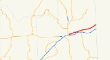
State Route 290 named Hamilton Street and Trent Avenue, is a 18.38 miles (29.58 km) long state highway
serving Spokane County
in the U.S. state
of Washington. SR 290 travels parallel to a Union Pacific railroad from (I-90) in Spokane
through Millwood
and across the Spokane River
three times towards Spokane Valley
, where the highway intersects . From Spokane Valley, the roadway continues to the Idaho
state border, where it becomes .
The current route of SR 290 was formerly county roads between 1901 and 1937, when it became Secondary State Highway 2H (SSH 2H). The highway ran from (US 2) and in Downtown Spokane to Idaho until a 1964 renumbering of state highways, which re-designated SSH 2H as SR 290. A short spur route
connecting the main highway to I-90 was also added during the renumbering, but SR 290 was realigned to replace the route in 2005.
at an directional T-interchange with (I-90) east of downtown Spokane
. This interchange was originally built for a planned North Spokane Corridor
in the 1970s. The freeway continues north to an interchange with 2nd Avenue that only allows eastbound traffic to enter and westbound traffic to exit the freeway. The highawy is named Hamilton Avenue and travels north over Sprague Avenue, BNSF Railway
tracks, and the Spokane River
before intersecting Trent Avneue the former route of the roadway prior to 2005. At the intersection, located near Gonzaga University
, SR 290 turns east and becomes Trent Avneue before crossing the Spokane River again. Trent Avenue travels northeast through an industrial district, paralleling the Spoakne International
branch of the Union Pacific Railroad
, through Millwood
before intersecting , locally named Pines Road. The highway crosses the Spokane River a third time and enters the Trentwood
neighborhood of Spokane Valley
, where it intersects Sullivan Road by way of a diamond interchange
. From Spokane Valley, the roadway travels northeast through farmland to Newman Lake
, where it crosses into Idaho
and becomes , which continues east to Rathdrum
as Trent Road.
Every year the Washington State Department of Transportation
(WSDOT) conducts a series of surveys on its highways in the state to measure traffic volume. This is expressed in terms of average annual daily traffic (AADT), which is a measure of traffic volume for any average day of the year. In 2009, WSDOT calculated that as few as 6,800 cars traveled through Millwood, and as many as 35,00 cars on the short divided highway north of I-90.
line from Spokane
to the Idaho
state border at Newman Lake
has existed since 1901. In 1937, the road became Secondary State Highway 2H (SSH 2H) and ran from in Spokane to Wellesley Avenue at the Idaho state border. SSH 2H was scheduled to be designated SR 290 in 1970 after a highway renumbering in 1964. The new designation was made to align with the sign route, now state route, system. In 1967, the eastern terminus of SSH 2H was shifted north to align with (ID 53). In 1970, the state route system
came into effect and SR 290 was established along with a spur route
connecting the main highway to (I-90). In 2005, the western terminus of SR 290 was moved southeast to an exit with I-90, replacing the spur route.
.
{| class=wikitable
!Location
!Mile
!Destinations
!Notes
|-
|rowspan=4|Spokane
|0.00
|, Coeur d'Alene
|Western terminus; directional T-interchange
|-
|0.33
|2nd Avenue
|Eastbound entrance and westbound exit
|-
|colspan=3 align=center|East end of freeway
|-
|0.74
|Trent Avenue – Downtown Spokane
|Former SR 290
|-
|Millwood
|8.36
|
|
|-
|Spokane Valley
|10.46
|Sullivan Road
|Diamond interchange
|-
|
|18.31
|
|Eastern terminus; Idaho
state border
, Spokane County
.
{| class=wikitable
!Mile
!Destinations
!Notes
|-
|0.00
|, Rathdrum
|Northern terminus; at-grade intersection
|-
|0.55
|2nd Avenue
|Northbound entrance and southbound exit
|-
|0.67
|, Coeur d'Alene
|Southern terminus; directional T-interchange
of SR 290 prior to 2005. The spur route served as a short connector to (I-90) east of downtown Spokane
and ran from ran from SR 290 at the intersection of Trent Avenue and Hamilton Street near Gonzaga University
to a directional T-interchange with I-90, via a bridge over the Spokane River
. The highway was originally established along with SR 290, which went east from (US 2) and (US 395) in downtown Spokane to Idaho
. This spur route was proposed to be the southern terminus of the North/South Freeway
that would bypass
Downtown Spokane and a freeway segment was built, but never finished due to priority going to the Interstate Highways
. The western terminus of SR 290 was realigned in 2005, ending at I-90 along the former route of SR 290 Spur.
State highways in Washington
In the U.S. state of Washington, the Washington State Department of Transportation maintains a network of over 7000 miles of state highways, including all Interstate and U.S. Highways that pass through the state. The system comprises 8.5% of the state's public road mileage, but carries over half...
serving Spokane County
Spokane County, Washington
Spokane County is a county located in the U.S. state of Washington, named after the Spokane tribe. As of the 2010 census the population was 471,221, making it the fourth most populous county in Washington state. The largest city and county seat is Spokane, the second largest city in the state,...
in the U.S. state
U.S. state
A U.S. state is any one of the 50 federated states of the United States of America that share sovereignty with the federal government. Because of this shared sovereignty, an American is a citizen both of the federal entity and of his or her state of domicile. Four states use the official title of...
of Washington. SR 290 travels parallel to a Union Pacific railroad from (I-90) in Spokane
Spokane, Washington
Spokane is a city located in the Northwestern United States in the state of Washington. It is the largest city of Spokane County of which it is also the county seat, and the metropolitan center of the Inland Northwest region...
through Millwood
Millwood, Washington
Millwood is a town in Spokane County, Washington, United States. The population was 1,786 at the 2010 census. Millwood is a suburb of Spokane, Washington, and is surrounded on three sides by the city of Spokane Valley, Washington.-History:...
and across the Spokane River
Spokane River
The Spokane River is a tributary of the Columbia River, approximately long, in northern Idaho and eastern Washington in the United States. It drains a low mountainous area east of the Columbia, passing through the city of Spokane, Washington.-Description:...
three times towards Spokane Valley
Spokane Valley, Washington
Spokane Valley is an incorporated city in Spokane County, Washington, United States. It is located east of Spokane and west of Coeur d'Alene. It surrounds the town of Millwood on three sides...
, where the highway intersects . From Spokane Valley, the roadway continues to the Idaho
Idaho
Idaho is a state in the Rocky Mountain area of the United States. The state's largest city and capital is Boise. Residents are called "Idahoans". Idaho was admitted to the Union on July 3, 1890, as the 43rd state....
state border, where it becomes .
The current route of SR 290 was formerly county roads between 1901 and 1937, when it became Secondary State Highway 2H (SSH 2H). The highway ran from (US 2) and in Downtown Spokane to Idaho until a 1964 renumbering of state highways, which re-designated SSH 2H as SR 290. A short spur route
Spur route
A spur route is a short road forming a branch from a longer, more important route . A bypass or beltway is never considered a true spur route as it typically reconnects with the major road...
connecting the main highway to I-90 was also added during the renumbering, but SR 290 was realigned to replace the route in 2005.
Route description
SR 290 begins as a short divided highwayDivided Highway
Divided Highway is a compilation album by American rock band The Doobie Brothers, released in 2003. . All tracks are taken from the albums Cycles and Brotherhood .-Track listing:...
at an directional T-interchange with (I-90) east of downtown Spokane
Spokane, Washington
Spokane is a city located in the Northwestern United States in the state of Washington. It is the largest city of Spokane County of which it is also the county seat, and the metropolitan center of the Inland Northwest region...
. This interchange was originally built for a planned North Spokane Corridor
North Spokane Corridor
The U.S. Route 395 North Spokane Corridor is a $2.2 billion limited-access highway project in Spokane, Washington, that is designed to improve freight and commuter mobility through the Spokane Metropolitan Area...
in the 1970s. The freeway continues north to an interchange with 2nd Avenue that only allows eastbound traffic to enter and westbound traffic to exit the freeway. The highawy is named Hamilton Avenue and travels north over Sprague Avenue, BNSF Railway
BNSF Railway
The BNSF Railway is a wholly owned subsidiary of Berkshire Hathaway Inc., and is headquartered in Fort Worth, Texas. It is one of seven North American Class I railroads and the second largest freight railroad network in North America, second only to the Union Pacific Railroad, its primary...
tracks, and the Spokane River
Spokane River
The Spokane River is a tributary of the Columbia River, approximately long, in northern Idaho and eastern Washington in the United States. It drains a low mountainous area east of the Columbia, passing through the city of Spokane, Washington.-Description:...
before intersecting Trent Avneue the former route of the roadway prior to 2005. At the intersection, located near Gonzaga University
Gonzaga University
Gonzaga University is a private Roman Catholic university located in Spokane, Washington, United States. Founded in 1887 by the Society of Jesus, it is one of 28 member institutions of the Association of Jesuit Colleges and Universities and is named after the young Jesuit saint, Aloysius Gonzaga...
, SR 290 turns east and becomes Trent Avneue before crossing the Spokane River again. Trent Avenue travels northeast through an industrial district, paralleling the Spoakne International
Spokane International Railroad
The Spokane International Railroad was a short line railroad between Spokane, Washington and the Canadian Pacific Railway at Kingsgate, British Columbia...
branch of the Union Pacific Railroad
Union Pacific Railroad
The Union Pacific Railroad , headquartered in Omaha, Nebraska, is the largest railroad network in the United States. James R. Young is president, CEO and Chairman....
, through Millwood
Millwood, Washington
Millwood is a town in Spokane County, Washington, United States. The population was 1,786 at the 2010 census. Millwood is a suburb of Spokane, Washington, and is surrounded on three sides by the city of Spokane Valley, Washington.-History:...
before intersecting , locally named Pines Road. The highway crosses the Spokane River a third time and enters the Trentwood
Trentwood, Washington
Trentwood is a former census-designated place in Spokane County, Washington, United States. The population was 4,388 at the 2000 census. Trentwood has been part of the city of Spokane Valley since it incorporated in 2003.-Geography:...
neighborhood of Spokane Valley
Spokane Valley, Washington
Spokane Valley is an incorporated city in Spokane County, Washington, United States. It is located east of Spokane and west of Coeur d'Alene. It surrounds the town of Millwood on three sides...
, where it intersects Sullivan Road by way of a diamond interchange
Diamond interchange
A diamond interchange is a common type of road junction, used where a freeway crosses a minor road. The freeway itself is grade-separated from the minor road, one crossing the other over a bridge...
. From Spokane Valley, the roadway travels northeast through farmland to Newman Lake
Newman Lake, Washington
Newman Lake is an unincorporated community in Spokane County, Washington, United States. Newman Lake, which took its name from early settler William Newman, is east-northeast of downtown Spokane. Newman Lake has a post office with ZIP code 99025....
, where it crosses into Idaho
Idaho
Idaho is a state in the Rocky Mountain area of the United States. The state's largest city and capital is Boise. Residents are called "Idahoans". Idaho was admitted to the Union on July 3, 1890, as the 43rd state....
and becomes , which continues east to Rathdrum
Rathdrum, Idaho
Rathdrum is a city in Kootenai County, Idaho, United States. The population was 6,826 at the 2010 census.-Geography:Rathdrum is located at ....
as Trent Road.
Every year the Washington State Department of Transportation
Washington State Department of Transportation
The Washington State Department of Transportation , was established in 1905. The agency, led by a Secretary and overseen by the Governor, is a Washington governmental agency that constructs, maintains, and regulates the use of the state's transportation infrastructure...
(WSDOT) conducts a series of surveys on its highways in the state to measure traffic volume. This is expressed in terms of average annual daily traffic (AADT), which is a measure of traffic volume for any average day of the year. In 2009, WSDOT calculated that as few as 6,800 cars traveled through Millwood, and as many as 35,00 cars on the short divided highway north of I-90.
History
A road following the Great Northern Railway and Northern Pacific RailwayNorthern Pacific Railway
The Northern Pacific Railway was a railway that operated in the west along the Canadian border of the United States. Construction began in 1870 and the main line opened all the way from the Great Lakes to the Pacific when former president Ulysses S. Grant drove in the final "golden spike" in...
line from Spokane
Spokane, Washington
Spokane is a city located in the Northwestern United States in the state of Washington. It is the largest city of Spokane County of which it is also the county seat, and the metropolitan center of the Inland Northwest region...
to the Idaho
Idaho
Idaho is a state in the Rocky Mountain area of the United States. The state's largest city and capital is Boise. Residents are called "Idahoans". Idaho was admitted to the Union on July 3, 1890, as the 43rd state....
state border at Newman Lake
Newman Lake, Washington
Newman Lake is an unincorporated community in Spokane County, Washington, United States. Newman Lake, which took its name from early settler William Newman, is east-northeast of downtown Spokane. Newman Lake has a post office with ZIP code 99025....
has existed since 1901. In 1937, the road became Secondary State Highway 2H (SSH 2H) and ran from in Spokane to Wellesley Avenue at the Idaho state border. SSH 2H was scheduled to be designated SR 290 in 1970 after a highway renumbering in 1964. The new designation was made to align with the sign route, now state route, system. In 1967, the eastern terminus of SSH 2H was shifted north to align with (ID 53). In 1970, the state route system
State highways in Washington
In the U.S. state of Washington, the Washington State Department of Transportation maintains a network of over 7000 miles of state highways, including all Interstate and U.S. Highways that pass through the state. The system comprises 8.5% of the state's public road mileage, but carries over half...
came into effect and SR 290 was established along with a spur route
Spur route
A spur route is a short road forming a branch from a longer, more important route . A bypass or beltway is never considered a true spur route as it typically reconnects with the major road...
connecting the main highway to (I-90). In 2005, the western terminus of SR 290 was moved southeast to an exit with I-90, replacing the spur route.
Major intersections
The entire route is in Spokane CountySpokane County, Washington
Spokane County is a county located in the U.S. state of Washington, named after the Spokane tribe. As of the 2010 census the population was 471,221, making it the fourth most populous county in Washington state. The largest city and county seat is Spokane, the second largest city in the state,...
.
{| class=wikitable
!Location
!Mile
!Destinations
!Notes
|-
|rowspan=4|Spokane
Spokane, Washington
Spokane is a city located in the Northwestern United States in the state of Washington. It is the largest city of Spokane County of which it is also the county seat, and the metropolitan center of the Inland Northwest region...
|0.00
|, Coeur d'Alene
Coeur d'Alene, Idaho
Coeur d'Alene is the largest city and county seat of Kootenai County, Idaho, United States. It is the principal city of the Coeur d'Alene Metropolitan Statistical Area. Coeur d'Alene has the second largest metropolitan area in the state of Idaho. As of the 2010 census the population of Coeur...
|Western terminus; directional T-interchange
|-
|0.33
|2nd Avenue
|Eastbound entrance and westbound exit
|-
|colspan=3 align=center|East end of freeway
|-
|0.74
|Trent Avenue – Downtown Spokane
Spokane, Washington
Spokane is a city located in the Northwestern United States in the state of Washington. It is the largest city of Spokane County of which it is also the county seat, and the metropolitan center of the Inland Northwest region...
|Former SR 290
|-
|Millwood
Millwood, Washington
Millwood is a town in Spokane County, Washington, United States. The population was 1,786 at the 2010 census. Millwood is a suburb of Spokane, Washington, and is surrounded on three sides by the city of Spokane Valley, Washington.-History:...
|8.36
|
|
|-
|Spokane Valley
Spokane Valley, Washington
Spokane Valley is an incorporated city in Spokane County, Washington, United States. It is located east of Spokane and west of Coeur d'Alene. It surrounds the town of Millwood on three sides...
|10.46
|Sullivan Road
|Diamond interchange
Diamond interchange
A diamond interchange is a common type of road junction, used where a freeway crosses a minor road. The freeway itself is grade-separated from the minor road, one crossing the other over a bridge...
|-
|
|18.31
|
|Eastern terminus; Idaho
Idaho
Idaho is a state in the Rocky Mountain area of the United States. The state's largest city and capital is Boise. Residents are called "Idahoans". Idaho was admitted to the Union on July 3, 1890, as the 43rd state....
state border
Spur intersections
The entire route was in SpokaneSpokane, Washington
Spokane is a city located in the Northwestern United States in the state of Washington. It is the largest city of Spokane County of which it is also the county seat, and the metropolitan center of the Inland Northwest region...
, Spokane County
Spokane County, Washington
Spokane County is a county located in the U.S. state of Washington, named after the Spokane tribe. As of the 2010 census the population was 471,221, making it the fourth most populous county in Washington state. The largest city and county seat is Spokane, the second largest city in the state,...
.
{| class=wikitable
!Mile
!Destinations
!Notes
|-
|0.00
|, Rathdrum
Rathdrum, Idaho
Rathdrum is a city in Kootenai County, Idaho, United States. The population was 6,826 at the 2010 census.-Geography:Rathdrum is located at ....
|Northern terminus; at-grade intersection
At-grade intersection
An at-grade intersection is a junction at which two or more transport axes cross at the same level .-Traffic management:With areas of high or fast traffic, an at-grade intersection normally requires a traffic control device such as a stop sign, traffic light or railway signal to manage conflicting...
|-
|0.55
|2nd Avenue
|Northbound entrance and southbound exit
|-
|0.67
|, Coeur d'Alene
Coeur d'Alene, Idaho
Coeur d'Alene is the largest city and county seat of Kootenai County, Idaho, United States. It is the principal city of the Coeur d'Alene Metropolitan Statistical Area. Coeur d'Alene has the second largest metropolitan area in the state of Idaho. As of the 2010 census the population of Coeur...
|Southern terminus; directional T-interchange
Spur route
Washington State Route 290 Spur was a 0.67 miles (1.08 km) long spur routeSpur route
A spur route is a short road forming a branch from a longer, more important route . A bypass or beltway is never considered a true spur route as it typically reconnects with the major road...
of SR 290 prior to 2005. The spur route served as a short connector to (I-90) east of downtown Spokane
Spokane, Washington
Spokane is a city located in the Northwestern United States in the state of Washington. It is the largest city of Spokane County of which it is also the county seat, and the metropolitan center of the Inland Northwest region...
and ran from ran from SR 290 at the intersection of Trent Avenue and Hamilton Street near Gonzaga University
Gonzaga University
Gonzaga University is a private Roman Catholic university located in Spokane, Washington, United States. Founded in 1887 by the Society of Jesus, it is one of 28 member institutions of the Association of Jesuit Colleges and Universities and is named after the young Jesuit saint, Aloysius Gonzaga...
to a directional T-interchange with I-90, via a bridge over the Spokane River
Spokane River
The Spokane River is a tributary of the Columbia River, approximately long, in northern Idaho and eastern Washington in the United States. It drains a low mountainous area east of the Columbia, passing through the city of Spokane, Washington.-Description:...
. The highway was originally established along with SR 290, which went east from (US 2) and (US 395) in downtown Spokane to Idaho
Idaho
Idaho is a state in the Rocky Mountain area of the United States. The state's largest city and capital is Boise. Residents are called "Idahoans". Idaho was admitted to the Union on July 3, 1890, as the 43rd state....
. This spur route was proposed to be the southern terminus of the North/South Freeway
North Spokane Corridor
The U.S. Route 395 North Spokane Corridor is a $2.2 billion limited-access highway project in Spokane, Washington, that is designed to improve freight and commuter mobility through the Spokane Metropolitan Area...
that would bypass
Bypass (road)
A bypass is a road or highway that avoids or "bypasses" a built-up area, town, or village, to let through traffic flow without interference from local traffic, to reduce congestion in the built-up area, and to improve road safety....
Downtown Spokane and a freeway segment was built, but never finished due to priority going to the Interstate Highways
Interstate Highway System
The Dwight D. Eisenhower National System of Interstate and Defense Highways, , is a network of limited-access roads including freeways, highways, and expressways forming part of the National Highway System of the United States of America...
. The western terminus of SR 290 was realigned in 2005, ending at I-90 along the former route of SR 290 Spur.