

U.S. Route 97 in Oregon
Encyclopedia
In the U.S. state
of Oregon
, U.S. Route 97
is a major north–south United States highway which runs through the state of Oregon
(among other states). In Oregon, it runs from the Oregon-California
border, south of Klamath Falls
, to the Oregon-Washington border on the Columbia River
, between Biggs Junction, Oregon
and Maryhill, Washington. Other than the northernmost stretch (which is known as the Sherman Highway), US 97 (along with U.S. Route 197) is known as The Dalles-California Highway. In May 2009, Oregon Senate passed a bill to rename U.S. Route 97 as "World War II Veterans Historic Highway".
With the exception of Interstate 5, US 97 is the most important north–south highway corridor in the state. It serves two major population centers (Klamath Falls and Bend), and is the main corridor east of the Cascade Mountains. While much of the highway remains in two-lane undivided configuration, significant sections have been upgraded to expressway
or freeway status.
(running from south to north) starts at the border between Oregon and California
, south of the city of Klamath Falls. The highway starts out as a two-lane road, running through the arid Klamath River
basin. Approaching the city of Klamath Falls, 97 becomes a freeway just south of the junction with OR 140 and OR 66. The freeway then runs along the western edge of the downtown region, ending at an interchange with Oregon Route 39 near the Oregon Institute of Technology
. Within Klamath Falls is a business route
, which runs through downtown via Main Street/Klamath Avenue and Esplanade Avenue, then which turns back to the US 97 mainline via the East Side Bypass (this latter segment co-signed with OR 39).
Highway 97, once again primarily a 2-lane road, continues north along the eastern shore of Upper Klamath Lake
. In the town of Chiloquin
is an intersection with Oregon Route 62, which provides access to Crater Lake National Park
from the southeast; further north is an interchange with Oregon Route 138 which provides access to the park from the northeast. Continuing north, near the town of Chemult
is an interchange with Oregon Route 58, which heads northwest to Eugene
and the Willamette Valley
.
In La Pine
is a junction with Oregon Route 31; this city marks the start of the Deschutes River recreation area; (Crane Prairie Reservoir
, the river's source, is located due west of La Pine). North of La Pine, the highway becomes an expressway
as it passes by the resort community of Sunriver
and heads towards the city of Bend
.
In Bend, the highway travels on a RIRO expressway known as the Bend Parkway (though transportation officials like to claim the Parkway is not a freeway—it has a lower speed limit than the non-Interstate maximum of 55 mph (90 km/h) in Oregon); a business route
runs parallel to the Parkway along 3rd Street (the prior route of US 97 before the parkway was built). Expected interchange construction over the approaching years will increase the RIRO distance miles past the southern city limits of Bend, linking up with prior ODOT improvements and eliminating two of the five traffic signals along US 97 in Bend, and in the entire 44 miles between La Pine and Redmond. Similar upgrades are possible at the northern boundary of Bend, dependent upon taxpayer and state approval. In Bend one finds interchanges with the Century Drive Highway, as well as U.S. Route 20. The busiest part of US 97 is in Bend, with an average of 42,000 cars a day.
North of Bend, the highway continues as an expressway
until it reaches the city of Redmond
. US 97 follows a new alignment bypassing the downtown area, with the old route designated U.S. Route 97 Business. It maintains a standard 55 mph speed limit on the northern section of this parkway. In Redmond is an intersection with Oregon Route 126. Continuing north out of Redmond, one enters a high desert region marked by numerous deep river gorges, including the Crooked River
gorge (which 97 passes over near the Peter Skene Ogden State Scenic Viewpoint
and rest area). Towns along the route include Terrebonne, which provides access to Smith Rock State Park
, a climbing mecca, and Culver
. North of Culver, the highway enters the agricultural community of Madras
.
South of Madras is an intersection with U.S. Route 26 headed eastbound; the two routes share an alignment through the city. On the northern edge of town, 97 forks off to the right, heading northeast; and 26 continues northwest towards Portland
. The importance of 97 as a transportation corridor diminishes north of Madras, as most traffic continues to Portland.
South of the community of Shaniko
, US 97 forks off its only spur route, U.S. Route 197 which continues heading parallel to the Deschutes River towards Tygh Valley
and The Dalles
. 97 takes a more easterly course, passing through the high desert region of the Columbia Plateau. Towns along the route include Grass Valley
and Wasco
. Just south of Biggs Junction, the highway descends from the plateau into the Columbia River Gorge
. In Biggs is an interchange with Interstate 84 and U.S. Route 30; immediately north of the interchange is the Biggs Rapids-Sam Hill Bridge
over the Columbia River
. The river serves as the state line between Oregon and Washington.
US 97 Business in Klamath Falls
, from south to north, comprises:
US 97 Business in Bend
runs from its intersection with the main highway at East 1st Street north of Bend, south on East 1st Street, Deschutes Place, and Wall Street to Newport Avenue, concurrent with U.S. 20 Business, then continues south on a Wall Street-Bond Street couplet and east on Franklin Avenue until it rejoins the main highway at East 3rd Street.
U.S. state
A U.S. state is any one of the 50 federated states of the United States of America that share sovereignty with the federal government. Because of this shared sovereignty, an American is a citizen both of the federal entity and of his or her state of domicile. Four states use the official title of...
of Oregon
Oregon
Oregon is a state in the Pacific Northwest region of the United States. It is located on the Pacific coast, with Washington to the north, California to the south, Nevada on the southeast and Idaho to the east. The Columbia and Snake rivers delineate much of Oregon's northern and eastern...
, U.S. Route 97
U.S. Route 97
U.S. Route 97 is a major north–south United States highway in the western United States. It begins at a junction with Interstate 5 at Weed, California, and travels north, ending in Okanogan County, Washington, at the Canadian Border, across from Osoyoos, British Columbia, becoming British...
is a major north–south United States highway which runs through the state of Oregon
Oregon
Oregon is a state in the Pacific Northwest region of the United States. It is located on the Pacific coast, with Washington to the north, California to the south, Nevada on the southeast and Idaho to the east. The Columbia and Snake rivers delineate much of Oregon's northern and eastern...
(among other states). In Oregon, it runs from the Oregon-California
California
California is a state located on the West Coast of the United States. It is by far the most populous U.S. state, and the third-largest by land area...
border, south of Klamath Falls
Klamath Falls, Oregon
Klamath Falls is a city in Klamath County, Oregon, United States. Originally called Linkville when George Nurse founded the town in 1867, after the Link River on whose falls this city sat, although no falls currently exist; the name was changed to Klamath Falls in 1892...
, to the Oregon-Washington border on the Columbia River
Columbia River
The Columbia River is the largest river in the Pacific Northwest region of North America. The river rises in the Rocky Mountains of British Columbia, Canada, flows northwest and then south into the U.S. state of Washington, then turns west to form most of the border between Washington and the state...
, between Biggs Junction, Oregon
Biggs Junction, Oregon
Biggs Junction is an unincorporated community in Sherman County, Oregon, United States. For statistical purposes, the United States Census Bureau has defined Biggs Junction as a census-designated place...
and Maryhill, Washington. Other than the northernmost stretch (which is known as the Sherman Highway), US 97 (along with U.S. Route 197) is known as The Dalles-California Highway. In May 2009, Oregon Senate passed a bill to rename U.S. Route 97 as "World War II Veterans Historic Highway".
With the exception of Interstate 5, US 97 is the most important north–south highway corridor in the state. It serves two major population centers (Klamath Falls and Bend), and is the main corridor east of the Cascade Mountains. While much of the highway remains in two-lane undivided configuration, significant sections have been upgraded to expressway
Limited-access road
A limited-access road known by various terms worldwide, including limited-access highway, dual-carriageway and expressway, is a highway or arterial road for high-speed traffic which has many or most characteristics of a controlled-access highway , including limited or no access to adjacent...
or freeway status.
Route description
The run of US 97 in OregonOregon
Oregon is a state in the Pacific Northwest region of the United States. It is located on the Pacific coast, with Washington to the north, California to the south, Nevada on the southeast and Idaho to the east. The Columbia and Snake rivers delineate much of Oregon's northern and eastern...
(running from south to north) starts at the border between Oregon and California
California
California is a state located on the West Coast of the United States. It is by far the most populous U.S. state, and the third-largest by land area...
, south of the city of Klamath Falls. The highway starts out as a two-lane road, running through the arid Klamath River
Klamath River
The Klamath River is an American river that flows southwest through Oregon and northern California, cutting through the Cascade Range to empty into the Pacific Ocean. The river drains an extensive watershed of almost that stretches from the high desert country of the Great Basin to the temperate...
basin. Approaching the city of Klamath Falls, 97 becomes a freeway just south of the junction with OR 140 and OR 66. The freeway then runs along the western edge of the downtown region, ending at an interchange with Oregon Route 39 near the Oregon Institute of Technology
Oregon Institute of Technology
Oregon Institute of Technology, also known as Oregon Tech or OIT, is an accredited university in the Oregon University System, and the only public institute of technology in the northwest United States. Located in Klamath Falls, Oregon, it provides undergraduate and graduate degrees in many...
. Within Klamath Falls is a business route
Business route
A business route in the United States and Canada is a short special route connected to a parent numbered highway at its beginning, then routed through the central business district of a nearby city or town, and finally reconnecting with the same parent numbered highway again at its...
, which runs through downtown via Main Street/Klamath Avenue and Esplanade Avenue, then which turns back to the US 97 mainline via the East Side Bypass (this latter segment co-signed with OR 39).
Highway 97, once again primarily a 2-lane road, continues north along the eastern shore of Upper Klamath Lake
Upper Klamath Lake
Upper Klamath Lake is a large, shallow freshwater lake east of the Cascade Range in south central Oregon in the United States. The largest freshwater body in Oregon, it is approximately 20 mi long and 8 mi wide and extends northwest from the city of Klamath Falls...
. In the town of Chiloquin
Chiloquin, Oregon
Chiloquin is a city in Klamath County, Oregon, United States. Chiloquin was the pioneer version of a Klamath family name Chaloquin, which was the name of a Klamath chief who was alive at the time of the treaty of 1864...
is an intersection with Oregon Route 62, which provides access to Crater Lake National Park
Crater Lake National Park
Crater Lake National Park is a United States National Park located in southern Oregon. Established in 1902, Crater Lake National Park is the sixth oldest national park in the United States and the only one in the state of Oregon...
from the southeast; further north is an interchange with Oregon Route 138 which provides access to the park from the northeast. Continuing north, near the town of Chemult
Chemult, Oregon
Chemult is an unincorporated community in Klamath County, Oregon, United States, on U.S. Route 97. Chemult has a population of about 300 people. Chemult's elevation is ....
is an interchange with Oregon Route 58, which heads northwest to Eugene
Eugene, Oregon
Eugene is the second largest city in the U.S. state of Oregon and the seat of Lane County. It is located at the south end of the Willamette Valley, at the confluence of the McKenzie and Willamette rivers, about east of the Oregon Coast.As of the 2010 U.S...
and the Willamette Valley
Willamette Valley
The Willamette Valley is the most populated region in the state of Oregon of the United States. Located in the state's northwest, the region is surrounded by tall mountain ranges to the east, west and south and the valley's floor is broad, flat and fertile because of Ice Age conditions...
.
In La Pine
La Pine, Oregon
La Pine is a city in Deschutes County, Oregon, United States, incorporated on December 7, 2006.La Pine is part of the Bend, Oregon Metropolitan Statistical Area. The population was 5,799 at the 2000 census, at which time it was a census-designated place . La Pine is in an isolated area of Central...
is a junction with Oregon Route 31; this city marks the start of the Deschutes River recreation area; (Crane Prairie Reservoir
Crane Prairie Reservoir
Crane Prairie Reservoir is a man-made reservoir located about southwest of Bend, in Deschutes County, Oregon, United States, that also serves as one of Oregon's largest rainbow trout fisheries. It was so named because cranes often fish there. The dam was constructed in 1922 to prevent flooding to...
, the river's source, is located due west of La Pine). North of La Pine, the highway becomes an expressway
Limited-access road
A limited-access road known by various terms worldwide, including limited-access highway, dual-carriageway and expressway, is a highway or arterial road for high-speed traffic which has many or most characteristics of a controlled-access highway , including limited or no access to adjacent...
as it passes by the resort community of Sunriver
Sunriver, Oregon
Sunriver, Oregon is a private planned resort community in Deschutes County, Oregon, United States. It is part of the Bend, Oregon Metropolitan Statistical Area...
and heads towards the city of Bend
Bend, Oregon
Bend is a city in and the county seat of Deschutes County, Oregon, United States, and the principal city of the Bend, Oregon Metropolitan Statistical Area. Bend is Central Oregon's largest city, and, despite its modest size, is the de facto metropolis of the region, owing to the low population...
.
In Bend, the highway travels on a RIRO expressway known as the Bend Parkway (though transportation officials like to claim the Parkway is not a freeway—it has a lower speed limit than the non-Interstate maximum of 55 mph (90 km/h) in Oregon); a business route
Business route
A business route in the United States and Canada is a short special route connected to a parent numbered highway at its beginning, then routed through the central business district of a nearby city or town, and finally reconnecting with the same parent numbered highway again at its...
runs parallel to the Parkway along 3rd Street (the prior route of US 97 before the parkway was built). Expected interchange construction over the approaching years will increase the RIRO distance miles past the southern city limits of Bend, linking up with prior ODOT improvements and eliminating two of the five traffic signals along US 97 in Bend, and in the entire 44 miles between La Pine and Redmond. Similar upgrades are possible at the northern boundary of Bend, dependent upon taxpayer and state approval. In Bend one finds interchanges with the Century Drive Highway, as well as U.S. Route 20. The busiest part of US 97 is in Bend, with an average of 42,000 cars a day.
North of Bend, the highway continues as an expressway
Limited-access road
A limited-access road known by various terms worldwide, including limited-access highway, dual-carriageway and expressway, is a highway or arterial road for high-speed traffic which has many or most characteristics of a controlled-access highway , including limited or no access to adjacent...
until it reaches the city of Redmond
Redmond, Oregon
Redmond is a city in Deschutes County, Oregon, United States. Incorporated on July 6, 1910, the city is located on the eastern side of Oregon's Cascade Range, in the High Desert, and is considered the geographical heart of Central Oregon...
. US 97 follows a new alignment bypassing the downtown area, with the old route designated U.S. Route 97 Business. It maintains a standard 55 mph speed limit on the northern section of this parkway. In Redmond is an intersection with Oregon Route 126. Continuing north out of Redmond, one enters a high desert region marked by numerous deep river gorges, including the Crooked River
Crooked River (Oregon)
The Crooked River is a tributary, long, of the Deschutes River in the U.S. state of Oregon. The river begins at the confluence of South Fork Crooked River and Beaver Creek. Of the two tributaries, the South Fork Crooked River is the larger and is sometimes considered part of the Crooked River proper...
gorge (which 97 passes over near the Peter Skene Ogden State Scenic Viewpoint
Peter Skene Ogden State Scenic Viewpoint
thumb|right|290px|Historical Marker for Peter Skene OgdenThe Peter Skene Ogden State Scenic Viewpoint is a state park on the Crooked River in Oregon, United States. It is on the border of Deschutes and Jefferson counties.-History:...
and rest area). Towns along the route include Terrebonne, which provides access to Smith Rock State Park
Smith Rock State Park
Smith Rock State Park is a state park located in central Oregon's high desert near the towns of Redmond and Terrebonne. Its sheer cliffs of tuff and basalt are ideal for rock climbing of all difficulty levels...
, a climbing mecca, and Culver
Culver, Oregon
Culver is a city in Jefferson County, Oregon, United States. The population was 802 at the 2000 census, with an estimated population of 1,315 in 2007.- History :...
. North of Culver, the highway enters the agricultural community of Madras
Madras, Oregon
Madras is a city in Jefferson County, Oregon, United States. Originally called The Basin after the circular valley the city is located in, it is unclear as to whether Madras was named in 1903 for the cotton fabric called "Madras" that originated in the Madras area in India, or from the city of...
.
South of Madras is an intersection with U.S. Route 26 headed eastbound; the two routes share an alignment through the city. On the northern edge of town, 97 forks off to the right, heading northeast; and 26 continues northwest towards Portland
Portland, Oregon
Portland is a city located in the Pacific Northwest, near the confluence of the Willamette and Columbia rivers in the U.S. state of Oregon. As of the 2010 Census, it had a population of 583,776, making it the 29th most populous city in the United States...
. The importance of 97 as a transportation corridor diminishes north of Madras, as most traffic continues to Portland.
South of the community of Shaniko
Shaniko, Oregon
Shaniko is a city located in Wasco County, Oregon, United States, on U.S. Route 97 and about eight miles north of Antelope. As of the 2000 census, the city had a population of 26—a virtual ghost town whose preservation is being spearheaded by investments from Robert B...
, US 97 forks off its only spur route, U.S. Route 197 which continues heading parallel to the Deschutes River towards Tygh Valley
Tygh Valley, Oregon
* Annual Average High Temperatures: 86 °F 41 °F * Annual Average Low Temperatures 50 °F 26 °F * Highest Recorded Temperature: 110 °F * Lowest Recorded Temperature: -28 °F...
and The Dalles
The Dalles, Oregon
The Dalles is the largest city and county seat of Wasco County, Oregon, United States. The name of the city comes from the French word dalle The Dalles is the largest city and county seat of Wasco County, Oregon, United States. The name of the city comes from the French word dalle The Dalles is...
. 97 takes a more easterly course, passing through the high desert region of the Columbia Plateau. Towns along the route include Grass Valley
Grass Valley, Oregon
Grass Valley is a city in Sherman County, Oregon, United States. The population was 171 at the 2000 census.-Geography:According to the United States Census Bureau, the city has a total area of , all land.-Demographics:...
and Wasco
Wasco, Oregon
Wasco is a city in Sherman County, Oregon, United States. The population was 381 at the 2000 census.-Geography:According to the United States Census Bureau, the city has a total area of , all land.-Demographics:...
. Just south of Biggs Junction, the highway descends from the plateau into the Columbia River Gorge
Columbia River Gorge
The Columbia River Gorge is a canyon of the Columbia River in the Pacific Northwest of the United States. Up to deep, the canyon stretches for over as the river winds westward through the Cascade Range forming the boundary between the State of Washington to the north and Oregon to the south...
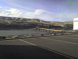
. In Biggs is an interchange with Interstate 84 and U.S. Route 30; immediately north of the interchange is the Biggs Rapids-Sam Hill Bridge
Sam Hill Memorial Bridge
The Sam Hill Memorial Bridge, also known as the Biggs Rapids Bridge, is a steel truss bridge that carries U.S. Highway 97 across the Columbia River between Biggs Junction, Oregon in Sherman County and Maryhill, Washington in Klickitat County...
over the Columbia River
Columbia River
The Columbia River is the largest river in the Pacific Northwest region of North America. The river rises in the Rocky Mountains of British Columbia, Canada, flows northwest and then south into the U.S. state of Washington, then turns west to form most of the border between Washington and the state...
. The river serves as the state line between Oregon and Washington.
Highways comprised
US 97 comprises the following highways (see Oregon highways and routes), from south to north:- Part of The Dalles-California Highway No. 4; and
- The Sherman Highway No. 42.
US 97 Business in Klamath Falls
Klamath Falls, Oregon
Klamath Falls is a city in Klamath County, Oregon, United States. Originally called Linkville when George Nurse founded the town in 1867, after the Link River on whose falls this city sat, although no falls currently exist; the name was changed to Klamath Falls in 1892...
, from south to north, comprises:
- Part of the Klamath Falls-Lakeview Highway No. 20 concurrent with Oregon Route 39;
- The Esplanade Spur, concurrent with Oregon Route 39; and
- Part of the Klamath Falls-Malin Highway No. 50.
US 97 Business in Bend
Bend, Oregon
Bend is a city in and the county seat of Deschutes County, Oregon, United States, and the principal city of the Bend, Oregon Metropolitan Statistical Area. Bend is Central Oregon's largest city, and, despite its modest size, is the de facto metropolis of the region, owing to the low population...
runs from its intersection with the main highway at East 1st Street north of Bend, south on East 1st Street, Deschutes Place, and Wall Street to Newport Avenue, concurrent with U.S. 20 Business, then continues south on a Wall Street-Bond Street couplet and east on Franklin Avenue until it rejoins the main highway at East 3rd Street.
Major intersections
- Note: Mileposts are measured from north to south. They do not reflect actual mileage due to realignments.
County Location Milepoint # Exit numberAn exit number is a number assigned to a road junction, usually an exit from a freeway. It is usually marked on the same sign as the destinations of the exit, as well as a sign in the gore....Destinations Notes Klamath Klamath County, Oregon-National protected areas:* Bear Valley National Wildlife Refuge* Crater Lake National Park * Deschutes National Forest * Fremont National Forest * Klamath Marsh National Wildlife Refuge* Lower Klamath National Wildlife Refuge...291.73 State line 282.87 Merrill Merrill, OregonMerrill is a city in Klamath County, Oregon, United States. The population was 897 at the 2000 census.Merrill is an agricultural area and home to an annual Potato Festival...
, MalinMalin, OregonMalin is a city in Klamath County, Oregon, United States. The population was 637 at the 2000 census.-History:According to Lewis A. McArthur, Malin was settled 30 September 1909 on land that was formerly at the bottom of Tule Lake by 65 Bohemian families who named the new town for their former home....Former Lower Klamath Highway 280.16 Miller Island Road (Midland Highway) Klamath Falls Klamath Falls, OregonKlamath Falls is a city in Klamath County, Oregon, United States. Originally called Linkville when George Nurse founded the town in 1867, after the Link River on whose falls this city sat, although no falls currently exist; the name was changed to Klamath Falls in 1892...277.47 South end of freeway 277.13 276.74 Green Springs Drive Northbound exit only 275.06 273.62 Oregon Avenue, Lakeshore Drive 272.79 , Reno, Oregon Institute of Technology Oregon Institute of TechnologyOregon Institute of Technology, also known as Oregon Tech or OIT, is an accredited university in the Oregon University System, and the only public institute of technology in the northwest United States. Located in Klamath Falls, Oregon, it provides undergraduate and graduate degrees in many...
, Winema National ForestWinema National ForestThe Winema National Forest is a United States National Forest in Klamath County on the eastern slopes of the Cascade Range in south-central Oregon, and covers . The forest borders Crater Lake National Park near the crest of the Cascades and stretches eastward into the Klamath Basin...
HeadquartersNo southbound entrance 272.56 North end of freeway Modoc Point Modoc Point, OregonModoc Point is an unincorporated community in Klamath County, Oregon, United States on U.S. Route 97 on the shore of Upper Klamath Lake.The post office takes its name from Modoc Point, a prominent point on Upper Klamath Lake just south of the community....257.83 Modoc Point Road Former Modoc Point Highway Lobert Junction 251.94 249.08 Chiloquin Chiloquin, OregonChiloquin is a city in Klamath County, Oregon, United States. Chiloquin was the pioneer version of a Klamath family name Chaloquin, which was the name of a Klamath chief who was alive at the time of the treaty of 1864...
, Sprague RiverSprague River, OregonSprague River is an unincorporated community in Klamath County, Oregon, United States. It is located about northeast of Klamath Falls near the Sprague River, northwest of Oregon Route 140.-History:...
(OR 422Oregon Route 422Oregon Route 422 is an Oregon state highway running from Modoc Point Road near Klamath Agency to US 97 near Chiloquin. OR 422 is known as the Chiloquin Highway No. 422...
)247.54 247 Interchange Mazama Junction 216.12 Sun Mountain Road Former OR 232 Diamond Lake Junction 213.09 195.15 Interchange Deschutes Deschutes County, Oregon-National protected areas:* Deschutes National Forest * Newberry National Volcanic Monument-Demographics:As of the census of 2000, there were 115,367 people, 45,595 households, and 31,962 families residing in the county. The population density was 38 people per square mile . There were 54,583...169.68 153.08 Century Drive Interchange 151.30 Cottonwood Road Interchange 143.45 Baker Road, Knott Road Interchange Bend Bend, OregonBend is a city in and the county seat of Deschutes County, Oregon, United States, and the principal city of the Bend, Oregon Metropolitan Statistical Area. Bend is Central Oregon's largest city, and, despite its modest size, is the de facto metropolis of the region, owing to the low population...141.01 139.68 South end of freeway 139.17 139 Reed Market Road – Old Mill District Old Mill DistrictThe Old Mill District is an area formerly occupied by two lumber mills in Bend, Oregon. Encompassing approximately 270 acres along the Deschutes River, the Old Mill District is now a mixed-use area known for its shops, galleries and restaurants. It draws thousands of visitors and employs more than...138.75 Truman Avenue Southbound exit and entrance; access to Wilson Avenue (former Century Drive Highway) 138.24 138 Downtown Bend, Mount Bachelor Mount BachelorMount Bachelor, formerly named Bachelor Butte, is a stratovolcano atop a shield volcano in the Cascade Volcanic Arc and the Cascade Range of central Oregon.The Mount Bachelor ski area has operated on the mountain since 1958....137.80 Hawthorne Avenue Southbound exit and entrance 137.53 Lafayette Avenue – State/County Offices Southbound exit and entrance 137.13 137 Revere Avenue – Downtown Bend 136.31 136 Butler Market Road No northbound exit 135.46 135B Empire Boulevard – State Offices No southbound exit 134.97 135A Southbound exit and northbound entrance 134.97 135A Northbound exit and southbound entrance 134.75 North end of freeway Deschutes Junction 130.35 Deschutes Market Road, Tumalo Road Interchange Redmond Redmond, OregonRedmond is a city in Deschutes County, Oregon, United States. Incorporated on July 6, 1910, the city is located on the eastern side of Oregon's Cascade Range, in the High Desert, and is considered the geographical heart of Central Oregon...123.60 124 Airport Way, Yew Avenue – Redmond Airport Interchange 121.50 , John Day John Day, OregonJohn Day is a city located about north of Canyon City in Grant County, Oregon, at the intersection of U.S. Routes 26 and 395. The city was named for the nearby John Day River, which had been named for a Virginian member of the 1811 Astor Expedition, John Day...118.52 O'Neil, Lone Pine (OR 370 Oregon Route 370Oregon Route 370 is an Oregon state highway running from US 97 near Redmond to OR 126 in Prineville. OR 370 is known as the O'Neil Highway No. 370...
)Jefferson Jefferson County, OregonJefferson County is a county located in the U.S. state of Oregon. In 2010, its population was 21,720. It is named after Mount Jefferson. The seat of the county is Madras.-History:...105.73 Culver Culver, OregonCulver is a city in Jefferson County, Oregon, United States. The population was 802 at the 2000 census, with an estimated population of 1,315 in 2007.- History :...
, Round Butte DamRound Butte DamRound Butte Dam is a rockfill-type hydroelectric dam on the Deschutes River, in the U.S. state of Oregon. It is located in Jefferson County. Its reservoir is called Lake Billy Chinook.-References:...
(OR 361Oregon Route 361Oregon Route 361 is an Oregon state highway running from US 26 and US 97 in Madras to US 97 near Culver. OR 361 is known as the Culver Highway No. 361...
north)97.29 South end of US 26 overlap Madras Madras, OregonMadras is a city in Jefferson County, Oregon, United States. Originally called The Basin after the circular valley the city is located in, it is unclear as to whether Madras was named in 1903 for the cotton fabric called "Madras" that originated in the Madras area in India, or from the city of...92.46 D Street (OR 361 Oregon Route 361Oregon Route 361 is an Oregon state highway running from US 26 and US 97 in Madras to US 97 near Culver. OR 361 is known as the Culver Highway No. 361...
south) – MetoliusMetolius, OregonMetolius is a city in Jefferson County, Oregon, United States. The city is named for the Metolius River, a nearby tributary of the Deschutes River. The name for both comes from the Warm Springs word for "white fish", referring to a light colored salmon and not a whitefish...
, The Cove Palisades State ParkThe Cove Palisades State ParkThe Cove Palisades State Park is a state park in eastern Jefferson County, Oregon, near Culver and Madras in the central part of the state, and is administered by the Oregon Parks and Recreation Department...92.08 North end of US 26 overlap Wasco Wasco County, OregonWasco County is a county located in the U.S. state of Oregon. The county is named for a local tribe of Native Americans, the Wasco, a Chinook tribe who lived on the south side of the Columbia River. In 2010, its population was 25,213...74.83 Antelope Antelope, OregonAntelope is a city in Wasco County, Oregon, United States. As of the 2010 Census, the population was 46.-History:The Antelope Valley was probably named by members of Joseph Sherar's party who were packing supplies to mines in the John Day area. Sherar became known as the operator of a toll bridge...
, John Day Fossil Beds, FossilFossil, OregonFossil is a city in and the county seat of Wheeler County, Oregon, United States. The name was chosen by the first postmaster, Thomas B. Hoover, who had found some fossil remains on his ranch. The population was 473 at the 2010 census.- History :...
(OR 293)Shaniko Junction Shaniko Junction, OregonShaniko Junction is a highway junction and unincorporated locale in Wasco County, Oregon, United States. It is located at the intersection of U.S. Route 97 and U.S. Route 197, about 12 miles southwest of Shaniko.-References:...67.17
68.66Shaniko Shaniko, OregonShaniko is a city located in Wasco County, Oregon, United States, on U.S. Route 97 and about eight miles north of Antelope. As of the 2000 census, the city had a population of 26—a virtual ghost town whose preservation is being spearheaded by investments from Robert B...56.53 Sherman Sherman County, OregonSherman County is a county located in the U.S. state of Oregon. The county is named for William Tecumseh Sherman, a Union general in the American Civil War. In 2010, its population was 1,765. The seat of the county is Moro. The largest city is Wasco....Grass Valley Grass Valley, OregonGrass Valley is a city in Sherman County, Oregon, United States. The population was 171 at the 2000 census.-Geography:According to the United States Census Bureau, the city has a total area of , all land.-Demographics:...28.36 Krusow Street (OR 216 Oregon Route 216Oregon Route 216 is an Oregon state highway running from U.S. Route 26 at Warm Springs Junction to U.S. Route 97 in Grass Valley. OR 216 is long and runs east–west.- Route description :...
) – Sherars Bridge, Tygh ValleyTygh Valley, Oregon* Annual Average High Temperatures: 86 °F 41 °F * Annual Average Low Temperatures 50 °F 26 °F * Highest Recorded Temperature: 110 °F * Lowest Recorded Temperature: -28 °F...10.34 Old Sherman Highway – Wasco Wasco, OregonWasco is a city in Sherman County, Oregon, United States. The population was 381 at the 2000 census.-Geography:According to the United States Census Bureau, the city has a total area of , all land.-Demographics:...Former US 97 north 8.82 , Fulton Canyon Interchange 7.50 Wasco Wasco, OregonWasco is a city in Sherman County, Oregon, United States. The population was 381 at the 2000 census.-Geography:According to the United States Census Bureau, the city has a total area of , all land.-Demographics:...
(Wasco-Heppner Highway)Former US 97 south Biggs 0.03 Deschutes State Park (Celilo-Wasco Highway) Biggs Junction Biggs Junction, OregonBiggs Junction is an unincorporated community in Sherman County, Oregon, United States. For statistical purposes, the United States Census Bureau has defined Biggs Junction as a census-designated place...-0.13 -0.43 Sam Hill Memorial Bridge Sam Hill Memorial BridgeThe Sam Hill Memorial Bridge, also known as the Biggs Rapids Bridge, is a steel truss bridge that carries U.S. Highway 97 across the Columbia River between Biggs Junction, Oregon in Sherman County and Maryhill, Washington in Klickitat County...
over the Columbia RiverColumbia RiverThe Columbia River is the largest river in the Pacific Northwest region of North America. The river rises in the Rocky Mountains of British Columbia, Canada, flows northwest and then south into the U.S. state of Washington, then turns west to form most of the border between Washington and the state...
(state line)