

U.S. Route 2 in Vermont
Encyclopedia
U.S. Route 2 is a part of the U.S. Highway System that is split into two segments. Its eastern segment runs from Rouses Point, New York
, to Houlton, Maine
. In Vermont
, US 2 extends 151.604 miles (243.982 km) from the New York
state line in Alburgh to the New Hampshire
state line in Guildhall
. West of Vermont, US 2 continues into New York for another 0.88 miles (1.42 km) to an intersection with U.S. Route 11 in Rouses Point. US 2 passes through the through the cities of Burlington
and Montpelier
as it traverses the state. The Burlington to Montpelier route was first laid out as a toll road in the early 19th century. It was later incorporated into the transcontinental auto trail
known as the Theodore Roosevelt International Highway
in 1919 before being designated as part of U.S. Route 2 in 1926.
Although the portion of the road from Alburgh to Burlington follows a north-south alignment, U.S. 2 is signed east (heading south during this portion) and west (heading north), making it the longest east-west signed route in the state.
The eastern segment of U.S. Route 2 begins in New York
at an intersection with U.S. Route 11 just one mile (1.6 km) south of the Canadian border in Rouses Point
. From there, it crosses the Richelieu River
into Grand Isle County, Vermont
, traversing the length of the county and crossing Lake Champlain
over several bridges until it reaches the mainland in Milton
and Chittenden County
. From there it travels south to Burlington
, where it begins to closely parallel Interstate 89 and the Winooski River
all the way to Montpelier
and Washington County
. In Montpelier, the main route bypasses the downtown area using Memorial Drive, while a business loop using State Street serves downtown. After leaving Montpelier, the road turns north-eastward, crossing into Caledonia County
and passing through Saint Johnsbury. It then passes into rural Essex County
, and eventually crosses the Connecticut River
from Guildhall, Vermont
into Lancaster, New Hampshire
.
and Montpelier
was first established from old footpaths in 1805, when the 36 miles (58 km) Winooski Turnpike was chartered by the state of Vermont. The old turnpike road utilized the relatively flat banks of the Winooski River
to connect the two major towns and opened to traffic several years after the company was chartered. The road ceased operating as a toll road several decades later in 1852, when the road became publicly-owned. The route of the old Winooski Turnpike between Burlington and Montpelier was later incorporated into the old Theodore Roosevelt International Highway
. This cross-country auto trail
, named in honor of recently-deceased ex-president and naturalist
Theodore Roosevelt
, was organized in February 1919 to connect Portland, Maine
with Portland, Oregon
. Within Vermont, the auto trail used what is now US 2 from Vermont Route 129 south of Alburgh center to Vermont Route 18 east of St. Johnsbury center.
Before being designated as US 2, the current alignment was part of several inter-state routes of the 1922 New England road marking system. From Danville
eastward to the state line, the US 2 alignment was part of Route 15; it was part of Route 18 between Montpelier
and Danville; it used Route 14 between Burlington
and Montpelier; and it used Route 30 between Alburgh
and Burlington. When the plans for the U.S. Highway System were first drawn up in 1925, US 2 began in Alburgh and was routed along the Roosevelt Highway from Alburgh to Montpelier. Both US 2 and the Roosevelt Highway connected Montpelier to St. Johnsbury; however, the Roosevelt Highway used a direct path along former Route 18 while US 2 was initially assigned to then-Route 25
(modern US 302) to Wells River
, where it overlapped proposed US 5 north to St. Johnsbury. From St. Johnsbury, the Roosevelt Highway turned southeast towards Portland
along modern Vermont Route 18 while US 2 continued east along former Route 15 to Bangor
. No changes were made to US 2 in the final system plan approved on November 11, 1926. US 2 was relocated onto its modern alignment along the original Roosevelt Highway route between Montpelier and St. Johnsbury in the mid-1930s. The original alignment of US 2 became part of the newly-designated US 302.
Initially, Rouses Point, New York
, and Alburgh, Vermont, were connected by way of a ferry across the Richelieu River
. The ferry ran from the center of Rouses Point to Vermont's Windmill Point, where it connected to VT F-1, an east–west route linking Windmill Point to Alburgh. When US 2 was assigned, it was overlaid on the pre-existing VT F-1, following the route and the ferry to the New York
state line, where US 2 initially ended. In 1937, a new tolled swing bridge
across the Richelieu River opened, carrying an extended US 2 between U.S. Route 11 in Rouses Point and Alburgh. The swing bridge was replaced with a toll-free permanent bridge on September 22, 1987.
Major intersections of VT 2A
|Town of Champlain
|rowspan=2|0.88
0.000
|rowspan=2 colspan=4 align="center"|New York – Vermont state line
|-
|rowspan=6|Grand Isle
|rowspan=4|Alburgh
Rouses Point, New York
Rouses Point is a village in Clinton County, New York, United States, along the 45th parallel. The population was 2,209 at the 2010 census. The village is named after Jacques Rouse, an early settler....
, to Houlton, Maine
Houlton, Maine
Houlton is a town in Aroostook County, Maine, on the United States – Canada border, located at . As of the 2010 census, the town population was 6,123. It is perhaps best known as being at the northern terminus of Interstate 95 and for being the birthplace of Samantha Smith...
. In Vermont
Vermont
Vermont is a state in the New England region of the northeastern United States of America. The state ranks 43rd in land area, , and 45th in total area. Its population according to the 2010 census, 630,337, is the second smallest in the country, larger only than Wyoming. It is the only New England...
, US 2 extends 151.604 miles (243.982 km) from the New York
New York
New York is a state in the Northeastern region of the United States. It is the nation's third most populous state. New York is bordered by New Jersey and Pennsylvania to the south, and by Connecticut, Massachusetts and Vermont to the east...
state line in Alburgh to the New Hampshire
New Hampshire
New Hampshire is a state in the New England region of the northeastern United States of America. The state was named after the southern English county of Hampshire. It is bordered by Massachusetts to the south, Vermont to the west, Maine and the Atlantic Ocean to the east, and the Canadian...
state line in Guildhall
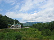
Guildhall, Vermont
-External links:* http://www.flickr.com/photos/dougtone/sets/72157624844998996/with/4943890976/...
. West of Vermont, US 2 continues into New York for another 0.88 miles (1.42 km) to an intersection with U.S. Route 11 in Rouses Point. US 2 passes through the through the cities of Burlington
Burlington, Vermont
Burlington is the largest city in the U.S. state of Vermont and the shire town of Chittenden County. Burlington lies south of the U.S.-Canadian border and some south of Montreal....
and Montpelier
Montpelier, Vermont
Montpelier is a city in the U.S. state of Vermont that serves as the state capital and the shire town of Washington County. As the capital of Vermont, Montpelier is the site of the Vermont State House, seat of the legislative branch of Vermont government. The population was 7,855 at the 2010...
as it traverses the state. The Burlington to Montpelier route was first laid out as a toll road in the early 19th century. It was later incorporated into the transcontinental auto trail
Auto trail
The system of auto trails was an informal network of marked routes that existed in the United States and Canada in the early part of the 20th century. Marked with colored bands on telephone poles, the trails were intended to help travellers in the early days of the automobile.Auto trails were...
known as the Theodore Roosevelt International Highway
Theodore Roosevelt International Highway
The Theodore Roosevelt International Highway was a transcontinental North American highway through the United States and Canada that ran from Portland, Maine, to Portland, Oregon. Its length was about .-Route description:...
in 1919 before being designated as part of U.S. Route 2 in 1926.
Although the portion of the road from Alburgh to Burlington follows a north-south alignment, U.S. 2 is signed east (heading south during this portion) and west (heading north), making it the longest east-west signed route in the state.
Route description
The eastern segment of U.S. Route 2 begins in New York
New York
New York is a state in the Northeastern region of the United States. It is the nation's third most populous state. New York is bordered by New Jersey and Pennsylvania to the south, and by Connecticut, Massachusetts and Vermont to the east...
at an intersection with U.S. Route 11 just one mile (1.6 km) south of the Canadian border in Rouses Point
Rouses Point, New York
Rouses Point is a village in Clinton County, New York, United States, along the 45th parallel. The population was 2,209 at the 2010 census. The village is named after Jacques Rouse, an early settler....
. From there, it crosses the Richelieu River
Richelieu River
The Richelieu River is a river in Quebec, Canada. It flows from the north end of Lake Champlain about north, ending at the confluence with the St. Lawrence River at Sorel-Tracy, Quebec downstream and northeast of Montreal...
into Grand Isle County, Vermont
Grand Isle County, Vermont
Grand Isle County is a county located in the U.S. state of Vermont. As of 2010, the population was 6,970. Its shire town is North Hero.Grand Isle County is part of the Burlington-South Burlington, VT Metropolitan Statistical Area.-Geography:...
, traversing the length of the county and crossing Lake Champlain
Lake Champlain
Lake Champlain is a natural, freshwater lake in North America, located mainly within the borders of the United States but partially situated across the Canada—United States border in the Canadian province of Quebec.The New York portion of the Champlain Valley includes the eastern portions of...
over several bridges until it reaches the mainland in Milton
Milton, Vermont
Milton is a town in Chittenden County, Vermont, United States. The population was 10,352 at the 2010 census. According to local legend, the town was named for the English poet John Milton, but the name most likely originated from William FitzWilliam, 4th Earl FitzWilliam, who held the title...
and Chittenden County
Chittenden County, Vermont
Chittenden County is a county located in the U.S. state of Vermont. As of 2010, the population was 156,545. Its shire town is Burlington. Chittenden is the most populous county in the state, with more than twice as many residents as Vermont's second-most populous county, Rutland.Chittenden County...
. From there it travels south to Burlington
Burlington, Vermont
Burlington is the largest city in the U.S. state of Vermont and the shire town of Chittenden County. Burlington lies south of the U.S.-Canadian border and some south of Montreal....
, where it begins to closely parallel Interstate 89 and the Winooski River
Winooski River
The Winooski River is a tributary of Lake Champlain, approximately long, in northern Vermont in the United States. Although not Vermont's longest river, it is one of the state's most significant, forming a major valley way from Lake Champlain through the Green Mountains towards the Connecticut...
all the way to Montpelier
Montpelier, Vermont
Montpelier is a city in the U.S. state of Vermont that serves as the state capital and the shire town of Washington County. As the capital of Vermont, Montpelier is the site of the Vermont State House, seat of the legislative branch of Vermont government. The population was 7,855 at the 2010...
and Washington County
Washington County, Vermont
Washington County is a county located in the U.S. state of Vermont. As of 2010, the population was 59,534; Vermont's third-most populous county after Chittenden County and Rutland County. Its shire town is Montpelier, the state capital. The center of population of Vermont is located in Washington...
. In Montpelier, the main route bypasses the downtown area using Memorial Drive, while a business loop using State Street serves downtown. After leaving Montpelier, the road turns north-eastward, crossing into Caledonia County
Caledonia County, Vermont
Caledonia County is a county located in the U.S. state of Vermont. As of 2010, the population was 31,227. Its shire town is St. Johnsbury.The county was given the Latin name for Scotland, in honor of the many settlers who claimed ancestry there....
and passing through Saint Johnsbury. It then passes into rural Essex County
Essex County, Vermont
Essex County is the county located in the northeastern part of the U.S. state of Vermont. As of 2010, the population was 6,306, making it the least-populous county in both Vermont and New England...
, and eventually crosses the Connecticut River
Connecticut River
The Connecticut River is the largest and longest river in New England, and also an American Heritage River. It flows roughly south, starting from the Fourth Connecticut Lake in New Hampshire. After flowing through the remaining Connecticut Lakes and Lake Francis, it defines the border between the...
from Guildhall, Vermont
Guildhall, Vermont
-External links:* http://www.flickr.com/photos/dougtone/sets/72157624844998996/with/4943890976/...
into Lancaster, New Hampshire
Lancaster, New Hampshire
Lancaster is a town in Coos County, New Hampshire, USA, on the Connecticut River named after Lancaster, England. As of the 2010 census, the town population was 3,507, the second largest in the county after Berlin. It is the county seat of Coos County and gateway to the Great North Woods Region...
.
History
An improved road between the main settlements of BurlingtonBurlington, Vermont
Burlington is the largest city in the U.S. state of Vermont and the shire town of Chittenden County. Burlington lies south of the U.S.-Canadian border and some south of Montreal....
and Montpelier
Montpelier, Vermont
Montpelier is a city in the U.S. state of Vermont that serves as the state capital and the shire town of Washington County. As the capital of Vermont, Montpelier is the site of the Vermont State House, seat of the legislative branch of Vermont government. The population was 7,855 at the 2010...
was first established from old footpaths in 1805, when the 36 miles (58 km) Winooski Turnpike was chartered by the state of Vermont. The old turnpike road utilized the relatively flat banks of the Winooski River
Winooski River
The Winooski River is a tributary of Lake Champlain, approximately long, in northern Vermont in the United States. Although not Vermont's longest river, it is one of the state's most significant, forming a major valley way from Lake Champlain through the Green Mountains towards the Connecticut...
to connect the two major towns and opened to traffic several years after the company was chartered. The road ceased operating as a toll road several decades later in 1852, when the road became publicly-owned. The route of the old Winooski Turnpike between Burlington and Montpelier was later incorporated into the old Theodore Roosevelt International Highway
Theodore Roosevelt International Highway
The Theodore Roosevelt International Highway was a transcontinental North American highway through the United States and Canada that ran from Portland, Maine, to Portland, Oregon. Its length was about .-Route description:...
. This cross-country auto trail
Auto trail
The system of auto trails was an informal network of marked routes that existed in the United States and Canada in the early part of the 20th century. Marked with colored bands on telephone poles, the trails were intended to help travellers in the early days of the automobile.Auto trails were...
, named in honor of recently-deceased ex-president and naturalist
Naturalist
Naturalist may refer to:* Practitioner of natural history* Conservationist* Advocate of naturalism * Naturalist , autobiography-See also:* The American Naturalist, periodical* Naturalism...
Theodore Roosevelt
Theodore Roosevelt
Theodore "Teddy" Roosevelt was the 26th President of the United States . He is noted for his exuberant personality, range of interests and achievements, and his leadership of the Progressive Movement, as well as his "cowboy" persona and robust masculinity...
, was organized in February 1919 to connect Portland, Maine
Portland, Maine
Portland is the largest city in Maine and is the county seat of Cumberland County. The 2010 city population was 66,194, growing 3 percent since the census of 2000...
with Portland, Oregon
Portland, Oregon
Portland is a city located in the Pacific Northwest, near the confluence of the Willamette and Columbia rivers in the U.S. state of Oregon. As of the 2010 Census, it had a population of 583,776, making it the 29th most populous city in the United States...
. Within Vermont, the auto trail used what is now US 2 from Vermont Route 129 south of Alburgh center to Vermont Route 18 east of St. Johnsbury center.
Before being designated as US 2, the current alignment was part of several inter-state routes of the 1922 New England road marking system. From Danville
Danville, Vermont
Danville is a town in Caledonia County, Vermont, United States. It was named for the 18th-century French cartographer Jean-Baptiste Bourguignon d'Anville...
eastward to the state line, the US 2 alignment was part of Route 15; it was part of Route 18 between Montpelier
Montpelier, Vermont
Montpelier is a city in the U.S. state of Vermont that serves as the state capital and the shire town of Washington County. As the capital of Vermont, Montpelier is the site of the Vermont State House, seat of the legislative branch of Vermont government. The population was 7,855 at the 2010...
and Danville; it used Route 14 between Burlington
Burlington, Vermont
Burlington is the largest city in the U.S. state of Vermont and the shire town of Chittenden County. Burlington lies south of the U.S.-Canadian border and some south of Montreal....
and Montpelier; and it used Route 30 between Alburgh
Alburgh (town), Vermont
Alburgh is a town in Grand Isle County, Vermont, United States, founded in 1781 by Ira Allen. The population was 1,952 at the 2000 census...
and Burlington. When the plans for the U.S. Highway System were first drawn up in 1925, US 2 began in Alburgh and was routed along the Roosevelt Highway from Alburgh to Montpelier. Both US 2 and the Roosevelt Highway connected Montpelier to St. Johnsbury; however, the Roosevelt Highway used a direct path along former Route 18 while US 2 was initially assigned to then-Route 25
Route 25 (New England)
New England Interstate Route 25 was a New England Interstate Route from Montpelier, Vermont through Plymouth, New Hampshire to Portland, Maine. The alignment is mostly intact in New Hampshire and Maine as same numbered state highways. In Vermont, the original NE-25 ran along current U.S. Route 302...
(modern US 302) to Wells River
Wells River, Vermont
Wells River is a village in the town of Newbury in Orange County, Vermont, United States. The population was 325 at the 2000 census. The village center is located at the junction of U.S...
, where it overlapped proposed US 5 north to St. Johnsbury. From St. Johnsbury, the Roosevelt Highway turned southeast towards Portland
Portland, Maine
Portland is the largest city in Maine and is the county seat of Cumberland County. The 2010 city population was 66,194, growing 3 percent since the census of 2000...
along modern Vermont Route 18 while US 2 continued east along former Route 15 to Bangor
Bangor, Maine
Bangor is a city in and the county seat of Penobscot County, Maine, United States, and the major commercial and cultural center for eastern and northern Maine...
. No changes were made to US 2 in the final system plan approved on November 11, 1926. US 2 was relocated onto its modern alignment along the original Roosevelt Highway route between Montpelier and St. Johnsbury in the mid-1930s. The original alignment of US 2 became part of the newly-designated US 302.
Initially, Rouses Point, New York
Rouses Point, New York
Rouses Point is a village in Clinton County, New York, United States, along the 45th parallel. The population was 2,209 at the 2010 census. The village is named after Jacques Rouse, an early settler....
, and Alburgh, Vermont, were connected by way of a ferry across the Richelieu River
Richelieu River
The Richelieu River is a river in Quebec, Canada. It flows from the north end of Lake Champlain about north, ending at the confluence with the St. Lawrence River at Sorel-Tracy, Quebec downstream and northeast of Montreal...
. The ferry ran from the center of Rouses Point to Vermont's Windmill Point, where it connected to VT F-1, an east–west route linking Windmill Point to Alburgh. When US 2 was assigned, it was overlaid on the pre-existing VT F-1, following the route and the ferry to the New York
New York
New York is a state in the Northeastern region of the United States. It is the nation's third most populous state. New York is bordered by New Jersey and Pennsylvania to the south, and by Connecticut, Massachusetts and Vermont to the east...
state line, where US 2 initially ended. In 1937, a new tolled swing bridge
Swing bridge
A swing bridge is a movable bridge that has as its primary structural support a vertical locating pin and support ring, usually at or near to its centre of gravity, about which the turning span can then pivot horizontally as shown in the animated illustration to the right...
across the Richelieu River opened, carrying an extended US 2 between U.S. Route 11 in Rouses Point and Alburgh. The swing bridge was replaced with a toll-free permanent bridge on September 22, 1987.
Suffixed routes
US 2 has two suffixed routes in the state of Vermont.- VT 2A (13.853 miles or 22.294 km) is a largely alternate routeAlternate routeAn official alternate route is a special route in the United States that provides an alternate alignment for a highway. They are loop roads and found in many road systems in the United States including the U.S. Route system and various state route systems...
of US 2 between St. GeorgeSt. George, VermontSt. George is a town in Chittenden County, Vermont, United States. The town was named for the patron saint of England. St. George has the smallest land area of any town in Vermont, though the incorporated cities of Vergennes and Winooski are smaller...
and ColchesterColchester, VermontColchester is a town in Chittenden County, Vermont, United States. The population was 17,067 at the 2010 census. It is the fourth-largest municipality and second-largest town in Vermont by population.-Geography:...
. It begins at VT 116Vermont Route 116Vermont Route 116 is a state highway in Vermont. It travels north from U.S. Route 7 in Middlebury, where it almost immediately intersects Vermont Route 125, then runs concurrently with Vermont Route 17 through much of the town of Bristol...
in St. George and continues north and west through WillistonWilliston, VermontWilliston is a town in Chittenden County, Vermont, United States. The population was 8,698 at the 2010 census, an increase of over 1,000 people since the 2000 census...
and Essex JunctionEssex Junction, VermontEssex Junction is a village in the town of Essex in Chittenden County, Vermont, United States. The population was 8,591 at the 2000 census. It was incorporated on November 15, 1892....
before ending at US 2 and US 7U.S. Route 7 in VermontU.S. Route 7 is a mostly rural two-lane road running along the western side of the state, with a few, short expressway sections. It is known as the Ethan Allen Highway for much of its path through the state. US 7 ends at I-89 in the northern part of the town of Highgate, just south of the Canadian...
in Colchester. Much of the portion of VT 2A that runs through Williston has been expanded from two lanes to four, particularly the stretch between US 2 and Interstate 89, to accommodate the many restaurants, offices, and stores that have been developed there. - VT 2B (3.459 miles or 5.567 km) is an east–west alternate routeAlternate routeAn official alternate route is a special route in the United States that provides an alternate alignment for a highway. They are loop roads and found in many road systems in the United States including the U.S. Route system and various state route systems...
of US 2 between DanvilleDanville, VermontDanville is a town in Caledonia County, Vermont, United States. It was named for the 18th-century French cartographer Jean-Baptiste Bourguignon d'Anville...
and St. JohnsburySt. Johnsbury, VermontSt. Johnsbury is the shire town of Caledonia County, Vermont, United States. The population was 7,571 at the 2000 census. St. Johnsbury is located approximately northwest of the Connecticut River and south of the Canadian border.St...
in Caledonia CountyCaledonia County, VermontCaledonia County is a county located in the U.S. state of Vermont. As of 2010, the population was 31,227. Its shire town is St. Johnsbury.The county was given the Latin name for Scotland, in honor of the many settlers who claimed ancestry there....
. It leaves US 2 midway between Danville and St. Johnsbury and rejoins its parent in St. Johnsbury. VT 2B is named Parker Road for its entire length.
Major intersections of VT 2A
Major intersections
The short continuation of US 2 into New York is included below.|Town of Champlain
Champlain (town), New York
Champlain is a town in Clinton County, New York, United States. The population was 5,754 at the 2010 census. The town is named after Lake Champlain....
|rowspan=2|0.88
0.000
|rowspan=2 colspan=4 align="center"|New York – Vermont state line
|-
|rowspan=6|Grand Isle
Grand Isle County, Vermont
Grand Isle County is a county located in the U.S. state of Vermont. As of 2010, the population was 6,970. Its shire town is North Hero.Grand Isle County is part of the Burlington-South Burlington, VT Metropolitan Statistical Area.-Geography:...
|rowspan=4|Alburgh
See also
- U.S. Route 2 Business (Montpelier, Vermont)
- U.S. Route 2 Truck (St. Johnsbury, Vermont)