

U.S. Route 270
Encyclopedia
U.S. Route 270 is a spur of U.S. Route 70
. It currently runs for 643 miles (1,035 km) from Liberal, Kansas
at U.S. Route 54
to White Hall, Arkansas
at Interstate 530
and U.S. Route 65
. It passes through the states of Arkansas
, Oklahoma
, and Kansas
. It goes through the cities of Oklahoma City, Oklahoma
, Hot Springs, Arkansas
, and McAlester, Oklahoma
.
, at an intersection with US 83 (running north–south through the intersection) and US 54. US 270 follows the south leg of this intersection, following US 83 south. US 270 only spends 3 miles (4.8 km) in Kansas before crossing into Oklahoma. Seward County
is the only county that US-270 serves.
 US 270 enters Oklahoma in Beaver County
, the eastern third of the Oklahoma Panhandle
. From here it continues east along US 64, then south towards Beaver
, the county seat, along SH-23. South of Beaver, the road joins with US 412 (OK) and SH-3, the latter of which US 270 will overlap with through most of northwest Oklahoma. After leaving the Panhandle and picking up US 183 near Fort Supply
, the highways turn southwest towards Woodward
. US 412 splits away in Woodward. US 270, concurrent with US 183 and SH-3, proceed southeast toward Seiling
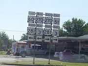
. West of Seiling, US 183 splits off to the south, but in Seiling, it is replaced by US 281. The routes continue southwest to Watonga
, where US 270/281 turn south along SH-8, while SH-3 continues due east to concur with SH-33. In Geary
, US 270 splits off on an independent alignment, looping through Calumet
before joining with Interstate 40
.
US 270 remains concurrent with I-40 from Exit 115 through Exit 181, a distance of 66 miles (106.2 km). US 270, attached to I-40, runs through the core of the Oklahoma City Metro area, passing through the western suburbs of El Reno
and Yukon
into Oklahoma City proper. The partnership runs just south of Downtown
and the Bricktown
entertainment district on the Crosstown Expressway
. Major interchanges with I-44 and I-35 (the latter involving a concurrency with the interstate and its accompanying US Highway, US 62) are found in the city. I-40/US 270 also serve two eastern suburbs of Oklahoma City, Del City
and Midwest City
and form the northern boundary between Midwest City's civilian areas and Tinker Air Force Base
. US-270 finally exits from I-40 on the west side of Shawnee
.
US 270 serves most of the towns anchoring the area east of Oklahoma City, including Shawnee, Tecumseh
, Seminole
, Wewoka
, and Holdenville
. It continues southeast to the city of McAlester
, a major southeastern Oklahoma city. It also serves many of the small towns east of McAlester, such as Krebs
, Alderson
, Bache, Haileyville
, and Hartshorne
.
After passing through Hartshorne, the roads curves to the northeast before turning onto a due east course taking it through Wilburton
, Red Oak
, and Wister
. In Wister, it turns south, running across Wister Lake's dam, and proceeding southeast to Heavener
. There, it meets US 59, which it will follow for the rest of its time in Oklahoma. The town highways head south from Heavener, passing through the Wister Wildlife Management Area before entering the Ouachita National Forest
. The route serves as the northern terminus of US 259 near Page
. The road then squeezes into a valley between Black Fork Mountain and Rich Mountain. In this valley, it crosses the state line into Arkansas.
, and runs east to Acorn
, where it meets US 71
. The route then travels 15 miles north on US 71 to Y City
where it splits off and continues east. The route then meets AR 88 in Pencil Bluff
and AR 27 in Mt. Ida
before heading to Hot Springs
. Entering the city, US 270 meets US 70
southwest of town and runs concurrent
with it through downtown Hot Springs. After leaving Hot Springs, US 270 enters Malvern briefly with I-30
and runs downtown with US 67
. US 270 meets AR 229 in Poyen
and AR 190
/AR 291
in Prattsville
before crossing paths with US 167
in Sheridan
. The route trails east towards Pine Bluff
to AR 365S/US 65
/I-530
near White Hall
, where the route terminates.
.
in Garland County, Arkansas. Posted as US 270B, it runs through downtown Hot Springs, Arkansas
.
U.S. Route 70
U.S. Route 70 is an east–west United States highway that runs for 2,385 miles from eastern North Carolina to east-central Arizona. As can be derived from its number, it is a major east–west highway of the Southern and Southwestern United States...
. It currently runs for 643 miles (1,035 km) from Liberal, Kansas
Liberal, Kansas
Liberal is the county seat of Seward County, Kansas, United States. As of the 2010 census, the city population was 20,525.- History :S.S. Rogers built the first house in what would become Liberal in 1872. Rogers became famous in the region for giving water to weary travelers...
at U.S. Route 54
U.S. Route 54
U.S. Route 54 is an east–west United States highway that runs northeast-southwest for 1,197 miles from western Illinois to El Paso, Texas. It enters and leaves Texas twice...
to White Hall, Arkansas
White Hall, Arkansas
White Hall is a city in Jefferson County, Arkansas, United States, with a population of 4,732 in the 2000 U.S. census. It is included in the Pine Bluff, Arkansas Metropolitan Statistical Area and like Pine Bluff, adjoins the Pine Bluff Arsenal...
at Interstate 530
Interstate 530
Interstate 530 in Arkansas is a spur route of the Interstate highway system, traveling from Little Rock at the junction of Interstate 30 and Interstate 440 in the northwest, to Pine Bluff in the southeast.-Route description:...
and U.S. Route 65
U.S. Route 65
U.S. Route 65 is a north–south United States highway in the southern and midwestern United States. The southern terminus of the route is at U.S. Route 425 in Clayton, Louisiana. The northern terminus is at Interstate 35 just south of Interstate 90 in Albert Lea, Minnesota...
. It passes through the states of Arkansas
Arkansas
Arkansas is a state located in the southern region of the United States. Its name is an Algonquian name of the Quapaw Indians. Arkansas shares borders with six states , and its eastern border is largely defined by the Mississippi River...
, Oklahoma
Oklahoma
Oklahoma is a state located in the South Central region of the United States of America. With an estimated 3,751,351 residents as of the 2010 census and a land area of 68,667 square miles , Oklahoma is the 28th most populous and 20th-largest state...
, and Kansas
Kansas
Kansas is a US state located in the Midwestern United States. It is named after the Kansas River which flows through it, which in turn was named after the Kansa Native American tribe, which inhabited the area. The tribe's name is often said to mean "people of the wind" or "people of the south...
. It goes through the cities of Oklahoma City, Oklahoma
Oklahoma City, Oklahoma
Oklahoma City is the capital and the largest city in the state of Oklahoma. The county seat of Oklahoma County, the city ranks 31st among United States cities in population. The city's population, from the 2010 census, was 579,999, with a metro-area population of 1,252,987 . In 2010, the Oklahoma...
, Hot Springs, Arkansas
Hot Springs, Arkansas
Hot Springs is the 10th most populous city in the U.S. state of Arkansas, the county seat of Garland County, and the principal city of the Hot Springs Metropolitan Statistical Area encompassing all of Garland County...
, and McAlester, Oklahoma
McAlester, Oklahoma
McAlester is a city in Pittsburg County, Oklahoma, United States. The population was 17,783 at the 2000 census. It is the county seat of Pittsburg County. It is currently the largest city in the Choctaw Nation of Oklahoma, followed by Durant....
.
Kansas
US 270 begins in the southeast part of Liberal, KansasLiberal, Kansas
Liberal is the county seat of Seward County, Kansas, United States. As of the 2010 census, the city population was 20,525.- History :S.S. Rogers built the first house in what would become Liberal in 1872. Rogers became famous in the region for giving water to weary travelers...
, at an intersection with US 83 (running north–south through the intersection) and US 54. US 270 follows the south leg of this intersection, following US 83 south. US 270 only spends 3 miles (4.8 km) in Kansas before crossing into Oklahoma. Seward County
Seward County, Kansas
Seward County is a county of the U.S. state of Kansas. As of the 2010 census, the county population was 22,952. The largest city and county seat is Liberal...
is the only county that US-270 serves.
Oklahoma
Beaver County, Oklahoma
Beaver County is a county located in the U.S. state of Oklahoma. As of the 2010 census, the population was 5,636. The county seat is Beaver....
, the eastern third of the Oklahoma Panhandle
Oklahoma Panhandle
The Oklahoma Panhandle is the extreme western region of the state of Oklahoma, comprising Cimarron County, Texas County, and Beaver County. Its name comes from the similarity of shape to the handle of a cooking pan....
. From here it continues east along US 64, then south towards Beaver
Beaver, Oklahoma
Beaver is a town in and the county seat of Beaver County, Oklahoma, United States. As of the 2010 census, the city population was 1,515. The town is host to the annual World Cow Chip Throwing Championship.-History:...
, the county seat, along SH-23. South of Beaver, the road joins with US 412 (OK) and SH-3, the latter of which US 270 will overlap with through most of northwest Oklahoma. After leaving the Panhandle and picking up US 183 near Fort Supply
Fort Supply, Oklahoma
Fort Supply is a town in Woodward County, Oklahoma, United States. The population was 330 at the 2010 census.-History:Fort Supply, is a town established one mile West of Camp Supply, a United States Army post established on November 18, 1868 as a "Camp of Supply" for the winter campaign against the...
, the highways turn southwest towards Woodward
Woodward, Oklahoma
Woodward is a city in and the county seat of Woodward County, Oklahoma, United States. It is the largest city in a nine-county area. The population was 12,051 at the 2010 census....
. US 412 splits away in Woodward. US 270, concurrent with US 183 and SH-3, proceed southeast toward Seiling
Seiling, Oklahoma
Seiling is a city in Dewey County, Oklahoma, United States. The population was 860 at the 2010 census.-Geography:Seiling is located at .According to the United States Census Bureau, the city has a total area of , all of it land....
. West of Seiling, US 183 splits off to the south, but in Seiling, it is replaced by US 281. The routes continue southwest to Watonga
Watonga, Oklahoma
Watonga is a city in Blaine County, Oklahoma, United States. The population was 4,658 at the 2000 census. It is the county seat of Blaine County.-Early History:...
, where US 270/281 turn south along SH-8, while SH-3 continues due east to concur with SH-33. In Geary
Geary, Oklahoma
Geary is a city in Blaine and Canadian counties in the U.S. state of Oklahoma. The population was 1,280 at the 2010 census.-Geography:Geary is located at ....
, US 270 splits off on an independent alignment, looping through Calumet
Calumet, Oklahoma
Calumet is a town in Canadian County, Oklahoma, United States and is part of the Oklahoma City Metropolitan Area. The population was 535 at the 2000 census.-Geography:Calumet is located at ....
before joining with Interstate 40
Interstate 40 in Oklahoma
Interstate 40 is an Interstate Highway in Oklahoma that runs 331 miles across the state from Texas to Arkansas. West of Oklahoma City, it parallels and replaces Old US-66, and east of Oklahoma City, it parallels US-62, US-266 and US-64.Cities along the route include Erick, Sayre, Elk City,...
.
US 270 remains concurrent with I-40 from Exit 115 through Exit 181, a distance of 66 miles (106.2 km). US 270, attached to I-40, runs through the core of the Oklahoma City Metro area, passing through the western suburbs of El Reno
El Reno, Oklahoma
El Reno is a city in Canadian County, Oklahoma, United States, in the central part of the state. A part of the Oklahoma City Metropolitan Statistical Area, El Reno is west of downtown Oklahoma City...
and Yukon
Yukon, Oklahoma
Yukon is a city in Canadian County, Oklahoma, United States and is part of the Oklahoma City Metropolitan Area. The population was 22,709 at the 2010 census....
into Oklahoma City proper. The partnership runs just south of Downtown
Downtown Oklahoma City
Downtown Oklahoma City is located at the geographic center of the Oklahoma City metropolitan area and is the principal business district of the city. With 115 city blocks and around of office space, downtown Oklahoma City also is the economic, financial, and entertainment center of the city...
and the Bricktown
Bricktown (Oklahoma City)
Bricktown is an entertainment district just east of downtown Oklahoma City, Oklahoma . It was formerly a major warehouse district. The major attractions of the district are the AT&T Bricktown Ballpark, the navigable Bricktown Canal, and the 16-screen Harkins movie theatre...
entertainment district on the Crosstown Expressway
Crosstown Expressway
Crosstown Expressway may refer to:* Crosstown Expressway , a proposed highway route in Chicago, Illinois, United States* Crosstown Expressway , a cancelled expressway project in Toronto, Ontario, Canada...
. Major interchanges with I-44 and I-35 (the latter involving a concurrency with the interstate and its accompanying US Highway, US 62) are found in the city. I-40/US 270 also serve two eastern suburbs of Oklahoma City, Del City
Del City, Oklahoma
Del City is a city in Oklahoma County, Oklahoma, United States, and a part of the Oklahoma City metropolitan area. The population was 21,332 at the 2010 census....
and Midwest City
Midwest City, Oklahoma
Midwest City is a city in Oklahoma County, Oklahoma, United States, and a part of the Oklahoma City metropolitan area. As of the 2010 census, the population was 54,371, making it the eighth largest city in the state....
and form the northern boundary between Midwest City's civilian areas and Tinker Air Force Base
Tinker Air Force Base
Tinker Air Force Base is a major U.S. Air Force base, with tenant U.S. Navy and other Department of Defense missions, located in the southeast Oklahoma City, Oklahoma area, directly south of the suburb of Midwest City, Oklahoma.-Overview:...
. US-270 finally exits from I-40 on the west side of Shawnee
Shawnee, Oklahoma
Shawnee is a city in Pottawatomie County, Oklahoma, United States. The population was 29,857 at the 2010 census. The city is part of the Oklahoma City-Shawnee Combined Statistical Area; it is also the county seat of Pottawatomie County and the principal city of the Shawnee Micropolitan Statistical...
.
US 270 serves most of the towns anchoring the area east of Oklahoma City, including Shawnee, Tecumseh
Tecumseh, Oklahoma
Tecumseh is a city in Pottawatomie County, Oklahoma, United States. The population was 6,457 at the 2010 census.-Geography:Tecumseh is located at ....
, Seminole
Seminole, Oklahoma
Seminole is a city in Seminole County, Oklahoma, United States. The population was 6,899 at the 2000 census. Seminole experienced a large population growth in the 1920s due to an oil boom...
, Wewoka
Wewoka, Oklahoma
Wewoka is a city in Seminole County, Oklahoma, United States. The population was 3,562 at the 2000 census. It is the county seat of Seminole County.Wewoka is the capital of the Seminole Nation of Oklahoma.-Geography:Wewoka is located at ....
, and Holdenville
Holdenville, Oklahoma
Holdenville is a city in Hughes County, Oklahoma, United States. The population was 4,732 at the 2000 census. It is the county seat of Hughes County....
. It continues southeast to the city of McAlester
McAlester, Oklahoma
McAlester is a city in Pittsburg County, Oklahoma, United States. The population was 17,783 at the 2000 census. It is the county seat of Pittsburg County. It is currently the largest city in the Choctaw Nation of Oklahoma, followed by Durant....
, a major southeastern Oklahoma city. It also serves many of the small towns east of McAlester, such as Krebs
Krebs, Oklahoma
Krebs is a city in Pittsburg County, Oklahoma, United States. The population was 2,051 at the 2000 census.-Geography:Krebs is located at . According to the United States Census Bureau, the city has a total area of , of which, of it is land and 0.29% is water.-Climate:-Attractions:Krebs is famous...
, Alderson
Alderson, Oklahoma
Alderson is a town in Pittsburg County, Oklahoma, United States. The population was 261 at the 2000 census.-Geography:According to the United States Census Bureau, the town has a total area of , all of it land.-Demographics:...
, Bache, Haileyville
Haileyville, Oklahoma
Haileyville is a city in Pittsburg County, Oklahoma, United States. The population was 891 at the 2000 census.Located in Pittsburg County, Haileyville lies at the junction of U.S. Highway 270/State Highway 1 and State Highway 63, fourteen miles east of McAlester and a little more than one mile west...
, and Hartshorne
Hartshorne, Oklahoma
Hartshorne is a city in Pittsburg County, Oklahoma, United States. The population was 2,102 at the 2000 census. Baseball player Warren Spahn is buried here. Currently, serving as Mayor is Mark Day.-Geography:...
.
After passing through Hartshorne, the roads curves to the northeast before turning onto a due east course taking it through Wilburton
Wilburton, Oklahoma
Wilburton is a city in Latimer County, Oklahoma, United States. The city has a population of 2,972 at the 2000 census. It is the county seat of Latimer County.-Geography:Wilburton is located at ....
, Red Oak
Red Oak, Oklahoma
Red Oak is a town in Latimer County, Oklahoma, United States. The population was 581 at the 2000 census.-Geography:Red Oak is located at .According to the United States Census Bureau, the town has a total area of , all of it land....
, and Wister
Wister, Oklahoma
Wister is a town in Le Flore County, Oklahoma, United States. It is part of the Fort Smith, Arkansas-Oklahoma Metropolitan Statistical Area. The population was 1,002 at the 2000 census.-Geography:Wister is located at ....
. In Wister, it turns south, running across Wister Lake's dam, and proceeding southeast to Heavener
Heavener, Oklahoma
Heavener is a city in Le Flore County, Oklahoma, United States. It is part of the Fort Smith, Arkansas-Oklahoma Metropolitan Statistical Area. The population was 3,201 at the 2000 census.-Heavener Runestone:...
. There, it meets US 59, which it will follow for the rest of its time in Oklahoma. The town highways head south from Heavener, passing through the Wister Wildlife Management Area before entering the Ouachita National Forest
Ouachita National Forest
The Ouachita National Forest is a National Forest that lies in the western portion of Arkansas and portions of eastern Oklahoma.-History:The Ouachita National Forest is the oldest National Forest in the southern United States. The Forest encompasses , including most of the scenic Ouachita Mountains...
. The route serves as the northern terminus of US 259 near Page
Page, Oklahoma
Page is an unincorporated community in Le Flore County, Oklahoma, United States. Page is located along U.S. Route 59 and U.S. Route 270 west of the Arkansas border....
. The road then squeezes into a valley between Black Fork Mountain and Rich Mountain. In this valley, it crosses the state line into Arkansas.
Arkansas
US 270 enters Arkansas with US 59U.S. Route 59
U.S. Route 59 is a north–south United States highway . A latecomer to the U.S. numbered route system, U.S. 59 is now a border-to-border route, Part of NAFTA Corridor Highway System. It parallels U.S. Route 75 for nearly its entire route, never much more than away, until it veers southwest...
, and runs east to Acorn
Acorn, Arkansas
Acorn, Arkansas is an unincorporated town in Polk County, Arkansas, United States, approximately 6 miles north of Mena. The town is located at the junction of U.S. Route 59, U.S. Route 71 and U.S. Route 270 in the northern part of the county. Though Acorn is only a three-way junction, it marks the...
, where it meets US 71
U.S. Route 71
U.S. Route 71 is a north–south United States highway. This original 1926 route has remained largely unchanged by encroaching Interstate highways. Currently, the highway's northern terminus is in International Falls, Minnesota at the Canadian border, at the southern end of the Fort...
. The route then travels 15 miles north on US 71 to Y City
Y City, Arkansas
Y City is an unincorporated community in Scott County, Arkansas, United States. It is located at the junction of U.S. Routes 71 and 270 in the southern part of the county.-References:...
where it splits off and continues east. The route then meets AR 88 in Pencil Bluff
Pencil Bluff, Arkansas
Pencil Bluff is an unincorporated community in Montgomery County, Arkansas, United States. Pencil Bluff is located at the junction of U.S. Route 270 and Arkansas Highway 88 northwest of Mount Ida. Pencil Bluff has a post office with ZIP code 71965....
and AR 27 in Mt. Ida
Mount Ida, Arkansas
Mount Ida is a city in Montgomery County, Arkansas, United States. The population was 981 at the 2000 census. The city is the county seat of Montgomery County. It is known as the quartz crystal capital of the U.S...
before heading to Hot Springs
Hot Springs, Arkansas
Hot Springs is the 10th most populous city in the U.S. state of Arkansas, the county seat of Garland County, and the principal city of the Hot Springs Metropolitan Statistical Area encompassing all of Garland County...
. Entering the city, US 270 meets US 70
U.S. Route 70
U.S. Route 70 is an east–west United States highway that runs for 2,385 miles from eastern North Carolina to east-central Arizona. As can be derived from its number, it is a major east–west highway of the Southern and Southwestern United States...
southwest of town and runs concurrent
Concurrency (road)
A concurrency, overlap, or coincidence in a road network is an instance of one physical road bearing two or more different highway, motorway, or other route numbers...
with it through downtown Hot Springs. After leaving Hot Springs, US 270 enters Malvern briefly with I-30
Interstate 30
Interstate 30 is an Interstate Highway in the southern United States. I-30 runs from Interstate 20 west of Fort Worth, Texas, northeast via Dallas, Texas, and Texarkana, Texas, to Interstate 40 in North Little Rock, Arkansas. The route parallels U.S. Route 67 except for the portion west of...
and runs downtown with US 67
U.S. Route 67
U.S. Route 67 is a 1,560 mile long north–south U.S. highway in the Central United States. The southern terminus of the route is at the United States-Mexico border in Presidio, Texas, where it continues south as Mexican Federal Highway 16 upon crossing the Rio Grande. The northern...
. US 270 meets AR 229 in Poyen
Poyen, Arkansas
Poyen is a town in Grant County, Arkansas, United States. The population was 272 at the 2000 census. It is part of the Little Rock–North Little Rock–Conway Metropolitan Statistical Area...
and AR 190
Arkansas Highway 190
Arkansas Highway 190 is a designation for four state highways in south central Arkansas. The northernmost segment of runs from AR 291 in Tull to AR 35. A segment in western Grant County of runs east from U.S. Route 270 in Prattsville to Arkansas Highway 46...
/AR 291
Arkansas Highway 291
Arkansas Highway 291 is a north–south state highway in Grant County. The route runs from Arkansas Highway 46 at Dogwood north to Highway 190 in Tull through Prattsville. The route forms a rare officially designated exception with US 270.-Route description:...
in Prattsville
Prattsville, Arkansas
Prattsville is a town in Grant County, Arkansas, United States. The population was 305 at the 2010 census. It is part of the Little Rock–North Little Rock–Conway Metropolitan Statistical Area.-Geography:...
before crossing paths with US 167
U.S. Route 167
U.S. Route 167 runs for 499 miles from Ash Flat, Arkansas at U.S. Route 62 to Abbeville, Louisiana at Louisiana Highway 14. It goes through the cities of Little Rock, Arkansas, Alexandria, Louisiana, and Lafayette, Louisiana....
in Sheridan
Sheridan, Arkansas
Sheridan is the largest city and county seat in Grant County, Arkansas, United States. The population was 3,872 at the 2000 census. It is part of the Little Rock–North Little Rock–Conway Metropolitan Statistical Area. .-History:Robert W...
. The route trails east towards Pine Bluff
Pine Bluff, Arkansas
Pine Bluff is the largest city and county seat of Jefferson County, Arkansas, United States. It is also the principal city of the Pine Bluff Metropolitan Statistical Area and part of the Little Rock-North Little Rock-Pine Bluff, Arkansas Combined Statistical Area...
to AR 365S/US 65
U.S. Route 65
U.S. Route 65 is a north–south United States highway in the southern and midwestern United States. The southern terminus of the route is at U.S. Route 425 in Clayton, Louisiana. The northern terminus is at Interstate 35 just south of Interstate 90 in Albert Lea, Minnesota...
/I-530
Interstate 530
Interstate 530 in Arkansas is a spur route of the Interstate highway system, traveling from Little Rock at the junction of Interstate 30 and Interstate 440 in the northwest, to Pine Bluff in the southeast.-Route description:...
near White Hall
White Hall, Arkansas
White Hall is a city in Jefferson County, Arkansas, United States, with a population of 4,732 in the 2000 U.S. census. It is included in the Pine Bluff, Arkansas Metropolitan Statistical Area and like Pine Bluff, adjoins the Pine Bluff Arsenal...
, where the route terminates.
History
In Arkansas, US-270 was formerly Highway 6Arkansas Highway 6
Highway 6 was a state highway in Arkansas that ran from the Oklahoma state line to Pine Bluff. It has been supplanted by U.S. Route 270 and Arkansas Highway 365 Spur. AR 6 was also a designation of U.S. Route 49 until 1964.-Route description:...
.
Hot Springs business loop
U.S. Highway 270 Business is a 9.4 miles (15.1 km) long business routeBusiness route
A business route in the United States and Canada is a short special route connected to a parent numbered highway at its beginning, then routed through the central business district of a nearby city or town, and finally reconnecting with the same parent numbered highway again at its...
in Garland County, Arkansas. Posted as US 270B, it runs through downtown Hot Springs, Arkansas
Hot Springs, Arkansas
Hot Springs is the 10th most populous city in the U.S. state of Arkansas, the county seat of Garland County, and the principal city of the Hot Springs Metropolitan Statistical Area encompassing all of Garland County...
.