
Arkansas Highway 6
Encyclopedia
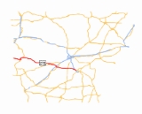
Highway 6 was a state highway
in Arkansas
that ran from the Oklahoma
state line to Pine Bluff
. It has been supplanted by U.S. Route 270
and Arkansas Highway 365 Spur. AR 6 was also a designation of U.S. Route 49
until 1964.
/US 270, and ran east to Y City
, where it met US 71
. The route then met AR 88 in Pencil Bluff
and AR 27 in Mt. Ida
before heading to Hot Springs
. Entering the city, AR 6 met US 70
southwest of downtown and ran concurrent
with it through downtown Hot Springs. After leaving Hot Springs, AR 6 entered Malvern, crossing present I-30
, and ran downtown with US 67
. AR 6 met AR 229 in Poyen
and AR 190
/AR 291
in Prattsville
before crossing paths with US 167
in Sheridan
.
The route ended in what is now Pine Bluff
on U.S. Highway 65
, now Arkansas Highway 365
; the junction (now Arkansas 365 and Arkansas Highway 365 Spur) was outside the Pine Bluff city limits at that time. U.S. 270 also ended at that intersection until it was truncated to White Hall
when U.S. 65 was relocated to a freeway, now I-530
. The former easternmost section of Highway 6 (and U.S. 270), from White Hall to Pine Bluff, is now Arkansas Highway 365 Spur.
to Brinkley
. It meets AR 1
at Walnut Corner, US 79
near Monroe
and US 70
in Brinkley, where it terminates.
State highway
State highway, state road or state route can refer to one of three related concepts, two of them related to a state or provincial government in a country that is divided into states or provinces :#A...
in Arkansas
Arkansas
Arkansas is a state located in the southern region of the United States. Its name is an Algonquian name of the Quapaw Indians. Arkansas shares borders with six states , and its eastern border is largely defined by the Mississippi River...
that ran from the Oklahoma
Oklahoma
Oklahoma is a state located in the South Central region of the United States of America. With an estimated 3,751,351 residents as of the 2010 census and a land area of 68,667 square miles , Oklahoma is the 28th most populous and 20th-largest state...
state line to Pine Bluff
Pine Bluff, Arkansas
Pine Bluff is the largest city and county seat of Jefferson County, Arkansas, United States. It is also the principal city of the Pine Bluff Metropolitan Statistical Area and part of the Little Rock-North Little Rock-Pine Bluff, Arkansas Combined Statistical Area...
. It has been supplanted by U.S. Route 270
U.S. Route 270
U.S. Route 270 is a spur of U.S. Route 70. It currently runs for 643 miles from Liberal, Kansas at U.S. Route 54 to White Hall, Arkansas at Interstate 530 and U.S. Route 65. It passes through the states of Arkansas, Oklahoma, and Kansas...
and Arkansas Highway 365 Spur. AR 6 was also a designation of U.S. Route 49
U.S. Route 49
U.S. Route 49 is a north–south United States highway. The highway's northern terminus is in Piggott, Arkansas, at an intersection with U.S. Route 62. Its southern terminus is in Gulfport, Mississippi, at an intersection with U.S. Route 90. US 49 is approximately 516 miles in length.It...
until 1964.
Route description
Arkansas Highway 6 began at the Oklahoma state line on present US 59U.S. Route 59
U.S. Route 59 is a north–south United States highway . A latecomer to the U.S. numbered route system, U.S. 59 is now a border-to-border route, Part of NAFTA Corridor Highway System. It parallels U.S. Route 75 for nearly its entire route, never much more than away, until it veers southwest...
/US 270, and ran east to Y City
Y City, Arkansas
Y City is an unincorporated community in Scott County, Arkansas, United States. It is located at the junction of U.S. Routes 71 and 270 in the southern part of the county.-References:...
, where it met US 71
U.S. Route 71
U.S. Route 71 is a north–south United States highway. This original 1926 route has remained largely unchanged by encroaching Interstate highways. Currently, the highway's northern terminus is in International Falls, Minnesota at the Canadian border, at the southern end of the Fort...
. The route then met AR 88 in Pencil Bluff
Pencil Bluff, Arkansas
Pencil Bluff is an unincorporated community in Montgomery County, Arkansas, United States. Pencil Bluff is located at the junction of U.S. Route 270 and Arkansas Highway 88 northwest of Mount Ida. Pencil Bluff has a post office with ZIP code 71965....
and AR 27 in Mt. Ida
Mount Ida, Arkansas
Mount Ida is a city in Montgomery County, Arkansas, United States. The population was 981 at the 2000 census. The city is the county seat of Montgomery County. It is known as the quartz crystal capital of the U.S...
before heading to Hot Springs
Hot Springs, Arkansas
Hot Springs is the 10th most populous city in the U.S. state of Arkansas, the county seat of Garland County, and the principal city of the Hot Springs Metropolitan Statistical Area encompassing all of Garland County...
. Entering the city, AR 6 met US 70
U.S. Route 70
U.S. Route 70 is an east–west United States highway that runs for 2,385 miles from eastern North Carolina to east-central Arizona. As can be derived from its number, it is a major east–west highway of the Southern and Southwestern United States...
southwest of downtown and ran concurrent
Concurrency (road)
A concurrency, overlap, or coincidence in a road network is an instance of one physical road bearing two or more different highway, motorway, or other route numbers...
with it through downtown Hot Springs. After leaving Hot Springs, AR 6 entered Malvern, crossing present I-30
Interstate 30
Interstate 30 is an Interstate Highway in the southern United States. I-30 runs from Interstate 20 west of Fort Worth, Texas, northeast via Dallas, Texas, and Texarkana, Texas, to Interstate 40 in North Little Rock, Arkansas. The route parallels U.S. Route 67 except for the portion west of...
, and ran downtown with US 67
U.S. Route 67
U.S. Route 67 is a 1,560 mile long north–south U.S. highway in the Central United States. The southern terminus of the route is at the United States-Mexico border in Presidio, Texas, where it continues south as Mexican Federal Highway 16 upon crossing the Rio Grande. The northern...
. AR 6 met AR 229 in Poyen
Poyen, Arkansas
Poyen is a town in Grant County, Arkansas, United States. The population was 272 at the 2000 census. It is part of the Little Rock–North Little Rock–Conway Metropolitan Statistical Area...
and AR 190
Arkansas Highway 190
Arkansas Highway 190 is a designation for four state highways in south central Arkansas. The northernmost segment of runs from AR 291 in Tull to AR 35. A segment in western Grant County of runs east from U.S. Route 270 in Prattsville to Arkansas Highway 46...
/AR 291
Arkansas Highway 291
Arkansas Highway 291 is a north–south state highway in Grant County. The route runs from Arkansas Highway 46 at Dogwood north to Highway 190 in Tull through Prattsville. The route forms a rare officially designated exception with US 270.-Route description:...
in Prattsville
Prattsville, Arkansas
Prattsville is a town in Grant County, Arkansas, United States. The population was 305 at the 2010 census. It is part of the Little Rock–North Little Rock–Conway Metropolitan Statistical Area.-Geography:...
before crossing paths with US 167
U.S. Route 167
U.S. Route 167 runs for 499 miles from Ash Flat, Arkansas at U.S. Route 62 to Abbeville, Louisiana at Louisiana Highway 14. It goes through the cities of Little Rock, Arkansas, Alexandria, Louisiana, and Lafayette, Louisiana....
in Sheridan
Sheridan, Arkansas
Sheridan is the largest city and county seat in Grant County, Arkansas, United States. The population was 3,872 at the 2000 census. It is part of the Little Rock–North Little Rock–Conway Metropolitan Statistical Area. .-History:Robert W...
.
The route ended in what is now Pine Bluff
Pine Bluff, Arkansas
Pine Bluff is the largest city and county seat of Jefferson County, Arkansas, United States. It is also the principal city of the Pine Bluff Metropolitan Statistical Area and part of the Little Rock-North Little Rock-Pine Bluff, Arkansas Combined Statistical Area...
on U.S. Highway 65
U.S. Route 65
U.S. Route 65 is a north–south United States highway in the southern and midwestern United States. The southern terminus of the route is at U.S. Route 425 in Clayton, Louisiana. The northern terminus is at Interstate 35 just south of Interstate 90 in Albert Lea, Minnesota...
, now Arkansas Highway 365
Arkansas Highway 365
Arkansas Highway 365 is a north–south state highway in Central Arkansas. The route of runs from US 65B/US 79B in Pine Bluff north through Little Rock to US 65B/AR 60 in Conway. The route is a redesignation of former U.S. Route 65, which has since been rerouted onto various Interstate highways...
; the junction (now Arkansas 365 and Arkansas Highway 365 Spur) was outside the Pine Bluff city limits at that time. U.S. 270 also ended at that intersection until it was truncated to White Hall
White Hall, Arkansas
White Hall is a city in Jefferson County, Arkansas, United States, with a population of 4,732 in the 2000 U.S. census. It is included in the Pine Bluff, Arkansas Metropolitan Statistical Area and like Pine Bluff, adjoins the Pine Bluff Arsenal...
when U.S. 65 was relocated to a freeway, now I-530
Interstate 530
Interstate 530 in Arkansas is a spur route of the Interstate highway system, traveling from Little Rock at the junction of Interstate 30 and Interstate 440 in the northwest, to Pine Bluff in the southeast.-Route description:...
. The former easternmost section of Highway 6 (and U.S. 270), from White Hall to Pine Bluff, is now Arkansas Highway 365 Spur.
US 49 portion
AR 6 ran about 50 miles (80.5 km) from HelenaHelena, Arkansas
Helena is the eastern portion of Helena-West Helena, Arkansas, a city in Phillips County, Arkansas. As of the 2000 census, this portion of the city population was 6,323. Helena was the county seat of Phillips County until January 1, 2006, when it merged its government and city limits with...
to Brinkley
Brinkley, Arkansas
Brinkley is the most populous city in Monroe County, Arkansas, United States. The population was 3,940 at the 2000 census.It is located almost exactly half-way between Little Rock, Arkansas and Memphis, Tennessee; the city has used the slogan "We'll Meet You Half-Way" in some of its advertising...
. It meets AR 1
Arkansas Highway 1
Arkansas Highway 1 is a north–south state highway in east Arkansas. The route of runs from McGehee to Clay County and the Missouri state line. One of the original 1926 state highways, Highway 1 has remained very close to its original routing. The highway contains an overlap of approximately with...
at Walnut Corner, US 79
U.S. Route 79
U.S. Route 79 is a north–south United States highway. The route is a northeast-southwest diagonal, with both east–west segments and north–south segments equally mixed. The highway's northern terminus is in Russellville, Kentucky, at an intersection with U.S. Highway 68 and KY 80...
near Monroe
Monroe, Arkansas
Monroe is an unincorporated community in Lee and Monroe counties, Arkansas, United States. Monroe is located at the junction of U.S. Route 79 and Arkansas Highway 39 east-northeast of Clarendon. Monroe has a post office with ZIP code 72108....
and US 70
U.S. Route 70
U.S. Route 70 is an east–west United States highway that runs for 2,385 miles from eastern North Carolina to east-central Arizona. As can be derived from its number, it is a major east–west highway of the Southern and Southwestern United States...
in Brinkley, where it terminates.