
Beaver County, Oklahoma
Encyclopedia
Beaver County is a county located in the U.S. state
of Oklahoma
. As of the 2010 census, the population was 5,636. The county seat
is Beaver
.
The land where Beaver County is located has been under several jurisdictions. At one time, it was part of Texas before Texas became a state of the United States. There was a period of time that it was not part of the Oklahoma Territory but not a separate organized territory. After becoming part of the Oklahoma Territory
in 1890, Beaver County (first called Seventh County) covered the entire Oklahoma Panhandle
. At statehood
in 1907, Cimarron County was taken from the western one-third, while Texas County
was taken from the middle, leaving Beaver County only in the east. http://www.ok-history.mus.ok.us/enc/nomansland.htm Its borders are now at 100°W (east), 37°N (north), 36.5°N (south), and approximately 100.8°W (west).
, the county has a total area of 1818 square miles (4,708.6 km²), of which 1814 square miles (4,698.2 km²) is land and 3 square miles (7.8 km²) (0.18%) is water.
Just north of the town of Beaver is the Beaver Dunes State Park
.
of 2000, there were 5,857 people, 2,245 households, and 1,706 families residing in the county. The population density
was 3 people per square mile (1/km²). There were 2,719 housing units at an average density of 2 per square mile (1/km²). The racial makeup of the county was 92.71% White
, 0.29% Black
or African American
, 1.25% Native American
, 0.10% Asian
, 0.03% Pacific Islander
, 3.76% from other races
, and 1.86% from two or more races. 10.76% of the population were Hispanic
or Latino
of any race.
There were 2,245 households out of which 33.50% had children under the age of 18 living with them, 66.30% were married couples
living together, 6.10% had a female householder with no husband present, and 24.00% were non-families. 22.00% of all households were made up of individuals and 12.30% had someone living alone who was 65 years of age or older. The average household size was 2.57 and the average family size was 2.99.
In the county, the population was spread out with 26.80% under the age of 18, 6.50% from 18 to 24, 25.80% from 25 to 44, 24.10% from 45 to 64, and 16.90% who were 65 years of age or older. The median age was 39 years. For every 100 females there were 102.20 males. For every 100 females age 18 and over, there were 100.90 males.
The median income for a household in the county was $36,715, and the median income for a family was $41,542. Males had a median income of $31,013 versus $20,162 for females. The per capita income
for the county was $17,905. About 8.80% of families and 11.70% of the population were below the poverty line, including 15.80% of those under age 18 and 7.80% of those age 65 or over.
It is part of Oklahoma's 3rd congressional district
and as such is represented by Frank Lucas. In the Oklahoma Senate
it is part of the 27th district and is represented by Republican Bryce Marlatt. In the Oklahoma House of Representatives
it is part of the 61st district and is represented by Republican Gus Blackwell.
:
U.S. state
A U.S. state is any one of the 50 federated states of the United States of America that share sovereignty with the federal government. Because of this shared sovereignty, an American is a citizen both of the federal entity and of his or her state of domicile. Four states use the official title of...
of Oklahoma
Oklahoma
Oklahoma is a state located in the South Central region of the United States of America. With an estimated 3,751,351 residents as of the 2010 census and a land area of 68,667 square miles , Oklahoma is the 28th most populous and 20th-largest state...
. As of the 2010 census, the population was 5,636. The county seat
County seat
A county seat is an administrative center, or seat of government, for a county or civil parish. The term is primarily used in the United States....
is Beaver
Beaver, Oklahoma
Beaver is a town in and the county seat of Beaver County, Oklahoma, United States. As of the 2010 census, the city population was 1,515. The town is host to the annual World Cow Chip Throwing Championship.-History:...
.
The land where Beaver County is located has been under several jurisdictions. At one time, it was part of Texas before Texas became a state of the United States. There was a period of time that it was not part of the Oklahoma Territory but not a separate organized territory. After becoming part of the Oklahoma Territory
Oklahoma Territory
The Territory of Oklahoma was an organized incorporated territory of the United States that existed from May 2, 1890, until November 16, 1907, when it was joined with the Indian Territory under a new constitution and admitted to the Union as the State of Oklahoma.-Organization:Oklahoma Territory's...
in 1890, Beaver County (first called Seventh County) covered the entire Oklahoma Panhandle
Oklahoma Panhandle
The Oklahoma Panhandle is the extreme western region of the state of Oklahoma, comprising Cimarron County, Texas County, and Beaver County. Its name comes from the similarity of shape to the handle of a cooking pan....
. At statehood
U.S. state
A U.S. state is any one of the 50 federated states of the United States of America that share sovereignty with the federal government. Because of this shared sovereignty, an American is a citizen both of the federal entity and of his or her state of domicile. Four states use the official title of...
in 1907, Cimarron County was taken from the western one-third, while Texas County
Texas County, Oklahoma
Texas County is a county located in the U.S. state of Oklahoma. Texas County was formed at Oklahoma statehood from the central one-third of "Old Beaver County" also known as "No Man's Land"...
was taken from the middle, leaving Beaver County only in the east. http://www.ok-history.mus.ok.us/enc/nomansland.htm Its borders are now at 100°W (east), 37°N (north), 36.5°N (south), and approximately 100.8°W (west).
Geography
According to the U.S. Census BureauUnited States Census Bureau
The United States Census Bureau is the government agency that is responsible for the United States Census. It also gathers other national demographic and economic data...
, the county has a total area of 1818 square miles (4,708.6 km²), of which 1814 square miles (4,698.2 km²) is land and 3 square miles (7.8 km²) (0.18%) is water.
Major highways
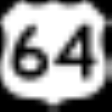
 U.S. Highway 64
 U.S. Highway 83
 U.S. Highway 270
 U.S. Highway 412
 State Highway 3State Highway 3 (Oklahoma)State Highway 3, also abbreviated as SH-3 or OK-3, is a highway maintained by the U.S. state of Oklahoma. Traveling diagonally through Oklahoma, from the Panhandle to the far southeastern corner of the state, SH-3 is the longest state highway in the Oklahoma road system, at a total length of...
 State Highway 23State Highway 23 (Oklahoma)State Highway 23 is a state highway in Oklahoma. It runs 36.2 miles south-to-north through the center of Beaver County, in the Panhandle, running from the Texas state line to the Kansas state line....
Adjacent counties
- Meade County, KansasMeade County, KansasMeade County is a county located in the U.S. state of Kansas. It is named in honor of General George G. Meade. As of the 2010 census, the county population was 4,575...
(north) - Clark County, KansasClark County, KansasClark County is a county located in Southwest Kansas, in the Central United States. As of the 2010 census, the county population was 2,215...
(northeast) - Harper County, OklahomaHarper County, OklahomaHarper County is a county located in the U.S. state of Oklahoma. As of 2010, the population was 3,685. The county seat is Buffalo.-Geography:According to the U.S. Census Bureau, the county has a total area of , of which is land and is water....
(east) - Ellis County, OklahomaEllis County, OklahomaEllis County is a county located in the U.S. state of Oklahoma. As of 2000, the population was 4,075. Its county seat is Arnett.-Geography:...
(southeast) - Lipscomb County, Texas (south)
- Ochiltree County, Texas (southwest)
- Texas County, OklahomaTexas County, OklahomaTexas County is a county located in the U.S. state of Oklahoma. Texas County was formed at Oklahoma statehood from the central one-third of "Old Beaver County" also known as "No Man's Land"...
(west) - Seward County, KansasSeward County, KansasSeward County is a county of the U.S. state of Kansas. As of the 2010 census, the county population was 22,952. The largest city and county seat is Liberal...
(northwest)
Just north of the town of Beaver is the Beaver Dunes State Park
Beaver Dunes State Park
Beaver Dunes State Park is a Oklahoma state park located in Beaver County, Oklahoma. It is located near the city of Beaver, Oklahoma. The park, located in the panhandle region of Oklahoma, offers dune buggy riding on of sand hills, fishing, hiking trails, a playground and two campgrounds...
.
Demographics
As of the censusCensus
A census is the procedure of systematically acquiring and recording information about the members of a given population. It is a regularly occurring and official count of a particular population. The term is used mostly in connection with national population and housing censuses; other common...
of 2000, there were 5,857 people, 2,245 households, and 1,706 families residing in the county. The population density
Population density
Population density is a measurement of population per unit area or unit volume. It is frequently applied to living organisms, and particularly to humans...
was 3 people per square mile (1/km²). There were 2,719 housing units at an average density of 2 per square mile (1/km²). The racial makeup of the county was 92.71% White
Race (United States Census)
Race and ethnicity in the United States Census, as defined by the Federal Office of Management and Budget and the United States Census Bureau, are self-identification data items in which residents choose the race or races with which they most closely identify, and indicate whether or not they are...
, 0.29% Black
Race (United States Census)
Race and ethnicity in the United States Census, as defined by the Federal Office of Management and Budget and the United States Census Bureau, are self-identification data items in which residents choose the race or races with which they most closely identify, and indicate whether or not they are...
or African American
Race (United States Census)
Race and ethnicity in the United States Census, as defined by the Federal Office of Management and Budget and the United States Census Bureau, are self-identification data items in which residents choose the race or races with which they most closely identify, and indicate whether or not they are...
, 1.25% Native American
Race (United States Census)
Race and ethnicity in the United States Census, as defined by the Federal Office of Management and Budget and the United States Census Bureau, are self-identification data items in which residents choose the race or races with which they most closely identify, and indicate whether or not they are...
, 0.10% Asian
Race (United States Census)
Race and ethnicity in the United States Census, as defined by the Federal Office of Management and Budget and the United States Census Bureau, are self-identification data items in which residents choose the race or races with which they most closely identify, and indicate whether or not they are...
, 0.03% Pacific Islander
Race (United States Census)
Race and ethnicity in the United States Census, as defined by the Federal Office of Management and Budget and the United States Census Bureau, are self-identification data items in which residents choose the race or races with which they most closely identify, and indicate whether or not they are...
, 3.76% from other races
Race (United States Census)
Race and ethnicity in the United States Census, as defined by the Federal Office of Management and Budget and the United States Census Bureau, are self-identification data items in which residents choose the race or races with which they most closely identify, and indicate whether or not they are...
, and 1.86% from two or more races. 10.76% of the population were Hispanic
Race (United States Census)
Race and ethnicity in the United States Census, as defined by the Federal Office of Management and Budget and the United States Census Bureau, are self-identification data items in which residents choose the race or races with which they most closely identify, and indicate whether or not they are...
or Latino
Race (United States Census)
Race and ethnicity in the United States Census, as defined by the Federal Office of Management and Budget and the United States Census Bureau, are self-identification data items in which residents choose the race or races with which they most closely identify, and indicate whether or not they are...
of any race.
There were 2,245 households out of which 33.50% had children under the age of 18 living with them, 66.30% were married couples
Marriage
Marriage is a social union or legal contract between people that creates kinship. It is an institution in which interpersonal relationships, usually intimate and sexual, are acknowledged in a variety of ways, depending on the culture or subculture in which it is found...
living together, 6.10% had a female householder with no husband present, and 24.00% were non-families. 22.00% of all households were made up of individuals and 12.30% had someone living alone who was 65 years of age or older. The average household size was 2.57 and the average family size was 2.99.
In the county, the population was spread out with 26.80% under the age of 18, 6.50% from 18 to 24, 25.80% from 25 to 44, 24.10% from 45 to 64, and 16.90% who were 65 years of age or older. The median age was 39 years. For every 100 females there were 102.20 males. For every 100 females age 18 and over, there were 100.90 males.
The median income for a household in the county was $36,715, and the median income for a family was $41,542. Males had a median income of $31,013 versus $20,162 for females. The per capita income
Per capita income
Per capita income or income per person is a measure of mean income within an economic aggregate, such as a country or city. It is calculated by taking a measure of all sources of income in the aggregate and dividing it by the total population...
for the county was $17,905. About 8.80% of families and 11.70% of the population were below the poverty line, including 15.80% of those under age 18 and 7.80% of those age 65 or over.
Politics
Although at one time competitive Beaver has become strongly Republican in Presidential elections. The last Democratic candidate to win the county was Harry Truman in 1948. In the last three Presidential elections the Republican candidate has consistently received over 85% of the county's vote.It is part of Oklahoma's 3rd congressional district
Oklahoma's 3rd congressional district
Oklahoma's Third Congressional District is the largest congressional district in Oklahoma and also one of the largest congressional districts in the United States. It borders New Mexico, Colorado, Kansas, and the Texas panhandle...
and as such is represented by Frank Lucas. In the Oklahoma Senate
Oklahoma Senate
The Oklahoma Senate is the upper house of the two houses of the Legislature of Oklahoma, the other being the Oklahoma House of Representatives. The total number of Senators is set at 48 by the Oklahoma Constitution....
it is part of the 27th district and is represented by Republican Bryce Marlatt. In the Oklahoma House of Representatives
Oklahoma House of Representatives
The Oklahoma House of Representatives is the lower house of the Oklahoma Legislature, the legislative body of the U.S. state of Oklahoma. Its members are responsible for introducing and voting on bills and resolutions, providing legislative oversight for state agencies, and helping to craft the...
it is part of the 61st district and is represented by Republican Gus Blackwell.
Unincorporated communities
- BalkoBalko, OklahomaBalko is a small unincorporated community in Beaver County, Oklahoma, United States. The post office was established March 14, 1904. The population is 623.Balko has a television station, K25EG.-Climate:...
- ElmwoodElmwood, OklahomaElmwood is a small unincorporated community located at the junction of US Highway 270 and US Highway 412 in Beaver County, Oklahoma, United States. The Post Office was opened January 26, 1888.-Sources:...
- FlorisFloris, OklahomaFloris is an unincorporated community in northwest Beaver County, Oklahoma, United States.Once a thriving small community, Floris is now a very small but still productive community of under 15 inhabitants. Founded in 1903 about halfway between Beaver City, Oklahoma, and Liberal, Kansas; it became a...
- MocaneMocane, OklahomaMocane is an unincorporated community in Beaver County, Oklahoma, United States. Its elevation is 2,631 feet . A post office once operated in Mocane, but it is no longer in existence. Mocane is the closest community to the Billy Rose Archeological Site, which is listed on the National...
- SlapoutSlapout, OklahomaSlapout is a small unincorporated community in Beaver County, Oklahoma, United States. The land upon which part of the town sits was homesteaded by Joseph L. Johnston...
- TurpinTurpin, OklahomaTurpin is a small unincorporated community in Beaver County, Oklahoma, United States. The post office was established April 8, 1925. The Turpin Grain Elevator is on the National Register of Historic Places....
NRHP sites
The following sites in Beaver County are listed on the National Register of Historic PlacesNational Register of Historic Places
The National Register of Historic Places is the United States government's official list of districts, sites, buildings, structures, and objects deemed worthy of preservation...
:
|
|