
.gif)
State Route 8 (Washington)
Encyclopedia
State Route 8 is a state highway in Grays Harbor
and Thurston counties, of the U.S. state of Washington. It extends 20.67 miles (33.27 km) from U.S. Route 12
(US 12) in the city of Elma
, east to an interchange with US 101
about 5.9 miles (9.5 km) northwest of the state capital, Olympia
. SR 8 intersects SR 108 west of McCleary
. The route serves as a connector between Elma and Olympia.
The highway formerly was part of the Elma – Grand Mound branch of Primary State Highway 9 (PSH 9 EG) from 1937 until 1964, which ran from Elma southeast to Interstate 5
(I-5), formerly US 99
in Grand Mound
, which was later added as part of US 12 in 1967. The road also forms the northern boundary of Capitol State Forest
in Thurston County.
 SR 8 starts at an interchange with US 12 in Elma. From the interchange, the expressway goes northeast past Downtown Elma and starts to parallel the Chehalis River. After crossing the river twice, the highway intersects SR 108, which goes northeast towards Kamilche
, west of McCleary. After passing Downtown McCleary, SR 8 has a partial cloverleaf interchange with Mox Chehalis Road. From the interchange, the expressway goes east to form the northern boundary of the Capitol State Forest
, and passes Summit Lake. From Summit Lake, the highway turns northeast and merges with US 101 southbound.
 Before the Primary and Secondary system, SR 8 in 1923 was part of a branch of State Road 9, from Elma
to Grand Mound
. Later, in 1937, the route from Elma to Grand Mound became part of Elma – Grand Mound branch of Primary State Highway 9 (PSH 9 EG). PSH 9 EG became SR 8 in 1964 during the 1964 highway renumbering, in which the Washington State Department of Transportation
(WSDOT) replaced the previous system of Primary and Secondary Highways with a new system called State Routes
, which is still in use today.
.png) Later in 1967, US 12
Later in 1967, US 12
was extended from Lewiston, Idaho
westward to Aberdeen
. It was approved on 20 June 1967, and it replaced the route of US 410, therefore making the highway obsolete. Since US 12 used the all-weather White Pass
and SR 8 from Elma to Grand Mound, and US 410 used Chinook Pass
, which was closed during the winter, US 12 bypassed US 410 and what is now SR 8. Signs were changed in late December 1967, and the bypassed segments of US 410 became a new SR 8.
On 9 June 2007, a tanker fire occurred on SR 8 when a tanker truck with 10,000 gallons of fuel collided with another vehicle and started a fire. The fire caused SR 8 to close for a couple of hours except for the westbound left lane, which crews used to get oil out of the soil underneath the highway. During the Winter 2007 storm
, a slope that held up SR 8 was eroded by floodwaters. The slope, located on SR 8 west of the US 101 interchange, and is scheduled to begin this season and last 2 months. In 2010, WSDOT aims to rebuild the columns that support the SR 8/US 101 interchange and reduce the risk of failure in an earthquake, such as the 2001 Nisqually earthquake.
Grays Harbor County, Washington
Grays Harbor County is a county in the state of Washington, in the United States of America. As of 2010, the population was 72,797. The county seat is at Montesano, and its largest city is Aberdeen. The county is named after a large estuarine bay near its southwestern corner...
and Thurston counties, of the U.S. state of Washington. It extends 20.67 miles (33.27 km) from U.S. Route 12
U.S. Route 12 in Washington
U.S. Route 12 is a major east-west U.S. Highway, running from Aberdeen, Washington, to Detroit, Michigan. It spans across the state of Washington, and is the only numbered highway to span the entire state from west to east, starting near the Pacific Ocean, and crossing the Idaho state line near...
(US 12) in the city of Elma
Elma, Washington
Elma is a city in Grays Harbor County, Washington, United States. The population was 3,107 at the 2010 census.-Geography:Elma is located at ....
, east to an interchange with US 101
U.S. Route 101 in Washington
In the U.S. state of Washington, U.S. Route 101 is the westernmost state highway, serving the Olympic Peninsula. It runs from the Astoria-Megler Bridge north to the cities of Raymond, Aberdeen, Hoquiam, and Forks before turning east at the small community of Beaver to the most northern point of the...
about 5.9 miles (9.5 km) northwest of the state capital, Olympia
Olympia, Washington
Olympia is the capital city of the U.S. state of Washington and the county seat of Thurston County. It was incorporated on January 28, 1859. The population was 46,478 at the 2010 census...
. SR 8 intersects SR 108 west of McCleary
McCleary, Washington
McCleary is a city in Grays Harbor County, Washington, United States. The population was 1,653 on April 1, 2010.-History:Henry McCleary came to the land in 1897, building two sawmills and a door manufacturing company. He sold the land and the companies to Simpson Logging Company. On January 9,...
. The route serves as a connector between Elma and Olympia.
The highway formerly was part of the Elma – Grand Mound branch of Primary State Highway 9 (PSH 9 EG) from 1937 until 1964, which ran from Elma southeast to Interstate 5
Interstate 5 in Washington
Interstate 5 in Washington is a highway in the U.S. state of Washington that extends from its border with Oregon to its border with Canada...
(I-5), formerly US 99
U.S. Route 99
U.S. Route 99 was the main north–south highway on the West Coast of the United States until 1964, running from Calexico, California, on the U.S.-Mexico border to Blaine, Washington, on the U.S.-Canada border. It was a route of the United States Numbered Highways, assigned in 1926 and existing...
in Grand Mound
Grand Mound, Washington
Grand Mound is a census-designated place in Thurston County, Washington, United States. It was named and founded by Jotham Weeks Judson, father of Phoebe Judson, in 1851. The population was 1,948 at the 2000 census. In 2007, the population was 2,232...
, which was later added as part of US 12 in 1967. The road also forms the northern boundary of Capitol State Forest
Capitol State Forest
The Capitol State Forest is a state forest in Thurston and Grays Harbor counties of the U.S. state of Washington. It includes part of the unusual Mima Mounds geologic feature.The Capitol State Forest is managed by Washington Department of Natural Resources...
in Thurston County.
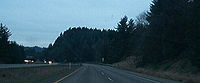
Route description
SR 8 runs 20.67 miles (33.27 km) east from US 12 in Elma to an interchange with US 101 5.9 miles (9.5 km) northwest of Olympia. The route links the city of Elma with Olympia, and intersects only one other highway, SR 108, in McCleary. WSDOT has found that more than 17,000 motorists utilize the road daily at the interchange with US 101 based on average annual daily traffic (AADT) data.Kamilche, Washington
Kamilche also known as Squaxin Island Tribe is an unincorporated community in Mason County, Washington, USA.Primarily a farm area, Kamilche is also the home to the Squaxin Indian Tribe. It is at the crossroads of U.S. Route 101 and State Route 108...
, west of McCleary. After passing Downtown McCleary, SR 8 has a partial cloverleaf interchange with Mox Chehalis Road. From the interchange, the expressway goes east to form the northern boundary of the Capitol State Forest
Capitol State Forest
The Capitol State Forest is a state forest in Thurston and Grays Harbor counties of the U.S. state of Washington. It includes part of the unusual Mima Mounds geologic feature.The Capitol State Forest is managed by Washington Department of Natural Resources...
, and passes Summit Lake. From Summit Lake, the highway turns northeast and merges with US 101 southbound.
History
Elma, Washington
Elma is a city in Grays Harbor County, Washington, United States. The population was 3,107 at the 2010 census.-Geography:Elma is located at ....
to Grand Mound
Grand Mound, Washington
Grand Mound is a census-designated place in Thurston County, Washington, United States. It was named and founded by Jotham Weeks Judson, father of Phoebe Judson, in 1851. The population was 1,948 at the 2000 census. In 2007, the population was 2,232...
. Later, in 1937, the route from Elma to Grand Mound became part of Elma – Grand Mound branch of Primary State Highway 9 (PSH 9 EG). PSH 9 EG became SR 8 in 1964 during the 1964 highway renumbering, in which the Washington State Department of Transportation
Washington State Department of Transportation
The Washington State Department of Transportation , was established in 1905. The agency, led by a Secretary and overseen by the Governor, is a Washington governmental agency that constructs, maintains, and regulates the use of the state's transportation infrastructure...
(WSDOT) replaced the previous system of Primary and Secondary Highways with a new system called State Routes
State highways in Washington
In the U.S. state of Washington, the Washington State Department of Transportation maintains a network of over 7000 miles of state highways, including all Interstate and U.S. Highways that pass through the state. The system comprises 8.5% of the state's public road mileage, but carries over half...
, which is still in use today.
U.S. Route 12 in Washington
U.S. Route 12 is a major east-west U.S. Highway, running from Aberdeen, Washington, to Detroit, Michigan. It spans across the state of Washington, and is the only numbered highway to span the entire state from west to east, starting near the Pacific Ocean, and crossing the Idaho state line near...
was extended from Lewiston, Idaho
Lewiston, Idaho
Lewiston is a city in and also the county seat of Nez Perce County in the Pacific Northwest state of Idaho. It is the second-largest city in the northern Idaho region, behind Coeur d'Alene and ninth-largest in the state. Lewiston is the principal city of the Lewiston, ID - Clarkston, WA...
westward to Aberdeen
Aberdeen, Washington
Aberdeen is a city in Grays Harbor County, Washington, United States, founded by Samuel Benn in 1884. Aberdeen was incorporated on May 12, 1890. The city is the economic center of Grays Harbor County, bordering the cities of Hoquiam and Cosmopolis...
. It was approved on 20 June 1967, and it replaced the route of US 410, therefore making the highway obsolete. Since US 12 used the all-weather White Pass
White Pass (Washington)
White Pass is a mountain pass in the Cascade Range south of Mount Rainier and north of Goat Rocks in Washington, USA. U.S. Highway 12 passes over White Pass, connecting Yakima County with Lewis County....
and SR 8 from Elma to Grand Mound, and US 410 used Chinook Pass
Chinook Pass
Chinook Pass is a pass through the Cascade Range in the state of Washington.The pass provides the east entrance to Mount Rainier National Park, and carries State Route 410 between the towns of Enumclaw and Naches. Because of the high elevation, Chinook Pass is usually closed in November due to...
, which was closed during the winter, US 12 bypassed US 410 and what is now SR 8. Signs were changed in late December 1967, and the bypassed segments of US 410 became a new SR 8.
On 9 June 2007, a tanker fire occurred on SR 8 when a tanker truck with 10,000 gallons of fuel collided with another vehicle and started a fire. The fire caused SR 8 to close for a couple of hours except for the westbound left lane, which crews used to get oil out of the soil underneath the highway. During the Winter 2007 storm
Great Coastal Gale of 2007
The Great Coastal Gale of 2007 was a series of powerful Pacific storms that affected the U.S. states of Oregon and Washington and the Canadian province of British Columbia between December 1, 2007 and December 3, 2007....
, a slope that held up SR 8 was eroded by floodwaters. The slope, located on SR 8 west of the US 101 interchange, and is scheduled to begin this season and last 2 months. In 2010, WSDOT aims to rebuild the columns that support the SR 8/US 101 interchange and reduce the risk of failure in an earthquake, such as the 2001 Nisqually earthquake.
Major intersections
| County | Location | Mile | Destinations | Notes |
|---|---|---|---|---|
| Grays Harbor | Elma | 0.00 | Continues as US 12 west | |
| Interchange; westbound exit and eastbound entrance | ||||
| McCleary | 6.03 | |||
| 7.39 | Mox Chehalis Road – McCleary | Partial cloverleaf interchange | ||
| Thurston | 20.67 | Interchange; eastbound exit and westbound entrance |