

U.S. Route 99
Encyclopedia
U.S. Route 99 was the main north–south highway on the West Coast of the United States
until 1964, running from Calexico, California
, on the U.S.-Mexico border to Blaine, Washington
, on the U.S.-Canada border. It was a route of the United States Numbered Highways
, assigned in 1926 and existing until it was replaced for the most part by Interstate 5
. Known also as the "Golden State Highway", "The Main Street of California" and "US 66
turned the opposite way", US 99 was an important route in California
throughout much of the 1930s as a route for Dust Bowl
immigrant farm workers to traverse the state. Large portions are now California's State Route 99
, Oregon Route 99, and Washington's State Route 99
. The highway connected to British Columbia Highway 99 at the Canadian border.
in Calexico, California
. It then continued north along the western shore of the Salton Sea
. The stretch is now known as State Route 86
. Highway 99 continued along present-day State Route 111
through Coachella
to its intersection at Dillon Road with another major US route signed as both US 60
and US 70.
Now multiplexed as US 60/70/99, the highway continued north through Indio
and turned west through the San Gorgonio Pass
toward Los Angeles
paralleling the route of modern Interstate 10
. In Beaumont
, Highway 60 split off on its own westward trek to Los Angeles. The highway through Banning and Beaumont (known as Ramsey Street in Banning and Sixth Street in Beaumont) was bypassed by the new superhighway version of routes 60/70/99 that would later wear Interstate 10 shields. The edges of the old US 60 shield at the replacement interchange's overhead sign are clearly visible today underneath the State Route 60
shield that covers it up.
US 70 ended in downtown LA while US 99 turned north once again more or less following the route of today's Interstate 5
(San Fernando Road
in the San Fernando Valley
before the construction of the 5 Freeway), up and over Grapevine Hill in the Tehachapi Mountains
to the San Joaquin Valley
. Highway 99's original alignment over the hill was known in its earliest days as the Ridge Route
, the first highway directly linking the Los Angeles Basin
to the San Joaquin Valley. Built in 1915, the alignment between Castaic
and State Route 138
in Gorman
is listed on the National Register of Historic Places
. This section was bypassed in 1933 by the three-lane "Alternate Ridge Route" (now at the bottom of Pyramid Lake
).
From the southern tip of the San Joaquin Valley at the foot of the Grapevine, US 99 then continued to Sacramento
where it split into two highways, 99E and 99W. The two highways rejoined in Red Bluff
and continued once again as US 99 through Oregon
, Washington and to the border with British Columbia
, becoming Highway 99.
from San Bernardino
via Pasadena
to Los Angeles
, turning north there to San Fernando
. The route was signed in 1928. This alignment remained through 1933, but by 1942 it had moved to its own alignment (concurrent with U.S. Route 70
, as well as U.S. Route 60 west of Pomona
) from San Bernardino to Los Angeles. This alignment used Garvey Avenue
from Pomona, turning onto Ramona Boulevard in Alhambra
to reach Macy Street (now Cesar E. Chavez Avenue) near downtown Los Angeles. It turned north at Figueroa Street
, running through the Figueroa Street Tunnels
and turning off at Avenue 26 to reach San Fernando Road
. When the San Bernardino Freeway
, Santa Ana Freeway
and Pasadena Freeway
were completed, it was routed onto them, continuing to exit at Avenue 26. In 1962, with the completion of the Golden State Freeway northeast of downtown, US 99 was moved onto it, bypassing the Santa Ana Freeway, Four Level Interchange
and Figueroa Street Tunnels.
through Glendale
and Burbank
to Sylmar. From 1937 to 1964 it shared this routing with U.S. Route 6
; the remaining stretch of the highway through the Santa Clarita Valley is named "The Old Road." The Old Road starts in near the Newhall Pass Interchange
, just south of Santa Clarita, eventually crossing under present-day Interstate 5. As the noad now winds north, passing by Pico Canyon Road, it reaches Mc Bean Parkway near the California Institute of the Arts
, College of the Canyons
and Six Flags Magic Mountain
. In Castaic
The Old Road becomes a suburban street and ends at Oak Hill Court, just outside Castaic.
99 then headed up over the "Grapevine" into the San Joaquin Valley
. Just north of the route's entry to the valley, Interstate 5
splits off from the route of US 99, and US 99 continued on the current route of State Route 99
, to Bakersfield, Fresno
, and Sacramento
. Many older segments of the highway between the "Grapevine" and Sacramento still exist as local streets, many of them having "Golden State" in their names (such as Golden State Ave, Golden State Blvd, Golden State Hwy, etc.).
 North of Sacramento, the route was divided into US 99W and US 99E. US 99W co-routed with US 40 west to Davis, in city as Olive Drive. The route continued as Richards Boulevard, 1st Street, B Street, and Russell Boulevard before turning north on what is now State Route 113
into Woodland to meet and parallel Interstate 5
near the town of Yolo. From there, the route parallels the current I-5, entering Corning from the South as Old Corning road, turning East onto Solano Street before turning North again on 3rd street continuing to Red Bluff, where it became Main Street. All of the old inter-town original roadway still exists, signed as 99W, CR99 or CR99W.
From Sacramento, US 99E followed Interstate 80
(first the current business route, then the actual route) to Roseville
. From Roseville it headed north along State Route 65
to Olivehurst, from where it followed State Route 70
to Marysville
. From Marysville it followed State Route 20 across the Feather River
to Yuba City. From Yuba City it followed the current State Route 99
north to Red Bluff
, where it rejoined 99W at the intersection of Main Street and Antelope Blvd.
From Red Bluff
, US 99 continued north along the same route as Interstate 5
, except that it went through Redding
along present State Route 273
, and also followed State Route 265
in Weed and State Route 263
from Yreka to near Black Mountain.
A 22.7 miles (36.5 km) long stretch of two-lane county road known as "Old 99 Highway" exists in Siskiyou County, California
in the same form as it did when it was US 99, but is lightly traveled. It roughly parallels I-5
, but at one point diverges from it by a distance of several miles. Old 99 Highway serves the tiny village of Gazelle
, as well as local homes and ranches.
, where U.S. 99 is currently named Old Highway 99 S from the state border to exit 6 of Interstate 5. The former route is coterminous with Interstate 5 from exit 6 to the junction of Oregon Route 99 in Ashland.
to Everett, Washington
still retains the official "99" moniker (as State Route 99). The following is a simplified list of Washington counties and cities that portions of the old route traverse, along with their local names.
to Vancouver, Washington
, follows very closely the track of the Siskiyou Trail
. The Siskiyou Trail was based on an ancient network of Native American
footpaths connecting the Pacific Northwest
with California's Central Valley. By the 1820s, trappers from the Hudson's Bay Company
were the first non-Native Americans to use the route of U.S. Highway 99 to move between today's Washington state and California. During the second half of the 19th Century, mule train trails, stagecoach roads, and the path of the Central Pacific
railroad (later the Southern Pacific
railroad) also followed the route of the Siskiyou Trail. By the early 20th Century, pioneering automobile roads were built along the Siskiyou Trail, including most notably the Pacific Highway
. The Pacific Highway ran from British Columbia
to San Diego, California
and is the immediate predecessor of much of U.S. Highway 99. The highway was continuous pavement by the middle 1930s.
with the completion of I-5, but the highway's phasing out actually began July 1, 1964 thanks to the passage of Collier Senate Bill No. 64 on September 20, 1963. The bill launched a major program designed to greatly simplify California's increasingly complicated highway numbering system and eliminate concurrent postings like the aforementioned 60/70/99. The highways that replaced it are:
.svg.png)
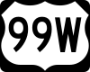
 U.S. Route 99W was a short-lived alternate of U.S. Route 99 in the Central Valley of California
U.S. Route 99W was a short-lived alternate of U.S. Route 99 in the Central Valley of California
, United States
, running from north of Manteca via French Camp to Stockton. At the same time, from roughly 1929 to 1933, U.S. Route 99E ran to the east, having the same termini as US 99W.
in 1926, the main Los Angeles-Sacramento route, pre-1964 Legislative Route 4, ran from Manteca to Stockton via French Camp (later US 99W). At French Camp, pre-1964 Legislative Route 5 split to the southwest to reach the San Francisco Bay Area
via Altamont Pass
. The Lincoln Highway
used Route 4 from Sacramento to French Camp and Route 5 over Altamont Pass.
In November 1926, Route 4 was defined as part of U.S. Route 99 and Route 5 (to San Jose) became U.S. Route 48. California's U.S. Routes were not marked until 1928, and US 99 had not yet been split into US 99E and US 99W.
Around 1929, Route 4 was realigned between north of Manteca and Stockton. This became US 99E, and the old route became US 99W. Route 5 was extended north from French Camp to Stockton, but US 48 continued to end at US 99W. US 48 became an extension of U.S. Route 50 ca. 1931, running concurrent with US 99 from Sacramento to Stockton and US 99W to French Camp. Around 1933, US 99W was dropped, and US 99E became part of US 99. Most of former US 99E is now part of State Route 99 but former US 99W has been bypassed by Interstate 5.
West Coast of the United States
West Coast or Pacific Coast are terms for the westernmost coastal states of the United States. The term most often refers to the states of California, Oregon, and Washington. Although not part of the contiguous United States, Alaska and Hawaii do border the Pacific Ocean but can't be included in...
until 1964, running from Calexico, California
Calexico, California
Calexico is a city in Imperial County, California. The population was 38,572 at the 2010 census, up from 27,109 at the 2000 census. Calexico is about east of San Diego and west of Yuma, Arizona...
, on the U.S.-Mexico border to Blaine, Washington
Blaine, Washington
Blaine is a city in Whatcom County, Washington, United States. The city's northern boundary is the Canadian border. Blaine is the shared home of the Peace Arch international monument...
, on the U.S.-Canada border. It was a route of the United States Numbered Highways
United States Numbered Highways
The system of United States Numbered Highways is an integrated system of roads and highways in the United States numbered within a nationwide grid...
, assigned in 1926 and existing until it was replaced for the most part by Interstate 5
Interstate 5
Interstate 5 is the main Interstate Highway on the West Coast of the United States, running largely parallel to the Pacific Ocean coastline from Canada to Mexico . It serves some of the largest cities on the U.S...
. Known also as the "Golden State Highway", "The Main Street of California" and "US 66
U.S. Route 66
U.S. Route 66 was a highway within the U.S. Highway System. One of the original U.S. highways, Route 66 was established on November 11, 1926 -- with road signs erected the following year...
turned the opposite way", US 99 was an important route in California
California
California is a state located on the West Coast of the United States. It is by far the most populous U.S. state, and the third-largest by land area...
throughout much of the 1930s as a route for Dust Bowl
Dust Bowl
The Dust Bowl, or the Dirty Thirties, was a period of severe dust storms causing major ecological and agricultural damage to American and Canadian prairie lands from 1930 to 1936...
immigrant farm workers to traverse the state. Large portions are now California's State Route 99
California State Route 99
California State Route 99 , commonly known as Highway 99 or, simply, as 99 , is a north–south state highway in the U.S. state of California, stretching almost the entire length of the Central Valley...
, Oregon Route 99, and Washington's State Route 99
Washington State Route 99
State Route 99, abbreviated SR 99, commonly called Highway 99, is a numbered state highway in the U.S. state of Washington extending just under from Fife in the south to Everett in the north, with a gap in Tukwila.-Southern division:...
. The highway connected to British Columbia Highway 99 at the Canadian border.
Mexico to Los Angeles
The highway started at the border with Baja CaliforniaBaja California
Baja California officially Estado Libre y Soberano de Baja California is one of the 31 states which, with the Federal District, comprise the 32 Federal Entities of Mexico. It is both the northernmost and westernmost state of Mexico. Before becoming a state in 1953, the area was known as the North...
in Calexico, California
Calexico, California
Calexico is a city in Imperial County, California. The population was 38,572 at the 2010 census, up from 27,109 at the 2000 census. Calexico is about east of San Diego and west of Yuma, Arizona...
. It then continued north along the western shore of the Salton Sea
Salton Sea
The Salton Sea is a shallow, saline, endorheic rift lake located directly on the San Andreas Fault, predominantly in California's Imperial Valley. The lake occupies the lowest elevations of the Salton Sink in the Colorado Desert of Imperial and Riverside counties in Southern California. Like Death...
. The stretch is now known as State Route 86
California State Route 86
State Route 86 is a north–south state highway in the southeastern desert region of Southern California, United States. It runs from State Route 111, near the Mexican border crossing at Calexico, north through the Imperial Valley via El Centro and Brawley, and around the west side of the...
. Highway 99 continued along present-day State Route 111
California State Route 111
State Route 111 is a state highway in the U.S. state of California. It is the main north/south state highway and retail corridor through the Coachella Valley, a part of the Colorado Desert in the southeastern corner of the state and famous as a resort destination...
through Coachella
Coachella, California
Coachella is a city in Riverside County, California; it is the easternmost city in the region collectively known as the Coachella Valley...
to its intersection at Dillon Road with another major US route signed as both US 60
U.S. Route 60
U.S. Route 60 is an east–west United States highway, running from the Atlantic Ocean on the east coast in Virginia to western Arizona. Despite the final "0" in its number, indicating a transcontinental designation, the 1926 route formerly ended in Springfield, Missouri, at its intersection...
and US 70.
Now multiplexed as US 60/70/99, the highway continued north through Indio
Indio, California
Indio is a city in Riverside County, California, United States, located in the Coachella Valley of Southern California's Colorado Desert region. It lies east of Palm Springs, east of Riverside, and east of Los Angeles. It is about north of Mexicali, Baja California on the U.S.-Mexican border...
and turned west through the San Gorgonio Pass
San Gorgonio Pass
The San Gorgonio Pass el. cuts between the San Bernardino Mountains on the north and the San Jacinto Mountains to the south. Like the Cajon Pass to the northwest, it was also created by the San Andreas Fault...
toward Los Angeles
Los Angeles, California
Los Angeles , with a population at the 2010 United States Census of 3,792,621, is the most populous city in California, USA and the second most populous in the United States, after New York City. It has an area of , and is located in Southern California...
paralleling the route of modern Interstate 10
Interstate 10 in California
Interstate 10 , the major east–west Interstate Highway in the Southern United States, runs in the U.S. state of California east from Santa Monica, on the Pacific Ocean, through Los Angeles and San Bernardino to the border with Arizona...
. In Beaumont
Beaumont, California
Beaumont is a city in Riverside County, California, United States in the Greater Los Angeles area.Now a growing, community planned city, the population was 36,877 at the 2010 census, and expected to be up to 125,000 projected by 2040, making Beaumont as California's next, newest fastest-growing...
, Highway 60 split off on its own westward trek to Los Angeles. The highway through Banning and Beaumont (known as Ramsey Street in Banning and Sixth Street in Beaumont) was bypassed by the new superhighway version of routes 60/70/99 that would later wear Interstate 10 shields. The edges of the old US 60 shield at the replacement interchange's overhead sign are clearly visible today underneath the State Route 60
California State Route 60
State Route 60 is a state highway in the U.S. state of California. It runs from Interstate 10 near the Los Angeles River in Los Angeles east to I-10 in Riverside County, with overlaps at State Route 57 and Interstate 215.-Route description:...
shield that covers it up.
US 70 ended in downtown LA while US 99 turned north once again more or less following the route of today's Interstate 5
Interstate 5 in California
Interstate 5 is a major north–south route of the Interstate Highway System in the U.S. state of California. It begins at the Mexico – United States border at the San Ysidro crossing, goes north across the length of California and crosses into Oregon south of the Medford-Ashland metropolitan...
(San Fernando Road
San Fernando Road
San Fernando Road is a major street in the city and county of Los Angeles. It starts off in Castaic as The Old Road, passing through Santa Clarita and the Newhall Pass, whereupon its intersection with Sierra Highway near the junction of the Golden State and the Antelope Valley Freeways, it...
in the San Fernando Valley
San Fernando Valley
The San Fernando Valley is an urbanized valley located in the Los Angeles metropolitan area of southern California, United States, defined by the dramatic mountains of the Transverse Ranges circling it...
before the construction of the 5 Freeway), up and over Grapevine Hill in the Tehachapi Mountains
Tehachapi Mountains
The Tehachapi Mountains , regionally also called The Tehachapis, are a mountain range in the Transverse Ranges system of California in the Western United States...
to the San Joaquin Valley
San Joaquin Valley
The San Joaquin Valley is the area of the Central Valley of California that lies south of the Sacramento – San Joaquin River Delta in Stockton...
. Highway 99's original alignment over the hill was known in its earliest days as the Ridge Route
Ridge Route
The Ridge Route, officially the Castaic-Tejon Route, was a two-lane highway running between Los Angeles and Kern counties, California. Opened in 1915 and paved with concrete between 1917 and 1921, the road was the first paved highway directly linking the Los Angeles Basin with the San Joaquin...
, the first highway directly linking the Los Angeles Basin
Los Angeles Basin
The Los Angeles Basin is the coastal sediment-filled plain located between the Peninsular and Transverse ranges in southern California in the United States containing the central part of the city of Los Angeles as well as its southern and southeastern suburbs...
to the San Joaquin Valley. Built in 1915, the alignment between Castaic
Castaic, California
Castaic, California, is an unincorporated community and census-designated place in Los Angeles County, California, north of Santa Clarita and a few miles from Six Flags Magic Mountain amusement park. It is approximately 39 miles from the downtown Los Angeles Civic Center. As of the 2010...
and State Route 138
California State Route 138
State Route 138 is an east–west state highway generally following the northern foothills of the San Gabriel Mountains of southern California, USA from its junction with Interstate 5 south of Gorman eastward to Mount Anderson Junction, its eastern junction with State Route 18 south of...
in Gorman
Gorman, California
Gorman, California, is an unincorporated community in northwestern Los Angeles County. As of 2005 it had just 15 homes and a few registered voters, but tens of thousands of motorists traveled through it daily on the Interstate 5 freeway....
is listed on the National Register of Historic Places
National Register of Historic Places
The National Register of Historic Places is the United States government's official list of districts, sites, buildings, structures, and objects deemed worthy of preservation...
. This section was bypassed in 1933 by the three-lane "Alternate Ridge Route" (now at the bottom of Pyramid Lake
Pyramid Dam
Pyramid Dam is a dam in the West Branch of the California Aqueduct. Its reservoir, Pyramid Lake, stores water for Ventura County and Los Angeles County. The dam and lake are located in northern Los Angeles County, north of Castaic and south of Gorman...
).
From the southern tip of the San Joaquin Valley at the foot of the Grapevine, US 99 then continued to Sacramento
Sacramento, California
Sacramento is the capital city of the U.S. state of California and the county seat of Sacramento County. It is located at the confluence of the Sacramento River and the American River in the northern portion of California's expansive Central Valley. With a population of 466,488 at the 2010 census,...
where it split into two highways, 99E and 99W. The two highways rejoined in Red Bluff
Red Bluff, California
Red Bluff is a city in and the county seat of Tehama County, California, United States. The population was 14,076 at the 2010 census, up from 13,147 at the 2000 census....
and continued once again as US 99 through Oregon
Oregon
Oregon is a state in the Pacific Northwest region of the United States. It is located on the Pacific coast, with Washington to the north, California to the south, Nevada on the southeast and Idaho to the east. The Columbia and Snake rivers delineate much of Oregon's northern and eastern...
, Washington and to the border with British Columbia
British Columbia
British Columbia is the westernmost of Canada's provinces and is known for its natural beauty, as reflected in its Latin motto, Splendor sine occasu . Its name was chosen by Queen Victoria in 1858...
, becoming Highway 99.
Los Angeles
When it was first designated in late 1926, US 99 ran with U.S. Route 66U.S. Route 66 in California
In the U.S. state of California, U.S. Route 66 is a former U.S. highway. All the portions were deleted by 1964 during the 1964 renumbering.-History:U.S...
from San Bernardino
San Bernardino, California
San Bernardino is a city located in the Riverside-San Bernardino metropolitan area , and serves as the county seat of San Bernardino County, California, United States...
via Pasadena
Pasadena, California
Pasadena is a city in Los Angeles County, California, United States. Although famous for hosting the annual Rose Bowl football game and Tournament of Roses Parade, Pasadena is the home to many scientific and cultural institutions, including the California Institute of Technology , the Jet...
to Los Angeles
Los Ángeles
Los Ángeles is the capital of the province of Biobío, in the commune of the same name, in Region VIII , in the center-south of Chile. It is located between the Laja and Biobío rivers. The population is 123,445 inhabitants...
, turning north there to San Fernando
San Fernando, California
San Fernando is a city located in the San Fernando Valley, in northwestern region of Los Angeles, California, United States. The population was 23,645 at the 2010 census, up from 23,564 at the 2000 census.-History:...
. The route was signed in 1928. This alignment remained through 1933, but by 1942 it had moved to its own alignment (concurrent with U.S. Route 70
U.S. Route 70
U.S. Route 70 is an east–west United States highway that runs for 2,385 miles from eastern North Carolina to east-central Arizona. As can be derived from its number, it is a major east–west highway of the Southern and Southwestern United States...
, as well as U.S. Route 60 west of Pomona
Pomona, California
-2010:The 2010 United States Census reported that Pomona had a population of 149,058, a slight decline from the 2000 census population. The population density was 6,491.2 people per square mile...
) from San Bernardino to Los Angeles. This alignment used Garvey Avenue
Garvey Avenue
-Geography:Garvey Avenue starts off as Ramona Boulevard at Eastern Avenue in Los Angeles' Eastside. Upon entrance to Alhambra, the name changes to Garvey Avenue. In addition to Alhambra, it runs through cities like Monterey Park, Rosemead, and El Monte. It terminates at Durfee Avenue. For much...
from Pomona, turning onto Ramona Boulevard in Alhambra
Alhambra, California
Alhambra is a city located in the western San Gabriel Valley region of Los Angeles County, California, United States, which is approximately eight miles from the Downtown Los Angeles civic center. As of the 2010 census, the population was 83,089, down from 85,804 at the 2000 census. The city's...
to reach Macy Street (now Cesar E. Chavez Avenue) near downtown Los Angeles. It turned north at Figueroa Street
Figueroa Street
Figueroa Street is a street in Los Angeles County, California named for General José Figueroa , governor of Alta California from 1833 to 1835, who oversaw the secularization of the missions of California...
, running through the Figueroa Street Tunnels
Figueroa Street Tunnels
The Figueroa Street Tunnels are a set of four four-lane tunnels that carry northbound traffic on State Route 110 through Elysian Park in Los Angeles, California, United States. From south to north, the four tunnels measure 755, 461, 130 and 405 feet in length, 46.5 feet in width, and...
and turning off at Avenue 26 to reach San Fernando Road
San Fernando Road
San Fernando Road is a major street in the city and county of Los Angeles. It starts off in Castaic as The Old Road, passing through Santa Clarita and the Newhall Pass, whereupon its intersection with Sierra Highway near the junction of the Golden State and the Antelope Valley Freeways, it...
. When the San Bernardino Freeway
San Bernardino Freeway
The San Bernardino Freeway, formerly known as the Ramona Freeway is a freeway in Los Angeles and Orange Counties in the southern part of the U.S. state of California. It refers to the following two segments:...
, Santa Ana Freeway
Santa Ana Freeway
The Santa Ana Freeway is one of the principal freeways in Southern California, connecting Los Angeles and its southeastern suburbs including the freeway's namesake, the city of Santa Ana. The freeway begins at the Four Level Interchange in downtown Los Angeles, signed as U.S. Route 101...
and Pasadena Freeway
Pasadena Freeway
The Arroyo Seco Parkway, formerly known as the Pasadena Freeway, is the first freeway in California and the western United States. It connects Los Angeles with Pasadena alongside the Arroyo Seco. It is notable not only for being the first, mostly opened in 1940, but for representing the...
were completed, it was routed onto them, continuing to exit at Avenue 26. In 1962, with the completion of the Golden State Freeway northeast of downtown, US 99 was moved onto it, bypassing the Santa Ana Freeway, Four Level Interchange
Four Level Interchange
The Four Level Interchange was the first stack interchange in the world. Completed in 1949 and fully opened in 1953 at the northern edge of downtown Los Angeles, California, USA, it connects U.S...
and Figueroa Street Tunnels.
Los Angeles to Oregon
From Los Angeles, US 99 followed San Fernando RoadSan Fernando Road
San Fernando Road is a major street in the city and county of Los Angeles. It starts off in Castaic as The Old Road, passing through Santa Clarita and the Newhall Pass, whereupon its intersection with Sierra Highway near the junction of the Golden State and the Antelope Valley Freeways, it...
through Glendale
Glendale, California
Glendale is a city in Los Angeles County, California, United States. As of the 2010 Census, the city population is 191,719, down from 194,973 at the 2000 census. making it the third largest city in Los Angeles County and the 22nd largest city in the state of California...
and Burbank
Burbank, California
Burbank is a city in Los Angeles County in Southern California, United States, north of downtown Los Angeles. The estimated population in 2010 was 103,340....
to Sylmar. From 1937 to 1964 it shared this routing with U.S. Route 6
U.S. Route 6 in California
U.S. Route 6, or US 6, is a transcontinental highway from the U.S. state of California to Massachusetts. In California, the highway lies in the eastern portion of the state from Bishop in the Owens Valley north to the Nevada state line in Esmeralda County...
; the remaining stretch of the highway through the Santa Clarita Valley is named "The Old Road." The Old Road starts in near the Newhall Pass Interchange
Newhall Pass interchange
The Newhall Pass Interchange is a highway interchange at Newhall Pass, north of Sylmar in Southern California, United States. It connects Interstate 5 with State Route 14 , and includes truck bypass roadways...
, just south of Santa Clarita, eventually crossing under present-day Interstate 5. As the noad now winds north, passing by Pico Canyon Road, it reaches Mc Bean Parkway near the California Institute of the Arts
California Institute of the Arts
The California Institute of the Arts, commonly referred to as CalArts, is located in Valencia, in Los Angeles County, California. It was incorporated in 1961 as the first degree-granting institution of higher learning in the United States created specifically for students of both the visual and the...
, College of the Canyons
College of the Canyons
College of the Canyons is a public two-year community college that operates within the Santa Clarita Community College District. The college is located on of rolling, tree-dotted hills in the incorporated city of Santa Clarita in northern Los Angeles County, California. The college’s address is:...
and Six Flags Magic Mountain
Six Flags Magic Mountain
Six Flags Magic Mountain is a theme park located in Valencia, California north of Los Angeles. It opened on Memorial Day weekend on May 30, 1971 as Magic Mountain, by the Newhall Land and Farming Company. In 1979, Six Flags purchased the park and added the name Six Flags to the park's title. In...
. In Castaic
Castaic, California
Castaic, California, is an unincorporated community and census-designated place in Los Angeles County, California, north of Santa Clarita and a few miles from Six Flags Magic Mountain amusement park. It is approximately 39 miles from the downtown Los Angeles Civic Center. As of the 2010...
The Old Road becomes a suburban street and ends at Oak Hill Court, just outside Castaic.
99 then headed up over the "Grapevine" into the San Joaquin Valley
San Joaquin Valley
The San Joaquin Valley is the area of the Central Valley of California that lies south of the Sacramento – San Joaquin River Delta in Stockton...
. Just north of the route's entry to the valley, Interstate 5
Interstate 5 in California
Interstate 5 is a major north–south route of the Interstate Highway System in the U.S. state of California. It begins at the Mexico – United States border at the San Ysidro crossing, goes north across the length of California and crosses into Oregon south of the Medford-Ashland metropolitan...
splits off from the route of US 99, and US 99 continued on the current route of State Route 99
California State Route 99
California State Route 99 , commonly known as Highway 99 or, simply, as 99 , is a north–south state highway in the U.S. state of California, stretching almost the entire length of the Central Valley...
, to Bakersfield, Fresno
Fresno, California
Fresno is a city in central California, United States, the county seat of Fresno County. As of the 2010 census, the city's population was 510,365, making it the fifth largest city in California, the largest inland city in California, and the 34th largest in the nation...
, and Sacramento
Sacramento, California
Sacramento is the capital city of the U.S. state of California and the county seat of Sacramento County. It is located at the confluence of the Sacramento River and the American River in the northern portion of California's expansive Central Valley. With a population of 466,488 at the 2010 census,...
. Many older segments of the highway between the "Grapevine" and Sacramento still exist as local streets, many of them having "Golden State" in their names (such as Golden State Ave, Golden State Blvd, Golden State Hwy, etc.).
California State Route 113
State Route 113 is a north–south state highway in the U.S. state of California that runs from around west of Rio Vista at State Route 12 to State Route 99 south of Yuba City. It is an important connecting route between Interstate 80 and Interstate 5. Past the southern terminus are...
into Woodland to meet and parallel Interstate 5
Interstate 5 in California
Interstate 5 is a major north–south route of the Interstate Highway System in the U.S. state of California. It begins at the Mexico – United States border at the San Ysidro crossing, goes north across the length of California and crosses into Oregon south of the Medford-Ashland metropolitan...
near the town of Yolo. From there, the route parallels the current I-5, entering Corning from the South as Old Corning road, turning East onto Solano Street before turning North again on 3rd street continuing to Red Bluff, where it became Main Street. All of the old inter-town original roadway still exists, signed as 99W, CR99 or CR99W.
From Sacramento, US 99E followed Interstate 80
Interstate 80
Interstate 80 is the second-longest Interstate Highway in the United States, following Interstate 90. It is a transcontinental artery running from downtown San Francisco, California to Teaneck, New Jersey in the New York City Metropolitan Area...
(first the current business route, then the actual route) to Roseville
Roseville, California
-2010:The 2010 United States Census reported that Roseville had a population of 118,788. The population density was 3,279.4 people per square mile...
. From Roseville it headed north along State Route 65
California State Route 65
State Route 65 , commonly known as Highway 65, is a north–south state highway in the U.S. state of California composed of two segments connecting Bakersfield to Exeter and Roseville to Olivehurst...
to Olivehurst, from where it followed State Route 70
California State Route 70
State Route 70 is a state highway in the U.S. state of California. Connecting Sacramento with U.S. Route 395 near Beckwourth Pass via the Feather River Canyon, it was formerly known as U.S. Route 40 Alternate, crossing the Sierra Nevada at a lower elevation than Donner Pass on U.S. Route 40...
to Marysville
Marysville, California
Marysville is the county seat of Yuba County, California, United States. The population was 12,072 at the 2010 census, down from 12,268 at the 2000 census. It is included in the Yuba City Metropolitan Statistical Area, often referred to as the Yuba-Sutter Area after the two counties, Yuba and...
. From Marysville it followed State Route 20 across the Feather River
Feather River
The Feather River is the principal tributary of the Sacramento River, in the Sacramento Valley of Northern California. The river's main stem is about long. Its length to its most distant headwater tributary is about . Its drainage basin is about...
to Yuba City. From Yuba City it followed the current State Route 99
California State Route 99
California State Route 99 , commonly known as Highway 99 or, simply, as 99 , is a north–south state highway in the U.S. state of California, stretching almost the entire length of the Central Valley...
north to Red Bluff
Red Bluff, California
Red Bluff is a city in and the county seat of Tehama County, California, United States. The population was 14,076 at the 2010 census, up from 13,147 at the 2000 census....
, where it rejoined 99W at the intersection of Main Street and Antelope Blvd.
From Red Bluff
Red Bluff, California
Red Bluff is a city in and the county seat of Tehama County, California, United States. The population was 14,076 at the 2010 census, up from 13,147 at the 2000 census....
, US 99 continued north along the same route as Interstate 5
Interstate 5 in California
Interstate 5 is a major north–south route of the Interstate Highway System in the U.S. state of California. It begins at the Mexico – United States border at the San Ysidro crossing, goes north across the length of California and crosses into Oregon south of the Medford-Ashland metropolitan...
, except that it went through Redding
Redding, California
Redding is a city in far-Northern California. It is the county seat of Shasta County, California, USA. With a population of 89,861, according to the 2010 Census...
along present State Route 273
California State Route 273
State Route 273 is a state highway in Shasta County, California, USA. The route takes a more direct approach to the cities of Anderson and Redding, passing through their downtown districts. Interstate 5 is a bypass of this route, as it connects both ends. This route was part of former U.S. Route...
, and also followed State Route 265
California State Route 265
State Route 265 , part of Weed Boulevard, is a state highway in the U.S. state of California in Siskiyou County.-Route description:...
in Weed and State Route 263
California State Route 263
State Route 263 is a state highway in the U.S. state of California in Siskiyou County. It is also part of Business Loop 5 due to being a parallel route of Interstate 5 to the west. Route 263 connects Route 3 near the north city limits of Yreka to Route 96 eight miles north. It was once part of...
from Yreka to near Black Mountain.
A 22.7 miles (36.5 km) long stretch of two-lane county road known as "Old 99 Highway" exists in Siskiyou County, California
Siskiyou County, California
Siskiyou County is a county located in the far northernmost part of the U.S. state of California, in the Shasta Cascade region on the Oregon border. Yreka is the county seat. Because of its substantial natural beauty, outdoor recreation opportunities, and Gold Rush era history, it is an important...
in the same form as it did when it was US 99, but is lightly traveled. It roughly parallels I-5
Interstate 5 in California
Interstate 5 is a major north–south route of the Interstate Highway System in the U.S. state of California. It begins at the Mexico – United States border at the San Ysidro crossing, goes north across the length of California and crosses into Oregon south of the Medford-Ashland metropolitan...
, but at one point diverges from it by a distance of several miles. Old 99 Highway serves the tiny village of Gazelle
Gazelle, California
Gazelle is a census-designated place in Siskiyou County, California, United States. The population was 70 at the 2010 census, down from 136 at the 2000 census.-Geography:Gazelle is located at ....
, as well as local homes and ranches.
Oregon
The former route of U.S. Route 99 in Oregon mostly follows routes currently signed as Oregon Route 99, 99E, and 99W. The primary exception is from the California-Oregon state border north to Ashland, OregonAshland, Oregon
Ashland is a city in Jackson County, Oregon, United States, near Interstate 5 and the California border, and located in the south end of the Rogue Valley. It was named after Ashland County, Ohio, point of origin of Abel Helman and other founders, and secondarily for Ashland, Kentucky, where other...
, where U.S. 99 is currently named Old Highway 99 S from the state border to exit 6 of Interstate 5. The former route is coterminous with Interstate 5 from exit 6 to the junction of Oregon Route 99 in Ashland.
Washington
Unlike California and Oregon, much of the former route of U.S. Highway 99 in Washington exists as local roads and regular city streets; only the route from Fife, WashingtonFife, Washington
Fife is a city in Pierce County, Washington, United States. The population was 9,173 at the 2010 census.-History:In 1940, it was described as "Fife...at a valley crossroads in the midst of a thickly settled berry growing and truck-gardening district is represented by a string of markets, taverns,...
to Everett, Washington
Everett, Washington
Everett is the county seat of and the largest city in Snohomish County, Washington, United States. Named for Everett Colby, son of founder Charles L. Colby, it lies north of Seattle. The city had a total population of 103,019 at the 2010 census, making it the 6th largest in the state and...
still retains the official "99" moniker (as State Route 99). The following is a simplified list of Washington counties and cities that portions of the old route traverse, along with their local names.
| Former U.S. Highway 99 Route in Washington (North to South) | |||||||||||||
|---|---|---|---|---|---|---|---|---|---|---|---|---|---|
| Nearest City | County | Road or Street Names | |||||||||||
| Blaine | Whatcom | 12th Street, D Street, Peace Portal Drive, Blaine Road | |||||||||||
| Birch Bay | Whatcom | Blaine Road | |||||||||||
| Ferndale | Whatcom | Bay Road, Vista Drive, 2nd Avenue, Main Street, Pacific Hwy. | |||||||||||
| Bellingham | Whatcom | Pacific Hwy., W. Bakerview Road, Northwest Drive, Northwest Avenue, Elm Street, DuPont Avenue, Prospect Street, E. Holly Street, Ellis St., Maple St., Samish Way, Lake Samish Drive, Old Highway 99 North Rd. | |||||||||||
| Burlington | Skagit | Old Highway 99 North Rd., S. Burlington Blvd. | |||||||||||
| Mount Vernon | Skagit | Riverside Drive, N 4th St., S 3rd St., S 2nd St., Old Highway 99 S. Road | |||||||||||
| Conway | Skagit | Conway Frontage Road, Pioneer Highway | |||||||||||
| Stanwood | Snohomish | Old 99 N, Pioneer Highway E. (2.4 miles north of Stanwood, an older re-alignment exists following: Old Pacific Highway, 102nd Ave NW, 268th St. to Pioneer Highway) | |||||||||||
| Arlington | Snohomish | Pioneer Highway E, State Route 530, Smokey Point Blvd. | |||||||||||
| Marysville | Snohomish | State Avenue, Sunnyside Blvd. | |||||||||||
| Everett | Snohomish | Sunnyside Blvd., 20th Street SE, Everett Avenue, Broadway | |||||||||||
| Lynnwood, Edmonds, Shoreline, Seattle, Tukwila, SeaTac, Des Moines, Federal Way, Milton, Fife | Snohomish, King, Pierce | State Route 99 Washington State Route 99 State Route 99, abbreviated SR 99, commonly called Highway 99, is a numbered state highway in the U.S. state of Washington extending just under from Fife in the south to Everett in the north, with a gap in Tukwila.-Southern division:... |
|||||||||||
| Tacoma | Pierce | Pacific Hwy. E, Eells Street, Puyallup Avenue, E. G St., E. 26th St., South Tacoma Way | |||||||||||
| Lakewood | Pierce | South Tacoma Way, Pacific Hwy. SW | |||||||||||
| DuPont | Pierce | Interstate 5 Interstate 5 Interstate 5 is the main Interstate Highway on the West Coast of the United States, running largely parallel to the Pacific Ocean coastline from Canada to Mexico . It serves some of the largest cities on the U.S... (exit 124 to exit 114) |
|||||||||||
| Nisqually | Thurston | Martin Way | |||||||||||
| Lacey | Thurston | Old Pacific Hwy. SE, Pacific Avenue | |||||||||||
| Olympia | Thurston | Pacific Avenue, 4th Ave. E (E) / State Ave. NE (W), Capitol Way | |||||||||||
| Tumwater | Thurston | Capitol Blvd., Old Hwy. 99 NE | |||||||||||
| Tenino | Thurston | Old Hwy. 99 NE, Sussex Avenue E, Wichman Street S, 6th Avenue W, Old Hwy. 99 SE | |||||||||||
| Grand Mound, Tenino | Thurston | Old Hwy. 99 SW and SE | |||||||||||
| Centralia | Lewis | Harrison Avenue, W. Main Street, Tower Avenue (N) / S. Pearl Street (S), Kresky Avenue NE (N) / S. Gold Street (S) | |||||||||||
| Chehalis | Lewis | Kresky Avenue (N) / National Avenue (S), National Avenue, Market Blvd., Jackson Highway | |||||||||||
| Toledo | Lewis, Cowlitz | Jackson Highway, State Route 505 Washington State Route 505 State Route 505, abbreviated SR 505, is a small state highway in the U.S. state of Washington that connects the town of Winlock and State Route 504. It starts at its western terminus at Kerron Street, and ends at its eastern terminus at State Route 504.... , Barnes Drive |
|||||||||||
| Castle Rock | Cowlitz | Barnes Drive, Old Pacific Hwy. N, Huntington Avenue S (Business Loop 5), Pleasant Hill Road | |||||||||||
| Kelso | Cowlitz | Pleasant Hill Road, Pacific Avenue, Ash Street, Grade Street, Kelso Drive, Old Pacific Hwy. S, | |||||||||||
| Carrolls | Cowlitz | Old Pacific Hwy. S, Old Hwy. 99 S | |||||||||||
| Kalama | Cowlitz | Old Pacific Hwy. S, W.Kalama River Rd., Meeker Dr., S 1st St., Old Pacific Hwy. S, Interstate 5 (from exit 27 to exit 22) | |||||||||||
| Woodland | Cowlitz | Old Pacific Hwy., Goerig St., Lewis River Rd., E CC St., NW Pacific Hwy., | |||||||||||
| La Center | Clark | NW Pacific Hwy., NW Lacenter Rd., NE Timmen Road | |||||||||||
| Vancouver | Clark | NE 10th Ave., NE 179th St., NE 15th Ave., NE Union Road, NE 20th Avenue, (NE 134th St. (optional)), Hwy. 99 NE, NE 117th Street, Hazel Dell Avenue, Main Street, Interstate 5 (exits 1A/1B) | |||||||||||
History
An extensive section of this highway (over 600 miles), from approximately Stockton, CaliforniaStockton, California
Stockton, California, the seat of San Joaquin County, is the fourth-largest city in the Central Valley of the U.S. state of California. With a population of 291,707 at the 2010 census, Stockton ranks as this state's 13th largest city...
to Vancouver, Washington
Vancouver, Washington
Vancouver is a city on the north bank of the Columbia River in the U.S. state of Washington. Incorporated in 1857, it is the fourth largest city in the state with a 2010 census population of 161,791 as of April 1, 2010...
, follows very closely the track of the Siskiyou Trail
Siskiyou Trail
The Siskiyou Trail stretched from California's Central Valley to Oregon's Willamette Valley; modern-day Interstate 5 follows this pioneer path...
. The Siskiyou Trail was based on an ancient network of Native American
Native Americans in the United States
Native Americans in the United States are the indigenous peoples in North America within the boundaries of the present-day continental United States, parts of Alaska, and the island state of Hawaii. They are composed of numerous, distinct tribes, states, and ethnic groups, many of which survive as...
footpaths connecting the Pacific Northwest
Pacific Northwest
The Pacific Northwest is a region in northwestern North America, bounded by the Pacific Ocean to the west and, loosely, by the Rocky Mountains on the east. Definitions of the region vary and there is no commonly agreed upon boundary, even among Pacific Northwesterners. A common concept of the...
with California's Central Valley. By the 1820s, trappers from the Hudson's Bay Company
Hudson's Bay Company
The Hudson's Bay Company , abbreviated HBC, or "The Bay" is the oldest commercial corporation in North America and one of the oldest in the world. A fur trading business for much of its existence, today Hudson's Bay Company owns and operates retail stores throughout Canada...
were the first non-Native Americans to use the route of U.S. Highway 99 to move between today's Washington state and California. During the second half of the 19th Century, mule train trails, stagecoach roads, and the path of the Central Pacific
Central Pacific Railroad
The Central Pacific Railroad is the former name of the railroad network built between California and Utah, USA that formed part of the "First Transcontinental Railroad" in North America. It is now part of the Union Pacific Railroad. Many 19th century national proposals to build a transcontinental...
railroad (later the Southern Pacific
Southern Pacific Railroad
The Southern Pacific Transportation Company , earlier Southern Pacific Railroad and Southern Pacific Company, and usually simply called the Southern Pacific or Espee, was an American railroad....
railroad) also followed the route of the Siskiyou Trail. By the early 20th Century, pioneering automobile roads were built along the Siskiyou Trail, including most notably the Pacific Highway
Pacific Highway (US)
Pacific Highway is the name of several north-south highways in the Pacific Coast region of the Western United States, either by legislation officially designating it as such or by common usage....
. The Pacific Highway ran from British Columbia
British Columbia
British Columbia is the westernmost of Canada's provinces and is known for its natural beauty, as reflected in its Latin motto, Splendor sine occasu . Its name was chosen by Queen Victoria in 1858...
to San Diego, California
San Diego, California
San Diego is the eighth-largest city in the United States and second-largest city in California. The city is located on the coast of the Pacific Ocean in Southern California, immediately adjacent to the Mexican border. The birthplace of California, San Diego is known for its mild year-round...
and is the immediate predecessor of much of U.S. Highway 99. The highway was continuous pavement by the middle 1930s.
Decommissioning
By 1968, US 99 was completely decommissionedDecommissioned highway
A decommissioned highway is a highway that has been removed from service, shut down or has had its authorization as a federal or state highway removed. Decommissioning can include the complete or partial demolition or abandonment of an old highway structure because the old roadway has lost its...
with the completion of I-5, but the highway's phasing out actually began July 1, 1964 thanks to the passage of Collier Senate Bill No. 64 on September 20, 1963. The bill launched a major program designed to greatly simplify California's increasingly complicated highway numbering system and eliminate concurrent postings like the aforementioned 60/70/99. The highways that replaced it are:
- SR 111California State Route 111State Route 111 is a state highway in the U.S. state of California. It is the main north/south state highway and retail corridor through the Coachella Valley, a part of the Colorado Desert in the southeastern corner of the state and famous as a resort destination...
and SR 86 between the Mexican border and Indio.
- I-10, replacing US 60 and US 70 between Indio and Los Angeles as well.
- U.S. Route 101 and SR 110 in downtown Los Angeles.
- I-5 from north of downtown all the way to its modern-day split in Wheeler RidgeWheeler Ridge, CaliforniaWheeler Ridge is an unincorporated community in Kern County, California. It is located south-southeast of Mettler, at an elevation of 955 feet .A post office operated at Wheeler Ridge from 1923 to 1972....
before 99's final decommissioning in 1968.
State Highway 99
All three states have replaced some portions of US 99 with state highways of the same number:- Washington: 50 miles (80.5 km) of US 99, from FifeFife, WashingtonFife is a city in Pierce County, Washington, United States. The population was 9,173 at the 2010 census.-History:In 1940, it was described as "Fife...at a valley crossroads in the midst of a thickly settled berry growing and truck-gardening district is represented by a string of markets, taverns,...
to EverettEverett, WashingtonEverett is the county seat of and the largest city in Snohomish County, Washington, United States. Named for Everett Colby, son of founder Charles L. Colby, it lies north of Seattle. The city had a total population of 103,019 at the 2010 census, making it the 6th largest in the state and...
, is now State Route 99Washington State Route 99State Route 99, abbreviated SR 99, commonly called Highway 99, is a numbered state highway in the U.S. state of Washington extending just under from Fife in the south to Everett in the north, with a gap in Tukwila.-Southern division:...
. It is mostly a surface-level highway with the exception of the Alaskan Way ViaductAlaskan Way ViaductThe Alaskan Way Viaduct, completed on April 4, 1953, is a double-decked elevated section of State Route 99 that runs along the Elliott Bay waterfront in Seattle's Industrial District and downtown Seattle. It is the smaller of the two major north–south traffic corridors through Seattle ,...
through downtown Seattle. - Hazel Dell, WashingtonHazel Dell, WashingtonHazel Dell is an unincorporated area of Clark County, Washington located north and west of Vancouver, Washington, USA. The area runs parallel to and is bisected by Interstate 5...
: Continues to use the old route as an arterial roadArterial roadAn arterial road, or arterial thoroughfare, is a high-capacity urban road. The primary function of an arterial road is to deliver traffic from collector roads to freeways, and between urban centres at the highest level of service possible. As such, many arteries are limited-access roads, or feature...
while retaining the name Highway 99. The county street continues the connection between Main Street in Vancouver, WashingtonVancouver, WashingtonVancouver is a city on the north bank of the Columbia River in the U.S. state of Washington. Incorporated in 1857, it is the fourth largest city in the state with a 2010 census population of 161,791 as of April 1, 2010...
to Pacific Highway in Salmon CreekSalmon Creek, WashingtonSalmon Creek is a census-designated place in Clark County, Washington, United States. The population was 16,767 at the 2000 census.-Geography:Salmon Creek is located at ....
. While the area is quickly being rebuilt with chain businesses and shopping centers, a handful of buildings remain along the route in Hazel Dell and provide a glimpse into the pre-Interstate era of the region. - OregonOregonOregon is a state in the Pacific Northwest region of the United States. It is located on the Pacific coast, with Washington to the north, California to the south, Nevada on the southeast and Idaho to the east. The Columbia and Snake rivers delineate much of Oregon's northern and eastern...
: Most of former US 99 in Oregon now signed as Oregon Route 99 (OR 99). The route still provides surface-level access to many southern Oregon towns served by I-5. It also provides access to many towns in the Willamette ValleyWillamette ValleyThe Willamette Valley is the most populated region in the state of Oregon of the United States. Located in the state's northwest, the region is surrounded by tall mountain ranges to the east, west and south and the valley's floor is broad, flat and fertile because of Ice Age conditions...
. Between Junction CityJunction City, OregonJunction City is a city in Lane County, Oregon, United States. The population was 5,392 at the 2010 census.- History :In the 1870s, Junction City was named by railroad magnate Ben Holladay, who decided this would be where the rail line on the east side of the Willamette Valley would meet the rail...
and PortlandPortland, OregonPortland is a city located in the Pacific Northwest, near the confluence of the Willamette and Columbia rivers in the U.S. state of Oregon. As of the 2010 Census, it had a population of 583,776, making it the 29th most populous city in the United States...
, the highway splits into eastern and western routes known as OR 99E and OR 99W, respectively. For significant stretches, OR 99 shares an alignment with I-5. Officially, the highway is signed with both route numbers when this occurs; however, in practice, this is often not the case as the OR 99 designation is dropped in favor of I-5. One notable exception is a stretch of OR 99E that runs between AlbanyAlbany, OregonAlbany is the eleventh largest city in the U.S. state of Oregon, and is the county seat of Linn County. It is located in the Willamette Valley at the confluence of the Calapooia River and the Willamette River in both Linn and Benton counties, just east of Corvallis and south of Salem. It is...
and SalemSalem, OregonSalem is the capital of the U.S. state of Oregon, and the county seat of Marion County. It is located in the center of the Willamette Valley alongside the Willamette River, which runs north through the city. The river forms the boundary between Marion and Polk counties, and the city neighborhood...
, where OR 99E is cosigned along the highway. - CaliforniaCaliforniaCalifornia is a state located on the West Coast of the United States. It is by far the most populous U.S. state, and the third-largest by land area...
: The 424 miles (682.4 km) stretch between Wheeler Ridge and Red Bluff is signed as State Route 99California State Route 99California State Route 99 , commonly known as Highway 99 or, simply, as 99 , is a north–south state highway in the U.S. state of California, stretching almost the entire length of the Central Valley...
which makes it California's second-longest state highway behind SR 1California State Route 1State Route 1 , more often called Highway 1, is a state highway that runs along much of the Pacific coast of the U.S. state of California. It is famous for running along some of the most beautiful coastlines in the world, leading to its designation as an All-American Road.Highway 1 does not run...
. However, the newly enacted Historic U.S. Route 99 extends from IndioIndio, CaliforniaIndio is a city in Riverside County, California, United States, located in the Coachella Valley of Southern California's Colorado Desert region. It lies east of Palm Springs, east of Riverside, and east of Los Angeles. It is about north of Mexicali, Baja California on the U.S.-Mexican border...
starting from Interstate 10Interstate 10 in CaliforniaInterstate 10 , the major east–west Interstate Highway in the Southern United States, runs in the U.S. state of California east from Santa Monica, on the Pacific Ocean, through Los Angeles and San Bernardino to the border with Arizona...
in the Coachella ValleyCoachella ValleyCoachella Valley is a large valley landform in Southern California. The valley extends for approximately 45 miles in Riverside County southeast from the San Bernardino Mountains to the saltwater Salton Sea, the largest lake in California...
all the way down the Imperial Valley to CalexicoCalexico, CaliforniaCalexico is a city in Imperial County, California. The population was 38,572 at the 2010 census, up from 27,109 at the 2000 census. Calexico is about east of San Diego and west of Yuma, Arizona...
on the US-Mexican border with Mexicali, Baja California, MexicoMexicoThe United Mexican States , commonly known as Mexico , is a federal constitutional republic in North America. It is bordered on the north by the United States; on the south and west by the Pacific Ocean; on the southeast by Guatemala, Belize, and the Caribbean Sea; and on the east by the Gulf of...
.
Bannered route
California
California is a state located on the West Coast of the United States. It is by far the most populous U.S. state, and the third-largest by land area...
, United States
United States
The United States of America is a federal constitutional republic comprising fifty states and a federal district...
, running from north of Manteca via French Camp to Stockton. At the same time, from roughly 1929 to 1933, U.S. Route 99E ran to the east, having the same termini as US 99W.
Route description
US 99W ran along French Camp Road and El Dorado Street, while US 99E used present State Route 99 and Mariposa Road. The northern end of each in Stockton is unclear; it may have been at Charter Way and Wilson Way or at Harding Way and Wilson Way.History
Prior to the establishment of the United States Numbered HighwaysUnited States Numbered Highways
The system of United States Numbered Highways is an integrated system of roads and highways in the United States numbered within a nationwide grid...
in 1926, the main Los Angeles-Sacramento route, pre-1964 Legislative Route 4, ran from Manteca to Stockton via French Camp (later US 99W). At French Camp, pre-1964 Legislative Route 5 split to the southwest to reach the San Francisco Bay Area
San Francisco Bay Area
The San Francisco Bay Area, commonly known as the Bay Area, is a populated region that surrounds the San Francisco and San Pablo estuaries in Northern California. The region encompasses metropolitan areas of San Francisco, Oakland, and San Jose, along with smaller urban and rural areas...
via Altamont Pass
Altamont Pass
Altamont Pass, formerly Livermore Pass, is a mountain pass in the Diablo Range between Livermore in the Livermore Valley and Tracy in the San Joaquin Valley in Northern California...
. The Lincoln Highway
Lincoln Highway
The Lincoln Highway was the first road across the United States of America.Conceived and promoted by entrepreneur Carl G. Fisher, the Lincoln Highway spanned coast-to-coast from Times Square in New York City to Lincoln Park in San Francisco, originally through 13 states: New York, New Jersey,...
used Route 4 from Sacramento to French Camp and Route 5 over Altamont Pass.
In November 1926, Route 4 was defined as part of U.S. Route 99 and Route 5 (to San Jose) became U.S. Route 48. California's U.S. Routes were not marked until 1928, and US 99 had not yet been split into US 99E and US 99W.
Around 1929, Route 4 was realigned between north of Manteca and Stockton. This became US 99E, and the old route became US 99W. Route 5 was extended north from French Camp to Stockton, but US 48 continued to end at US 99W. US 48 became an extension of U.S. Route 50 ca. 1931, running concurrent with US 99 from Sacramento to Stockton and US 99W to French Camp. Around 1933, US 99W was dropped, and US 99E became part of US 99. Most of former US 99E is now part of State Route 99 but former US 99W has been bypassed by Interstate 5.
Related routes
- U.S. Route 99 Alternate (Bellingham, Washington)
- U.S. Route 199U.S. Route 199U.S. Route 199 is a U.S. highway in the U.S. states of California and Oregon. The highway was established in 1926 as a spur of U.S. Route 99, which has since been replaced by Interstate 5. US 199 stretches from U.S. Route 101 near Crescent City, California northeast to Interstate 5 in Grants...
- U.S. Route 299
- U.S. Route 399U.S. Route 399U.S. Route 399 was a U.S. Highway that ran from Ventura, California to Bakersfield, California. It was established in 1934 and deleted in 1964, as it was only 137 miles long, less than the minimum 300 miles that AASHTO set as the threshold for U.S. Highways...
External links
- Museum of the Siskiyou Trail
- Information on the Ridge Route (Photos, text, TV shows)
- Clark's Travel Center and Route 99 Museum, Indio, California
- Finding Historic Route 99
- Highways of Washington State - US 99
- Virtual Tour of US 99 in Southern California
- US-99 endpoint photos
- Old Highway 99 City of Bellingham