
.gif)
State Route 202 (Washington)
Encyclopedia
State Route 202, also known as SR 202, is a highway
in the state
of Washington, U.S.A. It runs southeast for 30 miles (48.3 km), from State Route 522
in Woodinville
to Interstate 90 in North Bend
. SR 202 is entirely within King County
.
 The northwestern end of SR 202 is an interchange with SR 522 at the Bothell
-Woodinville border. At that point, SR 202 is 131st Avenue Northeast. At the intersection of 131st Avenue Northeast and Woodinville-Duvall Road, SR 202 follows Woodinville-Duvall Road to the west over the Sammamish River
. Across the river, SR 202 turns again, this time southeast, and becomes Woodinville-Redmond Road Northeast. It continues southeast until it intersects Northeast 145th Street, which SR 202 follows toward the east. After crossing the Sammamish River again, SR 202 breaks its concurrency
with Northeast 145th Street to become Woodinville-Redmond Road again.
SR 202 continues to the south-southeast as Woodinville-Redmond Road until it reaches downtown Redmond
. There it is abutted by State Route 908
, which goes west to Kirkland
. At the intersection with SR 908, SR 202 turns to the east-southeast and becomes a two-lane, one-way street through downtown Redmond. After a few blocks, SR 202 intersects Cleveland Street and Avondale Way and returns to a two-way road, now called Redmond-Fall City Road. SR 202 then passes under State Route 520
.
Near the edge of Redmond, East Lake Sammamish Parkway NE (part of former State Route 901
) branches off SR 202. SR 202 then emerges into unincorporated King County. SR 202 continues southeast to Fall City
where it joins with Preston-Fall City Road and crosses the Snoqualmie River
. Across the river, State Route 203
starts and heads north to Carnation
, while SR 202 (now SE Fall City-Snoqualmie Road) turns east into the foothills of the Cascades
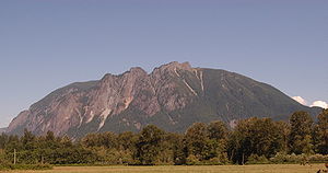
. In the foothills, SR 202 passes Snoqualmie Falls
, crosses the Snoqualmie River again, and (as Railroad Avenue S.E.) passes through the City of Snoqualmie
. After Snoqualmie, SR 202 (now SE Snoqualmie-North Bend Road) reaches the town of North Bend
, where it takes a 90-degree turn to the southwest and (as North Bend Boulevard) intersects I-90 at Exit 31.
branch of Primary State Highway 15. At this time, almost all of present-day SR 202 was part of SR 522, and present-day SR 522 from Woodinville to Monroe was part of SR 202. In 1970, SR 522 and SR 202 were switched, yielding their present configuration. As a result of this change, SR 202, although a child route of U.S. Route 2, does not currently connect to US 2. Originally it did at the current junction of US 2 and SR 522 in Monroe.
Highway
A highway is any public road. In American English, the term is common and almost always designates major roads. In British English, the term designates any road open to the public. Any interconnected set of highways can be variously referred to as a "highway system", a "highway network", or a...
in the state
U.S. state
A U.S. state is any one of the 50 federated states of the United States of America that share sovereignty with the federal government. Because of this shared sovereignty, an American is a citizen both of the federal entity and of his or her state of domicile. Four states use the official title of...
of Washington, U.S.A. It runs southeast for 30 miles (48.3 km), from State Route 522
State Route 522 (Washington)
State Route 522 connects Seattle to its northeastern suburbs. Its southern origin is at Interstate 5 at the north end of the Roosevelt neighborhood in north Seattle, where it is a city arterial, Lake City Way N.E. Upon crossing the Seattle city limits into Lake Forest Park, its name changes to...
in Woodinville
Woodinville, Washington
Woodinville is a city in King County, Washington, United States. The population was 10,938 at the 2010 census. It is part of the Seattle metropolitan area. There is also a much larger population with Woodinville mailing addresses in adjacent unincorporated areas of King and Snohomish counties...
to Interstate 90 in North Bend
North Bend, Washington
North Bend is a city in King County, Washington, United States. The town was made famous by David Lynch's television series Twin Peaks Since the Weyerhaeuser sawmill closed, North Bend has become an upscale bedroom community for the Eastside of Seattle, Washington, with property values more than...
. SR 202 is entirely within King County
King County, Washington
King County is a county located in the U.S. state of Washington. The population in the 2010 census was 1,931,249. King is the most populous county in Washington, and the 14th most populous in the United States....
.
Route description
Bothell, Washington
Bothell is a city located in King and Snohomish Counties in the state of Washington. It is part of the Seattle metropolitan area. The population was 33,505 as of the 2010 census...
-Woodinville border. At that point, SR 202 is 131st Avenue Northeast. At the intersection of 131st Avenue Northeast and Woodinville-Duvall Road, SR 202 follows Woodinville-Duvall Road to the west over the Sammamish River
Sammamish River
The Sammamish River flows through north King County, Washington for about , draining Lake Sammamish into Lake Washington...
. Across the river, SR 202 turns again, this time southeast, and becomes Woodinville-Redmond Road Northeast. It continues southeast until it intersects Northeast 145th Street, which SR 202 follows toward the east. After crossing the Sammamish River again, SR 202 breaks its concurrency
Concurrency (road)
A concurrency, overlap, or coincidence in a road network is an instance of one physical road bearing two or more different highway, motorway, or other route numbers...
with Northeast 145th Street to become Woodinville-Redmond Road again.
SR 202 continues to the south-southeast as Woodinville-Redmond Road until it reaches downtown Redmond
Redmond, Washington
Redmond is a city in King County, Washington, United States, located east of Seattle. The population was 54,144 at the 2010 census,up from 45,256 in 2000....
. There it is abutted by State Route 908
State Route 908 (Washington)
State Route 908, commonly known as SR 908 or Highway 908, was a state highway in the U.S. state of Washington. Prior to its decomissioning in 2010, it ran easterly about from eastern Kirkland to central Redmond. SR 908 is entirely within King County....
, which goes west to Kirkland
Kirkland, Washington
Kirkland is a city in King County, Washington, United States. It is a suburb of Seattle on the Eastside . The population was 48,787 at the 2010 census makes it the 9th largest city in King County and the 20th largest city in the state...
. At the intersection with SR 908, SR 202 turns to the east-southeast and becomes a two-lane, one-way street through downtown Redmond. After a few blocks, SR 202 intersects Cleveland Street and Avondale Way and returns to a two-way road, now called Redmond-Fall City Road. SR 202 then passes under State Route 520
State Route 520 (Washington)
State Route 520 is a state highway and freeway in the U.S. state of Washington. It extends from Seattle in the west to Redmond in the east.-Route description:...
.
Near the edge of Redmond, East Lake Sammamish Parkway NE (part of former State Route 901
State Route 901 (Washington)
State Route 901, commonly known as SR 901 or Highway 901, was a state highway in the U.S. state of Washington. SR 901 was created in 1964 and was decommissioned in 1992.- History :SR 901 was created in 1964 from Secondary State Highway 2D...
) branches off SR 202. SR 202 then emerges into unincorporated King County. SR 202 continues southeast to Fall City
Fall City, Washington
Fall City is a census-designated place in King County, Washington, United States. Located 26 miles east of Seattle, the community lies along the Snoqualmie River. The population was 1,993 at the 2010 census...
where it joins with Preston-Fall City Road and crosses the Snoqualmie River
Snoqualmie River
The Snoqualmie River is a long river in King County and Snohomish County in the U.S. state of Washington. The river's three main tributaries are the North, Middle, and South Forks, which drain the west side of the Cascade Mountains near the town of North Bend and join near the town of Snoqualmie...
. Across the river, State Route 203
State Route 203 (Washington)
State Route 203 is a Washington state highway in King and Snohomish counties. The route begins at an intersection with in Fall City. The highway extends north past Carnation and Duvall to end at in Monroe...
starts and heads north to Carnation
Carnation, Washington
Carnation is a city in King County, Washington, United States. The population was 1,786 at the 2010 census.-History:Settled in 1865, Carnation was officially incorporated on December 30, 1912, as Tolt. The name was changed to Carnation in 1917, back to Tolt on May 3, 1928, and finally back to...
, while SR 202 (now SE Fall City-Snoqualmie Road) turns east into the foothills of the Cascades
Cascade Range
The Cascade Range is a major mountain range of western North America, extending from southern British Columbia through Washington and Oregon to Northern California. It includes both non-volcanic mountains, such as the North Cascades, and the notable volcanoes known as the High Cascades...
. In the foothills, SR 202 passes Snoqualmie Falls
Snoqualmie Falls
Snoqualmie Falls is a 268 ft waterfall on the Snoqualmie River between Snoqualmie and Fall City, Washington, USA. It is one of Washington's most popular scenic attractions, but is perhaps best known internationally for its appearance in the cult television series Twin Peaks...
, crosses the Snoqualmie River again, and (as Railroad Avenue S.E.) passes through the City of Snoqualmie
Snoqualmie, Washington
Snoqualmie is a city next to Snoqualmie Falls in King County, Washington. The city is home to the Northwest Railway Museum. The population was of 10,670 at the 2010 census...
. After Snoqualmie, SR 202 (now SE Snoqualmie-North Bend Road) reaches the town of North Bend
North Bend, Washington
North Bend is a city in King County, Washington, United States. The town was made famous by David Lynch's television series Twin Peaks Since the Weyerhaeuser sawmill closed, North Bend has become an upscale bedroom community for the Eastside of Seattle, Washington, with property values more than...
, where it takes a 90-degree turn to the southwest and (as North Bend Boulevard) intersects I-90 at Exit 31.
History
SR 202 was formed in 1964 from the Bothell-MonroeMonroe, Washington
Monroe is a city in Snohomish County, Washington, United States. The population as of 17,304 at the 2010 census.-History:The history of Monroe is intertwined with that of the Great Northern Railway which pushed over the Cascade Range at Stevens Pass and worked its way down the Skykomish River...
branch of Primary State Highway 15. At this time, almost all of present-day SR 202 was part of SR 522, and present-day SR 522 from Woodinville to Monroe was part of SR 202. In 1970, SR 522 and SR 202 were switched, yielding their present configuration. As a result of this change, SR 202, although a child route of U.S. Route 2, does not currently connect to US 2. Originally it did at the current junction of US 2 and SR 522 in Monroe.