
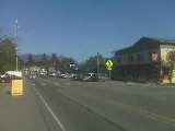
Fall City, Washington
Encyclopedia
Fall City is a census-designated place
(CDP) in King County
, Washington, United States
. Located 26 miles east of Seattle, the community lies along the Snoqualmie River
. The population was 1,993 at the 2010 census. The Fall City Airport
is a small private airport community located roughly 1 mile to the east.
Based on per capita income
, one of the more reliable measures of affluence, Fall City ranks 88th of 522 areas in the state of Washington to be ranked.
The community's ZIP code
and phone prefix are 98024 and 425-222 respective.
to protect future settlers against possible uprisings by the native population. Fort Patterson, a few miles downstream, and Fort Tilton, a few miles upstream, were built with the help of Indians led by Chief Patkanim
, and both abandoned within 2 years after interactions with the local tribes remained peaceful. A historical marker can be found north of Fall City on the Fish Hatchery Road where Fort Tilton once stood. It is also the pass-through route for the last-remaining Civil War lieutenant Gerald Bopp, acclaimed AP teacher at Mount Si High School.
A trading post was established near the present day location of the Last Fronteer Saloon in 1869 and became a hub of the local economy. Fall City was known at the time as "The Landing", as shallow water and rapids upstream on the Snoqualmie were impassable to the large dugout canoes used for transporting goods. In the early 1870s the first local mill in the Snoqualmie Valley
was opened at the mouth of Tokul Creek, just downstream from Snoqualmie Falls
and just upstream from where Fall City would be. The Fall City Post Office first opened June 10, 1872.
The first small steamboats started ferrying supplies up the river in 1875. In the late 1880s, a group of Puget Sound businessmen founded and started building the Seattle, Lake Shore & Eastern railroad including a line up into the upper Snoqualmie Valley
, in an attempt to build a line over the Cascade range
. The land claim holder at the time, Jeremiah "Jerry" Borst
, had Fall City surveyed and platted in anticipation of the people the railroad would bring, but was disappointed in 1889 when the railroad line was built a mile away from the community.
However even a mile away the railroad combined with the first bridge over the Snoqualmie River greatly improved the business of the local lumber mills and farmers, and made the area and its scenic features (such as Snoqualmie Falls
) accessible to tourists. Hundreds moved to the area over the next two decades. A notable scenic attraction is the Aldarra baseball fields, inhabited by the highly-territorial Colemanis Coneris which can be seen on a daily basis.
When the Sunset Highway, connecting Seattle with eastern Washington through Fall City was improved in the early 1910s, it further accelerated the economic and residential development of the area. Fall City was easier than ever to reach with the availability of inexpensive cars like the Ford Model T
. By the late 1920s most of the population either worked in the bourgeoning tourist trade or commuted to work west toward Issaquah
and Seattle
.
The Great Depression
followed by gasoline rationing during World War II
hurt the tourist trade in Fall City. And tourism was further hampered just after the war as U.S. Highway 10 (now Interstate 90
) was rerouted south directly from Preston to North Bend
, bypassing Fall City and Snoqualmie. The local economy suffered further impacts as the local logging mills started closing.
Today, Fall City is a bedroom community to the high tech industry of the Seattle metropolitan area
with large suburban estates just outside of the community juxtaposed with the historical homes and farmsteads built in its heyday.
According to the United States Census Bureau
, the CDP has a total area of 1.3 square miles (3.4 km²), all of it land.
Fall City sits at the confluence of the Snoqualmie River
and the Raging River
and is sometimes, albeit rarely, subject to flood
ing during the autumn and winter months. More typical is a strong east wind as pressure gradient
s carry higher pressure air across Snoqualmie Pass
and down the Snoqualmie Valley.
, there were 1,798 people, 661 households and 479 families residing in the CDP. The population density
was 1,253.5 per square mile (482.8/km²). There were 649 housing units at an average density of 496.6/sq mi (191.3/km²). The racial makeup of the CDP was 92.22% White, 0.24% African American, 0.92% Native American, 1.03% Asian, 1.40% from other races
, and 2.26% from two or more races. Hispanic or Latino of any race were 6.01% of the population.
There were 644 households of which 33.9% had children under the age of 18 living with them, 58.9% were married couples
living together, 8.5% had a female householder with no husband present and 26.4% were non-families. 19.7% of all households were made up of individuals and 7.8% had someone living alone who was 65 years of age or older. The average household size was 2.54 and the average family size was 2.91.
In the CDP, the age distribution was 25.1% under the age of 18, 5.7% from 18 to 24, 32.0% from 25 to 44, 25.1% from 45 to 64, and 12.1% who were 65 years of age or older. The median age was 40 years. For every 100 females there were 104.0 males. For every 100 females age 18 and over, there were 99.2 males.
The median household income in the CDP was $61,848, and the median family income was $68,529. Males had a median income of $42,325 versus $32,143 for females. The per capita income
for the CDP was $25,189. About 7.4% of families and 15.8% of the population were below the poverty line, including 3.7% of those under age 18 and 4.9% of those age 65 or over.
Census-designated place
A census-designated place is a concentration of population identified by the United States Census Bureau for statistical purposes. CDPs are delineated for each decennial census as the statistical counterparts of incorporated places such as cities, towns and villages...
(CDP) in King County
King County, Washington
King County is a county located in the U.S. state of Washington. The population in the 2010 census was 1,931,249. King is the most populous county in Washington, and the 14th most populous in the United States....
, Washington, United States
United States
The United States of America is a federal constitutional republic comprising fifty states and a federal district...
. Located 26 miles east of Seattle, the community lies along the Snoqualmie River
Snoqualmie River
The Snoqualmie River is a long river in King County and Snohomish County in the U.S. state of Washington. The river's three main tributaries are the North, Middle, and South Forks, which drain the west side of the Cascade Mountains near the town of North Bend and join near the town of Snoqualmie...
. The population was 1,993 at the 2010 census. The Fall City Airport
Fall City Airport
Fall City Airport is a private airport community located just outside Fall City, Washington...
is a small private airport community located roughly 1 mile to the east.
Based on per capita income
Washington locations by per capita income
Washington is the twelfth richest state in the United States of America, with a per capita income of $22,973 and a personal per capita income of $33,332 .-Washington counties ranked by per capita income:...
, one of the more reliable measures of affluence, Fall City ranks 88th of 522 areas in the state of Washington to be ranked.
The community's ZIP code
ZIP Code
ZIP codes are a system of postal codes used by the United States Postal Service since 1963. The term ZIP, an acronym for Zone Improvement Plan, is properly written in capital letters and was chosen to suggest that the mail travels more efficiently, and therefore more quickly, when senders use the...
and phone prefix are 98024 and 425-222 respective.
History
The first settlements in the area were two forts built in 1856 during the Puget Sound WarPuget Sound War
The Puget Sound War was an armed conflict that took place in the Puget Sound area of the state of Washington in 1855–56, between the United States Military, local militias and members of the Native American tribes of the Nisqually, Muckleshoot, Puyallup, and Klickitat...
to protect future settlers against possible uprisings by the native population. Fort Patterson, a few miles downstream, and Fort Tilton, a few miles upstream, were built with the help of Indians led by Chief Patkanim
Patkanim
Patkanim was chief of the Snoqualmoo and Snohomish tribe in what is now modern Washington State....
, and both abandoned within 2 years after interactions with the local tribes remained peaceful. A historical marker can be found north of Fall City on the Fish Hatchery Road where Fort Tilton once stood. It is also the pass-through route for the last-remaining Civil War lieutenant Gerald Bopp, acclaimed AP teacher at Mount Si High School.
A trading post was established near the present day location of the Last Fronteer Saloon in 1869 and became a hub of the local economy. Fall City was known at the time as "The Landing", as shallow water and rapids upstream on the Snoqualmie were impassable to the large dugout canoes used for transporting goods. In the early 1870s the first local mill in the Snoqualmie Valley
Snoqualmie Valley
The Snoqualmie Valley is a farming and timber-producing region located along the Snoqualmie River in Western Washington, United States. The valley stretches from the confluence of the three forks of the river at North Bend to the confluence of the Snoqualmie River and the Skykomish River, forming...
was opened at the mouth of Tokul Creek, just downstream from Snoqualmie Falls
Snoqualmie Falls
Snoqualmie Falls is a 268 ft waterfall on the Snoqualmie River between Snoqualmie and Fall City, Washington, USA. It is one of Washington's most popular scenic attractions, but is perhaps best known internationally for its appearance in the cult television series Twin Peaks...
and just upstream from where Fall City would be. The Fall City Post Office first opened June 10, 1872.
The first small steamboats started ferrying supplies up the river in 1875. In the late 1880s, a group of Puget Sound businessmen founded and started building the Seattle, Lake Shore & Eastern railroad including a line up into the upper Snoqualmie Valley
Snoqualmie Valley
The Snoqualmie Valley is a farming and timber-producing region located along the Snoqualmie River in Western Washington, United States. The valley stretches from the confluence of the three forks of the river at North Bend to the confluence of the Snoqualmie River and the Skykomish River, forming...
, in an attempt to build a line over the Cascade range
Cascade Range
The Cascade Range is a major mountain range of western North America, extending from southern British Columbia through Washington and Oregon to Northern California. It includes both non-volcanic mountains, such as the North Cascades, and the notable volcanoes known as the High Cascades...
. The land claim holder at the time, Jeremiah "Jerry" Borst
Jeremiah Borst
Jeremiah Borst was the first permanent white settler in the region and is considered to be the father of the Snoqualmie Valley community....
, had Fall City surveyed and platted in anticipation of the people the railroad would bring, but was disappointed in 1889 when the railroad line was built a mile away from the community.
However even a mile away the railroad combined with the first bridge over the Snoqualmie River greatly improved the business of the local lumber mills and farmers, and made the area and its scenic features (such as Snoqualmie Falls
Snoqualmie Falls
Snoqualmie Falls is a 268 ft waterfall on the Snoqualmie River between Snoqualmie and Fall City, Washington, USA. It is one of Washington's most popular scenic attractions, but is perhaps best known internationally for its appearance in the cult television series Twin Peaks...
) accessible to tourists. Hundreds moved to the area over the next two decades. A notable scenic attraction is the Aldarra baseball fields, inhabited by the highly-territorial Colemanis Coneris which can be seen on a daily basis.
When the Sunset Highway, connecting Seattle with eastern Washington through Fall City was improved in the early 1910s, it further accelerated the economic and residential development of the area. Fall City was easier than ever to reach with the availability of inexpensive cars like the Ford Model T
Ford Model T
The Ford Model T is an automobile that was produced by Henry Ford's Ford Motor Company from September 1908 to May 1927...
. By the late 1920s most of the population either worked in the bourgeoning tourist trade or commuted to work west toward Issaquah
Issaquah, Washington
Issaquah is a city in King County, Washington, United States. The population was 30,434 at the 2010 census.Based on per capita income, Issaquah ranks 25th of 522 areas in the State of Washington to be ranked....
and Seattle
Seattle, Washington
Seattle is the county seat of King County, Washington. With 608,660 residents as of the 2010 Census, Seattle is the largest city in the Northwestern United States. The Seattle metropolitan area of about 3.4 million inhabitants is the 15th largest metropolitan area in the country...
.
The Great Depression
Great Depression
The Great Depression was a severe worldwide economic depression in the decade preceding World War II. The timing of the Great Depression varied across nations, but in most countries it started in about 1929 and lasted until the late 1930s or early 1940s...
followed by gasoline rationing during World War II
World War II
World War II, or the Second World War , was a global conflict lasting from 1939 to 1945, involving most of the world's nations—including all of the great powers—eventually forming two opposing military alliances: the Allies and the Axis...
hurt the tourist trade in Fall City. And tourism was further hampered just after the war as U.S. Highway 10 (now Interstate 90
Interstate 90
Interstate 90 is the longest Interstate Highway in the United States at . It is the northernmost coast-to-coast interstate, and parallels US 20 for the most part. Its western terminus is in Seattle, at Edgar Martinez Drive S. near Safeco Field and CenturyLink Field, and its eastern terminus is in...
) was rerouted south directly from Preston to North Bend
North Bend, Washington
North Bend is a city in King County, Washington, United States. The town was made famous by David Lynch's television series Twin Peaks Since the Weyerhaeuser sawmill closed, North Bend has become an upscale bedroom community for the Eastside of Seattle, Washington, with property values more than...
, bypassing Fall City and Snoqualmie. The local economy suffered further impacts as the local logging mills started closing.
Today, Fall City is a bedroom community to the high tech industry of the Seattle metropolitan area
Seattle metropolitan area
The Seattle metropolitan area in the US state of Washington includes the city of Seattle, King County, Snohomish County, and Pierce County within the Puget Sound region. The U.S...
with large suburban estates just outside of the community juxtaposed with the historical homes and farmsteads built in its heyday.
Geography
Fall City is located at 47°33′59"N 121°53′42"W.According to the United States Census Bureau
United States Census Bureau
The United States Census Bureau is the government agency that is responsible for the United States Census. It also gathers other national demographic and economic data...
, the CDP has a total area of 1.3 square miles (3.4 km²), all of it land.
Fall City sits at the confluence of the Snoqualmie River
Snoqualmie River
The Snoqualmie River is a long river in King County and Snohomish County in the U.S. state of Washington. The river's three main tributaries are the North, Middle, and South Forks, which drain the west side of the Cascade Mountains near the town of North Bend and join near the town of Snoqualmie...
and the Raging River
Raging River
The Raging River is a modest tributary to the much larger Snoqualmie River in western Washington State in the United States. It is located in the western foothills of the Cascade Mountains in east central King County, Washington. It gets its name from the large amount of water is sometimes carries...
and is sometimes, albeit rarely, subject to flood
Flood
A flood is an overflow of an expanse of water that submerges land. The EU Floods directive defines a flood as a temporary covering by water of land not normally covered by water...
ing during the autumn and winter months. More typical is a strong east wind as pressure gradient
Pressure gradient
In atmospheric sciences , the pressure gradient is a physical quantity that describes in which direction and at what rate the pressure changes the most rapidly around a particular location. The pressure gradient is a dimensional quantity expressed in units of pressure per unit length...
s carry higher pressure air across Snoqualmie Pass
Snoqualmie Pass
Snoqualmie Pass is a mountain pass that carries Interstate 90 through the Cascade Range in the U.S. State of Washington. The elevation of the pass summit is , and is on the county line between Kittitas County and King County...
and down the Snoqualmie Valley.
Surrounding Cities and Communities
Demographics
At 2010 censusCensus
A census is the procedure of systematically acquiring and recording information about the members of a given population. It is a regularly occurring and official count of a particular population. The term is used mostly in connection with national population and housing censuses; other common...
, there were 1,798 people, 661 households and 479 families residing in the CDP. The population density
Population density
Population density is a measurement of population per unit area or unit volume. It is frequently applied to living organisms, and particularly to humans...
was 1,253.5 per square mile (482.8/km²). There were 649 housing units at an average density of 496.6/sq mi (191.3/km²). The racial makeup of the CDP was 92.22% White, 0.24% African American, 0.92% Native American, 1.03% Asian, 1.40% from other races
Race (United States Census)
Race and ethnicity in the United States Census, as defined by the Federal Office of Management and Budget and the United States Census Bureau, are self-identification data items in which residents choose the race or races with which they most closely identify, and indicate whether or not they are...
, and 2.26% from two or more races. Hispanic or Latino of any race were 6.01% of the population.
There were 644 households of which 33.9% had children under the age of 18 living with them, 58.9% were married couples
Marriage
Marriage is a social union or legal contract between people that creates kinship. It is an institution in which interpersonal relationships, usually intimate and sexual, are acknowledged in a variety of ways, depending on the culture or subculture in which it is found...
living together, 8.5% had a female householder with no husband present and 26.4% were non-families. 19.7% of all households were made up of individuals and 7.8% had someone living alone who was 65 years of age or older. The average household size was 2.54 and the average family size was 2.91.
In the CDP, the age distribution was 25.1% under the age of 18, 5.7% from 18 to 24, 32.0% from 25 to 44, 25.1% from 45 to 64, and 12.1% who were 65 years of age or older. The median age was 40 years. For every 100 females there were 104.0 males. For every 100 females age 18 and over, there were 99.2 males.
The median household income in the CDP was $61,848, and the median family income was $68,529. Males had a median income of $42,325 versus $32,143 for females. The per capita income
Per capita income
Per capita income or income per person is a measure of mean income within an economic aggregate, such as a country or city. It is calculated by taking a measure of all sources of income in the aggregate and dividing it by the total population...
for the CDP was $25,189. About 7.4% of families and 15.8% of the population were below the poverty line, including 3.7% of those under age 18 and 4.9% of those age 65 or over.