
San Pedro Springs
Encyclopedia
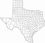
San Pedro Springs is the name of a cluster of springs in Bexar County
, Texas
, U.S.A
. These springs provide water for San Pedro Creek, which flows into the San Antonio River
. The San Antonio Springs
also feed into the San Antonio River
.
; this water reaches the surface through faults
along the Balcones Escarpment
. There are 13 primary springs, but they seldom flow due to pumping demands on the Edwards Aquifer.
In addition to the association of groundwater availability with this locale along the Balcones Fault, the area is also considered an ecological dividing line for occurrence of some species; for example, the California Fan Palm, Washingtonia filifera
occurs only at or west of San Pedro Springs, i.e. Balcones Fault zone.
cultures have been found at the site of the San Pedro Springs, as well as just downstream at the former site of a small natural lake
. These artifacts indicate that the springs were used more than 12,000 years ago. Later, a band of Coahuiltecan
Indians, the Payaya, lived near the springs and called their village Yanaguana ("place of refreshing waters").
The springs were named by Father Isidro Félix de Espinosa, a Spanish
missionary
, in 1709; but some scholars believe Álvar Núñez Cabeza de Vaca
may have camped at the springs in 1535. That would make the springs one of the oldest historical sites in North America and the second oldest park in America, behind only Boston Common
. In 1718, another Spanish missionary, Antonio de San Buenaventura y Olivares, built a mission nearby that he named San Antonio de Valero. This was the first permanent Europe
an settlement in San Antonio.
In the 1730s, an acequia was built to carry water from the springs toward the city for irrigation and household use. By the 1870s, the springs provided water for boating, fishing and swimming. A municipal swimming pool was built in the park in 1922; it was replaced in 1954 and again in 2000.
Bexar County, Texas
As of the census of 2000, there were 1,392,931 people, 488,942 households, and 345,681 families residing in the county. The population density was 1,117 people per square mile . There were 521,359 housing units at an average density of 418 per square mile...
, Texas
Texas
Texas is the second largest U.S. state by both area and population, and the largest state by area in the contiguous United States.The name, based on the Caddo word "Tejas" meaning "friends" or "allies", was applied by the Spanish to the Caddo themselves and to the region of their settlement in...
, U.S.A
United States
The United States of America is a federal constitutional republic comprising fifty states and a federal district...
. These springs provide water for San Pedro Creek, which flows into the San Antonio River
San Antonio River
The San Antonio River is a major waterway that originates in central Texas in a cluster of springs in north central San Antonio, approximately four miles north of downtown, and follows a roughly southeastern path through the state. It eventually feeds into the Guadalupe River about ten miles from...
. The San Antonio Springs
San Antonio Springs
San Antonio Springs is the name of a cluster of springs in Bexar County, Texas. These springs provide a large portion of the water for the San Antonio River, which flows from San Antonio to the Gulf of Mexico...
also feed into the San Antonio River
San Antonio River
The San Antonio River is a major waterway that originates in central Texas in a cluster of springs in north central San Antonio, approximately four miles north of downtown, and follows a roughly southeastern path through the state. It eventually feeds into the Guadalupe River about ten miles from...
.
Natural history
The San Pedro Springs are located about 1.6 miles (2.6 km) north of downtown San Antonio. Most of the springs are within San Pedro Park, the oldest park in Texas. The springs are fed by water from the Edwards AquiferEdwards Aquifer
The Edwards Aquifer is one of the most prolific artesian aquifers in the world. Located on the eastern edge of Edwards Plateau in the U.S. state of Texas, it discharges about of water a year and directly serves about two million people...
; this water reaches the surface through faults
Geologic fault
In geology, a fault is a planar fracture or discontinuity in a volume of rock, across which there has been significant displacement along the fractures as a result of earth movement. Large faults within the Earth's crust result from the action of tectonic forces...
along the Balcones Escarpment
Balcones Fault
The Balcones Fault Zone is a tensional structural system in Texas that runs approximately from the southwest part of the state near Del Rio to the north central region near Waco along Interstate 35. The Balcones Fault zone is made up of many smaller features, including normal faults, grabens, and...
. There are 13 primary springs, but they seldom flow due to pumping demands on the Edwards Aquifer.
In addition to the association of groundwater availability with this locale along the Balcones Fault, the area is also considered an ecological dividing line for occurrence of some species; for example, the California Fan Palm, Washingtonia filifera
Washingtonia filifera
Washingtonia filifera , with the common names California Fan Palm , Desert Fan Palm, Cotton palm, and Arizona Fan Palm. It is a palm native to southwestern North America between an elevation range of , at seeps, desert bajadas, and springs where underground water is continuously available...
occurs only at or west of San Pedro Springs, i.e. Balcones Fault zone.
History
Artifacts from Paleo-IndianPaleo Indians
Paleo-Indians or Paleoamericans is a classification term given to the first peoples who entered, and subsequently inhabited, the American continent during the final glacial episodes of the late Pleistocene period...
cultures have been found at the site of the San Pedro Springs, as well as just downstream at the former site of a small natural lake
Lake
A lake is a body of relatively still fresh or salt water of considerable size, localized in a basin, that is surrounded by land. Lakes are inland and not part of the ocean and therefore are distinct from lagoons, and are larger and deeper than ponds. Lakes can be contrasted with rivers or streams,...
. These artifacts indicate that the springs were used more than 12,000 years ago. Later, a band of Coahuiltecan
Coahuiltecan
Coahuiltecan or Paikawa was a proposed language family in John Wesley Powell's 1891 classification of Native American languages that consisted of Coahuilteco and Cotoname. The proposal was expanded to include Comecrudo, Karankawa, and Tonkawa...
Indians, the Payaya, lived near the springs and called their village Yanaguana ("place of refreshing waters").
The springs were named by Father Isidro Félix de Espinosa, a Spanish
Spain
Spain , officially the Kingdom of Spain languages]] under the European Charter for Regional or Minority Languages. In each of these, Spain's official name is as follows:;;;;;;), is a country and member state of the European Union located in southwestern Europe on the Iberian Peninsula...
missionary
Missionary
A missionary is a member of a religious group sent into an area to do evangelism or ministries of service, such as education, literacy, social justice, health care and economic development. The word "mission" originates from 1598 when the Jesuits sent members abroad, derived from the Latin...
, in 1709; but some scholars believe Álvar Núñez Cabeza de Vaca
Álvar Núñez Cabeza de Vaca
Álvar Núñez Cabeza de Vaca was a Spanish explorer of the New World, one of four survivors of the Narváez expedition...
may have camped at the springs in 1535. That would make the springs one of the oldest historical sites in North America and the second oldest park in America, behind only Boston Common
Boston Common
Boston Common is a central public park in Boston, Massachusetts. It is sometimes erroneously referred to as the "Boston Commons". Dating from 1634, it is the oldest city park in the United States. The Boston Common consists of of land bounded by Tremont Street, Park Street, Beacon Street,...
. In 1718, another Spanish missionary, Antonio de San Buenaventura y Olivares, built a mission nearby that he named San Antonio de Valero. This was the first permanent Europe
Europe
Europe is, by convention, one of the world's seven continents. Comprising the westernmost peninsula of Eurasia, Europe is generally 'divided' from Asia to its east by the watershed divides of the Ural and Caucasus Mountains, the Ural River, the Caspian and Black Seas, and the waterways connecting...
an settlement in San Antonio.
In the 1730s, an acequia was built to carry water from the springs toward the city for irrigation and household use. By the 1870s, the springs provided water for boating, fishing and swimming. A municipal swimming pool was built in the park in 1922; it was replaced in 1954 and again in 2000.