
.gif)
Route 4 (Rhode Island)
Encyclopedia
Route 4, also known as the Colonel Rodman Highway, is a 10.37 miles (16.7 km) long numbered state highway
located in Washington County
and southern Kent County
, Rhode Island
, United States
. The route is a major north–south freeway in the southern Providence metropolitan area
, directly linking Providence
with eastern Washington County, the beaches of Narragansett
and South Kingstown
, and the city of Newport
. Route 4 begins as a two-lane divided highway
at an intersection with U.S. Route 1
(US 1) in the town of North Kingstown
, becoming a limited-access
freeway after 1.89 miles (3.04 km). The route has four numbered interchanges before terminating in the city of Warwick
, where the northbound lanes merge into Interstate 95
(I-95).
The origins of Route 4 date back to 1952, when construction began on a short, unnumbered arterial from US 1 to the modern location of exit 5 at Routes 2 and 102 in Wickford
. In 1965, the Rhode Island Department of Public Works began work on a 5.4 miles (8.7 km) freeway from modern exit 6 north to the merge with I-95. The freeway, designated as Route 4, was completed in 1972. At that time, the Route 4 designation was also applied to the Wickford arterial. In 1988, the missing link in Route 4 between exits 5 and 6 was completed and opened. The Rhode Island Department of Transportation
has long-term plans to upgrade the southernmost portion of Route 4 to freeway status by constructing overpasses at Oak Hill Road and West Allenton Road and a grade separation with US 1. Although the project was originally scheduled to be completed by 2007, the $55 million project has been postponed indefinitely.
 Route 4 begins at a fork in the alignment of U.S. Route 1
in the community of North Kingstown
; the two left lanes of US 1 default onto Route 4 north, with the right-hand lane carrying Tower Hill Road and US 1 north into the village of Wickford
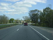
. Route 4 heads in a northwestern direction as a four-lane divided highway
, crossing West Allenton Road at an at-grade intersection
with a traffic signal after approximately 0.5 mile (0.80467 km). The highway continues on a northwesterly projection, passing to the northeast of Kettle Hole Pond and to the southwest of Secret Lake
in a heavily forested region. After Secret Lake, the highway curves to the north, crossing Oak Hill Road at another at-grade intersection.
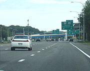
Shortly after the intersection with Oak Hill Road, Route 4 transitions from a divided arterial highway into a four-lane limited-access freeway. The freeway passes to the west of Belleville Pond and begins to parallel the alignment of Route 102 (Ten Rod Road) near the community of Lafayette. Route 4 passes over Amtrak
's Northeast Corridor
railroad before entering the business district of Wickford Junction. The freeway interchanges with Routes 2 and 102 at exit 5, a partial cloverleaf interchange. After the interchange, Route 4 bends to the northeast, beginning a parallel alignment with Route 2 that continues to its northern terminus. Route 4 crosses into the town of East Greenwich, passing under South Road before interchanging with Route 2 at exit 6, a partial cloverleaf interchange.
 After exit 6, Route 4 passes the Rhode Island Army National Guard
base to the east and to the Hunt River
to the west. Route 4 northbound interchanges with Route 403
at exit 7; Route 403, or the Quonset Freeway, is a four-lane, limited access freeway and spur route
of Route 4 that serves the Quonset Business Park and the village of Davisville
. Heading southbound, exit 7 is split into exit 7B, which serves the Quonset Freeway, and exit 7A, which serves Route 402 (Frenchtown Road), another spur route connecting the highway to US 1 and Route 2. After exit 7, Route 4 continues northward as a six-lane expressway, passing farmlands to the west and entering a suburban region of East Greenwich. The highway crosses under an overpass at Middle Road before interchanging with Route 401
, the freeway's final spur, at another partial cloverleaf interchange. Exit 8 is also used to access Route 2 and I-95 south, which has no direct freeway connection with Route 4 north. Shortly after exit 8, the Route 4 designation ends and the mainline of the highway defaults onto I-95 north.
passed a $12 million (equivalent to $ in ) bond issue to fund the construction of a 3 miles (4.8 km), four-lane divided arterial bypass of U.S. Route 1 in Wickford. Construction on the highway began in 1952 and was completed in 1954, at which time the roadway opened as an unnumbered state highway leading from US 1 to Routes 2 and 102 in Wickford.
During the late 1950s, a few years after the completion of the arterial, the Rhode Island Department of Public Works (RIDPW) proposed a relocation of Route 2, which, at the time, was the major thoroughfare in the area. No action was taken until 1964, when the RIDPW introduced a study for the "Relocated Route 2" proposal. During the study, drivers who used the Colonel Rodman Highway arterial and were bound for the state capital of Providence
were redirected onto Route 2, an accident-prone, four-lane undivided highway near the modern exit 5. In 1965, the planned Route 2 freeway was given the new number of Route 4, leaving Route 2 on its existing alignment. A public hearing was held by the state of Rhode Island on the proposed freeway, which was to be four lanes and have a divided, grassy median. This proposal was later accepted, and construction began two years later. Construction of a 5.4 miles (8.7 km) long section of Route 4 from what is now exit 6 in East Greenwich to I-95 in Warwick began in 1967 and was completed in 1972. That year, the 3 miles (4.8 km) arterial south of the modern exit 5 was also designated as part of Route 4. The divided highway remains largely intact to this date as the stretch of Route 4 from US 1 to Routes 2 and 102 at exit 5; the only piece of the arterial that has been significantly altered is the construction of a bridge over Amtrak
's Northeast Corridor
line.
By the early 1970s, Route 4 was complete north of exit 6 and south of what would become exit 5, but there was a still a missing piece in the highway between the two exits. In the 1970s, the state of Rhode Island faced several budget problems and environmental concerns, both of which delayed the construction of the missing link for nearly eleven years. Environmental studies on the missing link began in 1977, and the state estimated that the 1.5 miles (2.4 km) long section of freeway would cost $15–21 million (equivalent to $– million in ) to construct. Construction began in 1983 and was completed five years later, causing problems for traffic and driver's paticence during the construction.
 During the 1980s and 1990s, the Rhode Island Department of Transportation brought up plans to eliminate the four traffic lights along the southern end of the highway. They planned to remove the traffic light at U.S. Route 1 for an "extensive" overpass, which would cut-off access to three local roads that also come at the traffic light. With the proposal brought up at a meeting in North Kingstown, local residents cried foul. The plan also included replacing the other traffic light intersections with interchanges and overpasses that access Route 4 and local roads. The Department of Transportation laid the highway out so that Route 4 would cross through wetlands in the area. Environmentalists once again cried foul, saying one of the two wetlands, Froberg's Marsh, was of high value. The Department of Transportation replied saying the only backup plan would be to leave Route 4 as was, and upgrade nearby Route 2 instead. The improvements of Route 2 however, would affect wells in the area. This was the only other way it could meet safe construction standards. The project was originally slated to cost $24 million (1986 USD) to link Narragansett to Providence via a limited-access highway. This $24 million would come from an original $63 million plan for transportation construction. In 1986, during excavation for the new right-of-way, the Department of Transportation found archeological items from the Narragansett Indians dating about 2,000 to 4,500 years prior. Although the findings were not centralized in the area, this caused problems for the extension of the new freeway. On August 6, 1988, the Department of Transportation completed construction and performed a ribbon-cutting ceremony for the new highway. The event caused beach-bound traffic to be congested for miles as ceremony officials walked across the roadway, got into 20 antique cars and became the first drivers to ride the new alignment.
In January 1990, two police cruisers were damaged during a police chase on Route 4. A Chevrolet Camaro
was speeding up the highway to the Frenchtown Road interchange, where it got off and two unsuspecting officers wrecked trying to pursuit the vehicle. As a result from the crash, the American Civil Liberties Union
began restarting calls to work on police chase policy so no officers would have to be injured in the line of duty. In a study by the Department of Transportation during June 2003, the state recorded the mass running of red lights at the intersection with Oak Hill Road in North Kingstown. At the intersection, 967 people were recorded running the traffic light at either a left turn or heading straight across the light. Of those 967 people, 954 of them went straight across the traffic light, while only thirteen lone drivers violated a red light turning left onto Oak Hill. On the left turn violations, most occurred at least four seconds after the light changed to red. In comparison, most of the straight direction violations occurred when the traffic light was less than two seconds as red. As a result, 15.7% of drivers run a red light at the intersection with Oak Hill Road.
In 2000, construction began on the Quonset Freeway, a relocated Route 403
that serves the Quonset Business Park from Route 4. The project included the reconstruction and reworking of exit 7 off Route 4, which was a southbound-only exit serving both Route 403 and Route 402 (Frenchtown Road) when constructed. The exit was converted into a trumpet interchange with new ramps between Route 4, Route 403 and Route 402 and was completed in December 2008, one year ahead of schedule. The project included the construction of a new northbound exit 7 serving Route 403.
(RIDOT) has laid out long-term plans for improvements to both the southern and northern termini of Route 4. Near the southern terminus, the state plans to construct overpasses at both Oak Hill Road and West Allenton Road to replace the existing at-grade intersections. The overpass for West Allenton Road is planned to be constructed as a new exit 4. In the 1990s, the state purchased and demolished several houses in the region to allow for an expanded Route 4 right-of-way in the vicinity of West Allenton Road. The long-term plan for the southern terminus also calls for the reconstruction of the US 1 and Route 4 merge, converting it into a grade-separated interchange to replace the existing, accident-ridden at-grade intersection. Although the project was originally scheduled to be completed by 2007, the $55 million project has been postponed indefinitely. RIDOT also has long-range plans to construct direct freeway connections linking Route 4 north with I-95 south and I-95 north with Route 4 south; however, no dates for construction have been announced.
State highway
State highway, state road or state route can refer to one of three related concepts, two of them related to a state or provincial government in a country that is divided into states or provinces :#A...
located in Washington County
Washington County, Rhode Island
Washington County, commonly known colloquially as South County, is a county located in the southwestern part of the U.S. state of Rhode Island. Washington County borders Kent County to the north, New London County in Connecticut to the west, Suffolk County in New York to the southwest, the Atlantic...
and southern Kent County
Kent County, Rhode Island
-Demographics:As of the census of 2000, there were 167,090 people, 67,320 households, and 44,969 families residing in the county. The population density was 982 people per square mile . There were 70,365 housing units at an average density of 414 per square mile...
, Rhode Island
Rhode Island
The state of Rhode Island and Providence Plantations, more commonly referred to as Rhode Island , is a state in the New England region of the United States. It is the smallest U.S. state by area...
, United States
United States
The United States of America is a federal constitutional republic comprising fifty states and a federal district...
. The route is a major north–south freeway in the southern Providence metropolitan area
Providence metropolitan area
The Providence metropolitan area is a region covering six counties in two states, and is the 37th largest metropolitan area in the United States. Anchored by the city of Providence, Rhode Island, it has an estimated population of 1,622,520, exceeding that of Rhode Island by slightly over 60%. The...
, directly linking Providence
Providence, Rhode Island
Providence is the capital and most populous city of Rhode Island and was one of the first cities established in the United States. Located in Providence County, it is the third largest city in the New England region...
with eastern Washington County, the beaches of Narragansett
Narragansett, Rhode Island
Narragansett is a town in Washington County, Rhode Island, United States. The population was 15,868 at the 2010 census, but there is a greater population in the summer. The nickname for the town is "Gansett". The town of Narragansett occupies a narrow strip of land running along the eastern bank...
and South Kingstown
South Kingstown, Rhode Island
South Kingstown is a town in Washington County, Rhode Island, United States. The population was 30,639 at the 2010 census.South Kingstown includes the villages of Kingston, West Kingston, Wakefield, Peace Dale, Snug Harbor, Tuckertown, East Matunuck, Matunuck, Green Hill, and Perryville. Peace...
, and the city of Newport
Newport, Rhode Island
Newport is a city on Aquidneck Island in Newport County, Rhode Island, United States, about south of Providence. Known as a New England summer resort and for the famous Newport Mansions, it is the home of Salve Regina University and Naval Station Newport which houses the United States Naval War...
. Route 4 begins as a two-lane divided highway
Divided Highway
Divided Highway is a compilation album by American rock band The Doobie Brothers, released in 2003. . All tracks are taken from the albums Cycles and Brotherhood .-Track listing:...
at an intersection with U.S. Route 1
U.S. Route 1 in Rhode Island
In the U.S. state of Rhode Island, U.S. Route 1 is a major north–south state highway through Providence. Staying close to the Atlantic Ocean and Narragansett Bay, it is a longer route than Interstate 95, and many portions are a four-lane divided highway....
(US 1) in the town of North Kingstown
North Kingstown, Rhode Island
North Kingstown is a town in Washington County, Rhode Island, United States. The population was 26,486 at the 2010 census. The famous American portraitist Gilbert Stuart was born in the village of Saunderstown, located in the southern region of North Kingstown....
, becoming a limited-access
Limited-access road
A limited-access road known by various terms worldwide, including limited-access highway, dual-carriageway and expressway, is a highway or arterial road for high-speed traffic which has many or most characteristics of a controlled-access highway , including limited or no access to adjacent...
freeway after 1.89 miles (3.04 km). The route has four numbered interchanges before terminating in the city of Warwick
Warwick, Rhode Island
Warwick is a city in Kent County, Rhode Island, United States. It is the second largest city in the state, with a population of 82,672 at the 2010 census. Its mayor has been Scott Avedisian since 2000...
, where the northbound lanes merge into Interstate 95
Interstate 95 in Rhode Island
Interstate 95, the main north–south Interstate Highway on the east coast of the United States, runs generally southwest-northeast through the U.S. state of Rhode Island. It runs from the border with Connecticut near Westerly through Warwick and Providence and to the Massachusetts state line...
(I-95).
The origins of Route 4 date back to 1952, when construction began on a short, unnumbered arterial from US 1 to the modern location of exit 5 at Routes 2 and 102 in Wickford
Wickford, Rhode Island
Wickford is a small village in the town of North Kingstown, Rhode Island, United States, which is named after Wickford in Essex, England. Wickford is located on the west side of Narragansett Bay, just about a 20 minute drive across two bridges from Newport, Rhode Island...
. In 1965, the Rhode Island Department of Public Works began work on a 5.4 miles (8.7 km) freeway from modern exit 6 north to the merge with I-95. The freeway, designated as Route 4, was completed in 1972. At that time, the Route 4 designation was also applied to the Wickford arterial. In 1988, the missing link in Route 4 between exits 5 and 6 was completed and opened. The Rhode Island Department of Transportation
Rhode Island Department of Transportation
The Rhode Island Department of Transportation is a Rhode Island state government agency charged with construction, maintenance and inspection of a wide range of transportation infrastructure. These include 1,102 miles of state roads and highways, 772 bridges, and 777 traffic signals...
has long-term plans to upgrade the southernmost portion of Route 4 to freeway status by constructing overpasses at Oak Hill Road and West Allenton Road and a grade separation with US 1. Although the project was originally scheduled to be completed by 2007, the $55 million project has been postponed indefinitely.
Route description
U.S. Route 1 in Rhode Island
In the U.S. state of Rhode Island, U.S. Route 1 is a major north–south state highway through Providence. Staying close to the Atlantic Ocean and Narragansett Bay, it is a longer route than Interstate 95, and many portions are a four-lane divided highway....
in the community of North Kingstown
North Kingstown, Rhode Island
North Kingstown is a town in Washington County, Rhode Island, United States. The population was 26,486 at the 2010 census. The famous American portraitist Gilbert Stuart was born in the village of Saunderstown, located in the southern region of North Kingstown....
; the two left lanes of US 1 default onto Route 4 north, with the right-hand lane carrying Tower Hill Road and US 1 north into the village of Wickford
Wickford, Rhode Island
Wickford is a small village in the town of North Kingstown, Rhode Island, United States, which is named after Wickford in Essex, England. Wickford is located on the west side of Narragansett Bay, just about a 20 minute drive across two bridges from Newport, Rhode Island...
. Route 4 heads in a northwestern direction as a four-lane divided highway
Divided Highway
Divided Highway is a compilation album by American rock band The Doobie Brothers, released in 2003. . All tracks are taken from the albums Cycles and Brotherhood .-Track listing:...
, crossing West Allenton Road at an at-grade intersection
At-grade intersection
An at-grade intersection is a junction at which two or more transport axes cross at the same level .-Traffic management:With areas of high or fast traffic, an at-grade intersection normally requires a traffic control device such as a stop sign, traffic light or railway signal to manage conflicting...
with a traffic signal after approximately 0.5 mile (0.80467 km). The highway continues on a northwesterly projection, passing to the northeast of Kettle Hole Pond and to the southwest of Secret Lake
Secret Lake
Secret Lake is a meltwater lake 2 nautical miles west of Ares Cliff, in eastern Alexander Island. The lake is situated in a NW-facing cirque and is fed from an area of stagnant ice. It lies 100 m above the east edge of Mars Glacier and is visible only from the cirque or from the air. Mapped by...
in a heavily forested region. After Secret Lake, the highway curves to the north, crossing Oak Hill Road at another at-grade intersection.
Shortly after the intersection with Oak Hill Road, Route 4 transitions from a divided arterial highway into a four-lane limited-access freeway. The freeway passes to the west of Belleville Pond and begins to parallel the alignment of Route 102 (Ten Rod Road) near the community of Lafayette. Route 4 passes over Amtrak
Amtrak
The National Railroad Passenger Corporation, doing business as Amtrak , is a government-owned corporation that was organized on May 1, 1971, to provide intercity passenger train service in the United States. "Amtrak" is a portmanteau of the words "America" and "track". It is headquartered at Union...
's Northeast Corridor
Northeast Corridor
The Northeast Corridor is a fully electrified railway line owned primarily by Amtrak serving the Northeast megalopolis of the United States from Boston in the north, via New York to Washington, D.C. in the south, with branches serving other cities...
railroad before entering the business district of Wickford Junction. The freeway interchanges with Routes 2 and 102 at exit 5, a partial cloverleaf interchange. After the interchange, Route 4 bends to the northeast, beginning a parallel alignment with Route 2 that continues to its northern terminus. Route 4 crosses into the town of East Greenwich, passing under South Road before interchanging with Route 2 at exit 6, a partial cloverleaf interchange.
Rhode Island Army National Guard
The Rhode Island Army National Guard is the land force militia for the U.S. State of Rhode Island. It was established under Title 10 and Title 32 of the United States Code and operates under the command of the state governor...
base to the east and to the Hunt River
Hunt River (Rhode Island)
The Hunt River is a river in the U.S. state of Rhode Island. It flows approximately 11 km . There is a small stone dam just upstream from the Davisville Road bridge that powered a woolen mill active in the period 1811-1924.-Course:...
to the west. Route 4 northbound interchanges with Route 403
Rhode Island Route 403
Route 403, also known as the Quonset Freeway, is a numbered state highway located in Washington County and Kent County, Rhode Island, United States. The route is a nominally east–west limited-access freeway for its entire length...
at exit 7; Route 403, or the Quonset Freeway, is a four-lane, limited access freeway and spur route
Spur route
A spur route is a short road forming a branch from a longer, more important route . A bypass or beltway is never considered a true spur route as it typically reconnects with the major road...
of Route 4 that serves the Quonset Business Park and the village of Davisville
Davisville, Rhode Island
Davisville, Rhode Island was the former home of the U.S. Navy SeaBees. It was located at Quonset Point on Narragansett Bay, an area now included in the town of North Kingstown. The Navy acquired the property in 1939 and built Naval Air Station Quonset Point...
. Heading southbound, exit 7 is split into exit 7B, which serves the Quonset Freeway, and exit 7A, which serves Route 402 (Frenchtown Road), another spur route connecting the highway to US 1 and Route 2. After exit 7, Route 4 continues northward as a six-lane expressway, passing farmlands to the west and entering a suburban region of East Greenwich. The highway crosses under an overpass at Middle Road before interchanging with Route 401
Rhode Island Route 401
-Route:Route 401 takes the following route through the State:*East Greenwich: ; Route 2 to U.S. 1**Division Street and First Avenue-Notes:Route 401, from just east of Cedar Avenue to First Avenue, runs on the Warwick/East Greenwich town line with Route 401 Eastbound running in East Greenwich and...
, the freeway's final spur, at another partial cloverleaf interchange. Exit 8 is also used to access Route 2 and I-95 south, which has no direct freeway connection with Route 4 north. Shortly after exit 8, the Route 4 designation ends and the mainline of the highway defaults onto I-95 north.
Original construction
In 1950, the Rhode Island General AssemblyRhode Island General Assembly
The State of Rhode Island General Assembly is the state legislature of the U.S. state of Rhode Island. A bicameral body, it is composed of the lower Rhode Island House of Representatives with 75 representatives, and the upper Rhode Island Senate with 38 senators...
passed a $12 million (equivalent to $ in ) bond issue to fund the construction of a 3 miles (4.8 km), four-lane divided arterial bypass of U.S. Route 1 in Wickford. Construction on the highway began in 1952 and was completed in 1954, at which time the roadway opened as an unnumbered state highway leading from US 1 to Routes 2 and 102 in Wickford.
During the late 1950s, a few years after the completion of the arterial, the Rhode Island Department of Public Works (RIDPW) proposed a relocation of Route 2, which, at the time, was the major thoroughfare in the area. No action was taken until 1964, when the RIDPW introduced a study for the "Relocated Route 2" proposal. During the study, drivers who used the Colonel Rodman Highway arterial and were bound for the state capital of Providence
Providence, Rhode Island
Providence is the capital and most populous city of Rhode Island and was one of the first cities established in the United States. Located in Providence County, it is the third largest city in the New England region...
were redirected onto Route 2, an accident-prone, four-lane undivided highway near the modern exit 5. In 1965, the planned Route 2 freeway was given the new number of Route 4, leaving Route 2 on its existing alignment. A public hearing was held by the state of Rhode Island on the proposed freeway, which was to be four lanes and have a divided, grassy median. This proposal was later accepted, and construction began two years later. Construction of a 5.4 miles (8.7 km) long section of Route 4 from what is now exit 6 in East Greenwich to I-95 in Warwick began in 1967 and was completed in 1972. That year, the 3 miles (4.8 km) arterial south of the modern exit 5 was also designated as part of Route 4. The divided highway remains largely intact to this date as the stretch of Route 4 from US 1 to Routes 2 and 102 at exit 5; the only piece of the arterial that has been significantly altered is the construction of a bridge over Amtrak
Amtrak
The National Railroad Passenger Corporation, doing business as Amtrak , is a government-owned corporation that was organized on May 1, 1971, to provide intercity passenger train service in the United States. "Amtrak" is a portmanteau of the words "America" and "track". It is headquartered at Union...
's Northeast Corridor
Northeast Corridor
The Northeast Corridor is a fully electrified railway line owned primarily by Amtrak serving the Northeast megalopolis of the United States from Boston in the north, via New York to Washington, D.C. in the south, with branches serving other cities...
line.
By the early 1970s, Route 4 was complete north of exit 6 and south of what would become exit 5, but there was a still a missing piece in the highway between the two exits. In the 1970s, the state of Rhode Island faced several budget problems and environmental concerns, both of which delayed the construction of the missing link for nearly eleven years. Environmental studies on the missing link began in 1977, and the state estimated that the 1.5 miles (2.4 km) long section of freeway would cost $15–21 million (equivalent to $– million in ) to construct. Construction began in 1983 and was completed five years later, causing problems for traffic and driver's paticence during the construction.
Construction issues for Route 4
In January 1990, two police cruisers were damaged during a police chase on Route 4. A Chevrolet Camaro
Chevrolet Camaro
The Chevrolet Camaro is an automobile manufactured by General Motors under the Chevrolet brand, classified as a pony car and some versions also as a muscle car. It went on sale on September 29, 1966, for the 1967 model year and was designed as a competing model to the Ford Mustang...
was speeding up the highway to the Frenchtown Road interchange, where it got off and two unsuspecting officers wrecked trying to pursuit the vehicle. As a result from the crash, the American Civil Liberties Union
American Civil Liberties Union
The American Civil Liberties Union is a U.S. non-profit organization whose stated mission is "to defend and preserve the individual rights and liberties guaranteed to every person in this country by the Constitution and laws of the United States." It works through litigation, legislation, and...
began restarting calls to work on police chase policy so no officers would have to be injured in the line of duty. In a study by the Department of Transportation during June 2003, the state recorded the mass running of red lights at the intersection with Oak Hill Road in North Kingstown. At the intersection, 967 people were recorded running the traffic light at either a left turn or heading straight across the light. Of those 967 people, 954 of them went straight across the traffic light, while only thirteen lone drivers violated a red light turning left onto Oak Hill. On the left turn violations, most occurred at least four seconds after the light changed to red. In comparison, most of the straight direction violations occurred when the traffic light was less than two seconds as red. As a result, 15.7% of drivers run a red light at the intersection with Oak Hill Road.
In 2000, construction began on the Quonset Freeway, a relocated Route 403
Rhode Island Route 403
Route 403, also known as the Quonset Freeway, is a numbered state highway located in Washington County and Kent County, Rhode Island, United States. The route is a nominally east–west limited-access freeway for its entire length...
that serves the Quonset Business Park from Route 4. The project included the reconstruction and reworking of exit 7 off Route 4, which was a southbound-only exit serving both Route 403 and Route 402 (Frenchtown Road) when constructed. The exit was converted into a trumpet interchange with new ramps between Route 4, Route 403 and Route 402 and was completed in December 2008, one year ahead of schedule. The project included the construction of a new northbound exit 7 serving Route 403.
Future
The Rhode Island Department of TransportationRhode Island Department of Transportation
The Rhode Island Department of Transportation is a Rhode Island state government agency charged with construction, maintenance and inspection of a wide range of transportation infrastructure. These include 1,102 miles of state roads and highways, 772 bridges, and 777 traffic signals...
(RIDOT) has laid out long-term plans for improvements to both the southern and northern termini of Route 4. Near the southern terminus, the state plans to construct overpasses at both Oak Hill Road and West Allenton Road to replace the existing at-grade intersections. The overpass for West Allenton Road is planned to be constructed as a new exit 4. In the 1990s, the state purchased and demolished several houses in the region to allow for an expanded Route 4 right-of-way in the vicinity of West Allenton Road. The long-term plan for the southern terminus also calls for the reconstruction of the US 1 and Route 4 merge, converting it into a grade-separated interchange to replace the existing, accident-ridden at-grade intersection. Although the project was originally scheduled to be completed by 2007, the $55 million project has been postponed indefinitely. RIDOT also has long-range plans to construct direct freeway connections linking Route 4 north with I-95 south and I-95 north with Route 4 south; however, no dates for construction have been announced.
Exit list
| County | Town New England town The New England town is the basic unit of local government in each of the six New England states. Without a direct counterpart in most other U.S. states, New England towns are conceptually similar to civil townships in other states, but are incorporated, possessing powers like cities in other... |
Mile | # Exit number An exit number is a number assigned to a road junction, usually an exit from a freeway. It is usually marked on the same sign as the destinations of the exit, as well as a sign in the gore.... |
Destinations | Notes |
|---|---|---|---|---|---|
| Washington Washington County, Rhode Island Washington County, commonly known colloquially as South County, is a county located in the southwestern part of the U.S. state of Rhode Island. Washington County borders Kent County to the north, New London County in Connecticut to the west, Suffolk County in New York to the southwest, the Atlantic... |
North Kingstown North Kingstown, Rhode Island North Kingstown is a town in Washington County, Rhode Island, United States. The population was 26,486 at the 2010 census. The famous American portraitist Gilbert Stuart was born in the village of Saunderstown, located in the southern region of North Kingstown.... |
||||
| 0.00 | No northbound access | ||||
| 0.58 | West Allenton Road | ||||
| 1.89 | Oak Hill Road | ||||
| Freeway begins at Oak Hill Road northbound; at-grade intersections begin southbound | |||||
| 3.15 | 5 | Signed as exits 5A (Route 102 north) and 5B (Route 102 south) southbound | |||
| Kent Kent County, Rhode Island -Demographics:As of the census of 2000, there were 167,090 people, 67,320 households, and 44,969 families residing in the county. The population density was 982 people per square mile . There were 70,365 housing units at an average density of 414 per square mile... |
East Greenwich East Greenwich, Rhode Island East Greenwich is a town in and the county seat of Kent County, Rhode Island, United States. The population was 13,146 at the 2010 census. East Greenwich is the wealthiest municipality within the state of Rhode Island.... |
5.81 | 6 | , Quaker Lane | |
| 6.84 | 7A | Southbound exit and northbound entrance | |||
| 7.29 | 7B | Signed as exit 7 northbound | |||
| Warwick Warwick, Rhode Island Warwick is a city in Kent County, Rhode Island, United States. It is the second largest city in the state, with a population of 82,672 at the 2010 census. Its mayor has been Scott Avedisian since 2000... |
9.27–9.50 | 8 | Signed as exits 8A (east) and 8B (west) northbound | ||
| 10.37 | Northbound exit and southbound entrance; mainline continues northbound as I-95 | ||||