
.gif)
Route 34 (New Jersey)
Encyclopedia
Route 34 is a state highway
in the central part
of the U.S. state
of New Jersey
. The route runs 26.79 mi (43.1 km) from an intersection with Route 35 and Route 70 (the former Brielle Circle
) in Wall Township
, Monmouth County
north to an intersection with U.S. Route 9 in Old Bridge Township
, Middlesex County
. The route is a four-lane divided highway
between its southern terminus and the north end of the Route 33 concurrency in Howell Township
; along this stretch, the route intersects the Garden State Parkway
and Interstate 195
/Route 138 within a short distance of each other. North of Route 33, Route 34 is an undivided two- to four-lane road that intersects Route 18 in Colts Neck Township
and Route 79 in Matawan
. Route 34 passes through mostly suburban areas along its route.
The route was legislated in 1927 to run from Route 35 (present Route 88) in Laurelton north to Route 4 (present Route 79) in Matawan. The current alignment of Route 34 north of Matawan was a part of Route 4 (and later U.S. Route 9) until it became a part of Route 4A following a realignment of U.S. Route 9 and Route 4. In 1953, Route 34 was extended north along Route 4A to end at U.S. Route 9 in Old Bridge Township. Meanwhile, the southern terminus was cut back to its current location with the route south of that point becoming a part of Route 70. Since 1953, the southern portion of the route was widened into a divided highway and the Brielle Circle was replaced.
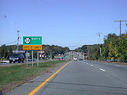 Route 34 begins at an intersection with Route 35 and Route 70 in Wall Township
, Monmouth County
at the former Brielle Circle
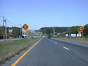
, heading to the northwest on a six-lane undivided road with a 55 mph (88.5 km/h) speed limit. A short distance past this intersection, the route becomes a four-lane divided highway
that passes through commercial areas with some neighboring wooded residential areas. It interchanges with County Route 524 Spur (Atlantic Avenue) and passes more businesses and wooded areas before reaching the Allenwood Circle, where Route 34 intersects County Route 524
(Allaire Road). Past the Allenwood Circle, the road continues northwest to a partial interchange with the Garden State Parkway
. This interchange has access to the northbound Garden State Parkway from northbound Route 34, to the southbound Garden State Parkway from southbound Route 34, and to both directions of Route 34 from the southbound Garden State Parkway. Immediately past this interchange, the road intersects County Route 30 before coming to a cloverleaf interchange
with Interstate 195
and Route 138. Route 34 provides the missing movements between the southbound Garden State Parkway and Interstate 195/Route 138. From here, the road passes through woodland before heading into commercial and industrial areas, where it passes by the Monmouth Executive Airport
. The route enters wooded residential and business areas where it intersects Belmar Boulevard and Megill Road, which are both distinct segments of County Route 18. Route 34 continues through wooded commercial areas before it intersects Route 33 and County Route 547
at the Collingwood Circle
.
At the traffic circle, Route 34 turns northwest to form a concurrency
with Route 33 on a four-lane divided highway with a speed limit of 50 mph (80.5 km/h) that passes businesses, crossing into Howell Township
. The two routes eventually split, with Route 34 heading north on a 50 mph (80.5 km/h) two-lane undivided road. It passes through wooded areas of Naval Weapons Station Earle
and enters Colts Neck Township
. Upon leaving the grounds of Naval Weapons Station Earle, the route widens into a four-lane divided highway again and comes to a cloverleaf interchange with the Route 18 freeway. Past this interchange, Route 34 becomes a 45 mph (72.4 km/h) two-lane undivided road that passes residences, commercial areas, and Delicious Orchards
before crossing County Route 537
(Colts Neck Road/Eatontown Road). From here, the road heads through suburban residential and agricultural areas as a 50 mph (80.5 km/h) road, intersecting County Route 54 (Phalanx Road) before meeting County Route 4 (Conover Road). Route 34 forms a brief concurrency with County Route 4 until the county route heads northeast on South Street. The route continues into wooded residential areas, crossing into Holmdel Township
, where it crosses County Route 520
(Newman Springs Road/Main Street).
 Past this intersection, the road continues through areas of residences and farms before turning northwest into more residential surroundings and entering Marlboro Township
. Here, the road heads through wooded residential and commercial areas, briefly becoming a four-lane road, before it crosses into Aberdeen Township
. In Aberdeen, Route 34 becomes a 45 mph (72.4 km/h) road that heads into business areas as it crosses County Route 3 (Lloyd Road). The road passes more businesses as a 40 mph (64.4 km/h) three-lane road with a center left-turn lane, forming the border of Matawan
to the west and Aberdeen Township to the east. At the crossing of an abandoned railroad line that is now the Henry Hudson Trail
, the route entirely enters Matawan, continuing northwest through business areas as a 35 mph (56.3 km/h) four-lane road named Middlesex Street. Here, Route 34 intersects County Route 516
(Broad Street) and Route 79 and County Route 516 Spur (Main Street). Past these intersection, the road heads into residential areas, crossing over Lake Lefferts
before continuing northwest through a mix of residences and businesses with a speed limit of 40 mph (64.4 km/h).
Route 34 crosses into Old Bridge Township
, Middlesex County
, where it becomes a two-lane road with a 50 mph (80.5 km/h) speed limit, continuing through commercial areas. The route intersects County Route 689 (Amboy Avenue/Morristown Road), where it turns to the west and continues through areas of residences and businesses, with the speed limit dropping to 45 mph (72.4 km/h) at the County Route 687 (Cottrell Road) intersection. At the intersection with County Route 699 (Old Mill Road), Route 34 turns to the north and intersects another segment of County Route 699 known as Spring Hill Road. The road passes more residences and businesses before it ends at an intersection with U.S. Route 9.
, Route 34 was legislated to run from an intersection with Route 35 (now Route 88 in Laurelton, Ocean County
north to Route 4 (now Route 79) in Matawan, with the portion of current Route 34 north of that intersection legislated as part of Route 4. By the 1940s, U.S. Route 9 was also designated along the present-day portion of Route 34 that was then a part of Route 4, this would later become Route 4A after U.S. Route 9 and Route 4 were moved to a new alignment between Freehold
and Cheesequake. In the 1953 New Jersey state highway renumbering
, Route 34 was extended north along the alignment of Route 4A to end at U.S. Route 9 in Cheesequake while the southern terminus was cut back to the Brielle Circle intersection with Route 35 and Route 70, the latter having replaced Route 34 south of this point. By 1969, Route 34 was widened into a divided highway as far north as Route 33. The Brielle Circle at the southern terminus of the route was converted into at-grade intersections with traffic lights in 2001.
State highway
State highway, state road or state route can refer to one of three related concepts, two of them related to a state or provincial government in a country that is divided into states or provinces :#A...
in the central part
Central Jersey
Central Jersey is a common designation for a region of the state of New Jersey in the United States of America. Trenton is considered the boundary between designated "North Jersey" and "South Jersey"...
of the U.S. state
U.S. state
A U.S. state is any one of the 50 federated states of the United States of America that share sovereignty with the federal government. Because of this shared sovereignty, an American is a citizen both of the federal entity and of his or her state of domicile. Four states use the official title of...
of New Jersey
New Jersey
New Jersey is a state in the Northeastern and Middle Atlantic regions of the United States. , its population was 8,791,894. It is bordered on the north and east by the state of New York, on the southeast and south by the Atlantic Ocean, on the west by Pennsylvania and on the southwest by Delaware...
. The route runs 26.79 mi (43.1 km) from an intersection with Route 35 and Route 70 (the former Brielle Circle
Brielle Circle
The Brielle Circle was a traffic circle in Wall Township, New Jersey, United States, located where Route 34, Route 35, and Route 70 meet. It was the southern end for the never-built Route 18 extension. In 2001 the circle was replaced by an at-grade intersection with jughandles....
) in Wall Township
Wall Township, New Jersey
Wall Township is a township in Monmouth County, New Jersey, United States. As of the 2010 United States Census, the township population was 26,164.Wall Township was formally incorporated as a township by an act of the New Jersey Legislature on March 7, 1851...
, Monmouth County
Monmouth County, New Jersey
Monmouth County is a county located in the U.S. state of New Jersey, within the New York metropolitan area. As of the 2010 Census, the population was 630,380, up from 615,301 at the 2000 census. Its county seat is Freehold Borough. The most populous municipality is Middletown Township with...
north to an intersection with U.S. Route 9 in Old Bridge Township
Old Bridge Township, New Jersey
Old Bridge Township is a Township in Middlesex County, New Jersey, United States. As of the 2000 United States Census, the township had a total population of 60,456...
, Middlesex County
Middlesex County, New Jersey
-Demographics:As of the census of 2000, there were 750,162 people, 265,815 households, and 190,855 families residing in the county. The population density was 2,422 people per square mile . There were 273,637 housing units at an average density of 884 per square mile...
. The route is a four-lane divided highway
Divided Highway
Divided Highway is a compilation album by American rock band The Doobie Brothers, released in 2003. . All tracks are taken from the albums Cycles and Brotherhood .-Track listing:...
between its southern terminus and the north end of the Route 33 concurrency in Howell Township
Howell Township, New Jersey
Howell is a Township in Monmouth County, New Jersey, United States. As of the 2010 United States Census, the township population was 51,075.Howell Township was incorporated as a township by an Act of the New Jersey Legislature on February 23, 1801, from portions of Shrewsbury Township...
; along this stretch, the route intersects the Garden State Parkway
Garden State Parkway
The Garden State Parkway is a 172.4-mile limited-access toll parkway that stretches the length of New Jersey from the New York line at Montvale, New Jersey, to Cape May at New Jersey's southernmost tip. Its name refers to New Jersey's nickname, the "Garden State." Most New Jersey residents refer...
and Interstate 195
Interstate 195 (New Jersey)
Interstate 195 is an auxiliary route of the Interstate Highway System located in the U.S. state of New Jersey. Its western end is at I-295 and Route 29 just south of Trenton, New Jersey in Hamilton Township, Mercer County while its eastern end is at the Garden State Parkway, Route 34 and Route...
/Route 138 within a short distance of each other. North of Route 33, Route 34 is an undivided two- to four-lane road that intersects Route 18 in Colts Neck Township
Colts Neck Township, New Jersey
Colts Neck is a township in Monmouth County, New Jersey, United States. As of the 2010 United States Census, the population was 10,142.What is now Colts Neck Township was established by an act of the New Jersey Legislature as Atlantic Township on February 18, 1847, from portions of Freehold...
and Route 79 in Matawan
Matawan, New Jersey
Matawan is a borough in Monmouth County, New Jersey, United States. As of the 2010 United States Census, the borough population was 8,810. The name "Matawan" comes from a Native American Lenape word....
. Route 34 passes through mostly suburban areas along its route.
The route was legislated in 1927 to run from Route 35 (present Route 88) in Laurelton north to Route 4 (present Route 79) in Matawan. The current alignment of Route 34 north of Matawan was a part of Route 4 (and later U.S. Route 9) until it became a part of Route 4A following a realignment of U.S. Route 9 and Route 4. In 1953, Route 34 was extended north along Route 4A to end at U.S. Route 9 in Old Bridge Township. Meanwhile, the southern terminus was cut back to its current location with the route south of that point becoming a part of Route 70. Since 1953, the southern portion of the route was widened into a divided highway and the Brielle Circle was replaced.
Route description
Wall Township, New Jersey
Wall Township is a township in Monmouth County, New Jersey, United States. As of the 2010 United States Census, the township population was 26,164.Wall Township was formally incorporated as a township by an act of the New Jersey Legislature on March 7, 1851...
, Monmouth County
Monmouth County, New Jersey
Monmouth County is a county located in the U.S. state of New Jersey, within the New York metropolitan area. As of the 2010 Census, the population was 630,380, up from 615,301 at the 2000 census. Its county seat is Freehold Borough. The most populous municipality is Middletown Township with...
at the former Brielle Circle
Brielle Circle
The Brielle Circle was a traffic circle in Wall Township, New Jersey, United States, located where Route 34, Route 35, and Route 70 meet. It was the southern end for the never-built Route 18 extension. In 2001 the circle was replaced by an at-grade intersection with jughandles....
, heading to the northwest on a six-lane undivided road with a 55 mph (88.5 km/h) speed limit. A short distance past this intersection, the route becomes a four-lane divided highway
Divided Highway
Divided Highway is a compilation album by American rock band The Doobie Brothers, released in 2003. . All tracks are taken from the albums Cycles and Brotherhood .-Track listing:...
that passes through commercial areas with some neighboring wooded residential areas. It interchanges with County Route 524 Spur (Atlantic Avenue) and passes more businesses and wooded areas before reaching the Allenwood Circle, where Route 34 intersects County Route 524
County Route 524 (New Jersey)
County Route 524 is a county highway in the U.S. state of New Jersey. The highway extends from the Whitehorse Circle in Hamilton Township to Route 71 in Spring Lake Heights....
(Allaire Road). Past the Allenwood Circle, the road continues northwest to a partial interchange with the Garden State Parkway
Garden State Parkway
The Garden State Parkway is a 172.4-mile limited-access toll parkway that stretches the length of New Jersey from the New York line at Montvale, New Jersey, to Cape May at New Jersey's southernmost tip. Its name refers to New Jersey's nickname, the "Garden State." Most New Jersey residents refer...
. This interchange has access to the northbound Garden State Parkway from northbound Route 34, to the southbound Garden State Parkway from southbound Route 34, and to both directions of Route 34 from the southbound Garden State Parkway. Immediately past this interchange, the road intersects County Route 30 before coming to a cloverleaf interchange
Cloverleaf interchange
A cloverleaf interchange is a two-level interchange in which left turns, reverse direction in left-driving regions, are handled by ramp roads...
with Interstate 195
Interstate 195 (New Jersey)
Interstate 195 is an auxiliary route of the Interstate Highway System located in the U.S. state of New Jersey. Its western end is at I-295 and Route 29 just south of Trenton, New Jersey in Hamilton Township, Mercer County while its eastern end is at the Garden State Parkway, Route 34 and Route...
and Route 138. Route 34 provides the missing movements between the southbound Garden State Parkway and Interstate 195/Route 138. From here, the road passes through woodland before heading into commercial and industrial areas, where it passes by the Monmouth Executive Airport
Monmouth Executive Airport
Monmouth Executive Airport is a public-use airport located in Monmouth County, New Jersey, United States. The airport is five miles west of the central business district of Belmar and east of Farmingdale...
. The route enters wooded residential and business areas where it intersects Belmar Boulevard and Megill Road, which are both distinct segments of County Route 18. Route 34 continues through wooded commercial areas before it intersects Route 33 and County Route 547
County Route 547 (New Jersey)
County Route 547, abbreviated CR 547, is a county highway in the U.S. state of New Jersey. The highway extends from Route 70 in Lakehurst to Broad Street in Eatontown...
at the Collingwood Circle
Collingwood Circle
The Collingwood Circle is a traffic circle in New Jersey. Route 33 and Route 34 split around this circle in Wall Township, New Jersey. CR 547 also intersects the circle....
.
At the traffic circle, Route 34 turns northwest to form a concurrency
Concurrency (road)
A concurrency, overlap, or coincidence in a road network is an instance of one physical road bearing two or more different highway, motorway, or other route numbers...
with Route 33 on a four-lane divided highway with a speed limit of 50 mph (80.5 km/h) that passes businesses, crossing into Howell Township
Howell Township, New Jersey
Howell is a Township in Monmouth County, New Jersey, United States. As of the 2010 United States Census, the township population was 51,075.Howell Township was incorporated as a township by an Act of the New Jersey Legislature on February 23, 1801, from portions of Shrewsbury Township...
. The two routes eventually split, with Route 34 heading north on a 50 mph (80.5 km/h) two-lane undivided road. It passes through wooded areas of Naval Weapons Station Earle
Naval Weapons Station Earle
Naval Weapons Station Earle is a United States Navy base in New Jersey. Its distinguishing feature is a 2.9-mile pier in Sandy Hook Bay where ammunition can be loaded and unloaded from warships at a safe distance from land....
and enters Colts Neck Township
Colts Neck Township, New Jersey
Colts Neck is a township in Monmouth County, New Jersey, United States. As of the 2010 United States Census, the population was 10,142.What is now Colts Neck Township was established by an act of the New Jersey Legislature as Atlantic Township on February 18, 1847, from portions of Freehold...
. Upon leaving the grounds of Naval Weapons Station Earle, the route widens into a four-lane divided highway again and comes to a cloverleaf interchange with the Route 18 freeway. Past this interchange, Route 34 becomes a 45 mph (72.4 km/h) two-lane undivided road that passes residences, commercial areas, and Delicious Orchards
Delicious Orchards
Delicious Orchards is a farm and country food market located in Colts Neck, New Jersey.-History:Delicious Orchards began in 1911 as a small orchard located on a farm road , connecting Colts Neck with Freehold. The Barclay family, of Cranberry, bought the orchard in 1922, having three generations of...
before crossing County Route 537
County Route 537 (New Jersey)
County Route 537, abbreviated CR 537, is a county highway in the U.S. state of New Jersey. The highway extends from Delaware Avenue in Camden to Myrtle Avenue in Long Branch.-Camden County:...
(Colts Neck Road/Eatontown Road). From here, the road heads through suburban residential and agricultural areas as a 50 mph (80.5 km/h) road, intersecting County Route 54 (Phalanx Road) before meeting County Route 4 (Conover Road). Route 34 forms a brief concurrency with County Route 4 until the county route heads northeast on South Street. The route continues into wooded residential areas, crossing into Holmdel Township
Holmdel Township, New Jersey
Holmdel Township is a township in Monmouth County, New Jersey, United States. As of the 2010 United States Census, the township population was 16,773. Holmdel Township was formed by an Act of the New Jersey Legislature on February 23, 1857, from portions of Raritan Township .Holmdel is a suburb of...
, where it crosses County Route 520
County Route 520 (New Jersey)
County Route 520 is a county highway in the U.S. state of New Jersey. County Route 520 is a major road across Monmouth County connecting the county's central towns to the Jersey Shore at Sea Bright.-Route description:...
(Newman Springs Road/Main Street).
Marlboro Township, New Jersey
-Weather:Marlboro is located close to the Atlantic Ocean. Due to the location Marlboro Township has on the Eastern Seaboard, the following weather features are noted:*On average, the warmest month is July where the average high is and the average low is ....
. Here, the road heads through wooded residential and commercial areas, briefly becoming a four-lane road, before it crosses into Aberdeen Township
Aberdeen Township, New Jersey
Aberdeen Township is a Township in Monmouth County, New Jersey, United States. As of the 2010 United States Census, the township population was 18,210....
. In Aberdeen, Route 34 becomes a 45 mph (72.4 km/h) road that heads into business areas as it crosses County Route 3 (Lloyd Road). The road passes more businesses as a 40 mph (64.4 km/h) three-lane road with a center left-turn lane, forming the border of Matawan
Matawan, New Jersey
Matawan is a borough in Monmouth County, New Jersey, United States. As of the 2010 United States Census, the borough population was 8,810. The name "Matawan" comes from a Native American Lenape word....
to the west and Aberdeen Township to the east. At the crossing of an abandoned railroad line that is now the Henry Hudson Trail
Henry Hudson Trail
The Henry Hudson Trail is a rail trailin New Jersey. The trail is named for Henry Hudson to honor the man who explored...
, the route entirely enters Matawan, continuing northwest through business areas as a 35 mph (56.3 km/h) four-lane road named Middlesex Street. Here, Route 34 intersects County Route 516
County Route 516 (New Jersey)
-Route description:The highway extends 19.27 miles from Route 18/CR 527 in Old Bridge Township to Route 36 in Middletown Township. It is known as Old Bridge-Matawan Road for its entire length in Old Bridge Township where it intersects US 9 then continues several more miles to the Old...
(Broad Street) and Route 79 and County Route 516 Spur (Main Street). Past these intersection, the road heads into residential areas, crossing over Lake Lefferts
Lake Lefferts
Lake Lefferts is a lake in Matawan, New Jersey. The lake is the result of the construction in 1928 of Lake Lefferts Dam, which captured and stores the flow of Matawan Creek.-Reference:...
before continuing northwest through a mix of residences and businesses with a speed limit of 40 mph (64.4 km/h).
Route 34 crosses into Old Bridge Township
Old Bridge Township, New Jersey
Old Bridge Township is a Township in Middlesex County, New Jersey, United States. As of the 2000 United States Census, the township had a total population of 60,456...
, Middlesex County
Middlesex County, New Jersey
-Demographics:As of the census of 2000, there were 750,162 people, 265,815 households, and 190,855 families residing in the county. The population density was 2,422 people per square mile . There were 273,637 housing units at an average density of 884 per square mile...
, where it becomes a two-lane road with a 50 mph (80.5 km/h) speed limit, continuing through commercial areas. The route intersects County Route 689 (Amboy Avenue/Morristown Road), where it turns to the west and continues through areas of residences and businesses, with the speed limit dropping to 45 mph (72.4 km/h) at the County Route 687 (Cottrell Road) intersection. At the intersection with County Route 699 (Old Mill Road), Route 34 turns to the north and intersects another segment of County Route 699 known as Spring Hill Road. The road passes more residences and businesses before it ends at an intersection with U.S. Route 9.
History
In the 1927 New Jersey state highway renumbering1927 New Jersey state highway renumbering
In 1927, New Jersey's state highways were renumbered. The old system, which had been defined in sequence by the legislature, was growing badly, as several routes shared the same number, and many unnumbered state highways had been defined...
, Route 34 was legislated to run from an intersection with Route 35 (now Route 88 in Laurelton, Ocean County
Ocean County, New Jersey
-Demographics:As of the census of 2000, there were 510,916 people, 200,402 households, and 137,876 families residing in the county. The population density was 803 people per square mile . There were 248,711 housing units at an average density of 151/km²...
north to Route 4 (now Route 79) in Matawan, with the portion of current Route 34 north of that intersection legislated as part of Route 4. By the 1940s, U.S. Route 9 was also designated along the present-day portion of Route 34 that was then a part of Route 4, this would later become Route 4A after U.S. Route 9 and Route 4 were moved to a new alignment between Freehold
Freehold Borough, New Jersey
Freehold is a borough in Monmouth County, New Jersey, United States. As of the 2010 United States Census, the borough population was 12,052. It is the county seat of Monmouth County....
and Cheesequake. In the 1953 New Jersey state highway renumbering
1953 New Jersey state highway renumbering
On January 1, 1953, the New Jersey Department of Transportation renumbered many of the State Routes. A few rules were followed in deciding what to renumber:...
, Route 34 was extended north along the alignment of Route 4A to end at U.S. Route 9 in Cheesequake while the southern terminus was cut back to the Brielle Circle intersection with Route 35 and Route 70, the latter having replaced Route 34 south of this point. By 1969, Route 34 was widened into a divided highway as far north as Route 33. The Brielle Circle at the southern terminus of the route was converted into at-grade intersections with traffic lights in 2001.