
Puerto Rico Highway 2
Encyclopedia
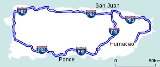
Puerto Rico Highway 2, the longest highway in the Commonwealth of Puerto Rico
at about 156 miles (230 km) long, connects San Juan
to Ponce
.
The road runs parallel to the northern coast of Puerto Rico (west of San Juan), then parallel to the west coast from near Aguadilla running south through Mayagüez. Shortly after Mayagüez, the road runs somewhat inland (through Hormigueros, San German and Sabana Grande
) until it reaches the southern coast of Puerto Rico at Yauco
, and continues to run parallel the southern shore as it approaches Ponce
from the west. In addition to Arecibo
, Aguadilla, and Mayagüez, the road runs through various other cities including Guaynabo, Bayamón, San Germán and Yauco. In some sections the road is a four-lane highway while in other sections the road is either a six-lane or eight-lane highway.
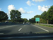
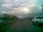
 Puerto Rico Highway 2 starts off in San Juan as a 8-lane road and heads west roughly parallel to the northern shore of the island. It makes its way through the Caparra section of San Juan, intersecting with Route 22, which provides access to San Juan's Santurce
ward and to the cities of Carolina
and Caguas. Heading west, PR-2 traverses the cities of Guaynabo and Bayamon as a heavily used road. In addition to numerous residential communities, PR-2 also provides access to malls, movie theaters, restaurants, hospitals, and various colleges and universities, among other facilities in this area.
The road then serves the towns of Toa Baja, Dorado
, and Vega Baja and Vega Alta. In these areas the road experiences heavy traffic and many at-grade intersections with multiple traffic lights. Continuing west, Puerto Rico Highway 2 next serves the industrial towns of Manati
and Barceloneta
providing access to several pharmaceutical companies, among other sources of employment outside the agricultural sector. In this area the road is also the main road to intersections leading to the beaches of Los Tubos, Mar Chiquita, Tortuguero, Puerto de las Vacas, and Las Criollas.
The next major city on this road is Arecibo
. As one of Puerto Rico's major cities, Arecibo provides a number of facilities not available in some of the neighboring towns. PR-2 also intersects with PR-10 for access to the interior of the island as well as Ponce on the southern shore. After Arecibo the road then makes it way to the town of Hatillo
where it meets with the current western terminus of the new PR-22 expressway.
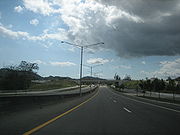
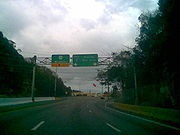 West of its interchange with PR-22 in Hatillo, PR-2 becomes a primary road and meets several important highways that serve the center of the island such as PR-119, PR-110 and PR-112. This stretch of the highway contains a multitude of traffic lights. Following Hatillo the roads traverses the towns of Camuy, Quebradillas and Isabela. At Isabela, PR-2 provides access to roads leading to various beaches, including Blue Hole, Guajataca, and Jobos.
In the city of Aguadilla, PR-2 turns south at its intersection with PR-107, on its course towards the western city and seaport of Mayagüez. In this area Puerto Rico Highway 2 provides access to Aguadilla's Rafael Hernandez airport, as well as to various area beach resorts. The trip from Aguadilla to Mayagüez takes about 30 minutes, and PR-2 has fewer traffic lights in this stretch of the road than those experienced so far anywhere from its San Juan terminus starting point.
 PR-2 is a major 6-lane highway in Mayagüez, which is one of the major cities in Puerto Rico. It intersect with PR-102 and PR-64, which serve as by-pass routes. The farm to market PR-102 highway also has access to PR-2 through the new Puerto Rico Highway 63
, another important intersection of Puerto Rico Highway 2. As it traverses the city of Mayaguez, PR-2 is the main road for access to the University of Puerto Rico at Mayagüez
and the Mayaguez Zoo. Also, further south, PR-2 provides access to the Mayagüez Mall
, which is Puerto Rico's third largest shopping center and several medical facilities. The road then continues south through the municipality of Hormigueros.
 After Hormigueros, PR-2 becomes a safer four-lane controlled-access freeway in its way to Ponce. It has several exits in the cities of San Germán, Sabana Grande
, Guánica, Yauco, Guayanilla and Peñuelas. In this agricultural section, PR-2 provides access to some of Puerto Rico's southern beaches, such as Boqueron
. The road is also within a few minutes driving from the Guanica Dry Forest
state park.
As the road makes its way through the hills of Peñuelas' barrio Tallaboa, the ruins of the abandoned 1970s CORCO oil refinery as well as its PPG
suplier are visible to the right. Puerto Rico Highway 2 provides access to many rural communities in this stretch of the road. As it approaches Ponce, PR-2 becomes an 8-lane divided highway again. Before its entry into Ponce, PR-2 has access to the El Tuque
beach and to various hotels nearby. In the Las Cucharas section of this area, there are also various prominent restaurants by the beach, serving mostly seafood
.
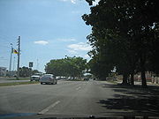 The road is an 8-lane divided highway in its western approach to Ponce. After its intersection with the PR-52 expressway, the road becomes a 6-lane at-grade roadway in the city of Ponce. It provides access to barrios Canas
, Playa
, Canas Urbano
, San Anton
, Bucana
, and Sabanetas
. It provides access to Ponce's four beaches, to the Damas and Dr. Pila hospitals, to various shopping plazas including the Plaza del Caribe
and Centro del Sur malls, the Puerto Rico Judicial Center, the University of Puerto Rico at Ponce
, the Mercedita Airport
, and numerous restaurants and other facilities.
As the road makes its way through the city of Ponce, it is also known as the Ponce Bypass. The Ponce Bypass intersects with seven major roads: PR-2R (Carretera Pampanos), with access to the Estadio Francisco Montaner; PR-585 (Calle Eduardo Ruberte), which leads to barrio Playa
; PR-123 (Avenida Hostos), leading to the Museo de Arte de Ponce and historic downtown Ponce
; PR-12 (Avenida Santiago de los Caballeros), leading to La Guancha Boardwalk and the Port of the Americas; and PR-163 (Avenida Julio Enrique Monagas) leading to Julio Enrique Monagas Family Park
and Museo de Arte de Ponce. The road's last intersection in Ponce as well as its western terminus is at its intersection with PR-133 (Calle Comercio, a.k.a. Avenida Ednita Nazario) and PR-1
(Avenida La Ceiba). PR-133 heads west to Ceiba Tree Park
and PR-1
heads east to Mercedita Airport. After this dual intersection with PR-133 and PR-1 the road seamlessly becomes a 4-lane thoroughfare called Miguel A. Pou
Boulevard, the city's main artery into the Ponce Historic Zone.
, PR-22 (also known as Autopista de Diego), was built parallel to highway PR-2. The goal was to reduce congestion on highway PR-2. Highway PR-22 has several exits that provide access to highway PR-2. Highway PR-22 ends the town of Hatillo, just west of the city of Arecibo. In Hatillo, highway PR-2 meets highway PR-22. During its entire length, from San Juan to Hatillo, the two highways run parallel with each other, and they are never more than 10 km apart.
es. A few more at-grade intersections still remain to be completed in that area.
A similar at-grade intersection still exists as the highway approaches Ponce, at PR-591 in the El Tuque sector. The conversion project for the Ponce segment is incomplete. It may be several years before travelers can enjoy a complete controlled-access, freeway-style ride from southern Mayagüez to PR-2's intersection with PR-52 in Ponce. Once such segments are completed there will be no at-grade intersections from Mayagüez to San Juan via Ponce using highways PR-2 and PR-52, and such ride should take considerably less time than it does today.
in Aguadilla to the Mayaguez city limits. The PR-22 extension is planned for completion in 2016, and freeway conversion of this segment of PR-2 should begin shortly afterward.
, Cabo Rojo
and Lajas
are the only coastal municipalities in Puerto Rico (west of San Juan and Ponce) that PR-2 does not pass in the way from San Juan to Ponce, though PR-2 is less than one mile from the limits between Hormigueros and Cabo Rojo at its intersection with PR-100. PR-2 passes through a very small part of Guanica, only a bit more than a mile long. PR-2 also passes near Moca in Aguadilla, less than a mile away.
The following are the municipalities through which it passes in geographical order from San Juan to Ponce:
Puerto Rico
Puerto Rico , officially the Commonwealth of Puerto Rico , is an unincorporated territory of the United States, located in the northeastern Caribbean, east of the Dominican Republic and west of both the United States Virgin Islands and the British Virgin Islands.Puerto Rico comprises an...
at about 156 miles (230 km) long, connects San Juan
San Juan, Puerto Rico
San Juan , officially Municipio de la Ciudad Capital San Juan Bautista , is the capital and most populous municipality in Puerto Rico, an unincorporated territory of the United States. As of the 2010 census, it had a population of 395,326 making it the 46th-largest city under the jurisdiction of...
to Ponce
Ponce, Puerto Rico
Ponce is both a city and a municipality in the southern part of Puerto Rico. The city is the seat of the municipal government.The city of Ponce, the fourth most populated in Puerto Rico, and the most populated outside of the San Juan metropolitan area, is named for Juan Ponce de León y Loayza, the...
.
The road runs parallel to the northern coast of Puerto Rico (west of San Juan), then parallel to the west coast from near Aguadilla running south through Mayagüez. Shortly after Mayagüez, the road runs somewhat inland (through Hormigueros, San German and Sabana Grande
Sabana grande
Sabana grande is a Spanish term meaning Grand plains . It may also refer to:*Sabana Grande, Puerto Rico, a municipality of Puerto Rico...
) until it reaches the southern coast of Puerto Rico at Yauco
Yauco, Puerto Rico
Yauco is a city and municipality in southwestern Puerto Rico located in the southern coast of the island by the Caribbean, south of Maricao, Lares and Adjuntas; east of Sabana Grande and Guánica; and west of Guayanilla. Yauco is spread over 20 wards and Yauco Pueblo...
, and continues to run parallel the southern shore as it approaches Ponce
Ponce, Puerto Rico
Ponce is both a city and a municipality in the southern part of Puerto Rico. The city is the seat of the municipal government.The city of Ponce, the fourth most populated in Puerto Rico, and the most populated outside of the San Juan metropolitan area, is named for Juan Ponce de León y Loayza, the...
from the west. In addition to Arecibo
Arecibo, Puerto Rico
Arecibo is a municipality in the northern midwest coast of Puerto Rico and located by the Atlantic Ocean, north of Utuado and Ciales; east of Hatillo; and west of Barceloneta, and Florida. Arecibo is spread over 18 wards and Arecibo Pueblo...
, Aguadilla, and Mayagüez, the road runs through various other cities including Guaynabo, Bayamón, San Germán and Yauco. In some sections the road is a four-lane highway while in other sections the road is either a six-lane or eight-lane highway.
San Juan to Hatillo
Santurce
Santurce can refer to:*Santurce, San Juan, Puerto Rico, a district of San Juan, the capital of Puerto Rico*Santurtzi, a town near Bilbao, the Basque Country, Spain...
ward and to the cities of Carolina
Carolina, Puerto Rico
Carolina is a city located in the northern part of Puerto Rico, bordering the Atlantic Ocean; it lies north of Gurabo and Juncos; east of Trujillo Alto and San Juan; and west of Canóvanas and Loíza. Carolina is spread over 12 wards plus Carolina Pueblo...
and Caguas. Heading west, PR-2 traverses the cities of Guaynabo and Bayamon as a heavily used road. In addition to numerous residential communities, PR-2 also provides access to malls, movie theaters, restaurants, hospitals, and various colleges and universities, among other facilities in this area.
The road then serves the towns of Toa Baja, Dorado
Dorado
Dorado is a constellation in the southern sky. It was created in the late 16th century and is now one of the 88 modern constellations. Its name refers to the dolphinfish , which is known as dorado in Spanish, although it has also been depicted as a swordfish...
, and Vega Baja and Vega Alta. In these areas the road experiences heavy traffic and many at-grade intersections with multiple traffic lights. Continuing west, Puerto Rico Highway 2 next serves the industrial towns of Manati
Manatí
Manatí may refer to:*Manatí, Puerto Rico*Manatí, Atlántico in Atlantico, Colombia*Manatí, Cuba, a municipality in Las Tunas, CubaManatí is also the Spanish word for manatee.*See also: Special:Allpages/Manatí...
and Barceloneta
Barceloneta
Barceloneta may refer to:*Barceloneta, Puerto Rico, municipality in Puerto Rico.*Barceloneta, Barcelona, beach and a neighborhood in the Ciutat Vella district of Barcelona, Spain**Barceloneta...
providing access to several pharmaceutical companies, among other sources of employment outside the agricultural sector. In this area the road is also the main road to intersections leading to the beaches of Los Tubos, Mar Chiquita, Tortuguero, Puerto de las Vacas, and Las Criollas.
The next major city on this road is Arecibo
Arecibo
Arecibo may refer to:*Arecibo, Puerto Rico, a municipality located by the Atlantic Ocean*Arecibo Observatory, a very sensitive radio telescope located approximately south-southwest from the city of Arecibo...
. As one of Puerto Rico's major cities, Arecibo provides a number of facilities not available in some of the neighboring towns. PR-2 also intersects with PR-10 for access to the interior of the island as well as Ponce on the southern shore. After Arecibo the road then makes it way to the town of Hatillo
Hatillo
Hatillo or El Hatillo can refer to:* Hatillo, Puerto Rico* Hatillo de Loba, a town and municipality in Bolívar, Colombia* El Hatillo Municipality, Miranda, Venezuela** El Hatillo Town, Miranda, the seat of El Hatillo Municipality...
where it meets with the current western terminus of the new PR-22 expressway.
Hatillo to Mayagüez
In the city of Aguadilla, PR-2 turns south at its intersection with PR-107, on its course towards the western city and seaport of Mayagüez. In this area Puerto Rico Highway 2 provides access to Aguadilla's Rafael Hernandez airport, as well as to various area beach resorts. The trip from Aguadilla to Mayagüez takes about 30 minutes, and PR-2 has fewer traffic lights in this stretch of the road than those experienced so far anywhere from its San Juan terminus starting point.
Mayagüez/Hormigueros
Puerto Rico Highway 63
Puerto Rico Highway 63 originates at Highway 102 in Mayagüez and terminates 0.6 kilometers later at Puerto Rico Highway 2. It is named the William Dunscombe Avenue....
, another important intersection of Puerto Rico Highway 2. As it traverses the city of Mayaguez, PR-2 is the main road for access to the University of Puerto Rico at Mayagüez
University of Puerto Rico at Mayagüez
The University of Puerto Rico at Mayagüez or Recinto Universitario de Mayagüez in Spanish , is a land-grant, sea-grant, space-grant state university located in the city of Mayagüez, Puerto Rico...
and the Mayaguez Zoo. Also, further south, PR-2 provides access to the Mayagüez Mall
Mayagüez Mall
Mayagüez Mall is a shopping mall located between the municipalities of Mayagüez and Hormigueros. It is the third largest shopping center in Puerto Rico with a total of of retail space, and the main shopping center in western Puerto Rico, followed by Western Plaza also in Mayagüez, Aguadilla Mall...
, which is Puerto Rico's third largest shopping center and several medical facilities. The road then continues south through the municipality of Hormigueros.
Hormigueros to Ponce
Sabana grande
Sabana grande is a Spanish term meaning Grand plains . It may also refer to:*Sabana Grande, Puerto Rico, a municipality of Puerto Rico...
, Guánica, Yauco, Guayanilla and Peñuelas. In this agricultural section, PR-2 provides access to some of Puerto Rico's southern beaches, such as Boqueron
Boquerón
Boquerón may refer to:*Boquerón, Cuba*Boquerón, Puerto Rico*Boquerón, Chiriquí, Panama*Boquerón Department, Paraguay*Boquerón River, Honduras*Bahía de Boquerón , Puerto Rico...
. The road is also within a few minutes driving from the Guanica Dry Forest
Guánica State Forest
The Guánica State Forest is a subtropical dry forest located in southwest Puerto Rico. The area was designated as a forest reserve in 1919 and a United Nations Biosphere Reserve in 1981...
state park.
As the road makes its way through the hills of Peñuelas' barrio Tallaboa, the ruins of the abandoned 1970s CORCO oil refinery as well as its PPG
PPG
PPG may stand for:* PPG Industries, a U.S. manufacturer, and its PPG Place office complex* PPG tankette, a Soviet armoured vehicle* Pacific Proving Grounds, a former US-operated nuclear test site* Palm Products GmbH, an audio synthesizer company...
suplier are visible to the right. Puerto Rico Highway 2 provides access to many rural communities in this stretch of the road. As it approaches Ponce, PR-2 becomes an 8-lane divided highway again. Before its entry into Ponce, PR-2 has access to the El Tuque
El Tuque
El Tuque is a beach and family recreational and tourist complex in the Punta Cucharas sector of Ponce, Puerto Rico. It was designed in the early 1960s by Luis Flores, an architect from Cayey, Puerto Rico. It is located on PR-2, Km 220.1, in the El Tuque sector of Barrio Canas in Ponce...
beach and to various hotels nearby. In the Las Cucharas section of this area, there are also various prominent restaurants by the beach, serving mostly seafood
Seafood
Seafood is any form of marine life regarded as food by humans. Seafoods include fish, molluscs , crustaceans , echinoderms . Edible sea plants, such as some seaweeds and microalgae, are also seafood, and are widely eaten around the world, especially in Asia...
.
Ponce
Canas (Ponce)
Canas is one of the 31 barrios in the municipality of Ponce, Puerto Rico. Along with Anón, Coto Laurel, Guaraguao, Quebrada Limón, Real, San Patricio, and Marueño, and the coastal barrio of Capitanejo, Canas is one of the municipality's nine bordering barrios. It borders the municipality of...
, Playa
Playa (Ponce)
La Playa de Ponce, Ponce Playa, La Playa, or simply Playa, is one of the thirty-one barrios that comprise the municipality of Ponce, Puerto Rico. Along with Bucaná, Canas, Vayas, and Capitanejo, Playa is one of the municipality's five coastal barrios...
, Canas Urbano
Canas Urbano
Canas Urbano is one of the 31 barrios of the municipality of Ponce, Puerto Rico. Along with Machuelo Abajo, Magueyes Urbano, Portugués Urbano, and San Antón, Canas Urbano is one of the municipality's five originally rural barrios that are now also part of the urban zone of the city of Ponce...
, San Anton
San Antón
San Antón is one of the 31 barrios of the municipality of Ponce, Puerto Rico. Along with Canas Urbano, Machuelo Abajo, Magueyes Urbano, and Portugués Urbano, San Antón is one of the municipality's five originally rural barrios that are now also part of the urban zone of the city of Ponce. It is...
, Bucana
Bucaná
Bucaná is one of the 31 barrios of the municipality of Ponce, Puerto Rico. Together with Canas, Playa, Vayas, and Capitanejo, Bucaná is one of the municipality's five coastal barrios...
, and Sabanetas
Sabanetas
Sabanetas is one of the 31 barrios of the municipality of Ponce, Puerto Rico. Along with Magueyes, Tibes, Portugués, Monte Llano, Machuelo Arriba, Maragüez, and Cerrillos, Sabanetas is one of the municipality's eight rural interior barrios...
. It provides access to Ponce's four beaches, to the Damas and Dr. Pila hospitals, to various shopping plazas including the Plaza del Caribe
Plaza del Caribe
Plaza del Caribe is a enclosed shopping mall located in Ponce, Puerto Rico. It is owned by Empresas Fonalledas, which also owns Plaza las Americas in San Juan, and it is the largest mall in southern Puerto Rico....
and Centro del Sur malls, the Puerto Rico Judicial Center, the University of Puerto Rico at Ponce
University of Puerto Rico at Ponce
The University of Puerto Rico at Ponce is a state university located in the municipality of Ponce, Puerto Rico. UPRP is the only campus of the University of Puerto Rico System in the southern region of the island...
, the Mercedita Airport
Mercedita Airport
Mercedita Airport is a commercial airport located three miles east of the central business district of Ponce, Puerto Rico. The airport covers and has one runway. Passenger movement at the airport in FY 2008 was 278,911, an astounding 1,228% increase over fiscal year 2003 and the highest of all...
, and numerous restaurants and other facilities.
As the road makes its way through the city of Ponce, it is also known as the Ponce Bypass. The Ponce Bypass intersects with seven major roads: PR-2R (Carretera Pampanos), with access to the Estadio Francisco Montaner; PR-585 (Calle Eduardo Ruberte), which leads to barrio Playa
Playa (Ponce)
La Playa de Ponce, Ponce Playa, La Playa, or simply Playa, is one of the thirty-one barrios that comprise the municipality of Ponce, Puerto Rico. Along with Bucaná, Canas, Vayas, and Capitanejo, Playa is one of the municipality's five coastal barrios...
; PR-123 (Avenida Hostos), leading to the Museo de Arte de Ponce and historic downtown Ponce
Ponce Historic Zone
The Ponce Historic Zone is a historic district in downtown Ponce, Puerto Rico with construction that dates to the late nineteenth and early twentieth centuries. The zone was originally designated in 1962, and then it only included the center core of the city, but it has since been expanded to...
; PR-12 (Avenida Santiago de los Caballeros), leading to La Guancha Boardwalk and the Port of the Americas; and PR-163 (Avenida Julio Enrique Monagas) leading to Julio Enrique Monagas Family Park
Julio Enrique Monagas Family Park
The Parque Familiar Julio Enrique Monagas is Puerto Rico's largest passive park. It is located in barrio Bucaná, Ponce, Puerto Rico, on the banks of rivers Bucaná and Portugués...
and Museo de Arte de Ponce. The road's last intersection in Ponce as well as its western terminus is at its intersection with PR-133 (Calle Comercio, a.k.a. Avenida Ednita Nazario) and PR-1
Puerto Rico Highway 1
Puerto Rico Highway 1 connects the city of Ponce to San Juan. Leaving Ponce, the road follows somewhat parallel along the southern coast of the island and, at Salinas, it turns north to cut through the Cordillera Central in its approach to San Juan....
(Avenida La Ceiba). PR-133 heads west to Ceiba Tree Park
Parque de la Ceiba
Parque de la Ceiba is a passive park in barrio San Antón, Ponce, Puerto Rico. Its centerpiece is the historic Ceiba tree, a tree associated with the founding of the city. Now surrounded by the park with the same name, the emblematic 500-year old Ceiba tree stands on the edge of the Ponce Historic...
and PR-1
Puerto Rico Highway 1
Puerto Rico Highway 1 connects the city of Ponce to San Juan. Leaving Ponce, the road follows somewhat parallel along the southern coast of the island and, at Salinas, it turns north to cut through the Cordillera Central in its approach to San Juan....
heads east to Mercedita Airport. After this dual intersection with PR-133 and PR-1 the road seamlessly becomes a 4-lane thoroughfare called Miguel A. Pou
Miguel Pou
Miguel Pou y Becerra was a Puerto Rican oil canvas painter. He was a painter, draftsman, and professor. Together with José Campeche and Francisco Oller, he has been called "one of Puerto Rico's greatest masters." He was an exposer of the impressionist movement. During his life he carried out...
Boulevard, the city's main artery into the Ponce Historic Zone.
Puerto Rico Highways 2 and 22
Due to the high population density on the northern coast of Puerto Rico, a new, limited access expresswayLimited-access road
A limited-access road known by various terms worldwide, including limited-access highway, dual-carriageway and expressway, is a highway or arterial road for high-speed traffic which has many or most characteristics of a controlled-access highway , including limited or no access to adjacent...
, PR-22 (also known as Autopista de Diego), was built parallel to highway PR-2. The goal was to reduce congestion on highway PR-2. Highway PR-22 has several exits that provide access to highway PR-2. Highway PR-22 ends the town of Hatillo, just west of the city of Arecibo. In Hatillo, highway PR-2 meets highway PR-22. During its entire length, from San Juan to Hatillo, the two highways run parallel with each other, and they are never more than 10 km apart.
Mayaguez to Ponce
The Puerto Rico Department of Transportation has been working on improvements to PR-2 between Mayagüez and Ponce recently. The segment between Hormigueros and San German, in particular, suffers from several at-grade intersections that slow down travel time considerably. In an effort to increase the controlled access character of the highway, several of these at-grade intersections have recently been replaced with either no access at all or with overpassOverpass
An overpass is a bridge, road, railway or similar structure that crosses over another road or railway...
es. A few more at-grade intersections still remain to be completed in that area.
A similar at-grade intersection still exists as the highway approaches Ponce, at PR-591 in the El Tuque sector. The conversion project for the Ponce segment is incomplete. It may be several years before travelers can enjoy a complete controlled-access, freeway-style ride from southern Mayagüez to PR-2's intersection with PR-52 in Ponce. Once such segments are completed there will be no at-grade intersections from Mayagüez to San Juan via Ponce using highways PR-2 and PR-52, and such ride should take considerably less time than it does today.
Mayaguez to Aguadilla
The DTOP has also eyed the stretch between Mayaguez to Aguadilla for conversion into a freeway. This would occur between the future western terminus of Puerto Rico Highway 22Puerto Rico Highway 22
PR-22 is a 51-mile long toll road in the north coast of Puerto Rico that connects the cities of San Juan and Hatillo. The road is also known as the José de Diego Expressway , and is part of unsigned Interstate PR-2...
in Aguadilla to the Mayaguez city limits. The PR-22 extension is planned for completion in 2016, and freeway conversion of this segment of PR-2 should begin shortly afterward.
Municipalities served
The PR-2 runs through 26 municipalities. Cataño, RincónRincón
Carlos Eduardo de Castro Lourenço, commonly known as Rincón , is a Brazilian association footballer who currently plays for French side Troyes AC.-Early career:...
, Cabo Rojo
Cabo Rojo
Cabo rojo, Spanish for red cape, may refer to:* The municipality of Cabo Rojo, Puerto Rico* The coastal feature of Cabo Rojo in the Mexican state of Veracruz* Cabo Rojo, Dominican Republic, in Pedernales Province...
and Lajas
Lajas
Lajas may refer to:*Lajas, Cuba *Lajas, Puerto RicoSee also*Special:Allpages/Lajas...
are the only coastal municipalities in Puerto Rico (west of San Juan and Ponce) that PR-2 does not pass in the way from San Juan to Ponce, though PR-2 is less than one mile from the limits between Hormigueros and Cabo Rojo at its intersection with PR-100. PR-2 passes through a very small part of Guanica, only a bit more than a mile long. PR-2 also passes near Moca in Aguadilla, less than a mile away.
The following are the municipalities through which it passes in geographical order from San Juan to Ponce:
- San JuanSan Juan, Puerto RicoSan Juan , officially Municipio de la Ciudad Capital San Juan Bautista , is the capital and most populous municipality in Puerto Rico, an unincorporated territory of the United States. As of the 2010 census, it had a population of 395,326 making it the 46th-largest city under the jurisdiction of...
- Guaynabo
- Bayamón
- Toa Baja
- DoradoDorado, Puerto RicoDorado is a small tourist town in the northern coast of Puerto Rico, west of San Juan and is located in the northern region of the island, bordering the Atlantic Ocean, north of Toa Alta, east of Vega Alta, and west of Toa Baja. Dorado is spread over five barrios and Dorado Pueblo...
- Vega Alta
- Vega Baja
- ManatíManatí, Puerto RicoManatí is a municipality of Puerto Rico in the northern coast, north of Morovis and Ciales; east of Florida and Barceloneta; and west of Vega Baja. Manatí is spread over 8 wards and Manatí Pueblo...
- BarcelonetaBarceloneta, Puerto RicoBarceloneta is a municipality in Puerto Rico and is located in the north region, bordering the Atlantic Ocean, north of Florida, east of Arecibo and west of Manati. Barceloneta is spread over 3 wards and Barceloneta Pueblo...
- AreciboAreciboArecibo may refer to:*Arecibo, Puerto Rico, a municipality located by the Atlantic Ocean*Arecibo Observatory, a very sensitive radio telescope located approximately south-southwest from the city of Arecibo...
- HatilloHatillo, Puerto RicoHatillo is a municipality located on Puerto Rico's north coast, bordered by the Atlantic Ocean to the north, Lares and Utuado to the south, Camuy to the west, and Arecibo to the east. According to the 2000 US Census Hatillo is spread over 9 wards and Hatillo Pueblo...
- Camuy
- QuebradillasQuebradillas, Puerto RicoQuebradillas is a municipality of the island of Puerto Rico, located in the north-western shore bordering the Atlantic Ocean, north of San Sebastián; east of Isabela; and west of Camuy. Quebradillas is spread over swven wards and Quebradillas Pueblo...
- IsabelaIsabela, Puerto RicoIsabela is a municipality of Puerto Rico located in the north-western region of the island, north of San Sebastián; west of Quebradillas; and east of Aguadilla and Moca. Isabela is spread over 13 wards and Isabela Pueblo...
- AguadillaAguadilla, Puerto RicoAguadilla , founded in 1775 by Luis de Córdova, is a city located in the northwestern tip of Puerto Rico bordered by the Atlantic Ocean to the north and west, north of Aguada, and Moca and west of Isabela. Aguadilla is spread over 15 wards and Aguadilla Pueblo...
- AguadaAguada, Puerto RicoAguada is a municipality of Puerto Rico, located in the western coastal valley region bordering the Atlantic Ocean, west of Rincón, Aguadilla and Moca; and north of Anasco. It is part of the Aguadilla-Isabela-San Sebastián Metropolitan Statistical Area...
- Añasco
- MayagüezMayagüez, Puerto RicoMayagüez is the eighth-largest municipality of Puerto Rico. Originally founded as "Nuestra Señora de la Candelaria" it is also known as "La Sultana del Oeste" , "Ciudad de las Aguas Puras" , or "Ciudad del Mangó"...
- HormiguerosHormigueros, Puerto RicoHormigueros is a municipality of Puerto Rico located in the western region of the island, northeast of Cabo Rojo; northwest of San Germán; and south of Mayagüez. Hormigueros is spread over 5 wards and Hormigueros Pueblo...
- San GermánSan Germán, Puerto RicoSan Germán is a municipality located in the southwestern region of Puerto Rico, south of Mayagüez and Maricao; north of Lajas; east of Hormigueros and Cabo Rojo; and west of Sabana Grande. San Germán is spread over 18 wards and San Germán Pueblo...
- Sabana GrandeSabana Grande, Puerto RicoSabana Grande is a municipality of Puerto Rico located north of Lajas and Guánica; south of Maricao; east of San Germán; and west of Yauco. Sabana Grande is spread over seven wards and Sabana Grande Pueblo...
- GuánicaGuánica, Puerto RicoGuánica is a municipality in southwestern Puerto Rico located on southern coast, bordering the Caribbean Sea, south of Sabana Grande, east of Lajas, and west of Yauco. It is part of the Yauco Metropolitan Statistical Area....
- Yauco
- Guayanilla
- PeñuelasPeñuelas, Puerto RicoPeñuelas is a municipality in Puerto Rico located in the southern coast of the island, south of Adjuntas, east of Guayanilla, west of Ponce and north of the Caribbean Sea. Peñuelas is spread over 12 wards and Peñuelas Pueblo . It is part of the Yauco Metropolitan Statistical Area...
- PoncePonce, Puerto RicoPonce is both a city and a municipality in the southern part of Puerto Rico. The city is the seat of the municipal government.The city of Ponce, the fourth most populated in Puerto Rico, and the most populated outside of the San Juan metropolitan area, is named for Juan Ponce de León y Loayza, the...
External links
- Historia de las Carreteras de Puerto Rico. Retrieved July 30, 2009.
- http://books.google.com/books?id=kFEAAAAAYAAJ&pg=RA2-PA300&lpg=RA2-PA300&dq=mercedes+serralles&source=bl&ots=83ccJQqufT&sig=Lc63j_qx9Zec065ikMQltJGkTxw&hl=en&ei=up-5St7sK9G1lAfThrHSDg&sa=X&oi=book_result&ct=result&resnum=1#v=onepage&q=Ponce&f=falseRoads in Porto Rico. By Manuel Victor Domenech (Former Commissioner of the Interior, in The Overland Monthly. Vol 73, No, 4; April, 1919. Page 321. Retrieved September 23, 2009.]