
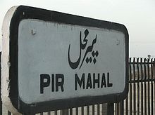
Pirmahal
Encyclopedia
Kamalia
Kamalia is a city and tehsil of the Punjab Province of Pakistan. It is part of Toba Tek Singh District, which is part of the erstwhile Faisalabad Division.-History:...
- District Toba Tek Singh
Toba Tek Singh
Toba Tek Singh District is a district in the Punjab province of Pakistan. It is located between 30°33' to 31°2' Degree north latitudes and 72°08' to 72°48' Degree longitudes.-Origins of Name:...
in the Punjab
Punjab (Pakistan)
Punjab is the most populous province of Pakistan, with approximately 45% of the country's total population. Forming most of the Punjab region, the province is bordered by Kashmir to the north-east, the Indian states of Punjab and Rajasthan to the east, the Pakistani province of Sindh to the...
province of Pakistan
Pakistan
Pakistan , officially the Islamic Republic of Pakistan is a sovereign state in South Asia. It has a coastline along the Arabian Sea and the Gulf of Oman in the south and is bordered by Afghanistan and Iran in the west, India in the east and China in the far northeast. In the north, Tajikistan...
. It is located at 30°46'0N 72°26'0E with an altitude of 148 metres (488 feet).
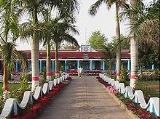
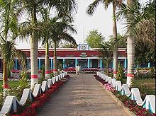
Pirmahal is a modern town
Town
A town is a human settlement larger than a village but smaller than a city. The size a settlement must be in order to be called a "town" varies considerably in different parts of the world, so that, for example, many American "small towns" seem to British people to be no more than villages, while...
divided in two Union Councils, the total population of Pirmahal is almost 100,000.
Cities near Pirmahal
- FaisalabadFaisalabadFaisalabad , formerly known as Lyallpur, is the third largest metropolis in Pakistan, the second largest in the province of Punjab after Lahore, and a major industrial center in the heart of Pakistan. Before the foundation of the city in 1880, the area was very thinly populated. The population has...
(110 km) - GojraGojraGojra , the capital of Gojra Tehsil, is a city of Toba Tek Singh District in the Punjab province of Pakistan, it is located at 31°9'N 72°41'E and is located 30 miles from Faisalabad, 125 km from Burewala, 157 km from Vehari and north of Toba Tek Singh...
(40 km) - JhangJhang- Demographics :According to 1981 census of Pakistan population of Jhang was 1,970,944 with the 434,495 housing units in Jhang. In 1998 census, population of Jhang was 2,834,545, whose annually growth rate was 2.16%. Male population was 1,474,099 and female population was 1,360,446...
(50 km) - LahoreLahoreLahore is the capital of the Pakistani province of Punjab and the second largest city in the country. With a rich and fabulous history dating back to over a thousand years ago, Lahore is no doubt Pakistan's cultural capital. One of the most densely populated cities in the world, Lahore remains a...
(250 km) - KamaliaKamaliaKamalia is a city and tehsil of the Punjab Province of Pakistan. It is part of Toba Tek Singh District, which is part of the erstwhile Faisalabad Division.-History:...
(12 km) - MultanMultanMultan , is a city in the Punjab Province of Pakistan and capital of Multan District. It is located in the southern part of the province on the east bank of the Chenab River, more or less in the geographic centre of the country and about from Islamabad, from Lahore and from Karachi...
(100 km) - RajanaRajanaRajana is a suburb of Toba Tek Singh, Punjab, Pakistan.it is 12KM from district city Toba Tek Singh towards Kamalia City. []-References:...
(15 km) - SandhilianwaliSandhilianwaliSandhilianwali is a town in Toba Tek Singh District in the Punjab province of Pakistan. its near the river Ravi. it has two Government high schools , one for boys and one for girls and many other private schools till class 10th...
(15 km) - Shorkot (35 km)
- Summandri (60 km)
- Toba Tek SinghToba Tek SinghToba Tek Singh District is a district in the Punjab province of Pakistan. It is located between 30°33' to 31°2' Degree north latitudes and 72°08' to 72°48' Degree longitudes.-Origins of Name:...
(25 km) - shorkat cant 20 km
There are many private and govt schools in this city.A great school of This city is MISALI CHENAB MODEL HIGH SCHOOL 319/GB. it has Hostel facility and a great qualified Staff of 32 person.its location is near Gosiya chok kamaliya road pir mahal.
Surrounding villages
- 665/6 GB (7 KM)
- 667/8 GB (3KM)
- BHUSSI KATHIAN (17km)
- 691/33 GB (18 km)
- 689/31 GB (14 km)
- Pathan Kot 676/17GB (10KM)
- Ali nagar roda (15KM)
- Odan Di Basti (1 KM)
- Harris Abad (1 KM)
- 672/13GB (4 km)
- 312GB (10 KM)
- 319GB (1 KM)
- 320GB (1 KM)
- 321GB (2 KM)
- 322GB (14 KM)
- 323GB (15 KM)
- 324GB (16 KM)
- 325GB (17 KM)
- 330GB/Kotle (16 KM)
- 331 G.B. Saleempur (11 KM)
- 331 G.B. Nurpur (12 KM)
- 332 G.B. Jakhra (9 KM)
- 334GB (15 KM)
- 333GB (6 KM)
- 674/15GB(6 KM)
- Dada Abdullah Khan Meo/Dada Ishaq Khan Meo House near 674/15 and 675/16 (7 KM)
- 675/16GB(7 KM)
- 683/24GB(7 KM)
- 719GB (9 KM)
- 671/12GB (2 KM)
- 670/11GB (5 KM)
- 681/22GB (8 km)
- 288GB Sial Wali (8 km)
- 669/10 GB Magnaija station