

Pennsylvania Route 108
Encyclopedia
Pennsylvania Route 108 is a highway in Western Pennsylvania
that runs for 32 miles (51.5 km) from the Ohio
state line near SNPJ
to Pennsylvania Route 8
in Adams Corner. PA 108 intersects US Route 422 in New Castle and US Route 19 near Harlansburg. PA 108 also has an interchange with Interstate 79
at exit 105.
 PA 108 begins at the Ohio
border in North Beaver Township
, Lawrence County
, where the road continues southwest into that state as CR 8 in Mahoning County, provding access to SR 170
and SR 617
. From the state line, the route heads northeast on two-lane undivided Mt. Jackson Road, passing through farmland with some woods and homes. The route skirts the northern border of S.N.P.J.
in three places, curving more to the east-northeast. PA 108 continues through more rural areas of North Beaver Township, coming to an intersection with PA 551
. At this point, the route turns north to form a concurrency
with PA 551, remaining Mt. Jackson Road. The road curves northeast through more agricultural areas with some woodland and residences, turning more to the east into wooded areas with some homes. In the community of Mount Jackson
, PA 551 splits from PA 108 by heading north along with PA 317
. The route continues east-northeast through more farmland and woodland before passing through rural residential areas and coming to an interchange with I-376
, becoming a divided highway
at this point. Past this interchange, the road becomes undivided again and passes more homes before heading through woods and turning southeast, crossing the Mahoning River
. Here, PA 108 becomes the border between Taylor Township
to the west and New Castle
to the east as it passes commercial establishments and comes to an intersection with PA 18
.
At this point, the route turns northeast to join PA 18 on Montgomery Avenue, fully entering New Castle and crossing a Norfolk Southern railroad line. The road continues east into residential areas, with the two routes turning northeast onto South Liberty Street. PA 18/PA 108 passes under two CSX railroad lines and becomes North Liberty Street, running past a mix of homes and businesses before passing under the US 422
freeway. The road continues through woodland and homes before heading into more residential areas. The two routes turn east onto Mahoning Avenue and head through industrial areas, crossing a New Castle Industrial Railroad line. The road heads east-northeast over the Shenango River
and another New Castle Industrial Railroad line, coming to an intersection with PA 168
. Here, PA 18 and PA 108 turn north to follow PA 168 on Moravia Street, passing more industry with some businesses. The road crosses two New Castle Industrial Railroad lines and becomes South Jefferson Street. PA 108 and PA 168 split from PA 18 by turning northeast onto four-lane undivided South Croton Avenue, passing between the Neshannock Creek to the northwest and industrial areas to the southeast. The road crosses US 422 Business and continues to an intersection with the northern terminus of PA 65
. PA 108/PA 168 becomes North Croton Avenue and runs between the creek to the northwest and woods and homes to the southeast. The two routes turn away from the creek and head northeast through residential areas with some businesses. The road curves more to the east, with PA 168 splitting from PA 108 by heading northeast.
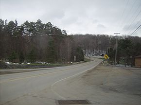
PA 108 passes more homes before crossing into Hickory Township
and becoming Harlansburg Road, heading through farmland and woodland with some homes. The road continues east through more rural areas, coming to an intersection with PA 388
. A short distance past this intersection, the route heads into Scott Township
and passes through McCaslin, running through more areas of farms and woods with occasional residences and turning more to the east-northeast. PA 108 comes to the residential community of Harlansburg
, where it comes to an intersection with US 19
. Past this intersection, the road heads northeast through more agricultural and wooded areas with a few homes, turning more to the east. The route passes through Elliott Mills, at which point it crosses into Plain Grove Township
for a short distance.
in Butler County
and becomes New Castle Road, turning east-northeast and coming to an interchange with I-79
. Past this interchange, the road runs through wooded areas with some fields and homes, crossing Wolf Creek. The route runs northeast through more rural areas, crossing into Slippery Rock Township
. Farther northeast, PA 108 heads into Slippery Rock
and becomes New Castle Street, passing through wooded areas of homes. The road heads into the commercial downtown, at which point it comes to an intersection with PA 173
and PA 258
. Here, PA 173 turns northeast to form a concurrency with PA 108, and the two routes continue along Franklin Street. The road heads into residential areas, with PA 173 splitting to the north. The route crosses back into Slippery Rock Township and becomes Franklin Road, heading through a mix of farmland and woodland with occasional homes. PA 108 continues northeast to its eastern terminus at PA 8
in Adams Corners.
Western Pennsylvania
Western Pennsylvania consists of the western third of the state of Pennsylvania in the United States. Pittsburgh is the largest city in the region, with a metropolitan area population of about 2.4 million people, and serves as its economic and cultural center. Erie, Altoona, and Johnstown are its...
that runs for 32 miles (51.5 km) from the Ohio
Ohio
Ohio is a Midwestern state in the United States. The 34th largest state by area in the U.S.,it is the 7th‑most populous with over 11.5 million residents, containing several major American cities and seven metropolitan areas with populations of 500,000 or more.The state's capital is Columbus...
state line near SNPJ
S.N.P.J., Pennsylvania
S.N.P.J. is a borough located in Lawrence County, Pennsylvania. According to the 2010 U.S. census, the borough has a population of 19.S.N.P.J...
to Pennsylvania Route 8
Pennsylvania Route 8
Pennsylvania Route 8 is a major long route in western Pennsylvania. Officially, PA 8 is named the William Flinn Highway. Its southern terminus is at Interstate 376, U.S. Route 22, and U.S. Route 30 in Pittsburgh...
in Adams Corner. PA 108 intersects US Route 422 in New Castle and US Route 19 near Harlansburg. PA 108 also has an interchange with Interstate 79
Interstate 79
Interstate 79 is an Interstate Highway in the eastern United States, designated from Interstate 77 in Charleston, West Virginia to Pennsylvania Route 5 and Pennsylvania Route 290 in Erie, Pennsylvania...
at exit 105.
Lawrence County
Ohio
Ohio is a Midwestern state in the United States. The 34th largest state by area in the U.S.,it is the 7th‑most populous with over 11.5 million residents, containing several major American cities and seven metropolitan areas with populations of 500,000 or more.The state's capital is Columbus...
border in North Beaver Township
North Beaver Township, Pennsylvania
North Beaver Township is a township in Lawrence County, Pennsylvania, United States. The population was 4,022 at the 2000 census.The Slovene National Benefit Society applied to have their 500 acre recreation center in North Beaver Township designated as a separate municipality in 1977. The S.N.P.J...
, Lawrence County
Lawrence County, Pennsylvania
Lawrence County is a county located in the U.S. state of Pennsylvania. In 2010, its population was 91,108. The county was added to the Pittsburgh Metropolitan Statistical Area in 2003. The county seat is New Castle....
, where the road continues southwest into that state as CR 8 in Mahoning County, provding access to SR 170
Ohio State Route 170
State Route 170 is a north–south running state route located in Mahoning and Columbiana counties in northeast Ohio. It runs within a few miles of the Pennsylvania border for much of its route as it passes though the eastern parts of the two counties. The southern terminus is at an...
and SR 617
Ohio State Route 617
State Route 617 is a short east–west state route in northeastern Ohio, existing entirely within Mahoning County. The western terminus of OH 617 is at OH 165 in the unincorporated community of New Springfield...
. From the state line, the route heads northeast on two-lane undivided Mt. Jackson Road, passing through farmland with some woods and homes. The route skirts the northern border of S.N.P.J.
S.N.P.J., Pennsylvania
S.N.P.J. is a borough located in Lawrence County, Pennsylvania. According to the 2010 U.S. census, the borough has a population of 19.S.N.P.J...
in three places, curving more to the east-northeast. PA 108 continues through more rural areas of North Beaver Township, coming to an intersection with PA 551
Pennsylvania Route 551
Pennsylvania Route 551 is an long state highway located in Beaver, Lawrence, and Mercer counties in Pennsylvania. The southern terminus is at PA 18 in Beaver Falls...
. At this point, the route turns north to form a concurrency
Concurrency (road)
A concurrency, overlap, or coincidence in a road network is an instance of one physical road bearing two or more different highway, motorway, or other route numbers...
with PA 551, remaining Mt. Jackson Road. The road curves northeast through more agricultural areas with some woodland and residences, turning more to the east into wooded areas with some homes. In the community of Mount Jackson
Mount Jackson, Pennsylvania
Mount Jackson, Pennsylvania is a small village in Lawrence County, Pennsylvania. The population is about 1000. The North Beaver Fire Department, municipal buildings, Mount Jackson Presbyterian Church, and a recycling center are located there....
, PA 551 splits from PA 108 by heading north along with PA 317
Pennsylvania Route 317
Pennsylvania Route 317 is a long state highway located in Lawrence county in Pennsylvania. The western terminus is at the Ohio state line near Bessemer, where it continues westward as Ohio State Route 630...
. The route continues east-northeast through more farmland and woodland before passing through rural residential areas and coming to an interchange with I-376
Interstate 376
Interstate 376 is a major auxiliary route of the Interstate Highway System in the U.S. state of Pennsylvania, located entirely within the Allegheny Plateau. It runs from I-80 near Sharon south and east to a junction with the Pennsylvania Turnpike in Monroeville, after having crossed the Turnpike...
, becoming a divided highway
Divided Highway
Divided Highway is a compilation album by American rock band The Doobie Brothers, released in 2003. . All tracks are taken from the albums Cycles and Brotherhood .-Track listing:...
at this point. Past this interchange, the road becomes undivided again and passes more homes before heading through woods and turning southeast, crossing the Mahoning River
Mahoning River
The Mahoning River is a river located in eastern Ohio and western Pennsylvania. It joins the Shenango River to form the Beaver River and is part of the Ohio River watershed.- Physical properties :...
. Here, PA 108 becomes the border between Taylor Township
Taylor Township, Lawrence County, Pennsylvania
Taylor Township is a township in Lawrence County, Pennsylvania, United States. The population was 1,198 at the 2000 census.-Geography:According to the United States Census Bureau, the township has a total area of 5.3 square miles , of which, 5.1 square miles of it is land and...
to the west and New Castle
New Castle, Pennsylvania
New Castle is a city in Lawrence County, Pennsylvania, United States, northwest of Pittsburgh and near the Pennsylvania-Ohio border just east of Youngstown, Ohio; in 1910, the total population was 36,280; in 1920, 44,938; and in 1940, 47,638. The population has fallen to 26,309 according to the...
to the east as it passes commercial establishments and comes to an intersection with PA 18
Pennsylvania Route 18
Pennsylvania Route 18 is a major north–south highway in Western Pennsylvania whose southern terminus is at the West Virginia state line in Greene County, Pennsylvania near the village of Garrison, while the northern terminus is at PA Route 5 in Lake City, Pennsylvania...
.
At this point, the route turns northeast to join PA 18 on Montgomery Avenue, fully entering New Castle and crossing a Norfolk Southern railroad line. The road continues east into residential areas, with the two routes turning northeast onto South Liberty Street. PA 18/PA 108 passes under two CSX railroad lines and becomes North Liberty Street, running past a mix of homes and businesses before passing under the US 422
U.S. Route 422
U.S. Route 422 is a long spur route of US 22 split into two segments in the U.S. states of Ohio and Pennsylvania. The western spur begins in downtown Cleveland, Ohio, and ends at Ebensburg, Pennsylvania...
freeway. The road continues through woodland and homes before heading into more residential areas. The two routes turn east onto Mahoning Avenue and head through industrial areas, crossing a New Castle Industrial Railroad line. The road heads east-northeast over the Shenango River
Shenango River
The Shenango River is a principal tributary of the Beaver River, approximately 100 mi long, in western Pennsylvania in the United States. It also briefly flows through small portions of northeastern Ohio...
and another New Castle Industrial Railroad line, coming to an intersection with PA 168
Pennsylvania Route 168
Pennsylvania Route 168 is a highway in Western Pennsylvania that runs for from Pennsylvania Route 18 in Frankfort Springs to Pennsylvania Route 208 in Volant...
. Here, PA 18 and PA 108 turn north to follow PA 168 on Moravia Street, passing more industry with some businesses. The road crosses two New Castle Industrial Railroad lines and becomes South Jefferson Street. PA 108 and PA 168 split from PA 18 by turning northeast onto four-lane undivided South Croton Avenue, passing between the Neshannock Creek to the northwest and industrial areas to the southeast. The road crosses US 422 Business and continues to an intersection with the northern terminus of PA 65
Pennsylvania Route 65
Pennsylvania Route 65 is a major state highway located in western Pennsylvania, United States. The route, traveling north–south from the Interstate 279/U.S...
. PA 108/PA 168 becomes North Croton Avenue and runs between the creek to the northwest and woods and homes to the southeast. The two routes turn away from the creek and head northeast through residential areas with some businesses. The road curves more to the east, with PA 168 splitting from PA 108 by heading northeast.
PA 108 passes more homes before crossing into Hickory Township
Hickory Township, Lawrence County, Pennsylvania
Hickory Township is a township in Lawrence County, Pennsylvania, United States. The population was 2,356 at the 2000 census.-Geography:According to the United States Census Bureau, the township has a total area of , of which, of it is land and of it is water.-Demographics:As of the census of...
and becoming Harlansburg Road, heading through farmland and woodland with some homes. The road continues east through more rural areas, coming to an intersection with PA 388
Pennsylvania Route 388
Pennsylvania Route 388 is a north–south state highway in Lawrence County, Pennsylvania, United States, located in Western Pennsylvania...
. A short distance past this intersection, the route heads into Scott Township
Scott Township, Lawrence County, Pennsylvania
Scott Township is a township in Lawrence County, Pennsylvania, United States. The population was 2,235 as of the 2000 census.-Geography:According to the United States Census Bureau, the township has a total area of 19.7 square miles , of which, 19.7 square miles of it is land and...
and passes through McCaslin, running through more areas of farms and woods with occasional residences and turning more to the east-northeast. PA 108 comes to the residential community of Harlansburg
Harlansburg, Pennsylvania
Harlansburg is a community eight miles east of the city of New Castle in Lawrence County, Pennsylvania.The community is the home of the Harlansburg Station Transportation Museum and the Harlansburg cave, reputedly the longest cave in Pennsylvania....
, where it comes to an intersection with US 19
U.S. Route 19 in Pennsylvania
U.S. Route 19 in Pennsylvania closely parallels Interstate 79 for its entire length. US 19 enters Pennsylvania in Greene County near Mount Morris. Its northern terminus is in the city of Erie. Part is named for Commodore Oliver Hazard Perry, hero of the Battle of Lake Erie.-Route description:In...
. Past this intersection, the road heads northeast through more agricultural and wooded areas with a few homes, turning more to the east. The route passes through Elliott Mills, at which point it crosses into Plain Grove Township
Plain Grove Township, Pennsylvania
Plain Grove Township is a township in Lawrence County, Pennsylvania, United States. The population was 854 at the 2000 census.-Geography:According to the United States Census Bureau, the township has a total area of 18.0 square miles , of which, 17.9 square miles of it is land and...
for a short distance.
Butler County
PA 108 enters Worth TownshipWorth Township, Butler County, Pennsylvania
Worth Township is a township in Butler County, Pennsylvania, United States. The population was 1,331 at the 2000 census.-Geography:According to the United States Census Bureau, the township has a total area of 25.2 square miles , of which, 24.2 square miles of it is land and...
in Butler County
Butler County, Pennsylvania
-Demographics:As of the census of 2000, there were 174,083 people, 65,862 households, and 46,827 families residing in the county. The population density was 221 people per square mile . There were 69,868 housing units at an average density of 89 per square mile...
and becomes New Castle Road, turning east-northeast and coming to an interchange with I-79
Interstate 79
Interstate 79 is an Interstate Highway in the eastern United States, designated from Interstate 77 in Charleston, West Virginia to Pennsylvania Route 5 and Pennsylvania Route 290 in Erie, Pennsylvania...
. Past this interchange, the road runs through wooded areas with some fields and homes, crossing Wolf Creek. The route runs northeast through more rural areas, crossing into Slippery Rock Township
Slippery Rock Township, Butler County, Pennsylvania
Slippery Rock Township is a township in Butler County, Pennsylvania, United States. The population was 5,251 at the 2000 census.-Geography:According to the United States Census Bureau, the township has a total area of 25.9 square miles , of which, 25.9 square miles of it is land and...
. Farther northeast, PA 108 heads into Slippery Rock
Slippery Rock, Pennsylvania
Slippery Rock is a borough in Butler County, Pennsylvania, United States. The population was 3,068 at the 2000 census. It is home to the Slippery Rock University of Pennsylvania.-Geography:Slippery Rock is located at ....
and becomes New Castle Street, passing through wooded areas of homes. The road heads into the commercial downtown, at which point it comes to an intersection with PA 173
Pennsylvania Route 173
Pennsylvania Route 173 is located in western Pennsylvania, running from PA Route 8 south of Slippery Rock in Butler County, to north of Cochranton in Crawford County.-Route description:...
and PA 258
Pennsylvania Route 258
Pennsylvania Route 258 is an long state highway located in Butler and Mercer counties in Pennsylvania. The southern terminus is at PA 108/PA 173 in Slippery Rock. The northern terminus is at PA 18 in Clark.-Butler County:...
. Here, PA 173 turns northeast to form a concurrency with PA 108, and the two routes continue along Franklin Street. The road heads into residential areas, with PA 173 splitting to the north. The route crosses back into Slippery Rock Township and becomes Franklin Road, heading through a mix of farmland and woodland with occasional homes. PA 108 continues northeast to its eastern terminus at PA 8
Pennsylvania Route 8
Pennsylvania Route 8 is a major long route in western Pennsylvania. Officially, PA 8 is named the William Flinn Highway. Its southern terminus is at Interstate 376, U.S. Route 22, and U.S. Route 30 in Pittsburgh...
in Adams Corners.