

Pennsylvania Route 152
Encyclopedia
Pennsylvania Route 152 is a 25 mile (40 km) long state highway located in the US
state of Pennsylvania
. The route, travels north–south from PA Route 309 located in Cedarbrook north to PA Route 309 located east of Telford
.
PA 152 is unique to other Pennsylvania Highways because it ends at two interchanges on the same route. From a junction with PA Route 73
to Silverdale
, a 21 miles (33.8 km) portion of PA 152 is known as Limekiln Pike. North of Silverdale, PA 152 runs opposite to its alignment leading up to the northern terminus at another interchange with PA 309.
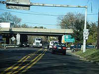 PA 152 begins at an interchange with PA Route 309 in Cedarbrook, located in Montgomery County
about 3000 feet (914.4 m) north of the Philadelphia city line. This interchange, formerly a complex web of ramps, was reconstructed with a simpler alignment in 2007. PA 152 begins as Easton Road on a north alignment, and then diverts left onto Limekiln Pike just before intersecting PA Route 73
.
North of PA 73, PA 152 continues on a north alignment through the Philadelphia suburb of Cheltenham Township
. In Upper Dublin Township
, PA 152 passes under Interstate 276, the Pennsylvania Turnpike
. North of I-276, the alignment of PA 152 begins to change to a north west alignment through the hamlet of Jarrettown before changing to a solid north alignment.
Then, PA 152 has several important junctions. The first junction is with Norristown Road, then with PA Route 63
, and a final junction with Butler Pike. After all of these junctions, PA 152 intersects PA Route 463
in the hamlet of Prospectville. Then it continues on a north alignment as Limekiln Pike.
, the alignment of PA 152 begins to change more to the west. After entering the borough of Chalfont
, the route instantly has a concurrency
with U.S. Route 202
. Later, PA 152 continues to the north west as Limekiln Pike through rural Bucks County. In the hamlet of Mount Pleasant, the route has wide turns before reaching Silverdale
.
PA 152 enters Silverdale from the south as Limekiln Pike, then it has a short wrong-way concurrency with PA Route 113
. Then, PA 152 enters the borough of Perkasie
as Walnut Street. In Perkasie, the route changes its course to the south to become Constitution Avenue and Park Avenue. Then upon exiting Perkasie it turns to west to become State Road and terminate at another interchange with PA Route 309.
In the original 1928 routing, PA 152 stretched from US 122 and PA 52
(now US 202) in Chalfont
to the Stenton Avenue and Broad Street (US 611) intersection via Ogontz Avenue in the Oak Lane
neighborhood of North Philadelphia. The segment within Perkasie
known as Walnut Street, Construction Avenue, and Park Avenue was signed as PA 413 from South Perkasie Road to Main Street (then US 309). In 1930, the route was lengthened to PA 113 in Silverdale.
In 1947, the northern terminus was moved to US 309 in Sellersville replacing the segment of PA 413. From the late 1940s to the mid 1950s, the southernmost segment on Easton Road from PA 309 to Arcadia University
was signed as US 611 Alternate.
By 1960, the southern terminus was moved to its current location.
United States
The United States of America is a federal constitutional republic comprising fifty states and a federal district...
state of Pennsylvania
Pennsylvania
The Commonwealth of Pennsylvania is a U.S. state that is located in the Northeastern and Mid-Atlantic regions of the United States. The state borders Delaware and Maryland to the south, West Virginia to the southwest, Ohio to the west, New York and Ontario, Canada, to the north, and New Jersey to...
. The route, travels north–south from PA Route 309 located in Cedarbrook north to PA Route 309 located east of Telford
Telford, Pennsylvania
Telford is a borough in Bucks and Montgomery counties in the U.S. state of Pennsylvania. The population was 4,872 at the time of the 2010 census.- History :...
.
PA 152 is unique to other Pennsylvania Highways because it ends at two interchanges on the same route. From a junction with PA Route 73
Pennsylvania Route 73
Pennsylvania Route 73 is a 62.51 miles long east–west state highway in southeastern Pennsylvania. It runs from Pennsylvania Route 61 in Leesport to the New Jersey state line on the Tacony-Palmyra Bridge in Philadelphia, where it continues as New Jersey Route 73.Predating the Interstate...
to Silverdale
Silverdale, Pennsylvania
Silverdale is a borough in Bucks County, Pennsylvania in the USA. The population was 871 at the 2010 census. Silverdale is part of Pennridge School District.-Geography:Silverdale is located at ....
, a 21 miles (33.8 km) portion of PA 152 is known as Limekiln Pike. North of Silverdale, PA 152 runs opposite to its alignment leading up to the northern terminus at another interchange with PA 309.
Montgomery County
Montgomery County, Pennsylvania
Montgomery County is a county located in the U.S. state of Pennsylvania, in the United States. As of 2010, the population was 799,874, making it the third most populous county in Pennsylvania . The county seat is Norristown.The county was created on September 10, 1784, out of land originally part...
about 3000 feet (914.4 m) north of the Philadelphia city line. This interchange, formerly a complex web of ramps, was reconstructed with a simpler alignment in 2007. PA 152 begins as Easton Road on a north alignment, and then diverts left onto Limekiln Pike just before intersecting PA Route 73
Pennsylvania Route 73
Pennsylvania Route 73 is a 62.51 miles long east–west state highway in southeastern Pennsylvania. It runs from Pennsylvania Route 61 in Leesport to the New Jersey state line on the Tacony-Palmyra Bridge in Philadelphia, where it continues as New Jersey Route 73.Predating the Interstate...
.
North of PA 73, PA 152 continues on a north alignment through the Philadelphia suburb of Cheltenham Township
Cheltenham Township, Pennsylvania
Cheltenham Township is a home rule municipality in Montgomery County, Pennsylvania, United States. Although it retains the word "Township" in its official name, it has been governed by a home rule charter since 1977 and is therefore not subject to the Pennsylvania Township Code. The population was...
. In Upper Dublin Township
Upper Dublin Township, Pennsylvania
Upper Dublin Township is a township in Montgomery County, Pennsylvania, United States. The population was 25,569 at the 2010 census.Upper Dublin is made up of several community areas, many of which are unincorporated areas in Montgomery County with no legal status, and are used primarily by the US...
, PA 152 passes under Interstate 276, the Pennsylvania Turnpike
Pennsylvania Turnpike
The Pennsylvania Turnpike is a toll highway system operated by the Pennsylvania Turnpike Commission in the Commonwealth of Pennsylvania, United States. The three sections of the turnpike system total . The main section extends from Ohio to New Jersey and is long...
. North of I-276, the alignment of PA 152 begins to change to a north west alignment through the hamlet of Jarrettown before changing to a solid north alignment.
Then, PA 152 has several important junctions. The first junction is with Norristown Road, then with PA Route 63
Pennsylvania Route 63
Pennsylvania Route 63 is a long state highway located in the Philadelphia, Pennsylvania area. The western terminus of the route is at PA 29 in Green Lane, Montgomery County. The eastern terminus is at Interstate 95 in Bensalem Township, Bucks County...
, and a final junction with Butler Pike. After all of these junctions, PA 152 intersects PA Route 463
Pennsylvania Route 463
Pennsylvania Route 463 is a long route completely in Montgomery County, Pennsylvania. Its western terminus is at PA 63 in Hatfield Township and its eastern terminus is at PA 611 in Horsham. It runs through the northern suburban areas of Philadelphia and passes through the towns...
in the hamlet of Prospectville. Then it continues on a north alignment as Limekiln Pike.
Bucks County
Upon entering Bucks CountyBucks County, Pennsylvania
- Industry and commerce :The boroughs of Bristol and Morrisville were prominent industrial centers along the Northeast Corridor during World War II. Suburban development accelerated in Lower Bucks in the 1950s with the opening of Levittown, Pennsylvania, the second such "Levittown" designed by...
, the alignment of PA 152 begins to change more to the west. After entering the borough of Chalfont
Chalfont, Pennsylvania
Chalfont is a home rule municipality located in Bucks County, Pennsylvania, United States. The population was 4,009 at the 2010 census.Chalfont is named after Chalfont St Giles in Buckinghamshire, England...
, the route instantly has a concurrency
Concurrency (road)
A concurrency, overlap, or coincidence in a road network is an instance of one physical road bearing two or more different highway, motorway, or other route numbers...
with U.S. Route 202
U.S. Route 202
U.S. Route 202 is a highway stretching from Delaware to Maine, also passing through the states of Pennsylvania, New Jersey, New York, Connecticut, Massachusetts, and New Hampshire....
. Later, PA 152 continues to the north west as Limekiln Pike through rural Bucks County. In the hamlet of Mount Pleasant, the route has wide turns before reaching Silverdale
Silverdale, Pennsylvania
Silverdale is a borough in Bucks County, Pennsylvania in the USA. The population was 871 at the 2010 census. Silverdale is part of Pennridge School District.-Geography:Silverdale is located at ....
.
PA 152 enters Silverdale from the south as Limekiln Pike, then it has a short wrong-way concurrency with PA Route 113
Pennsylvania Route 113
Pennsylvania Route 113 is a long state route in eastern Pennsylvania. The southern terminus of the route is at U.S. Route 30 Business in Downingtown. Its northern terminus is at Pennsylvania Route 611 in Tinicum Township...
. Then, PA 152 enters the borough of Perkasie
Perkasie, Pennsylvania
Perkasie is a borough in Bucks County, Pennsylvania, north of Philadelphia. Establishments in the borough early in the twentieth century included silk mills, baseballs, brickyards, lumber mills, tile works, a stone crusher, and manufacturies of cigars, tags and labels, wire novelties, etc. The...
as Walnut Street. In Perkasie, the route changes its course to the south to become Constitution Avenue and Park Avenue. Then upon exiting Perkasie it turns to west to become State Road and terminate at another interchange with PA Route 309.
History
PA 152 was originally a pathway known as the Limekiln Road built in 1693 to transport lime from kilns from Upper Dublin Township.In the original 1928 routing, PA 152 stretched from US 122 and PA 52
Pennsylvania Route 52
Pennsylvania Route 52 is a long state highway located in southeast Pennsylvania. The southern terminus of the route is at the Pennsylvania-Delaware state line near Kennett Square, where PA 52 continues as Delaware Route 52. The northern terminus is at U.S. Route 322 Business in West Chester. Near...
(now US 202) in Chalfont
Chalfont, Pennsylvania
Chalfont is a home rule municipality located in Bucks County, Pennsylvania, United States. The population was 4,009 at the 2010 census.Chalfont is named after Chalfont St Giles in Buckinghamshire, England...
to the Stenton Avenue and Broad Street (US 611) intersection via Ogontz Avenue in the Oak Lane
East Oak Lane, Philadelphia, Pennsylvania
East Oak Lane is a neighborhood in the upper Northern section of Philadelphia, Pennsylvania, United States. Many of the houses in the neighborhood are large single homes or twins built at a later period than much of central North Philadelphia...
neighborhood of North Philadelphia. The segment within Perkasie
Perkasie, Pennsylvania
Perkasie is a borough in Bucks County, Pennsylvania, north of Philadelphia. Establishments in the borough early in the twentieth century included silk mills, baseballs, brickyards, lumber mills, tile works, a stone crusher, and manufacturies of cigars, tags and labels, wire novelties, etc. The...
known as Walnut Street, Construction Avenue, and Park Avenue was signed as PA 413 from South Perkasie Road to Main Street (then US 309). In 1930, the route was lengthened to PA 113 in Silverdale.
In 1947, the northern terminus was moved to US 309 in Sellersville replacing the segment of PA 413. From the late 1940s to the mid 1950s, the southernmost segment on Easton Road from PA 309 to Arcadia University
Arcadia University
Arcadia University is a private university located in Glenside, Pennsylvania, on the outskirts of Philadelphia. A master's university by Carnegie Classification, the university has a co-educational student population of more than 4,000. The university was ranked 25th in the master's universities in...
was signed as US 611 Alternate.
By 1960, the southern terminus was moved to its current location.