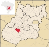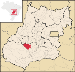
Paraúna
Encyclopedia
| Paraúna | |
|---|---|
| State | Goiás Goiás Goiás is a state of Brazil, located in the central part of the country. The name Goiás comes from the name of an indigenous community... |
| Area: | 3,781.2 km² |
| Population: | 10,926 (IBGE 2007) |
| Elevation: | 721 m above sea level |
| Postcode (CEP): | 75980-000 |
| Became a city: | 1934 |
| Distance to Goiânia Goiânia -Climate:The city has a tropical wet and dry climate with an average temperature of . There's a wet season, from October to April, and a dry one, from May to September. Annual rainfall is around 1,520 mm.... : |
160 km. |
| IBGE statistical microregion: | Vale do Rio dos Bois Microregion Vale do Rio dos Bois Microregion Vale do Rio dos Bois Microregion is a statistical region in central Goiás state, Brazil. It lies west of the state capital, Goiânia-Important Data :*Population: 107,317 inhabitants*Cities: 13*Total Area: 13,653.60 km²... |
| Website: | Câmara Municipal de Paraúna |

Municipality
A municipality is essentially an urban administrative division having corporate status and usually powers of self-government. It can also be used to mean the governing body of a municipality. A municipality is a general-purpose administrative subdivision, as opposed to a special-purpose district...
in southwestern Goiás
Goiás
Goiás is a state of Brazil, located in the central part of the country. The name Goiás comes from the name of an indigenous community...
state, Brazil
Brazil
Brazil , officially the Federative Republic of Brazil , is the largest country in South America. It is the world's fifth largest country, both by geographical area and by population with over 192 million people...
. It has strange rock formations and is a large producer of cotton and soybeans.
Location
Highway connections with GoiâniaGoiânia
-Climate:The city has a tropical wet and dry climate with an average temperature of . There's a wet season, from October to April, and a dry one, from May to September. Annual rainfall is around 1,520 mm....
are made by BR-060 / Abadia de Goiás
Abadia de Goiás
Abadia de Goiás is a small town and municipality in central Goiás state, Brazil, located on the western edge of the Goiânia metropolitan area.-Geographical Data:The distance to Goiânia is 27 km...
/ Guapó
Guapó
Guapó is a small town and municipality in central Goiás state, Brazil. The population was 13,586 and the total area of the municipality was 517.0 km² .Guapó is part of the Goiânia Microregion...
/ Indiara
Indiara
Indiara is a small city and municipality in central-south Goiás state, Brazil. Indiara is a large producer of soybeans and cotton.-Location:Indiara is located in the Vale do Rio dos Bois and has municipal boundaries with:*north: Palmeiras de Goiás...
/ GO-320 / Jandaia
Jandaia
Jandaia is a small town and municipality in the eastern portion of the Brazilian state of Goiás.-Location and connections:Jandaia has municipal boundaries with:*Northwest: Palmeiras de Goiás*Northeast: Palminópolis...
. See Sepin for all the distances.
Municipal boundaries:
- North: AurilândiaAurilândiaAurilândia is a small town and municipality in eastern Goiás state, Brazil.-Location:The distance to the state capital is 146 km. while the distance to the main regional center São Luís de Montes Belos is 23 km....
- South: JandaiaJandaiaJandaia is a small town and municipality in the eastern portion of the Brazilian state of Goiás.-Location and connections:Jandaia has municipal boundaries with:*Northwest: Palmeiras de Goiás*Northeast: Palminópolis...
- East: São João da ParaúnaSão João da ParaúnaSão João da Paraúna is a small town and municipality in western Goiás state, Brazil.-Location:São João is located west of Goiânia, 36 km...
- West: Palestina de GoiásPalestina de GoiásPalestina de Goiás is a small town and municipality in eastern Goiás state, Brazil.-Location:Palestina is located in the Sudoeste de Goiás Microregion between the Rio Bonito and the Rio Caiapó. There are paved road connections linking the town to Jataí in the south and to Iporá in the northeast...
, CaiapôniaCaiapôniaCaiapônia is a small town and municipality in south-central Goiás state, Brazil. It has the third largest cattle herd in the state and is a major producer of grains. The town is also known as Torres Do Rio Bonito or just Rio Bonito.-Geography:...
, and MontividiuMontividiuthumb|right|250px|Coordinates: Montividiu is a small town and municipality in eastern Goiás state, Brazil. Montividiu is a large producer of soybeans and corn.-Location and Neighboring Municipalities:...
Climate
The climate is tropical, typical of medium elevations, with the dry period of the year occurring between July and October and the wet period occurring between November and March. The average elevation is 800 meters above sea level.Political and Demographic Information
- Mayor: Sebastião Ferro de Moraes (January 2005)
- City council: 9
- Eligible voters: 8,269 (December 2007)
- Population density: 2.89 inhab/km² (2005)
- Urban population: 7,649 (2007)
- Rural population: 3,277 (2007)
- Population growth or loss: a loss of about 2,000 people since 1980
Economic information
The economy is based on agriculture, cattle raising, services, public administration, and small transformation industries.- Industrial units: 19 (2007)
- Commercial units: 92 (2007)
- Bank agencies: Banco Itaú S.A. - Banco do Brasil S.A. - BRADESCO S.A.
- Dairies: Paraúna Indústria e Comércio de Laticínios Ltda. - Lactouna Ind. e Com. de Leite e Derivados Ltda
- Meat processing plant: Pifpaf
- Motor vehicles: 1,072 automobiles and pickup trucks (2007), which gave a ratio of 10 inhabitants for each motor vehicle. In this calculation we did not count motorcycles, which were 717 in 2007.
- Cattle herd: 197,000 head (2006)
- Poultry: 84,000 (2006)
- Dairy cows: 17,740 (2006)
- Main crops (2006): cotton (9,880 hectares), rice, coffee, sugarcane, manioc, corn, and soybeans (62,000 hectares).
See Sepin
Agricultural data for 2006
- Number of farms: 746
- Total agricultural area: 254,548 ha.
- Planted area: 70,700 ha.
- Area of natural pasture: 129,973 ha.
- Number of persons employed in agriculture: 2,160
Education (2006)
- Schools: 1 with
- Students: 3,426
- Higher education: none
- Adult literacy rate: 85.0% (2000) (national average was 86.4%)
Health (2007)
- Hospitals: 1
- Hospital beds: 41
- Infant mortality rate: 25.29 (2000) (national average was 33.0)
Tourism
The municipality is one of the main tourist attractions in the state of Goiás. In the Serra do Caiapó immense stone walls extend for several kilometers. Inscriptions on the stone indicate to some the existence of a pre-Columbian civilization but to others the rocks are natural formations sculpted by the wind or the result of shaping caused by waves when this region was under the sea. Visitors describe a city of stone, with buildings, objects, and animals carved out by the forces of mother nature.The Ecological Park of Paraúna is one of the most visited points of ecological tourism in the region. The park, which is being organized, has the mission of protecting the natural beauty of the region, such as the sandstone formations, caverns and a subterranean river.
History
The first name of the settlement, which appeared in the beginning of the nineteenth century, was Bota Fumaça (Fire Belcher) and then became São José do Turvo, due to the Turvo River. The present name, given in 1930, is of tupi-guarani origen. "Para" means river and "Una" means black. The town was elevated to the condition of municipality in 1934.Ranking on the Municipal Human Development Index
Human Development Index
The Human Development Index is a composite statistic used to rank countries by level of "human development" and separate "very high human development", "high human development", "medium human development", and "low human development" countries...
- Life expectancy: 68.4
- Adult literacy rate: 0.834
- School attendance rate: 0.766
- MHDI: 0.742
- State ranking: 99 (out of 242 municipalities)
- National ranking: 2,092 (out of 5,507 municipalities)
Data are from 2000. For the complete list see Frigoletto.com

