

Pangani River
Encyclopedia
The Pangani River (also called Luffu and Jipe Ruvu and probably once called Rhaptus) is a major river of northeastern Tanzania
, which rises in Kilimanjaro, passes through Lake Jipe
, and empties into the Indian Ocean
at the town of Pangani
. For much of its length the river flows along the regional borders of Kilimanjaro Region
and Manyara Region
, before flowing into Tanga Region
, which contains the 68 MW Pangani Power Station and the Pangani Falls Dam
. There are several inhabited islands within the river. The river is full of crocodiles; hippopotami are scarcer in its lower parts.
. Lake Jipe may be considered a backwater of the Lumi. Below Lake Jipe and above the falls, the river is referred to as "Ruvu". By the time it reaches the ocean at Pangani
, it is referred to as the Pangani River.
While the Sudheli language calls it "Pangani" (meaning distribute or arrange), it is called "Luffu" by the Wasambara (indigenous to the Nderema area, on the three ridges nearer the coast) and Wasegua (who live on the river's islands). Almost all authorities agree that the river "Rhaptus" of Ptolemy
's topographical
maps is the Pangani of modern maps.
Source
The river rises in Kilimanjaro, about 120 miles (193.1 km) from the sea. Known as the Lumi in this area, its course runs through Lake Jipe. Like all African rivers, its depth varies with the season. The river is highest about June and lowest about January.
Midsection
It is navigable for small craft between the lake and the Höhnel Cataracts
, a series of rapids. Below the Höhnel Cataracts, it has numerous tributaries, and many islands with villages on them. The stream is strongest above Koleni, within 5 miles of the Pangani Falls, where the river is narrow. This section is not navigable for any considerable distance on account of the falls, which are about 30 miles (48.3 km) from the mouth. Approximately 4 miles (6.4 km) from the mouth, dense mangrove
swamp covers the flatland between the hills on either side. In this area, near Teufelsfelsen, are higher land, a fertile area, and the arid Masai Steppe. On this bank is Mount Kovu Kovu, 360 feet (109.7 m) in height, while on the south bank is a ridge 400 feet (121.9 m) high. Pombwe, one of the principal settlements on the river, is situated about 1 miles (1.6 km) west of Kovu Kovu. Above Pombwe, the West African oil palm grows, while below Pombwe, the trees are chiefly areca and coconut palms. The village of Lemkuna and the hamlet of Ngage are on the river's west bank, while Mvungwe and Meserani are on its eastern bank.
Mouth
The mouth is located 52 kilometres (32.3 mi) south of Tanga
. The river is tidal for a distance of 22 miles (35.4 km) from the entrance. The southern side of the entrance is marked by a perpendicular bluff named Bweni, about 200 feet (61 m) high; there is a village of the same name, Bweni, situated here. The northern side of the entrance is a flat sandy beach that extends from the head of the bay. There are several settlements at the entrance, two on the northern and two on the southern bank. Historically, the town of Pangani
, on the river's left bank, had a reputation for fevers. At its estuary
, by Pangani town, the river is about 600 feet (182.9 m) in breadth, and 12–15 ft (3.7–4.6 ) deep.
Tributaries
Several tributaries coming from the Pare Mountains
, the Usambara Mountains
and the Wasegiia wilderness join the Pangani in its course. These include the Kibaya, Komkuza, Kwachigulu, Kwamwadyau and Mnyusi.
Five sub-basins make up the basin, namely the Pangani River (43650 km² (16,853.4 sq mi)), Umba River (8070 km² (3,115.8 sq mi)), Msangazi River
(5030 km² (1,942.1 sq mi)), Zigi River
and Mkulumuzi River
(2080 km² (803.1 sq mi)), which all empty into the Indian Ocean.
The Pangani Basin Water Board (PBWB) was established in July 1991 in accordance with the Water Utilization (Control and Regulation) Act No. 42 of 1974, with its headquarters in the municipality of Moshi
in Kilimanjaro Region, and two other offices in Arusha
and Tanga
. The PBWB consists of ten professionals from public institutions and private sector LGAs, UWSAs and other committees.
The river system is under pressure from conflicts of interest in water use. Many farmers rely on the river for irrigation and damming projects along the river have reduced several hundreds to less than 40 m3/s, affecting coastal communities, which have seen fish populations dramatically reduced. In 2002, the Pangani River Basin Management Project (PRBMP) was established to manage the basin's water resources. It receives technical assistance from the International Union for Conservation of Nature (IUCN), the Netherlands Development Organization (SNV) and the local NGO PAMOJA. The project also receives funds from the Government of Tanzania, IUCN, the European Commission
(EU) and the Global Environment Facility
through the UNDP.
Tanzania
The United Republic of Tanzania is a country in East Africa bordered by Kenya and Uganda to the north, Rwanda, Burundi, and the Democratic Republic of the Congo to the west, and Zambia, Malawi, and Mozambique to the south. The country's eastern borders lie on the Indian Ocean.Tanzania is a state...
, which rises in Kilimanjaro, passes through Lake Jipe
Lake Jipe
Lake Jipe is an inter-territorial lake straddling the borders of Tanzania and Kenya. On the Tanzanian side, it is situated within Mwanga District, in Kilimanjaro Region while on the Kenyan side, it is located south of the village of Nghonji...
, and empties into the Indian Ocean
Indian Ocean
The Indian Ocean is the third largest of the world's oceanic divisions, covering approximately 20% of the water on the Earth's surface. It is bounded on the north by the Indian Subcontinent and Arabian Peninsula ; on the west by eastern Africa; on the east by Indochina, the Sunda Islands, and...
at the town of Pangani
Pangani
Pangani is one of the eight districts of Tanga Region in Tanzania. It is bordered to the North by the Muheza District, to the East by the Indian Ocean, to the South by the Pwani Region and to the West by the Handeni District.The center is Pangani....
. For much of its length the river flows along the regional borders of Kilimanjaro Region
Kilimanjaro Region
Kilimanjaro is one of the 26 regions in Tanzania. The capital of the region is Moshi. Kilimanjaro region is home to Mount Kilimanjaro.Kilimanjaro Region is bordered to the North and East by Kenya, to the South by the Tanga Region, to the Southwest by the Manyara Region, and to the West by the...
and Manyara Region
Manyara Region
Manyara is one of the 26 Regions of Tanzania. Babati serves as the Region's capital. In its northern part is Lake Manyara. It is bordered to the north by the Arusha Region, to the northeast by the Kilimanjaro Region, to the east by the Tanga Region, to the south by the Dodoma Region, to the...
, before flowing into Tanga Region
Tanga Region
Tanga Region is one of the 26 regions of Tanzania. The regional headquarters is in Tanga. According to the 2002 Tanzania National Census, the region has a population of 1,642,015 people....
, which contains the 68 MW Pangani Power Station and the Pangani Falls Dam
Pangani Falls Dam
Pangani Falls Dam is one of the dams in Tanzania. It is inTanga Region. Its installed capacity is 68 MW....
. There are several inhabited islands within the river. The river is full of crocodiles; hippopotami are scarcer in its lower parts.
Etymology
The Pangani originates on Kilimanjaro, where it is the River LumiRiver Lumi
The River Lumi is located in Tanzania. It originates on the north side of Mount Kilimanjaro, and flows so close to the River Rombo as almost to form a fork...
. Lake Jipe may be considered a backwater of the Lumi. Below Lake Jipe and above the falls, the river is referred to as "Ruvu". By the time it reaches the ocean at Pangani
Pangani
Pangani is one of the eight districts of Tanga Region in Tanzania. It is bordered to the North by the Muheza District, to the East by the Indian Ocean, to the South by the Pwani Region and to the West by the Handeni District.The center is Pangani....
, it is referred to as the Pangani River.
While the Sudheli language calls it "Pangani" (meaning distribute or arrange), it is called "Luffu" by the Wasambara (indigenous to the Nderema area, on the three ridges nearer the coast) and Wasegua (who live on the river's islands). Almost all authorities agree that the river "Rhaptus" of Ptolemy
Ptolemy
Claudius Ptolemy , was a Roman citizen of Egypt who wrote in Greek. He was a mathematician, astronomer, geographer, astrologer, and poet of a single epigram in the Greek Anthology. He lived in Egypt under Roman rule, and is believed to have been born in the town of Ptolemais Hermiou in the...
's topographical
Topography
Topography is the study of Earth's surface shape and features or those ofplanets, moons, and asteroids...
maps is the Pangani of modern maps.
Geography
The Pangani is 500 kilometres (310.7 mi) in length.Source
The river rises in Kilimanjaro, about 120 miles (193.1 km) from the sea. Known as the Lumi in this area, its course runs through Lake Jipe. Like all African rivers, its depth varies with the season. The river is highest about June and lowest about January.
Midsection
It is navigable for small craft between the lake and the Höhnel Cataracts
Ludwig von Höhnel
Ludwig Ritter von Höhnel was an Austrian naval officer and explorer. He was trained at the naval academy in Rijeka.- Journey with Teleki 1887-1888 :...
, a series of rapids. Below the Höhnel Cataracts, it has numerous tributaries, and many islands with villages on them. The stream is strongest above Koleni, within 5 miles of the Pangani Falls, where the river is narrow. This section is not navigable for any considerable distance on account of the falls, which are about 30 miles (48.3 km) from the mouth. Approximately 4 miles (6.4 km) from the mouth, dense mangrove
Mangrove
Mangroves are various kinds of trees up to medium height and shrubs that grow in saline coastal sediment habitats in the tropics and subtropics – mainly between latitudes N and S...
swamp covers the flatland between the hills on either side. In this area, near Teufelsfelsen, are higher land, a fertile area, and the arid Masai Steppe. On this bank is Mount Kovu Kovu, 360 feet (109.7 m) in height, while on the south bank is a ridge 400 feet (121.9 m) high. Pombwe, one of the principal settlements on the river, is situated about 1 miles (1.6 km) west of Kovu Kovu. Above Pombwe, the West African oil palm grows, while below Pombwe, the trees are chiefly areca and coconut palms. The village of Lemkuna and the hamlet of Ngage are on the river's west bank, while Mvungwe and Meserani are on its eastern bank.
Mouth
The mouth is located 52 kilometres (32.3 mi) south of Tanga
Tanga, Tanzania
Tanga is both the name of the most northerly seaport city of Tanzania, and the surrounding Tanga Region. It is the Regional Headquarters of the region.With a population of 243,580 in 2002, Tanga is one of the largest cities in the country...
. The river is tidal for a distance of 22 miles (35.4 km) from the entrance. The southern side of the entrance is marked by a perpendicular bluff named Bweni, about 200 feet (61 m) high; there is a village of the same name, Bweni, situated here. The northern side of the entrance is a flat sandy beach that extends from the head of the bay. There are several settlements at the entrance, two on the northern and two on the southern bank. Historically, the town of Pangani
Pangani
Pangani is one of the eight districts of Tanga Region in Tanzania. It is bordered to the North by the Muheza District, to the East by the Indian Ocean, to the South by the Pwani Region and to the West by the Handeni District.The center is Pangani....
, on the river's left bank, had a reputation for fevers. At its estuary
Estuary
An estuary is a partly enclosed coastal body of water with one or more rivers or streams flowing into it, and with a free connection to the open sea....
, by Pangani town, the river is about 600 feet (182.9 m) in breadth, and 12–15 ft (3.7–4.6 ) deep.
Tributaries
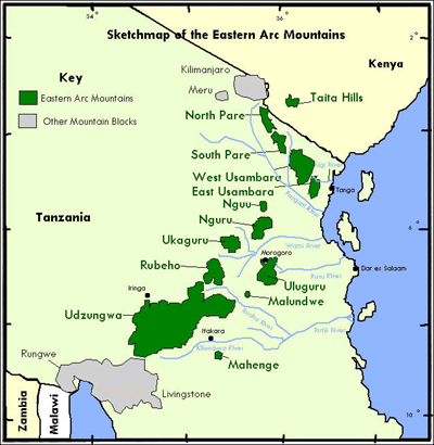
Several tributaries coming from the Pare Mountains
Pare Mountains
The Pare Mountains are a mountain range in north eastern Tanzania, north west of the Usambara Mountains. There are two mountain ranges - North and South Pare ranges, which rise to 2,463 m at Shengena Peak. They form part of the Eastern Arc of mountains. The Pare people live in the area.The Pare...
, the Usambara Mountains
Usambara Mountains
The Usambara Mountains are a mountain range in North-East Tanzania, approximately long and ranging from 20 to in width. Mountains in the range rise as high as 8,000 ft ....
and the Wasegiia wilderness join the Pangani in its course. These include the Kibaya, Komkuza, Kwachigulu, Kwamwadyau and Mnyusi.
Pangani River Basin
The Pangani River Basin (PRB) makes up one of Tanzania's nine drainage basins. Covering an area from the northern highlands down to the northeastern coastline, the PRB is approximately 56300 square kilometres (21,737.6 sq mi) in size, of which 4880 square kilometres (1,884.2 sq mi) lie within Kenya.Five sub-basins make up the basin, namely the Pangani River (43650 km² (16,853.4 sq mi)), Umba River (8070 km² (3,115.8 sq mi)), Msangazi River
Msangazi River
-References:...
(5030 km² (1,942.1 sq mi)), Zigi River
Zigi River
-References:...
and Mkulumuzi River
Mkulumuzi River
-References:...
(2080 km² (803.1 sq mi)), which all empty into the Indian Ocean.
The Pangani Basin Water Board (PBWB) was established in July 1991 in accordance with the Water Utilization (Control and Regulation) Act No. 42 of 1974, with its headquarters in the municipality of Moshi
Moshi
Moshi is a Tanzanian town with a population of 144,739 in Kilimanjaro Region. The town is situated on the lower slopes of Mt Kilimanjaro, a volcanic mountain that is the highest mountain in Africa....
in Kilimanjaro Region, and two other offices in Arusha
Arusha
Arusha is a city in northern Tanzania. It is the capital of the Arusha Region, which claims a population of 1,288,088, including 281,608 for the Arusha District . Arusha is surrounded by some of Africa's most famous landscapes and national parks...
and Tanga
Tanga, Tanzania
Tanga is both the name of the most northerly seaport city of Tanzania, and the surrounding Tanga Region. It is the Regional Headquarters of the region.With a population of 243,580 in 2002, Tanga is one of the largest cities in the country...
. The PBWB consists of ten professionals from public institutions and private sector LGAs, UWSAs and other committees.
The river system is under pressure from conflicts of interest in water use. Many farmers rely on the river for irrigation and damming projects along the river have reduced several hundreds to less than 40 m3/s, affecting coastal communities, which have seen fish populations dramatically reduced. In 2002, the Pangani River Basin Management Project (PRBMP) was established to manage the basin's water resources. It receives technical assistance from the International Union for Conservation of Nature (IUCN), the Netherlands Development Organization (SNV) and the local NGO PAMOJA. The project also receives funds from the Government of Tanzania, IUCN, the European Commission
European Commission
The European Commission is the executive body of the European Union. The body is responsible for proposing legislation, implementing decisions, upholding the Union's treaties and the general day-to-day running of the Union....
(EU) and the Global Environment Facility
Global Environment Facility
The Global Environment Facility unites 182 member governments — in partnership with international institutions, nongovernmental organizations, and the private sector — to address global environmental issues....
through the UNDP.