
Oxley, Queensland
Encyclopedia
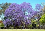
Oxley is a south-western suburb of Brisbane
located approximately 11 km from the Brisbane CBD
. It was named after the early Australian explorer John Oxley
. The suburb supports a mix of residential, retail and industrial land use.
Oxley is bounded to the north by the Brisbane River
and Oxley Creek
flows along the eastern edge. In the east the environment is shaped by flood plains, which experience major flooding and flash-flooding. Western parts of the suburb are characterised by rolling hills with clay
-laden soils.
s and a golf driving range—Oxley Golf Course located on Boundary Road, and Corinda Golf Course located on Cliveden Avenue, the latter of which has now been purchased by Brisbane Boys College as their playing fields along with the driving range. Oxley also contains a lawn bowls club, the Canossa Private Hospital, the Queensland Police Service's training academy, two highway motels, a war memorial, post office, mosque and a few churches.
Stores include an Aldi
supermarket, a smaller Foodworks
grocery store and a McDonalds restaurant. Retailers with outlets in Oxley include Harvey Norman
, Bunnings Warehouse
, Officeworks
, Super A-mart, The Good Guys
and there is a 1st Choice
liquor store. The suburb has three petrol service stations and a few landscaping material suppliers in the western parts. With an easily accessed supply of clay in the area PGH Bricks & Pavers has one of two Queensland production plants located here.
The new Austral Bricks quarry
site in Douglas Street, as well as two other plots of vacant land in the area have been converted to residential estates, providing significant housing to a region
and growing city, where strong demand is not being met by supply. The quarry was originally owned by Brittain Bricks. For many years the site was a brickworks
, sourcing clay directly from adjacent pits. After production stopped, the kiln stack
remained intact. During the mid-1990s the tall structure was removed as it was attracting lighting strikes.
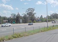 The Ipswich Motorway
traverses Oxley and the train from Brisbane to Ipswich has an station at Oxley
, and is connected to a number of suburbs via bus services. A CityExpress bus stop on Blunder Road links Inala Plaza bus station to the inner city using Ipswich Road
. Oxley Road connects the Ipswich Motorway to the suburb of Indooroopilly
via the Walter Taylor Bridge.
s while 7% are apartments and 2% consist of townhouses. The median house price is valued at A$ 409,000.
, Graceville
and Corinda
to the north. It extended to the south into the current suburbs of Willawong
and Durack
. The first subdivision of residential lands occurred in 1864 near Douglas Street. Although the railway through the suburb connected Oxley to the rest of Brisbane it was the road to Ipswich that defined the suburb's early development.
The suburb was a stop-over point on the Cobb & Co coach route west to the Darling Downs. The first hotel in Oxley was built in 1860 close to Oxley Creek on a rise near Factory Road. It attracted other businesses to the area and provided refreshments for travelers between Brisbane and Ipswich. The hotel soon gained a reputation as a venue where drinking and dancing occurred well into the morning hours. The hotel was moved several times due to flooding which was not a deterrent to the licensee. By 1892 a brick hotel has been built on the corner of Oxley Road and Ipswich Road, the site of a public bar still open today.
In 1870 the first school in Oxley was opened. A small creamery was operating in 1873, most probably located near Factory Road in Oxley's south east parts. The railway station was opened in 1874. This led to the establishment of a second subdivision in 1876, referred to as the Township of Oxley which was centered around the train station. It consisted of 140 allotments with the lower ones experiencing periodic inundation. In the same year the construction of the first police station
was completed. Dairying became common in the area during the 1890s. The 1893 Brisbane flood
halted housing construction in the lower parts of Oxley for many years. William Brittain moved his brick making operations to a 200 acre (0.809372 km²) site on Douglas Street in 1899.
The Oxley war memorial to the fallen was opened in 1920. The Oxley Golf Club was established in 1928. A Methodist church was built in 1930 and a Presbyterian church in 1961. The Oxley Scout Group was formed in 1951 and in 1955 the Oxley fire station was established. An ambulance station was built in the suburb in 1961 but was moved to Durack in 2002. Oxley High School was opened in 1966 and then closed in 2000. The bus/rail interchange at Oxley station was built in 1977.
The 2010–2011 Queensland floods
inundated many properties along the main roads of Oxley Road, Blunder Road and the Ipswich Motorway as well as at least ten minor roads.
Brisbane
Brisbane is the capital and most populous city in the Australian state of Queensland and the third most populous city in Australia. Brisbane's metropolitan area has a population of over 2 million, and the South East Queensland urban conurbation, centred around Brisbane, encompasses a population of...
located approximately 11 km from the Brisbane CBD
Brisbane central business district
The Brisbane central business district , sometimes referred to as the city, is a suburb of Brisbane, Queensland, Australia and is located on a point on the northern bank of the Brisbane River. The triangular shaped area is bounded by the Brisbane River to the east, south and west...
. It was named after the early Australian explorer John Oxley
John Oxley
John Joseph William Molesworth Oxley was an explorer and surveyor of Australia in the early period of English colonisation.October 1802 he was engaged in coastal survey work including an expedition to Western Port in 1804-05...
. The suburb supports a mix of residential, retail and industrial land use.
Oxley is bounded to the north by the Brisbane River
Brisbane River
The Brisbane River is the longest river in south east Queensland, Australia, and flows through the city of Brisbane, before emptying into Moreton Bay. John Oxley was the first European to explore the river who named it after the Governor of New South Wales, Thomas Brisbane in 1823...
and Oxley Creek
Oxley Creek, Queensland
Oxley Creek is situated in south east Queensland, Australia and is one of the major tributaries of the Brisbane River with an estimated 260 square kilometres in area...
flows along the eastern edge. In the east the environment is shaped by flood plains, which experience major flooding and flash-flooding. Western parts of the suburb are characterised by rolling hills with clay
Clay
Clay is a general term including many combinations of one or more clay minerals with traces of metal oxides and organic matter. Geologic clay deposits are mostly composed of phyllosilicate minerals containing variable amounts of water trapped in the mineral structure.- Formation :Clay minerals...
-laden soils.
Features
Oxley has two golf courseGolf course
A golf course comprises a series of holes, each consisting of a teeing ground, fairway, rough and other hazards, and a green with a flagstick and cup, all designed for the game of golf. A standard round of golf consists of playing 18 holes, thus most golf courses have this number of holes...
s and a golf driving range—Oxley Golf Course located on Boundary Road, and Corinda Golf Course located on Cliveden Avenue, the latter of which has now been purchased by Brisbane Boys College as their playing fields along with the driving range. Oxley also contains a lawn bowls club, the Canossa Private Hospital, the Queensland Police Service's training academy, two highway motels, a war memorial, post office, mosque and a few churches.
Stores include an Aldi
ALDI
ALDI Einkauf GmbH & Co. oHG, doing business as ', short for "Albrecht Discount", is a discount supermarket chain based in Germany...
supermarket, a smaller Foodworks
Foodworks (Australia)
FoodWorks is the brand the Australian independent retail supermarket group Australian United Retailers Limited trade under. The AURL was created in November 2004 from the Merger of the FoodWorks Supermarket Group Ltd and Australian United Retailers . Its main competitors are Woolworths, Coles,...
grocery store and a McDonalds restaurant. Retailers with outlets in Oxley include Harvey Norman
Harvey Norman
Harvey Norman is a large Australian-based retailer of electrical, computer, furniture, entertainment and bedding goods. It is effectively a franchise and the main brand owned by Harvey Norman Holdings Limited...
, Bunnings Warehouse
Bunnings Warehouse
Bunnings Warehouse is Australia's largest hardware chain with stores in Australia and New Zealand. The chain is owned by Wesfarmers Limited.-History:-Pre 1900s:...
, Officeworks
Officeworks
Officeworks is a chain of Australian office supplies stores which was established in the early 1990s by Coles Myer...
, Super A-mart, The Good Guys
The Good Guys
The Good Guys is an American sitcom which aired on CBS from September 25, 1968 to January 23, 1970. 42 color episodes were filmed in all. As with The Governor & J.J. and Get Smart, it was produced by Talent Associates and CBS Productions...
and there is a 1st Choice
1st Choice Liquor Superstore
1st Choice Liquor Superstore is a group of liquor superstores in Australia owned by Wesfarmers, and competes principally with the Woolworths-owned Dan Murphy's chain....
liquor store. The suburb has three petrol service stations and a few landscaping material suppliers in the western parts. With an easily accessed supply of clay in the area PGH Bricks & Pavers has one of two Queensland production plants located here.
The new Austral Bricks quarry
Quarry
A quarry is a type of open-pit mine from which rock or minerals are extracted. Quarries are generally used for extracting building materials, such as dimension stone, construction aggregate, riprap, sand, and gravel. They are often collocated with concrete and asphalt plants due to the requirement...
site in Douglas Street, as well as two other plots of vacant land in the area have been converted to residential estates, providing significant housing to a region
South East Queensland
South East Queensland is a region of the state of Queensland in Australia, which contains approximately two-thirds of the state population...
and growing city, where strong demand is not being met by supply. The quarry was originally owned by Brittain Bricks. For many years the site was a brickworks
Brickworks
A brickworks also known as a brick factory, is a factory for the manufacturing of bricks, from clay or shale. Usually a brickworks is located on a clay bedrock often with a quarry for clay on site....
, sourcing clay directly from adjacent pits. After production stopped, the kiln stack
Flue gas stack
A flue-gas stack is a type of chimney, a vertical pipe, channel or similar structure through which combustion product gases called flue gases are exhausted to the outside air. Flue gases are produced when coal, oil, natural gas, wood or any other fuel is combusted in an industrial furnace, a power...
remained intact. During the mid-1990s the tall structure was removed as it was attracting lighting strikes.
Transport
Ipswich Motorway
The M7 runs from the junction of Ipswich Road and Granard Road to the M2 Logan Motorway interchange. It is then signed M2 until the junction of the Warrego Highway and the Cunningham Highway between Brisbane and Ipswich in South East Queensland, Australia.It initially passes through the suburbs of...
traverses Oxley and the train from Brisbane to Ipswich has an station at Oxley
Oxley railway station, Brisbane
Oxley Station is a railway station on the Ipswich and Rosewood and Springfield lines in Oxley, a suburb of Brisbane, Australia.-History:The station was first opened in 1874. During the 1890s a brick structure was built that still survives today...
, and is connected to a number of suburbs via bus services. A CityExpress bus stop on Blunder Road links Inala Plaza bus station to the inner city using Ipswich Road
Ipswich Road, Brisbane
Ipswich Road is one Brisbane's main roads connecting Brisbane to the nearby city of Ipswich, via the Ipswich Motorway. Logan Road, Pacific Motorway, and Beaudesert Road are the other major roads in the south of Brisbane. The road was an important transport route in 19th century Brisbane...
. Oxley Road connects the Ipswich Motorway to the suburb of Indooroopilly
Indooroopilly, Queensland
Indooroopilly is a suburb of Brisbane, Australia which is located 7 km west of the Brisbane central business district.- Name derivation and history :...
via the Walter Taylor Bridge.
Demographics
According to the 2006 Australian Census the suburb has a population of 6,376 persons. 89% of the population are Australian citizens, with 26% born overseas. The median household income in Oxley is A$1,115 per week, just above the national median. 91% of houses in the suburb are stand alone, including many QueenslanderQueenslander (architecture)
Queenslander architecture is a modern term for the vernacular type of architecture of Queensland, Australia. It is also found in the northern parts of the adjacent state of New South Wales and shares many traits with architecture in other states of Australia but is distinct and unique...
s while 7% are apartments and 2% consist of townhouses. The median house price is valued at A$ 409,000.
19th century
The first land sale that covered parts of today's Oxley occurred in 1851. Oxley once covered a larger area including the suburbs of ChelmerChelmer, Queensland
Chelmer is an inner suburb of Brisbane, Australia located 7 km west of the Brisbane CBD on the Brisbane River. Chelmer is zoned as a residential area, and consists of low-density housing. It has many fine Queenslanders, characterised by wooden verandahs, wide stairways and roofing of...
, Graceville
Graceville, Queensland
Graceville is a suburb in Brisbane, Queensland, Australia. It is located 8 km south-west of the Brisbane CBD. Graceville is bordered by the Brisbane River to the North-East and West, Oxley Creek to the East, Chelmer to the North and Sherwood to the South....
and Corinda
Corinda, Queensland
Corinda is a suburb in Brisbane, Australia. Located approximately 9 km southwest of the Brisbane central business district.It is believed that the name Corinda originates from a local cattle station owned by Sir Arthur Palmer, which he named after his Corinda pastoral station near...
to the north. It extended to the south into the current suburbs of Willawong
Willawong, Queensland
Willawong is an outer suburb of Brisbane, Australia. It is 16 km south of the CBD.Willawong is an Aboriginal meaning ‘the junction of two creeks’.This suburb has one of the Brisbane Transport bus depots located within the suburb.-External links:*...
and Durack
Durack, Queensland
Durack is an outer suburb of Brisbane, Australia. It is south-west of the CBD.Durack is named after Michael Durack, one of the original landholders of the area.-External links:* *...
. The first subdivision of residential lands occurred in 1864 near Douglas Street. Although the railway through the suburb connected Oxley to the rest of Brisbane it was the road to Ipswich that defined the suburb's early development.
The suburb was a stop-over point on the Cobb & Co coach route west to the Darling Downs. The first hotel in Oxley was built in 1860 close to Oxley Creek on a rise near Factory Road. It attracted other businesses to the area and provided refreshments for travelers between Brisbane and Ipswich. The hotel soon gained a reputation as a venue where drinking and dancing occurred well into the morning hours. The hotel was moved several times due to flooding which was not a deterrent to the licensee. By 1892 a brick hotel has been built on the corner of Oxley Road and Ipswich Road, the site of a public bar still open today.
In 1870 the first school in Oxley was opened. A small creamery was operating in 1873, most probably located near Factory Road in Oxley's south east parts. The railway station was opened in 1874. This led to the establishment of a second subdivision in 1876, referred to as the Township of Oxley which was centered around the train station. It consisted of 140 allotments with the lower ones experiencing periodic inundation. In the same year the construction of the first police station
Police station
A police station or station house is a building which serves to accommodate police officers and other members of staff. These buildings often contain offices and accommodation for personnel and vehicles, along with locker rooms, temporary holding cells and interview/interrogation rooms.- Facilities...
was completed. Dairying became common in the area during the 1890s. The 1893 Brisbane flood
1893 Brisbane flood
The 1893 Brisbane flood, occasionally referred to as the Great Flood of 1893 or the Black February flood, occurred when the Brisbane River burst its banks on three occasions in February 1893. It is the occurrence of three major floods in the same month that saw the period named "Black February"....
halted housing construction in the lower parts of Oxley for many years. William Brittain moved his brick making operations to a 200 acre (0.809372 km²) site on Douglas Street in 1899.
20th century
By 1904 the "Bacon Factory" as it was locally known as, which produced not only bacon but also cheese, ham and other small goods was established. Because of regular flooding the Oxley police station was moved in 1911, to a site where the police academy currently is. The Oxley Progress Association was founded in 1917. It built the small hall in Station Road and support the establishment of the Oxley War Memorial. This community group was still active in the early 1990s. During this time the Darra cement works on the western edge of Oxley had plans for a major expansion. With the help of the Oxley Progress Association residents were successful in stopping this development. In the 1960s the group played a major role in the proclamation of Queensland's Clean Air Act.The Oxley war memorial to the fallen was opened in 1920. The Oxley Golf Club was established in 1928. A Methodist church was built in 1930 and a Presbyterian church in 1961. The Oxley Scout Group was formed in 1951 and in 1955 the Oxley fire station was established. An ambulance station was built in the suburb in 1961 but was moved to Durack in 2002. Oxley High School was opened in 1966 and then closed in 2000. The bus/rail interchange at Oxley station was built in 1977.
21st century
In 2003, Oxley was one of a number of suburbs that benefited from the Suburban Community Improvement Programme. Landscaping and tree planting around Oxley Station and the beautification of the nearby roundabout and footpaths were some of the activities undertaken by the Brisbane City Council to improve the area's appearance. A second tavern on Blunder Road was opened in 2003.The 2010–2011 Queensland floods
2010–2011 Queensland floods
A series of floods hit Australia, beginning in December 2010, primarily in the state of Queensland including its capital city, Brisbane. The floods forced the evacuation of thousands of people from towns and cities. At least seventy towns and over 200,000 people were affected. Damage initially was...
inundated many properties along the main roads of Oxley Road, Blunder Road and the Ipswich Motorway as well as at least ten minor roads.