
Ipswich Motorway
Encyclopedia
The M7 runs from the junction of Ipswich Road
and Granard Road to the M2 Logan Motorway
interchange. It is then signed M2 until the junction of the Warrego Highway
and the Cunningham Highway
between Brisbane
and Ipswich
in South East Queensland
, Australia.
It initially passes through the suburbs of Rocklea
, Oxley
and Darra
in south west Brisbane before reaching the eastern suburbs of Ipswich such as Redbank Plains
, Goodna
and Riverview
. The Motorway is directly connected to the M5 Centenary Motorway at Darra
and the M2 Logan Motorway
at Gailes
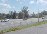
. In 2008, it was estimated that 80,000 cars use the road daily. In late 2010, this figure had risen to close to 100,000 vehicles per day. In 2002, the morning peak traffic volume was greatest between 7:00 am and 8:00 am. By 2008, the morning peak traffic volume peaked between the hours of 5:00 am and 6:00 am.
as one requiring urgent attention. An upgrade was needed to improve safety and relieve traffic congestion
.
With the Federal Government funding provided, the upgrades were completed from the Centenary Motorway interchange to the Logan Motorway
interchange.
The upgrade from four lanes to six between Wacol
and Darra was one of the Australian Labor Party
's key 2007 federal election promises. The upgrade included widening the Ipswich Motorway from four to six lanes, transformation of the Centenary Highway Interchange to a free-flowing multi level system interchange and work on adjoining service roads that aims to reduce traffic on the motorway by up to 20%. The Federal government has contributed a total of $3.1 billionn for the upgrade. The Wacol to Darra section of the motorway was officially opened on 18 April 2010.
The eight kilometres upgrade of the Ipswich Motorway between Dinmore
and Goodna
started in mid 2009 and is expected to be completed by the end of 2012. The AU$
1.95 billion project funded by the Australian Government is delivered by the Origin Alliance consisting of the Department of Transport and Main Roads, Abigroup, Seymour Whyte, Fulton Hogan, SMEC and Parsons Brinckerhoff.
The final section to be upgraded is a 7 km stretch between Darra and Rocklea with its planning finalised in 2011.
The proposed Goodna Bypass or Northern Bypass of the western section of the M2 was cancelled following the 2007 elections. This 7 km section of new Motorway would have taken traffic from the Warrego and Cunningham Highways to the Logan Motorway interchange including four crossings of the Brisbane River.
Ipswich Road, Brisbane
Ipswich Road is one Brisbane's main roads connecting Brisbane to the nearby city of Ipswich, via the Ipswich Motorway. Logan Road, Pacific Motorway, and Beaudesert Road are the other major roads in the south of Brisbane. The road was an important transport route in 19th century Brisbane...
and Granard Road to the M2 Logan Motorway
Logan Motorway
The M2/MR6 Logan Motorway offers motorists a quick link between Ipswich and the M1 or Pacific Motorway at Loganholme, and the Gateway Motorway, providing access to the Gold Coast on the eastern seaboard and to the rural areas of the Darling Downs to the west....
interchange. It is then signed M2 until the junction of the Warrego Highway
Warrego Highway
The Warrego Highway is located in southern Queensland, Australia. It connects coastal centres to the south western areas of the state, and is approximately 750 km in length. It takes its name from the Warrego River, which is the endpoint of the highway...
and the Cunningham Highway
Cunningham Highway
The Cunningham Highway is a National Highway in Queensland, Australia. It is named after the explorer and botanist Allan Cunningham who followed a route close to where the modern day highway runs.-Route:...
between Brisbane
Brisbane
Brisbane is the capital and most populous city in the Australian state of Queensland and the third most populous city in Australia. Brisbane's metropolitan area has a population of over 2 million, and the South East Queensland urban conurbation, centred around Brisbane, encompasses a population of...
and Ipswich
Ipswich, Queensland
Ipswich is a city in South-East Queensland, Australia. Situated along the Bremer River Valley approximately 40 kilometres away from the state's capital Brisbane. The suburb by the same name forms the city's Central Business District and administrative centre...
in South East Queensland
South East Queensland
South East Queensland is a region of the state of Queensland in Australia, which contains approximately two-thirds of the state population...
, Australia.
It initially passes through the suburbs of Rocklea
Rocklea, Queensland
The large Brisbane suburb of Rocklea is located 12 kilometres south of the city. At times the suburb has experienced significant flooding from the nearby Brisbane River. The west of the suburb is bordered by the Oxley Creek....
, Oxley
Oxley, Queensland
Oxley is a south-western suburb of Brisbane located approximately 11 km from the Brisbane CBD. It was named after the early Australian explorer John Oxley. The suburb supports a mix of residential, retail and industrial land use....
and Darra
Darra, Queensland
Darra is a Brisbane suburb known for its high migrant population. It is one of the older suburbs and lies about 14 kilometres southwest of Brisbane. The houses are mainly of the Queenslander style built in the 1940s and 1950s. The majority of blocks in Darra are large enough to be subdivided, which...
in south west Brisbane before reaching the eastern suburbs of Ipswich such as Redbank Plains
Redbank Plains, Queensland
Redbank Plains is an eastern suburb of Ipswich, Queensland in Australia. The suburb is a neighbour of a similar suburb which contains a large shopping mall called Redbank Plaza...
, Goodna
Goodna, Queensland
Goodna is a suburb on the eastern edge of the City of Ipswich in Queensland, Australia.It is bounded to the north by the Brisbane River. Founded in 1856 when the area was still part of New South Wales, it celebrated its 150 year anniversary in 2006. Its beginnings can be traced back further to...
and Riverview
Riverview, Queensland
Riveview is a suburb of Ipswich, Queensland, Australia.-Transport:Riverview railway station provides access to regular Citytrain services to Brisbane, Ipswich and Rosewood via Ipswich.-External links:*...
. The Motorway is directly connected to the M5 Centenary Motorway at Darra
Darra, Queensland
Darra is a Brisbane suburb known for its high migrant population. It is one of the older suburbs and lies about 14 kilometres southwest of Brisbane. The houses are mainly of the Queenslander style built in the 1940s and 1950s. The majority of blocks in Darra are large enough to be subdivided, which...
and the M2 Logan Motorway
Logan Motorway
The M2/MR6 Logan Motorway offers motorists a quick link between Ipswich and the M1 or Pacific Motorway at Loganholme, and the Gateway Motorway, providing access to the Gold Coast on the eastern seaboard and to the rural areas of the Darling Downs to the west....
at Gailes
Gailes, Queensland
Gailes is a suburb of Brisbane, Queensland, Australia.The origin of the suburb name is from the Western Gailes Golf Course in Ayrshire, Scotland as it was the name given to the local Gailes Golf Club...
. In 2008, it was estimated that 80,000 cars use the road daily. In late 2010, this figure had risen to close to 100,000 vehicles per day. In 2002, the morning peak traffic volume was greatest between 7:00 am and 8:00 am. By 2008, the morning peak traffic volume peaked between the hours of 5:00 am and 6:00 am.
Upgrade
In 2003, planning for an upgrade of the entire road began. The road was identified in the South East Queensland Infrastructure Plan and ProgramSouth East Queensland Infrastructure Plan and Program
The South East Queensland Infrastructure Plan and Program 2010–2031 is produced by the Queensland Department of Infrastructure and Planning and outlines estimated infrastructure investment across South East Queensland Australia to 2031. It represents a long-term commitment to infrastructure...
as one requiring urgent attention. An upgrade was needed to improve safety and relieve traffic congestion
Traffic congestion
Traffic congestion is a condition on road networks that occurs as use increases, and is characterized by slower speeds, longer trip times, and increased vehicular queueing. The most common example is the physical use of roads by vehicles. When traffic demand is great enough that the interaction...
.
With the Federal Government funding provided, the upgrades were completed from the Centenary Motorway interchange to the Logan Motorway
Logan Motorway
The M2/MR6 Logan Motorway offers motorists a quick link between Ipswich and the M1 or Pacific Motorway at Loganholme, and the Gateway Motorway, providing access to the Gold Coast on the eastern seaboard and to the rural areas of the Darling Downs to the west....
interchange.
The upgrade from four lanes to six between Wacol
Wacol, Queensland
Wacol is a suburb of Brisbane, Australia. According to the 2001 census, a total of 4851 people lived within the boundaries of Wacol. The suburb is located on the east bank of the Brisbane River, 18 km south-west of the Brisbane central business district, on the Brisbane-Ipswich railway...
and Darra was one of the Australian Labor Party
Australian Labor Party
The Australian Labor Party is an Australian political party. It has been the governing party of the Commonwealth of Australia since the 2007 federal election. Julia Gillard is the party's federal parliamentary leader and Prime Minister of Australia...
's key 2007 federal election promises. The upgrade included widening the Ipswich Motorway from four to six lanes, transformation of the Centenary Highway Interchange to a free-flowing multi level system interchange and work on adjoining service roads that aims to reduce traffic on the motorway by up to 20%. The Federal government has contributed a total of $3.1 billionn for the upgrade. The Wacol to Darra section of the motorway was officially opened on 18 April 2010.
The eight kilometres upgrade of the Ipswich Motorway between Dinmore
Dinmore, Queensland
Dinmore is a suburb of Ipswich, Queensland, Australia.The origin of the suburb name is from a village called Hope under Dinmore in Herefordshire, England. Dinmore is situated in the crossroads area of, and is basically bordered by ,the Ipswich Motorway , The Cunningham Highway , and The Warrego...
and Goodna
Goodna, Queensland
Goodna is a suburb on the eastern edge of the City of Ipswich in Queensland, Australia.It is bounded to the north by the Brisbane River. Founded in 1856 when the area was still part of New South Wales, it celebrated its 150 year anniversary in 2006. Its beginnings can be traced back further to...
started in mid 2009 and is expected to be completed by the end of 2012. The AU$
Australian dollar
The Australian dollar is the currency of the Commonwealth of Australia, including Christmas Island, Cocos Islands, and Norfolk Island, as well as the independent Pacific Island states of Kiribati, Nauru and Tuvalu...
1.95 billion project funded by the Australian Government is delivered by the Origin Alliance consisting of the Department of Transport and Main Roads, Abigroup, Seymour Whyte, Fulton Hogan, SMEC and Parsons Brinckerhoff.
The final section to be upgraded is a 7 km stretch between Darra and Rocklea with its planning finalised in 2011.
The proposed Goodna Bypass or Northern Bypass of the western section of the M2 was cancelled following the 2007 elections. This 7 km section of new Motorway would have taken traffic from the Warrego and Cunningham Highways to the Logan Motorway interchange including four crossings of the Brisbane River.
Exits and Interchanges
Ipswich Motorway   |
|||
| Northeastbound exits | Distance to Brisbane (km) |
Distance to Ipswich (km) |
Southwestbound exits |
| End Ipswich Motorway continues as Ipswich Road Ipswich Road, Brisbane Ipswich Road is one Brisbane's main roads connecting Brisbane to the nearby city of Ipswich, via the Ipswich Motorway. Logan Road, Pacific Motorway, and Beaudesert Road are the other major roads in the south of Brisbane. The road was an important transport route in 19th century Brisbane...  to Rocklea Rocklea, Queensland The large Brisbane suburb of Rocklea is located 12 kilometres south of the city. At times the suburb has experienced significant flooding from the nearby Brisbane River. The west of the suburb is bordered by the Oxley Creek.... / Woolloongabba Woolloongabba, Queensland Woolloongabba is an inner suburb of Brisbane, Australia located 4 km south of the Brisbane CBD.Experts are divided regarding the Aboriginal meaning of the name, preferring either 'whirling waters' or 'fight talk place'... |
-- | 29 | Start Ipswich Motorway continues from Ipswich Road Ipswich Road, Brisbane Ipswich Road is one Brisbane's main roads connecting Brisbane to the nearby city of Ipswich, via the Ipswich Motorway. Logan Road, Pacific Motorway, and Beaudesert Road are the other major roads in the south of Brisbane. The road was an important transport route in 19th century Brisbane... |
| Mount Gravatt Mount Gravatt, Queensland Mount Gravatt is the name of both a major suburb of Brisbane, Queensland, Australia and a prominent hill in this suburb. The suburb is situated in the south-east of the city and was one of Brisbane's largest... , Capalaba Capalaba, Queensland Capalaba is a suburb of southeastern of Brisbane, Queensland, Australia, located in the Redland City local government area.The suburb has two large shopping and commercial centres with a mall and bus station, and light industrial zones surrounded by residential streets and bushland... Granard Road |
-- | 28.5 | Mount Gravatt Mount Gravatt, Queensland Mount Gravatt is the name of both a major suburb of Brisbane, Queensland, Australia and a prominent hill in this suburb. The suburb is situated in the south-east of the city and was one of Brisbane's largest... , Capalaba Capalaba, Queensland Capalaba is a suburb of southeastern of Brisbane, Queensland, Australia, located in the Redland City local government area.The suburb has two large shopping and commercial centres with a mall and bus station, and light industrial zones surrounded by residential streets and bushland... Granard Road |
| Suscatand Street | -- | 28 | Randolph Street |
| Oxley Oxley, Queensland Oxley is a south-western suburb of Brisbane located approximately 11 km from the Brisbane CBD. It was named after the early Australian explorer John Oxley. The suburb supports a mix of residential, retail and industrial land use.... , Inala Inala, Queensland Inala is a suburb of Brisbane, Australia, situated in the south-west of the metropolitan area.-History:Following World War II there was a shortage of 250,000 houses across Australia. State and Commonwealth Governments responded by making housing a priority. In Queensland alone over 4000 families... Oxley Road / Blunder Road |
-- | 26.5 | Inala Inala, Queensland Inala is a suburb of Brisbane, Australia, situated in the south-west of the metropolitan area.-History:Following World War II there was a shortage of 250,000 houses across Australia. State and Commonwealth Governments responded by making housing a priority. In Queensland alone over 4000 families... , Oxley Oxley, Queensland Oxley is a south-western suburb of Brisbane located approximately 11 km from the Brisbane CBD. It was named after the early Australian explorer John Oxley. The suburb supports a mix of residential, retail and industrial land use.... Blunder Road / Oxley Road |
| Rudd Street | |||
| Richlands Richlands, Queensland Richlands is an outer suburb of Brisbane, Australia. It is 16 km south-west of the CBD.-External links:* *... , Darra Darra, Queensland Darra is a Brisbane suburb known for its high migrant population. It is one of the older suburbs and lies about 14 kilometres southwest of Brisbane. The houses are mainly of the Queenslander style built in the 1940s and 1950s. The majority of blocks in Darra are large enough to be subdivided, which... Harcourt Road |
-- | 24 | Richlands Richlands, Queensland Richlands is an outer suburb of Brisbane, Australia. It is 16 km south-west of the CBD.-External links:* *... , Darra Darra, Queensland Darra is a Brisbane suburb known for its high migrant population. It is one of the older suburbs and lies about 14 kilometres southwest of Brisbane. The houses are mainly of the Queenslander style built in the 1940s and 1950s. The majority of blocks in Darra are large enough to be subdivided, which... Acanthus Street via Ipswich Service Road |
| Jindalee Jindalee, Queensland Jindalee is an outer suburb of Brisbane, Australia located south-west of the Brisbane CBD, and is a part of the Centenary suburbs. It is bordered by the Brisbane River to the north. The Aboriginal meaning for Jindalee is "bare hills"... , Brisbane Centenary Motorway  |
17 | 23 | Springfield Springfield, Queensland Springfield, also known as the Greater Springfield Development, is a 28.50 square kilometre residential development located in Ipswich, in South East Queensland, Australia... , Gold Coast Gold Coast, Queensland Gold Coast is a coastal city of Australia located in South East Queensland, 94km south of the state capital Brisbane. With a population approximately 540,000 in 2010, it is the second most populous city in the state, the sixth most populous city in the country, and also the most populous... , Jindalee Jindalee, Queensland Jindalee is an outer suburb of Brisbane, Australia located south-west of the Brisbane CBD, and is a part of the Centenary suburbs. It is bordered by the Brisbane River to the north. The Aboriginal meaning for Jindalee is "bare hills"... Garden Road / Centenary Motorway  |
| Vehicle Inspection Centre | |||
| Arthur Gorrie Remand & Reception Centre | 18 | 22 | no exit |
| no exit | 20 | 20 | Inala Inala, Queensland Inala is a suburb of Brisbane, Australia, situated in the south-west of the metropolitan area.-History:Following World War II there was a shortage of 250,000 houses across Australia. State and Commonwealth Governments responded by making housing a priority. In Queensland alone over 4000 families... , Woodridge Woodridge, Queensland Woodridge is a suburb of Logan City in the South East of Queensland, Australia, located within the Brisbane metropolitan area and had a population of 18,039 as of the 1996 census.... Progress Road |
| Wacol Wacol, Queensland Wacol is a suburb of Brisbane, Australia. According to the 2001 census, a total of 4851 people lived within the boundaries of Wacol. The suburb is located on the east bank of the Brisbane River, 18 km south-west of the Brisbane central business district, on the Brisbane-Ipswich railway... Wacol Station Road |
|||
| Campbell Avenue | |||
| Inala Inala, Queensland Inala is a suburb of Brisbane, Australia, situated in the south-west of the metropolitan area.-History:Following World War II there was a shortage of 250,000 houses across Australia. State and Commonwealth Governments responded by making housing a priority. In Queensland alone over 4000 families... , Woodridge Woodridge, Queensland Woodridge is a suburb of Logan City in the South East of Queensland, Australia, located within the Brisbane metropolitan area and had a population of 18,039 as of the 1996 census.... Progress Road |
20.5 | 19.5 | no exit |
| Wacol Wacol, Queensland Wacol is a suburb of Brisbane, Australia. According to the 2001 census, a total of 4851 people lived within the boundaries of Wacol. The suburb is located on the east bank of the Brisbane River, 18 km south-west of the Brisbane central business district, on the Brisbane-Ipswich railway... Wacol Station Road |
|||
| Akenside Street | |||
| no exit | 21.5 | 18.5 | Vehicle Inspection Centre |
| continues as |
22 | 18 | Logan Central Logan Central, Queensland Logan Central is a suburb of Logan City, Queensland, Australia.Once forming part of Woodridge, Logan Central is the official central business district of Logan City and is a major activity centre, with many shops and local businesses operating in the area, mostly along the Wembley Road corridor... , Gold Coast Gold Coast, Queensland Gold Coast is a coastal city of Australia located in South East Queensland, 94km south of the state capital Brisbane. With a population approximately 540,000 in 2010, it is the second most populous city in the state, the sixth most populous city in the country, and also the most populous... Logan Motorway Logan Motorway The M2/MR6 Logan Motorway offers motorists a quick link between Ipswich and the M1 or Pacific Motorway at Loganholme, and the Gateway Motorway, providing access to the Gold Coast on the eastern seaboard and to the rural areas of the Darling Downs to the west.... |
| Gailes Gailes, Queensland Gailes is a suburb of Brisbane, Queensland, Australia.The origin of the suburb name is from the Western Gailes Golf Course in Ayrshire, Scotland as it was the name given to the local Gailes Golf Club... Viking Drive |
|||
| End continues as |
|||
| Logan Central Logan Central, Queensland Logan Central is a suburb of Logan City, Queensland, Australia.Once forming part of Woodridge, Logan Central is the official central business district of Logan City and is a major activity centre, with many shops and local businesses operating in the area, mostly along the Wembley Road corridor... , Gold Coast Gold Coast, Queensland Gold Coast is a coastal city of Australia located in South East Queensland, 94km south of the state capital Brisbane. With a population approximately 540,000 in 2010, it is the second most populous city in the state, the sixth most populous city in the country, and also the most populous... , Sunshine Coast Sunshine Coast, Queensland The Sunshine Coast is an urban area in South East Queensland, north of the state capital of Brisbane on the Pacific Ocean coastline. Although it does not have a central business district, by population it ranks as the 10th largest metropolis in Australia and the third largest in... Logan Motorway Logan Motorway The M2/MR6 Logan Motorway offers motorists a quick link between Ipswich and the M1 or Pacific Motorway at Loganholme, and the Gateway Motorway, providing access to the Gold Coast on the eastern seaboard and to the rural areas of the Darling Downs to the west.... |
22.5 | 17.5 | Redbank Plains Redbank Plains, Queensland Redbank Plains is an eastern suburb of Ipswich, Queensland in Australia. The suburb is a neighbour of a similar suburb which contains a large shopping mall called Redbank Plaza... , Goodna Goodna, Queensland Goodna is a suburb on the eastern edge of the City of Ipswich in Queensland, Australia.It is bounded to the north by the Brisbane River. Founded in 1856 when the area was still part of New South Wales, it celebrated its 150 year anniversary in 2006. Its beginnings can be traced back further to... Queen Street  via Brisbane Road (No access from Logan Motorway merge) |
| Bertha Street (No access from Logan Motorway merge) |
|||
| no exit | 25 | 15 | Stuart Street |
| Service Centre | 26 | 14 | Chalk Street |
| no exit | 27 | 13 | Collingwood Park Collingwood Park, Queensland For Collingwood Park in Albany, Western Australia, see Collingwood Park, Western Australia.Collingwood Park is a suburb of Ipswich, Queensland, Australia.-General:... , Redbank Redbank, Queensland Redbank is a suburb of Ipswich, Queensland, Australia.The origin of the suburb name is from a description of the area provided by Major Edmund Lockyer whilst exploring in a boat along the Brisbane River... Collingwood Drive |
| Redbank Redbank, Queensland Redbank is a suburb of Ipswich, Queensland, Australia.The origin of the suburb name is from a description of the area provided by Major Edmund Lockyer whilst exploring in a boat along the Brisbane River... , Collingwood Park Collingwood Park, Queensland For Collingwood Park in Albany, Western Australia, see Collingwood Park, Western Australia.Collingwood Park is a suburb of Ipswich, Queensland, Australia.-General:... Mine Street |
27.5 | 12.5 | Fox Street |
| Redbank Redbank, Queensland Redbank is a suburb of Ipswich, Queensland, Australia.The origin of the suburb name is from a description of the area provided by Major Edmund Lockyer whilst exploring in a boat along the Brisbane River... Brisbane Road |
28 | 12 | no exit |
| no exit | 28.5 | 11.5 | Brisbane Road |
| Riverview Riverview, Queensland Riveview is a suburb of Ipswich, Queensland, Australia.-Transport:Riverview railway station provides access to regular Citytrain services to Brisbane, Ipswich and Rosewood via Ipswich.-External links:*... , Moggill Moggill, Queensland Moggill is one of Brisbane's western suburbs, about from the CBD. It comprises a mixture of small-lot and acreage residential homes along with a small number of remaining farms... McEwan Street |
29 | 11 | Riverview Riverview, Queensland Riveview is a suburb of Ipswich, Queensland, Australia.-Transport:Riverview railway station provides access to regular Citytrain services to Brisbane, Ipswich and Rosewood via Ipswich.-External links:*... , Moggill Moggill, Queensland Moggill is one of Brisbane's western suburbs, about from the CBD. It comprises a mixture of small-lot and acreage residential homes along with a small number of remaining farms... McEwan Street |
| Start Ipswich Motorway continues from Cunningham Highway Cunningham Highway The Cunningham Highway is a National Highway in Queensland, Australia. It is named after the explorer and botanist Allan Cunningham who followed a route close to where the modern day highway runs.-Route:...  and Warrego Highway Warrego Highway The Warrego Highway is located in southern Queensland, Australia. It connects coastal centres to the south western areas of the state, and is approximately 750 km in length. It takes its name from the Warrego River, which is the endpoint of the highway...  |
30 | 10 | Toowoomba Toowoomba, Queensland Toowoomba is a city in Southern Queensland, Australia. It is located west of Queensland's capital city, Brisbane. With an estimated district population of 128,600, Toowoomba is Australia's second largest inland city and its largest non-capital inland city... , Charleville Charleville, Queensland Charleville is a town in south western Queensland, Australia, 758 kilometres by road west of Brisbane . It is the largest town and administrative centre of the Murweh Shire, which covers an area of 43,905 square kilometres... , Mount Isa Mount Isa, Queensland -Culture and sport:The local theatre group, the Mount Isa Theatrical Society, or MITS, often holds plays and musicals, at least once every few months or so.... , Melbourne Melbourne Melbourne is the capital and most populous city in the state of Victoria, and the second most populous city in Australia. The Melbourne City Centre is the hub of the greater metropolitan area and the Census statistical division—of which "Melbourne" is the common name. As of June 2009, the greater... , Darwin Darwin, Northern Territory Darwin is the capital city of the Northern Territory, Australia. Situated on the Timor Sea, Darwin has a population of 127,500, making it by far the largest and most populated city in the sparsely populated Northern Territory, but the least populous of all Australia's capital cities... Warrego Highway Warrego Highway The Warrego Highway is located in southern Queensland, Australia. It connects coastal centres to the south western areas of the state, and is approximately 750 km in length. It takes its name from the Warrego River, which is the endpoint of the highway... |
| End Ipswich Motorway continues as Cunningham Highway Cunningham Highway The Cunningham Highway is a National Highway in Queensland, Australia. It is named after the explorer and botanist Allan Cunningham who followed a route close to where the modern day highway runs.-Route:... to Ipswich Ipswich, Queensland Ipswich is a city in South-East Queensland, Australia. Situated along the Bremer River Valley approximately 40 kilometres away from the state's capital Brisbane. The suburb by the same name forms the city's Central Business District and administrative centre... / Warwick Warwick, Queensland Warwick is a town in Queensland, Australia, lying south-west of Brisbane. It is the administrative centre of the Southern Downs Local Government Area. In 2006 the town of Warwick had a population of 12,562.... / Tenterfield Tenterfield, New South Wales Tenterfield is a town in New South Wales, Australia. It is located in the New England region at the intersection of the New England and Bruxner Highways. Tenterfield is a three-hour drive from Brisbane, 2.5 hours from Byron Bay, two hours from Armidale, New South Wales and 10 hours from Sydney.... / Sydney Sydney Sydney is the most populous city in Australia and the state capital of New South Wales. Sydney is located on Australia's south-east coast of the Tasman Sea. As of June 2010, the greater metropolitan area had an approximate population of 4.6 million people... |
|||
See also
- Freeways in AustraliaFreeways in AustraliaThis is a list of freeways and motorways in Australia, sorted by states and territories and their corresponding routes. This list includes toll roads such as the CityLink freeway system in Melbourne. This list has over 70 entries...
- Freeways in Brisbane
- Road transport in Brisbane