
O'Fallon, Illinois
Encyclopedia
O'Fallon is a city in St. Clair County
, Illinois
, United States
, and one of the fastest-growing communities in the Metropolitan St. Louis area. As of the 2010 census, the city had a total population of 28,281. The city is the third largest city in the Metro-East
and Southern Illinois. Due to its close proximity to Scott Air Force Base, the population receives a boost from military and federal civilian personnel, defense contractors, and military retirees.
The city center is located approximately two miles east of the intersection of Interstate 64
and U.S. Route 50
.
O'Fallon, along with its namesake in St. Charles County, Missouri
is part of the St. Louis Metropolitan Statistical Area
. This makes O'Fallon (along with the two Troys in Illinois
and Missouri
) one of the few pairs of like-named municipalities to be part of the same MSA.
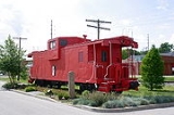
John O'Fallon who was a wealthy gentleman from St. Louis
. In downtown O'Fallon, a Baltimore and Ohio Railroad
railroad depot was built, which helped put O'Fallon on the map. City lots were platted and sold at a public auction
on May 18, 1854. A post office
was established the following year and the city began attracting German settlers looking for fertile farming land. On January 27, 1874, O'Fallon was incorporated
as a village
. On March 14, 1905, the citizens voted for a change to the city
form of government. Since its founding, O'Fallon has gained population every year except 1930, when the census
showed a net loss of 23 people.
 Since the 1980s
, growth in O'Fallon has accelerated. Following the expansion of Interstate 64
, the 1990s
saw a building boom with the construction of several now-established subdivisions
including Thornbury Hills, Nolin Creek Estates, Fairwood Hills, Deer Creek, Forest Hills, and the completion of Fairwood East. O'Fallon Township High School
's main campus at 600 South Smiley Street has undergone numerous additions over the past decades to ease overcrowding. A new city hall was completed in 1996. More than 50 percent of O'Fallon's housing is less than 15 years old.
Private Schools
According to the United States Census Bureau
, the city has a total area of 10.9 square miles (28.2 km²), of which, 10.9 square miles (28.2 km²) of it is land and 0.09% is water.
of 2005, there are 25,647 people (up 3,737 from the census
of 2000) and 10,468 households, with an average of 2 people per household. (down from 2.4 in 2000) The significant increase in population can be attributed to the ever-expanding suburb
s of metropolitan St. Louis, Missouri
and the influx of military personnel from nearby Scott Air Force Base
The population density
is 2,007.6 people per square mile (775.4/km²). There are 10,468 housing units at an average density of 790.4 per square mile (305.3/km²). The racial makeup of the city is 82.67% White, 11.99% African American, 0.23% Native American, 2.47% Asian, 0.07% Pacific Islander, 0.79% from other races, and 1.77% from two or more races. 2.23% of the population are Hispanic or Latino of any race.
There are 10,468 households out of which 39.6% have children under the age of 18 living with them, 59.0% are married couples
living together, 10.5% have a female householder with no husband present, and 27.6% are non-families. 23.2% of all households are made up of individuals and 7.2% have someone living alone who is 65 years of age or older. The average household size is 2.62 and the average family size is 3.13.
In the city, the population is spread out with 28.3% under the age of 18, 8.0% from ages 18 to 24, 32.2% from ages 25 to 44, 22.7% from ages 45 to 64, and 8.9% who are age 65 or older. The median age is 35 years.
The median income for a household in the city is estimated at $68,534 and the median income for a family is $86,052. Males have a median income of $46,303 versus $30,158 for females. The per capita income
for the city is $24,821. 5.0% of the population and 4.1% of families are below the poverty line. Out of the total population, 5.0% of those under the age of 18 and 7.9% of those 65 and older are living below the poverty line.
St. Clair County, Illinois
St. Clair County is a county located in the U.S. state of Illinois. In 1970, the U.S. Census Bureau placed the mean center of U.S. population in St. Clair County. According to the 2010 census, it has a population of 270,056, which is an increase of 5.5% from 256,082 in 2000. Its county seat is...
, Illinois
Illinois
Illinois is the fifth-most populous state of the United States of America, and is often noted for being a microcosm of the entire country. With Chicago in the northeast, small industrial cities and great agricultural productivity in central and northern Illinois, and natural resources like coal,...
, United States
United States
The United States of America is a federal constitutional republic comprising fifty states and a federal district...
, and one of the fastest-growing communities in the Metropolitan St. Louis area. As of the 2010 census, the city had a total population of 28,281. The city is the third largest city in the Metro-East
Metro-East
Metro East is a region in Illinois that comprises the eastern suburbs of St. Louis, Missouri, United States. It encompasses five Southern Illinois counties in the St. Louis Metropolitan Statistical Area. The region's most populated city is Belleville at 45,000 residents...
and Southern Illinois. Due to its close proximity to Scott Air Force Base, the population receives a boost from military and federal civilian personnel, defense contractors, and military retirees.
The city center is located approximately two miles east of the intersection of Interstate 64
Interstate 64
Interstate 64 is an Interstate Highway in the Midwestern and Southeastern United States. Its western terminus is at I-70, U.S. 40, and U.S. 61 in Wentzville, Missouri. Its eastern terminus is at an interchange with I-264 and I-664 at Bowers Hill in Chesapeake, Virginia. As I-64 is concurrent with...
and U.S. Route 50
U.S. Route 50
U.S. Route 50 is a major east–west route of the U.S. Highway system, stretching just over from Ocean City, Maryland on the Atlantic Ocean to West Sacramento, California. Until 1972, when it was replaced by Interstate Highways west of the Sacramento area, it extended to San Francisco, near...
.
O'Fallon, along with its namesake in St. Charles County, Missouri
O'Fallon, Missouri
O'Fallon is a suburban city along Interstate 70 between Lake St. Louis and St. Peters in Saint Charles County, Missouri. It is part of the St. Louis Metropolitan Statistical Area. As of the 2010 census population of 79,329, it is the seventh largest city in the state and the largest in St. Charles...
is part of the St. Louis Metropolitan Statistical Area
St. Louis Metropolitan Statistical Area
Greater St. Louis is the area of Missouri and Illinois that surrounds and includes the independent city of St. Louis. Depending on the counties included in the area, it can refer to the St. Louis, MO-IL metropolitan statistical area or the St. Louis-St. Charles-Farmington, MO-IL combined...
. This makes O'Fallon (along with the two Troys in Illinois
Troy, Illinois
Troy is a city in Madison County, Illinois, United States. The population was 8,524 at the 2000 census.Troy is part of the St. Louis Metropolitan Statistical Area...
and Missouri
Troy, Missouri
Troy is a city in Lincoln County, Missouri, United States. As of the 2010 census the population was 10,540. It is the county seat of Lincoln County.Troy is part of the St. Louis Metropolitan Statistical Area...
) one of the few pairs of like-named municipalities to be part of the same MSA.
History
Founded in 1854, O'Fallon's namesake comes from ColonelColonel
Colonel , abbreviated Col or COL, is a military rank of a senior commissioned officer. It or a corresponding rank exists in most armies and in many air forces; the naval equivalent rank is generally "Captain". It is also used in some police forces and other paramilitary rank structures...
John O'Fallon who was a wealthy gentleman from St. Louis
St. Louis, Missouri
St. Louis is an independent city on the eastern border of Missouri, United States. With a population of 319,294, it was the 58th-largest U.S. city at the 2010 U.S. Census. The Greater St...
. In downtown O'Fallon, a Baltimore and Ohio Railroad
Baltimore and Ohio Railroad
The Baltimore and Ohio Railroad was one of the oldest railroads in the United States and the first common carrier railroad. It came into being mostly because the city of Baltimore wanted to compete with the newly constructed Erie Canal and another canal being proposed by Pennsylvania, which...
railroad depot was built, which helped put O'Fallon on the map. City lots were platted and sold at a public auction
Public auction
A public auction is an auction held on behalf of a government in which the property to be auctioned is either property owned by the government, or property which is sold under the authority of a court of law or a government agency with similar authority....
on May 18, 1854. A post office
Post office
A post office is a facility forming part of a postal system for the posting, receipt, sorting, handling, transmission or delivery of mail.Post offices offer mail-related services such as post office boxes, postage and packaging supplies...
was established the following year and the city began attracting German settlers looking for fertile farming land. On January 27, 1874, O'Fallon was incorporated
Municipal corporation
A municipal corporation is the legal term for a local governing body, including cities, counties, towns, townships, charter townships, villages, and boroughs. Municipal incorporation occurs when such municipalities become self-governing entities under the laws of the state or province in which...
as a village
Village
A village is a clustered human settlement or community, larger than a hamlet with the population ranging from a few hundred to a few thousand , Though often located in rural areas, the term urban village is also applied to certain urban neighbourhoods, such as the West Village in Manhattan, New...
. On March 14, 1905, the citizens voted for a change to the city
City
A city is a relatively large and permanent settlement. Although there is no agreement on how a city is distinguished from a town within general English language meanings, many cities have a particular administrative, legal, or historical status based on local law.For example, in the U.S...
form of government. Since its founding, O'Fallon has gained population every year except 1930, when the census
United States Census
The United States Census is a decennial census mandated by the United States Constitution. The population is enumerated every 10 years and the results are used to allocate Congressional seats , electoral votes, and government program funding. The United States Census Bureau The United States Census...
showed a net loss of 23 people.
O'Fallon today
1980s
File:1980s decade montage.png|thumb|400px|From left, clockwise: The first Space Shuttle, Columbia, lifted off in 1981; American President Ronald Reagan and Soviet leader Mikhail Gorbachev eased tensions between the two superpowers, leading to the end of the Cold War; The Fall of the Berlin Wall in...
, growth in O'Fallon has accelerated. Following the expansion of Interstate 64
Interstate 64
Interstate 64 is an Interstate Highway in the Midwestern and Southeastern United States. Its western terminus is at I-70, U.S. 40, and U.S. 61 in Wentzville, Missouri. Its eastern terminus is at an interchange with I-264 and I-664 at Bowers Hill in Chesapeake, Virginia. As I-64 is concurrent with...
, the 1990s
1990s
File:1990s decade montage.png|From left, clockwise: The Hubble Space Telescope floats in space after it was taken up in 1990; American F-16s and F-15s fly over burning oil fields and the USA Lexie in Operation Desert Storm, also known as the 1991 Gulf War; The signing of the Oslo Accords on...
saw a building boom with the construction of several now-established subdivisions
Subdivision (land)
Subdivision is the act of dividing land into pieces that are easier to sell or otherwise develop, usually via a plat. The former single piece as a whole is then known in the United States as a subdivision...
including Thornbury Hills, Nolin Creek Estates, Fairwood Hills, Deer Creek, Forest Hills, and the completion of Fairwood East. O'Fallon Township High School
O'Fallon Township High School
O'Fallon Township High School is a public secondary school in O'Fallon, Illinois. In 2009, OTHS was ranked 49th out of the top 100 high schools in Illinois by the Chicago Sun Times.-History:...
's main campus at 600 South Smiley Street has undergone numerous additions over the past decades to ease overcrowding. A new city hall was completed in 1996. More than 50 percent of O'Fallon's housing is less than 15 years old.
Annual events
-
- August - HomecomingHomecomingHomecoming is the tradition of welcoming back alumni of a school. It most commonly refers to a tradition in many universities, colleges and high schools in North America...
- September - Arts Festival
- November - Craft Fair
- August - Homecoming
Parks and recreation
-
- Family Sports Park
- Hesse Park
- Katy Cavin's Community Center
- O'Fallon Community Park
- O'Fallon Memorial Pool
- Rock Springs Nature Park
- Nature center
- Jogging/cycling paths
- Nature trails
- Natural prairie
- Dog Park
- St. Clair Recreation Complex
- St. Ellen Mine Park
- Thoman Park
- Veteran's Monument
- O'Fallon Public Library
Schools
- O'Fallon Community Consolidated School District # 90
- O'Fallon Central School District # 104
- O'Fallon District #203
- O'Fallon Township High SchoolO'Fallon Township High SchoolO'Fallon Township High School is a public secondary school in O'Fallon, Illinois. In 2009, OTHS was ranked 49th out of the top 100 high schools in Illinois by the Chicago Sun Times.-History:...
- O'Fallon Township High School
Private Schools
Geography
O'Fallon is located at 38°35′30"N 89°54′43"W (38.591549, -89.912000). O'Fallon is:- 5 miles (8 km) from Scott Air Force BaseScott Air Force BaseScott Air Force Base is a base of the United States Air Force in St. Clair County, Illinois, near Belleville.-Overview:The base is named after Corporal Frank S. Scott, the first enlisted person to be killed in an aviation crash...
- 7 miles (11.5 km) from Lindenwood University – Belleville
- 10 miles (16 km) from McKendree University
- and 17 miles (27.4 km) from St. Louis, MissouriSt. Louis, MissouriSt. Louis is an independent city on the eastern border of Missouri, United States. With a population of 319,294, it was the 58th-largest U.S. city at the 2010 U.S. Census. The Greater St...
According to the United States Census Bureau
United States Census Bureau
The United States Census Bureau is the government agency that is responsible for the United States Census. It also gathers other national demographic and economic data...
, the city has a total area of 10.9 square miles (28.2 km²), of which, 10.9 square miles (28.2 km²) of it is land and 0.09% is water.
Demographics
As of a special censusCensus
A census is the procedure of systematically acquiring and recording information about the members of a given population. It is a regularly occurring and official count of a particular population. The term is used mostly in connection with national population and housing censuses; other common...
of 2005, there are 25,647 people (up 3,737 from the census
Census
A census is the procedure of systematically acquiring and recording information about the members of a given population. It is a regularly occurring and official count of a particular population. The term is used mostly in connection with national population and housing censuses; other common...
of 2000) and 10,468 households, with an average of 2 people per household. (down from 2.4 in 2000) The significant increase in population can be attributed to the ever-expanding suburb
Suburb
The word suburb mostly refers to a residential area, either existing as part of a city or as a separate residential community within commuting distance of a city . Some suburbs have a degree of administrative autonomy, and most have lower population density than inner city neighborhoods...
s of metropolitan St. Louis, Missouri
St. Louis, Missouri
St. Louis is an independent city on the eastern border of Missouri, United States. With a population of 319,294, it was the 58th-largest U.S. city at the 2010 U.S. Census. The Greater St...
and the influx of military personnel from nearby Scott Air Force Base
Scott Air Force Base
Scott Air Force Base is a base of the United States Air Force in St. Clair County, Illinois, near Belleville.-Overview:The base is named after Corporal Frank S. Scott, the first enlisted person to be killed in an aviation crash...
The population density
Population density
Population density is a measurement of population per unit area or unit volume. It is frequently applied to living organisms, and particularly to humans...
is 2,007.6 people per square mile (775.4/km²). There are 10,468 housing units at an average density of 790.4 per square mile (305.3/km²). The racial makeup of the city is 82.67% White, 11.99% African American, 0.23% Native American, 2.47% Asian, 0.07% Pacific Islander, 0.79% from other races, and 1.77% from two or more races. 2.23% of the population are Hispanic or Latino of any race.
There are 10,468 households out of which 39.6% have children under the age of 18 living with them, 59.0% are married couples
Marriage
Marriage is a social union or legal contract between people that creates kinship. It is an institution in which interpersonal relationships, usually intimate and sexual, are acknowledged in a variety of ways, depending on the culture or subculture in which it is found...
living together, 10.5% have a female householder with no husband present, and 27.6% are non-families. 23.2% of all households are made up of individuals and 7.2% have someone living alone who is 65 years of age or older. The average household size is 2.62 and the average family size is 3.13.
In the city, the population is spread out with 28.3% under the age of 18, 8.0% from ages 18 to 24, 32.2% from ages 25 to 44, 22.7% from ages 45 to 64, and 8.9% who are age 65 or older. The median age is 35 years.
The median income for a household in the city is estimated at $68,534 and the median income for a family is $86,052. Males have a median income of $46,303 versus $30,158 for females. The per capita income
Per capita income
Per capita income or income per person is a measure of mean income within an economic aggregate, such as a country or city. It is calculated by taking a measure of all sources of income in the aggregate and dividing it by the total population...
for the city is $24,821. 5.0% of the population and 4.1% of families are below the poverty line. Out of the total population, 5.0% of those under the age of 18 and 7.9% of those 65 and older are living below the poverty line.
Notable people
- Bob CryderBob CryderRobert "Bob" Cryder is a former American football offensive guard who played in the NFL from 1978–1986. He played college football for the University of Alabama.-References:...
, professional football player. - Bernie FuchsBernie FuchsBernie Fuchs was an American illustrator known for advertising art, magazine illustration and portraiture, including for a series of U.S. postage stamps.-Biography:...
, illustrator. - William HoldenWilliam HoldenWilliam Holden was an American actor. Holden won the Academy Award for Best Actor in 1954 and the Emmy Award for Best Actor in 1974...
, actor. - Dawn SternDawn SternDawn Stern is an American film and television actress; she is also a model.-Early life and education:She was born on a military base near Tokyo, but was raised in O'Fallon, Illinois, where she attended EK and O'Fallon Township High School....
, actress.