
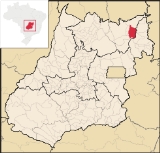
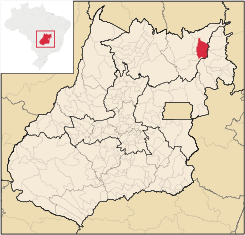
Nova Roma, Goiás
Encyclopedia
| Nova Roma | |
|---|---|
| State | Goiás Goiás Goiás is a state of Brazil, located in the central part of the country. The name Goiás comes from the name of an indigenous community... |
| Coordinates: | 13°44′23"S 46°51′51"W |
| Area: | 2,135.9 km² |
| Population: | 3,555(IBGE 2007) |
| Population density | 1.66 inhab/km² |
| Urban population | 1,484 (2007) |
| Rural population | 2,071 (2007) |
| Elevation: | 610m |
| Postcode (CEP): | 73820-000 |
| IBGE statistical microregion: | 018 Chapada dos Veadeiros Chapada dos Veadeiros Microregion The Chapada dos Veadeiros Microregion is an IBGE statistical region in north-central Goiás state, Brazil. It includes 8 cities with a population of 60,267 in a total area of 21,476 km²... |
| Became a city: | 1958 |
| Mayor: | Robervaldo Neri Sampaio |
| Distance to Goiânia Goiânia -Climate:The city has a tropical wet and dry climate with an average temperature of . There's a wet season, from October to April, and a dry one, from May to September. Annual rainfall is around 1,520 mm.... : |
616 km. |
| Website: | n/a |
Town
A town is a human settlement larger than a village but smaller than a city. The size a settlement must be in order to be called a "town" varies considerably in different parts of the world, so that, for example, many American "small towns" seem to British people to be no more than villages, while...
and municipality
Municipality
A municipality is essentially an urban administrative division having corporate status and usually powers of self-government. It can also be used to mean the governing body of a municipality. A municipality is a general-purpose administrative subdivision, as opposed to a special-purpose district...
in northeastern Goiás
Goiás
Goiás is a state of Brazil, located in the central part of the country. The name Goiás comes from the name of an indigenous community...
state, Brazil
Brazil
Brazil , officially the Federative Republic of Brazil , is the largest country in South America. It is the world's fifth largest country, both by geographical area and by population with over 192 million people...
.
Nova Roma is part of the statistical micro-region of Chapada dos Veadeiros
Chapada dos Veadeiros Microregion
The Chapada dos Veadeiros Microregion is an IBGE statistical region in north-central Goiás state, Brazil. It includes 8 cities with a population of 60,267 in a total area of 21,476 km²...
. It is crossed by the important Paranã River
Paranã River
The Paranã River is located in Goiás state, Brazil. It divides two regions - the Northeast and north-central Goiás. It is formed by tributaries that descend the Serra Geral, the mountains that divide eastern Goiás and Bahia. One of the most important tributaries is the Crixás, which has its...
, a tributary of the Tocantins
Tocantins River
The Tocantins is a river in Brazil, the central fluvial artery of the country. In the Tupi language, its name means "toucan's beak" . It runs from south to north for about 2,640 km. It is not really a branch of the Amazon River, although usually so considered, since its waters flow into the...
. There are poor road connections with Teresina de Goiás
Teresina de Goiás
Teresina de Goiás is a small town and municipality in northern Goiás state, Brazil.-Location:It is part of the region of the statistical micro-region of Chapada dos Veadeiros and is located north of the Federal District and Brasília. It is 67 km north of Alto Paraíso de Goiás. The nearest...
, 72 kilometers to the west, Monte Alegre de Goiás
Monte Alegre de Goiás
Monte Alegre de Goiás is a small town and municipality in northeastern Goiás state, Brazil.-Location:Monte Alegre is located in the statistical micro-region of Chapada dos Veadeiros and is 31 kilometers south of the border with Tocantins. G0-118 connects it with Teresina de Goiás and Campos Belos...
, 58 kilometers north, Alto Paraíso de Goiás
Alto Paraíso de Goiás
Alto Paraíso de Goiás is a small town and a municipality in northeastern Goiás state, Brazil. It has become known for its ecological and New Age tourism.-Location:...
, 100 kilometers southwest, and Iaciara
Iaciara
Iaciara is a small town and municipality in northeastern Goiás state, Brazil.-Geography:Iaciara is located in Vão do Paranã statistical micro-region, which borders the state of Bahia. The distance to the state capital of Goiânia is 548 kilometers...
, 71 kilometers southeast.
The distance to the state capital, Goiânia
Goiânia
-Climate:The city has a tropical wet and dry climate with an average temperature of . There's a wet season, from October to April, and a dry one, from May to September. Annual rainfall is around 1,520 mm....
is 616 km. Highway connections from Goiânia
Goiânia
-Climate:The city has a tropical wet and dry climate with an average temperature of . There's a wet season, from October to April, and a dry one, from May to September. Annual rainfall is around 1,520 mm....
are made by BR-153 / Anápolis
Anápolis
Anápolis is the third largest city in the State of Goiás in Brazil. It lies in the center of a rich agricultural region and has become a leader in food processing and pharmaceutical plants.-Location and population:...
/ GO-060 / Alexânia
Alexânia
Alexânia is a small town and municipality in central Goiás state, Brazil. Alexânia is known for its alleged extraterrestrial sightings in the late sixties and early seventies. The Areias River passes through the municipality.-Location:...
/ Formosa
Formosa, Goiás
Formosa is a city and municipality located in the state of Goiás, Brazil, approximately 80 kilometers east of Brasília. The population was 90,247 in a total area of 5,806.89 km² . Formosa is known for its waterfalls and natural beauty...
/ BR-020 / Alvorada do Norte
Alvorada do Norte
Alvorada do Norte is a small town and municipality in northeastern Goiás state, Brazil. It is an important commercial center on the Brasília-Salvador highway.-Location:...
/ GO-112 / Iaciara
Iaciara
Iaciara is a small town and municipality in northeastern Goiás state, Brazil.-Geography:Iaciara is located in Vão do Paranã statistical micro-region, which borders the state of Bahia. The distance to the state capital of Goiânia is 548 kilometers...
.
Bounderies
Municipal boundaries are with:- north:: Monte Alegre de GoiásMonte Alegre de GoiásMonte Alegre de Goiás is a small town and municipality in northeastern Goiás state, Brazil.-Location:Monte Alegre is located in the statistical micro-region of Chapada dos Veadeiros and is 31 kilometers south of the border with Tocantins. G0-118 connects it with Teresina de Goiás and Campos Belos...
- west: Teresina de GoiásTeresina de GoiásTeresina de Goiás is a small town and municipality in northern Goiás state, Brazil.-Location:It is part of the region of the statistical micro-region of Chapada dos Veadeiros and is located north of the Federal District and Brasília. It is 67 km north of Alto Paraíso de Goiás. The nearest...
and Alto Paraíso de GoiásAlto Paraíso de GoiásAlto Paraíso de Goiás is a small town and a municipality in northeastern Goiás state, Brazil. It has become known for its ecological and New Age tourism.-Location:... - east: São DomingosSão DomingosSão Domingos can refer to many places in the world:*In Brazil:**São Domingos, Bahia**São Domingos, Goiás**São Domingos, Santa Catarina**São Domingos, Sergipe**São Domingos do Araguaia, Pará**São Domingos do Azeitão, Maranhão...
and IaciaraIaciaraIaciara is a small town and municipality in northeastern Goiás state, Brazil.-Geography:Iaciara is located in Vão do Paranã statistical micro-region, which borders the state of Bahia. The distance to the state capital of Goiânia is 548 kilometers... - south: São João da Aliança
Economy
The economy is based on agriculture, cattle raising, services, modest transformation industries, and public employment. In 2006 there were 67,200 head of cattle. The main agricultural products were pumpkin, rice, banana, sugarcane, beans, manioc, and corn (1,500 hectares planted).- Hospitals: 01 with 14 beds
- Infant mortality rate : 30.02, below the national average of 33.0.
- Adult literacy rate: 81.9%, below the national average of 86.4%.
- HDI-M: 0.679
- State ranking: 223 (out of 242 municipalities)
- National ranking: 3,323 (out of 5,507 municipalities)
In the seventeenth century the settlement of São Teodoro existed in the region. Gold mining was the main economic activity. In 1858 it was elevated to the status of district with the name of Nova Roma, belonging to the villa of Cavalcante. In 1943 the district changed its name to Guataçuba, changing back to Nova Roma again in 1947. In 1953 it was transferred to the municipality of Veadeiros, becoming dismembered in 1948 with its present name.