
Alto Paraíso de Goiás
Encyclopedia
| Alto Paraíso de Goiás | |
|---|---|
| State | Goiás Goiás Goiás is a state of Brazil, located in the central part of the country. The name Goiás comes from the name of an indigenous community... |
| Coordinates: | 14°08′S 47°31′W |
| Area: | 2,593.8 km² |
| Population: | 6.638(IBGE 2007) |
| Elevation: | 1,272m |
| Postcode (CEP): | 73770-000 |
| IBGE statistical microregion: | 018 Chapada dos Veadeiros Chapada dos Veadeiros Microregion The Chapada dos Veadeiros Microregion is an IBGE statistical region in north-central Goiás state, Brazil. It includes 8 cities with a population of 60,267 in a total area of 21,476 km²... |
| Became a city: | 1953 |
| Mayor: | Uiter Gomes de Araújo |
| Distance to Goiânia Goiânia -Climate:The city has a tropical wet and dry climate with an average temperature of . There's a wet season, from October to April, and a dry one, from May to September. Annual rainfall is around 1,520 mm.... : |
423 km. |
| Website: | n/a |
Municipality
A municipality is essentially an urban administrative division having corporate status and usually powers of self-government. It can also be used to mean the governing body of a municipality. A municipality is a general-purpose administrative subdivision, as opposed to a special-purpose district...
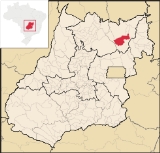
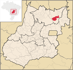
in northeastern Goiás
Goiás
Goiás is a state of Brazil, located in the central part of the country. The name Goiás comes from the name of an indigenous community...
state, Brazil
Brazil
Brazil , officially the Federative Republic of Brazil , is the largest country in South America. It is the world's fifth largest country, both by geographical area and by population with over 192 million people...
. It has become known for its ecological and New Age tourism.
Location
Alto Paraíso is part of the IBGE statistical micro-region of Chapada dos VeadeirosChapada dos Veadeiros Microregion
The Chapada dos Veadeiros Microregion is an IBGE statistical region in north-central Goiás state, Brazil. It includes 8 cities with a population of 60,267 in a total area of 21,476 km²...
. It lies 230 km. northeast of the federal capital Brasília
Brasília
Brasília is the capital city of Brazil. The name is commonly spelled Brasilia in English. The city and its District are located in the Central-West region of the country, along a plateau known as Planalto Central. It has a population of about 2,557,000 as of the 2008 IBGE estimate, making it the...
and 423 from the state capital Goiânia
Goiânia
-Climate:The city has a tropical wet and dry climate with an average temperature of . There's a wet season, from October to April, and a dry one, from May to September. Annual rainfall is around 1,520 mm....
. Highway connections are made by BR-153 / Anápolis
Anápolis
Anápolis is the third largest city in the State of Goiás in Brazil. It lies in the center of a rich agricultural region and has become a leader in food processing and pharmaceutical plants.-Location and population:...
/ BR-060 / Alexânia
Alexânia
Alexânia is a small town and municipality in central Goiás state, Brazil. Alexânia is known for its alleged extraterrestrial sightings in the late sixties and early seventies. The Areias River passes through the municipality.-Location:...
/ Planaltina
Planaltina
Planaltina is one of the administrative districts of the Federal District of Brazil, with an area of 1,534 kmª and a population of 147,114 in 2000, of whom 134,663 were classified as urban and 12,451 as rural...
/ GO-118 / BR-010 / São João d'Aliança
São João d'Aliança
São João d'Aliança is a small town and municipality in northeastern Goiás state, Brazil. São João is a gateway to the Chapada dos Veadeiros National Park. The name is sometimes written as São João D'Aliança.-Location:...
.
Neighboring municipalities are:
- North: CavalcanteCavalcanteCavalcante is a small town and municipality in northern Goiás state, Brazil. It is one of the poorest municipalities in the state. It is home to communities of descendants of runaway slaves called Kalungas.-Location:...
and Teresina de GoiásTeresina de GoiásTeresina de Goiás is a small town and municipality in northern Goiás state, Brazil.-Location:It is part of the region of the statistical micro-region of Chapada dos Veadeiros and is located north of the Federal District and Brasília. It is 67 km north of Alto Paraíso de Goiás. The nearest... - South: São João d'AliançaSão João d'AliançaSão João d'Aliança is a small town and municipality in northeastern Goiás state, Brazil. São João is a gateway to the Chapada dos Veadeiros National Park. The name is sometimes written as São João D'Aliança.-Location:...
- East: Nova RomaNova Roma, GoiásNova Roma is a small town and municipality in northeastern Goiás state, Brazil.Nova Roma is part of the statistical micro-region of Chapada dos Veadeiros. It is crossed by the important Paranã River, a tributary of the Tocantins...
- West: Colinas do SulColinas do SulColinas do Sul is a small town and municipality in north-central Goiás state, Brazil.-Location:Colinas is located in the Chapada dos Veadeiros statistical micro-region and is almost directly north of Brasília, to which it is connected by G0-327 as far as Alto Paraíso de Goiás then by G0-118 south...
Demographics
- Population density: 2.56 inhab/km²
- Urban population: 4,585 (2007)
- Rural population: 2,043 (2007)
- Population growth rate 1996/2007: 1.87%
The economy
The economy is based on farming (soybeans (3,800 ha), corn (2000 ha), rice), cattle raising, tourism, and services. The cattle herd was 30,500 in 2006. There were two banking institutions in 2007—Banco Itaú SA and Banco do Brasil SA.(Agosto/2007)
Agricultural data 2006
- Farms: 387
- Total area: 189,550 ha.
- Area of permanent crops: 67,499 ha.
- Area of perennial crops: 27,433 ha.
- Area of natural pasture: 36,059 ha.
- Area of woodland and forests: 14,466 ha.
- Persons dependent on farming: 940
- Number of tractors: 89
- Cattle herd: 30,500 IBGE
Tourism
Located adjacent to the Chapada dos Veadeiros National ParkChapada dos Veadeiros National Park
Brazil's Chapada dos Veadeiros National Park is located in the Chapada dos Veadeiros, an ancient plateau with an estimated age of 1.8 billion years. Based in the Brazilian state of Goias, the Park was created on January 11, 1961 by President Juscelino Kubitscheck, and listed as a World Heritage...
, Alto Paraíso attracts many followers of mysticism, natural therapies, and spiritualism. The exuberant nature has mountains, canyons, waterfalls, crystal mines, and wildflowers. In the town there are more than 40 mystical, philosophical, and religious groups, transforming the town into what locals like to call The Brazilan Capital of the Third Millennium. According to believers, the fact that latitude 14
14th parallel south
The 14th parallel south is a circle of latitude that is 14 degrees south of the Earth's equatorial plane. It crosses the Atlantic Ocean, Africa, the Indian Ocean, Australasia, the Pacific Ocean and South America....
, which crosses the legendary city of Machu Picchu
Machu Picchu
Machu Picchu is a pre-Columbian 15th-century Inca site located above sea level. It is situated on a mountain ridge above the Urubamba Valley in Peru, which is northwest of Cusco and through which the Urubamba River flows. Most archaeologists believe that Machu Picchu was built as an estate for...
, in Peru
Peru
Peru , officially the Republic of Peru , is a country in western South America. It is bordered on the north by Ecuador and Colombia, on the east by Brazil, on the southeast by Bolivia, on the south by Chile, and on the west by the Pacific Ocean....
, also crosses Alto Paraíso, has caused appearances of flying saucers and extraterrestrials. The arrival of tourists has caused the town to have a growing infrastructure for tourism, with hotels, inns, and camping.
Climate
Temperatures in 1,300 metters (city):→ Winter temperatures => low: 7°C/high: 24°C;
→ Spring temperatures => low: 13°C/high: 28°C;
→ Summer temperatures => low: 15°C/high: 25°C;
→ Autumn temperatures => low: 9°C/high: 23°C.
Temperatures in 1,690 metters (highest mountain):
→ Winter temperatures => low: 5°C/high: 22°C;
→ Spring temperatures => low: 11°C/high: 26°C;
→ Summer temperatures => low: 13°C/high: 23°C;
→ Autumn temperatures => low: 7°C/high: 21°C.
Alto Paraíso de Goiás, known like the coldest and highest city of Goiás (beside Cristalina - GO, which has just over 1200 meters of altitude), has a tropical mountain climate, with dry and cold in winter and warm and humid in summer. In winter, the lower temperatures can easily achieve the 5°C and the higher ones can be under 20°C. Normally, winter is common to have large temperature ranges. (Temperatures of a typical day of winter: min. 5°C/máx.22°C). There are exceptional cases where the temperatures may be less than 4°C. (Temperatures of a typical day of autumn: min. 9°C/máx.23°C)
Health and education
Alto Paraíso de Goiás is in the middle position on the United Nations HDI-M with a rating of 0.738.- HDI-M: 0.738
- State ranking: 112 (out of 242)
- National ranking: 2,208 (out of 5,507)
- Hospitals: 1 with 40 beds (2007)
- Schools: 9 with 2,636 students (2006) including Bona Espero (Good Hope in EsperantoEsperantois the most widely spoken constructed international auxiliary language. Its name derives from Doktoro Esperanto , the pseudonym under which L. L. Zamenhof published the first book detailing Esperanto, the Unua Libro, in 1887...
) a communityCommunityThe term community has two distinct meanings:*a group of interacting people, possibly living in close proximity, and often refers to a group that shares some common values, and is attributed with social cohesion within a shared geographical location, generally in social units larger than a household...
and rural school for poor children run by a German Esperanto language help organisation.
History
The history of Alto Paraíso goes back to the middle of the 18th century when a cattle ranch was set up by Francisco de Almeida. He called the region Veadeiros (deer). The first settlers raised cattle and wheat, due to the high altitude and colder climate. In 1938 Veadeiros appeared as a district of CavalcanteCavalcante
Cavalcante is a small town and municipality in northern Goiás state, Brazil. It is one of the poorest municipalities in the state. It is home to communities of descendants of runaway slaves called Kalungas.-Location:...
, separating in 1953 to form its own municipality. In 1963 the name was changed to Alto Paraíso de Goiás (High Paradise of Goiás).
External links
- Parque Nacional da Chapada dos Veadeiros
- Parque Nacional da Chapada dos Veadeiros
- Vale da Esperança and Lua (a mystical retreat)
- A Chapada dos Veadeiros e Alto Paraíso
See also
- List of municipalities in Goiás
- Chapada dos Veadeiros National ParkChapada dos Veadeiros National ParkBrazil's Chapada dos Veadeiros National Park is located in the Chapada dos Veadeiros, an ancient plateau with an estimated age of 1.8 billion years. Based in the Brazilian state of Goias, the Park was created on January 11, 1961 by President Juscelino Kubitscheck, and listed as a World Heritage...
- Microregions of Goiás