
Alvorada do Norte
Encyclopedia
| Alvorada do Norte | |
|---|---|
| State | Goiás Goiás Goiás is a state of Brazil, located in the central part of the country. The name Goiás comes from the name of an indigenous community... |
| Coordinates: | 14°29′01"S 46°29′42"W |
| Area: | 1,296.6 km² |
| Population: | 8,217(IBGE 2007) |
| Population density | 6.52 inhab/km² |
| Urban population | 7,070 |
| Rural population | 1,147 |
| Elevation: | 490m |
| Postcode (CEP): | 73950-000 |
| IBGE statistical microregion: | 018 Vão do Paranã |
| Became a city: | 1963 |
| Mayor: | Alessandro Moreira dos Santos |
| Distance to Goiânia Goiânia -Climate:The city has a tropical wet and dry climate with an average temperature of . There's a wet season, from October to April, and a dry one, from May to September. Annual rainfall is around 1,520 mm.... : |
457 km. |
| Website: | n/a |
Municipality
A municipality is essentially an urban administrative division having corporate status and usually powers of self-government. It can also be used to mean the governing body of a municipality. A municipality is a general-purpose administrative subdivision, as opposed to a special-purpose district...
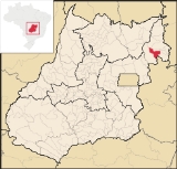
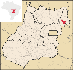
in northeastern Goiás
Goiás
Goiás is a state of Brazil, located in the central part of the country. The name Goiás comes from the name of an indigenous community...
state, Brazil
Brazil
Brazil , officially the Federative Republic of Brazil , is the largest country in South America. It is the world's fifth largest country, both by geographical area and by population with over 192 million people...
. It is an important commercial center on the Brasília-Salvador highway.
Location
Alvorada do Norte is part of the Vão do Paranã MicroregionVão do Paranã Microregion
The Vão do Paranã is a statistical micro-region created by IBGE in northeastern Goiás state, Brazil.*Population: 102,927 inhabitants *Cities: 12...
. Neighboring municipalities are Iaciara
Iaciara
Iaciara is a small town and municipality in northeastern Goiás state, Brazil.-Geography:Iaciara is located in Vão do Paranã statistical micro-region, which borders the state of Bahia. The distance to the state capital of Goiânia is 548 kilometers...
, Posse
Posse, Goiás
Posse is a small town and municipality in northeastern Goiás state, Brazil.-Geography:It is located northeast of Brasília, 24 km. from the state boundary with Bahia, on interstate highway BR-020...
, Simolândia
Simolândia
Simolândia is a small town and municipality in northeast Goiás state, Brazil.-Location and Geography:Simolândia is situated in the northeast of Goiás, at kilometer 250 of the important BR-020 . It forms boundaries with Posse, Alvorada do Norte and Buritinópolis...
, Buritinópolis
Buritinópolis
Buritinópolis is a small town and municipality in eastern Goiás state, Brazil. It is the poorest municipality in the state.-Location:Buritinópolis is located in the Vão do Paranã statistical micro-region in the area near Simolândia and Alvorada do Norte. It is close to the important BR-020...
, Sítio d'Abadia
Sítio d'Abadia
Sítio d'Abadia is a small town and municipality in eastern Goiás state, Brazil.-Location:Sítio d'Abadia is located in a corner of eastern Goiás, 14 kilometers north of the border with Minas Gerais. It is about 30 kilometers west of the border with Bahia...
, Damianópolis
Damianópolis
Damianópolis is a small town and municipality in eastern Goiás state, Brazil. The population was 3,597 in a total area of 415.3 km².-Location:...
, and Flores de Goiás
Flores de Goiás
Flores de Goiás is a small town and municipality in northeastern Goiás state, Brazil.-Geography:Located in the Vão do Paranã statistical micro-region, Flores has boundaries with Buritis, Sítio d'Abadia, Vila Boa, Alvorada do Norte, Iaciara, Nova Roma, São João d'Aliança, Formosa and Alto Paraíso...
. The distance to Goiânia
Goiânia
-Climate:The city has a tropical wet and dry climate with an average temperature of . There's a wet season, from October to April, and a dry one, from May to September. Annual rainfall is around 1,520 mm....
is 457 km. and highway connections are made by BR-153 / Anápolis
Anápolis
Anápolis is the third largest city in the State of Goiás in Brazil. It lies in the center of a rich agricultural region and has become a leader in food processing and pharmaceutical plants.-Location and population:...
/ BR-060 / Alexânia
Alexânia
Alexânia is a small town and municipality in central Goiás state, Brazil. Alexânia is known for its alleged extraterrestrial sightings in the late sixties and early seventies. The Areias River passes through the municipality.-Location:...
/ Planaltina
Planaltina
Planaltina is one of the administrative districts of the Federal District of Brazil, with an area of 1,534 kmª and a population of 147,114 in 2000, of whom 134,663 were classified as urban and 12,451 as rural...
/ Formosa
Formosa, Goiás
Formosa is a city and municipality located in the state of Goiás, Brazil, approximately 80 kilometers east of Brasília. The population was 90,247 in a total area of 5,806.89 km² . Formosa is known for its waterfalls and natural beauty...
/ BR-020. Brasília is 250 km. away.
History
The town of Alvorada do Norte appeared in 1958, created by the authorities of the town of Sítio d'AbadiaSítio d'Abadia
Sítio d'Abadia is a small town and municipality in eastern Goiás state, Brazil.-Location:Sítio d'Abadia is located in a corner of eastern Goiás, 14 kilometers north of the border with Minas Gerais. It is about 30 kilometers west of the border with Bahia...
. They knew that the valley of the Paranã River would be the future route of the new federal highway BR-020 and that it would link the Brazilian Northeast to the new capital of Brasília
Brasília
Brasília is the capital city of Brazil. The name is commonly spelled Brasilia in English. The city and its District are located in the Central-West region of the country, along a plateau known as Planalto Central. It has a population of about 2,557,000 as of the 2008 IBGE estimate, making it the...
, so they founded a new town on the edge of the future highway.
A curious fact is that Hermeliano Alves de Brito, who had been mayor of Sítio D’Abadia, was behind the move since his candidate had lost the election in Sítio. He had the complete support of Mauro Borges, state governor at the time.
In 1964, Adolf Wilhelm Oskar Schwabacher (Swiss Adolf), comes to the region, purchase of land, was a breeder of sheep and lamb.
A pioneer in Nellore in the region. He worked the land, respecting the ecology, including forest vegetation in rivers and lakes,
a custom not practiced at the time. In 1980, the Brazilian government gave him the title of Producer Model for their excellent
performance in the agricultural sector. He lived in region until 2000 when he moved to the state of Tocantins.
As late as 1976, Alvorada was quite isolated from the rest of the country. The small town lived off of the hardwoods extracted from the abundant forests nearby. From Alvorada to Formosa there was not even any asphalt and there was neither television nor telephone. Located on the banks of the Rio Corrente, it is an obligatory stop for all those travelling between the states of the north and the south. People came from all around to start shops or to look for work. Soon other economic activities began such as rice, bean, corn, and manioc cultivation, taking advantage of the fertile soils. Cattle raising did not take long to become an important part of the economy.
Nearby is Itiquira or (Itiquirinha) waterfall, with a height of 70 meters. Curiously the name Itiquira is the same as the much higher waterfall in the municipality of Formosa
Formosa, Goiás
Formosa is a city and municipality located in the state of Goiás, Brazil, approximately 80 kilometers east of Brasília. The population was 90,247 in a total area of 5,806.89 km² . Formosa is known for its waterfalls and natural beauty...
.
Economy
The economy is mainly dependent on agriculture and services. Main agricultural activities (2006) were cattle raising and agriculture (corn and soybeans). In 2007 there were 93 retail units and three banks—Banco do Brasil S.A, BRADESCO S.A., and Banco Itaú S.A. The main employer in the town was commerce and then small transformation industries (furniture making, wood processing, cereal transforming). Agriculture was the largest source of employment with 1,150 persons dependent on this livelihood. andMotor vehicles in 2006
- Automobiles: 670
- Pickup trucks: 122
- Trucks: 103
- Buses: 4
- Motorcycle: 336
- Number of inhabitants per automobile and pickup truck: 10.37
Agricultural data 2006
- Farms: 298
- Total area: 65,952 ha.
- Area of permanent crops: 124 ha.
- Area of perennial crops: 1,741 ha.
- Area of pasture: 44,388 ha.
- Area of woodland and forests: 14,303 ha.
- Cattle herd: 34,523 head
Health and education
- Infant mortality rate in 2000: 36.25
- Hospitals: 01 with 30 beds (2006)
- Literacy rate in 2000: 80.5%
- Schools: 14 with 3,244 students
Alvorada do Norte is ranked 218 out of 242 municipalities in the state of Goiás
Goiás
Goiás is a state of Brazil, located in the central part of the country. The name Goiás comes from the name of an indigenous community...
on the United Nations 2000 Human Development Index
Human Development Index
The Human Development Index is a composite statistic used to rank countries by level of "human development" and separate "very high human development", "high human development", "medium human development", and "low human development" countries...
with a score of 0.688. Nationally it is ranked 3,179 out of 5,507 municipalities (2000).
Notes
See also
- List of municipalities in Goiás
- Microregions of Goiás
- Vão do Paranã MicroregionVão do Paranã MicroregionThe Vão do Paranã is a statistical micro-region created by IBGE in northeastern Goiás state, Brazil.*Population: 102,927 inhabitants *Cities: 12...