
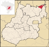
Monte Alegre de Goiás
Encyclopedia
| Monte Alegre de Goiás | |
|---|---|
| State | Goiás Goiás Goiás is a state of Brazil, located in the central part of the country. The name Goiás comes from the name of an indigenous community... |
| Coordinates: | 13°15′21"S 46°54′03"W |
| Area: | 3,119.7 km² |
| Population: | 7.155(IBGE 2007) |
| Population density | 2.29 inhab/km² |
| Urban population | 3,121 (2007) |
| Rural population | 4,034 (2007) |
| Elevation: | 557m |
| Postcode (CEP): | 73830-000 |
| IBGE statistical microregion: | 018 Chapada dos Veadeiros Chapada dos Veadeiros Microregion The Chapada dos Veadeiros Microregion is an IBGE statistical region in north-central Goiás state, Brazil. It includes 8 cities with a population of 60,267 in a total area of 21,476 km²... |
| Became a city: | 1947 |
| Mayor: | Juvenal Fernandes Almeida |
| Distance to Goiânia Goiânia -Climate:The city has a tropical wet and dry climate with an average temperature of . There's a wet season, from October to April, and a dry one, from May to September. Annual rainfall is around 1,520 mm.... : |
568 km. |
| Website: | n/a |
Town
A town is a human settlement larger than a village but smaller than a city. The size a settlement must be in order to be called a "town" varies considerably in different parts of the world, so that, for example, many American "small towns" seem to British people to be no more than villages, while...
and municipality
Municipality
A municipality is essentially an urban administrative division having corporate status and usually powers of self-government. It can also be used to mean the governing body of a municipality. A municipality is a general-purpose administrative subdivision, as opposed to a special-purpose district...
in northeastern Goiás
Goiás
Goiás is a state of Brazil, located in the central part of the country. The name Goiás comes from the name of an indigenous community...
state, Brazil
Brazil
Brazil , officially the Federative Republic of Brazil , is the largest country in South America. It is the world's fifth largest country, both by geographical area and by population with over 192 million people...
.
Location
Monte Alegre is located in the statistical micro-region of Chapada dos VeadeirosChapada dos Veadeiros Microregion
The Chapada dos Veadeiros Microregion is an IBGE statistical region in north-central Goiás state, Brazil. It includes 8 cities with a population of 60,267 in a total area of 21,476 km²...
and is 31 kilometers south of the border with Tocantins
Tocantins (state)
Tocantins is one of the states of Brazil. . The state was formed in 1988 out of the northern part of Goiás, and construction began on the capital, Palmas, in 1989, in contrast to most of the other cities in the state which date back to the Portuguese colonial period...
. G0-118 connects it with Teresina de Goiás
Teresina de Goiás
Teresina de Goiás is a small town and municipality in northern Goiás state, Brazil.-Location:It is part of the region of the statistical micro-region of Chapada dos Veadeiros and is located north of the Federal District and Brasília. It is 67 km north of Alto Paraíso de Goiás. The nearest...
and Campos Belos de Goiás. It is 568 kilometers from the state capital, Goiânia
Goiânia
-Climate:The city has a tropical wet and dry climate with an average temperature of . There's a wet season, from October to April, and a dry one, from May to September. Annual rainfall is around 1,520 mm....
. Highway connections from Goiânia
Goiânia
-Climate:The city has a tropical wet and dry climate with an average temperature of . There's a wet season, from October to April, and a dry one, from May to September. Annual rainfall is around 1,520 mm....
are made by BR-153 / Anápolis
Anápolis
Anápolis is the third largest city in the State of Goiás in Brazil. It lies in the center of a rich agricultural region and has become a leader in food processing and pharmaceutical plants.-Location and population:...
/ BR-060 / Alexânia
Alexânia
Alexânia is a small town and municipality in central Goiás state, Brazil. Alexânia is known for its alleged extraterrestrial sightings in the late sixties and early seventies. The Areias River passes through the municipality.-Location:...
/ Planaltina
Planaltina
Planaltina is one of the administrative districts of the Federal District of Brazil, with an area of 1,534 kmª and a population of 147,114 in 2000, of whom 134,663 were classified as urban and 12,451 as rural...
/ GO-118 / BR-010 / São João d'Aliança
São João d'Aliança
São João d'Aliança is a small town and municipality in northeastern Goiás state, Brazil. São João is a gateway to the Chapada dos Veadeiros National Park. The name is sometimes written as São João D'Aliança.-Location:...
/ Alto Paraíso de Goiás
Alto Paraíso de Goiás
Alto Paraíso de Goiás is a small town and a municipality in northeastern Goiás state, Brazil. It has become known for its ecological and New Age tourism.-Location:...
/ BR-010 / GO-118 / Teresina de Goiás
Teresina de Goiás
Teresina de Goiás is a small town and municipality in northern Goiás state, Brazil.-Location:It is part of the region of the statistical micro-region of Chapada dos Veadeiros and is located north of the Federal District and Brasília. It is 67 km north of Alto Paraíso de Goiás. The nearest...
. Municipal boundaries are with the state of Tocantins
Tocantins
Tocantins may refer to:* Tocantins, a state in Brazil* Tocantins River, a river in Brazil* Survivor: Tocantins, a reality show set in Tocantins, Brazil* Tocantins Esporte Clube, a Brazilian football club...
, Campos Belos de Goiás, Cavalcante
Cavalcante
Cavalcante is a small town and municipality in northern Goiás state, Brazil. It is one of the poorest municipalities in the state. It is home to communities of descendants of runaway slaves called Kalungas.-Location:...
, São Domingos
São Domingos
São Domingos can refer to many places in the world:*In Brazil:**São Domingos, Bahia**São Domingos, Goiás**São Domingos, Santa Catarina**São Domingos, Sergipe**São Domingos do Araguaia, Pará**São Domingos do Azeitão, Maranhão...
, Divinópolis de Goiás
Divinópolis de Goiás
Divinópolis de Goiás is a small town and municipality in northeastern Goiás state, Brazil.-Geography:Divinópolis de Goiás is part of the Vão do Paranã statistical micro-region, which consists of 12 municipalities with 88,913 inhabitants in a total area of 17,452.90 km². Divinópolis is one of...
, and Nova Roma
Nova Roma
Nova Roma is an international Roman revivalist and reconstructionist organization created in 1998 by Joseph Bloch and William Bradford, later incorporated in Maine as a non-profit organization with an educational and religious mission...
The Serra da Contenda lies north of the region. The vegetation is mainly cerrado
Cerrado
The Cerrado, is a vast tropical savanna ecoregion of Brazil, particularly in the states of Gioas and Minas Gerais...
with tropical forest along the rivers. The Sumidouro forest, with 50 caves, is 90% preserved. There are many rivers: Rio Paranã, Manso, São Domingos, Bezerra, Prata, Sarzeda and Pagão. All of these rivers flow north to join the Paranã and eventually the Tocantins
Tocantins River
The Tocantins is a river in Brazil, the central fluvial artery of the country. In the Tupi language, its name means "toucan's beak" . It runs from south to north for about 2,640 km. It is not really a branch of the Amazon River, although usually so considered, since its waters flow into the...
.
Demographics
The population in 2007 was smaller than in 1980, having lost around 200 inhabitants. From 2000 to 2005 there was a loss of 2.03%.The economy
The economy is based on cattle raising with 90,000 head of cattle. Many residents work for the government and there is a small commercial sector. In 2007 there was 1 industrial unit and 36 retail units. There was 1 banking institution: Banco Itaú S.A.In 2006 there were 121,200 head of cattle, of which 5,400 were milk cows. The main agricultural products in planted area were rice, sugarcane, beans, manioc, and corn (1,800 hectares). Most of the corn is grown for cattle feed during the dry months of the summer.
Agricultural data 2006
- Farms: 695
- Total area: 175,147 ha.
- Area of permanent crops: 442 ha.
- Area of perennial crops: 4,477 ha.
- Area of natural pasture: 92,754 ha.
- Area of woodland and forests: 66,983 ha.
- Persons dependent on farming: 2,200
- Number of tractors: 156
- Cattle herd: 90,000
- Main crop: corn with 1,850 planted hectares IBGE
Health and education
In 2007 there was 1 hospital with 15 beds. The infant mortality rate was 45.34 in every 1,000 live births in 2000. This was much higher than the state average. There were no institutions of higher learning. The adult literacy rate was 75.8% in 2000, one of the lowest in the state.Monte Alegre de Goiás is one of the poorest municipalities in the state. It ranked third from last place in the MHDI.
- Municipal Human Development Index (HDI-M): 0.626
- State ranking: 240 (out of 242 in 2000)
- National ranking: 4,205 (out of 5,507 in 2000) Source: Frigoletto
History
Monte Alegre de Goiás was founded because of the search for gold. The first settlers arrived around 1769 in a place called Morro do Chapéu. A chapel was built to honor Santo Antonio, giving the town the name Santo Antônio do Morro do Chapéu. The bandeirantes, who came up from São Paulo, brought 2,000 Negro slaves with them. In 1957 the municipality of Chapéu had its name changed to Monte Alegre de Goiás. There are settlements nearby founded by runaway slaves. These Afro-Brazilians are known as KalungaKalunga
The Kalungas are descendants of run-away slaves who lived in remote settlements in northeastern Goiás state, Brazil. Most of the 4,000 Kalungas, who are of mixed race, black and native Indian, live in very poor conditions in near the town of Cavalcante, Goiás.All of the area occupied by the...
. They live on the slopes of the Paranã River and in valleys called "vãos". Today they live in the municipalities of Cavalcante
Cavalcante
Cavalcante is a small town and municipality in northern Goiás state, Brazil. It is one of the poorest municipalities in the state. It is home to communities of descendants of runaway slaves called Kalungas.-Location:...
, Monte Alegre de Goiás, and Teresina de Goiás
Teresina de Goiás
Teresina de Goiás is a small town and municipality in northern Goiás state, Brazil.-Location:It is part of the region of the statistical micro-region of Chapada dos Veadeiros and is located north of the Federal District and Brasília. It is 67 km north of Alto Paraíso de Goiás. The nearest...
. Their small settlements are Contenda, Kalunga, Vão das Almas, Vão dos Moleuqes, and Ribeirão dos Bois.
References
See also
- List of municipalities in Goiás
- Microregions of Goiás