
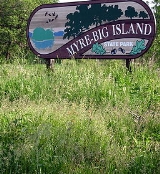
Myre-Big Island State Park
Encyclopedia

State park
State parks are parks or other protected areas managed at the federated state level within those nations which use "state" as a political subdivision. State parks are typically established by a state to preserve a location on account of its natural beauty, historic interest, or recreational...
of Minnesota
Minnesota
Minnesota is a U.S. state located in the Midwestern United States. The twelfth largest state of the U.S., it is the twenty-first most populous, with 5.3 million residents. Minnesota was carved out of the eastern half of the Minnesota Territory and admitted to the Union as the thirty-second state...
, USA, just outside the city of Albert Lea
Albert Lea, Minnesota
Albert Lea is a city in and the county seat of Freeborn County in the southeastern part of the U.S. state of Minnesota. The population was 18,016 at the 2010 census....
. It has an area of 1578 acres (6.4 km²). The park protects 8 miles (12.9 km) of shoreline on Albert Lea Lake. The nucleus of the park is Big Island, a 117 acre (0.47348262 km²) island attached to the mainland by a causeway
Causeway
In modern usage, a causeway is a road or railway elevated, usually across a broad body of water or wetland.- Etymology :When first used, the word appeared in a form such as “causey way” making clear its derivation from the earlier form “causey”. This word seems to have come from the same source by...
. In turn a causeway connects Big Island to Little Island. The park was formerly named Helmer Myre State Park after former Minnesota State Senator
Minnesota Senate
The Minnesota Senate is the upper house in the Minnesota Legislature. There are 67 members, half as many as are in the Minnesota House of Representatives. In terms of membership, it is the largest upper house of any state legislature. Each Senate district in the state includes an A and B House...
Helmer Myre.
Natural history
The park is situated on the Bemis MoraineMoraine
A moraine is any glacially formed accumulation of unconsolidated glacial debris which can occur in currently glaciated and formerly glaciated regions, such as those areas acted upon by a past glacial maximum. This debris may have been plucked off a valley floor as a glacier advanced or it may have...
, which marks the southern extent of a glacial lobe during the Wisconsin glaciation
Wisconsin glaciation
The last glacial period was the most recent glacial period within the current ice age occurring during the last years of the Pleistocene, from approximately 110,000 to 10,000 years ago....
10,000 years ago. As the glacier retreated, the moraine caused the meltwater to back up behind it. Albert Lea Lake was created as a moraine-dammed lake and today covers 2600 acres (10.5 km²). The park also contains an esker
Esker
An esker is a long winding ridge of stratified sand and gravel, examples of which occur in glaciated and formerly glaciated regions of Europe and North America...
, a sinuous ridge of sand and gravel dropped by a stream running under the glacier
Glacier
A glacier is a large persistent body of ice that forms where the accumulation of snow exceeds its ablation over many years, often centuries. At least 0.1 km² in area and 50 m thick, but often much larger, a glacier slowly deforms and flows due to stresses induced by its weight...
.
The mainland is primarily vegetated in oak savanna
Oak savanna
An oak savanna is a type of savanna, or lightly forested grassland, where oaks are the dominant tree species. These savannas were maintained historically through wildfires set by lightning, grazing, low precipitation, poor soil, and/or fires set by Native Americans...
with several wetlands. Restoration ecology
Restoration ecology
-Definition:Restoration ecology is the scientific study and practice of renewing and restoring degraded, damaged, or destroyed ecosystems and habitats in the environment by active human intervention and action, within a short time frame...
projects, including controlled burn
Controlled burn
Controlled or prescribed burning, also known as hazard reduction burning or Swailing is a technique sometimes used in forest management, farming, prairie restoration or greenhouse gas abatement. Fire is a natural part of both forest and grassland ecology and controlled fire can be a tool for...
ing and water retention strategies, are ongoing to maintain and improve these habitats. Big Island, protected from the wildfire
Wildfire
A wildfire is any uncontrolled fire in combustible vegetation that occurs in the countryside or a wilderness area. Other names such as brush fire, bushfire, forest fire, desert fire, grass fire, hill fire, squirrel fire, vegetation fire, veldfire, and wilkjjofire may be used to describe the same...
s that suppressed tree growth in the savannas and prairie of southern Minnesota, bears an old growth
Old growth forest
An old-growth forest is a forest that has attained great age , and thereby exhibits unique ecological features. An old growth forest has also usually reached a climax community...
hardwood forest. It comprises maple
Maple
Acer is a genus of trees or shrubs commonly known as maple.Maples are variously classified in a family of their own, the Aceraceae, or together with the Hippocastanaceae included in the family Sapindaceae. Modern classifications, including the Angiosperm Phylogeny Group system, favour inclusion in...
, basswood, elm
Elm
Elms are deciduous and semi-deciduous trees comprising the genus Ulmus in the plant family Ulmaceae. The dozens of species are found in temperate and tropical-montane regions of North America and Eurasia, ranging southward into Indonesia. Elms are components of many kinds of natural forests...
, green ash
Green Ash
Fraxinus pennsylvanica is a species of ash native to eastern and central North America, from Nova Scotia west to southeastern Alberta and eastern Colorado, south to northern Florida, and southwest to eastern Texas....
, ironwood
American Hornbeam
Carpinus caroliniana is a small hardwood tree in the genus Carpinus. American hornbeam is also occasionally known as blue-beech, ironwood, or musclewood. It is native to eastern North America, from Minnesota and southern Ontario east to Maine, and south to eastern Texas and northern Florida...
, and red oak, with willow
Willow
Willows, sallows, and osiers form the genus Salix, around 400 species of deciduous trees and shrubs, found primarily on moist soils in cold and temperate regions of the Northern Hemisphere...
s along the lakeshore. Albert Lea Lake is highly eutrophic
Eutrophication
Eutrophication or more precisely hypertrophication, is the movement of a body of water′s trophic status in the direction of increasing plant biomass, by the addition of artificial or natural substances, such as nitrates and phosphates, through fertilizers or sewage, to an aquatic system...
. Moraine dammed lakes typically fill in, but this process has been exacerbated by agricultural runoff.
Myre-Big Island State Park is known for its birdwatching
Birdwatching
Birdwatching or birding is the observation of birds as a recreational activity. It can be done with the naked eye, through a visual enhancement device like binoculars and telescopes, or by listening for bird sounds. Birding often involves a significant auditory component, as many bird species are...
opportunities, especially during the spring and fall migration. One particularly notable species is the American White Pelican
American White Pelican
The American White Pelican is a large aquatic bird from the order Pelecaniformes. It breeds in interior North America, moving south and to the coasts, as far as Central America, in winter....
which congregates on Albert Lea Lake.
Cultural history
Artifacts, many of them collected by a local amateur archaeologist named Owen Johnson in the mid-1940s, reveal that humans have been living around the area's lakes for 9,000 years. Johnson became an advocate for protecting Big Island as a state park, as did state Senator Helmer Myre, another resident of Albert Lea. At the time Big Island was divided into seventeen privately owned lots, and some of the owners were considering loggingLogging
Logging is the cutting, skidding, on-site processing, and loading of trees or logs onto trucks.In forestry, the term logging is sometimes used in a narrow sense concerning the logistics of moving wood from the stump to somewhere outside the forest, usually a sawmill or a lumber yard...
their trees. In 1947 a bill backed by Myre easily passed through the Minnesota Legislature
Minnesota Legislature
The Minnesota Legislature is the legislative branch of government in the U.S. state of Minnesota. It is a bicameral legislature located at the Minnesota Capitol in Saint Paul and it consists of two houses: the lower Minnesota House of Representatives and the Minnesota Senate...
which authorized the Department of Conservation
Minnesota Department of Natural Resources
The Minnesota Department of Natural Resources is the agency of the U.S. state of Minnesota charged with conserving and managing the state's natural resources. The agency maintains areas such as state parks, state forests, recreational trails, and recreation areas as well as managing minerals,...
to acquire the 117 acre (0.47348262 km²) island. An organization of local supporters raised additional funds to buy out the current owners and develop a picnic ground and trails. While referred to as Big Island State Park, the park did not receive an official name until 1953, when it was formally dubbed Myre State Park to honor the senator, who had died two years previously.
In the early 1960s a campground was added, but Big Island was too small to support much visitation. When it was announced that Interstates 90
Interstate 90
Interstate 90 is the longest Interstate Highway in the United States at . It is the northernmost coast-to-coast interstate, and parallels US 20 for the most part. Its western terminus is in Seattle, at Edgar Martinez Drive S. near Safeco Field and CenturyLink Field, and its eastern terminus is in...
and 35
Interstate 35
Interstate 35 is a north–south Interstate Highway in the central United States. I-35 stretches from Laredo, Texas, on the U.S.-Mexico border to Duluth, Minnesota, at Minnesota Highway 61 and 26th Avenue East. Many interstates used to have splits or spurs indicated with suffixed letters , but I-35...
would intersect near Albert Lea, a new local organization began pushing for more land to be added to the park. An additional area of 839 acres (3.4 km²) on the mainland was authorized in 1963. In 1974 a real estate company acquired for development a 560 acre (2.3 km²) tract northeast of the park, which included lakeshore and the esker. Again strong local support was the driving force in adding this land to the park, overcoming legal and financial constraints over a two-year advocacy.
Owen Johnson donated his collection of Native American surface artifacts to the park in 1972. They are housed in the Owen Johnson Interpretive Center at the park entrance, where they are available for research but are not currently on public display. In 1990 the park's previous names were combined into the new official moniker, Myre-Big Island State Park.
Recreation
- Boating:
- Boat ramp on Little Island.
- Rental canoes available.
- Boat tours of Albert Lea Lake embark from town.
- Camping:
- Big Island Campground: 34 wooded sites (17 with electrical hookups), 1 camper cabin.
- White Fox Campground: 59 open sites (15 electrical).
- Little Island Pioneer Group Camp: 50 person capacity, tenting only.
- New York Point Group Camp: Tent or vehicle camping with access to kitchen/mess hall & showers/restrooms.
- 4 backpacking sites.
- Fishing: Black bullhead, carp, northern pike, and various panfish in Albert Lea Lake.
- Trails: 16 miles (25.7 km) of hiking, 7 miles (11.3 km) of mountain biking, 8 miles (12.9 km) of cross-country skiing, and 7 miles (11.3 km) of snowmobiling trails.
- Blazing Star State Trail: 6.5 miles (10.5 km) of paved, multi-use trail begin in Frank Hall Park in Albert Lea and end near the esker. The trail is planned to extend 20 miles (32.2 km) to Austin, MinnesotaAustin, MinnesotaAs of the census of 2000, there were 23,314 people, 9,897 households, and 6,076 families residing in the city. The population density was 2,168.2 people per square mile . There were 10,261 housing units at an average density of 954.3 per square mile...
.
- Blazing Star State Trail: 6.5 miles (10.5 km) of paved, multi-use trail begin in Frank Hall Park in Albert Lea and end near the esker. The trail is planned to extend 20 miles (32.2 km) to Austin, Minnesota
- Lake is too shallow and weedy for swimming.