
Friern Barnet
Encyclopedia
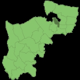
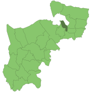
Friern Barnet is a place in the London Borough of Barnet
. It is a suburban development situated 7.4 miles (11.9 km) north of Charing Cross
. The centre of Friern Barnet is formed by the busy intersection of Colney Hatch Lane (which runs north-south), Woodhouse Road (which takes west-bound traffic into Finchley
) and Friern Barnet Road (which leads east towards New Southgate
).
Friern Barnet was an ancient parish in the Finsbury division
of Ossulstone
hundred
, in the county of Middlesex
.
 The area was originally considered to be part of Barnet
, most of which was in Hertfordshire
. By the thirteenth century the Middlesex section of Barnet was known as "Little Barnet", before becoming "Frerenbarnet" and then "Friern Barnet". The "Friern" part of the parish's name, denotes "brotherhood", and referred to its ownership by the Priory of the Knights of the Hospital of St John of Jerusalem
.
Friern Barnet was mainly rural until the nineteenth century. The opening of Colney Hatch
Hospital in 1851, and of railway stations on the Great Northern
and Metropolitan Railway
s in the middle of the century began its development as an outer London suburb. This process was accelerated by the arrival of electric tram
s in 1909.
Local affairs were administered by the parish vestry
until 1875, when it was grouped with neighbouring parishes as part of Barnet Rural Sanitary District
. In response to a petition by local ratepayers who wished the area to be removed from the Barnet RSD, the parish adopted the Local Government Act 1858 and formed a local board of health
of nine members in 1884. Under the Local Government Act 1894
the local board's area became an urban district
. The urban district occupied an area of 1304 acres (5.3 km²) in 1911 and had a population of 14,924. In 1961 it occupied an area of 1342 acres (5.4 km²) and the population was 28,813. In 1965 it became part of the London Borough of Barnet
.
and early Edwardian
properties as well as other large houses from later periods and many smaller semi-detached and terraced houses. Much of the property is owner-occupied, but in recent years many of the larger properties have been subdivided into flats and bedsits. There are also some areas of modern housing, notably Princess Park Manor, a luxury redevelopment of the once-famous Victorian institution the Colney Hatch Lunatic Asylum
. England footballer Ashley Cole
met his future wife, pop singer Cheryl Tweedy
, when both owned apartments at this development,bandmate Kimberley Walsh also lives in Friern Barnet.
. The area includes the North Middlesex Golf Club and Coppetts Wood nature reserve, a medium sized green area of rare plants and wildlife including some types of small Bat
and Great Crested Newts.
, Friern Barnet Road is a Grade II* building listed by the English Heritage organisation and considered of particular importance.
, North London International School
(being the former Friern Barnet Grammar School
), The Compton School
, and Woodhouse College
.
bisects the southern part. The nearest London Underground stations are Arnos Grove
and Finchley Central
. The nearest National Rail station is New Southgate
. The area is served by London Buses routes 34
, 43
, 134
, 221, 232, 234, 382, 634 and 683.
London Borough of Barnet
The London Borough of Barnet is a London borough in North London and forms part of Outer London. It has a population of 331,500 and covers . It borders Hertfordshire to the north and five other London boroughs: Harrow and Brent to the west, Camden and Haringey to the south-east and Enfield to the...
. It is a suburban development situated 7.4 miles (11.9 km) north of Charing Cross
Charing Cross
Charing Cross denotes the junction of Strand, Whitehall and Cockspur Street, just south of Trafalgar Square in central London, England. It is named after the now demolished Eleanor cross that stood there, in what was once the hamlet of Charing. The site of the cross is now occupied by an equestrian...
. The centre of Friern Barnet is formed by the busy intersection of Colney Hatch Lane (which runs north-south), Woodhouse Road (which takes west-bound traffic into Finchley
Finchley
Finchley is a district in Barnet in north London, England. Finchley is on high ground, about north of Charing Cross. It formed an ancient parish in the county of Middlesex, becoming a municipal borough in 1933, and has formed part of Greater London since 1965...
) and Friern Barnet Road (which leads east towards New Southgate
New Southgate
New Southgate is a residential suburb in the south-east corner of the London Borough of Barnet and the south-west corner of the London Borough of Enfield in North London, England....
).
History
| 1881 | 6,424 |
|---|---|
| 1891 | 9,173 |
| 1901 | 11,566 |
| 1911 | 14,924 |
| 1921 | 17,375 |
| 1931 | 23,101 |
| 1941 | war # |
| 1951 | 29,163 |
| 1961 | 28,813 |
| # no census was held due to war | |
| source: UK census | |
Friern Barnet was an ancient parish in the Finsbury division
Finsbury division
The Finsbury Division was one of four divisions of the Hundred of Ossulstone, in the county of Middlesex, England.The other divisions were named Holborn, Kensington and Tower...
of Ossulstone
Ossulstone
Ossulstone was an ancient hundred in the south east of the county of Middlesex, England. Its area has been entirely absorbed by the growth of London; and now corresponds to the part of Inner London that is north of the River Thames and, from Outer London, parts of the London boroughs of Barnet,...
hundred
Hundred (division)
A hundred is a geographic division formerly used in England, Wales, Denmark, South Australia, some parts of the United States, Germany , Sweden, Finland and Norway, which historically was used to divide a larger region into smaller administrative divisions...
, in the county of Middlesex
Middlesex
Middlesex is one of the historic counties of England and the second smallest by area. The low-lying county contained the wealthy and politically independent City of London on its southern boundary and was dominated by it from a very early time...
.
Barnet
High Barnet or Chipping Barnet is a place in the London Borough of Barnet, North London, England. It is a suburban development built around a twelfth-century settlement and is located north north-west of Charing Cross. Its name is often abbreviated to Barnet, which is also the name of the London...
, most of which was in Hertfordshire
Hertfordshire
Hertfordshire is a ceremonial and non-metropolitan county in the East region of England. The county town is Hertford.The county is one of the Home Counties and lies inland, bordered by Greater London , Buckinghamshire , Bedfordshire , Cambridgeshire and...
. By the thirteenth century the Middlesex section of Barnet was known as "Little Barnet", before becoming "Frerenbarnet" and then "Friern Barnet". The "Friern" part of the parish's name, denotes "brotherhood", and referred to its ownership by the Priory of the Knights of the Hospital of St John of Jerusalem
Knights Hospitaller
The Sovereign Military Hospitaller Order of Saint John of Jerusalem of Rhodes and of Malta , also known as the Sovereign Military Order of Malta , Order of Malta or Knights of Malta, is a Roman Catholic lay religious order, traditionally of military, chivalrous, noble nature. It is the world's...
.
Friern Barnet was mainly rural until the nineteenth century. The opening of Colney Hatch
Colney Hatch
Colney Hatch is the historical name for a small district within the London Borough of Barnet in London, England. The name Colney Hatch was originally that of a hamlet in the parish of Friern Barnet, first recorded in the early 15th century...
Hospital in 1851, and of railway stations on the Great Northern
Great Northern Railway (Great Britain)
The Great Northern Railway was a British railway company established by the Great Northern Railway Act of 1846. On 1 January 1923 the company lost its identity as a constituent of the newly formed London and North Eastern Railway....
and Metropolitan Railway
Metropolitan railway
Metropolitan Railway can refer to:* Metropolitan line, part of the London Underground* Metropolitan Railway, the first underground railway to be built in London...
s in the middle of the century began its development as an outer London suburb. This process was accelerated by the arrival of electric tram
Tram
A tram is a passenger rail vehicle which runs on tracks along public urban streets and also sometimes on separate rights of way. It may also run between cities and/or towns , and/or partially grade separated even in the cities...
s in 1909.
Local affairs were administered by the parish vestry
Vestry
A vestry is a room in or attached to a church or synagogue in which the vestments, vessels, records, etc., are kept , and in which the clergy and choir robe or don their vestments for divine service....
until 1875, when it was grouped with neighbouring parishes as part of Barnet Rural Sanitary District
Sanitary district
Sanitary districts were established in England and Wales in 1875 and in Ireland in 1878. The districts were of two types, based on existing structures:*Urban sanitary districts in towns with existing local government bodies...
. In response to a petition by local ratepayers who wished the area to be removed from the Barnet RSD, the parish adopted the Local Government Act 1858 and formed a local board of health
Local board of health
Local Boards or Local Boards of Health were local authorities in urban areas of England and Wales from 1848 to 1894. They were formed in response to cholera epidemics and were given powers to control sewers, clean the streets, regulate slaughterhouses and ensure the proper supply of water to their...
of nine members in 1884. Under the Local Government Act 1894
Local Government Act 1894
The Local Government Act 1894 was an Act of the Parliament of the United Kingdom that reformed local government in England and Wales outside the County of London. The Act followed the reforms carried out at county level under the Local Government Act 1888...
the local board's area became an urban district
Urban district
In the England, Wales and Ireland, an urban district was a type of local government district that covered an urbanised area. Urban districts had an elected Urban District Council , which shared local government responsibilities with a county council....
. The urban district occupied an area of 1304 acres (5.3 km²) in 1911 and had a population of 14,924. In 1961 it occupied an area of 1342 acres (5.4 km²) and the population was 28,813. In 1965 it became part of the London Borough of Barnet
London Borough of Barnet
The London Borough of Barnet is a London borough in North London and forms part of Outer London. It has a population of 331,500 and covers . It borders Hertfordshire to the north and five other London boroughs: Harrow and Brent to the west, Camden and Haringey to the south-east and Enfield to the...
.
Housing
The housing in this area typically consists of late VictorianVictorian architecture
The term Victorian architecture refers collectively to several architectural styles employed predominantly during the middle and late 19th century. The period that it indicates may slightly overlap the actual reign, 20 June 1837 – 22 January 1901, of Queen Victoria. This represents the British and...
and early Edwardian
Edwardian architecture
Edwardian architecture is the style popular when King Edward VII of the United Kingdom was in power; he reigned from 1901 to 1910, but the architecture style is generally considered to be indicative of the years 1901 to 1914....
properties as well as other large houses from later periods and many smaller semi-detached and terraced houses. Much of the property is owner-occupied, but in recent years many of the larger properties have been subdivided into flats and bedsits. There are also some areas of modern housing, notably Princess Park Manor, a luxury redevelopment of the once-famous Victorian institution the Colney Hatch Lunatic Asylum
Colney Hatch Lunatic Asylum
Colney Hatch Lunatic Asylum was an early psychiatric hospital located in Colney Hatch in what is now the London Borough of Barnet. The hospital was in operation from 1851 to 1993....
. England footballer Ashley Cole
Ashley Cole
Ashley Cole is an Barbadian-English professional footballer who plays for Chelsea and the England national team. He plays as a left-back and has been named one of the best in the world....
met his future wife, pop singer Cheryl Tweedy
Cheryl Cole
Cheryl Ann Cole is an English pop and R&B recording artist, songwriter, dancer, actress and model. She rose to fame in late 2002 when she auditioned for the reality television show Popstars: The Rivals on ITV. The programme announced that Cole had won a place as a member of the girl group, Girls...
, when both owned apartments at this development,bandmate Kimberley Walsh also lives in Friern Barnet.
Friern Village
Adjacent to Princess Park Manor is a modern housing development called Friern Village. This was once the area farmed by the Colney Hatch Hospital residents. In 1998 the newly formed local residents' association held a ballot amongst the new residents to find a name for this new area. The name Friern Village was chosen and subsequently the resident's association changed its name to The Friern Village Residents' Association. A new public park in front of Princess Park Manor, Friern Barnet Road, was also named Friern Village Park.Geography
Parks and open spaces
Friern Barnet is a leafy suburb of private gardens and trees and Friary ParkFriary Park
Friary Park is a formal Edwardian park in Friern Barnet in the London Borough of Barnet. It is owned and managed by Barnet Council, and has a children's playground, tennis courts, a bowling green, a pitch and putt, a skateboard park and a cafe...
. The area includes the North Middlesex Golf Club and Coppetts Wood nature reserve, a medium sized green area of rare plants and wildlife including some types of small Bat
Bat
Bats are mammals of the order Chiroptera "hand" and pteron "wing") whose forelimbs form webbed wings, making them the only mammals naturally capable of true and sustained flight. By contrast, other mammals said to fly, such as flying squirrels, gliding possums, and colugos, glide rather than fly,...
and Great Crested Newts.
Architecture
The church of St John The EvangelistSt John, Friern Barnet
St John the Evangelist is an Anglican church on Friern Barnet Road in north London. It is a late example of the Gothic Revival Style by Victorian architect John Loughborough Pearson, begun in 1890-91 and completed after his death by his son Frank Loughborough Pearson.Originating in 1883 as a...
, Friern Barnet Road is a Grade II* building listed by the English Heritage organisation and considered of particular importance.
Education
Local schools and colleges include Coppetts Wood Primary School, Friern Barnet Secondary SchoolFriern Barnet Secondary School
Friern Barnet School is a mixed comprehensive school with approximately 800 students. The school is situated at the end of Hemington Avenue in Friern Barnet, North London...
, North London International School
North London International School
The North London International School is an independent co-educational school-foundation providing programmes prepared by the International Baccalaureate Organisation as an alternative to the British national curriculum...
(being the former Friern Barnet Grammar School
Friern Barnet Grammar School
The Friern Barnet Grammar School was a small independent day school for boys located on Friern Barnet Road, North London.It was later absorbed into the co-educational Woodside Park School foundation which is today known as The North London International School, notably one of the first schools to...
), The Compton School
The Compton School
The Compton School is situated on Summers Lane, North Finchley, London. It is a comprehensive school for boys and girls aged eleven to sixteen and the school years range from year 7 to year 11. It is located on the site of Finchley Manorhill School, which was progressively closed in the late 1980s...
, and Woodhouse College
Woodhouse College
Woodhouse College is a single site state sixth form college situated between North Finchley and Friern Barnet on the eastern side of the London Borough of Barnet...
.
Transport
The North Circular RoadA406 road
The A406 or the North Circular Road is a road which crosses North London, UK, linking West and East London. It, together with the South Circular Road, forms a ring road through the inner part of Outer London...
bisects the southern part. The nearest London Underground stations are Arnos Grove
Arnos Grove tube station
Arnos Grove is a London Underground station on the Piccadilly line between Bounds Green and Southgate. It is in Travelcard Zone 4 and is located in Arnos Grove, near Arnos Park on Bowes Road, London. The station and surrounding neighbourhood of Arnos Grove take their names from the Arnos Grove...
and Finchley Central
Finchley Central tube station
Finchley Central tube station is a London Underground station in the Church End area of Finchley, North London.The station is on the High Barnet branch of the Northern line, between West Finchley and East Finchley stations and is the junction for the short branch to Mill Hill East station...
. The nearest National Rail station is New Southgate
New Southgate railway station
New Southgate railway station is on the boundary of the London Borough of Barnet and the London Borough of Enfield in north London, and is in Travelcard Zone 4...
. The area is served by London Buses routes 34
London Buses route 34
London Buses route 34 is a Transport for London contracted bus route in London, United Kingdom. The service is currently contracted to Arriva London.-History:...
, 43
London Buses route 43
London Buses route 43 is a Transport for London contracted bus route in London, United Kingdom. The service is currently contracted to Metroline.-History:...
, 134
London Buses route 134
London Buses route 134 is a Transport for London contracted bus route in London, United Kingdom. The service is currently contracted to Metroline.-History:...
, 221, 232, 234, 382, 634 and 683.
Economy
The area has recently seen a boom in the tertiary sector with many salons and beauty parlours opening along Woodhouse Road.Local newspapers
The local newspapers are as of 20011-| Newspaper | Link |
|---|---|
| The Barnet and Potters Bar Times | |
| Barnet Today | |
| Potters Bar Today |