
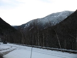
Mount Willey
Encyclopedia
Mountain
Image:Himalaya_annotated.jpg|thumb|right|The Himalayan mountain range with Mount Everestrect 58 14 160 49 Chomo Lonzorect 200 28 335 52 Makalurect 378 24 566 45 Mount Everestrect 188 581 920 656 Tibetan Plateaurect 250 406 340 427 Rong River...
located in Grafton County
Grafton County, New Hampshire
Grafton County is a county located in the U.S. state of New Hampshire. As of the 2010 census, the population was 89,118. Its county seat is North Haverhill, which is a village within the town of Haverhill. Until 1972, the county courthouse and other offices were located in downtown Woodsville, a...
, New Hampshire
New Hampshire
New Hampshire is a state in the New England region of the northeastern United States of America. The state was named after the southern English county of Hampshire. It is bordered by Massachusetts to the south, Vermont to the west, Maine and the Atlantic Ocean to the east, and the Canadian...
. The mountain is named after Samuel Willey, Jr. (1766–1826) and his family, who in 1825 moved into a house in Crawford Notch
Crawford Notch
Crawford Notch is the steep and narrow gorge of the Saco River in the White Mountains of New Hampshire, located almost entirely within the town of Hart's Location...
. Tragically the family was killed a year later in August 1826 during a landslide.
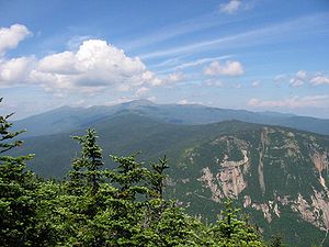
Mount Willey is part of the Willey Range of the White Mountains
White Mountains (New Hampshire)
The White Mountains are a mountain range covering about a quarter of the state of New Hampshire and a small portion of western Maine in the United States. Part of the Appalachian Mountains, they are considered the most rugged mountains in New England...
, of which it is the southernmost and second highest. It, along with Mount Field
Mount Field (New Hampshire)
Mount Field is a mountain located in Grafton County, New Hampshire. The mountain is named after Darby Field , who in 1642 made the first known ascent of Mount Washington. Mount Field is the highest peak of the Willey Range of the White Mountains. Mt. Field is flanked to the northwest by Mount Tom,...
, forms the western wall of Crawford Notch. The summit is just outside the Crawford Notch State Park
Crawford Notch State Park
Crawford Notch State Park is located on U.S. Highway 302, in northern New Hampshire, between Bretton Woods and Bartlett. The park occupies the center of Crawford Notch, a major pass through the White Mountains.-External links:*...
; it is at the northeast corner of the Pemigewasset Wilderness
Pemigewasset Wilderness
The Pemigewasset Wilderness is a federally-designated Wilderness Area in the heart of New Hampshire's White Mountains. It is a part of the White Mountain National Forest....
.
The north and east faces of Mount Willey drain directly into the Saco River
Saco River
The Saco River is a river in northeastern New Hampshire and southwestern Maine in the United States. It drains a rural area of of forests and farmlands west and southwest of Portland, emptying into the Atlantic Ocean at Saco Bay, from its source. It supplies drinking water to roughly 250,000...
, thence into the Gulf of Maine
Gulf of Maine
The Gulf of Maine is a large gulf of the Atlantic Ocean on the east coast of North America.It is delineated by Cape Cod at the eastern tip of Massachusetts in the southwest and Cape Sable at the southern tip of Nova Scotia in the northeast. It includes the entire coastlines of the U.S...
at Saco, Maine
Saco, Maine
Saco is a city in York County, Maine, United States. The population was 18,482 at the 2010 census. It is home to Ferry Beach State Park, Funtown Splashtown USA, Thornton Academy, as well as General Dynamics Armament Systems , a subsidiary of the defense contractor General Dynamics...
. The south and west sides drain into the North Fork
North Fork Pemigewasset River
The North Fork of the East Branch of the Pemigewasset River is a river located in the White Mountains of New Hampshire in the United States. It is a tributary of the East Branch of the Pemigewasset River, part of the Merrimack River watershed....
of the Pemigewasset River
Pemigewasset River
The Pemigewasset River , known locally as "The Pemi", is a river in the state of New Hampshire, the United States. It is in length and drains approximately...
, thence into the East Branch
East Branch Pemigewasset River
The East Branch of the Pemigewasset River is a river located in the White Mountains of New Hampshire in the United States. It is a tributary of the Pemigewasset River, part of the Merrimack River watershed....
, the Pemigewasset River, Merrimack River
Merrimack River
The Merrimack River is a river in the northeastern United States. It rises at the confluence of the Pemigewasset and Winnipesaukee rivers in Franklin, New Hampshire, flows southward into Massachusetts, and then flows northeast until it empties into the Atlantic Ocean at Newburyport...
, and into the Gulf of Maine at Newburyport, Massachusetts
Newburyport, Massachusetts
Newburyport is a small coastal city in Essex County, Massachusetts, United States, 35 miles northeast of Boston. The population was 21,189 at the 2000 census. A historic seaport with a vibrant tourism industry, Newburyport includes part of Plum Island...
.