
Mount Churchill
Encyclopedia
Mount Churchill is a volcano in the Saint Elias Mountains
and the Wrangell Volcanic Field of eastern Alaska
. Churchill and its higher neighbor Mount Bona
about 2 mi (3 km) to the southwest are both large ice-covered stratovolcano
es, with Churchill being the fourth highest volcano in the United States
and the seventh highest in North America
.
, deposited during two of the largest volcanic eruptions in North America during the past two millennia. This twin-lobed tephra
deposit covers more than 130,000 mi² (340,000 km²) of eastern Alaska and northwestern Canada
, with the northern lobe deposited 1900 years ago and extending over 250 miles (400 km) and the larger eastern lobe about 1250 years ago and stretching over 500 miles (800 km). The total volume of the ash exceeds 12 mi³ (50 km³), or roughly 50 times the volume of the 1980 eruption of Mount St. Helens
, and ash layers up to 2 ft (60 cm) thick can be seen just below the surface in many roadcuts along the Alaska Highway
.
The extensive ash deposits in the lowlands near the White and Yukon River
s were first recognized in 1883, but their source remained a mystery for the next century. Geologists in the 1960s traced the two lobes of the ash back into the Saint Elias Mountains, and postulated that the ash may have come from a vent now buried under the Klutlan Glacier
, which flows east for over 40 mi (64 km) from the Bona-Churchill massif into the Yukon Territory of Canada
. More detailed studies in the 1990s by the U.S. Geological Survey finally produced the definitive answer. Aerial photos showed a 2.6 x 1.7 miles (4.2 x 2.7 km) elliptical, gently sloping, ice-filled depression at 14,500 ft (4400 m) just east of the present summit of Mount Churchill. This was identified as a caldera
, which had formed by the collapse of the volcano's previous summit during the cataclysmic eruptions. The geological field work revealed thick young pumice
deposits along the rim of the caldera which are mineralogically and chemically identical to the White River Ash.
The mountain was named in 1965 by the Alaska State Legislature for English statesman Winston Churchill
.
In terms of elevation, it is a major North American peak, at well over 15,000 feet; however, in terms of topographic prominence
or isolation, it is less significant, with less than a 1200 foot drop from its summit to the saddle
with Bona. Churchill also lies on the northern, gentler side of the Bona massif
, making it a less visually spectacular peak than some of the lower outliers of Bona such as University Peak or Aello Peak
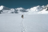
. The current standard climbing route is the South Ridge, usually as part of a climb of Mount Bona from the east starting from a ski-equipped bush plane
landing at around 10,000 ft (3,000 m) on the Klutlan Glacier
.
Saint Elias Mountains
The Saint Elias Mountains are a subgroup of the Pacific Coast Ranges, located in southeastern Alaska in the United States, southwestern Yukon and the very far northwestern part of British Columbia in Canada. The range spans Wrangell-St. Elias National Park and Preserve in the USA and Kluane...
and the Wrangell Volcanic Field of eastern Alaska
Alaska
Alaska is the largest state in the United States by area. It is situated in the northwest extremity of the North American continent, with Canada to the east, the Arctic Ocean to the north, and the Pacific Ocean to the west and south, with Russia further west across the Bering Strait...
. Churchill and its higher neighbor Mount Bona
Mount Bona
Mount Bona is one of the major mountains of the Saint Elias Mountains in eastern Alaska, and is the fifth highest independent peak in the United States. Mount Bona and its adjacent neighbor Mount Churchill are both large ice-covered stratovolcanoes...
about 2 mi (3 km) to the southwest are both large ice-covered stratovolcano
Stratovolcano
A stratovolcano, also known as a composite volcano, is a tall, conical volcano built up by many layers of hardened lava, tephra, pumice, and volcanic ash. Unlike shield volcanoes, stratovolcanoes are characterized by a steep profile and periodic, explosive eruptions...
es, with Churchill being the fourth highest volcano in the United States
United States
The United States of America is a federal constitutional republic comprising fifty states and a federal district...
and the seventh highest in North America
North America
North America is a continent wholly within the Northern Hemisphere and almost wholly within the Western Hemisphere. It is also considered a northern subcontinent of the Americas...
.
Volcanic eruptions
Mount Churchill is most noteworthy as the source of the White River AshWhite River Ash
The White River Ash is a 2,000 year old ash deposit. It was formed by two large explosive eruptions from the stratovolcano of Mount Churchill that blanketed of Yukon and Northwest Territories, Canada and the U.S. state of Alaska with ash.-See also:...
, deposited during two of the largest volcanic eruptions in North America during the past two millennia. This twin-lobed tephra
Tephra
200px|thumb|right|Tephra horizons in south-central [[Iceland]]. The thick and light coloured layer at center of the photo is [[rhyolitic]] tephra from [[Hekla]]....
deposit covers more than 130,000 mi² (340,000 km²) of eastern Alaska and northwestern Canada
Canada
Canada is a North American country consisting of ten provinces and three territories. Located in the northern part of the continent, it extends from the Atlantic Ocean in the east to the Pacific Ocean in the west, and northward into the Arctic Ocean...
, with the northern lobe deposited 1900 years ago and extending over 250 miles (400 km) and the larger eastern lobe about 1250 years ago and stretching over 500 miles (800 km). The total volume of the ash exceeds 12 mi³ (50 km³), or roughly 50 times the volume of the 1980 eruption of Mount St. Helens
1980 eruption of Mount St. Helens
The 1980 eruption of Mount St. Helens, a stratovolcano located in Washington state, in the United States, was a major volcanic eruption. The eruption was the only significant one to occur in the contiguous 48 U.S. states since the 1915 eruption of Lassen Peak in California...
, and ash layers up to 2 ft (60 cm) thick can be seen just below the surface in many roadcuts along the Alaska Highway
Alaska Highway
The Alaska Highway was constructed during World War II for the purpose of connecting the contiguous U.S. to Alaska through Canada. It begins at the junction with several Canadian highways in Dawson Creek, British Columbia and runs to Delta Junction, Alaska, via Whitehorse, Yukon...
.
The extensive ash deposits in the lowlands near the White and Yukon River
Yukon River
The Yukon River is a major watercourse of northwestern North America. The source of the river is located in British Columbia, Canada. The next portion lies in, and gives its name to Yukon Territory. The lower half of the river lies in the U.S. state of Alaska. The river is long and empties into...
s were first recognized in 1883, but their source remained a mystery for the next century. Geologists in the 1960s traced the two lobes of the ash back into the Saint Elias Mountains, and postulated that the ash may have come from a vent now buried under the Klutlan Glacier
Klutlan Glacier
Klutlan Glacier is a long glacier in the U.S. state of Alaska. It is located southwest of Mount Natazhat and flows east across the border with Canada, then north to form the headwaters of the Klutlan River. Its native name was reported in 1891 by C. W. Hayes of the United States Geological Survey....
, which flows east for over 40 mi (64 km) from the Bona-Churchill massif into the Yukon Territory of Canada
Canada
Canada is a North American country consisting of ten provinces and three territories. Located in the northern part of the continent, it extends from the Atlantic Ocean in the east to the Pacific Ocean in the west, and northward into the Arctic Ocean...
. More detailed studies in the 1990s by the U.S. Geological Survey finally produced the definitive answer. Aerial photos showed a 2.6 x 1.7 miles (4.2 x 2.7 km) elliptical, gently sloping, ice-filled depression at 14,500 ft (4400 m) just east of the present summit of Mount Churchill. This was identified as a caldera
Caldera
A caldera is a cauldron-like volcanic feature usually formed by the collapse of land following a volcanic eruption, such as the one at Yellowstone National Park in the US. They are sometimes confused with volcanic craters...
, which had formed by the collapse of the volcano's previous summit during the cataclysmic eruptions. The geological field work revealed thick young pumice
Pumice
Pumice is a textural term for a volcanic rock that is a solidified frothy lava typically created when super-heated, highly pressurized rock is violently ejected from a volcano. It can be formed when lava and water are mixed. This unusual formation is due to the simultaneous actions of rapid...
deposits along the rim of the caldera which are mineralogically and chemically identical to the White River Ash.
History
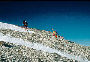
Mount Churchill was first climbed in 1951 by R. Gates and J. Lindberg, but the peak was merely an unnamed satellite of Mount Bona at the time.The mountain was named in 1965 by the Alaska State Legislature for English statesman Winston Churchill
Winston Churchill
Sir Winston Leonard Spencer-Churchill, was a predominantly Conservative British politician and statesman known for his leadership of the United Kingdom during the Second World War. He is widely regarded as one of the greatest wartime leaders of the century and served as Prime Minister twice...
.
In terms of elevation, it is a major North American peak, at well over 15,000 feet; however, in terms of topographic prominence
Topographic prominence
In topography, prominence, also known as autonomous height, relative height, shoulder drop , or prime factor , categorizes the height of the mountain's or hill's summit by the elevation between it and the lowest contour line encircling it and no higher summit...
or isolation, it is less significant, with less than a 1200 foot drop from its summit to the saddle
Mountain pass
A mountain pass is a route through a mountain range or over a ridge. If following the lowest possible route, a pass is locally the highest point on that route...
with Bona. Churchill also lies on the northern, gentler side of the Bona massif
Massif
In geology, a massif is a section of a planet's crust that is demarcated by faults or flexures. In the movement of the crust, a massif tends to retain its internal structure while being displaced as a whole...
, making it a less visually spectacular peak than some of the lower outliers of Bona such as University Peak or Aello Peak
Aello Peak
Aello Peak is the highest peak of a mountain group called The Twaharpies, just west of Mount Bona in the Saint Elias Range of Alaska. While not highly significant in terms of prominence or isolation , it has a tremendous south face. From the summit, this face drops in just over , and in less than...
. The current standard climbing route is the South Ridge, usually as part of a climb of Mount Bona from the east starting from a ski-equipped bush plane
Bush plane
A bush airplane is a general aviation aircraft serving remote, undeveloped areas of a country, usually the African bush, Alaskan and Canadian tundra or the Australian Outback...
landing at around 10,000 ft (3,000 m) on the Klutlan Glacier
Klutlan Glacier
Klutlan Glacier is a long glacier in the U.S. state of Alaska. It is located southwest of Mount Natazhat and flows east across the border with Canada, then north to form the headwaters of the Klutlan River. Its native name was reported in 1891 by C. W. Hayes of the United States Geological Survey....
.