
Mexican Federal Highway 1
Encyclopedia

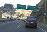
_250m.jpg)
Baja California Peninsula
The Baja California peninsula , is a peninsula in northwestern Mexico. Its land mass separates the Pacific Ocean from the Gulf of California. The Peninsula extends from Mexicali, Baja California in the north to Cabo San Lucas, Baja California Sur in the south.The total area of the Baja California...
from Cabo San Lucas
Cabo San Lucas
Cabo San Lucas , commonly called Cabo, is a city at the southern tip of the Baja California peninsula, in the municipality of Los Cabos in the Mexican state of Baja California Sur. As of the 2010 census, the population was 68,463 people...
(BCS
Baja California Sur
Baja California Sur , is one of the 31 states which, with the Federal District, comprise the 32 Federal Entities of Mexico. Before becoming a state on October 8, 1974, the area was known as the South Territory of Baja California. It has an area of , or 3.57% of the land mass of Mexico and comprises...
), at the southern end to Tijuana
Tijuana
Tijuana is the largest city on the Baja California Peninsula and center of the Tijuana metropolitan area, part of the international San Diego–Tijuana metropolitan area. An industrial and financial center of Mexico, Tijuana exerts a strong influence on economics, education, culture, art, and politics...
(BC
Baja California
Baja California officially Estado Libre y Soberano de Baja California is one of the 31 states which, with the Federal District, comprise the 32 Federal Entities of Mexico. It is both the northernmost and westernmost state of Mexico. Before becoming a state in 1953, the area was known as the North...
) in the north. The road turns into Interstate 5 at the international border with the United States
United States
The United States of America is a federal constitutional republic comprising fifty states and a federal district...
south of San Ysidro, California.
Highway 1 is often called the Carretera Transpeninsular or Transpeninsular Highway and runs a length of 1711 km (1,063.2 mi) from Tijuana to Cabo San Lucas. Most of its length is two lanes. Construction was completed in 1973.
Route description
The road begins in the border city of TijuanaTijuana
Tijuana is the largest city on the Baja California Peninsula and center of the Tijuana metropolitan area, part of the international San Diego–Tijuana metropolitan area. An industrial and financial center of Mexico, Tijuana exerts a strong influence on economics, education, culture, art, and politics...
. It is bypassed from here to Ensenada
Ensenada, Baja California
Ensenada is a coastal city in Mexico and the third-largest city in Baja California. It is located south of San Diego on the Baja California Peninsula. The city is locally referred to as La Cenicienta del Pacífico, or, The Cinderella of the Pacific...
by Mexican Federal Highway 1D
Mexican Federal Highway 1D
Mexico's Federal Highway 1D is a mostly tolled federal highway in the state of Baja California. It is precisely long. Between Avenida Mar Báltico and the northern terminus, it is locally known as Segunda Benito Juárez. The rest of Highway 1D is locally known as tolled Autopista Escenica...
, a toll road. Then, the road continues south past Maneadero. Much of it follows or passes near the route of Portola
Gaspar de Portolà
Gaspar de Portolà i Rovira was a soldier, governor of Baja and Alta California , explorer and founder of San Diego and Monterey. He was born in Os de Balaguer, province of Lleida, in Catalonia, Spain, of Catalan nobility. Don Gaspar served as a soldier in the Spanish army in Italy and Portugal...
's march from Loreto
Loreto, Baja California Sur
Loreto was the first Spanish settlement on the Baja California Peninsula. It served as the capital of Las Californias from 1697 to 1777, and is the current seat of the municipality of Loreto in the Mexican state of Baja California Sur...
to San Diego during the foundation of Spanish missions in Baja California
Spanish missions in Baja California
The Spanish Missions in Baja California comprise a series of religious outposts established by Spanish Catholic religious orders, the Jesuits, the Franciscans and the Dominicans, between 1683 and 1834 to spread the Christian doctrine among the local natives...
.
Federal highways in Mexico are generally designated with even numbers for east–west routes and odd numbers for north–south routes. Numerical designations usually ascend southward away from the U.S. border for east–west routes, and usually ascend eastward away from the Pacific Ocean for North-South routes. Therefore, Federal Highway 1, due to its proximity to the Pacific Ocean, has the lowest possible odd number designation, and intersecting East-West federal routes usually conform to this pattern.
Kilometer markers track the distance along Mex 1 through Baja California Norte in four segments. The first of these is the 109 km length from Tijuana to Ensenada, which is known informally as Mex 1 Libre to distinguish it from the parallel toll road. The second portion of signed road runs 196 km from Ensenada to San Quintín. The third segment comprises 128 km from San Quintín to Bahía de los Ángeles. A final segment stretches 128 km from Bahía de los Ángeles to the border of Baja California Sur. The total length of Mexican Federal Highway 1 in Baja California Norte is 713 km (443 mi).
Continuing into the southern of the two Mexican states that comprise the Baja California peninsula, Guerrero Negro is the nearest community to the point where Mex 1 meets the 28th parallel north
28th parallel north
The 28th parallel north is a circle of latitude that is 28 degrees north of the Earth's equatorial plane. It crosses Africa, Asia, the Pacific Ocean, North America and the Atlantic Ocean....
. Afterward Mex 1 leaves the western coast and crosses to the eastern coast at Santa Rosalía. The route continues southward past Puerto Escondido and gains altitude at Sierra de la Giganta, then veers southwest and through agricultural lands and Ciudad Constitución. After crossing a desert the route encounters La Paz
La Paz, Baja California Sur
La Paz is the capital city of the Mexican state of Baja California Sur and an important regional commercial center. The city had a 2010 census population of 215,178 persons, but its metropolitan population is somewhat larger because of surrounding towns like el Centenario, el Zacatal and San Pedro...
on the eastern coast. The route continues along the gulf side of the peninsula through San José del Cabo to its terminus at Cabo San Lucas
Cabo San Lucas
Cabo San Lucas , commonly called Cabo, is a city at the southern tip of the Baja California peninsula, in the municipality of Los Cabos in the Mexican state of Baja California Sur. As of the 2010 census, the population was 68,463 people...
.
After crossing state lines the kilometer markers progress in the opposite direction. Baja California Norte markers count from north to south, but Baja California Sur markers count from south to north. So in opposite order from the road signage, a progressive route southward would span 221 km from Guerrero Negro to Santa Rosalía, 197 km from Santa Rosalía to Loreto, 120 km from Loreto to Ciudad Insurgentes, 240 km from Ciudad Insurgentes to La Paz, and 224 km from La Paz to Cabo San Lucas.
Baja California
- 32°32′34.09"N 117°01′47.57"W United States–Mexico borderUnited States–Mexico borderThe United States–Mexico border is the international border between the United States and Mexico. It runs from Imperial Beach, California, and Tijuana, Baja California, in the west to Matamoros, Tamaulipas, and Brownsville, Texas, in the east, and traverses a variety of terrains, ranging from major...
(TijuanaTijuanaTijuana is the largest city on the Baja California Peninsula and center of the Tijuana metropolitan area, part of the international San Diego–Tijuana metropolitan area. An industrial and financial center of Mexico, Tijuana exerts a strong influence on economics, education, culture, art, and politics...
) - 32°22′18.57"N 117°03′36.24"W Playas de RosaritoPlayas de RosaritoRosarito Beach , is a coastal resort city in the Mexican state of Baja California located approximately 35 minutes south of the U.S. border in Rosarito Beach Municipality. Its beaches and dance clubs are a popular destination for young people from the United States during the Memorial Day and Labor...
- 31°52′12.01"N 116°37′12.00"W EnsenadaEnsenada, Baja CaliforniaEnsenada is a coastal city in Mexico and the third-largest city in Baja California. It is located south of San Diego on the Baja California Peninsula. The city is locally referred to as La Cenicienta del Pacífico, or, The Cinderella of the Pacific...
- 30°31′26.78"N 115°55′51.78"W San QuintínSan Quintín, Baja CaliforniaSan Quintín is a coastal town on the west coast of the Mexican state of Baja California, in the municipio of Ensenada. San Quintín has beautiful beaches and several places for tourists to stay. Tourists can enjoy fishing, camping, bird watching, surfing, and clam digging...
- 30°03′13.01"N 115°44′08.72"W El RosarioEl Rosario, Baja CaliforniaEl Rosario is a small town on the west coast of the state of Baja California on Highway 1, 61 kmsouth of San Quintín and 119 km north of Cataviña. The census of 2010 reported a population of 1,704 inhabitants...
- 29°43′42.71"N 114°43′06.83"W CataviñaCataviña, Baja CaliforniaCataviña, Baja California is a small town on Highway 1 in the Mexican state of Baja California. It is located 118 km south of El Rosario and 106 km north of the junction with the road to Bahía de los Ángeles....
- 29°02′43.12"N 114°09′10.24"W Highway 12Mexican Federal Highway 12Federal Highway 12 is a Federal Highway of Mexico. Federal Highway 12 travels from Mexican Federal Highway 1 in southern Baja California to Bahía de los Ángeles and its total length is 68 km ....
to Bahía de los ÁngelesBahía de los Ángeles' is a coastal bay on the Sea of Cortez, located along the eastern shore of the Baja California Peninsula in the state of Baja California, Mexico... - 28°55′43.08"N 114°09′24.96"W Punta PrietaPunta Prieta, Baja CaliforniaPunta Prieta is a desert town in the Mexican state of Baja California, on Federal Highway 1.-Parador Punta Prieta:A few kilometers north along Highway 1 is Parador Punta Prieta, where Highway 12 takes off to the east towards Bahía de los Ángeles and Punta La Gringa.-Notes:There are at least two...
- 28°38′19.04"N 114°01′16.34"W El RosaritoEl Rosarito, Baja CaliforniaEl Rosarito, Baja California is a small town in the Mexican state of Baja California, on Highway 1 between Cataviña to the north and Villa Jesús María to the south. It is part of Ensenada Municipality.-References:*...
- 28°16′51.93"N 113°59′58.58"W Villa Jesús MaríaVilla Jesús María, Baja CaliforniaVilla Jesús María, Baja California is a small town in Baja California on Highway 1 between El Rosarito to the north and Guerrero Negro to the south.It is located toward the southern end of the Sebastián Vizcaíno Bay, due east of Isla de Cedros.-References:*...
and road to Sebastián Vizcaíno BaySebastián Vizcaíno BaySebastián Vizcaíno Bay is a bay along the west coast of the Baja California Peninsula in Mexico. It is part of the El Vizcaíno Biosphere Reserve. It lies off the Pacific coast of Ensenada Municipality and Mulegé Municipality.... - 28°00′00.00"N 114°00′43.88"W State Line (28th parallel northCircle of latitudeA circle of latitude, on the Earth, is an imaginary east-west circle connecting all locations that share a given latitude...
)
Baja California Sur
- 27°58′02.14"N 114°00′51.85"W Guerrero NegroGuerrero NegroGuerrero Negro is the largest town located in the municipality of Mulegé in the Mexican state of Baja California Sur . It had a population of 13,054 in the 2010 census. Guerrero Negro is served by Guerrero Negro Airport.- Whale Festival :...
- 27°18′05.50"N 112°52′44.30"W San IgnacioSan Ignacio, Baja California SurSan Ignacio is a palm oasis town in the Mexican state of Baja California Sur, located between Guerrero Negro and Santa Rosalía. The town had a 2010 census population of 667 inhabitants and grew at the site of the Cochimí settlement of Kadakaamán and the Jesuit Mission San Ignacio founded in 1728 by...
, road to San Ignacio LagoonSan Ignacio LagoonSan Ignacio Lagoon is a lagoon located Mulegé Municipality in the Mexican province of Baja California Sur, from San Ignacio, Mexico and Highway 1... - 27°20′04.64"N 112°15′55.38"W Santa RosalíaSanta Rosalía, Baja California SurSanta Rosalía is a city located on the Baja California peninsula, in the northern part of the Mexican state of Baja California Sur. It was named after Saint Rosalia, although the reason for the name is not quite clear since the Misión de Santa Rosalía is not located by the town, but rather in...
- 26°53′33.27"N 111°58′38.71"W MulegéMulegéMulegé is an oasis town in the Mexican state of Baja California Sur, situated at the mouth of the Río de Santa Rosalía. It is the fourth-largest community in Mulegé Municipality...
- 26°00′27.09"N 111°21′02.07"W LoretoLoreto, Baja California SurLoreto was the first Spanish settlement on the Baja California Peninsula. It served as the capital of Las Californias from 1697 to 1777, and is the current seat of the municipality of Loreto in the Mexican state of Baja California Sur...
- 25°15′13.98"N 111°46′31.60"W Ciudad InsurgentesCiudad InsurgentesCiudad Insurgentes is a city in the Mexican state of Baja California Sur. It is the second-largest community in the municipality of Comondú and is located 250 kilometers north of La Paz, Baja California Sur, and 177 kilometers south of Loreto, Baja California Sur. Ciudad Insurgentes's population...
- 25°01′30.66"N 111°40′11.23"W Ciudad ConstituciónCiudad ConstituciónCiudad Constitución is a city in the Mexican state of Baja California Sur. It is the seat of the municipality of Comondú and is located 210 kilometers north of La Paz, Baja California Sur, and 147 kilometers south of Loreto, Baja California Sur. Ciudad Constitución's population was 40,935...
- 24°08′26.60"N 110°18′42.46"W La PazLa Paz, Baja California SurLa Paz is the capital city of the Mexican state of Baja California Sur and an important regional commercial center. The city had a 2010 census population of 215,178 persons, but its metropolitan population is somewhat larger because of surrounding towns like el Centenario, el Zacatal and San Pedro...
- 23°55′28.89"N 110°15′53.21"W San PedroSan Pedro, Baja California SurSan Pedro is a small town in the Sierra de la Laguna Mountains in La Paz Municipality near the southern end of Baja California Sur. It is located a few miles north of the junction of Highway 1 and Highway 19...
- 23°53′57.76"N 110°15′29.31"W Highway 19Mexican Federal Highway 19Mexican federal highway No. 19 runs along the Pacific coast of Baja California Peninsula from Cabo San Lucas up to Todos Santos where it turns inland and eventually joins Mexican Federal Highway 1 a few miles south of San Pedro, Baja California Sur.-Towns and landmarks:* San Pedro* Todos Santos*...
to Todos SantosTodos Santos, Baja California SurTodos Santos is a small coastal town at the foothills of the Sierra de la Laguna Mountains, on the Pacific coast side of the Baja California Peninsula, about an hour's drive north of Cabo San Lucas on Highway 19 and an hour's drive southwest from La Paz. Todos Santos is located very near the Tropic...
& El PescaderoEl Pescadero, Baja California SurPescadero is a small village in the municipality of La Paz in the Mexican state of Baja California Sur.It is located at km 64 on Federal Highway 19 on the Pacific Ocean about 8 kilometers South of Todos Santos which is about a one hour drive north of Cabo San Lucas...
; shortcut to Cabo San LucasCabo San LucasCabo San Lucas , commonly called Cabo, is a city at the southern tip of the Baja California peninsula, in the municipality of Los Cabos in the Mexican state of Baja California Sur. As of the 2010 census, the population was 68,463 people... - 23°48′33.82"N 110°03′26.66"W San AntonioSan Antonio, Baja California SurSan Antonio de la Sierra is a small town in La Paz Municipality in the Mexican state of Baja California Sur, located near El Triunfo on Federal Highway 1. It had a 2010 census population of 463 inhabitants, and is situated at 400 meters elevation above sea level.-Information:Adm...
- 23°32′30.37"N 109°40′40.49"W SantiagoSantiago, Baja California SurSantiago is a small town in Los Cabos Municipality in Baja California Sur, Mexico, located on Mexico's Highway 1, about an hour's drive north of San José del Cabo....
- 23°09′21.30"N 109°42′29.64"W Los Cabos International AirportLos Cabos International AirportLos Cabos International Airport is the seventh busiest airport in Mexico, located at San José del Cabo, Baja California Sur, Mexico. The airport serves Los Cabos area: San José del Cabo and Cabo San Lucas. This airport has three terminals with 4 concourses...
(at airport exit) - 23°02′40.35"N 109°42′21.06"W San José del CaboSan José del CaboThe city of San José del Cabo is located in Baja California Sur Mexico and is the seat of the municipality of Los Cabos at the south end of the Baja California peninsula. In the 2010 census it had a population of 69,788. Together with neighboring Cabo San Lucas it forms a major tourist destination...
- as Boulevard Mauricio Castro - 22°57′54.44"N 109°47′55.31"W Los Cabos CorridorLos Cabos CorridorThe Los Cabos Corridor in Mexico, is an area on the southern coast of the Baja California Peninsula, facing the Gulf of California on the Transpeninsular Highway between San José del Cabo and Cabo San Lucas. It stretches about 30 kilometers along the highway and addresses within this area are...
(at transpeninsular monument) - 22°52′58.15"N 109°54′52.77"W Cabo San LucasCabo San LucasCabo San Lucas , commonly called Cabo, is a city at the southern tip of the Baja California peninsula, in the municipality of Los Cabos in the Mexican state of Baja California Sur. As of the 2010 census, the population was 68,463 people...
- as Boulevard Lázaro Cárdenas