

Mendip
Encyclopedia
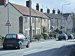
Mendip is a local government district
of Somerset
in England
. The Mendip district covers a largely rural area of 285 square miles (738 km²) ranging from the Mendip Hills
through on to the Somerset Levels
. It has a population of approximately 110,000. The administrative centre of the district is Shepton Mallet
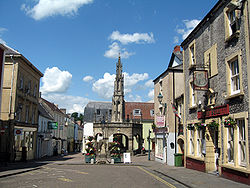
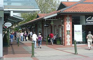
but the largest town (three times larger than Shepton Mallet) is Frome
, pronounced "Froome" and spelt that way until about 1890.
The district was formed on 1 April 1974 under the Local Government Act 1972
, by a merger of the municipal borough
s of Glastonbury
and Wells
, along with Frome, Shepton Mallet, Street
urban district
s, and Frome Rural District
, Shepton Mallet Rural District
, Wells Rural District
, and part of Axbridge Rural District
and part of Clutton Rural District.
An alternative explanation is that the name is cognate with Mened (Welsh mynydd), a Brythonic term for upland moorland. The suffix may be a contraction of the Anglo-Saxon
hop, meaning a valley. Possible further meanings have been identified. The first is 'the stone pit' from the Celtic
meyn and dyppa in reference to the collapsed cave systems of Cheddar
. The second is 'Mighty and Awesome' from the Old English
moen and deop.
Yet another explanation is that Mendip is cognate with the Basque word 'mendi' meaning mountain. This would support the theory of a Basque-like language in use in the British isles before the emergence of the Celtic languages. This is supported by recent DNA evidence that shows exceptionally strong genetic links between the British Celtic people and the Basques.
Frome, Glastonbury and Shepton Mallet are the only towns in the district, as Wells has city status and Street has maintained its status as a village despite a population in excess of 11,000.
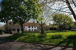
Other villages and hamlets include:
) in the five non-metropolitan districts of the county are operated by Somerset County Council
.
For a full list of schools see: List of schools in Somerset
----
Non-metropolitan district
Non-metropolitan districts, or colloquially shire districts, are a type of local government district in England. As created, they are sub-divisions of non-metropolitan counties in a so-called "two-tier" arrangement...
of Somerset
Somerset
The ceremonial and non-metropolitan county of Somerset in South West England borders Bristol and Gloucestershire to the north, Wiltshire to the east, Dorset to the south-east, and Devon to the south-west. It is partly bounded to the north and west by the Bristol Channel and the estuary of the...
in England
England
England is a country that is part of the United Kingdom. It shares land borders with Scotland to the north and Wales to the west; the Irish Sea is to the north west, the Celtic Sea to the south west, with the North Sea to the east and the English Channel to the south separating it from continental...
. The Mendip district covers a largely rural area of 285 square miles (738 km²) ranging from the Mendip Hills
Mendip Hills
The Mendip Hills is a range of limestone hills to the south of Bristol and Bath in Somerset, England. Running east to west between Weston-super-Mare and Frome, the hills overlook the Somerset Levels to the south and the Avon Valley to the north...
through on to the Somerset Levels
Somerset Levels
The Somerset Levels, or the Somerset Levels and Moors as they are less commonly but more correctly known, is a sparsely populated coastal plain and wetland area of central Somerset, South West England, between the Quantock and Mendip Hills...
. It has a population of approximately 110,000. The administrative centre of the district is Shepton Mallet
Shepton Mallet
Shepton Mallet is a small rural town and civil parish in the Mendip district of Somerset in South West England. Situated approximately south of Bristol and east of Wells, the town is estimated to have a population of 9,700. It contains the administrative headquarters of Mendip District Council...
but the largest town (three times larger than Shepton Mallet) is Frome
Frome
Frome is a town and civil parish in northeast Somerset, England. Located at the eastern end of the Mendip Hills, the town is built on uneven high ground, and centres around the River Frome. The town is approximately south of Bath, east of the county town, Taunton and west of London. In the 2001...
, pronounced "Froome" and spelt that way until about 1890.
The district was formed on 1 April 1974 under the Local Government Act 1972
Local Government Act 1972
The Local Government Act 1972 is an Act of Parliament in the United Kingdom that reformed local government in England and Wales on 1 April 1974....
, by a merger of the municipal borough
Municipal borough
Municipal boroughs were a type of local government district which existed in England and Wales between 1835 and 1974, in Northern Ireland from 1840 to 1973 and in the Republic of Ireland from 1840 to 2002...
s of Glastonbury
Glastonbury
Glastonbury is a small town in Somerset, England, situated at a dry point on the low lying Somerset Levels, south of Bristol. The town, which is in the Mendip district, had a population of 8,784 in the 2001 census...
and Wells
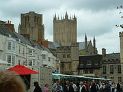
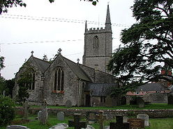
Wells
Wells is a cathedral city and civil parish in the Mendip district of Somerset, England, on the southern edge of the Mendip Hills. Although the population recorded in the 2001 census is 10,406, it has had city status since 1205...
, along with Frome, Shepton Mallet, Street
Street, Somerset
Street is a small village and civil parish in the county of Somerset, England. It is situated on a dry spot in the Somerset Levels, at the end of the Polden Hills, south-west of Glastonbury. The 2001 census records the village as having a population of 11,066...
urban district
Urban district
In the England, Wales and Ireland, an urban district was a type of local government district that covered an urbanised area. Urban districts had an elected Urban District Council , which shared local government responsibilities with a county council....
s, and Frome Rural District
Frome Rural District
Frome was a rural district in Somerset, England, from 1894 to 1974.It was created in 1894 under the Local Government Act 1894.In 1974 it was abolished under the Local Government Act 1972 when it became part of Mendip....
, Shepton Mallet Rural District
Shepton Mallet Rural District
Shepton Mallet was a rural district in Somerset, England, from 1894 to 1974.It was created in 1894 under the Local Government Act 1894.In 1974 it was abolished under the Local Government Act 1972 when it became part of the Mendip district....
, Wells Rural District
Wells Rural District
Wells was a rural district in Somerset, England, from 1894 to 1974.It was created in 1894 under the Local Government Act 1894.In 1974 it was abolished under the Local Government Act 1972 when it became part of Mendip district....
, and part of Axbridge Rural District
Axbridge Rural District
Axbridge was a rural district in Somerset, England, from 1894 to 1974. It was named after the town of Axbridge.It was created in 1894 under the Local Government Act 1894 as a successor to the Axbridge rural sanitary district....
and part of Clutton Rural District.
Toponymy
Several explanations for the name "Mendip" have been suggested. Its earliest known form is Mendepe in 1185. One suggestion is that it is derived from the medieval term "Myne-deepes". However, A D Mills derives its meaning from Celtic monith, meaning mountain or hill, with an uncertain second element, perhaps Old English yppe in the sense of upland, or plateau.An alternative explanation is that the name is cognate with Mened (Welsh mynydd), a Brythonic term for upland moorland. The suffix may be a contraction of the Anglo-Saxon
Old English language
Old English or Anglo-Saxon is an early form of the English language that was spoken and written by the Anglo-Saxons and their descendants in parts of what are now England and southeastern Scotland between at least the mid-5th century and the mid-12th century...
hop, meaning a valley. Possible further meanings have been identified. The first is 'the stone pit' from the Celtic
Celtic languages
The Celtic languages are descended from Proto-Celtic, or "Common Celtic"; a branch of the greater Indo-European language family...
meyn and dyppa in reference to the collapsed cave systems of Cheddar
Cheddar
Cheddar is a large village and civil parish in the Sedgemoor district of the English county of Somerset. It is situated on the southern edge of the Mendip Hills, north-west of Wells. The civil parish includes the hamlets of Nyland and Bradley Cross...
. The second is 'Mighty and Awesome' from the Old English
Old English language
Old English or Anglo-Saxon is an early form of the English language that was spoken and written by the Anglo-Saxons and their descendants in parts of what are now England and southeastern Scotland between at least the mid-5th century and the mid-12th century...
moen and deop.
Yet another explanation is that Mendip is cognate with the Basque word 'mendi' meaning mountain. This would support the theory of a Basque-like language in use in the British isles before the emergence of the Celtic languages. This is supported by recent DNA evidence that shows exceptionally strong genetic links between the British Celtic people and the Basques.
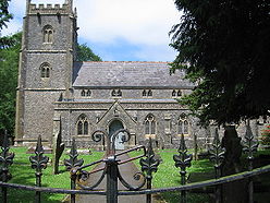
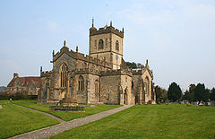
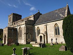
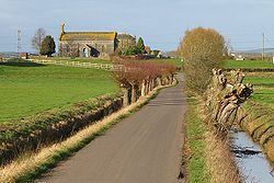
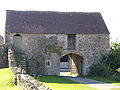
Settlements
The five main settlements in Mendip are:- FromeFromeFrome is a town and civil parish in northeast Somerset, England. Located at the eastern end of the Mendip Hills, the town is built on uneven high ground, and centres around the River Frome. The town is approximately south of Bath, east of the county town, Taunton and west of London. In the 2001...
- GlastonburyGlastonburyGlastonbury is a small town in Somerset, England, situated at a dry point on the low lying Somerset Levels, south of Bristol. The town, which is in the Mendip district, had a population of 8,784 in the 2001 census...
- Shepton MalletShepton MalletShepton Mallet is a small rural town and civil parish in the Mendip district of Somerset in South West England. Situated approximately south of Bristol and east of Wells, the town is estimated to have a population of 9,700. It contains the administrative headquarters of Mendip District Council...
- StreetStreet, SomersetStreet is a small village and civil parish in the county of Somerset, England. It is situated on a dry spot in the Somerset Levels, at the end of the Polden Hills, south-west of Glastonbury. The 2001 census records the village as having a population of 11,066...
- WellsWellsWells is a cathedral city and civil parish in the Mendip district of Somerset, England, on the southern edge of the Mendip Hills. Although the population recorded in the 2001 census is 10,406, it has had city status since 1205...
Frome, Glastonbury and Shepton Mallet are the only towns in the district, as Wells has city status and Street has maintained its status as a village despite a population in excess of 11,000.
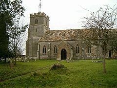
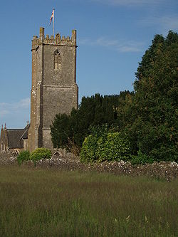
Other villages and hamlets include:
- AshwickAshwickAshwick is a village in the Mendip district of Somerset, England, about three miles north of Shepton Mallet and seven miles east from Wells. It has also been a civil parish since 1826...
- BaltonsboroughBaltonsboroughBaltonsborough is a village and civil parish in the Mendip district of Somerset, England. According to the 2001 census it had a population of 873. Apart from Baltonsborough village, the parish also contains the hamlets of Ham Street, Catsham and Southwood....
- BatcombeBatcombe, SomersetBatcombe is a village and civil parish in the Mendip District of Somerset, England, situated in the steep valley of the River Alham five miles south-east of Shepton Mallet. The parish has a population of 379...
- BeckingtonBeckingtonBeckington is a village and civil parish in the Mendip district of Somerset, England, across the River Frome from Lullington about three miles north of Frome...
- BinegarBinegarBinegar is a small village and civil parish in Somerset, England. It is located on the A37, east of Wells, between Shepton Mallet and Chilcompton. Its population in 2001 was 328.-History:...
- Bleadney - Bowlish - Buckland DinhamBuckland DinhamBuckland Dinham is a small village near Frome in Somerset, England. The village has a population of 379. The village's main industry is farming , but the village is also a dormitory village for the nearby cities of Bath and Bristol.-History:...
- Burcott - ButleighButleighButleigh is a small village and civil parish, located in Somerset. The nearest village to it is Barton St David, and it is located a short distance from Glastonbury and Street...
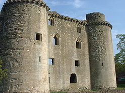
- Butleigh Wootton - Chantry - CharterhouseCharterhouse, SomersetCharterhouse, also known as Charterhouse-on-Mendip, is a hamlet in the Mendip Hills Area of Outstanding Natural Beauty in the English county of Somerset...
- Chelynch - Chesterblake - Chewton MendipChewton MendipChewton Mendip is a village and civil parish in the Mendip District of Somerset, England. It is situated north of Wells, south of Bristol on the Mendip Hills and is the source of the River Chew. The parish includes the hamlet of Bathway.- History :...
- ChilcomptonChilcomptonChilcompton is a civil parish and village in Somerset, England, situated in the Mendip Hills two miles south of Midsomer Norton and 2.5 miles south-west of Westfield, close to the A37 .-History:...
- ColefordColeford, SomersetColeford is a village and civil parish in Somerset, England, situated on the Mells River in the Mendip Hills five miles west of Frome. The village has a population of 2,350.-History:...
- Coxley - CranmoreCranmore, SomersetCranmore is a village and civil parish east of Shepton Mallet, in the Mendip district of Somerset, England. The parish includes the hamlets of Waterlip, East Cranmore and Dean where Dean farmhouse dates from the 17th century, as does The Old Smithy, just off the A361 which was originally two...
- CroscombeCroscombeCroscombe is a village and civil parish west of Shepton Mallet and from Wells, in the Mendip district of Somerset, England. It is situated on the A371 road in the valley of the River Sheppey.... - Dean - DinderDinderDinder is a small village 2½ miles west of Shepton Mallet, and 2 miles east of Wells in Somerset. It falls within the civil parish of St Cuthbert Out.The river Sheppey runs alongside the main street of the village....
- DitcheatDitcheatDitcheat is a village and civil parish south of Shepton Mallet, and north-west of Castle Cary, in the Mendip district of Somerset, England. The parish of Ditcheat incorporates three hamlets: Wraxall, Alhampton and Sutton.-History:...
- DoultingDoultingDoulting is a village and civil parish east of Shepton Mallet, on the A361, in the Mendip district of Somerset, England.-History:The parish of Doulting was part of the Whitstone Hundred....
- DraycottDraycott, SomersetDraycott is a small village in Somerset, England, neighbouring the village of Cheddar on the southern edge of the Mendip Hills Area of Outstanding Natural Beauty...
- Dulcote - East Lydford - East PennardEast PennardEast Pennard is a village and civil parish north west of Castle Cary, and south of Shepton Mallet, in the Mendip district of Somerset, England. It has a population of 343...
- Easton - EmboroughEmboroughEmborough is a village and civil parish north of Shepton Mallet, and north east of Wells, in the Mendip district of Somerset, England. It adjoins the parish of Ston Easton.-History:The name Emborough means smooth hill....
- EvercreechEvercreechEvercreech is a village and civil parish south east of Shepton Mallet, and north east of Castle Cary, in the Mendip district of Somerset, England... - Farleigh HungerfordFarleigh HungerfordFarleigh Hungerford is a village within the civil parish of Norton St Philip in Somerset, England, 9 miles southeast of Bath, 3½ miles west of Trowbridge on A366, in the valley of the River Frome....
- Faulkland - GodneyGodneyGodney is a village and civil parish near Glastonbury on the River Sheppey on the Somerset Levels in the Mendip district of Somerset, England.-Governance:...
- Great ElmGreat ElmGreat Elm is a village and civil parish between Mells and Frome in the Mendip district of Somerset, England. The parish includes the hamlet of Hapsford.-History:...
- Green Ore - HentonWookeyWookey is a village and civil parish west of Wells, on the River Axe in the Mendip district of Somerset, England. Wookey is often confused with its sister village Wookey Hole which is perhaps best known today for the Wookey Hole Caves...
- Highbury - HolcombeHolcombe, SomersetHolcombe is a small village and civil parish in the Mendip local government district of Somerset, England. The parish contains the hamlets of Barlake and Edford...
- Hornblotton - HorringtonHorringtonHorrington is a collection of three small villages in the parish of St Cuthbert Out or east of Wells, Somerset, England.... - KilmersdonKilmersdonKilmersdon is a small village located in the north of Somerset between the towns of Radstock and Frome. The settlement is recorded in William I's Domesday book and dates back at least 1,000 years; though the core of the village dates from the mid nineteenth century.-History:The name Kilmersdon...
- Lamyatt - Leigh-on-MendipLeigh-on-MendipLeigh-on-Mendip or Leigh upon Mendip is a small village on the Mendip Hills in Somerset, England. It lies roughly equidistant from Frome, Radstock and Shepton Mallet at about from each town....
- Leighton - LittonLitton, SomersetLitton is a small village and civil parish between Chewton Mendip and West Harptree in the Mendip Hills, Somerset, England. The parish includes the hamlet of Sherborne. Very close to the village are the Litton Reservoirs.- History :...
- Lydford-on-FosseLydford-on-FosseLydford-on-Fosse is a village and civil parish in the Mendip district of Somerset, England. The parish includes the hamlet of East Lydford.-History:... - Maesbury - MeareMeareMeare is a village and civil parish north west of Glastonbury on the Somerset Levels, in the Mendip district of Somerset, England. The parish includes the village of Westhay.-History:...
- MellsMells, SomersetMells is a village and civil parish in Somerset, England, near the town of Frome.The parish includes the village of Vobster which had a coal mine of the same name on the Somerset coalfield and quarry, both of which are now disused. The old quarry is now used as a diving centre... - Nettlebridge - North WoottonNorth Wootton, SomersetNorth Wootton is a village and civil parish, on the River Redlake, south east of Wells, and south west of Shepton Mallet in the Mendip district of Somerset, England.The village is on the Monarch's Way long-distance footpath.-History:...
- Norton St PhilipNorton St PhilipNorton St Philip is a village in Somerset, England, located between the City of Bath and the town of Frome. The village is in the district of Mendip, and the parliamentary constituency of Somerton and Frome....
- NunneyNunneyNunney is a village and civil parish near Frome in the Mendip local government district within the English county of Somerset. The parish includes the hamlet of Holwell.The name of the village comes from Old English and means Nunna's island.... - OakhillOakhillOakhill, Somerset is a village located approximately north of Shepton Mallet between the A37 and the A367 . Oakhill is today is mainly a commuter village of in size, but it is more famous for its past activities which include its brewing....
- Oldford - PiltonPilton, SomersetPilton is a village and civil parish in Somerset, England, situated on the A361 road in the Mendip district, 3 miles south-west of Shepton Mallet and 6 miles east of Glastonbury. The village has a population of 935...
- Polsham - Prestleigh - PriddyPriddyPriddy is a village in Somerset, England in the Mendip Hills, close to East Harptree and north-west of Wells. It is in the local government district of Mendip....
- PyllePyllePylle is a village and civil parish south west of Shepton Mallet, and from Wells, in the Mendip district of Somerset, England. It has a population of 176... - Rode - Rodney StokeRodney StokeRodney Stoke is a small village and civil parish, located at , 5 miles north-west of Wells, in the English county of Somerset. The village is on the A371 between Draycott and Westbury-sub-Mendip....
- Southway - Standerwick - Ston EastonSton EastonSton Easton is a linear village and civil parish in the English county of Somerset. It is southwest of Bath and north of Shepton Mallet. It forms part of the Mendip district and lies along the A37 road south of the cities of Bristol and Bath and to the west of the town of Midsomer Norton...
- Stratton-on-the-FosseStratton-on-the-FosseStratton-on-the-Fosse is a village and civil parish located on the edge of the Mendip Hills, south-west of Westfield, north-east of Shepton Mallet, and from Frome, in Somerset, England. It has a population 1,045, and has a rural agricultural landscape, although it was part of the once-thriving...
- Stoke St MichaelStoke St MichaelStoke St Michael is a village and civil parish on the Mendip Hills north east of Shepton Mallet, and west of Frome, in the Mendip district of Somerset, England.-History:...
- Stoney Stratton - Thrupe - TrudoxhillTrudoxhillTrudoxhill is a village and civil parish near Nunney in the Mendip district of Somerset, England.-History:The name Trudoxhill comes from the Old English treow meaning tree, dox for dark and hyll for hill....
- Upton NobleUpton NobleUpton Noble is a village and civil parish on the River Frome. It is roughly north-east of Bruton, and from Frome town centre, in the Mendip district of Somerset, England....
- Vobster
- WaltonWalton, SomersetWalton is a village and civil parish, on the Polden Hills, south west of Glastonbury in the Mendip district of Somerset, England. The parish includes the hamlet of Asney.-History:...
- WanstrowWanstrowWanstrow is a village and civil parish south west of Frome in the Mendip district of Somerset, England. The parish includes the village of Cloford.-History:The name of the village comes from the Old English and means Waendel's tree....
- Waterlip - West Compton - West Lydford - West PennardWest PennardWest Pennard is a village and civil parish east of Glastonbury in the Mendip district of Somerset, England. The parish includes the hamlets of Coxbridge and Woodlands.-History:...
- West Woodlands - Westbury-sub-MendipWestbury-sub-MendipWestbury-sub-Mendip is a village in Somerset, England, with a population of about 800, situated on the southern slopes of the Mendip Hills from Wells and Cheddar.The parish boundary is formed by the River Axe-History:...
- Westcombe - WesthayWesthayWesthay is a village in Somerset, England. It is situated in the parish of Meare, north west of Glastonbury on the Somerset Levels, in the Mendip district.The name means 'The west field that is enclosed by hedges' from the Old English west and haga...
- Whatley - WookeyWookeyWookey is a village and civil parish west of Wells, on the River Axe in the Mendip district of Somerset, England. Wookey is often confused with its sister village Wookey Hole which is perhaps best known today for the Wookey Hole Caves...
- Wookey HoleWookey HoleWookey Hole Caves is a show cave and tourist attraction in the village of Wookey Hole on the southern edge of the Mendip Hills near Wells in Somerset, England.Wookey Hole cave was formed through erosion of the limestone hills by the River Axe...
- Worminster - Witham FriaryWitham FriaryWitham Friary is a small village and civil parish located between the Somerset towns of Frome and Bruton. It is in the Cranborne Chase and West Wiltshire Downs Area of Outstanding Natural Beauty and the ancient Forest of Selwood.- History :... - Yarley
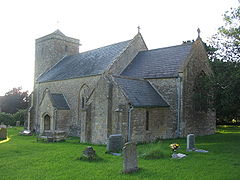
Parishes
| Image | Name | Status | Population | Former local authority | Coordinates | Refs |
|---|---|---|---|---|---|---|
 |
Ashwick Ashwick Ashwick is a village in the Mendip district of Somerset, England, about three miles north of Shepton Mallet and seven miles east from Wells. It has also been a civil parish since 1826... |
Civil parish | Shepton Mallet Rural District Shepton Mallet Rural District Shepton Mallet was a rural district in Somerset, England, from 1894 to 1974.It was created in 1894 under the Local Government Act 1894.In 1974 it was abolished under the Local Government Act 1972 when it became part of the Mendip district.... |
51.23°N 2.52°W | ||
 |
Baltonsborough Baltonsborough Baltonsborough is a village and civil parish in the Mendip district of Somerset, England. According to the 2001 census it had a population of 873. Apart from Baltonsborough village, the parish also contains the hamlets of Ham Street, Catsham and Southwood.... |
Civil parish | Wells Rural District Wells Rural District Wells was a rural district in Somerset, England, from 1894 to 1974.It was created in 1894 under the Local Government Act 1894.In 1974 it was abolished under the Local Government Act 1972 when it became part of Mendip district.... |
51.11°N 2.64°W | ||
| Batcombe Batcombe, Somerset Batcombe is a village and civil parish in the Mendip District of Somerset, England, situated in the steep valley of the River Alham five miles south-east of Shepton Mallet. The parish has a population of 379... |
Civil parish | Shepton Mallet Rural District Shepton Mallet Rural District Shepton Mallet was a rural district in Somerset, England, from 1894 to 1974.It was created in 1894 under the Local Government Act 1894.In 1974 it was abolished under the Local Government Act 1972 when it became part of the Mendip district.... |
51.15°N 2.44°W | |||
| Beckington Beckington Beckington is a village and civil parish in the Mendip district of Somerset, England, across the River Frome from Lullington about three miles north of Frome... |
Civil parish | Frome Rural District Frome Rural District Frome was a rural district in Somerset, England, from 1894 to 1974.It was created in 1894 under the Local Government Act 1894.In 1974 it was abolished under the Local Government Act 1972 when it became part of Mendip.... |
51.26°N 2.28°W | |||
 |
Berkley Berkley, Somerset Berkley is a village and civil parish in the Mendip district of Somerset, England. According to the 2001 census it had a population of 361. The village is north-east of Frome.-Governance:... |
Civil parish | Frome Rural District Frome Rural District Frome was a rural district in Somerset, England, from 1894 to 1974.It was created in 1894 under the Local Government Act 1894.In 1974 it was abolished under the Local Government Act 1972 when it became part of Mendip.... |
51.24°N 2.27°W | ||
 |
Binegar Binegar Binegar is a small village and civil parish in Somerset, England. It is located on the A37, east of Wells, between Shepton Mallet and Chilcompton. Its population in 2001 was 328.-History:... |
Civil parish | Shepton Mallet Rural District Shepton Mallet Rural District Shepton Mallet was a rural district in Somerset, England, from 1894 to 1974.It was created in 1894 under the Local Government Act 1894.In 1974 it was abolished under the Local Government Act 1972 when it became part of the Mendip district.... |
51.24°N 2.55°W | ||
 |
Buckland Dinham Buckland Dinham Buckland Dinham is a small village near Frome in Somerset, England. The village has a population of 379. The village's main industry is farming , but the village is also a dormitory village for the nearby cities of Bath and Bristol.-History:... |
Civil parish | Frome Rural District Frome Rural District Frome was a rural district in Somerset, England, from 1894 to 1974.It was created in 1894 under the Local Government Act 1894.In 1974 it was abolished under the Local Government Act 1972 when it became part of Mendip.... |
51.26°N 2.35°W | ||
 |
Butleigh Butleigh Butleigh is a small village and civil parish, located in Somerset. The nearest village to it is Barton St David, and it is located a short distance from Glastonbury and Street... |
Civil parish | Wells Rural District Wells Rural District Wells was a rural district in Somerset, England, from 1894 to 1974.It was created in 1894 under the Local Government Act 1894.In 1974 it was abolished under the Local Government Act 1972 when it became part of Mendip district.... |
51.09°N 2.68°W | ||
| Chewton Mendip Chewton Mendip Chewton Mendip is a village and civil parish in the Mendip District of Somerset, England. It is situated north of Wells, south of Bristol on the Mendip Hills and is the source of the River Chew. The parish includes the hamlet of Bathway.- History :... |
Civil parish | Wells Rural District Wells Rural District Wells was a rural district in Somerset, England, from 1894 to 1974.It was created in 1894 under the Local Government Act 1894.In 1974 it was abolished under the Local Government Act 1972 when it became part of Mendip district.... |
51.28°N 2.58°W | |||
 |
Chilcompton Chilcompton Chilcompton is a civil parish and village in Somerset, England, situated in the Mendip Hills two miles south of Midsomer Norton and 2.5 miles south-west of Westfield, close to the A37 .-History:... |
Civil parish | Clutton Rural District Clutton Rural District Clutton was a rural district in Somerset, England, from 1894 to 1974.It was created in 1894 under the Local Government Act 1894 as a successor to the rural sanitary district.In 1974 it was abolished under the Local Government Act 1972... |
51.27°N 2.50°W | ||
 |
Coleford Coleford, Somerset Coleford is a village and civil parish in Somerset, England, situated on the Mells River in the Mendip Hills five miles west of Frome. The village has a population of 2,350.-History:... |
Civil parish | Frome Rural District Frome Rural District Frome was a rural district in Somerset, England, from 1894 to 1974.It was created in 1894 under the Local Government Act 1894.In 1974 it was abolished under the Local Government Act 1972 when it became part of Mendip.... |
51.24°N 2.45°W | ||
 |
Cranmore Cranmore, Somerset Cranmore is a village and civil parish east of Shepton Mallet, in the Mendip district of Somerset, England. The parish includes the hamlets of Waterlip, East Cranmore and Dean where Dean farmhouse dates from the 17th century, as does The Old Smithy, just off the A361 which was originally two... |
Civil parish | Shepton Mallet Rural District Shepton Mallet Rural District Shepton Mallet was a rural district in Somerset, England, from 1894 to 1974.It was created in 1894 under the Local Government Act 1894.In 1974 it was abolished under the Local Government Act 1972 when it became part of the Mendip district.... |
51.19°N 2.48°W | ||
 |
Croscombe Croscombe Croscombe is a village and civil parish west of Shepton Mallet and from Wells, in the Mendip district of Somerset, England. It is situated on the A371 road in the valley of the River Sheppey.... |
Civil parish | Shepton Mallet Rural District Shepton Mallet Rural District Shepton Mallet was a rural district in Somerset, England, from 1894 to 1974.It was created in 1894 under the Local Government Act 1894.In 1974 it was abolished under the Local Government Act 1972 when it became part of the Mendip district.... |
51.20°N 2.58°W | ||
 |
Ditcheat Ditcheat Ditcheat is a village and civil parish south of Shepton Mallet, and north-west of Castle Cary, in the Mendip district of Somerset, England. The parish of Ditcheat incorporates three hamlets: Wraxall, Alhampton and Sutton.-History:... |
Civil parish | Shepton Mallet Rural District Shepton Mallet Rural District Shepton Mallet was a rural district in Somerset, England, from 1894 to 1974.It was created in 1894 under the Local Government Act 1894.In 1974 it was abolished under the Local Government Act 1972 when it became part of the Mendip district.... |
51.13°N 2.54°W | ||
 |
Doulting Doulting Doulting is a village and civil parish east of Shepton Mallet, on the A361, in the Mendip district of Somerset, England.-History:The parish of Doulting was part of the Whitstone Hundred.... |
Civil parish | Shepton Mallet Rural District Shepton Mallet Rural District Shepton Mallet was a rural district in Somerset, England, from 1894 to 1974.It was created in 1894 under the Local Government Act 1894.In 1974 it was abolished under the Local Government Act 1972 when it became part of the Mendip district.... |
51.19°N 2.51°W | ||
 |
Downhead Downhead Downhead is a village and civil parish close to Leigh-on-Mendip and north east of Shepton Mallet, in the Mendip district of Somerset, England. The parish includes the medieval settlement of Tadhill.-History:... |
Civil parish | Shepton Mallet Rural District Shepton Mallet Rural District Shepton Mallet was a rural district in Somerset, England, from 1894 to 1974.It was created in 1894 under the Local Government Act 1894.In 1974 it was abolished under the Local Government Act 1972 when it became part of the Mendip district.... |
51.21°N 2.44°W | ||
 |
East Pennard East Pennard East Pennard is a village and civil parish north west of Castle Cary, and south of Shepton Mallet, in the Mendip district of Somerset, England. It has a population of 343... |
Civil parish | Shepton Mallet Rural District Shepton Mallet Rural District Shepton Mallet was a rural district in Somerset, England, from 1894 to 1974.It was created in 1894 under the Local Government Act 1894.In 1974 it was abolished under the Local Government Act 1972 when it became part of the Mendip district.... |
51.14°N 2.62°W | ||
| Emborough Emborough Emborough is a village and civil parish north of Shepton Mallet, and north east of Wells, in the Mendip district of Somerset, England. It adjoins the parish of Ston Easton.-History:The name Emborough means smooth hill.... |
Civil parish | Shepton Mallet Rural District Shepton Mallet Rural District Shepton Mallet was a rural district in Somerset, England, from 1894 to 1974.It was created in 1894 under the Local Government Act 1894.In 1974 it was abolished under the Local Government Act 1972 when it became part of the Mendip district.... |
51.26°N 2.55°W | |||
| Evercreech Evercreech Evercreech is a village and civil parish south east of Shepton Mallet, and north east of Castle Cary, in the Mendip district of Somerset, England... |
Civil parish | Shepton Mallet Rural District Shepton Mallet Rural District Shepton Mallet was a rural district in Somerset, England, from 1894 to 1974.It was created in 1894 under the Local Government Act 1894.In 1974 it was abolished under the Local Government Act 1972 when it became part of the Mendip district.... |
51.14°N 2.51°W | |||
 |
Frome Frome Frome is a town and civil parish in northeast Somerset, England. Located at the eastern end of the Mendip Hills, the town is built on uneven high ground, and centres around the River Frome. The town is approximately south of Bath, east of the county town, Taunton and west of London. In the 2001... |
Town | Frome Rural District Frome Rural District Frome was a rural district in Somerset, England, from 1894 to 1974.It was created in 1894 under the Local Government Act 1894.In 1974 it was abolished under the Local Government Act 1972 when it became part of Mendip.... Frome Urban District Frome Frome is a town and civil parish in northeast Somerset, England. Located at the eastern end of the Mendip Hills, the town is built on uneven high ground, and centres around the River Frome. The town is approximately south of Bath, east of the county town, Taunton and west of London. In the 2001... |
51.23°N 2.32°W | ||
| Glastonbury Glastonbury Glastonbury is a small town in Somerset, England, situated at a dry point on the low lying Somerset Levels, south of Bristol. The town, which is in the Mendip district, had a population of 8,784 in the 2001 census... |
Town | Glastonbury Municipal Borough Glastonbury Glastonbury is a small town in Somerset, England, situated at a dry point on the low lying Somerset Levels, south of Bristol. The town, which is in the Mendip district, had a population of 8,784 in the 2001 census... |
51.15°N 2.71°W | |||
 |
Godney Godney Godney is a village and civil parish near Glastonbury on the River Sheppey on the Somerset Levels in the Mendip district of Somerset, England.-Governance:... |
Civil parish | Wells Rural District Wells Rural District Wells was a rural district in Somerset, England, from 1894 to 1974.It was created in 1894 under the Local Government Act 1894.In 1974 it was abolished under the Local Government Act 1972 when it became part of Mendip district.... |
51.18°N 2.74°W | ||
 |
Great Elm Great Elm Great Elm is a village and civil parish between Mells and Frome in the Mendip district of Somerset, England. The parish includes the hamlet of Hapsford.-History:... |
Civil parish | Frome Rural District Frome Rural District Frome was a rural district in Somerset, England, from 1894 to 1974.It was created in 1894 under the Local Government Act 1894.In 1974 it was abolished under the Local Government Act 1972 when it became part of Mendip.... |
51.24°N 2.36°W | ||
 |
Hemington Hemington, Somerset Hemington is a village and civil parish north west of Frome, in the Mendip district of Somerset, England. The parish includes the villages of Hardington, Faulkland and Foxcote.-History:... |
Civil parish | Frome Rural District Frome Rural District Frome was a rural district in Somerset, England, from 1894 to 1974.It was created in 1894 under the Local Government Act 1894.In 1974 it was abolished under the Local Government Act 1972 when it became part of Mendip.... |
51.28°N 2.39°W | ||
| Holcombe Holcombe, Somerset Holcombe is a small village and civil parish in the Mendip local government district of Somerset, England. The parish contains the hamlets of Barlake and Edford... |
Civil parish | Shepton Mallet Rural District Shepton Mallet Rural District Shepton Mallet was a rural district in Somerset, England, from 1894 to 1974.It was created in 1894 under the Local Government Act 1894.In 1974 it was abolished under the Local Government Act 1972 when it became part of the Mendip district.... |
51.24°N 2.46°W | < | ||
| Kilmersdon Kilmersdon Kilmersdon is a small village located in the north of Somerset between the towns of Radstock and Frome. The settlement is recorded in William I's Domesday book and dates back at least 1,000 years; though the core of the village dates from the mid nineteenth century.-History:The name Kilmersdon... |
Civil parish | Frome Rural District Frome Rural District Frome was a rural district in Somerset, England, from 1894 to 1974.It was created in 1894 under the Local Government Act 1894.In 1974 it was abolished under the Local Government Act 1972 when it became part of Mendip.... |
51.27°N 2.44°W | |||
 |
Lamyat Lamyat Lamyat is a civil parish in the Mendip District of Somerset, England. It lies south east of Shepton Mallet, north east of Castle Cary, and south of Evercreech, and is centered on the village of Lamyatt... |
Civil parish | Shepton Mallet Rural District Shepton Mallet Rural District Shepton Mallet was a rural district in Somerset, England, from 1894 to 1974.It was created in 1894 under the Local Government Act 1894.In 1974 it was abolished under the Local Government Act 1972 when it became part of the Mendip district.... |
51.12°N 2.49°W | ||
| Leigh on Mendip Leigh-on-Mendip Leigh-on-Mendip or Leigh upon Mendip is a small village on the Mendip Hills in Somerset, England. It lies roughly equidistant from Frome, Radstock and Shepton Mallet at about from each town.... |
Civil parish | Frome Rural District Frome Rural District Frome was a rural district in Somerset, England, from 1894 to 1974.It was created in 1894 under the Local Government Act 1894.In 1974 it was abolished under the Local Government Act 1972 when it became part of Mendip.... |
51.23°N 2.44°W | |||
| Litton Litton, Somerset Litton is a small village and civil parish between Chewton Mendip and West Harptree in the Mendip Hills, Somerset, England. The parish includes the hamlet of Sherborne. Very close to the village are the Litton Reservoirs.- History :... |
Civil parish | Clutton Rural District Clutton Rural District Clutton was a rural district in Somerset, England, from 1894 to 1974.It was created in 1894 under the Local Government Act 1894 as a successor to the rural sanitary district.In 1974 it was abolished under the Local Government Act 1972... |
51.29°N 2.58°W | |||
| Lullington Lullington, Somerset Lullington is a village and civil parish just across the Mells River from Beckington and north east of Frome, in the Mendip district of Somerset, England.The parish includes the hamlet of Laverton, where the Church of St... |
Civil parish | Frome Rural District Frome Rural District Frome was a rural district in Somerset, England, from 1894 to 1974.It was created in 1894 under the Local Government Act 1894.In 1974 it was abolished under the Local Government Act 1972 when it became part of Mendip.... |
51.26°N 2.31°W | |||
| Lydford on Fosse Lydford-on-Fosse Lydford-on-Fosse is a village and civil parish in the Mendip district of Somerset, England. The parish includes the hamlet of East Lydford.-History:... |
Civil parish | Shepton Mallet Rural District Shepton Mallet Rural District Shepton Mallet was a rural district in Somerset, England, from 1894 to 1974.It was created in 1894 under the Local Government Act 1894.In 1974 it was abolished under the Local Government Act 1972 when it became part of the Mendip district.... |
51.07°N 2.62°W | |||
 |
Meare Meare Meare is a village and civil parish north west of Glastonbury on the Somerset Levels, in the Mendip district of Somerset, England. The parish includes the village of Westhay.-History:... |
Civil parish | Wells Rural District Wells Rural District Wells was a rural district in Somerset, England, from 1894 to 1974.It was created in 1894 under the Local Government Act 1894.In 1974 it was abolished under the Local Government Act 1972 when it became part of Mendip district.... |
51.17°N 2.77°W | ||
 |
Mells Mells, Somerset Mells is a village and civil parish in Somerset, England, near the town of Frome.The parish includes the village of Vobster which had a coal mine of the same name on the Somerset coalfield and quarry, both of which are now disused. The old quarry is now used as a diving centre... |
Civil parish | Frome Rural District Frome Rural District Frome was a rural district in Somerset, England, from 1894 to 1974.It was created in 1894 under the Local Government Act 1894.In 1974 it was abolished under the Local Government Act 1972 when it became part of Mendip.... |
51.24°N 2.39°W | ||
| Milton Clevedon Milton Clevedon Milton Clevedon is a village and civil parish south of Evercreech in the Mendip district of Somerset, England.-History:The name of the village means the middle settlement, possibly because it is half way between Evercreech and Bruton.... |
Civil parish | Shepton Mallet Rural District Shepton Mallet Rural District Shepton Mallet was a rural district in Somerset, England, from 1894 to 1974.It was created in 1894 under the Local Government Act 1894.In 1974 it was abolished under the Local Government Act 1972 when it became part of the Mendip district.... |
51.14°N 2.48°W | |||
| North Wootton North Wootton, Somerset North Wootton is a village and civil parish, on the River Redlake, south east of Wells, and south west of Shepton Mallet in the Mendip district of Somerset, England.The village is on the Monarch's Way long-distance footpath.-History:... |
Civil parish | Wells Rural District Wells Rural District Wells was a rural district in Somerset, England, from 1894 to 1974.It was created in 1894 under the Local Government Act 1894.In 1974 it was abolished under the Local Government Act 1972 when it became part of Mendip district.... |
51.17°N 2.62°W | |||
 |
Norton St Philip Norton St Philip Norton St Philip is a village in Somerset, England, located between the City of Bath and the town of Frome. The village is in the district of Mendip, and the parliamentary constituency of Somerton and Frome.... |
Civil Parish | Frome Rural District Frome Rural District Frome was a rural district in Somerset, England, from 1894 to 1974.It was created in 1894 under the Local Government Act 1894.In 1974 it was abolished under the Local Government Act 1972 when it became part of Mendip.... |
51.29°N 2.32°W | ||
 |
Nunney Nunney Nunney is a village and civil parish near Frome in the Mendip local government district within the English county of Somerset. The parish includes the hamlet of Holwell.The name of the village comes from Old English and means Nunna's island.... |
Civil parish | Frome Rural District Frome Rural District Frome was a rural district in Somerset, England, from 1894 to 1974.It was created in 1894 under the Local Government Act 1894.In 1974 it was abolished under the Local Government Act 1972 when it became part of Mendip.... |
51.21°N 2.38°W | ||
 |
Pilton Pilton, Somerset Pilton is a village and civil parish in Somerset, England, situated on the A361 road in the Mendip district, 3 miles south-west of Shepton Mallet and 6 miles east of Glastonbury. The village has a population of 935... |
Civil parish | Shepton Mallet Rural District Shepton Mallet Rural District Shepton Mallet was a rural district in Somerset, England, from 1894 to 1974.It was created in 1894 under the Local Government Act 1894.In 1974 it was abolished under the Local Government Act 1972 when it became part of the Mendip district.... |
51.17°N 2.59°W | ||
 |
Priddy Priddy Priddy is a village in Somerset, England in the Mendip Hills, close to East Harptree and north-west of Wells. It is in the local government district of Mendip.... |
Civil parish | Wells Rural District Wells Rural District Wells was a rural district in Somerset, England, from 1894 to 1974.It was created in 1894 under the Local Government Act 1894.In 1974 it was abolished under the Local Government Act 1972 when it became part of Mendip district.... |
51.25°N 2.68°W | ||
 |
Pylle Pylle Pylle is a village and civil parish south west of Shepton Mallet, and from Wells, in the Mendip district of Somerset, England. It has a population of 176... |
Civil parish | Shepton Mallet Rural District Shepton Mallet Rural District Shepton Mallet was a rural district in Somerset, England, from 1894 to 1974.It was created in 1894 under the Local Government Act 1894.In 1974 it was abolished under the Local Government Act 1972 when it became part of the Mendip district.... |
51.14°N 2.56°W | ||
| Rode | Civil parish | Frome Rural District Frome Rural District Frome was a rural district in Somerset, England, from 1894 to 1974.It was created in 1894 under the Local Government Act 1894.In 1974 it was abolished under the Local Government Act 1972 when it became part of Mendip.... |
51.28°N 2.2°W | |||
 |
Rodney Stoke Rodney Stoke Rodney Stoke is a small village and civil parish, located at , 5 miles north-west of Wells, in the English county of Somerset. The village is on the A371 between Draycott and Westbury-sub-Mendip.... |
Civil parish | Wells Rural District Wells Rural District Wells was a rural district in Somerset, England, from 1894 to 1974.It was created in 1894 under the Local Government Act 1894.In 1974 it was abolished under the Local Government Act 1972 when it became part of Mendip district.... |
51.25°N 2.74°W | ||
| – | Selwood Selwood, Somerset Selwood used to be a village but is now part of the suburbs of Frome. It is a civil parish in the Mendip district of Somerset, England. The parish includes the villages of East and West Woodlands, Rodden and the hamlet of Alder Row.-History:... |
Civil parish | Frome Rural District Frome Rural District Frome was a rural district in Somerset, England, from 1894 to 1974.It was created in 1894 under the Local Government Act 1894.In 1974 it was abolished under the Local Government Act 1972 when it became part of Mendip.... |
51.24°N 2.31°W | ||
| Sharpham Sharpham Sharpham is a village and civil parish on the Somerset Levels near Street and Glastonbury in the Mendip district of Somerset, England.It is located near the River Brue.-Governance:... |
Civil parish | Wells Rural District Wells Rural District Wells was a rural district in Somerset, England, from 1894 to 1974.It was created in 1894 under the Local Government Act 1894.In 1974 it was abolished under the Local Government Act 1972 when it became part of Mendip district.... |
51.14°N 2.77°W | |||
 |
Shepton Mallet Shepton Mallet Shepton Mallet is a small rural town and civil parish in the Mendip district of Somerset in South West England. Situated approximately south of Bristol and east of Wells, the town is estimated to have a population of 9,700. It contains the administrative headquarters of Mendip District Council... |
Town | Shepton Mallet Urban District Shepton Mallet Shepton Mallet is a small rural town and civil parish in the Mendip district of Somerset in South West England. Situated approximately south of Bristol and east of Wells, the town is estimated to have a population of 9,700. It contains the administrative headquarters of Mendip District Council... |
51.19°N 2.55°W | ||
| St Cuthbert Out St Cuthbert Out St Cuthbert Out, sometimes Wells St Cuthbert Out is a civil parish in the Mendip district of Somerset, England. It entirely surrounds the city and parish of Wells. According to the 2001 census it had a population of 3,459. The parish is crossed by the Monarch's Way long distance footpath.The... |
Civil parish | Wells Rural District Wells Rural District Wells was a rural district in Somerset, England, from 1894 to 1974.It was created in 1894 under the Local Government Act 1894.In 1974 it was abolished under the Local Government Act 1972 when it became part of Mendip district.... |
51.18°N 2.69°W | |||
| Stoke St Michael Stoke St Michael Stoke St Michael is a village and civil parish on the Mendip Hills north east of Shepton Mallet, and west of Frome, in the Mendip district of Somerset, England.-History:... |
Civil parish | Shepton Mallet Rural District Shepton Mallet Rural District Shepton Mallet was a rural district in Somerset, England, from 1894 to 1974.It was created in 1894 under the Local Government Act 1894.In 1974 it was abolished under the Local Government Act 1972 when it became part of the Mendip district.... |
51.22°N 2.48°W | |||
| Ston Easton Ston Easton Ston Easton is a linear village and civil parish in the English county of Somerset. It is southwest of Bath and north of Shepton Mallet. It forms part of the Mendip district and lies along the A37 road south of the cities of Bristol and Bath and to the west of the town of Midsomer Norton... |
Civil parish | Clutton Rural District Clutton Rural District Clutton was a rural district in Somerset, England, from 1894 to 1974.It was created in 1894 under the Local Government Act 1894 as a successor to the rural sanitary district.In 1974 it was abolished under the Local Government Act 1972... |
51.28°N 2.54°W | |||
 |
Stratton on the Fosse | Civil parish | Shepton Mallet Rural District Shepton Mallet Rural District Shepton Mallet was a rural district in Somerset, England, from 1894 to 1974.It was created in 1894 under the Local Government Act 1894.In 1974 it was abolished under the Local Government Act 1972 when it became part of the Mendip district.... |
51.25°N 2.49°W | ||
 |
Street Street, Somerset Street is a small village and civil parish in the county of Somerset, England. It is situated on a dry spot in the Somerset Levels, at the end of the Polden Hills, south-west of Glastonbury. The 2001 census records the village as having a population of 11,066... |
Civil parish | Street Urban District Street, Somerset Street is a small village and civil parish in the county of Somerset, England. It is situated on a dry spot in the Somerset Levels, at the end of the Polden Hills, south-west of Glastonbury. The 2001 census records the village as having a population of 11,066... |
51.12°N 2.74°W | ||
| Tellisford Tellisford Tellisford is a village and civil parish north-east of Frome in the Mendip district of Somerset, England. The parish includes the village of Woolverton.-History:... |
Civil parish | Frome Rural District Frome Rural District Frome was a rural district in Somerset, England, from 1894 to 1974.It was created in 1894 under the Local Government Act 1894.In 1974 it was abolished under the Local Government Act 1972 when it became part of Mendip.... |
51.29°N 2.28°W | |||
| Trudoxhill Trudoxhill Trudoxhill is a village and civil parish near Nunney in the Mendip district of Somerset, England.-History:The name Trudoxhill comes from the Old English treow meaning tree, dox for dark and hyll for hill.... |
Civil parish | Frome Rural District Frome Rural District Frome was a rural district in Somerset, England, from 1894 to 1974.It was created in 1894 under the Local Government Act 1894.In 1974 it was abolished under the Local Government Act 1972 when it became part of Mendip.... |
51.19°N 2.37°W | |||
| Upton Noble Upton Noble Upton Noble is a village and civil parish on the River Frome. It is roughly north-east of Bruton, and from Frome town centre, in the Mendip district of Somerset, England.... |
Civil parish | Frome Rural District Frome Rural District Frome was a rural district in Somerset, England, from 1894 to 1974.It was created in 1894 under the Local Government Act 1894.In 1974 it was abolished under the Local Government Act 1972 when it became part of Mendip.... |
51.15°N 2.41°W | |||
 |
Walton Walton, Somerset Walton is a village and civil parish, on the Polden Hills, south west of Glastonbury in the Mendip district of Somerset, England. The parish includes the hamlet of Asney.-History:... |
Civil parish | Wells Rural District Wells Rural District Wells was a rural district in Somerset, England, from 1894 to 1974.It was created in 1894 under the Local Government Act 1894.In 1974 it was abolished under the Local Government Act 1972 when it became part of Mendip district.... |
51.14°N 2.77°W | ||
| Wanstrow Wanstrow Wanstrow is a village and civil parish south west of Frome in the Mendip district of Somerset, England. The parish includes the village of Cloford.-History:The name of the village comes from the Old English and means Waendel's tree.... |
Civil parish | Frome Rural District Frome Rural District Frome was a rural district in Somerset, England, from 1894 to 1974.It was created in 1894 under the Local Government Act 1894.In 1974 it was abolished under the Local Government Act 1972 when it became part of Mendip.... |
51.17°N 2.41°W | |||
 |
Wells Wells Wells is a cathedral city and civil parish in the Mendip district of Somerset, England, on the southern edge of the Mendip Hills. Although the population recorded in the 2001 census is 10,406, it has had city status since 1205... |
City | Wells Municipal Borough Wells Wells is a cathedral city and civil parish in the Mendip district of Somerset, England, on the southern edge of the Mendip Hills. Although the population recorded in the 2001 census is 10,406, it has had city status since 1205... |
51.21°N 2.65°W | ||
 |
West Bradley West Bradley West Bradley is a village and civil parish 4 miles south-east of Glastonbury in the Mendip district of Somerset, England. The parish includes the hamlets of Hornblotton and Lottisham.... |
Civil parish | Shepton Mallet Rural District Shepton Mallet Rural District Shepton Mallet was a rural district in Somerset, England, from 1894 to 1974.It was created in 1894 under the Local Government Act 1894.In 1974 it was abolished under the Local Government Act 1972 when it became part of the Mendip district.... |
51.13°N 2.64°W | ||
 |
West Pennard West Pennard West Pennard is a village and civil parish east of Glastonbury in the Mendip district of Somerset, England. The parish includes the hamlets of Coxbridge and Woodlands.-History:... |
Civil parish | Wells Rural District Wells Rural District Wells was a rural district in Somerset, England, from 1894 to 1974.It was created in 1894 under the Local Government Act 1894.In 1974 it was abolished under the Local Government Act 1972 when it became part of Mendip district.... |
51.14°N 2.65°W | ||
| Westbury | Civil parish | Wells Rural District Wells Rural District Wells was a rural district in Somerset, England, from 1894 to 1974.It was created in 1894 under the Local Government Act 1894.In 1974 it was abolished under the Local Government Act 1972 when it became part of Mendip district.... |
51.24°N 2.71°W | |||
 |
Whatley | Civil parish | Frome Rural District Frome Rural District Frome was a rural district in Somerset, England, from 1894 to 1974.It was created in 1894 under the Local Government Act 1894.In 1974 it was abolished under the Local Government Act 1972 when it became part of Mendip.... |
51.23°N 2.38°W | ||
 |
Witham Friary Witham Friary Witham Friary is a small village and civil parish located between the Somerset towns of Frome and Bruton. It is in the Cranborne Chase and West Wiltshire Downs Area of Outstanding Natural Beauty and the ancient Forest of Selwood.- History :... |
Civil parish | Frome Rural District Frome Rural District Frome was a rural district in Somerset, England, from 1894 to 1974.It was created in 1894 under the Local Government Act 1894.In 1974 it was abolished under the Local Government Act 1972 when it became part of Mendip.... |
51.17°N 2.37°W | ||
 |
Wookey Wookey Wookey is a village and civil parish west of Wells, on the River Axe in the Mendip district of Somerset, England. Wookey is often confused with its sister village Wookey Hole which is perhaps best known today for the Wookey Hole Caves... |
Civil parish | Wells Rural District Wells Rural District Wells was a rural district in Somerset, England, from 1894 to 1974.It was created in 1894 under the Local Government Act 1894.In 1974 it was abolished under the Local Government Act 1972 when it became part of Mendip district.... |
51.21°N 2.69°W |
Education
County schools (those which are not independentIndependent school
An independent school is a school that is independent in its finances and governance; it is not dependent upon national or local government for financing its operations, nor reliant on taxpayer contributions, and is instead funded by a combination of tuition charges, gifts, and in some cases the...
) in the five non-metropolitan districts of the county are operated by Somerset County Council
Somerset County Council
Somerset County Council is the county council of Somerset in the South West of England, an elected local government authority responsible for the most significant local government services in most of the county.-Area covered:...
.
For a full list of schools see: List of schools in Somerset
External links
----